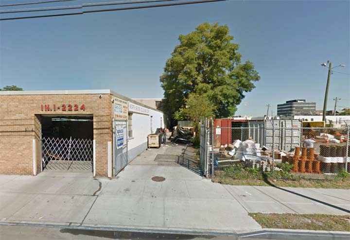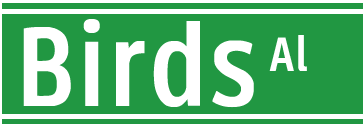
 There’s a short angled driveway on the north side of 32nd Avenue in an industrial end of Flushing trailing off east of Downing Street. I have had it in the back of my head for a few years now, because I know it has a name — at7 least, Google Street View has give it a name for several years now. It has never shown up on any “conventional” Hagstrom or Georgaphia street map of Flushing.

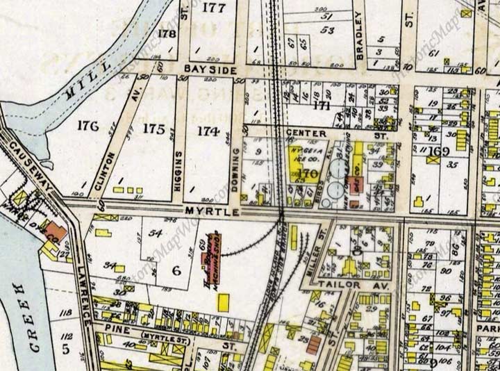
 This 1909 atlas plate shows it, though, running in the same spot and at the same angle between Myrtle (32nd) Avenue and Center Street (31st Drive), bordering the Hygeia Ice Company building.
No streets on this map section have kept their old names except Higgins, Downing and Miller Streets.
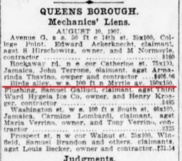
I found an edition of the Brooklyn Eagle from August 1907 listing Birds Alley, Myrtle Avenue and the Hygeia Ice Company. In my opinion, as Flushing became ever more populated, the alley became a dead end and lost its status as a mapped street several decades ago. Its ghost is still there in that angled driveway.
Flushing is quite old, and has something of an Old World street pattern in spots, with very short streets, some angled against the overall grid. Another remaining of these short Streets is Linnaeus Place, a C-shaped street beginning and ending on Prince Street north of 35th Street, with its own unique set of attached houses.
Previously in Flushing: Eagle Nest Lane
10/17/15

3 comments
Perhaps there is the beginning of Birds Alley shown here, On this Beers map from 1873, Atlas of Long Island New York, http://digitalcollections.nypl.org/items/510d47e2-635b-a3d9-e040-e00a18064a99, running next to the Flushing Gas and Light Company, between Center Street(31st Street?) and Myrtle Ave.(32nd Avenue?) Mapquest spells it Byrds Alley off of 31st street. Fascinating and totally absorbing.
PS There seems to be some refferences to “Byrds Alley” also in the ‘Brooklyn Daily Eagle’:
May 29, 1909 “Caroline F. Boardman and Frederic M. Van Nostrand sold a plot at Bayside to the Third Ward Hygeia Ice Company, 50 feet frontage on the west side of Byrd’s alley and 50 feet west of Flushing and North Shore Railroad, 125 feet In depth.
May 27, 1909, ” Peck. L H, & ors (sic) to Third Ward Hygl1 Co. Byrds alley, w s, 100 ft n Myrtle aV 125. Flushing
And from ‘Ice and Refrigeration Blue Book and Buyers’ Guide, 1920′, “Third Ward Hygeia Ice Co Centre St & Byrd’s Alley Jacob Haubeil Pres”
Was this former alley ever known for having birds or was it named for something else?