By SERGEY KADINSKY
Forgotten NY correspondent
Whenever I’m in need of a nostalgia trip for a taste of the old country I revisit Brighton Beach. Architecturally the neighborhood always satisfies. It has bungalows next to condos, alleys with repeating numbers, dead-ends, an elevated subway line, and historic synagogues. Recently Touro College moved some of its offices and classes into a new office building on Neptune Avenue and Brighton 3rd Street. I snuck to the rooftop for the views and then descended to the ground to explore some of the dead-ends and find material for my American Art History class.
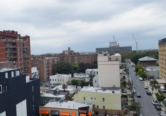
To the south of this office building one can find century-old alleys previously documented on Forgotten-NY, such as the Courts, Walks, and Lanes squeezed between Brighton 3rd and Brighton 8th Streets. Prior to the 1920s, this expanse of land hosted the Brighton Beach Race Course, which had its own beachfront hotel and train terminal. The neighborhood’s name remembers this racecourse, which in turn was named after the English seaside resort town of Brighton.
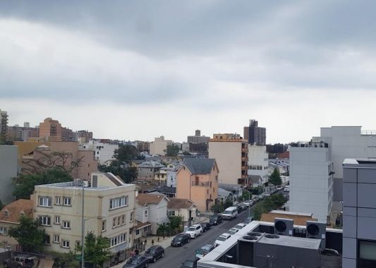
To the north the skyline is dominated by the lengthy balconies of the city-run Coney Island Hospital, whose present facility was completed in 1954. Its story began in 1875 as a first aid station on the beach. Between Touro’s office and the hospital, Brighton 3rd Street encounters its own set of alleys, a police horse stable, and a mosaic by a renowned artist known for the political and social themes in his works.
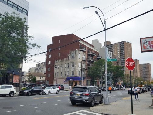
At the corner of Brighton 3rd Street and Neptune Avenue, we see an old corner building in the shadow of a post-millennial tower. Like the corner property on 34th Street and Broadway that refused to sell to Macy’s, it is an example of an architectural holdout.
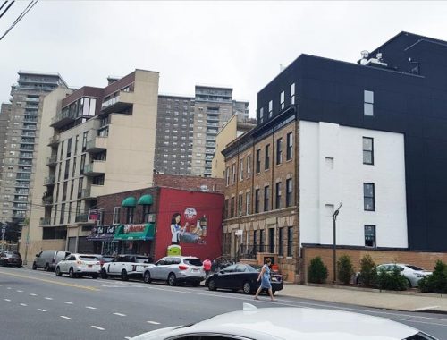
Across Neptune Avenue an old rowhouse with cornices had an extra floor added. Seems like an acceptable adaptation that preserves the old look and gives the side wall some color. A block to the west is an old painted wall ad that Kevin Walsh chronicled in 2012. Named after the Roman god of the sea, Neptune Avenue runs along the former north shore of Coney Island from the head of Sheepshead Bay going west to Sea Gate. The high-rise apartment in the background is part of Amalgamated Warbasse Houses, a labor-built co-op complex. Its towers stand next to Trump Village, the seven-tower superblock built by the president’s father.
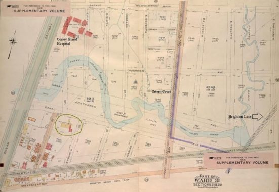
Looking back at the history of Brighton 3rd Street, the 1907 Belcher-Hyde Atlas shows it as the first developed road on the northern side of Brighton Beach. Dotted lines on Coney Island Creek indicate plans for its never-realized transformation into the Gravesend Ship Canal. A small piece of Canal Avenue a mile to the west is all we have of this planned canal. On the east, Squan Creek flows into this waterway. Coney Island Hospital stands alone on a grid of paper streets. Voorhies Avenue later was partially absorbed into Shore Parkway and Orient Court was entirely swallowed by this highway. On the south edge of this map, Sheepshead Bay Road ran its full course from Coney Island to Sheepshead Bay. Today it exists into two segments a mile apart from each other, with Neptune Avenue serving as its east-west successor.
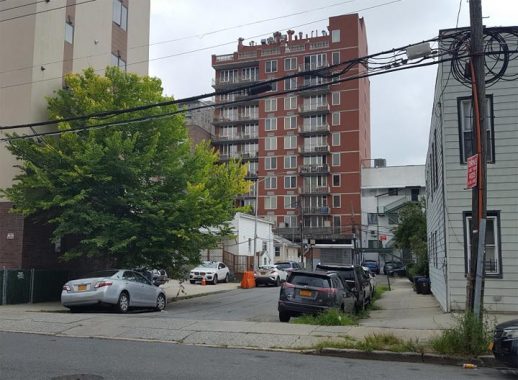
The first dead-end off of Brighton 3rd Street is Banner 3rd Terrace. On old maps it appears as Stack Place. To its north, the next dead-end is Banner 3rd Road, formerly known as Edith Place. The Banner to which these two roads refer is Banner Avenue, which runs east from Brighton 4th Street to East 12th Street.
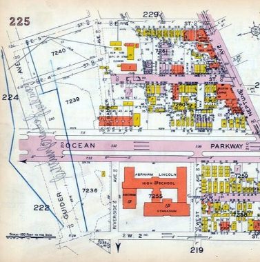
On the 1929 Belcher-Hyde Atlas, the route of Canal Avenue was renamed Banner Avenue. Plans intended for it to run west to Ocean Parkway, but this segment had a set of rowhouses, the wetland of Coney Island Creek and a pumping station that were in the way. Banner’s extension didn’t happen, but two of the alleys on this block were renamed for Banner as part of the proposed grid. Abraham Lincoln High School was completed in the year that this map was published.
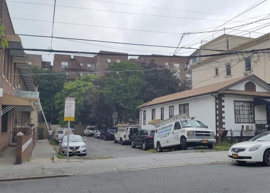
On the east side of Brighton 3rd Street is an alley formerly titled Gertrude Place, but on today’s maps as Brighton 3rd Road. Its companion alley, Clayton Court became the parking lot in 1969 for the Shore View Nursing Home.
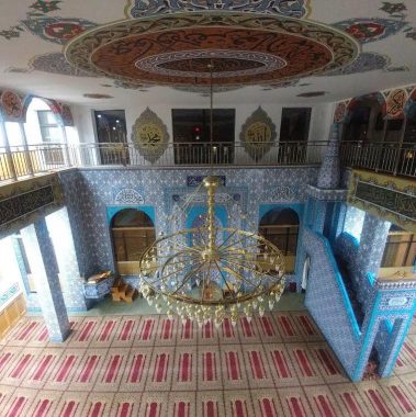
Certainly not forgotten on this block is the Turkish-American Eyup Sultan Cultural Center built in 2010. On the outside are hints of Islamic-inspired design but the interior is truly a gem with turquoise tiles inscribed with Quranic quotations. Its namesake and inspiration is a historic mosque in Istanbul. The neighborhood has a handful of smaller mosques that testify to its newest immigrant communities, comprising of Muslims mainly from Pakistan, Turkey, and Uzbekistan. On my stroll, I overheard one family here speaking Tatar. Brighton Beach is also home to Kashkar, the city’s only Uyghur restaurant, representing the Turkic Muslims of Xinjiang.
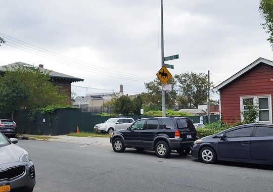
The brick structure with the oversized cornice functions as a police horse stable, lending its distinctive odor to this block. Built at the turn of the 20th century, it is a former pumping station that faced Coney Island Creek and was transferred to the police in the 1930s. Behind it is Grady Playground, which shares its namesake with William E. Grady High School. None of the students here have any idea why he merited the honor. Because this is Forgotten-NY, we know the story. Dr. Grady was the superintendent of Brooklyn schools in the early 20th century, a supporter of technical & vocational education, and a resident of nearby Manhattan Beach. He died in 1940.
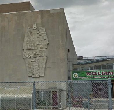
The school was completed in 1957 with a modernist design by Joseph Blumenkranz, whose firm also worked on Coney Island Hospital. The entrance on Brighton 4th Street features a relief sculpture, Abstract by Constantino Nivola. This Sardinian-born sculptor began his career as an apprentice stonemason. Initially celebrated by his country, he became a critic of fascism and immigrated to New York where he married fellow refugee Ruth Guggenheim. Their loss, our gain. In this city, Nivola’s works can also be found at P.S. 55 on Staten Island; In Brooklyn: P.S. 345, P.S. 320; I.S. 183 in the Bronx; Beach Channel High School in Queens; and Stephen Wise Towers in Manhattan.
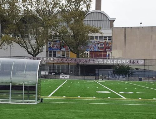
But the truly hidden artistic wonder of this school is Science and Technology mosaic by Ben Shahn. He was also a refugee, fleeing from persecution in tsarist Russia. With such experience, he was a lifelong advocate of politically progressive causes and at the same time his art was also imbued with Jewish themes, as he was raised by Orthodox parents. Unfortunately the mural is partially obscured by trees and the chain-link fence of the high school’s football field. Had it faced the street, it would have received more public attention than at this spot. But it makes for a grand banner in the place of Banner Avenue, on whose proposed path the school stands.
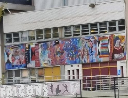
This mosaic depicts the fears of the cold war and atomic weaponry in an abstract form. The Jewish element here is a likeness of Maimonides with the quote “Teach thy tongue to say I do not know and thou shalt progress.” He was the leading rabbinic authority for medieval Jewry, who also knew Greek wisdom, spoke many languages, and worked as a physician.
In 1935, Shahn began work on a mural at the newly-opened prison on Rikers Island but was then stopped by the conservative-minded panel at the Municipal Art Commission. The rejection became a cause celebre on par with Diego Rivera’s banishment from Rockefeller Center that also happened in that decade. His other public artwork in this city is the Woodhaven Post Office mural titled First Amendment, completed in 1941.
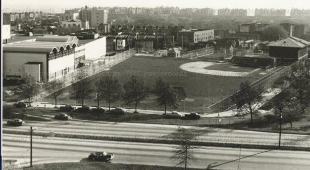
To the immediate north is Belt Parkway, constructed in 1940 on the filled course of Coney Island Creek. In this 1957 photo from the Municipal Archives, we see the school’s field, police stable, and Grady Playground. Although no longer an island, Brighton Beach still appears separate from the rest of Brooklyn by this highway.
Sergey Kadinsky is the author of Hidden Waters of New York City: A History and Guide to 101 Forgotten Lakes, Ponds, Creeks, and Streams in the Five Boroughs (2016, Countryman Press) and the webmaster of Hidden Waters Blog.
Check out the ForgottenBook, take a look at the gift shop, and as always, “comment…as you see fit.”
9/16/19


3 comments
Nice to see Coney Island Hospital still standing. I heard it was hit hard by Superstorm Sandy in 2012. I did a good deal of my Physician Assistant studies there in the mid-90’s. A veritable melting pot of cultures, and a great place for hands-on training.
There is now a second Uighur restaurant in NYC:
https://www.nytimes.com/2019/09/13/dining/nurlan-review-uighur-food.html?rref=collection%2Fsectioncollection%2Ffood&action=click&contentCollection=dining®ion=stream&module=stream_unit&version=latest&contentPlacement=10&pgtype=sectionfront
The Brighton numbered streets were originally part of the East numbered streets, I guess they changed the prefixes to Brighton, also noticed that Brighton 8 St was originally the extension to E 7 St while Brighton 7 St was originally the extension to Hubbard St