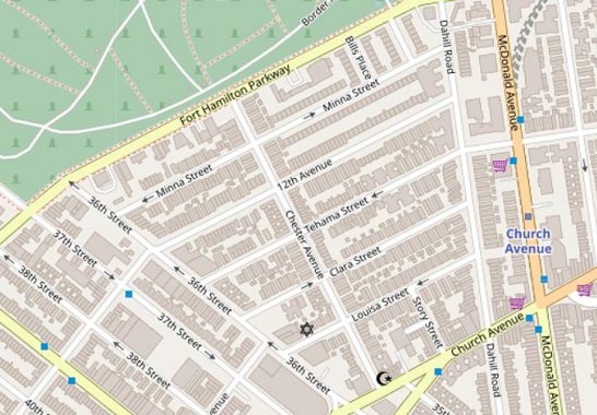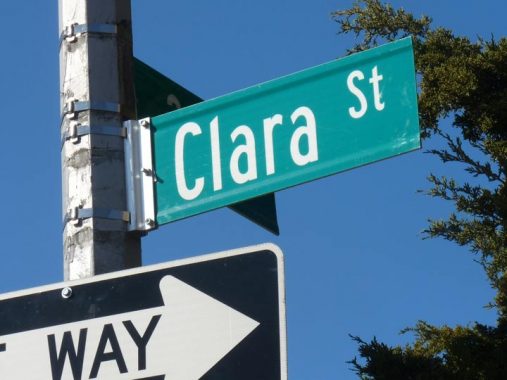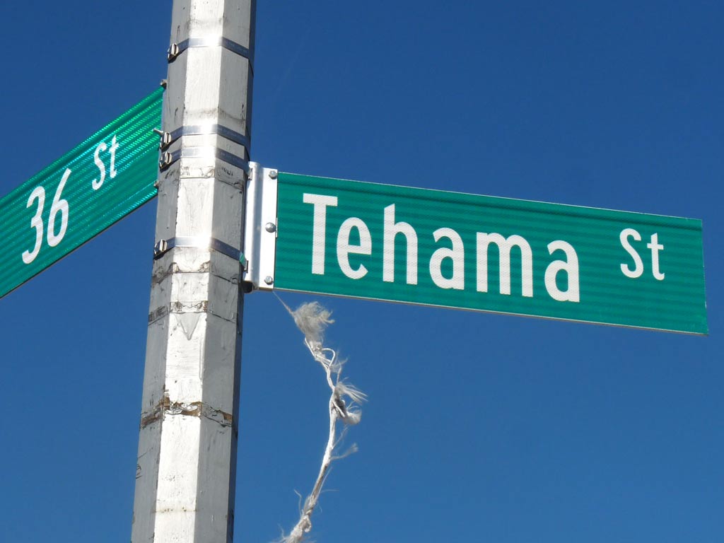
There is a small cluster of streets south of the Fort Hamilton Parkway border with Green-Wood Cemetery between 36th Street and Dahill Road, where the streets have four women’s names (or sound like women’s names) Minna, Tehama, Clara, and Louisa.

This set of streets has nothing to do with the rest of Brooklyn’s map: Louisa, Clara, Tehama and Minna Streets. Perusing older maps, you see that 12th Avenue was extended east through the region to meet Dahill Road.

An earlier comment on a FNY Kensington page says “Minna, Tehama and Clara, along with Clementina Street (now 12th Ave.) originated on an 1868 map of the Martense Farm. The now-vanished Clementina Street survives in San Francisco, right near the others. Intersecting the “daughter” streets is Chester Avenue (possibly a son?), and Martense Lane (now 36th Street) was the farm’s southwestern boundary.”
(I have yet to find any maps showing Clementina Street instead of 12th Avenue, but 12th does take a jog at 36th before continuing west into Borough Park.)
Thus the “girls” were either named for the daughters of an early Dutch settler named Martense (36th Street is the former Martense Lane) or those of a mid-19th Century landowner.

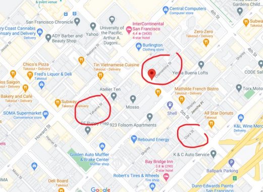
Here’s the transcontinental mystery. There are streets in the South of Market district in San Francisco that match three of the names: Clara, Tehama, Clementina. “Tehama” is hardly a common name, so how did it turn up in San Fran, a few blocks separate from Clara and Clementina, which accompany it in Brooklyn?
Comments is open for theories.
Check out the ForgottenBook, take a look at the gift shop, and as always, “comment…as you see fit.” I earn a small payment when you click on any ad on the site.
4/8/21


18 comments
Here is something to add to the mystery. No definitive answer, just more clues.
https://www.foundsf.org/index.php?title=SOMA_Side_Streets_Named_After_Ladies
The San Francisco info would seem to lay claim to these street names having originated there (circa 1850ish), and later being transferred to Brooklyn. In 1868, when these streets were laid out, the boroughwide street grid had yet to be set up, and Minna, Clementina, Tehama, etc. were aligned with the earlier grids of Windsor Terrace, Parkville and South Greenfield. It actually makes for a nice transition between the street systems of New Utrecht (36th Street, etc.) and Flatbush. (Dahill Rd., McDonald Ave, E 2 St., etc.)
Why were these names used here? It’s possible that the landowner or the surveyor had traveled to San Francisco and liked the names. The real reason is probably lost to time.
Minna St in San Francisco seems to be named for Minna Rae Simpson. Interesting story there.
There’s also a Minna Street.
Here’s an article suggesting the theory that the San Francisco street names may have been named for ships traveling around the area in the mid 1800s (Minna, Clementina, as well as their sisters Tehama and Natoma)
https://www.foundsf.org/index.php?title=SOMA_Side_Streets_Named_After_Ladies
There is a plate in the 1898 E. Belcher Hyde 1898 atlas of Flatbush & New Utrecht that does indeed note the section of 12th Avenue between (East) 36th Street (noted as Martense’s Lane [sic]) and West Street (today’s Dahill Road) as the former Clementina Street.
After perusing some of my other Brooklyn atlases, by both Bromley & Hyde, most of their atlases note Clementina Street as a former/alternate/co- name.
Sorry for the multiple posts this morning. Seems I’m still a little foggy before caffeine. Regardless of my mental fog, an interesting thing I noticed on the late 19th/early 20th century Brooklyn atlas pages is that Story Street was apparently originally planned to parallel the “girls” between 36th Street (Martense Lane) and Dahill Road (West Street). It would have slotted in between Louisa Street and Church Avenue. Presumably someone decided that Story Street laid out in that location either (1) would put it too close Church Avenue (which it would also parallel), or (2) there were issues with properties already existing within the proposed street line, so Story Street was turned 90 degrees and (as today) parallels Chester Avenue between Louisa Street and Church Avenue.
Tehama is a county in California. Its name, depending on whom you believe, derives from a Spanish word meaning “shingle” or a Native American word meaning “high water.” Because Tehama County is closer to San
Francisco than Brooklyn, my guess is the San Francisco streets came first, and they were plunked down in Brooklyn by somebody who was from, or had visited, San Francisco, and liked the sonorous names. Minna
Street in SF is said to have been named for a, um, lady of the evening, Minna Rae Simpson. Clementina and Clara, along with Jessie and (in another neighborhood) Octavia, were named for “wives, sisters, and
daughters of powerful Gold Rush-era landowners.” Whether Tehama Street was named for the county (there are no other streets named for California counties in that part of SF), or whether it was a name given to a girl (or adopted by a woman), or whether some city planner just liked streets ending in “a,” remains a mystery.
Tehama is a county in northern California, well north of San Francisco. It is a Native American word.
I stopped at an Elks Lodge in a South Carolina city (off 95 — all I remember) and the streets in that neighborhood were all Los Angeles street names.
Members of the Story family (as in Story Street) were members of the Martense clan. The Brooklyn Daily Eagle from 1/25/1901 reports that Rachel Martense, who was the sister-in-law of William Story and aunt of Joseph Story, was nearly 100 years old. The 7/6/1859 paper reports a land dispute involving William Story and Martense family members. The 5/2/1909 paper reports the homestead was being partitioned and sold off, and it mentions Tehama, Louisa, and Clara Streets (without explaining their origins).
An article in the Brooklyn Eagle, 2015 titled “Streets of Home” says most Brooklyn streets with names honored or remembered people of the era or history.
About these street is says; “Among the dozen women remembered are the three daughters of Kensington developer William Micieli: Clara, Tehama and Minna.”
So is “Bills Place” (in the same area) named after William Micieli?
I would say the street is probably named after him. A 2018 blog on this site says that Bills Place and Micieli Place were added later after WW2. I read that the Kensington streets are named after William Micieli and his children, Minna, Clara, and Louis. He bought the farms around 1900. Later developed the neighborhood. He may have been a developer in San Francisco too, but that’s just a guess.
Growing up in SF, i learned a legend that the streets were named athe madams who ran houses of ill repute along those thoroughfares during the Gold Rush. Calling those SOMA (South of Market Area) thoroughfares might be a stretch. They are glorified allies that are crammed into blocks bounded by much more prominent roads like the numbered streets and wider ones like Mission, Howard, Folsom, Harrison, & Bryant. California also has a Thema County in the northern Sacramento Valley.
I originally posted this comment to a “Take Me To Church” walking tour in 2016, but I believe it is appropriate here also:
The Church Ave tour brought back old memories. In the early 60’s I used to deliver The World Telegram & Sun throughout Borough Park. All the streets and avenues were numbered, so it was nearly impossible to get lost, and you could gauge how long it would take to complete a route. One afternoon, the manager asked me to come back to the office (52nd St and 18th Ave) after my regular route and deliver for someone who was sick. When I got back, he gave me the list of subscribers on Clara, Tehama, Minna, etc. I had NO idea where these streets were!. He said “Just head up Old New Utrecht Road to 17th Ave, then up to Dahill Rd, and you’ll see them when you cross Church Ave.”. We had a short section of Dahill Rd. near where I lived on 51st St, so I figured it couldn’t take too long.
Well, I found the neighborhood, delivered the newspapers, and made it back home long after dark. My folks wondered whether I’d been run over. Even they had never heard of those obscure little streets in the far corner of Borough Park!
What I find interesting is how this little block of odd streets buffers two separately angled rectilinear street grids, the Kensington and Borough Park grids, which probably represent the layouts of separate villages.