

Gantry State Park, on the Hunters Point waterfront facing Manhattan, is named for the massive cranes, known as gantries, that were used to load and unload rail car floats onto railcars that used the spur track to the main LIRR tracks. From there goods could be transported to the Island or over the Hell Gate Bridge to northern New York and New England. Four of the gantries have been left in place as silent witnesses to Hunters Point’s industrial past.
What follows are some vintage images courtesy of the Greater Astoria Historical Society taken during the era when they were in use, and the aftermath of that era.
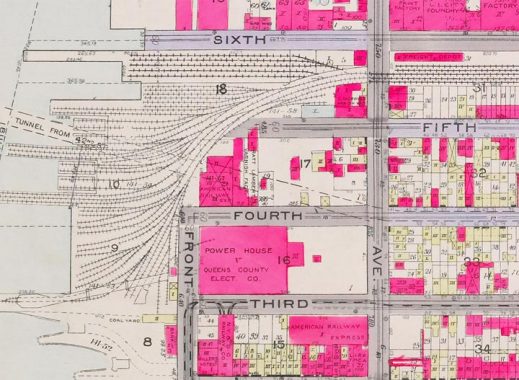
As you can see from this 1919 map, Hunters Point was once a hotbed of freight rail. The tracks at the top end of the map could until just recently have been found in an open cut between 48th and 49th Avenues, leading to the Sunnyside Yards which in turn led to points east all over Long Island. There were also connections to the Degnon freight rail system formerly in Sunnyside just south of the yards.
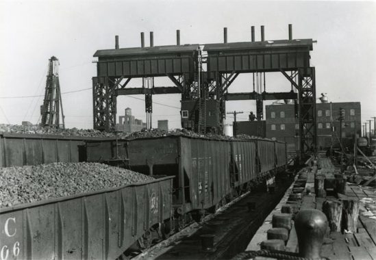
These cars are either on their way to the East River float barges or have just arrived. To walk in Gantry State Park today one would never believe this sort of activity ever took place there, as the trackways have completely disappeared, though park architects Abel Bainnon Butz have left the odd railroad tie in the park by the gantries as a reminder.
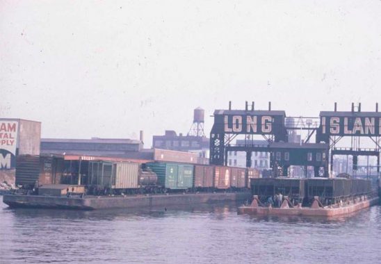
A look at the carfloats in action in the 1960s.
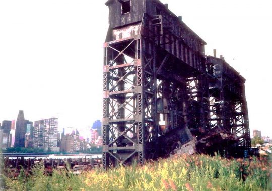
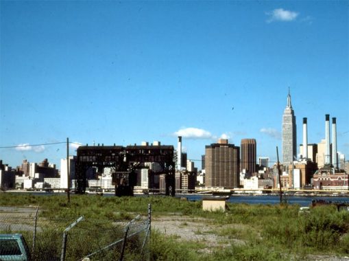
After rail and carfloat operations ended in the 1960s, the gantries were too large to be easily demolished. They stood alone in a grassy expanse on the East River waterfront until parkland was slowly developed in the 1990s. The Queens West housing development followed, and the 2010s-2020s continued the Hunters Point waterfront’s complete conversion to expensive residential housing and parkland. The rest of the infrastructure has to date failed to keep up, as such things as drainage, electrical conduits and even sufficient shopping have failed to materialize. Thankfully, the Vernon Boulevard shopping and restaurant district continues to do well. Amazon’s proposal to build a large office complex in the area, which may have jumpstarted improvements, was rejected by area elected representatives.
Few areas in the city have changed as massively as the Hunters Point waterfront from the early 20th to 21st Centuries.
As always, “comment…as you see fit.” I earn a small payment when you click on any ad on the site.
5/16/21
4 comments
Some Vernon blvd improvements for 3 billion in forgone tax revenue. Sounds fair. City planning should zone in so many tech bros per block restrictions.
I remember biking there before all the new development. We used to be able to sneak through a hole in the fence and sit on the rocks directly at Hunters Point. That said, the new park development along the water is great – especially at night when the Pepsi sign give everything a red glow.
The first photo – the railcars are actually ON the barge, and you are looking at land
There were actually an additional set of smaller gantries a bit further south than these ones as well, where the Jack Frost (?) sugar plant was located up until the turn of the 21st Century. After the buildings were demolished, that section was vacant for close to 15 years, and now houses the new Hunters Point Park South extension that opened about 3 years ago. I was able to get a tour of the park before it opened to the public, and asked the landscape architects and Parks Capital projects division about the gantries; they said they couldn’t (or wouldn’t) save them, unfortunately.