I know little about Dripps, the mid-century New York City and environs mapmaker; and in fact, I know little about its successors, Bromley, Belcher Hyde, Rand McNally, Hagstrom and Geographia. I do know that Hagstom was founded by immigrant Andre Hagstrom in the 1910 and Georgraphia by Alexander Gross at around the same time. There is rather more about Rand McNally in wikipedia.
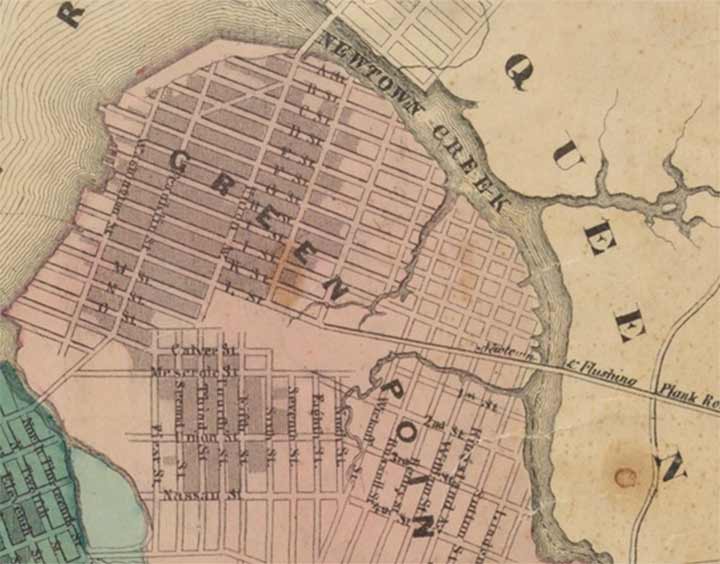
I’ve begun studying Dripps maps with more intensity lately. Here’s the oldest map, or one of the oldest, of Greenpoint, Brooklyn I can find, from the 1850s. At the time it had just been plotted to a grid system by Neziah Bliss. Veteran readers of FNY already know that the Greenpoint streets were once known only by letters and were then assigned names in alphabetical order, with many of the names relating to its waterside and manufacturing conditions that existed when they were named.
If you look at the bottom of the map, though, you notice that Greenpoint once had two separate blocks of numbered streets, one going east to west and another the opposite. this must have gotten rather confusing as all these streets were later given names. (In Williamsburg(h), this state of affairs lasted well into the 19th Century).


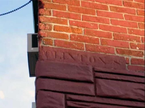
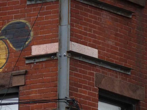
Chiseled signs on street corners often provide a peek into the past as they reveal streets’ former names. But in Greenpoint, there’s a mystery. Calyer Street, named for a colonial-era family, replaced P Street very early on, if P Street ever existed. However, a building on the SW corner has a “Clinton St.” sign on it. We find the same repeating a block north, at Oak, where a Madison Street sign appears.
My guess is that this happened: street names were in flux after it was decided to do away with the letter system, and interim, but not official names were devised that didn’t make the maps. I still hold that the letters were the original names as laid out by Bliss, and Ash, Box, etc. all the way to Quay were the official second names acquired in the late 19th Century.
As always, “comment…as you see fit.” I earn a small payment when you click on any ad on the site.
4/15/22


1 comment
Greenpoint’s lettered and numbered streets received names in 1855, when Greenpoint, Williamsburg(h) and Bushwick were annexed by the City of Brooklyn in 1855. The N/S numbered streets, 1st (First) to 5th (Fifth), were part of the Town of Bushwick numbering system/plan. These were later renamed in order, Calyer, Meserole, Union Street (later Norman Street, and, finally, Norman Avenue), Nassau Street, later Nassau Ave.) and Van Cott Street (later Avenue, then incorporated into Driggs Ave.). The E/W numbered streets in Greenpoint started at Guernsey Street (First Street) and ended at Eighth Street (later Diamond St.). BHS, on Pierrepont St., has a collection of Greenpoint maps dating back to 1839. They are available for viewing in its map collection room. I’ve spent many hours poring over these maps.You are allowed to photograph them; however, electronic flashes are prohibited due to the fact that extreme lighting, such as a camera flash, will affect the inks.