

QUEENS streets were numbered gradually by the Queens Topographical Bureau beginning in 1915, under a system designed by Charles U. Powell of the Queens Topographical Bureau. Many think that Robert Moses was the culprit, but the plan took shape in 1911, a couple of decades before Moses had real power. The street numbering was in place on maps, but far eastern districts such as Glen Oaks and Floral Park were mainly built up in the 1930s and 1940s and many streets weren’t even built until then.
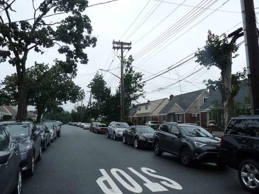
In Queens, you will find the highest numbered street in NYC. The Bronx makes it to 263; Manhattan, 220; Brooklyn, 108, and Staten Island… 10. In Glen Oaks, near the undefended border with Nassau County, you will find 271st Street, which runs for 4 blocks from 76th Avenue at Long Island Jewish Hospital southeast to Langdale Street at 79th Avenue. East of there, once within Nassau County, the numbers cease… but not always, as parts of Floral Park and Elmont have numbered streets that continue Queens numbering! And in Great Neck, some streets still have Queens house numbering, as its streets had Queens numbers, too.
271st is hardly the highest numbered street in the United States, as plenty of communities in the west and south have streets well into the 300s and 400s. In fact I’d like to discover the highest numbered street in the country that is part of an ordinal sequence that goes from lowest to highest (as opposed to a grid system of 1400 West etc.). The internet seems to have no immediate answer.
A mapmaker named Harold Cooper made the Extend NY map of the Manhattan 1811 gridiron street system and extended it worldwide, which led to some high numbers indeed.
Before 1898, all of Nassau County was part of Queens. This, of course, was long before the Queens numbered system was devised, But it would be interesting to speculate what would have happened had Queens remained fully intact and Powell’s street numbering went on and on… up to the Suffolk County border. How high would the streets go? 500s? 600s? I’m thinking of asking Cooper, who’s on twitter, to devise a map showing just that.
As always, “comment…as you see fit.” I earn a small payment when you click on any ad on the site.
4/14/22
12 comments
Manhattan goes to 228th, not 220th.
The highest street number I am aware of is in the West Valley Phoenix suburb of Buckeye, Arizona. It is North 571st Avenue with the lowest number street in the area being 1st Avenue and 1st Street on either side of Central Avenue in the center of Phoenix.
And in the East Valley, Queen Creek (as far south as you can go in Maricopa Co. before the Pinal Co border) has numbered streets that begin west of S. Ellsworth Road
Highest street number in the US might be Toledo, Ohio’s 326th Street.
FNY in March 2008 had a piece about the Broad Channel neighborhood in Queens. Here’s a quote: “Broad Channel’s street map bears no relation to the rest of Queens, with the exception of Cross Bay Boulevard, which links it to the mainland. There are a series of East and West numbered streets from 1 to 22, with just a few named north-south streets in Broad Channel’s widest section: Church, Walton, Lanark and West Roads, and east-west Noel Road. Channel Road is sometimes shown on maps, by exists only in short dead end pieces. In the 1960s and 70s, some maps showed Broad Channel’s east-west roads as Avenues in the 190s and 200s (Howard Beach’s highest numbered Avenue is 165th) and I imagine the City wished to renumber BC to conform to the rest of Queens’ system, and do it as if there were intervening avenues in the middle of Jamiaca Bay! This plan never flew, and BC retains its unique system.”
I remember the Hagstrom’s Map with those avenues, running from 188th to 208th north to south, in conformance with the rest of the Queens street system pattern. 208 is the highest NYC avenue number, for sure, even if it was only a phantom avenue. Ironically the nearby Rockaway peninsula goes completely contrary to the Queens street number pattern, with another unique pattern. Its numbers, all with the obvious Beach prefix, increase low to high going east to west.
And the Bronx doesn’t start at 1, it’s a continuation of Manhattan streets
For some reason the numbered streets in The Bronx don’t even align across the Harlem River with Manhattan and happen to be five up, which is something I will never get.
In the Bronx, east side doesn’t align with west side. For example, the exit on the Deegan for E 233 St. is 2 exits north of the exit for W. 231St.
In Manhattan, numbered blocks above First St. are a uniform 260 feet wide, including the street and sidewalk itself (20 x 260 = 5200 feet, or 20 blocks to the mile. A few of the cross streets (34th and 42nd as examples) have wider roadways than the narrower side streets, but the 20 blocks per mile is the rule. In The Bronx block widths vary somewhat because of topography, and because some streets do not always intersect at exact right angles. As an example, by the time you get to northern Manhattan, W. 207th Street, the corresponding Bronx street to the east, Fordham Road, is the equivalent to about E 190th St. The Bronx also has very few west house numbers because its Fifth Avenue (dividing line E -W) is Jerome Avenue, which leaves a lot more territory to the east. So the E-W numbered streets do not exactly coincide but are offset in a seemingly illogical pattern which has existed for 125 years and won’t change now.
The Bronx used to have numbered streets in the Castle Hill area south of Westchester Ave. They started at 1 and went to about 14.
The numbering system had some crazy twists in some Queens neighborhoods. I grew up in Kew Garden
Hills, notorious for having a strange street number grid. Some streets have just one iteration (73 Avenue,
79th Avenue), some have two (78th Road, 78th Avenue), some have four (72nd Avenue, 72nd Road,
72nd Drive and 72nd Crescent) and some have none (no 74th). In some parts of the neighborhood, the
“streets” run in 3’s (147th Street, 150th Street, 153rd Street) while in others they run in single file (136th,
137th, 138th Street). There are some streets that are very short (140th and 149th Streets are one block
long) and some are very long (150th Street runs the entire length of the neighborhood). Used to drive
my out of neighborhood friends crazy.
271st Street is actually a part of the “Lost Community,” i.e., one that doesn’t easily pigeonhole into any localities. It’s not Glen Oaks, which is several blocks away at least. New York Telephone used to call it Bellerose, a good mile and a half away, or Floral Park. Some people call it North Floral Park, but that never really caught on, and Floral Park is a Nassau County village at good mile and a half away. It’s actually New Hyde Park, and the USPS gives it a Nassau County Zip Code of 11040.