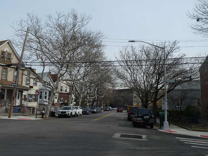
THERE’S a two-block stretch of Laurel Hill Boulevard between 65th Place and 67th Street independent of the BQE, and the block between 66th and 67th Streets actually has residences and buildings on both sides, instead of an elevated expressway one one side. It is the only section of this lengthy road, which runs from Calvary Cemetery and Review Avenue at the edge of the noxious and noisome Newtown Creek, that is free and clear of either the cemetery or the bustling Brooklyn-Queens Expressway, to which it functions as a service road whether it is elevated or depressed.
However, as I explain on FNY’s page dedicated to the boulevard, it’s actually one of Queens’ oldest traces and existed long before the BQE; in fact, it appears on maps from the 1850s and probably existed long before that. It is named for the dead Queens neighborhood of Laurel Hill.
What was Laurel Hill, and is now West Maspeth, is located in the area bordered by Calvary Cemetery/Brooklyn-Queens Expressway in the west; the Queens-Midtown Expressway (Long Island expressway) on the north; 58th Street in the east; and 56th Road/Long Island Rail Road tracks on the south.
In the post-colonial era Laurel Hill was a farm owned by Edward Waters, whose name was affixed to one of the streets laid out in it later; Waters Avenue was later renamed 54th Road. Waters sold the farm to Jacob Rapelye, who built a large mansion at 55th Drive and 46th Street that was torn down long ago (the intersection has been eliminated, as it is now part of a UPS Customer Service complex). The South Side Railroad arrived in 1890. Its trackage is now part of the freight-only Long Island Rail Road Montauk Branch. The proximity of the railroad attracted industry to the region with the Phelps-Dodge copper refining plant along Newtown Creek opening in 1920 and remaining in business until 1983. Its deposits into the Creek have long outlasted it. F. Haberman’s National Enameling and Stamping Company was so busy its own LIRR stop was constructed that outlasted the company, closing in 1998.
As always, “comment…as you see fit.” I earn a small payment when you click on any ad on the site.
4/21/22


4 comments
Lived just off LHB on 66th Street for a few years in my youth. Mailing address was Woodside but today clearly mapped as Maspeth.
There is a small group of 19 houses between 48street and 50 street / 54 avenue to 54 road.. (I own one of those homes!) I was wondering on the history. We are an isolated micro neighborhood, driveways and nothing is is within walking distance. I remember the deed history said something about it being called VanRose Manor and an elderly neighbor said they torn down a row of homes north side of 54 avenue with they double decked the Long Island Expressway.
Some years ago, I don’t remember when but it was well after the end of service to the intermediate stations, I rode on the Lower Montauk from Jamaica to LIC and some traces of the Phelps Dodge narrow gauge were still visible. I don’t know if they remain.
My father lived on 47th Street between 50tjh Avenue and 51st Avenue from 1928 until 1949. He told me that, on Sundays, they would walk on the trolley right-of-way and on Laurel Hill Boulevard to go to St. Michael’s on Greenpoint Avenue. Most of the streets were newly laid-out and were not yet paved.