
On July 5, 2024 I felt like getting in a boat, as July has been especially hot and humid this year even by recent standards. As I am chained to my computer all week doing “real” work editing biographies for Marquis Who’s Who, it’s especially important that I get out and move my legs when I have the time, and did just that over a 4-day weekend that featured punishing stickiness. The plan today was to take a NYC Ferry East River ferryboat from Long Island City to the Brooklyn Navy Yard, walk around there, and then head into Clinton Hill and Fort Greene. Mission mostly accomplished, though I was thwarted somewhat; I will get into that a little later.
GOOGLE MAP: LIC TO FORT GREENE
I took a #7 train to the Court Square station at 23rd Avenue and 45th Road. (Thus, my transit log today was three subway rides, a ferry and two Long Island Rail Road rides). This corner features a diner (that I won’t name as it is still thriving) in which I got what had to be a case of stomach poisoning in 2008 or 2009, I forget the year, it’s been awhile now.
Though 45th Road shares a lot of stock with a more famed group of row housing a block north on 45th Avenue, it hasn’t been granted NYC Landmarks status as 45th Avenue and a short section of 23rd Street has. I think the Landmarks Preservation Commission should look into it.
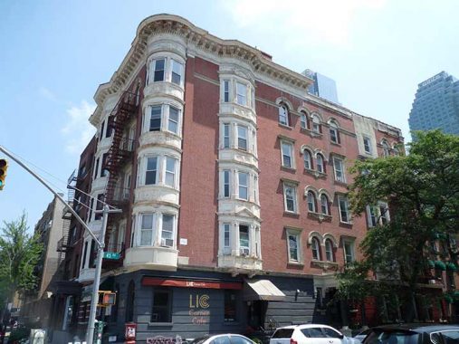
This handsome apartment building at 21st Street and 45th Road is “safely” out of the landmarked district, and so its history is obscure to everyone who doesn’t want to root around in NYC building records. But how about those bay windows on the corner and both sides.
Constructed in 1900 as Grace Methodist Episcopal Church, the Iglesia ni Cristo (INC) or Church of Christ, with a primarily Philippine congregation, is the only Christian religion to have started in a third world country and successfully expanded in the west. The INC has more than 3,500 centers worldwide in nearly 100 countries and territories. There are more than 38 congregations in the Northeastern Seaboard alone.
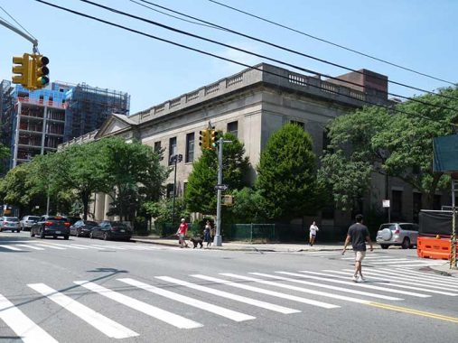
A block south on 21st Street at 46th Avenue, the Colonial Revival Long Island City Post Office was built in 1928, and is one of a number of post offices in New York designed by the Office of the Supervising Architect under director James A. Wetmore. Because of the maturing trees in front of the building, the front is only truly visible from November to April.
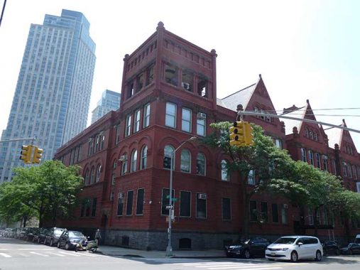
The north end of PS 1 can be seen at 21st Street and 46th Avenue. This Romanesque Revival former public school at 22-25 Jackson Avenue was built in the 1890s when Long Island City was indeed a real city. In the 1970s it was revived as a contemporary art museum and then began an association with the Metropolitan Museum of Art, housing exhibits that may have been thought too risky or outré for the more stolid MoMA. The museum has cleverly incorporated the old school’s interiors as art spaces, down to the bathrooms and boiler rooms. Older photos show that it once had a corner clock tower.
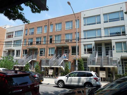
To get to the ferry I headed west on 46th Avenue, for the sole reason that I believe I have only walked on it once before, if that often. I usually don’t have anything good to say about new residential architecture, but I’m tolerant of this row because of its large windows: I am a proponent of letting as much light as possible into rooms. Somewhat tall staircases were built in the front to clear the ground floor apartments, so you have to be reasonably in shape to live above the first floor. (I once lived on the 4th floor in Flushing for 14 years in a non-elevator building and kept in reasonable shape by carrying a bicycle up and down.)
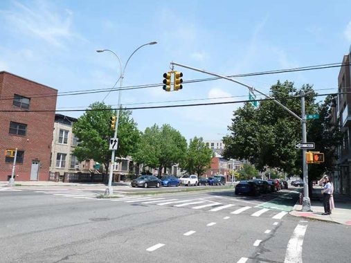
11th Street, seen here at 46th Avenue, connects to the Pulaski Bridge spanning Newtown Creek. Before Queens’ street and house numbering system began implementation in the 1920s, 11th Street was East Avenue and was likely widened when the bridge was constructed. 11th Street loses its extra lanes at 44th Drive a few blocks to the north.
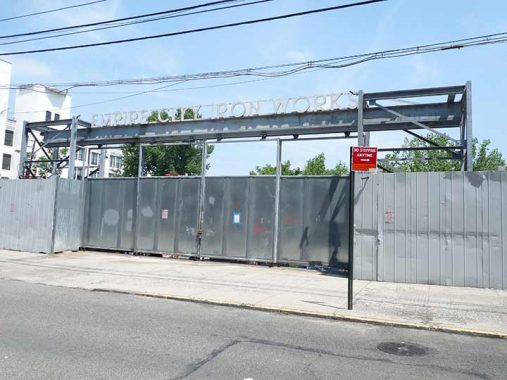
Empire City Iron Works, 46th Avenue between 11th Street and Vernon Boulevard. Here, I’ll turn it over to the Indispensable Walter Grutchfield:
Empire City Iron Works were founded 1907/08 when they were located at 838 10th Ave., Manhattan. In 1912 they moved to 898 8th Ave., where they stayed until 1919. Their telephone number at this location was Circle 1500 from 1915 until 1919. In 1920 the foundry in Manhattan closed and reopened in Long Island City, Queens, As reported in Engineering World, 1 Jan. 1920, “Empire City Iron Works, 898 Eighth Avenue, has acquired property on Tenth street, near Vernon avenue, Long Island City, comprising about 10,000 sq. ft. for the establishment of a new works.” The property between Vernon Blvd. and 11th St. on 46th Road (10-37 46th Rd.) and 46th Ave. (10-36 46th Ave.) has been their home since 1926/1927. A 1926 building on this site was reconstructed in 1959.
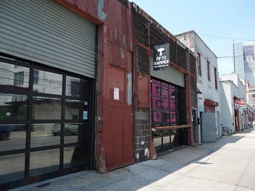
Other iron works or factory buildings on the south side of 46th Avenue have been repurposed. Fifth Hammer Brewing is a brewery, tap room and concert venue.
The name comes from the ancient Greek philosopher Pythagoras:
An ancient tradition holds that Pythagoras invented harmony. It is said that one day, he wandered by a forge and, hearing a wondrous sound come from within, ventured in to investigate. He found five men hammering with five hammers. To his astonishment, he discovered that four of the five hammers stood in a marvelous set of proportions, which, when combined, allowed him to reconstruct the laws of music. But there was also a fifth hammer. Pythagoras saw and heard it, but he could not measure it; nor could he reason its discordant sound. He therefore discarded it. [Princeton University Press]
The Gutter LIC continues a tradition from decades ago in which neighborhood bars also had bowling alleys. Neirs’ Tavern in Woodhaven, self-proclaimed oldest bar in NYC (it has been used as a tavern since 1829) has a pair of decommissioned alleys. At Gutter, the drinking is up front and eight lanes are in the back. I was attracted to its sidewalk shingle sign with a 1970s-style Coca Cola “swoosh” logo.
You’ve seen the ubiquitous magenta “Piece of Cake” moving vans. Here’s its equally magenta headquarters on 46th Avenue. In the early 20th Century, storage warehouses were often the tallest and most massive buildings in any given neighborhood.
Note how similar the two-story brick building midblock on 46th Avenue is to the corner building on Vernon Boulevard. They may have had the same builder. Such structures once contained offices for the factories, ironworks and warehouses that once dominated Hunters Point, which is now rapidly gentrifying as a residential area with tall, glass-fronted towers.
LIC Bar, on the corner of Vernon Boulevard and 46th Avenue, has an engaging retro-style neon sign and stenciled gold leaf signs in the windows, advertising cordials and draughts. You have to like those illuminated globes sporting LIC Bar signs at the side entrance. From the sign, you’d think that Neil Young himself was appearing on July 7th, but it was a variety of singers featuring his music.
Plaxall, a large plastics manufacturing company, has been centered in Long Island City for over 70 years and manages over 1 million square feet of real estate in southwestern LIC. The company was set to lease 290,000 square feet of property to Amazon before the deal was cancelled in 2019, with several of its buildings along the west end of 46th Avenue between Vernon Boulevard and 5th Street giving way to the Amazon campus.
“Plaxall has worked to cultivate a community within its properties, from providing space for local non-profit organizations like LIC Community Boathouse and Recycle-a-Bicycle to co-founding and sponsoring the popular LIC Flea & Food. Plaxall also proudly supports local businesses and civic organizations such as the Coalition for Queens, the Jacob A. Riis Settlement House, LIC Cultural Alliance and the LIC Partnership, among many others, through the Mathis Pfohl Foundation and – in several cases – active Board membership.” [Plaxall]
Recently Plaxall built this billboard reminiscent of roadside signs in mid-America indicating the businesses at 5-25. At the corner of 5th Street is a parking garage that went up in 2013. No American architect has yet been successful in designing an attractive parking garage.
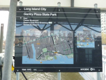
Gantry State Park is located in a new development at water’s edge known as Queens West. It makes a handsome riverside addition to New York City, which has shamelessly left undeveloped an incredibly large volume of waterside property which really should be available to the public as parkland.
Barge transfer gantries as seen from the new East River pier. Goods were floated across the river on barges, and transferred to a spur of the Long Island Rail Road at water’s edge in Hunters’ Point. When the park was built, the designers placed railroad tracks in the same spot where they used to run to the waters’ edge.
The Queens West high-rise apartment complex first appeared in 1998 and has slowly spread out along the waterfront west of 5th Street from 46th south to 50th Avenues. It was the precursor of the large thicket of high-rise glass front buildings that now dominate Hunters Point’s west end.
Ab welcome addition, though, is Gantry Plaza State Park, which opened in tandem with Queens West, and has grown along with the apartment development. Though the complex has been successful, some say it has overtaxed resources in the Hunters Point region, and a shopping and restaurant center has never really sprung up along Vernon Boulevard, the main north-south route. Vernon Boulevard still retains some of the small town charm it had when Hunters Point was home to industry and local residences.

To be truly appreciated Hunters Point’s iconic Pepsi Cola sign must be seen at night. Developers have retained structures such as the Pepsi sign as well as the Domino Sugar neon billboard in Williamsburg and the Colgate Clock in Jersey City despite those industries having long abandoned their former homes.
The Pepsi sign was built in 1936 by Artkraft Signs and comprised a 120-ft.-long sign grid covered with the product name. Shaped in the classic, 1930s, Art Deco, cursive script, the letters were formed with open-face channel letters outlined with exposed, ruby-red, neon lighting. Capitals “P” and “C” stood approximately 44 ft. high. Smaller letters ranged from 15 to 18 ft. high. Pepsi purists note that the “double dot” colon, which appeared with the original Pepsi name, was replaced by the dash in 1942 to “modernize” the logo.
Note the relatively modern Pepsi bottle neck logo (in use from 1970-1987). It was added when Artkraft Strauss refurbished the big sign in 1994.
Pepsi-Cola was first formulated by pharmacist Caleb Bradham in New Bern, North Carolina, in 1898 as “Brad’s Drink.” Within its first year of production it was renamed Pepsi-Cola from the digestive enzyme pepsin and kola nuts, which were both in the formula. It’s interesting that many modern soft drinks got their start as stomach settlers and were sold in drugstores, Perhaps that’s why many drug stores had ice cream soda counters in “the good old days.”
Anable Basin is a 500-foot long shipping channel issuing from the East River north of 46th Avenue, developed in 1862 by Henry Sheldon Anable, a developer in Hunters Point at the time and a relative by marriage to Eliaphet Nott, the cofounder of Hunters Point with Neziah Bliss. The basin was plied by vessels bringing materials to and from the various businesses located there including the giant Standard Oil, which also had a massive presence along the East River. There were paint and paving works, coal yards, and my favorite, Ward & Co. Lard Oil. Much of the industry and the pollution these firms caused — and the large number of people they employed — have vanished from the Hunters Point scene, and parkland now occupies the shoreline.
A single vessel can be seen moored in the basin.
In 2012, Plaxall purchased the Prudence Ferry, a decommissioned Bristol, Rhode Island ferry for $70,000 and parked it at Anable Basin. The intention was to operate it as a floating beer garden, but to date that hasn’t yet happened. That year, the nonprofit Coalition for Queens proposed to transform the 127,000 square foot Plaxall packaging warehouse on the basin’s shore into a tech incubator for start-up firms. That also has yet to happen. [Hidden Waters Blog]
More Plaxall-owned buildings, including a former beer distributorship and the home of Anable Basin Sailing can be seen across the waterway. A large illuminated countdown clock was installed on the building from 2017-2021 by an art group called the Creative Independent. It was co-created by famed artist Matthew Barney and counted down how many days until its creators hoped would be the end of the Donald Trump administration. Perhaps it will be installed once more?
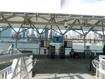
A couple of views of the East River taken while I awaited the ferry. I often consider how fortunate I was to be born in a city surrounded by waterways.
There have been independent ferries previously, but New York City got into the ferry business in a big way in the 2010s when Mayor Bill de Blasio proposed a citywide ferry service that would cost the same as a bus or train ride, including several new routes that would hopscotch along both sides of the East River and would reach as far as the Rockaways in Queens, Soundview in the Bronx, Coney Island in Brooklyn, and Stapleton in Staten Island. NYC Ferry now has routes to all these locales save Stapleton, but does have a St. George service from the Hudson River in midtown. Originally costing the same as a subway or bus ride, the heavily subsidized service was $4.00 per trip in July 2024.
On my wish list is a ferry stop in Little Neck, at the north end of Little Neck Parkway at Virginia Point. There’s a fairly busy LIRR-bus hub in Little Neck; but I think Gablers Creek at Virginia Point would have to be dredged for that to happen. Perhaps a Fort Totten ferry stop would be easier to accomplish.
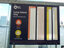
The ferry, which runs twice per hour on weekends, proceeded to 34th Street in Manhattan before heading expressly to the Brooklyn Navy Yard. There are stops on the Brooklyn waterfront such as Greenpoint and Williamsburg, but you need to catch the ferry from the Hunters Point station instead of the Gantry Park station for those. On a hot and humid day, I chose to sit indoors in the air conditioned cabin rather than outdoors on the deck as usual.
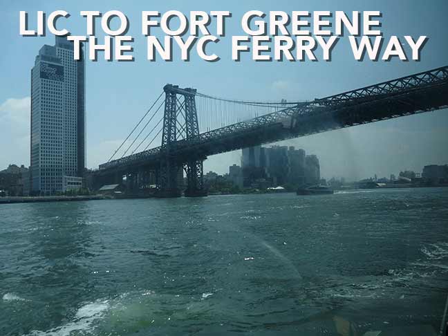
From the river, I saw the American Copper Building towers, one of which has an unusual angled design that makes them look from across the East River in Hunters Point as a giant reverse letter K or perhaps a crooked letter H; as well as some of the new Domino Square development alongside the Williamsburg Bridge.
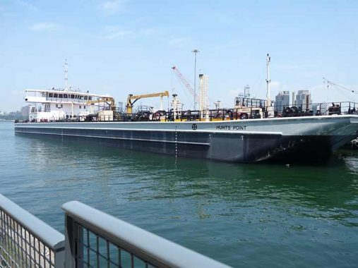
Upon alighting on the ferry dock, I caught sight of the barge Hunts Point, named for the southern Bronx area now home to NYC’s produce and fish market wholesalers.
The New York Naval Shipyard, known popularly as the Brooklyn Navy Yard, was established by the federal government in 1801. Robert Fulton’s steamship was built here and launched in 1815; the battleship Maine in 1890, as well as the first angled-deck aircraft carrier, the Antietam, were also built at the Navy Yard. The Navy Yard at its peak just previous to World War II employed 10,000 workers. It has 5 miles of paved streets; 4 dry docks (including the landmarked nation’s oldest, which began construction in 1840) ranging in length from 326 to 700 feet; two steel shipways; and six pontoons for salvage work. The Navy Yard was decommissioned in 1966 and is now a center for private manufacturing and industrial parks.
Shipping is not completely absent from the yard, as it remains home to the GMD Shipyard, which occupies three of the Yard’s remaining six dry docks. At GMD, barges and ferries serving the NYC area are serviced.

Every neighborhood gets a new glass-front building, it seems, and the Navy Yard is no exception. This is the Dock 72 building located next to the ferry landing and home to a number of private b usinesses including a We Work common working space. Its website explains:
Dock 72 is the home of 21st century manufacturing in the digital age – a laboratory for the production of ideas and innovation. The 675,000 square foot building was designed to integrate state-of-the-art modern Class-A office infrastructure with the unique design aesthetic developed for a community of collaborators. The building features 14’ floor to floor heights with 8’ of vision glass, intensifying the light and air throughout and building and highlighting the unobstructed views of Manhattan and Brooklyn. The building’s dual cores and two entrances provide access from the land and water side of the site. 18,000 square feet of private terraces provide an indoor-outdoor working environment and complement the building’s active vegetated open space. Dock 72 is a place to plug in, to refuel and to be inspired. [Dock 72]
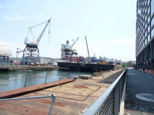
These super tall cranes, operated by GMD, are called “whirly cranes” because they can turn 360 degrees.
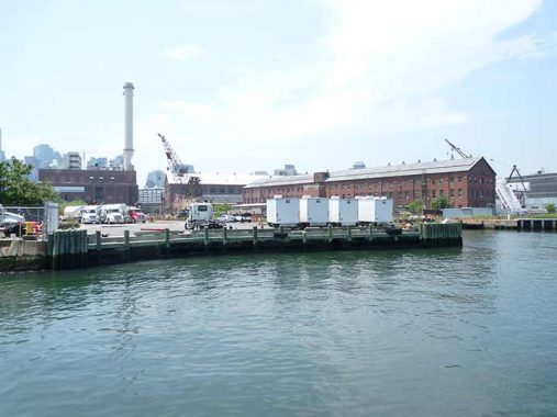
The view from the ferry landing.
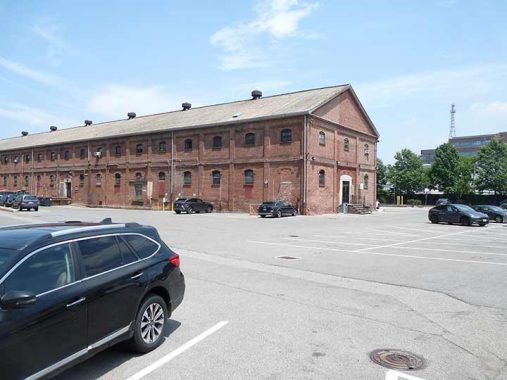
I have searched high and low for a definitive historical guide to the buildings within the Navy Yard, but management is tight lipped about these matters. Building 120 is a lengthy brick building facing Flushing Avenue; its length may be because it may have been used to make rope. Currently it is home to Barry Rust and Hub Woodworks woodworking and metal fabrication, ATZ Trading and Warehousing, New York Decks construction, and other businesses.

Building 77 was originally built in 1942 as a storage facility and Naval Intelligence office. It has been given a modern makeover and ther ground floor, open to the public, features several eateries that include a Brooklyn branch of the Russ & Daughters appetizing franchise. Private businesses occupy the top floors.
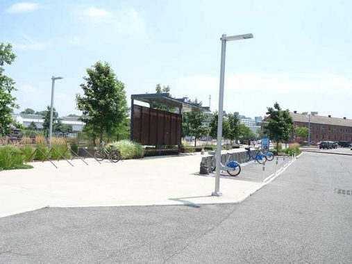
Note Citibike docks. The Navy Yard is cagey about what is private and what is public. Bicycling seems to be allowed. There is a bus shuttle connecting businesses in the vast Yards.
Note the new trend in street lighting. Formerly home to incandescent gumballs I saw in passing from Flushing Avenue in the 1970s, Navy Yard streetlamps are state of the art. This one is firmly in the minimalist trend, with LED bulbs on a simple L-shaped metal sticks.
Most Navy Yard streets are lit by these massive metal poles manufactured by Pfaff and Kendall. Each supports two large solar panels, but not all. One had a spinning wheel atop the shaft that was producing its electricity. Help me in Comments: what is it called?
Now to my complaint. Aside from a bagel at Russ & Daughters, this was as far as I got in the Navy Yard, as when security spotted me wielding a camera, they rolled up in a car with the familiar “Can I help you sir.” The guard explained that only Buildings 77 and 92, as well as the Wegmans supermarket and adjacent shops at the west end adjacent to Navy Street, are truly open to the public and photographable. He was pleasant enough, and I didn’t argue; he had a job to do on a hot, humid day.
I question the validity of banning the public from most of the Yard and forbidding photography. I would concur with keeping the shipyards and Steiner Studios private, but what’s the big secret about the rest of the place? The hospital could be cordoned off (as has been done with the Smallpox Hospital on Roosevelt Island). Do the Navy Yard’s host of manufacturers, artists and filmmakers want to keep their work private? They can, behind closed doors. The public should be allowed to stroll the Navy Yard and photograph what they like, no hindrances. I can walk round Forts Schuyler, Tilden and Totten and the Creedmoor grounds in Queens bold as brass, unstopped. What about the Navy Yard? It’s not 1801-1966 anymore. Open it up.
My associate Joe Anastasio of the LTV Squad did some surreptitious Navy Yard wandering and produced a book, “Brooklyn Navy Yard: Beyond the Wall,” on sale. Scenes include the incredible transformation of Building 128 from decrepit hulk to bustling workplace.
A note to the Brooklyn Navy Yard Development Corporation (BNYDC) is a not-for-profit corporation that serves as the real estate developer and property manager of the Yard, was met with, as I expected, stony silence. I suspect this is because the answer to my question about public access is “because we said so,” or they don’t want to give the real answer.
Free the Navy Yard!
Next in Part Two: Into Clinton Hill and Fort Greene
As always, “comment…as you see fit.” I earn a small payment when you click on any ad on the site. Take a look at the new JOBS link in the red toolbar at the top of the page on the desktop version, as I also get a small payment when you view a job via that link.
7/21/24

10 comments
I could kick myself now when I think of all the times I could wandered the Navy Yard with my
military ID when I was home on leave from the Navy back in the ’70s but didnt.It was a reserve
base for many years after the yard part was closed and SeaTrain had a repair facility but that was
it.But my thinking back then was,hell,after youve seen one govt. shipyard youve about seen them
all so why bother?
The “old” Pepsi logo neon sign in L.I.C. reminded me of my mother, who passed away two years ago, in the early1960s. At some point during that time, Pepsi introduced a more contemporary design for their bottles, sans the “old” logo. Even though the “old” and “new” bottles came from the same plant in New Bern, NC, she’s swear the Pepsi tasted better in the “old” bottles. True story.
Boston has some boat routes as part of their transit system, and London has some boat routes on the Thames that accept Oyster card (their version of a Metro card, which does charge by distance. I don’t know who came first with the idea of integrating boat services with the transit system except that I don’t think it’s New York! (in other news…My grandfather was a bricklayer, and my father told me he thinks one of the places my grandfather laid bricks was in the Navy Yard. That would probably be around 1920-1930. I will never know which building.)
Perhaps it’s time for a waterborne Forgotten-NY tour. Imagine giving a tour aboard a NYC Ferry from Soundview or Rockaways to Wall Street. So much to see without the walking.
That’s Mitch’s domain, if he was still here.
Visit the Navy Yard on a Open House NY or open studios day, and you get free rein of the yard.
My Dad worked at the Long Island City Post Office from about 1958 to 1983. He worked manually sorting mail in front of dozens of “pigeon holes”. He had to know every town, village, and city in New York State, and to which regional mail center the letter had to be directed to.He worked the 4pm-12pm shift, and often worked 4 hours overtime, especially the year end holiday rush. For many World War 2 veterans like my Dad, the post office job was the best you could get, low pay but health benefits, a pension, but no social security at that time.
He worked with Moe Biller, who later became head of the Postal Workers Union.
I love your walking tours of LIC because that is where I grew up right on Crescent Street around the corner from the 59th St Bridge. I lived there from 1954, the year I was born until 1978 when that part of my neighborhood started going to hell in a hand basket. I will give you one memory for now. My dentist at the time Herbert J. Berger owned(at least I think he did) a huge building that went from Crescent St to 27th Street on Bridge Plaza North half way up Crescent Street. It housed lots and lots of businesses but most notably in the lower reaches it housed a bowling alley. I don’t remember the name. That is where my parents met and where my father proposed to my mother way back in 1953. There was also a bar on the 27th Street side called Smugglers Cove..Sadly the building has been demolished for who knows what. I now live in Sunnyside. Keep up your walking tours. I love them
The dentist was Herbert J Breger not Berger
Small correction re PS 1, MoMA is not the Metropolitan Museum, it is the Museum of Modern Art.