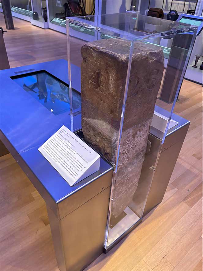
I was in the New-York Historical Society on July 4th, 2024 puttering around the exhibits, when i saw a rectangular post in a glass case, marked with a “4” on one side and a “26” on the other. I instinctively knew what it was: a marble post set at the corner of 4th Avenue (now called Park Avenue South) and East 26th Street around 1810, give or take a year. Only there were no 4th Avenue and 26th Street then, it was an open field where the city eventually hoped to build streets.
It was placed there by a surveyor named John Randel Jr., who was using hand tools, pen and paper, and traveling by foot and on horseback up and down the island, determining where streets would be built and how wide they were for a grid system determined by the a three-member group of commissioners that followed and modified similar grid plans developed in previous years. A grid was planned as far north as 155th Street, which the commissioners believed it would take a century or more to reach. Eventually, with a few major additions like Central Park, the street grid was built out, though Manhattan’s hilly topography above 110th Street compromised the grid somewhat. South of that, hills were modest enough to level using shovels and in some cases explosives.
As a rule, Randel set two posts were intersections would be located, catercorner to each other. The post on exhibit at NY Historical was unearthed when excavations for the second Madison Square Garden were underway in 1889. That MSG was designed by Stanford White and, in 1906, it was the place he was murdered by Ernest Thaw.
In some cases rock outcroppings made placing marble posts difficult. In those cases, metal bolts were placed. Two or three can still be found around town, and I note their appearances, but not their locations, as well as an expanded explanation of the grid system, on this FNY page.
As always, “comment…as you see fit.” I earn a small payment when you click on any ad on the site. Take a look at the new JOBS link in the red toolbar at the top of the page on the desktop version, as I also get a small payment when you view a job via that link.
7/6/24


2 comments
That is very neat!
I went last week, for my first visit, to the New-York Historical Society (I love that hyphen between New + York!) to view the Castello Plan installation curated by Russell Shorto.It ends today, unfortunately. It was special to see the original street plan for south of Wall Street. I came home with two items from their gift shop: A book, “Manhattan in Maps, 1527-2014” and a nice facsimile of the Castello plan in a matte I plan to have framed. Kevin, I have you to thank for my acquiring of the map collecting bug.