
By SERGEY KADINSKY
Forgotten New York correspondent
SINCE the turn of the millennium, the city’s bridges have been subject to road diets, in which space was dedicated for bikes and pedestrians, such as the inner lanes on the Brooklyn Bridge and the outer lanes on the Queensboro Bridge. The most glaring example of a bridge where cars had their last hurrah over non-motorized forms of transportation is the Triboro Bridge (renamed after RFK Sr. in 2008). Its north walkway has stairs rather than ramps, while its south walkway was abandoned in 1997.
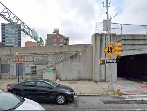
On the Queens side of the bridge, the north walkway has two maps, one from many decades ago and a more recent map. The older map shows Little Hell Gate nearly separating Wards and Randalls islands, and Downing Stadium which was replaced with Icahn Stadium in 2005. The current map has the two islands combined under the name Randalls Island plus the bridge’s official name honoring the country’s 64th Attorney General.
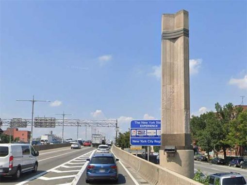
Motorists entering the bridge see a three-pointed pylon marking the Queens landing, along with a sign from the Andrew Cuomo administration promoting tourism. When this bridge was built, it received worldwide attention for its height, length, and size. It served as an example to subsequent bridges that cross much longer distances.
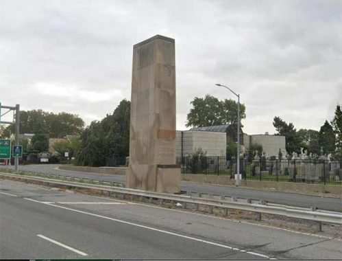
The great bridge was built in tandem with highways leading to it: Grand Central Parkway, Harlem River Drive, and East River Drive. More than a mile inland, each of these roads has Art Deco-style monumental pylons inscribed with “Triborough Bridge Approach” on one side and the road’s name on the other. As much as the DOT and MTA try to replace all Triborough signs with Robert F Kennedy’s name, on these pylons the original name is set for eternity.
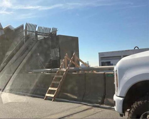
Considering the progressive politics among many Astorians, I am surprised that there isn’t a movement to revive the south walkway as it offers better views of Manhattan. Its reopening is as likely as walking on the Verrazzano or the Whitestone bridges. That’s because the stairs connecting to the south walkway were removed around 2000 on both sides of the bridge in favor of an additional lane for cars. Only construction workers can access this forgotten walkway using a ladder across the jersey barrier, or by climbing up a shaft inside the anchorage tower.
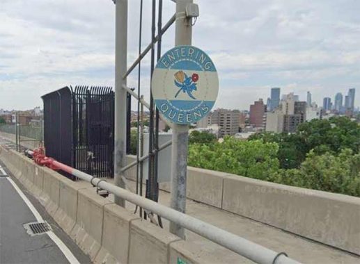
On the Queens side of the south walkway, a cage covers a shaft connecting to the ground, but there is room here for the walkway’s revival if the right lane were pedestrianized. The “Entering Queens” medallion has the colors of the borough’s flag, wampum beads, and two flowers- the Dutch tulip with the English rose.
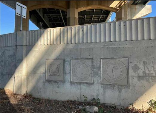
On a ramp built in this century on the Wards Island side, are three logos: Triborough Bridge and Tunnel Authority, NYC Parks Department, and the nonprofit Randalls Island Sports Foundation. The first of these is a unit of the MTA responsible for toll bridges and tunnels, renamed as MTA Bridges & Tunnels.
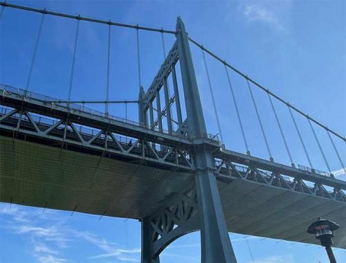
A panoramic view of the bridge from Wards Island shows a balcony on a suspension tower. Elevated above vehicles, the design of this walkway is similar to the Ben Franklin Bridge in Philadelphia, which in contrast has both of its walkways open to the public.
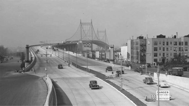
Looking back to 1938 with an archival photo from the Queens Borough President’s Office, we see how the south walkway appeared on the Astoria side, exactly two miles from the walkway’s entrance on Randalls Island. At the time, there were no pedestrian or automobile ramps on Wards Island, as it hosted an asylum. Many people see the high elevation of the Triborough and Hell Gate approach viaducts on that island and feel that their height was designed to prevent patients from escaping the island. Today, there’s still a psychiatric facility on the island, but it is surrounded by parkland.
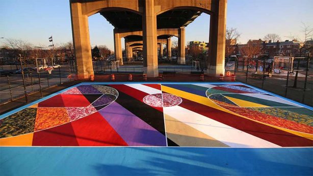
Underneath the Queens landing of this bridge is Triborough Bridge Playground B, which retains the old name of the RFK Bridge. On its basketball courts are murals painted in 2018 by Brooklyn-based artist Mark Paul Deren, better known as MADSTEEZ. It is one of five playgrounds under the bridge, named A through E.
Kevin Walsh walked on all the Manhattan and Queens spans of the Triboro Bridge in 2011 on Forgotten Tour 48.
As always, “comment…as you see fit.” I earn a small payment when you click on any ad on the site. Take a look at the new JOBS link in the red toolbar at the top of the page on the desktop version, as I also get a small payment when you view a job via that link.
11/10/24

13 comments
I’ve walked and run across this bridge several times. There’s a section of walkway over the East River where the fence that protects pedestrians from falling off is perhaps 5’ high. It’s very scary. You wanna be very polite to anyone you may encounter on the bridge for fear that they can easily throw you off.
I do not care for the height of the railings on both the Triboro and Marine Parkway bridges and rarely cross them n foot.
I’m guessing the psychiatric hospital would be Manhattan State which has
many famous alumni.
I’ve driven over the Triborough probably a thousand times in my life, and I can’t get used to calling it the RFK Bridge. Let me add one minor correction. The Triborough Bridge was indeed constructed in tandem with the East River (FDR) Drive and Grand Central Parkway, but not in tandem with the Harlem River Drive. That roadway was not built in 1947-64, according to the link on the page. Much more recently, a new ramp connecting the Manhattan arm of the bridge with the northbound Harlem River Drive was opened, eliminating the need for two blocks of zig-zagging on local streets.
As I recall from my reading of “The Power Broker: Robert Moses and the Fall of New York” by Robert Caro, there’s a reason those pylons marking the beginning of the bridge approach are so far from the bridge itself. Seems that at the time, there were funds specially designated to be used for the construction of bridge approach roads and ramps…. It was Moses’ talent to find all these obscure funding sources when building his projects, and “adjust” definitions and appropriate the funds for uses beyond the intention of the actual funders.
Another perfect example is that little exit ramp on the northbound side of the Henry Hudson Parkway that gets you into Fort Tyron Park. It’s only purpose was to allow the H.H. Parkway to meet the technical definition of a “park access road” – and there were funds set aside for the construction of such roads….
As Chairman of the Triborough Bridge Authority, Moses was able to use the bridge tolls, and float TBA bonds, to raise money for his many other non-TBA projects. “The Power Broker” is a fascinating read!
When we were kids, my brothers and I would buy a burger at Weston’s to get the free tickets to see the Cosmos’s play. Grab the bikes and ride over to Downing Stadium.
We did this several times and even met Pelé. Back then there was a little bridge connecting Wards and Randall’s islands.
The Weston’s Big W was much better than a Big Mac, IMO.
With the GWB having both its its walkways reopening to the public, perhaps people in Astoria can advocate for the same on the Triboro Bridge.
As a Boy in the 1950s all the athletes walked or ran to Randles. We also played all sports under the Bridge. Span over water was an area to show courage .
Sadly, the south walkway on the Triborough Bridge
was removed in May 2025.
The Triborough was designed by Allston Dana. NOT Othmar Ammann.
Does anybody know what the two large devices are on both sides right before entering manhattan? It looks like its got a bunch of traffic lights facing every direction, but they arent lights. Ive heard its a military weapon.