


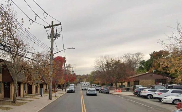
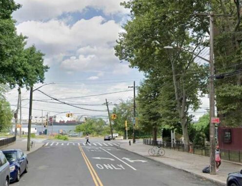
In the New Brighton neighborhood of Staten Island, Jersey and York streets run parallel to each other, with a steep slope between them, part of the borough’s complex geology. Kevin visited this street in 2020 and 2023 to document the fading Fletcher’s Castoria mural ad on 386 Jersey Street. Once a prosperous commercial strip, Jersey Street’s fortunes declined in the late 1960s as people moved to new neighborhoods on the west side of the island.
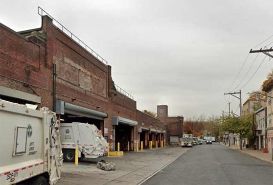
Jersey Street begins at Victory Boulevard, the historic 8-mile trans-island route that runs from east to west. This road was built in 1816 as Richmond Turnpike, a toll road by a company owned by Vice President Daniel Tompkins. It was renamed Victory Boulevard following the end of World War One. Between 1949 and 1968, it carried the state route number 439A. The sanitation garage here is architecturally uninspiring but on the side facing Brook Street there is a historical item on the wall. The only legible word here is “company,” hinting at the garage’s previous occupant, Staten Island Coach Company, initially for streetcars and then for buses.

On a visit to this street, I noticed a shuttered Church of God in Christ for sale, likely to be demolished in favor of a commercial structure. Looking at its design, it hinted at its original use as a synagogue, as it resembles the landmarked Tifereth Israel in Corona. “Christ is the A” seemed like the fitting message for a congregation in decline, unable to afford the high cost of upkeep on this century-old building.
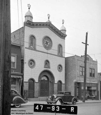
Agudath Achim Anshe Chesed opened in 1913, featuring stars of David in the rose window and atop the pediment. The synagogue’s name translates as “Union of Brethren People of Kindness,” nicknamed by its members as Triple A. As the Jewish community’s fortunes grew from working class to middle class, many members moved into single-family homes in other parts of Staten Island. In 1970, the congregation purchased a former Methodist church at 641 Delafield Avenue, holding services through 2005. The building suffered a fire in 2015 and was then demolished for a set of residences.
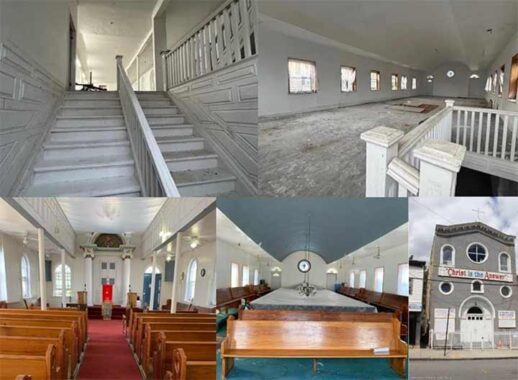
I was not able to enter the shuttered former synagogue, but fortunately there are plenty of photos available on Zillow and MLS showing the sanctuary virtually unchanged since its last Jewish service. The women’s balcony wraps around the sanctuary where men sat. One can imagine immigrant crowds from Eastern Europe walking up these creaking wooden steps in the first 63 years of this building.
Next door to the former synagogue, Mt. Sinai United Christian Church also has an interesting history, the building having previously hosted a funeral home and an American Legion post.
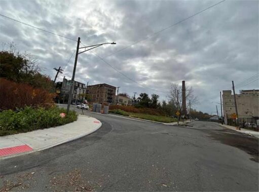
The street’s architectural and social decline is evident further north, where the federally-subsidized Richmond Gardens townhouses were built in 1984, chronically plagued with building violations and unsafe conditions. They were built as an urban renewal project that replaced rows of shuttered storefronts.
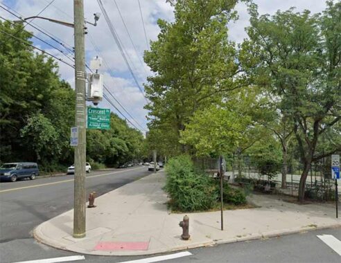
At Crescent Avenue, Mahoney Playground offers open space for recreation. The street sign here carries two honorary co-names: Eddie Watkins and Arnold Obey, two local physical education teachers. Street renamings and co-namings used to be rare, but since the turn of the millennium, the 51 Council Members have released lists of honorees every year, resulting in many more names being added to the map. In some spots, the lampposts now carry multiple names. Mahoney Playground’s namesake was a West Brighton resident killed in combat in World War One. This park was expanded in the 1960s when the NYCHA Richmond Terrace Houses were built next to it.
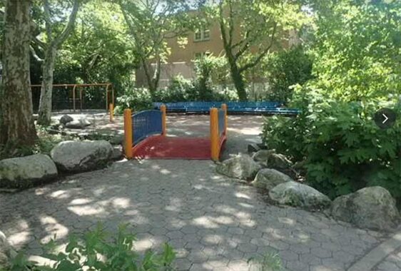
On the south side of Crescent Avenue is Davis Playground, which shares its namesake with P.S. 31, the William T. Davis School, honoring Staten Island’s famed naturalist who documented its unique geology and wildlife. Built in 1969 in tandem with the school, it interrupts Bismark Court, which misspells the name of Germany’s first chancellor.
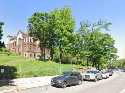
Across from the playground, St. Stanislaus Kostka Roman Catholic Church stands on a hill overlooking Jersey Street. Its namesake was a young Polish Jesuit who was renowned for his high level of spirituality. His name also appears on churches in Maspeth, Greenpoint, and the East Village, all of which offer services in Polish.
Jersey Street descends towards the north shore, flanked by Richmond Terrace Houses, which are as nondescript as any other NYCHA project seen across the city. This is where longtime Daily News columnist Denis Hamill grew up.
Jersey Street ends at Richmond Terrace, the winding road that follows the north shoreline of Staten Island. Prior to 1953, there was passenger train service paralleling this road and the water’s edge. Failing to turn as profit, its abandonment contributed to the isolation and decline of this neighborhood. The New Brighton station picked up passengers at this corner, all traces of it disappearing over the decades. The last freight trains here ran in 1989 and since then the tracks here were removed.
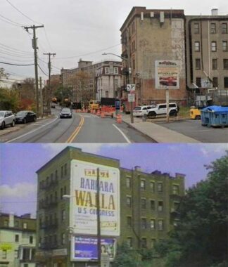
On this corner at 514 Richmond Terrace is a fading ad whose lettering is illegible, but a tax photo from the 1980s reveals a congressional campaign mural for Barbara Walla, who ran as a Democrat in 1986. She lost to incumbent Guy Molinari, who later served as Borough President. Although the North Shore of Staten Island is reliably Democratic, the rest of this borough is a Republican stronghold, marching to the opposite tune of the other boroughs.
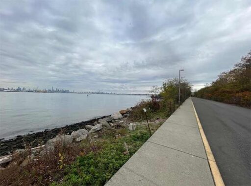
Between the minor league ballpark and Jersey Street, an extension of this road shown on maps as North Shore Esplanade runs on the route of the train line, and there is sufficient space here for a revived North Shore Branch. Since the turn of the millennium, there have been proposals drafted to restore transit here either as a busway, railroad, or light rail. For now, select bus service and bike lanes on Richmond Terrace will suffice.
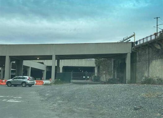
A short distance to the east of Jersey Street, train tracks appear in a tunnel underneath the parking garage for the Staten Island FerryHawks stadium. In 2001, the island received its own minor league stadium, used by an affiliate of the Yankees until 2020, and then the Atlantic League’s FerryHawks from 2022. From 2001 through 2010, the stadium had its own train station here which closed due to budget cuts.
The exact site of the New Brighton station was where Jersey Street meets the dead-end Bank Street that runs to the salt pile where a massive gypsum works once stood. It provided 500 jobs, relying on the waterway and tracks for deliveries. U.S. Gypsum closed its New Brighton plant in 1976, but there’s plenty of industry to see further west along the Kill Van Kull. Kevin first visited this site in 1999, seeing the abandoned gypsum works, documenting the city’s demolition of Bank Street’s bridge across the unused tracks.
[We also mourn Liedy’s Shore Inn, which served shipyard and gypsum plant workers on Richmond Terrace near Lafayette Avenue, closed in 2024.]
Sergey Kadinsky is the author of Hidden Waters of New York City: A History and Guide to 101 Forgotten Lakes, Ponds, Creeks, and Streams in the Five Boroughs (2016, Countryman Press), adjunct history professor at Touro University and the webmaster of Hidden Waters Blog.
Check out the ForgottenBook, take a look at the gift shop. As always, “comment…as you see fit.” I earn a small payment when you click on any ad on the site.
11/22/25
6 comments
Interesting post, thanks, Sergey. My family grew up on Jersey Street, and from what they say, it was a bit bedraggled well before the 1960s. Heavy rains in 1937 caused a tenement to collapse where the Richmond Terrace Houses now stand, killing 19 and injuring four others. The remaining housing stock nearby wasn’t much better. And while the SIRT North Shore Line did indeed close due to lack of revenue in 1953, I wouldn’t classify New Brighton as isolated. It’s only one mile west of St. George, the island’s civic and transportation center. Jersey Street is served by several bus lines to numerous parts of the island and to the nearby ferry terminal. BTW, that building at 514 Richmond Terrace served as Staten Island’s first Borough Hall until the current (and absolutely gorgeous) French Renaissance Borough Hall opened in 1906. Good stuff!
If there is a Jersey Street, I wondered, why is there not a Guernsey Street? But FNY has already found it, in Greenpoint. The only other Channel Island is waiting. Google does not know of a Sark Street anywhere!
Alderney feels left out.
Kevin, thanks for remembering the “forgotten borough”.
I remember Liedy’s Inn, went there once with my boss at the time, whose cousin owned the place. Sorry to hear that it has closed.
Right where Jersey St meets Richmond Terrace, there was a movie theater called the Star on the water side of the Terrace at #505 . According to Cinema Treasures, it closed in 1954, but I remember the building with the marquee intact still being there well into the 1960’s.