

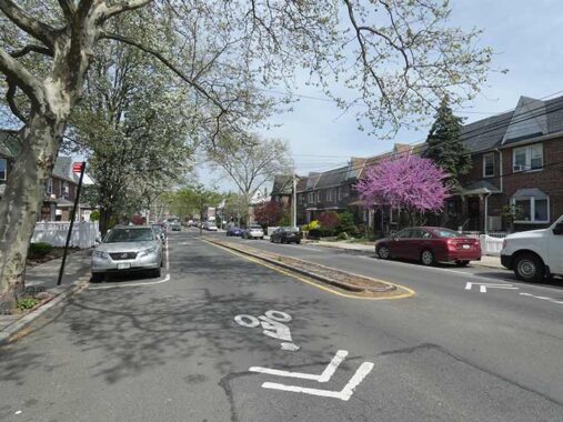
AFTER a long cold winter when I couldn’t really get out because of snow, cold and wind from December through much of February, I have been making up a bit, staging several camera walks around town even as I test for various suspected maladies, which is a feature after 65, not an exception. In April 2025 I decided to walk from Maspeth to Rego Park and it was a tough walk because of conditions on the opposite end of the scale, 90 degrees with humidity, as if it was mid-July. I was dragging by the time I reached the subway at Queens Boulevard (only about 4 miles, so I have to get back in walking shape), but this was a part of town I hadn’t been in for a few years at least, though I have covered each area adequately in FNY over the last 27 years.
GOOGLE MAP: MASPETH TO REGO PARK
I took a Q18 bus to Grand Avenue and 69th Street, after having to seek out a different bus stop because the wise heads at the MTA decided to eliminate several bus stops throughout Queens. Grand Avenue was once called Grand Street throughout its entire length from the Williamsburg waterfront to the heart of Elmhurst, but east of Newtown Creek it became Grand Avenue—which probably caused confusion with Astoria residents, which had their own Grand Avenue; the latter became 30th Avenue when Queens streets and addresses acquired their well-known numbering system. I also chose to follow a somewhat different route, in that I usually chose to stay with Grand Avenue all the way to Elmhurst in most previous forays. You can check my route at the above link.
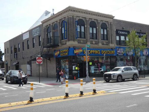
It has been decades since this building at Grand Avenue and 69th Place has been a movie theater and most area locals don’t remember it as one. Now a discount store and bingo hall, and before that a pharmacy, the Maspeth Theatre was the largest of the town’s three theaters. The venue was built in 1924 with 1,161 seats to a design by Architects Straus and Strausberg. The theater was taken over by William Fox in 1927 but went into bankruptcy in the crash of 1929. The successor company, Metropolitan Playhouse, assigned it to a company called Randforce Amusement Company, which ran the theater until 1965 when it closed its doors forever.
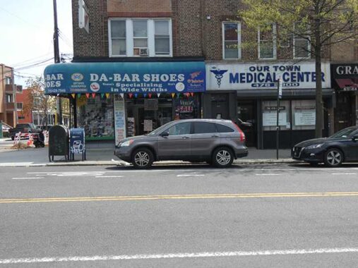
I have begun paying more attention to vintage sidewalk signs, such as these at Grand Avenue and 69th Lane, with the show store ad rendered in the Cooper Black font originated by Frederic Goudy, and next door, a classic vinyl and plastic sign for a local urgent care.
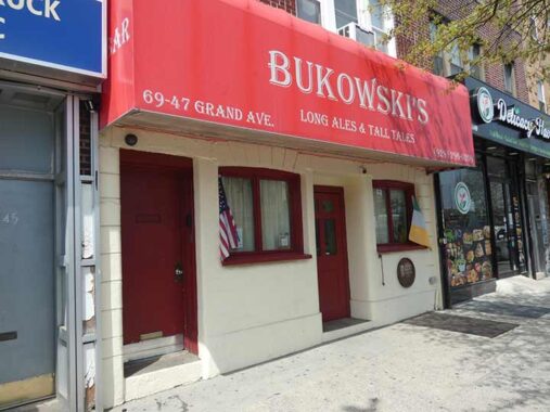
I have been all wet before — I used to think Connolly’s (see below) was named for Irish politician Michael Connolly (who knows why I plucked that out of my hat) but I’d also have to think Bukowski’s tavern, 69-47 Grand Avenue, may have been named for famed poet and well-known tippler Charles Bukowski (1920-1994).


I have always wondered about this building clad in buff bricks (though likely not Kreischers) at 69-61 Grand. Now home to a senior center, it hosted a bowling alley in 1940.
The Queens Public Library Maspeth branch, established in 1938, sits nearly directly across Grand Avenue at #69-70. I am unsure when this building opened, though.


Another pair of handcrafted signs I liked, for Burton Plumbing & Heating Supply and Maspeth Pizzeria (I have always been partial to Joey’s at 69th and grand, or Rosa’s, a block away on 69th). The camera was attracted to the sign in Italian flag colors as well as the illuminated shingle sign.
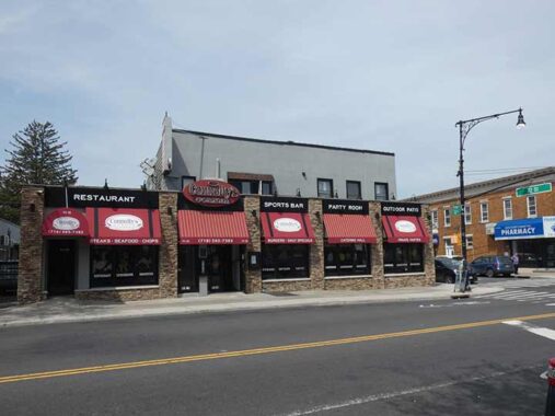
I have partaken at Connolly’s Corner, Grand Avenue at 72nd Street, on a handful of occasions over the years. In March 2011, it was the venue where I did a historic Maspeth presentation for the Newtown Historical Society, on which I am a trustee. What I remember about the day is that it was snowy and slushy but the chat still sold out and it was the very evening of the day I was laid off from Publishers Clearing House in Port Washington for the second time!


I have always been fascinated with Mazeau Street (pronounced by the locals to rhyme with “Magoo”) a short, crescent-shaped street issuing from Grand and 57th Avenues south to the Queens-Midtown Expressway. I’ve been saying on various tours and presentations that the street was renamed from Maiden Lane several decades ago. It’s not quite as straightforward as that, as I explain on this FNY page.
Meanwhile there’s a fork in the road at Grand Avenue and Mazaeau, as 57th Avenue runs east, eventually abutting the Queens Midtown Expressway, admitting only 74th and 80th Streets south. This is an old road originally called North Hempstead Plank Road. A number of Queens roads, including Northern Boulevard and Booth Memorial Avenue, sported “North Hempstead” in former names, indicating they pointed toward roads that would enter the Town of North Hempstead in Nassau County. Until 1899, all of Nassau County was included in Queens County, but opted for “independence” when western town in Queens voted to join Greater New York.
East of the present 80th Street, the road became part of Caldwell Avenue (though not today’s Caldwell Avenue; I’ll get to that).


Maspeth’s WWI Memorial in the fork was named for a local soldier, Walter Garlinge. Erroneously spelled, and despite the Parks Department signage, Garlinge was not the first Maspeth resident to lose his life in the war. It was designed by architect Paul C. Hunder and constructed in 1931. The memorial also contains the names of all Maspeth soldiers who were WWI casualties. For several years, Parks spelled the name “Garlinger” but that was rectified several years ago.
This triangle also contained a handsome street clock.
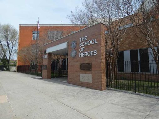
PS 58, 72-24 Grand Ave, is named the School of Heroes, as it opened in 2002 and was named to honor police, firefighters and first responders to the September 11 terrorist attack the previous September.


Some older dwellings can be found along 57th Avenue, such as this slanted-roofed house east of 73rd Street that has been nearly engulfed by outdoors glassy sun rooms.
Maspeth is occasionally hilly in spots, including steep grades here and there. The section of 73rd Place south of 57th Avenue is dead ended with a wall, rather than subject people climbing a steep hill to Grand Avenue. Other locations partially solve this issue with step streets (as on 53rd Avenue and 65th Place) but not here.
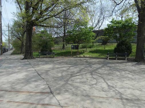
The prosaically named (in the post-Henry Stern era) “Elmhurst Sitting Area” can be found at the 74th Street QME underpass at 57th Avenue. A rather more picturesque rest stop is available in Elmhurst Park (see below).
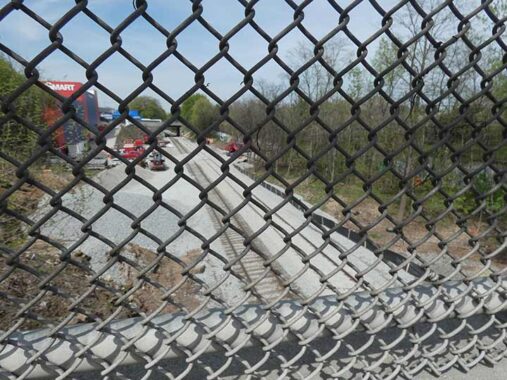
Workers are replacing railroad ties and concrete roadbeds at the NY Connecting Railroad, a freight route connecting the Fresh Pond Yards (Queens) and Oak Point Yards (Bronx). Some believe this is work for the hoped-for Interborough Express (IBX) but this work has nothing to do with the IBX, which still has to work out agreements with CSX, environmental concerns and funding before any work can commence.


The site of Elmhurst Park was once the location of two KeySpan Newtown gas holders, seen in a 1940 photo, a highway landmark popularly known as the “Elmhurst gas tanks.” With the support of the community, the site was sold by KeySpan to the City of New York for $1 and was cleaned up and returned to the public as open space. The tanks were built in 1910 and 1920 and in service until the 1990s.
A fascinating aspect was that the tanks covered a 17 million gallon basin of water used as a sealant. Tank inspections required a worker to crawl through the gas main to the water basin and use a wooden rowboat to navigate the basin while inspecting leaks, sort of like Charon ferrying the dead across the River Styx in the classic myths.
The park now features lush lawns, jogging paths, seating, sculpture, modern comfort stations, safety lighting, and more than 620 trees. The playground, designed for tots and young children, is energy-themed, in keeping with the site’s history. At the playground, you can pedal a stationary bike to provide a light effect on a nearby column. The new park is also in keeping with sustainable practices. Storm water at the site will be collected in an underground retention system to reduce the amount of water flowing into the sewer pipes in the street. It’s accessible from both Grand and 57th Avenues.
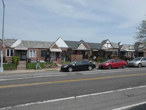
If you have read Forgotten NY long enough you know I refer to the small 2 and 3-story walkups found in Gowanus, Carroll Gardens and other locales in western Brooklyn as “the bread and butter of Brooklyn residential architecture.” I can say the same for these one-story brick attached dwellings with neat front lawns, found all over side streets in Elmhurst, Glendale, Rego Park and other areas in central Queens. These can be seen on 80th Street south of the Queens Midtown Expressway. Most were built in the late 1930s and early 1940s.
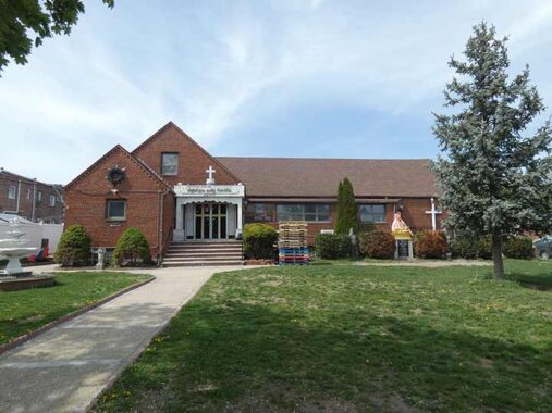


This simple brick ranch house, built in 1955 at 80th Street and Caldwell Avenue, my not resemble a church or spiritual center, but it contains two disparate Christian communities, one serving Tamil speakers (the language, one of Earth’s oldest, is spoken in India and parts of Malaysia) and a Filipino Seventh Day Adventist church. The building previously housed the United Church of Christ.
[D]etails…like the brass ceremonial lamps on the altar and the pulpit itself, are all from India and employ typical Tamil metalworking styles. They establish the link between Christhava Tamil Koil—which translates from the Tamil language as “Christian Tamil Church”—and Tamil Nadu, a state in southern India. There, Christians trace their faith to the Apostle Thomas who, they believe, came to India in A.D. 52 to evangelize. He is believed to have died in what is now the state’s capital, Chennai.
Compared with other world faiths, the Church of South India is not large. Christians make up just over 2 percent of the population of India and only 6 percent in Tamil Nadu. [Queens Chronicle]
“Ya doesn’t have to call me Johnson.” Though here it sits in the place of 59th Avenue, Caldwell has never been given a number, because it later turns southeast and intersects several other numbered avenues. Older maps show it as Johnson Avenue. Maps from about 1915 show a street grid here that was never fully implemented, though some of the proposed names, such as Caldwell and Eliot, were used later on. At one time, Johnson Avenue cut across open country, as seen on this 1909 map. I have a full story here.
Perhaps Johnson Avenue was renamed when Caldwell Avenue further north became part of 57th Avenue, but the city still wanted to honor the Caldwell it was named for.
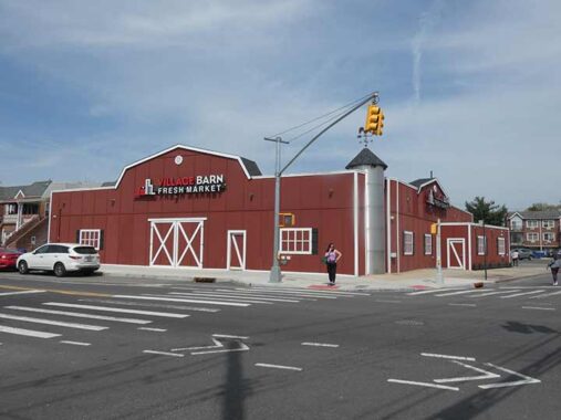
Village Barn Fresh Market, Caldwell Avenue and 80th Street, is one of Juniper Park/Middle Village’s most popular supermarkets, independently owned for over 40 years.
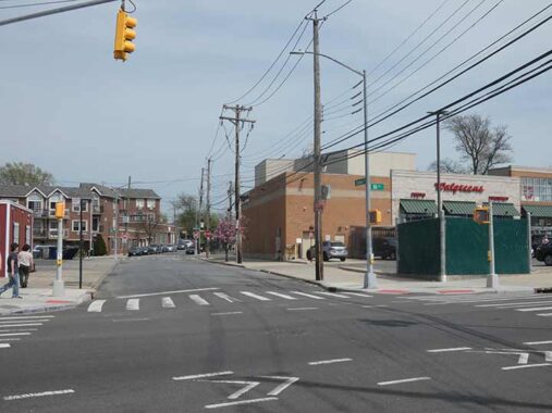
In 1967 the dairy, Silver Crest, which was located where Walgreen’s is today [one block south], placed outdoor milk machines next to their business. Those machines proved to be very popular with the public. As a result of their popularity, in 1969 the Schwartz family opened a small retail store, which was located on 80th Street, just south of Caldwell Avenue and which operated from 1969 to 1971 and this endeavor also proved to be a big success.
Seeing the handwriting on the wall and the need for a full-fledged retail business, the Schwartz family then bought the property immediately north of their small retail store which was across the street on Caldwell Avenue and in 1971 that move, created the Silver Barn Farms retail store that we have today. Previously there was an A&P Supermarket at that site and back in the day it was a baseball field and, in 1940, the local swimming hole. Juniper Park Civic Association
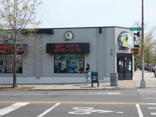
Nearby, on Eliot Avenue and 80th, is one serious Art Deco building hosting an independent drugstore that seems to be holding its own despite the presence of the giant Walgreens across the street. I’m quite used to that parrot, because he takes up a whole page in local publication Juniper Berry ads for the drugstore.
Eliot Avenue roars through Middle Village as one of the few continuous auto northeast routes through the neighborhood. It connects Metropolitan Avenue and 60th Street with Woodhaven Boulevard and 86th Street at the LIRR main line overpass. A short one-way section connects the other side of Woodhaven Boulevard with Queens Boulevard at the Long Island Expressway.
The road was built piecemeal between about 1915 and 1938; at its completion, it was nicknamed “World’s Fair Boulevard” as prior to the construction of the Queens Midtown Expressway it funneled Brooklyn motorists on Metropolitan Avenue toward Nassau Boulevard (which would become the LIE) which took you directly to the fairgrounds in 1939-1940.
Eliot Avenue is named for Walter G. Eliot, an engineer in the Queens Topographical Bureau who named the streets in the area before the decision was made to number Queens streets in place of the old names. For a few years, Eliot Avenue was 61st Avenue, until it was changed back to Eliot. Today, there is no 61st Avenue in Queens west of Douglaston Parkway in Glen Oaks.
The road was built at the line separating Mount Olivet from Lutheran (All Faiths) Cemetery, and narrows to a single lane of traffic each direction through the cemeteries.


I continued on Caldwell, which runs steeply southeast, creating some sharp corners. Here we see the same variety of attached brick buildings seen on 80th Street as well as some Tudors.
The camera, over which I have limited control and takes photos of what it will, pointed toward bright pink and magenta cherry blossom and eastern redbud trees. Blossoms are available for view for a few weeks in April and May.
Though Rego Park proper sits east of Woodhaven Boulevard, I was previously unaware of Rego Gardens, a large project constructed on a former dairy farm:
At the turn of the 20th century, Morris and Freida Lachter, Jewish immigrants from Poland, started a large dairy farm between 62nd Drive, Woodhaven Boulevard, 84th Street and Dry Harbor Road at the edge of Middle Village. Their children built it into a highly successful operation.
The entrance to the farm, run by Benjamin and his wife, Jessie, was at 61-49 Dry Harbor Road. The milk business, called The Elmhurst Dairy Co., was run by Louis and his wife, Rose. The milk truck was driven by Irving Lachter. Their large family home was situated on the southeast corner of the property, at 62-72 Woodhaven Blvd.
In 1952, after more than 50 years in the business, the family agreed to sell the property to mogul Julius Tishman Realty and Construction Co., of Park Avenue, which usually put up luxury buildings in Manhattan. Using architects Kelly and Gruzen, the firm built six modern six-story apartment buildings on the old farm, with landscaped gardens, a children’s playground and a modern shopping strip fronting on Woodhaven Boulevard. [Queens Chronicle]
In the 1920s, the Real Good Construction Company bought up the land and carved out a grid of crescent shaped streets. Along these they built more than 500 Tudor-style one-family attached and detached homes. In 1923, Rego Park was named as such by its developers; Rego being simply the contraction of “Real” and “Good.”
The Rego Park of today fills a triangular piece of land bordered by three major Boulevards: Queens, Woodhaven and Yellowstone. All three are major commercial strips as well as homes to large apartment complexes.
I find interest in mundanities. I had been previously unaware that the stretch of 63rd Avenue (laid out early in the 20th Century as Marion Avenue) between Woodhaven Boulevard and 82nd Place had a narrow center concrete median, which, at times, is dotted with trees. Further south 63rd Avenue borders Juniper Park and changes its name to Juniper Boulevard North.


63rd Avenue and Carlton Street are amidst a Tudor wonderland in this stretch of Rego Park as we edge closer to Forest Hills.


A pair of gateposts at Carlton Street and 63rd Drive. Eraly in the 20th Century developers marked the borders of their real estate projects by placing markers like this one. These two bear no street names, but surviving examples around town sometimes bear archaic names, such as gateposts at Ocean Avenue and Glenwood Road in Brooklyn marked as “Avenue G.”


A pair of esthetically attractive multifamily buildings on 63rd Drive at about Bourton Streets. City activists are now clamoring for multifamily buildings to be built in low density areas (not here, which is high density already, but further east in Queens). If built, they won’t look like this; rather…
…this, at 63rd Drive and Austin Street, is more what they have in mind. This building went up in the early 2020s and replaced the Shalimar Diner, built in 1972 after the “Rego Park Inferno” (a massive fire in February 1972 along the block of 63rd Drive between Austin Street and the Long Island Railroad overpass that destroyed a row of stores and the Rego Park branch of the public library which was subsequently rebuilt). The Shalimar closed in late 2018. Preservationist Mike Perlman made arrangements with the site’s developers to offer the diner for free to anyone who will pay for its relocation without success.
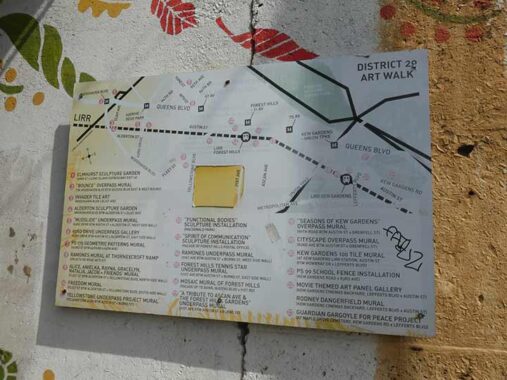
Walls along the (too few) Long Island Rail Road crossings in Rego Park and Forest Hills often feature interesting artwork. When I have more time, I’ll try to hit the ones described on this sign in the 63rd Drive underpass.

I saved it at a bigger size to make it easier to read. Click this Gallery for a larger view.
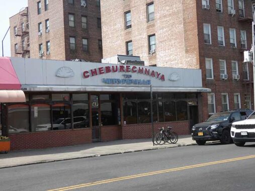
Parts of Rego Park and Forest Hillls are Eastern European strongholds. For example, Cheburechnaya, 63rd Drive and Austin, is a restaurant featuring Russian and Uzbeki cuisine.


Our Savior Lutheran Church, 63rd Drive at Wetherole, is an institution that has been in existence for almost 80 years. Services are conducted in English and Chinese, reflecting the diversity of modern-day Rego Park. The building was constructed in 1931 but appears to be rather older.


PS 139, 63rd Drive at Booth Street, is another great public school building. It’s hard to find architectural information for many public schools in NYC. Jeff Saltzman, whose lamppost site influenced the beginnings of Forgotten NY going back to 1996, reminisces about his time there. After 20 years in North Carolina, Jeff is relocating to Florida.
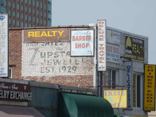
Fading painted ads are getting hard to find now, as many fade from recognition or are painted over or covered by new ads. This one advertising a jewelry store can be found on 63rd Drive near Queens Boulevard.
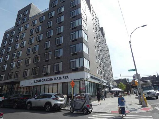
Marshall’s at Queens Boulevard and 63rd Drive was formerly a Queens branch of the department store, Alexander’s, before the retail chain folded in the 1990s. The site was once tabbed as a Walmart location, but politicians in NYC have effectively banned Walmart in NYC because of nonunion hiring (similar to what happened with Amazon). It recently moved to a different location in Rego Center, and this site will be redeveloped yet again.
This was the 63rd Drive subway stop, and my feet thanked that opportunity.
Check out the ForgottenBook, take a look at the gift shop. As always, “comment…as you see fit.” I earn a small payment when you click on any ad on the site.
4/25/26