
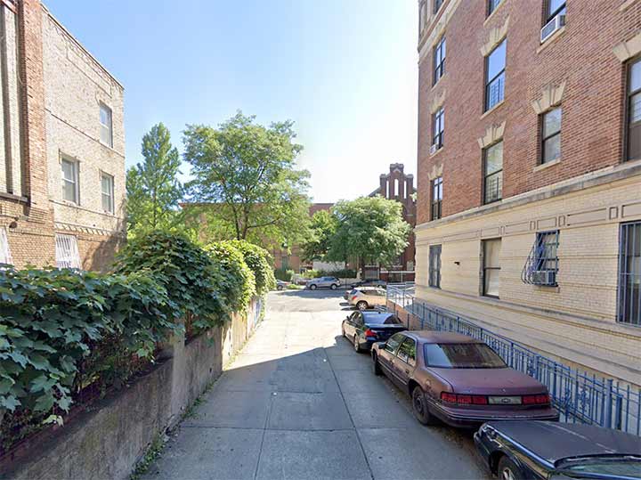

SADLY, the Bronx neighborhood just south of Crotona Park in its mid-south section isn’t one I’ve explored in depth; I last photo-canvassed the area back in 2016. But I was poring over a Google map of the area—as one does, it has an interesting street layout—when I noticed something interesting. On Prospect Avenue just south of the park, it depicts a short dead end called Lafayette Street. So, I checked it on Google Street View and there is indeed a dead end alley there, paved with concrete blocks, as the above photo shows.
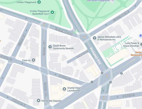
Here it’s shown on the 2026 Google map, which is updated often. Lafayette Street isn’t shown on the paper maps from Hagstrom or Geographia I have coinsulted much of my life.
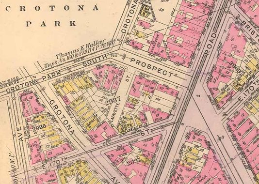
I consulted a 1928 Bromley map, which “drills down” and shows individual properties and streets in greater detail, and indeed, Lafayette Street turns up.
In the classic “History in Asphalt” the late Bronx historian John McNamara explains that Lafayette Street is the former name of Crotona Avenue between Boston Road and Crotona Park South and is on the boundary line between the manorlands of Morrisania and the “West Farms Patent”, a colonial land grant issued on April 26, 1666, by the British Royal Crown: actuallly the border was the now-underground Bungay Brook.
To me, though, that doesn’t explain the alley fully, as it’s on Prospect Avenue, not Crotona, nor why it was named for the Marquis de Lafayette, for whom numerous streets around town are named. The Department of Transportation doesn’t deign to mark it with a street sign.
Check out the ForgottenBook (HarperCollins, 2006), as well as Forgotten Queens (Arcadia, 2013). I also have a chapter in the anthology “New York Calling: From Blackout to Bloomberg” (Reaktion, 2007). As always, “comment…as you see fit.” I earn a small payment when you click on any ad on the site, which helps in site upkeep and also aids Greater Astoria Historical Society.
10/30/26