This all got started with a screen capture from Forgotten NY correspondent Sergey Kadinsky, who sent me a photo of a strangely-named Queens street and asked me if I knew where it was. Of course I knew, but it was a neighborhood I hadn’t been in for over a dozen years, the one just across the subway tracks from Kennedy Airport formerly called Ramblersville but now referred to as West Hamilton Beach. It’s built on the swampy and saturated ground surrounding old Hawtree Creek, which has been tamed into a canal — but tends to leach out after a heavy rain and flood the streets.
Mapmakers have always had a difficult time depicting the area accurately, since it’s a semiprivate area. When I was in there in 2000, I felt like plenty of sets of beady eyes were on me. Bespectacled, baseball-capped grotesques prowling about with cameras are not often seen in this area, considered remote by all but its residents. It’s likely that throughout the decades, other surveyors have experienced the patina of hostility as well, and so West Hamilton Beach (I always think of blenders when typing the name) doesn’t really show up on commercial maps as it really is (this has also happened in semiprivate areas like Riverdale and Harding Park in the Bronx). There had been a Hamilton Beach settlement east of the tracks, but it was cleared out when airport construction began in the 1940s.
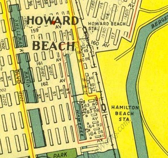
West Hamilton Beach, is west of the LIRR Hamilton Beach station shown here on this 1949 Hagstrom map. (The station, just a shack and a clearing by the tracks, closed in 1955, and the line was then purchased by the Transit Authority and converted to the NYC subway system.) The vertical road by the tracks and the intersecting dead end streets provide a generalized idea of the street layout, but the depiction of Hawtree Creek without a tributary is completely wrong. Note the bridge shown at 165th Avenue at the bottom — we’ll get back to that.
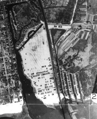
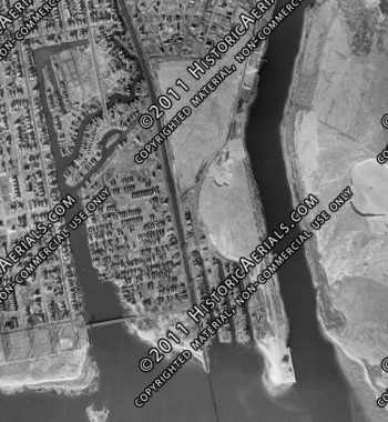
West Hamilton Beach in 1924, left, and in 1966, right. The neighborhood is west of the vertical line of the railroad tracks in both photos. (The image is covered with watermarks as a reminder that I’m not supposed to be using it like this.) As you can see, Hawtree Creek or Basin has a pair of tributaries that affect the street grid. Only maps produced in the last 30 years or show depict it. As such overhead views became more greatly disseminated on Google views, etc. mapmakers had to get more realistic when showing this area. And thus…
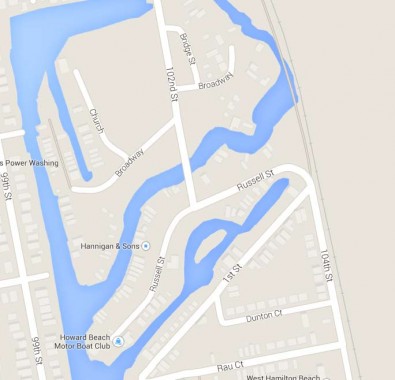
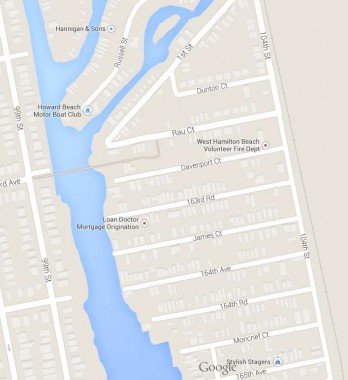
… Google, on both its satellite and map views, can now depict West Hamilton Beach as it truly is. It’s a small settlement squeezed between the subway tracks and Hawtree Basin, quite true, but there’s a distinct separation caused by the two small channels, or tributaries, that the basin gives rise to. The common road between the two is 102nd Street, which is bridged across the northernmost one by the Lenihan Bridge (see below) and then another road, Russell Street, carries traffic, including the Q11 bus, which runs down Woodhaven and Cross Bay Boulevards from Queens Plaza and has a complicated route down here. In effect, there’s a North West Hamilton Beach and South West Hamilton Beach, though nobody refers to them as such.
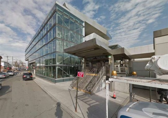
To access this remote settlement (by neither car nor boat) you take the A train of lore and song south to the Howard Beach station, originally a bare bones LIRR stop that was adapted for the subways in 1956 and then extensively modernized in the early 2000s with the arrival of AirTrain, an express rail system to the JFK Airport terminals. Prior to AirTrain, a shuttle bus rattled through the parking lots and eventually got you to your terminal, hopefully in time to catch your plane. (more photos of the station throughout its history available at the link.)
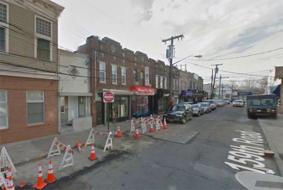
The small cluster of streets surrounding the Howard Beach station are known as Coleman Square and constitute the area’s main shopping and dining district, though most residents have cars and prefer to travel west to Cross Bay Boulevard to meet such needs.
By the way, I got the photos for this page from Google Street View and crudely edited out the street names depicted on the shots, though not in this case.
Hawtree
A number of streets and bodies of water in southern Queens are called Hawtree this or that: Hawtree Basin, Hawtree Avenue, Hawtree Street, and Hawtree Creek Road, a very old road in south Jamaica that originally led to the creek. “Hawtree” is an old word for “hawthorn” as in the tree, and we can surmise that there were plenty of hawthorns around when European navigators first surveyed and mapped the region in the early to mid-1800s.
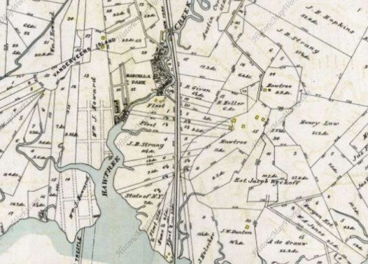
This 1909 map shows pretty much nothing yet built in this area, save the railroad, which arrived in the 1860s, and a few shacks along the creek near where the railroad bridged over it. However, property lines had already been diligently divided up. Note the name “Wm. J. Howard.”
Howard Beach was established in the 1890s by William J. Howard, a Brooklyn glove manufacturer who operated a 150 acre goat farm on meadow land near Aqueduct Racetrack as a source of skin for kid gloves. In 1897, he bought more land and filled it in and the following year, built 18 cottages and opened a hotel near the water, which he operated until it was destroyed by fire in October 1907. He gradually bought more land and formed the Howard Estates Development Company in 1909. He dredged and filled the land until he was able to accumulate 500 acres by 1914. He laid out several streets, water mains and gas mains, and built 35 houses that were priced in the $2,500–$5,000 range. wikipedia
Most of the area collectively known as Howard Beach would remain marshland until after World War II when the familiar suburban tract houses lining the grid pattern streets were built. Even they have a precarious existence, as the entire region was severely flooded by Hurricane Sandy in October 2012.
South of Howard Beach, 102nd street crosses a few oddities:
Broadway
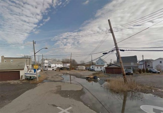
Broadway looking east from 102nd Street
All five boroughs have a Broadway (the Bronx Broadway is a continuation of the Manhattan Broadway) but Queens is blessed with two. However, the West Hamilton Beach Broadway is a far cry from the Great White Way, or even the other Queens Broadway, which runs from Astoria to the heart of Elmhurst. This Broadway is lined with modest one-family houses and seems to be frequently flooded.
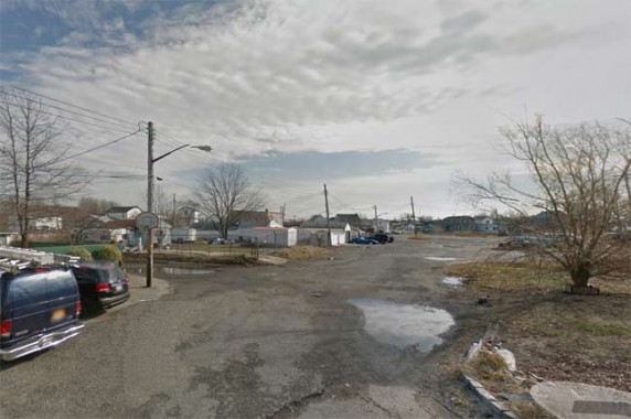
The intersection of Broadway and Bridge Street, proceeding north from Broadway east of 102nd Street.

West of 102nd Street Broadway comes to a dead end at Hawtree Basin. Many families in this area own boats, as you might expect, and vessels of several sizes and makes can be seen along the side streets and in accompanying yards.
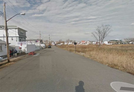
Church Street is a short dead-end leading north from Broadway, west of 102nd Street and paralleling it.
Ramblersville-Hawtree Memorial Bridge
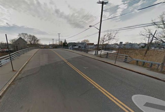
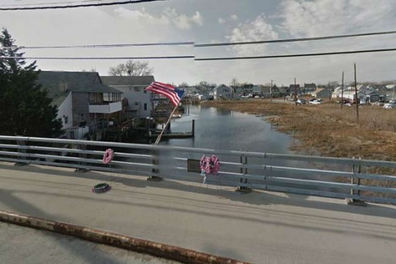
The 102nd, formerly Lenihan, Bridge carries traffic south over a Hawtree Basin inlet into West Hamilton Beach.
Sergey Kadinsky:
On the northern side of the footbridge, Hawtree Basin splits into three branches, the longest originating near the train tracks. The only road linking West Hamilton Beach to mainland Queens is 102nd Street, which crosses the northernmost branch of the inlet using a short and narrow. It is likely the shortest automobile-accessible crossing in the city with an official name. For much of the 20th century, it was known as Lenihan Bridge, named after local Alderman John Lenihan, who served from 1924 to 1935. He was remembered in his time for promoting transportation to the isolated enclave. In 1967, the City Council made the bridge name official.
The narrow bridge and its neighboring dead end roads often appeared in newspaper accounts as a traffic hazard. In October 1914, the New York Times reported on the death of motorist George Greenburg and passenger Rose Graber, who were traveling to Far Rockaway from their Brooklyn homes. Making a wrong turn into West Hamilton Beach on a rainy night, he drove off a bulkhead into the water. The vehicle rested in eight feet of water. Investigators found an open knife and a cut on the car’s tarp, suggesting a failed struggle to escape the drowning.
In February 1952, Queens resident Charles Langenfeld of Richmond Hill and Charles Haag, Jr. of Howard Beach drove their convertible through the wooden bridge railing, drowning in Hawtree Creek. The bridge was narrow, short and had a sharp turn at its southern landing.
Prior to 1995, West Hamilton Breach was one of a handful of neighborhoods in the city that was not connected to its sewer system and all residents had to rely on private cesspools to store wastewater. The much-anticipated installation of sewers required a controversial replacement for Lenihan Bridge in order to accommodate trucks carrying construction materials. Augustine Barry, a homeowner whose property abutted the bridge, opposed the project because a temporary bridge would be placed within four feet of his home. For Mr. Barry, the project smacked of injustice as he had moved to West Hamilton Beach 40 years earlier after his prior home was demolished to make was for the Long Island Expressway in Elmhurst. Apparently for his family, relocating to this isolated enclave could not keep him safe from the city’s power of eminent domain.
The construction of the temporary bridge resulted in cracks on the foundations of Barry’s home. Diesel exhaust from passing buses added to the aggravation. In June 2006, the city’s Department of Buildings declared the home unsafe, ordering Mr. Barry and his wife Ann to vacate. The city’s chief engineer, Robert J. Rohayne offered his Brooklyn apartment to Barry, but it was turned down. He chose to sleep in his car instead, in order to guard the home and its chickens from potential vandalism.
The story had a happy ending a year later. ”All’s well that ends well,” said the city’s Transportation Commissioner, Christopher R. Lynn. The city repaired the home to a tune of $455,000. Estimating the cost of the house at $150,000, Mr. Barry was pleased to move in but felt sorry for the taxpayers who footed the bill. As his brother Eugene summed it up, “”All’s well that ends well, sure. But this all could have been avoided.”
A final chapter in this bridge’s saga is the change in name for the bridge. In 2001, Lenihan was long forgotten and the crossing was renamed Ramblersville-Hawtree Memorial Bridge to honor seven soldiers from the neighborhood were killed in the Second World War.
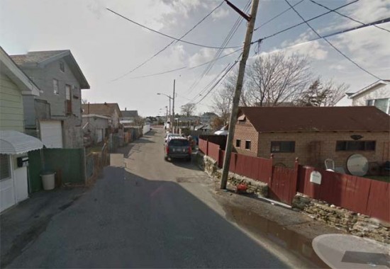
Russell Street also comes to a dead end at Hawtree Creek. However, east of 102nd Street it is the only connector to the main street of the southern section of West Hamilton Beach, which is…
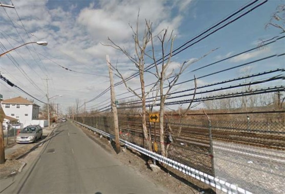
… 104th Street, which runs alongside the A train, formerly the Long Island rail Road Rockaway Branch.
Several dead end streets emanate west from 104th Street and, until fairly recently, I thought they all had number names, such as 163rd Avenue, Road and Drive, 164th Avenue, Road and Drive, and so on. However, back in the 1970s, Hagstrom maps began to list different names for a couple of these streets, and riding past on the subway, you saw different names on the signs, as well.
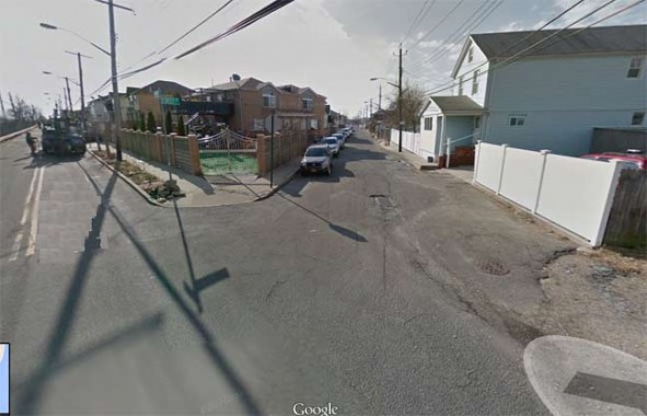
First Street (which is spelled “First” on the street sign, not “1st”) is the only diagonal street in the neighborhood, running from 104th southwest to Rau Court (see below). This makes three streets in Queens named “First” or “1st,” all of them quite short: 1st Street in Astoria, which runs from 26th Avenue to just past 27th, at Astoria Houses near the East River; 1st Street in Meadowmere, the very last bit of Queens as you are traveling south on Rockaway Boulevard before attaining the Five Towns (it is accompanied by 2nd and 3rd Streets) and First Street, here in West Hamilton Beach, which stands oin its own, unaccompanied by a Second Street.
Far away, in Gravesend, Brooklyn, there’s also a First, or 1st, Court off Coney Island Avenue, without any other similar numbers. South of that, there had been a 1st, 2nd and 3rd Places in Gravesend, and they’re gone for over 75 years — but can be seen on old maps.
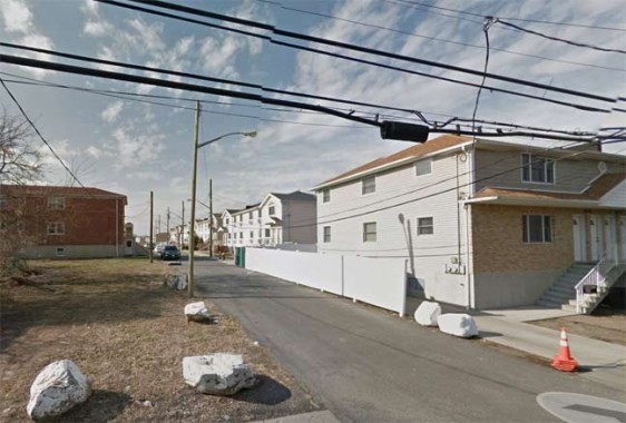
Dunton Court, south of First Street.
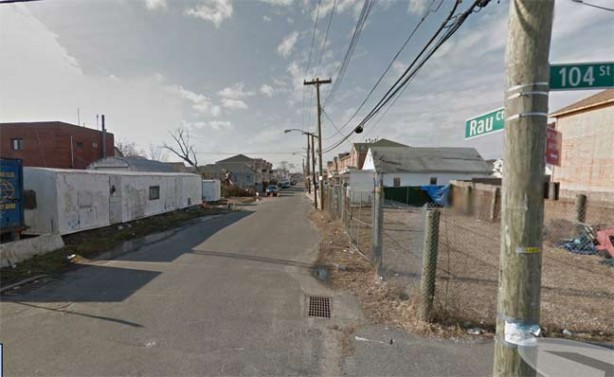
Rau Court, which along with First, is the only street west of 104th that doesn’t dead-end. The pedestrian bridge from Howard Beach crossing Hawtre Creek (see below) also empties onto Rau Court.
I have a feeling the name is pronounced to rhyme with “how”, because a 1970s Los Angeles Dodgers pitcher named Doug Rau pronounced his name like that, though I could be wrong. (Rau wasn’t well-known or a superstar by any means, but his statistics today would probably earn him a multimillion dollar contract.)
Doug Rau argues with Tommy Lasorda during the 1977 World Series
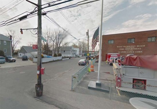
Davenport Court stands in for 163rd Avenue. The West Hamilton Beach Volunteer Fire and Ambulance Corps headquarters is located on the corner of 104th Street. Established in 1928, the Corps celebrated its 85th anniversary of service in 2013.
The original quarters was a house located on the same lot where the current building stands. It was converted into a garage which would be come the firehouse. Through the years many changes were made due to the variations in apparatus. The original building stood until 1992 to make way for the new building due to an unsound foundation. During construction the quarters was relocated into a trailer which still stands on the property and is in use by a non for profit organization.
The current quarters stands two stories high and is divided into two different apparatus bays. The fire bay has one door and fits two fire apparatus side by side. Firefighter gear, work bench, battery chargers as well as spare SCBA bottles are located in the fire bay. Best access to the fire bay from the second floor would be via the original pole from the original firehouse. The ambulance bay also fits two EMS apparatus side by side but each vehicle has its own bay door. Also located in the ambulance bay is a backup generator, EMS storage, equipment storage, a restroom and a mess sink. On the second floor, we have a bunk room with three bunk beds, an officers office, house watch, full size bathroom, kitchen, lounge and meeting room. HBVFD
Sergey Kadinsky:
In October 2012, Superstorm Sandy caused extensive damage in the neighborhood, resulting in the loss of all but one of the ambulances belonging to West Hamilton Beach Volunteer Fire Department. Within a year, the department raised funds and received donated vehicles, increasing its fleet to nine vehicles comprising of five ambulances and four fire trucks.
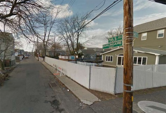
Burlingame Court is identified by a relatively new sign accompanying the one identifying it as 163rd Road. The names are apparently interchangeable. Area residents, let me know which street name is preferred on these side streets — the number, or the name?
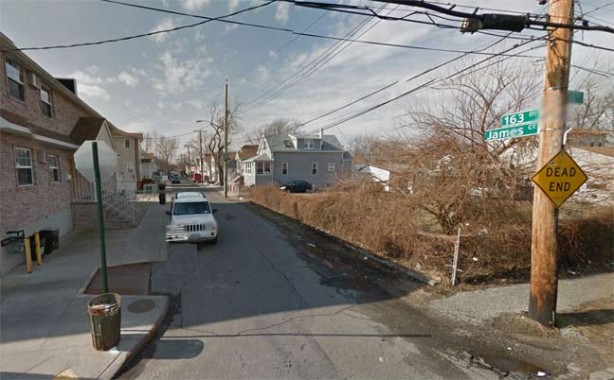
James Court, or 163rd Drive.
164th Avenue has retained the name, though the official Department of Transportation street signs must be relatively new — many of these dead ends have amateur signs with the street number scrawled on them nailed onto telephone poles!
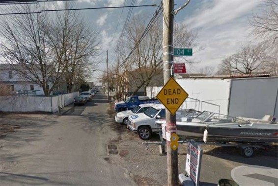
164th Road, a.k.a. Calhoun Court.
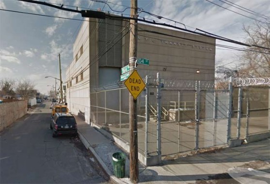
At 164th Drive/Moncrief Court, heavily protected by barbed wire, is an MTA substation, containing electrical relays for the third rail accompanying the nearby A train.
The DOT capitalizes the C in Moncrief on the street sign, but that’s probably an error. The name reminds me of Sidney Moncrief, the Milwaukee Bucks’ 1980s star basketballer.

Lockwood Court, or 165th Avenue, is the last dead-end along the strip. All the numbered avenues continue west of Hawtree Basin in Howard Beach, and 165th Avenue is the highest numbered avenue in the sequence (the lowest is 2nd Avenue, which consists of a couple of dead ends in Whitestone.)
As Sergey explains, 165th Avenue used to run directly into Howard Beach via a traffic bridge over Hawtree Basin, but no longer:
Prior to 1963, West Hamilton Beach had a second automobile connection with Howard Beach at 165th Avenue, also known as Lockwood Court. The bridge was a notorious traffic hazard, resulting in the death of a local motorist in 1956. A year later, the city banned buses and trucks from using this bridge, described in news reports as “decrepit.”
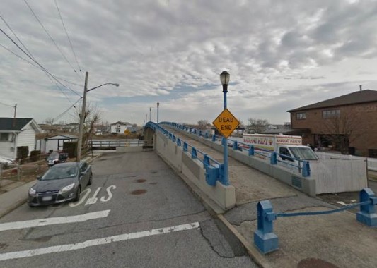
It was replaced in 1963 with the present Hawtree Basin Bridge (above), a pedestrian crossing in the form of a bright blue arc across the channel at Rau Court.
As global weather patterns suggest an increase in large storms, environmental and urban planning groups proposed a combination of manmade and natural barriers to mitigate storm surge damage. The natural element involves introducing reefs and marshes to serve as sponges in absorbing massive waves. The manmade element is inspired by existing examples in the Netherlands, where movable barriers are located at the mouths of streams. In this case, barriers installed at the mouths of inlets along Jamaica Bay would keep storm surges away from homes along the shore of Hawtree Creek and Shellbank Basin.
 FNY correspondent Sergey Kadinsky has been living in Queens since age eight. His interest in journalism can be traced back to childhood, when he made a hobby out of writing letters to the editors of local newspapers. He is a writer who aspires to a career in journalism and politics. At times, he has been spotted giving tourist-friendly monologues atop Gray Line buses. He also paints murals that contain maze puzzles. His website is mazeartist.
12/22/13


56 comments
Tommy Lasorda – Dodger “blue” indeed!!!! 🙂
As a kid from the 50’s I remember both bridges on what is now 165th Ave, both were made of wood.
Remember seeing the bridge from Cross Bay Blvd to Old Howard beach on the way to Rockaway with my family in the 50’s & my father telling me there was another one from OHB to Hamilton Beach. Both old wooden guys. And somewhere, don’t remember, I saw a pic of a Green Bus crossing one of them. I am going to think it was the Q11 going down 1 side & coming back the other, rather than the 2 seperate services it has today.
In 1942-43 my family live on 164th Avenue in Hamilton Beach. there was a wooden bridge that led to Howard Beach (on 165th Avenue (I believe). As kids, we would cross the bridge to go to the movie theater and an ice cream parlor next door,
Does anyone remember Smitty’s Bar (or tavern)?
Yes my dad would go there and we would play shuffle board also I think it was a hardware store before the bar
Yes we used to swim off the dock and eat smoked ells
An interesting look at Hamilton Beach, which presents quite a contrast to it’s larger neighbor of Howard Beach to which it is a part of. While Howard Beach consists largely of post war suburban syle capes, hi-ranches and split levels on relatively uniform 50 or 60 x 100 foot lots, (with the exception of Lindenwood (with it’s mutiple family garden and mid-high rise apartments), Hamilton Beach appears as a outpost to the past with its closely built largely pre-war beach bungalows. Hamilton Beach is one of those uniquely isolated neighborhoods that if you didn’t know that they were there, would easily go unnoticed, which I’m sure the residents of the area would prefer.
As a 12 year old in 1954/55 I had a classmate (James Casey) who lived in Hamilton Beach. Once the older part of the town was vacated to make way for Idelwild expansion ,east side of the RR tracks, it was a playground paradise for kids; vacated abandoned houses that still had some kitchen cabinets just crying to be pulled off walls, kitchen sinks just waiting for a hammer or boulder to be shattered, windows awaiting rocks, etc. many an afternoon was spent exploring the debris…ah, memories!
http://www.qchron.com/editions/south/in-hamilton-beach-recovery-is-stalled/article_e0948271-9b60-578c-a2a4-9e23e2220d4d.html
14 months post Sandy
Until now, I didn’t even know that Queens had a second Broadway.
Thanks for a very interesting look at this isolated area. Regarding the street signs for Burlingame Court/163rd Road, it appears that the “163 Rd” sign is the newer of the two, since it is in upper-and-lower case, while the Burlingame Court sign is all uppercase, suggesting it is the older one, rather than being “a relatively new sign accompanying” the numeric one.
The Burlingame Court sign is also a new one. “Court” is in upper and lower case letters. “Burlingame” should have been in mixed case as well but for some reason it was done in all caps.
I grow up in Hamilton on 163 rd I think the original name was Burlington court and then the it’s changed years later As were some of the other blocke. Durham never existed it was empty lot that was once used as a little league field
Check out one of my favorite objects of urban esoterica: the fire/police call box light on the photo of Davenport Court. Its support pole is interesting – I cannot tell from the image if the ornamental bracket curves back upon itself, or if a circular pendant of some sort is present.
I also enjoy the irony – What better place for a fire call box, with indicator light, than a telephone pole immediately in front of a fire house? 🙂
Those are the old-style fire alarm light masts. They originally supported incandescent street lamps .
Gomez,
I agree with your reply as it seems ironic to place the fire call box in front of the Fire House. As an Ex-Chief of the WHBVFD, I will say that the call box is actually connected to the F.D.N.Y. Emergency Response Dispatch Center. The West Hamilton Beach Fire Dept. and Ambulance Corps is a Volunteer Dept. which operates and assists within the response area of F.D.N.Y. E331 and L173 which are located in quarters on Cross Bay Blvd. Since West Hamilton Beach is remotely located “off the beaten path”, response times to the area were longer, hence the need for a local volunteer department was realized by area residents. More info about the Vollies can be seen at www. whbvfd.org
Very good in depth report.
Looking forward to your upcoming coverage of Proctor Silex.
I grew up in Ozone Park in the 1960’s. I remember going to West Hamilton Beach with a couple of other kids in my Boy Scout troop to meet a merit badge counselor. A friend’s Dad drove us, and had some trouble navigating the streets shown in this post to find his house. The counselor was a member of the West Hamilton Beach VFD and showed us the fire house. A couple of our troop’s adult leaders were NYFD firemen and we were amazed that there was a (non-NYFD) volunteer fire company only a 5 minute drive from where we lived. Thanks for posting this.
Hi…Skip,
In Your Posted Comment Dated: December 23, 2013 At 9:07 PM,
You Spoke About A Boy Scout Merit Badge Counselor In The 1960’s Who Also Belonged To
The WEST HAMILTON BEACH VOLUNTEER FIRE DEPT. And VOLUNTEER AMBULANCE CORPS.
You Are Speaking Of My Father: GEORGE E. THOROGOOD, Boy Scout Master TROOP 237, St. Barnabus
Lutheran Church, Howard Beach, Queens, N.Y.
My Dad Also Served Many Years As A Volunteer Fire Fighter
And Certified – Liscensed EMT For The VOLUNTEER AMBULANCE CORPS.
THANK YOU SO MUCH FOR REMEMBERING MY DAD.
He Was Very Committed In Serving The Members Of Our Community, He Loved The BSA And His TROOP 237 And Camping Trips To The TEN MILE RIVER BOY SCOUT CAMP, Up State, N.Y.
Saddly, My Dad Passed Away From A Massive Heart Attack On July 19th, 1977 During A Horrible Heat Wave And
City Wide BLACK OUT. He Became Very Upset While Listening To His Police And Fire Radio, When Several Of
His FDNY Fire Fighter Buddies Were Burned To Death When The Roof Of A Waldbaums Supermarket Collapsed
In Brooklyn, N.Y. Earlier That Morning.
GOD BLESS YOU!
And GOD BLESS The Members Of The WHBVFD And AMBULANCE CORPS…PAST, PRESENT And FUTURE!
Linda Thorogood.
A Former And Very Proud Resident Of The Original Howard Beach – From 1953 to 1991.
My late father worked for the LIRR and we used to travel across the bay to Rockaway to our summer house(which he later purchased in 1950)and the train stopped at both Howard beach and West Hamilton Beach(the station was near the fire house,if I recall the fire dept was volunteer)the ride cross the bay was on pilings most of way with 2 bridges…..later I took the A train to college in Manhatten across the bay……very nice trip in spring/summer,very cold in winter….
My father was a bridge tender for the LIRR out over Jamaica Bay in the 50s – 60s.
I want to give props to Sergey and his web site, which contains several articles I found fascinating. I was especially interested and gratified by his article on the Kissena Creek, which ran not far from where I grew up (much had been put underground in large storm drains some of the crazier kids in the neighborhood would explore). I remember parts of Kissena Park were still “swamp” when I was a kid, and everything from Kissena Blvd to Colden Field was wild in what is now called the “Kissena Corridor”. His other stuff on Flushing River is also great. Thanks Sergey!!
Dave Cuneo.
End of the earth, indeed! When I was a boy (ca. 1960), my dad and I explored this and other partially built areas, such as Canarsie, Mill Basin, etc. He referred to these places, and anywhere else where tall swamp grass (Yiddish “Skhakh” – from Russian) grew as “Eck velt” – end of the earth.
…only maps produced in the last 30 years or so depict it…
The earlier maps show the city’s plans to get rid of those streets and replace them with a different, more regular grid. The portion of 104th St. between 163rd and 165th Avs. would have been 103rd St, and most of the courts, and streets like Broadway and Church St, would have been eliminated. See link below.
http://www.davidrumsey.com/luna/servlet/detail/RUMSEY~8~1~212264~5500323:Shell-Greater-New-York-City–Easter?sort=Pub_List_No_InitialSort%2CPub_Date%2CPub_List_No%2CSeries_No&qvq=q:Brooklyn%2C%2BN;sort:Pub_List_No_InitialSort%2CPub_Date%2CPub_List_No%2CSeries_No;lc:RUMSEY~8~1&mi=150&trs=154
Another part of this plan consisted of imposing the Queens street and avenue grid on nearby Broad Channel. See link below. 6th Rd. would have become 192nd Av, Shad Creek Rd. would have been 98th St, Channel Rd (no name shown on this map) would have been 100th Pl.
http://www.davidrumsey.com/luna/servlet/detail/RUMSEY~8~1~212264~5500323:Shell-Greater-New-York-City–Easter?sort=Pub_List_No_InitialSort%2CPub_Date%2CPub_List_No%2CSeries_No&qvq=q:Brooklyn%2C%2BN;sort:Pub_List_No_InitialSort%2CPub_Date%2CPub_List_No%2CSeries_No;lc:RUMSEY~8~1&mi=150&trs=154
I’m not sure whether or not these links will zoom in to the actual locations.
Bob
My name is Roger Gendron and I am the President of the New Hamilton Beach Civic Association. I enjoyed the article about our neighborhood but there are a couple of corrections.
1) Ramblersville is still Ramblersville but our Civic association includes them as far as representing them with any issues they may have with the city.
2) The original streets in Hamilton Beach had names .The city had wanted to include us in the “grid” and the map at the top of the page shows what the proposed grid was going to look like but in 2008 the city de-mapped those proposed streets and mapped the street the way they always have been. After a fire in 2007 , in which a resident passed away, to help identify the streets in Hamilton Beach the then President of the civic requested that the original names be brought back. Residents were worried that this would cause confusion so the city left the numbered signs up and installed named signs below.
Thanks for your time,
Roger Gendron, President
New Hamilton Beach Civic
Know anything about the origins of Rau, Davenport etc, are they named for anyone? Looks like they were.
Fantastic article – this kind of in-depth examination of neighborhood topography and history is the main reason I keep coming back to FNY over the years. Thanks again.
163 Road which also shows as Burlingame on the street sign is incorrect. I have my deed which shows it as Burlingham!
Plans that were considered in the late 1800’s and early 1900’s would have brought massive change to this area and to all of Queens as we know it today.
To create more efficient movement of goods by ship, it was proposed to cut Hawtree Creek open from Jamaica Bay north and to connect it, through current Meadow Lake and Willow Lake into the Flushing River and Flushing Bay. This would have allowed for easy ship access to a new large harbor in Jamaica Bay that was accessible from either the Atlantic Ocean or the East River.
The LIRR’s Rockaway Line would have figured into this scheme by providing a rail freight link at the new harbor that would have provided access to Long Island and to the mainland via the railroad car-float facilities along the East River in Queens and the Upper Bay in Brooklyn.
Other outsized ideas of the time, like the Pennsylvania Railroad’s project that brought us the Sunnyside Yards, Pennsylvania Station on 7th Avenue and the Hell Gate Railroad Bridge in one swoop, may have come to pass, but this one did not.
It would have been quite a game-changer for Queens.
This is the best website on NYC that I have ever seen. It makes me wish that I could move to the Big Apple. Congrats from this land-locked Midwesterner. Charles Franklin Indianapolis
I LIVED IN RAMBLERSVILLE FROM 1939 TO 1954 IN THREE DIFFERENT HOUSES TWO OF WHICH ARE STILL STANDING MY BROTHER JOSEPH WAS BORN AUG 9 1943 AT 145 BROADWAY.IT WAS A GREAT PLACE TO GROW UP.
My family lived in Hamilton Beach in 1942 after we were “evicted” from Springfield Docks. the next year we were again “evicted” and moved to Richmond Hill. These moves wer all do the the expansion of Idlewild Airport into New York International Airport and eventually JFK International. Such are the results of progress. I wish that I could remember the tavern where my father hung out. As kids, we would cross the bridge to go to the movie in Howard Beach and the ice cream parlor nearby. As I remember, we weren’t “allowed” to go anywhere else in Howard Beach.
THE HOUSE IN THE MIDDLE OF THE PICTURE IS 9 BAYVIEW AVE I LIVED THERE FROM 1948 TO 1955 I LIVED IN RAMBLERSVILLE FROM 1939 TO 1955 I WAS IN TH E1950 CLASS OF OUR LADY OF GRACE SOME OF THE NAME WHO LIVED THERE WERE SCHUMWAY REIDERT MCCORD KISTLER LINDERDAMEN
Robert
Your brother was in my OLG class. I believe I have his class picture. Often wondered what happened to him Now realize you moved away! I HAVE MANY Howard Beach stories please contact me if you can.
Mark Randy Steele
mrsteele57@hotmail.com
Hamilton Beach was the best place to grown up. I went ice skating (because the rain would pool up) and played ball by walking through the weeds to an opening where there are now houses. I played handball against the Power House, hung out at Joe’s Grocery Store (when I was real young, there was Rosie’s Candy Store.) As teens, the guys would dig underground forts on Front Beach (No one knew they were there, hidden in the weeds, unless you were in “The Crowd!”) I watched many Firehouse Bucket Brigades, Baby and Labor Day Parades and attended the Annual Bazaar.
Some of the best times were in the summer, hanging out under the Walk Bridge, swinging off ropes and jumping off the bridge into the water. The guys would pick us up in their little boats, and take us over to Speed’s Creek (where the plane hangers are now) and we would ski all afternoon. On Wednesday nights, they would pick us up under the bridge and boatloads of us would drive to Rockaway to watch the fireworks on the water. I’m smiling just thinking about all the fun and wish, with all my heart, that I could click Rewind on my life’s remote and go back in time, even for just one day.
When I was a teen, if my sisters or I did anything we shouldn’t have done, my parents knew about it before we got home – neighbors had already called them. That’s how tight a community it was. Sadly, the neighborhood has changed a bit, at least in my opinion as an “outsider” now. The Civic Assoc. still tries by holding fundraisers and Baby Parades, but there is very little turnout today for what was once an epic event.
My mother grew up there as well, 163rd Drive. She is part of the Lynch family (10 boys and 3 girls), and the majority of them also lived in Hamilton. I believe street names were added to each road when an emergency happened and the police and fire departments could not locate the address.
My parents, God Bless them, are 87 years old and still live there. They live, and will always have lived, on 163rd Road, NOT Burlingame Court. West Hamilton Beach wasn’t much to look at, but it was Heaven to me!
Your right. It was the best place to grow up.
The Volunteer Ambulance Corp. did not exist before 1958. It was started by Artie Johnson of Johnson’s Salvage yard. The first ambulance was an old Cadillac hearse. Mr. Johnson found it, bought it, and renovated it. Before that if you needed an ambulance you could wait as long as eight hours before on would arrive from the city. I lived there until 1959. The Corp. originally was run by him out of his house. As I recall, you came to the salvage yard the block before the fire house.
When I was very small, I remember my mother going to vote in the civic hall, which was located where the fire department parking lot is, today.
The “commercial district” consisted of Sam’s Deli, a green grocer, a dry cleaner, Rosie’s Candy Store, and a Bar and Grill. I think it was called something like Two (or Three) Bob’s (or Bills). I know the men who owned it all had the same first name.
There was also Artie Allen’s Boat Dock and Repair Shop at the end of 164th Road. And Teddy’s Bar and Grill which was next door and reached by going through Allen’s parking lot.
It was the kind of neighborhood where kids were raised by the entire village. When a child got into trouble, the parents were visited by the offended party, and things were taken care of.
I remember tearing down the hill on my bicycle, and scaring the Green Line Bus driver, Julius, half to death. He parked the bus, told his passengers he’d return shortly, and walked down to my house to speak to my dad. I lost bicycle privileges for a month.
From the time I was born until 1955, I grew up in what was called South Aqueduct. The LIRR ran thru and I crossed the tracks to go to P. S. 146. Then Idewild took over that area and we moved to the other side of the tracks on 157 Avenue. My maiden name is Vereline. My grandmother, Louise Lampman lived with us in South Aqueduct. Is there anyone out there that remembers my family members?
My family lived on 164th Drive (now, I guess, Moncrief) from 1957 until 1991. I have lived in Virginia near Washington, D.C. since1979, but always be from Hamilton Beach. I grew up with the Doran’s, Giunta’s, York’s, Farrell’s, Fitzgibbons, Riley’s, Van Rosem’s, Fey’s, Tyranski’s, Glassey’s, Calese’s, Lennahan’s, Ketterman’s, Luderman’s, Fazio’s, Brennan’s and all of the other families who journeys to this country paint the history of NYC but I didn’t know that at the time. I remember Joe’s (Werner) Grocery Store (where as a 10 year old, I took notes from my mother to buy beer and cigarettes–to Joe’s embarrassment and mine), and Smitty’s Bar and the Howard Beach Yacht Club on Russell Street where the Doxey’s and Stanley’s lived. I never expected to get out alive, and here I am, 45 years later, unable to forget the people and places that are part of who I am today. I remember the walk from Our Lady of Grace to Coleman Square along the creek from Howard Beach into Hamilton Beach and the Volunteer Fire Station (one of only 4 in all of NYC) and the Baby Day Parade (over labor Day weekend) and the bridge from Hamilton into Howard to get to the basketball courts in Casino Park where Joey Esposito knocked out my front teeth (not your fault, Joey who said at the time: “Your mother is going to kill you.” She didn’t, but as a toothless 15 year old, I did have to cut lawns to make enough money to pay for the crowns). Linda is right: if I was foolish enough to tell my mother that the nuns had smacked me for cracking wise, it was a sure fire way of getting a second smack for the same offence. I remember taking the A train from Coleman Square over the Trestle through Broad Channel to Rockaway Beach before the projects and when Play Land was still a destination. This was our childhood and I couldn’t imagine any other. To this day, when I go to a dentist and he or she surveys the broken nose and teeth, I am asked where I grew up, and I am proud to say Hamilton Beach, Queens.
Carol:
My aunt Anna was married to Eddie Vereline. They lived off the Belt in Ozone Park. My cousins were Susie, Linda, Eddie Ray and Julie.
Hi Carol, I read your comments of several years ago and took note of the reference of the community of South Aqueduct which I’m working on with the Queens Central Library historical department to recognize it with pictures. We must have been in South Aqueduct at the same time as I did the same walk across the little wooden bridge, the LIRR tracks (via the trestle) and then to Our Lady of Grace s school. I lived in SA from my birth, 1942, until we moved to South Ozone park in 1953. We lived on 115 street and close to 159 Ave. and were the only street that had a canal in our back yard which we missed
many thanks for sharing. Please tell me just what you think of this home theater company company? Dallas Home Theater Installation Pros, 1403 E Levee St , Dallas, TX, 75207 (972) 818-5512
just went there to the yacht coub. looked
like venice
My aunt and uncle lived in Hamilton Beach from 1945 through the 2000s. Sylvia and Sam Salamone lived at 104-04 165th Ave. We used to visit there a lot in the 50s and 60s when I was a kid. Some of the families who lived there were the Trommers, next door to my aunt & uncle, and the Fogartys who lived down at the end of 165th Ave. Johnnie Fogarty had a bulldozer he used to use to plow out 165th Ave. because the city plows never came into Hamilton Beach. They Fogartys had a Coke machine in back of the house and we used to go down there and sit and talk for hours. The kids would haul in baskets of crabs…lots of fun and memories. IN the 1980s, My Aunt Sylvia lived on the bottom floor of the Fogartys house and I stayed with her for about a year when I was going to school at NYU. That was a long commute on the A train! I also remember the grocery stor on 104th Ave. I forget the owner’s name, but we used to get cold cuts and groceries there. Also my aunt used to send me over there to get a fresh semolina bread. Great place to live…more like a small village than a part of the city.
My Uncle ED Boll and his wife, my Aunt Dot, used to live on 165th Ave in the late 60’s to mid 70’s, before they moved out to middle island. They owned several properties along 165th street they used to rent out. Their main residents was at the end of 165th, in the back of their bar. My uncle owned that bar that was right on the water, and 165th. I cannot remember what it as called, to me it was Uncle Ed’s.
We would visit once in while from Floral Park where I lived, and I remember we would have to park the car, down by the train tracks, and walk the entire street to opposite end. We always passed a yard with a big dog that was tied up in the front yard. I think it was a German shepherd, it always scared the crap out me. The last house we would pass is a large 2 or 3 story white building, before road curved down to the water. That house is still there.
I used to play the old tabletop shuffleboard in the bar, and stare out the windows over the water, I could hear the planes from JFK, could never see them, only the train tracks crossing the bay.
I not sure what ever happen to the building, its now just an empty field I see from the aerial pics. I’ve never been back there, maybe someday.
Thanks for the additional info about this small slice of time in my childhood.
Mike
I WAS A VOLLY FIREMAN IN WEST HAMILTON BEACH FD FROM 1971 TO 1975 WHEN I WAS TRANSFERRED TO TULSA OK WITH AMERICAN AIRLINES. SOMEWHERE IN THAT TIME PERIOD THE BRIDGE CAUGHT FIRE. WE FAUGHT IT FROM THE OLD HOWARD BEACH SIDE WHILE THE FDNY FAUGHT IT FROM THE OTHER SIDE.
My mother, Eleanor Kastel, lived at 5 Broadway with her brothers, Howard and Charlie, and their parents, Charlie and Bertha, in the 30s and 40s. When she married my father in 1946, they moved to Richmond Hill and raised all us kids there. Her friends, Charlie Langenfeld and Charlie Haag were the two WW2 vets that drove off the Lenihan Bridge and drowned in the Creek below. There is a famous picture of my 16 year old mother kissing Charlie Langenfeld goodbye at Penn Station during the war. My mother’s whole family lived out there in Ramblersville, Howard Beach and Hamilton Beach. She had fond memories growing up with her Weigand cousins on the canal. She said it was the greatest place on earth. They were poor, after all, it was the Depression, but they didn’t know that, because everyone was poor! We drove out there in the 1980’s looking for her house but it was probably torn down because we couldn’t find it.
My Grandfather and Great grandfather both lived here!
they were both named Thomas McMonigle
My Grandfather Michael F. Connolly (he was a Longshoreman & part of the Democratic Party) and Mary (Mae) lived in Howard Beach at 4 or 6 Church Street. They purchased the home in July, 1956 I lived with my Grandparents and my mom, Helen,until I was 4 1/2 years old when my Grandmother Mary passed away. My cousin Raymond Robertson lived on Broadway, the house was condemned & torn down after Hurricane Sandy. But his cousin still lives in Howard Beach on Broadway I believe. I am looking for a map of Old Howard Beach to add to my Ancestry account. If anyone knows where I can get one pleas let me know. Thanks so much!
Loved the article and commentary by people that were familiar with Hamilton Beach.
In the 60s I knew a few people through John Adams HS as fellow students that lived in Howard Beach, Hamilton Beach, if I could just remember the correct spelling of their names. Gloria Albergo, Janice Norin was in a marching band which I think was supported by the Fire Department and whose father was a ferry boat captain and had a bait and tackle shop near the Hamilton Beach canal. and a Mary Spanelli. If anyone knew or knows them please tell them hello for me. I’d love to hear from them or hear about their lives after HS.
Ernie Fazio
I too grew up in Hamilton beach. I read with great interest the many stories that were posted. There was mention of the Fogarty’s, the
Lynch family Salamones, the Lenihans, Calise and several others. It felt like I was reading a take-off of Mayberry
In 1969 I was working in Grewenich Village in NYC and an artist was selling a picture he painted of the Hawtree Basin bridge. The one
that connected Lockwood Court to Coleman Park. He was asking $75 and I went home that night feeling sorry that I did not buy it. The next day I went back to where the artist was and it was sold. That was the wooden bridge that had a curve in it on the west end. That
bridge is an important memory. If anyone has a photo of the bridge please let me know, I want to use it in an essay I wrote.
Interesting article. I was wondering if you have information about the other side of the tracks in West Hamilton Beach. The area appears to be landfilled over, but photos from the early 1900s show several houses along that side of the tracks. What happened? Why is this side(which is close to JFK) completely landfilled and overgrowth?
Hi Carol, I read your comments of several years ago and took note of the reference of the community of South Aqueduct which I’m working on with the Queens Central Library historical department to recognize it with pictures. We must have been in South Aqueduct at the same time as I did the same walk across the little wooden bridge, the LIRR tracks (via the trestle) and then to Our Lady of Grace s school. I lived in SA from my birth, 1942, until we moved to South Ozone park in 1953. We lived on 115 street and close to 159 Ave. and were the only street that had a canal in our back yard which we missed after we moved. That is the last street before going over the little wooden bridge. If you know anyone that is still around that may want to have their pictures of the community forever stored at the Queens Library they can get in touch with me via email at n3twork.designs@gmail.com. I am out of state for some time now.
My cousins the Ruhel Family lived in Hamilton Beach from the forties thru the fifties !We drove down there about ten years ago to visit the family houses and the fire station plus the local Catholic church.
We also went to the American Legion building where my Grand father a member !
My whole family lived and grew up in Hamilton Beach. I don’t regret nothing about living there and growing up there was the best. My name is John McDermott and I had my sister Patty, sister Kathy, and brother Danny. Cousins Joey Liana, Petey, Michael, lived with their mom Helen and father Joe at the end of the road. My uncle Marty, aunt Alice and cousin Marty lived there. The Fogartys were the other big family on the block. We lived on Russell Street for a while and then moved to Calhoun or I believe 164 Ave now. My mom Ruthie or Nana as everyone loved to call her, lived there until she passed away. I’m old enough to remember both wooden bridges that connect Hamilton to Howard and then Howard to Crossbay which were fun to jump from during summer time for a swim. Talking about Joes market, how many remember the candy store that the Hagertys owned? I miss the smell of low tide, boating in the summer, crabbing in the pumpkin patch, jigging eels, scooping crabs. I miss the old neighborhood and all of my old friends, Knights, Gallaghers, Calise, Fogarty, Hagerty, were a great group of people to grow up with! Thanks for the memories at the age of 74.