Still thriving between St. George and Tottenville, the Staten Island Railway, a subway in everything but name that extends from St. George Ferry to Tottenville, was once much more extensive. On this page we’ll show you traces of the SIRT as it once was.
A short history:
Non-residents of Staten Island may not know that the borough has its very own rail line which, although resembling a subway, isn’t run as a subway at all. Formerly known as Staten Island Rapid Transit, the Staten Island Railway was begun by Cornelius Vanderbilt in 1851 for the purposes of linking Vanderbilt’s Landing in Stapleton to Clifton. By 1860, the line was extended to Eltingville, then on to Annadale, and finally to Tottenville.
In 1883, Erastus Wiman, in partnership with the Baltimore & Ohio Railroad, built a line to South Beach and along the North Shore. By 1885, what would become the SIRT was complete, with the completion of the tunnel between Stapleton and the St. George Ferry. The ferry terminal opened in 1897 (the present-day terminal was constructed in 2005 after a fire destroyed the 1946 terminal, which in turn replaced the original, also destroyed by a blaze).
By 1953, ridership had dropped to such a degree (due to reduced bus fares) that the B&O threatened to terminate all passenger service. The City agreed to subsidize service on the Tottenville line and terminate service on the North Shore and South Beach branches. The B&O ended its involvement with Staten Island Rapid Transit in 1971, selling it to NYC for $3.5 million. Quaint B&O passenger coaches that had operated on the line since 1925 were replaced by modern R-44 subway cars. Finally, the MTA changed the name of the SIRT in 1994, renaming it the Staten Island Railway.
This is a former Staten Island Rapid Transit car, No. 388, which ran in the SIRT until the year 1971.
It is currently residing in retirement at the Shoreline Trolley Museum in East Haven, CT.
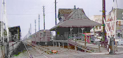
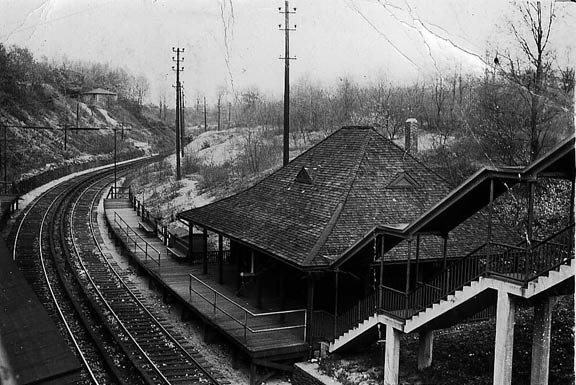
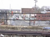
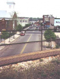
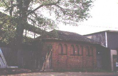
In the 1970s, the Richmondtown Restoration (at Richmond and Arthur Kill Roads) bought the old New Dorp station house and restored it. (The canopies on the outside of the station were removed.) It stands on Court Place today. The second photo shows it in place just before the grade cross was eliminated.
Some stationhouses dating to the 1930s are still found in many stations along the line.
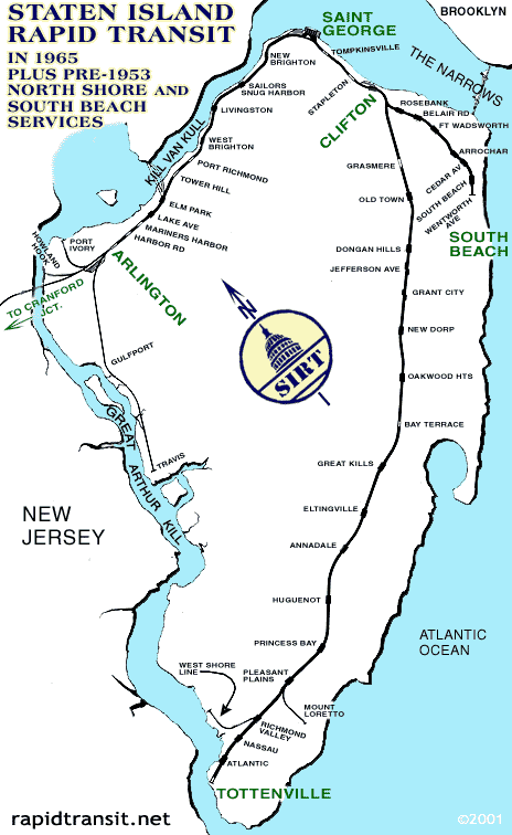
This map shows Staten Island Rapid Transit at its fullest extent, before the closures of the South Beach and North Shore branches in 1953. Today only the branch from the ferry to Tottenville remains. Note the spur tracks on the southern end — we will mention those later. On the left, the tracks to Travis were strictly freight and are still in use.
South Beach Branch
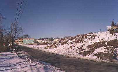
The South Beach Branch of the SIRT exists today only as a ghost branch. After service was stopped in 1953, the right-of-way remained in place for many years. Housing construction has begun on the remains of the old railroad.
The South Beach spur separated from the main line just south of Clifton and ran on a right-of-way through the Rosebank, Clifton and Arrochar neighborhoods that in many cases trundled on either side of private homes. The line terminated at Wentworth Avenue in South Beach, at a platform so short it was only a DOOR length!
While the North Shore branch has remained relatively intact, developers have been resolute in destroying nearly all traces of what was the South Beach Branch.
Arrochar station on the South Beach branch, photographed in the 1940s. This station was shuttered in 1953; the approach ramps for the Verrazano Bridge now stand in its place. Photo courtesy Anthony Paonita. The name “Arrochar” comes from the estate of W.W. MacFarland of the clan MacFarland in the 1840s, [who developed the area and named it for] his home village of Arrochar in Scotland. wikipedia
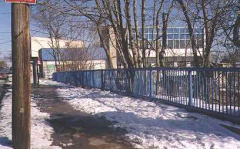
In 1999, a clear sign of the old SIRT could still be seen at McClean and Railroad Avenues, where there was still a bridge over the old railroad cut. The north side of the bridge is still intact here, but at the south side the cut has been filled in and the Pebble Lane Houses are being built there now. A very short portion of the old fence is still there. The fences have since vanished.
Railroad Avenue, sans railroad
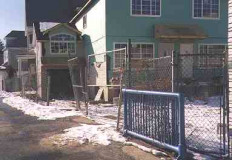
Railroad Avenue featured an actual railroad running alongside it between 1936 and 1953. All trace of its namesake has vanished, as new housing has sprung up on the former South Beach SIRT right of way.
Robin Road Bridge
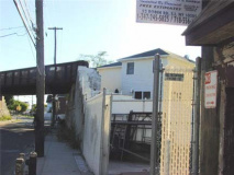
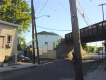
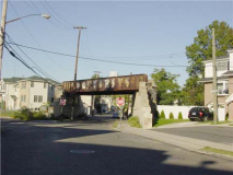
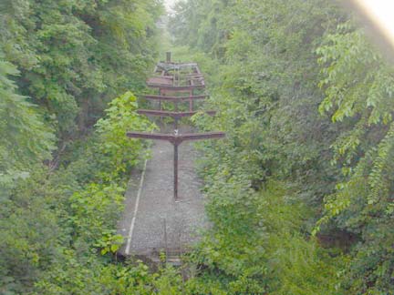
This old bridge, which is over Robin Road near Austin Avenue in the Arrochar section, is a rusting reminder that the South Beach Branch carried commuters between St George and Wentworth Avenue until 1953. It’s now one of the final remnants of the South Shore Branch, which is now being rapidly filled in by developers.
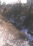
Embankment, just west of Robin Road on Austin Avenue, carried SIRT trains. The tresle shown above is just off the right edge of the picture. This scene is now filled with tract housing.
1936
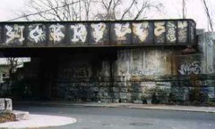
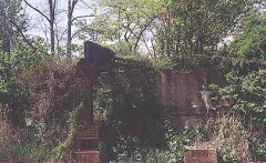
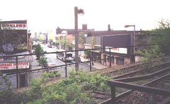
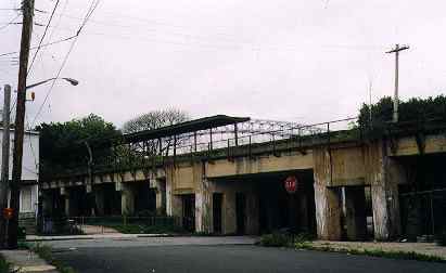
The presence of old SIRT stanchions on now-residential streets makes for some interesting juxtapositions. The SIRT formerly had a railroad bridge over St. Johns Avenue in Rosebank, just west of Wingham Street. After service was eliminated in 1953, the trestles were removed gradually, but some do remain, and some of the stanchions that supported them are still there. This section of St. Johns Avenue features a lot of new construction, but new residents may be confused about the large structure with the date 1936 carved into it. 1936 was the date this branch of the SIRT was elevated, removing the grade crossings.
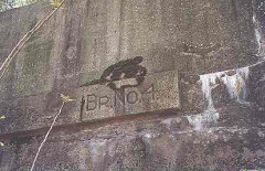
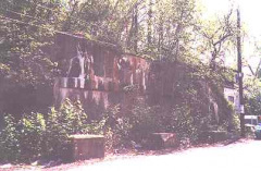
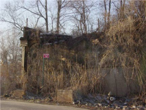
This was a rusting iron stanchion and a concrete wall that carried the SIRT over Willow Avenue and Langere Place in Clifton. The SIRT alternately ran at grade and on concrete and iron overpasses in Clifton. Note the “Bridge No. 4” sign. Trains ran for only 17 years here, between 1936 and 1953.
As of 2012 this, too, had been torn down.
Virginia Avenue
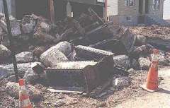
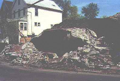
In a heartbreaking scene for railfans, the rubble of an SIRT overpass lies on Virginia Avenue and Tilson Place, waiting to be carted away. What’s going up in its place? Houses that all look the same.
Tompkins Avenue
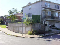
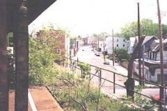
The Tompkins Avenue bridge, just south of Fingerboard Road, spans the old South Shore Branch RR cut. Photos: Gary Owen
North Shore Branch
Until the Staten Island Ferry Terminal was completely rehabilitated in 2005, the railroad station still employed these old-style track indicators. The indicator with the green light was the one where you boarded the train. After 1953, only the indicator reading TOTTENVILLE was supposed to be used, but, occasionally, a mistake was made and the indicator was set to ARLINGTON, like this one.
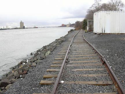
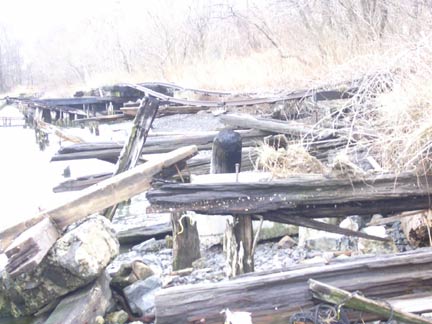
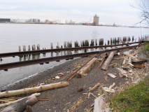
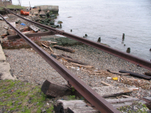
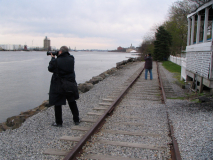
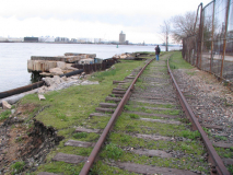
Between St. George and West Brighton the SIRT tracks are close to the Kill van Kull and the waves have taken their toll, with smashed up ties and bent rails. Photos: Joe Resse
Snug Harbor
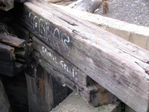
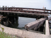
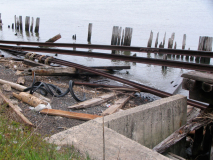
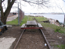
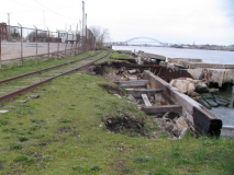
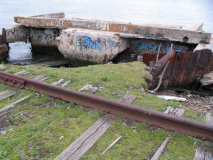
Also opposite Snug Harbor are these mysterious tablets facing Kill Van Kull. Since the SIRT had a Sung Harbor station, it’s possible these tablets were a part of the station, or were meant for passing boats. These partially-buried tracks can be found above Richmond Terrace opposite the Snug Harbor Cultural Center. Above 4 photos: Christina Wilkinson
On an expedition just south of Snug Harbor in the spring of 2011 the founder of the Newtown Pentacle and I found the tracks in good condition in some spots, but completely washed out in others.
![]() West Brighton station. Photo: Joe Resse.
West Brighton station. Photo: Joe Resse.
![]() The Port Richmond station, at Church Street and Port Richmond Avenue, used to anchor a thriving neighborhood that has slowly slipped into obscurity since the station closed in 1953.
The Port Richmond station, at Church Street and Port Richmond Avenue, used to anchor a thriving neighborhood that has slowly slipped into obscurity since the station closed in 1953.
The Port Richmond station was located between the tracks on the trestle above and behind the old public restroom on Church Street and Park Avenue. photos: Doug Douglass
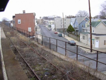
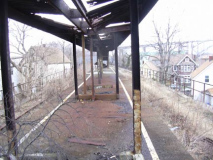
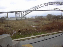
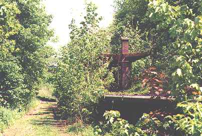
The Bayonne Bridge looms behind the Tower Hill station on Grove and Sharpe Avenues. The station took its name from the mansion belonging to the widow of pencil manufacturer Eberhard Faber, now the site of Faber Park and Pool. There is also a Faber Avenue in Port Richmond.
Photos: Doug Douglass
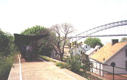
![]() Hey, if these folks are waiting for a train…should I break it to ’em? Photos: Doug Douglass
Hey, if these folks are waiting for a train…should I break it to ’em? Photos: Doug Douglass
![]() The Mariners Harbor station was located near Union Avenue 3 blocks south of Richmond Terrace. Photo: Doug Douglass
The Mariners Harbor station was located near Union Avenue 3 blocks south of Richmond Terrace. Photo: Doug Douglass
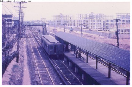
![]() Arlington was the last stop on the North Branch and was located near South Avenue, though the SIRT continued into New Jersey as a freight line, and still does. Prior to the 1930s the last passenger stop was Milliken, renamed Port Ivory for the now-abandoned Proctor & Gamble soap factory at the end of Richmond Terrace. Above 2 Photos: Doug Douglass.
Arlington was the last stop on the North Branch and was located near South Avenue, though the SIRT continued into New Jersey as a freight line, and still does. Prior to the 1930s the last passenger stop was Milliken, renamed Port Ivory for the now-abandoned Proctor & Gamble soap factory at the end of Richmond Terrace. Above 2 Photos: Doug Douglass.
Bottom: Arlington on the last day of service, 1953. NYCSubway.org
Arlington carries on as a freight yard, with the Arthur Kill lift bridge providing a connection to New Jersey.
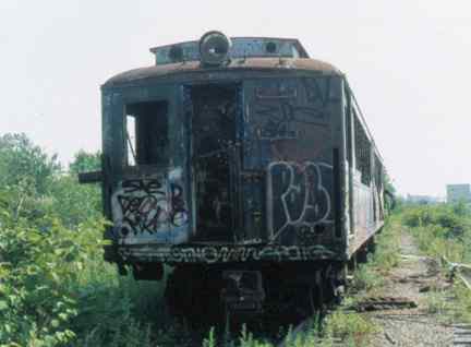
In the Travis yards southwest of the North Shore Branch between Victory Boulevard and Meredith Avenue, we had a genuine relic until recently…
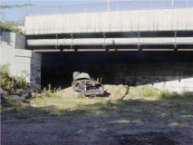
This 1925 vintage SIRT car was running on the SIRT when it was still part of the Baltimore and Ohio Railroad.
According to my sources, it belongs to the Trolley Museum of New York in Kingston, though the train car is in such decrepit condition that it apparently can’t be moved.
In November 2003, the car was moved to a separate location, and then disappeared, and we fear the worst.
Car photos: Marc Pitanza
More photos of this ghost can be found at
http://ltvsquad.com/Missions/Other/SIRTCar/Damned.php
Staten Island Railway Station that Looks Closed, But Isn’t:
In the early 1990s, The MTA renovated many Staten Island Rapid Transit stations, and gave the line a new name, Staten Island Railway.
However, the MTA planned on closing a couple of stations on the western end of the route and opening a new station on Arthur Kill Road in Tottenville. This plan never came to fruition, and the stations that were going to be closed, Nassau and Atlantic, have been left to deteriorate and decay. One or two cars open their doors at these very short platforms.
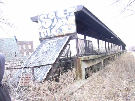
This is the Nassau station platform, which dates to the mid-to-late 1970s and hasn’t been touched since. The railing is likely much older. The platform edges are wooden, and dig the old stencil platform sign (which have been removed since this was shot in 1999). Above we see the stairway leading to the overpass on the Nassau station. The roof is caving in and the concrete steps are chipping and treacherous.
Unusual Sighting
Unusual sighting on the Tottenville Branch, Amboy Road and Luten Avenue, February 2005: as trackwork was being done, a work train consisting of several cabooses (cabeese?) was moving up and down the tracks.
Vintage Steam Staten Island
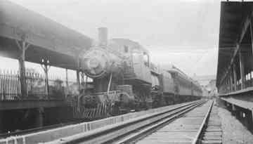
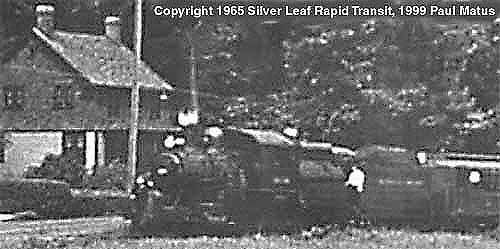
A Baltimore & Ohio Staten Island steamer pulls into Eltingville sometime in the 1920s.
Did you know that the SIRT once had a spur to the Mount Loretto children’s home in Pleasant Plains, near the end of the line in Tottenville? The spur accommodated steam engines and wasn’t electrified like the rest of the line. Although the service ended by mid-century, the tracks were in place until the 1980s and the spur’s junction with the SIRT was recently removed. Above is a rare picture of one of the steam engines used on the line courtesy of Paul Matus.
![]() Read more about the Staten Island Railway on nycsubway.org
Read more about the Staten Island Railway on nycsubway.org
![]() HopeTunnel has several excellent North Shore SIRT images
HopeTunnel has several excellent North Shore SIRT images
![]() Gary Owen’s SIRT tribute page: lots of photos and documents; the comprehensive SIR pages
Gary Owen’s SIRT tribute page: lots of photos and documents; the comprehensive SIR pages
Thanks to Forgotten Fans Jeff Barr, Gary Owen, Joe Resse, Doug Douglass and FNY CorrespondentChristina Wilkinson for assistance with this page
Written 7/20/99; updated 2009, 2012




















37 comments
I love that you are covering our borough!
FYI – the caboose at Luten and Amboy is in Huguenot. I know, I know, the school there is named Tottenville High School, lol. That’s because it USED to be in the actual town of Tottenville.
And you’re not kidding about being the forgotten borough. There’s not ONE shred of information about whether the Staten Island Rapid Transit is running after Hurricane Sandy 🙁
I know….in 1973,to appease the graduating class fhat year from the original Tottenville H.S. on Yetman Avenue,the name was changed from Huguenot High School in the new campus on Luten Avenuue to Tottenville High School. The nae Huguenot H.S. was already set in concrete over the front entrance and in 1973, the year the new school was built, the nae was changed back over outcry. The seniors did not want to graduate from a Huguenot High School,a name unfamiliar to them. While this is understandable,time moves on, and all subsequent students really should be going to the school that has a nae relecting where it is located….in Huguenot. Tottenville H.S. ceased to exist once the new campus opened its doors in 1973.
I thought you would like to know that there is another railroad station that was moved to the Richmondtown Restoration site.
It is directly behind the New Dorp Station and was part of a two structure move from the village of Annadale. Not much to look at now but it was saved from destruction by moving it as well as aniother building that was later attached to it.
The station is thought to be as early as 1865 and still retains it’s ticket window as well as a lot of early graffitti.
I prepared the building for the move years ago. I was also the one that did much of the stabilization work on the New Dorp Station as well back in the 1960’s.
“Forgotten New York” is a website I visit often. Just love it!
Bill Rigby
Thank you for preserving and retelling our history
Thanks for the interesting info. Im always curious about the old SI train lines.
FYI~ The Mariners Harbor Station was located on Maple Parkway. =)
Actually, the Mariner’s Harbor station- which still stands today- is located at Van Pelt Avenue.
Actually, you’re both right – The station was accessed by a direct stairway from Van Pelt Avenue, and was also accessible from a pedestrian walkway that crossed the railroad cut from near the end of Maple Parkway (Linden Avenue), with the walkway also extending along the north side of the railroad cut to DeHart Avenue, and continuing to Union Avenue, thus providing station access from multiple streets. We used to use the walkway to walk to Church (on Harbor Road) when we were kids, as a short cut to get from Maple Parkway to DeHart Avenue, then Union Avenue.
I grew up on Post Lane (A couple blocks west of South Ave in Mariners Harbor. ) in the late 60s till 80. One of my buddies lived on Van Pelt, and we’d walk the tracks to her place. I’d also walk the tracks to school when I went to Port Richmond HS, and hang out smoking under the overpass till it was time to go to class. Lots of fond and not so fond memories. Feral dogs getting killed by passing trains along the way from Port Ivory (Three Hills if you recall it – where they used to dump stolen cars and where my best friend’s cousin was found in the one of the underground bunkers murdered by a serial killer) and you had to hide when a train was coming by, cause if the Engineer saw you, the security guy would shoot rock salt at you. For the Bicentennial, my Girl Scout troop adopted one of the abandoned stations and overpasses to paint Red White and Blue. I have no idea why, since by that time, I think all we had was cargo trains, not passenger trains. The track infrastructure was so bad at the time, that many of the stairways that should have led down to the passenger stations went down to nowhere, and you’d have to take a path down the hill and walk along the tracks till you found another stairway or hill up again to the passenger walkway or the stairs up to the main streets again.
I have to comment about some of the mistruths and railroad legends. I was a career railroader and grew up on union ave, in the 1960s and 1970s so I knew these tracks well. My first railroad job was for SIRT in st George as a coach cleaner. We heard all the stories about caboose trainmen throwing out fireworks to the kids on July fourth and all the people who got shot at with rock salt shotguns by conductors. Lol. It never happened ever anywhere at any time on any railroad. Can you imagine the lawsuits if a rail employee shot a shot gun at children from a moving train? Even 75 years ago, weapon are strictly forbidden on any rail road property. I was a signalman and a freight conductor all over the country for 5 different railroad in forty years. No rail employees ever shot at kids with shotguns. The rock salt thing is crap. I watched videos on YouTube about salt loads and rock salt turns into useless powder right out of the barrel. Can’t be done. How these stories got started was probably from the depression in the 1930s when lots of hobos and people were riding the freights all over America looking for work.
Time to make the donuts and connet the SIRR to the subways in NYC
I am doing doe research on Pleasant Plains and the station there to include the Mt Loretto branch. Would anyone know when they elevated the train tracks in that area? I believe it was the early 1900’s but can’t find an exact year.
Thanks.
The WPA rasied the grade in 1939, the rail bridge over Amboy RD reads “1939” There is a plaque on the Eltingville Station telling of the WPAs efforts
I admire all who to contribute to this site –so much knowledge and enthusiasm regarding the rails. Regarding Pleasant Plains I have a distinct memory of boarding the train there when I was a little girl (approximately 5 yr. old). The train was a very short distance from my aunt’s house -a house my grandfather built at 108 Pleasant Plains Rd. The train had an engine (diesel, steam?) was at ground level and we had to climb up to board. (reminds me of some of the stations on the upstate Amtrak line where I now live). I am nearly 69 –so that would have been in 1954—was not elevated then.
I recall as a kid sitting by the New Dorp crossing and seeing a steam engine. This would have been 1948-1949. Is my memory serving correctly, I was only 3 years old but have pretty good recollections of that age.
I love pictures,story’s and history of the S.I.R.T. I picked up a B&O S.I.R.T lantern 1925 ,aS.I.R.T lantern 1920’s ,S.I.R.T train key and 1920s train tickets.Great job Gary!
At Utah Street in Tottenville there was a turntable for the steam trains to switch directions. It was manually operated with two men moving an entire loco 180 degrees.
My father grew up in Tottenville and his father worked for the B&O.
As a kid in the 50’s I used to walk the tracks from Port Ivory to the ferry terminal just to see where they went. Great memories of the past when Staten Island was a vibrant place . Thanks .
Oh wow. Just commented on that and then found your post. Hope you’re still monitoring! Yep we spent a lot of time in Port Ivory, though maybe a decade and a half later. At the time not so vibrant. Port Ivory was where stolen cars went to be lost. Feral dogs roamed the junk piles, and we silly kids would look for high ground whenever the dogs started barking. Didn’t usually walk as far as the ferry teminal! That’s a LONG walk!
The pictures identified as being the “West Brighton” station are actually either the Tower Hill or Port Richmond station. Once the line gets east of the Port Richmond station, it crosses Richmond Terrace and doesn’t stay on the concrete viaduct for long as it goes right down to the waterfront, which it then follows all the way to St. George. The West Brighton station was a non-elevated station down by the waterfront, between North Burgher Avenue and Broadway, and there’s probably no trace of it left today.
in high school (monsignor farrell) and college (pace university, new york) i commuted on the sirt every day from tottenville, about a five minute walk from my house
the photos bring back memories
thanks for putting this up
gary lahey
harris county, texas
As a young boy 10 years old I got the thrill of a lifetime. From 1961-62 an engineer name John let me ride in the cab with him. He taught me everything about railroading, from signals to operating trains which I did many times. I’m now 64 years old filled with happy memories operating old SIRT trains that will stay with me till the day I die. I only wish I new John’s last name. He was a German fellow about 43 years old in 1962. If he only knew the lasting impression he made on that 10 year old boy. The photos are the best.
Looks like the old Nassau & Atlantic stations were replaced by the newly constructed Arthur Kill Station on January 22, 2017 which opened on the same date. Now SIR really needs is to somehow complete, and connect the line with the BMT Forth Avenue Line at the Bay Ridge-95 Street BMT Station of the NYC Subway system, now you are talking something. This was proposed back in the 1920’s, but was stopped by the mayor at the time Hylan, due to his hatred of the IRT & BMT subway lines back then. This must be done as soon as possible, since Staten Island’s Express bus network is very much maxed-out as we speak.
I have ten SIRT brass or metal uniform button covers. I have had them for years and just this week found a picture of the monogram somewhere. I would like to send you a picture to confirm. To whom should I address the email?
Love the history of statenisland. Any you can share I appreciate it also a retired for statenisland railroad.
My Grandfather owned Arrochar Pharmacy. We would play on the old closed down station in the early 70’s located between Major Ave. and McClean. WE also played at another station which was locatedon the same line further down toward the water. I think that stop was actually Arrochar.
Thanks,
Charlie
I am from Abington, Pennsylvania. I knew very little of the Staten Island line other than it was a
separate division of the New York transit system. Very enlightening to say the least.
Lots of history here. I have learned a lot from the narratives and the photos. I am a member of the ERA.
Bruce Ernesto Miller
I lived in Eltingville on Sylvia Street which runs parallel to the train and was very close to the station – to age 15 – 1953 to1967.
Fond memories of watching the trains running – especially in the winter when snow /ice would cause big flashes from the power rail.
I rode the train daily from Eltingville and got off at – I do not see the station on the map but I remember walking down Midland Ave to go to Egbert Jr high.
My mother worked at Snug Harbor and my father rode the train and ferry daily to work in Manhattan.
Thank you for the photos and history.
I rode the 7:21 to school from Tottenville to St. George for three years. Loved it. Actually, I got on at Richmond Valley and there was often one seat left for me in the first car. In St. George I’d often meet two other girls from my class and we’d walk up to school together.
We’d often go to Tompkinsville for a swim as that was the only public pool on the Island at the time (late 50s, early 60s)
The 4:02 was the most fun home as that’s where the handsome boys were from McKee. I dated two of them.
The fianal elimination of all the grade crossings started during the 1960s. The construction began in August 1965 and ended in August 1968. The final blow to elimination of the grade crossings was a result of a school bus/ train accident in Grant City in 1960. On Monday November 7, 1960 a St. George bound SIRT train struck a school bus at the Bancroft Avenue crossing located between New Dorp Lane and Lincoln Avenue. Eight-year old Caroline Tarr was killed. Forty other children were injured 3 of them critically. The school bus drive was Edgar Hollowell; the engineer of the train was William Allan. Both the bus driver and the motorman resided in Tottenville. They are now both deceased. Hollowell died on November 12, 1990 in Edgewater, Florida. William Allan died during the summer of 1998. My family was from Tottenville. My father knew both HOllowell and Allan.
Does anyone reading this perhaps remember “Brunch ‘n Browse ?” It was located in the Annadale Town in the 1960’s and early 70’s. It was a restaurant that served breakfast and lunch. Run by a woman that had up in the attic all sorts of Staten Island historic memorabilia for people to peruse through after their meals. The treasure-trove contained things like: old Staten Island Advance pages and clippings of notable events, bric-a-brac, old photos of well-known sites around the island, old family and neighborhood photos on the island, menus from by-gone restaurants, books, pictures of the Staten Island Railroad through the decades, and so on ! If you do,please leave a comment on this blog and share your good,old memories,too.
Hello,
I retired from the B&O.
I have the original track profile dated Feb 1859 for the Staten Is RR after Vanderbilt purchased the property.
I am not a collector and would like to get this to the proper place. Any ideas?
Maybe the B&O train museum?
to charles boylan the arrochar station was at major ave right under the trestle on the st george bound side that was about two blocks from where the pharmacy is the next station was at cedar ave and conger street one block down from the mcclean ave trestle
This was known as ‘Cora Wilson’s’ Brunch and Browse. It was just off the Annadale circle, near Angelina’s restaurant (which closed several years ago). I remember when she was selling it. Having just made it into our first house, it was too much to consider buying it at that time. (If I remember correctly, she was asking around $35,000 for it 40+ years ago). I’m still looking for a photo of the old hotel in LaToja in Eltingville. That would have been the 1950’s. If anyone has one, please shoot me an email.
I need to know who owns/ is responsible for trestle walls put up during the street dig outs….
Great historical stories and photos. Should be a book or part of a Staten Island history publication of some kind