The Lower East Side of Manhattan, roughly defined by Houston Street on the north, the East River on the east and south, and by the Manhattan Bridge and the Bowery on the west, known in story and song as a teeming, bustling magnet for immigrants in the 19h and 20th Centuries, actually has a long and varied history. In the 17th and early 18th centuries, it was primarily countryside and farmland; the it attracted ship captains and wealthy landowners such as Rutgers and Delancey, whose names still are prominent on local street signs; and then came wave after wave of immigrants, first the Irish, escaping the potato famine and British repression in the 1860s…then the Germans in such numbers that the area became known as Kleindeutschland…and finally Eastern Europeans, many of them Jewish, starting in earnest in the mid-1880s, escaping repression in their homelands.
The tenement, as in other parts of New York City, was the dominant form of housing with hundreds of people occupying the same building, in some cases. Crowding, freezing cold in winter, and stifling heat in summer were the norm. Reform came only slowly.
Beginning in the 1930s, whole blocks began to be razed as ‘slum clearance’ gave way to housing projects, and an entire neighborhood was transformed. Entire streets disappeared too, and we’ll try to name them all here.
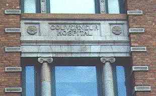
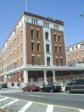
Gouverneur Hospital, at Gouverneur Slip and Water Street, is one of the few pre-war structures south of Henry Street and east of Rutgers Street that has survived. The former hospital was built in 1901 by McKim, Mead and White. The new Gouverneur Hospital on Madison Street was built in 1972.
Gouverneur Street and Slip are not named for any New York governors, but for Abraham Gouverneur, a French immigrant who became a merchant and political activist.
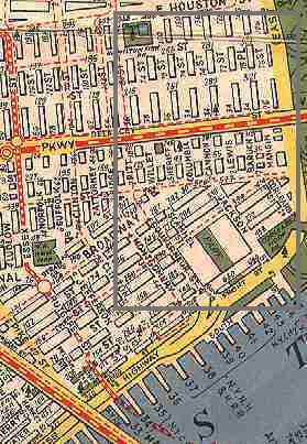
This map, prepared for the Federal Writers Project in 1936, shows what streets remained on the Lower East Side in those days. Housing projects would claim many of them by the 1950s.
SOUTH OF GRAND
Location: between Monroe and Cherry Streets east of Pike Street
What’s there now? Rutgers Houses
Location: between Division Street and the waterfront at Cherry Street
What’s there now? Market Street. It received that name about 1795. There were no less than eight George Streets in colonial Manhattan, most named for British monarch George III, and all received new names after the Revolution. Market Street received its new name in 1813 to mark the nearby Catherine Market.
Before the name change, George Street at the East River was a red light district.
Location: between Division Street and the waterfront at Cherry Street
What’s there now? Pike Street. Charlotte Street was renamed in the 1810s in honor of Zebulon Pike, explorer and soldier of Pike’s Peak fame.
Location: from what is now Chatham Square northeast to Grand Street.
What’s there now? East Broadway. Originally named for Harman Rutgers, brewer and member of the locally prominent Rutgers family (Henry Rutgers and Catherine Rutgers are also remembered this way). Renamed in the 1820s
Location: Pearl Street northeast to Grand Street
What’s there now? Madison Street. Renamed for the fourth President in 1826. Part of the street was also named Bancker Street, for a Rutgers in-law, but the Banckers wanted their name taken off the street signs as the neighborhood got worse in the 1820s.
Location: Catherine Street northeast to the East River
What’s there now? Monroe Street. Renamed in 1831 for the fifth President.
James Monroe was originally buried in the Marble Cemetery on Second Street, but the body was disinterred and moved to his native Virginia.
Location: Division Street southeast to the East River
What’s there now? Renamed Jefferson Street for the third President, likely because Washington had been honored with a street already, on the West Side.
Much of Jefferson Street has been replaced by the LaGuardia Houses.
Scammel Street’s former route is marked by a walkway in the Vladeck Park Houses.
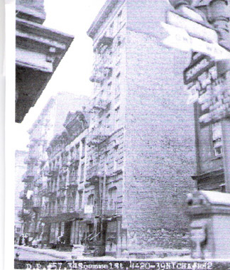
A couple of views of Scammel Street before the housing project replaced it.
Location: Grand St. and East Broadway to the East River. Scammel Street has been preserved as a path at Vladeck Park Houses. photo: Bob Mulero
What’s there now? The Vladeck Park Houses, built in 1940, occupy the route today. Scammel Street is most likely named for Revolutionary War hero Colonel Alexander Scammel.
Location: Fir Street ran from Grand Street to the East River between Scammel and Jackson Streets. Fir Street had disappreared from maps by the mid-1840s.
What’s there now? The Vladeck Park Houses
Location: Grand Street southeast to the east River
What’s there now? Jackson Street, renamed for the seventh President sometime in the 1850s; Jackson had died in 1845.
Location: from Monroe and Grand Streets southeast to the East River.
“Corlears Hook” is an old name for the part of the Lower East Side where the East River curves to the north.
What’s there now? The Corlears Hook (ILGWU Cooperative Village) Houses, built in 1956.
NORTH OF GRAND
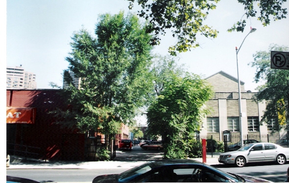
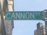
Cannon Street, now just an echo of its former self, exists as an alley between Delancey and Broome west of Lewis Street. It has survived because it faces a public school that was not razed in ‘slum clearances’ that began in the 1930s.
Forgotten Fan Peter Sefton recalls this old neighborhood of teeming tenements and bustling businesses:
I was struck by your reference to Cannon Street, where my great-grandparents were married at the long-vanished St. Rose of Lima Church. My family comes from the warren of dead streets just north of the Williamsburg Bridge, which were named after old-time Londoners like Mangin and Goerck. My grandfather was born at our ancestral coalyard-tenement on the long amputated foot of Rivington, just a hundred yards from the old city manure and Knickerbocker Ice Company docks at Piers 60 and 61. His block was between Tompkins, now the southbound slow lane of the FDR, and Mangin, today just a stub of a street that passes under the approach to the bridge. His mother came from the block of Goerck between Delancy and Rivington, which is also part of the green lawn at Baruch Holmes today.
This 1940s-era Hagstrom map shows the Lower East side north of Grand Street. Much of this map has utterly changed since the Fifties.
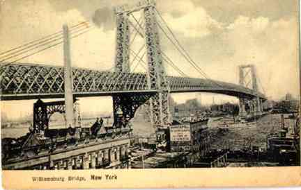
In about 1905 the firm of Dannat and Pell was at the foot of Grand street and the East River. The then-brand new Williamsburg Bridge dominates the scene.Photo courtesy Peter Sefton
The FDR Drive and the Corlears Hook Houses occupy the site today.
Location: The East River waterfront, between Grand and Rivington Streets. It was built on landfill in the late 1800s.
What’s there now? The Franklin Delano Roosevelt (FDR) Drive.
Manhattan has a West Street and a South Street, but its North and East streets have been obliterated. East Street has been gone since the early 1930s, when construction for the FDR Drive eliminated it.
Location: Between Grand Street and East Third Street. In the late 1800s-early 1900s, Tompkins Street bordered the waterfront between Rivington and Third Streets.
Tompkins Street, like Tompkins Square Park in the East Village and busy Tompkins Avenue in Staten Island, was named for Daniel Tompkins, three-term New York State Governor (1807-1817) and Vice President under James Monroe (1817-1825).
Tompkins built Victory Boulevard (first called Richmond Turnpike) and instituted the first ferry service between Staten Island and New York City.
What’s there now? FDR Drive
Location: From Grand Street north to Houston Street just west of the FDR Drive. A small piece of Mangin Street is still in place on Houston.
Mangin Street is one of the few streets in NYC in which the surveyor named a street for himself. Joseph François Mangin, a French immigrant, was a surveyor and architect who had a hand in New York’s City Hall as well as the Park Theatre on Park Row, which stood until the late 1840s, and the old State Prison at what is now West and Christopher Streets, which stood from 1797 to 1827.
In 1803, Mangin, with partner Casimir Goerck, submitted a city plan for Manhattan to the Common Council of New York City. The ambitious plan straightened crooked paths and evened out the shoreline. Mangin audaciously named streets for himself and Goerck. Ultimately, Mangin’s plan was passed over, in 1811, in favor of another one by John Randel, Jr. That plan is the familiar grid of numbered avenues and streets we have today.
What’s there now? The Corlears Hook Houses, now the ILGWU Cooperative Village (south of Delancey) and the Baruch Houses (north of Delancey)
Location: From Grand Street north to East Third Street. Named by surveyor Joseph Mangin to honor his partner, Casimir Goerck. Goerck died in 1798 before the survey could be finished.
What’s there now? The Corlears Hook Houses, now the ILGWU Cooperative Village (south of Delancey) and the Baruch Houses (north of Delancey)
The city has recently marked a very short section of Mangin Street between the two sections of Delancey Street below the Williamsburg Bridge.
Goerck Street was the epicenter of Lower East Side tenement living in the early days of the 20th Century. Conditions were crowded, bleak and depressing in the teeming district. Forgotten Fan Peter Sefton passes along an incident on Goerck Street, on which his family lived in the mid-1890s:
A curious group of eviction cases grew out of the determination of one Elias Russ, owning the tenement house at No.6 Goerck Street, to demand fifty cents a month extra rent for every baby on the premises after the beginning of March, 1905. The building was occupied by 30 families, who boasted of 150 children. The tenants refused to pay the increase. Dispossess writs were served. Mrs. Frederick Friedmann, one of the tenants, loudly cried: “What is it you would do? Should I turn my firstborn, Isaac, into the street, stab Rachael, strangle Moses, shoot Rebecca, drown Mira, poison Nathan, throw Lizzie from the roof, or hug the twin babies to death? Oh! monster of a man! ” The tenants, with many of their children, went in a body before Justice Worcester of the Thirteenth Municipal District Court to protest. Mrs. Fannie Frank became one of the spokesmen and declared, “The landlord is against the Scriptures which bid men multiply.” The justice gave the tenants only a stay until the following Monday, by which time they were to decide either to pay the increased rent demanded or to find other premises.
Author and playwright Bella Spewack, best known for the book of the Broadway smash Kiss Me, Kate, grew up in a series of tenements on the Lower East Side. She recalls Goerck Street in her memoir of the early 1900s, Streets:
I went several times to Goerck Street before we moved, compelled by fear and dread. It was a “tough” block. From there would come every offensive in the bottle fights that would visit Lewis, Cannon, Columbia, and Sheriff streets like some short, nasty pestilence. Bottle fights included every kind of weapon; some of the Goerck Street gangs used to throw rusty blades.
As a very little girl I would dare myself at night to go to Goerck Street and never get any further than the corner. Ours was and still is one of a row of red four-story houses, a fifth story being based on the stoop. There was a constant going and coming of moving vans and pushcarts one family moved into one house and moved out of the next. The houses formed a drably indifferent village that on rainy days looked like a row of washed-out, badly patched petticoats….
Location: Same as Goerck Street. Late in its career, Goerck Street was renamed Baruch Place, in honor of Simon Baruch, the innovative physician who emigrated from Poland as a youth and settled in NYC in 1881. He was the father of financier Bernard Baruch.
A small piece of Baruch Place is still in place, forming an arc with Mangin Street just south of Houston Street and the FDR Drive.
What’s there now? The Corlears Hook Houses, now the ILGWU Cooperative Village (south of Delancey) and the Baruch Houses (north of Delancey)
Location: Between Grand Street and East Third Street.
A small part of Cannon Street remains between Broome Street and Delancey (see picture above).
What’s there now? FDR Drive
Location: Manhattan Street was a very short extension of Cannon Street north of Houston Street.
Bella Spewack:
“On the other side of Houston Street, a street of noble width, Cannon Street narrows and narrows until it is but the wink of a blind man’s eye: Manhattan Street.”
What’s there now? The Lillian Wald Houses
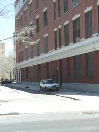
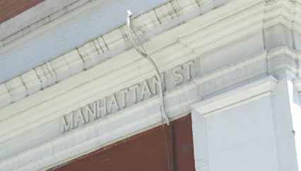
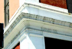
Manhattan Street is preserved as a driveway adjacent to PS 188.
“Manhattan St.” on side of PS188
Location: Rachel Lane was a tiny alley from Goerck Street east to Mangin just north of Grand Street.
What’s there now? The Corlears Hook Houses, now the ILGWU Cooperative Village (south of Delancey) and the Baruch Houses (north of Delancey)
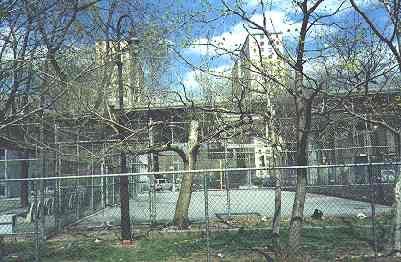
This tiny stub, on Broome Street just west of Columbia Street, is all that remains of Sheriff Street. It has now been assumed by a small park at the rear of the Amalgamated Dwellings.
The old corner of Broome and Sheriff is punctuated by the remains of a bishops crook lamppost.
Location: From Grand Street at East Broadway north to East Houston Street.
Sheriff Street appears on maps as early as 1797. It most likely takes its name from Colonel Marinus Willett, who was Sheriff of New York from 1784-88 and later Mayor (1807).
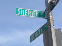
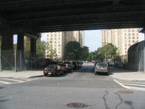
What’s there now? Similar to Mangin St., a short stretch of Sheriff (above) is still there under the Williamsburg Bridge. The Amalgamated Dwellings (1930) (south of Delancey) and the Masaryk Towers (north of Delancey).
One of the earliest and most innovative projects in the area, the Amalgamated Dwellings were the brainchild of Abraham Kazan, president of the United Housing Foundation, on behalf of the Amalgamated Clothing Workers Union.
Kazan has had a section of Columbia Street, between Grand and Delancey Street, renamed for him.
Other streets in the area have been greatly shortened by the construction of housing projects over the years.
PS188, surrounded by newer housing projects, preserves the paths of two Lower East Side streets, Manhattan Street (above) and Lewis Street.
Lewis Street once extended from Grand Street all the way north to East 8th Street. Its route has been taken over by the Baruch Houses, Lillian Wald Houses, and Jacob Riis Houses. A short stretch of East Third Street is also preserved, behind the school.
Columbia Street is one of the few streets in the area that has been allowed to keep all of its old route. It traverses the site of Peter Stuyvesant’s farm in the 1600s. Currently, it is the divider between the Baruch Houses and the Masaryk Towers.
Willett Street recalls Colonel Marinus Willett, a Revolutionary Army officer (and fiery activist among the Sons Of Liberty) and later sheriff and mayor of New York City. The northern course of Willett Street, above Delancey Street, is presently occupied by the Samuel Gompers Houses.
OTHER LOST STREETS OF THE LOWER EAST SIDE
There are a couple of other streets that got renamed or lost in the shuffle somehow in the area, and in the interest of being ruthlessly complete bordering on the tiresome, I’ll get into them here. And besides, it gives me a chance to create some more of these kewl fake green-and-white DOT signs.
This Jay Van Everen plaque, at the Canal Street BMT station token booth, shows a long-vanished NYC scene. But of what? Read on…
Van Everen, a painter by trade, designed a few of the plaques that appear in BMT station sbuilt from 1905-1920.
So what does the Van Everen mosaic in the Canal Street subway station depict?
It’s likely Van Everen saw this 1812 woodcut featuring the corner of Great George Street (today’s Broadway) and Canal Street. The building in the middle was the Stone Bridge Tavern. The stone bridge in the foreground carried Broadway over the canal.
When the canal was filled in, the bridge was buried under the street. It may still be there, although subway construction may have uprooted it.
Location: From about Centre Street east to Division Street.
What’s there now? Canal Street.
The history of Canal Street is, in many ways, a history in brief of the whole of Lower Manhattan, and you could devote a whole webpage to Canal Street alone from the 1830s to the present.
Canal Street, in the remote era between 1805 to 1815, really had a canal running down the middle of the street.
As hard as it is for us to believe today, the island of Manhattan used to be open country, with forests, streams and ponds. One of the ponds, known to the Dutch as Kaltchhookand to the Brits as Fresh Water Pond, was used by original Native American inhabitants as a campsite and a fertile fishing pool. The Dutch name was later Anglicized into “Collect”.
Collect Pond consisted of a small pond at where Centre and Duane streets are today, and a much larger pond centered at where Centre and Leonard are today. A stream led from ‘the Collect’ to the Hudson River.
By 1791 the area around the Collect had been largely settled. The neighborhood was growing and various plans were proposed, among them one by Joseph Mangin, to either fill the pond or build a canal deep enough to accommodate shipping.
One of the principal fountains of the Collect was located at Roosevelt and Chatham Streets and was known as the Teawater Pump, since the locals used it as a freshwater spring for their favorite beverage. A resort known as the Teawater Garden arose in the region. By 1829, though, the resort had disappeared, though it lent its name to Pump Street, which angled nearby.
It was finally decided to fill the Collect. But the area became a disreputable one while the work was being done, since all manner of garbage and offal from nearby slaughterhouses were used as landfill.
Much of the Collect’s waters were drained off via a canal dug in 1805, running to the Hudson River. But the unclean waters bred mosquitoes and other pests, and it was decided to pave over the canal in 1815. To this day, though, Canal Street is still plagued by occasional cave-ins with the running water underneath it.
As for Pump Street, it was renamed as an eastern extension of Canal Street by the early 1840s.
Location: Between the Bowery and Mulberry Street. Along with Bayard Street, named for Nicholas Bayard, NYC mayor in 1686.
What’s there now? Canal Street. By the early 1800s, this section was known as Pump Street, and by the 1840s the whole stretch was called Canal Street.
Location:Between the Bowery and Division street, south of Grand
What’s there now? Hester Street. Hester Rynders was the daughter of Jacob Leisler, a New York governor railroaded and executed for treason in 1691. The street was alternately known as Eagle Street and Hester Street until the early 1800s when “Hester Street” finally stuck.
Hester Street was the name of a 1975 movie that gave Carol Kane one of her first leading roles.
Location: The Bowery east to the East River north of Grand Street
What’s there now? Broome Street. Renamed for merchant and alderman John Broome in 1807.
Location:The Bowery east to the East River north of Stanton Street
What’s there now? Houston Street.
When North Street was laid out it represented the northern limit of Henry Rutgers; holdings and also the northern limit of the inhabited section of Manhattan.
It was renamed for William Houstoun, a Georgia Congressman who married the daughter of local bigwig Nicholas Bayard III. Houston Street has nothing to do with Texas patriot Sam Houston, as some suspect.
4/16/2000












1 comment
[…] had also not heard of Goerck Street, largely because it was wiped out by mid-1900s urban […]
Comments are closed.