Your webmaster lived in Bay Ridge between 1957 and 1993 (with an neighborhoodus interruptus in Dyker Heights in 1990-1991) and yet, the adjacent region to the east, Bensonhurst, the vast area between 14th Avenue, 65th Street and the Belt Parkway and Bay Parkway and Stillwell Avenue) largely remains unplumbed territory for me. I had had no antipathy of any sort for Bensonhurst, but in the bike rides of my youth, coming out of Bay Ridge … Bensonhurst was always a neighborhood I passed through on the way to Brooklyn and Queens’ southern reaches, and so I never had any time for it: on the way out I was eager to get where I was going, and on the way back I was tired and in a hurry to get home. So, I decided to do a little plumbing on Christmas Eve 2007 with a march down its main artery, 18th Avenue. With a few days off during the holidays, and a rare day of sun, the time was never better to see it at last.
On any NYC highway, you encounter many different populations and landscapes. Walking down any long avenue should be a required march for anyone interested in NYC’s cultures and building styles…
Bensonhurst has been home to Larry King, Sandy Koufax, Robert Merrill and Buddy Hackett as well as Elliott Gould, whom your webmaster met in October 2007 at a ceremony honoring Lorie Conway’s movie and book Forgotten Ellis Island; Gould narrated the film.
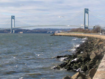
The 18th Avenue story begins, or, more officially, ends (the house numbers are highest at the southwest end) at Gravesend Bay, where I snagged this postcard-worthy shot. I couldn’t have cued the gulls and whitecaps any better. We are along the bike and pedestrian path that was fortuitously built during construction of the Belt Parkway in 1939-40 and ahead of us is, of course, the Verrazano-Narrows Bridge, which was built in my back yard.
Actually we’re at about 17th Avenue, but I want to show you something.
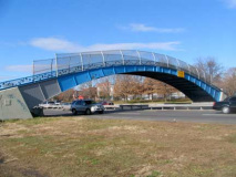
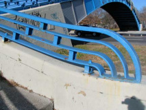
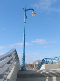
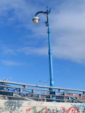
The Belt Parkway engineers built these gorgeous pedestrian bridges, four in number, at various locales along the Belt Parkway in Bay Ridge and Bensonhurst. There are two in Bay Ridge, at about 80th and 92nd Streets, and in Bensonhurst at 17th and 26th Avenues (we have already seen one on my Shore Road Slice). The bridges boast details like curved handrails found nowhere else in Department of Transportation engineering, and pedestrian bridges on other NYC Robert Moses parkways, such as the Cross Island Parkway, BQE or Long Island Expressway, are more…ah…pedestrian in appearance.
Post Rarity
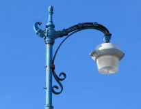
But two of these bridges also preserve the now very rare Type F lightpost, with reverse scrollwork (e.g. the little curl behind the post turns “up” in this design, while they were turned “down” in the lengthier long-arm NYC “Corvington” posts). There are just a handful of these left from the old days…one here, a couple on the 26th Avenue Belt Parkway ped bridge (seen on my Type F FNY page), West 13th Street between 6th and 7th Avenues, one in Ridgewood Gardens, Maspeth, Queens, and a couple on the SUNY Maritime College campus in Throgs Neck, Bronx. They used to light side streets in Manhattan by the thousands. A new mold has been cut and retro-Type F posts have reappeared on streets like West 8th in the Village and Wyckoff Avenue in Bushwick.
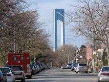
The VNB looms large over many southwestern Brooklyn streets but nowhere better than here, on westbound Shore Parkway, the Belt Parkway service road. I once looked at an apartment several years ago on 95th Street near 4th Avenue that had a view of the bridge out the living room window. I was all ready to sign when the landlord got cold feet about the whole thing. That happens when you are single and thirty. As it was, the apartment I had then, on 73rd, had a long-distance view, but only in winter when the leaves were down.
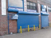
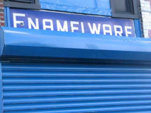
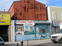
The west end of 18th Avenue features a great number of industrial and plumbing wholesalers. This one, Bruce Supply, has a number of vintage painted and enameled signs.
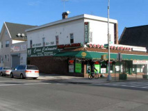
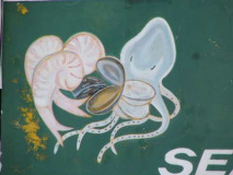
Casa Calamari, 18th and Bath Avenues…. the House of Squid. I enjoy seafood but have never been tempted to eat squid or octopus; it just looks unappetizing swimming around, with the arms and suckers and all. The Casa does boast Brooklyn’s “finest wood burning brick oven pizza” though.
Bath Beach and Bath Avenue were named for the British spa town on the Avon, famous in high-school British lit classes for the concupiscent, frequently-married heroine featured in Geoffrey Chaucer’s 14th-Century Canterbury Tales. This was a recreational area in Brooklyn too, as villas and yacht clubs clustered near the shore. It’s not a beach these days, but there’s a small sandy area along Gravesend Bay near the West 8th Street entrance on the Belt Parkway. Bath Beach also had an amusement park (Ulmer Park, closed 1899, remembered today only by the bus depot at 25th and Harway Avenues). The Depression ended Bath Beach’s days as a seaside resort area and soon, multi-unit housing appeared on its streets, further encouraged by the construction of the Belt Parkway through the neighborhood in 1939-1940. Till they hit it big in showbiz, the Three Stooges (two of them, anyway, Moe and Curly) were carpenters in Bath Beach.
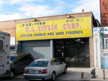
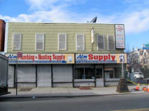
Two more wholesalers between Bath and Benson Avenues on 18th. The building at left could be a much-altered private home, possibly much grander in the old days.
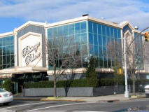
Amid all the supply stores there’s a big catering hall, the oddly-named (to your webmaster at least) Passage Palace. on Benson Avenue. Here’s a look inside, at awedding posted online.
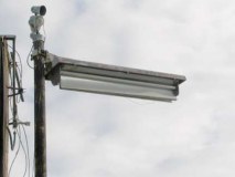
A busted light in an abandoned parking lot near Benson Avenue reminds me of the Westinghouse Whiteway lamps that formerly illuminated 3rd Avenue, 9th Avenue and Park Row in Manhattan.
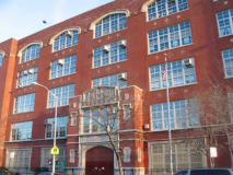
Not sure if it’s a new building or a renovated one, but the placement of the Fedders air conditioners is rather odd. I wonder if there’s a way to conceal these things. (Beside the point, I suppose, given air conditioner companies’ penchant for aggressive promotion.)
Bensonhurst and Benson Avenue are named for the colonial-era landholding Benson family, who produced a star in New York State’s first attorney general; NY Supreme Court justice; and US Representative Egbert Benson (1746-1833). Benson was interred in the now-largely abandoned Prospect Cemetery in Jamaica, Queens.
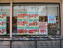
Bensonhurst is known primarily for its Italian-Americans, and we’ll see that later on, but beginning in the 1980s it has also attracted sizable Russian and Chinese populations as well; there are also African-American pockets. I haven’t been in Brighton Beach much lately, and I’d never seen wall to wall Cyrillic letters until I walked down 18th Avenue; here’s the first Cyrillic sign I’ve seen using the Cooper Black typefont.
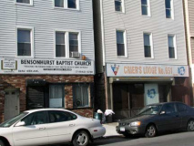
Between Benson Avenue and 86th Street, the Bensonhurst Baptist Church adjoins the social club Crier’s Lodge, while a Russian Orthodox church is across the street.
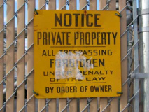
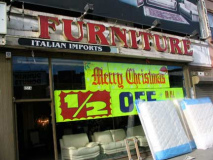
This yellow warning sign is pretty old, given its meticulous lettering in different styles and widths; a real pro did this sign. Care like this is never taken anymore. The font on the furniture store sign just north of 86th Street is Benguiat Bold; Edward Benguiat (1927- ; pronounced BENG-gat) was a honcho at a type shop on East 45th your webmaster worked at from 1982-88, Photo-Lettering, which, at the time, was NYC’s largest type shop. They’ve all disappeared, victims of the desktop publishing revolution. Benguiat has designed, to date, over 600 fonts, including this one. I carry my love of fonts from my stint there to this day.
Two of the schools I attended have closed, and an entire industry I toiled at has vanished. No wonder your webmaster created something Forgotten.
New Utrecht
We now come to the remains of one of Kings County’s original six towns…
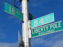
A network of old roads come together at 18th Avenue just north of 86th Street, where the Brooklyn, Greenwood and Bath Plank Road (now New Utrecht Avenue), Kings Highway (now 84th Street) and the Road from New Utrecht to Flatbush (18th Avenue) intersect.
Kings County, from the colonial era to the late 1800s was made up of six separate towns: Brooklyn, Bushwick, Flatlands, Flatbush, New Utrecht, and Gravesend. Over a couple of centuries, the City of Brooklyn gradually absorbed the other towns (after part of Flatlands became New Lots). By 1896, Kings County and the City of Brooklyn were finally coterminous…but then, Brooklyn voted to consolidate with New York City, by a very thin margin, in 1898.
The town of New Utrecht was named for Utrecht, Netherlands, the 4th largest city in that country. In Dutch, “Utrecht” is derived from two words that mean “old fort,” so that “New Utrecht” actually means “New Old Fort.” It’s remembered in Brooklyn by New Utrecht Avenue, the much shorter Old New Utrecht Road and by New Utrecht High School, which was shown in the opening credits for the 1970s Welcome Back Kotter TV show and where your webmaster took his math SATs.
New Utrecht Avenue is nearly, but not completely, dominated by the elevated West End BMT (as of 2008, the D and M trains) but it began life in 1852 as a private plank road called the Brooklyn, Greenwood and Bath Plank Road, yclept because it ran from the Green-Wood Cemetery area to Bath Beach. By 1865, Charles Gunther’s Brooklyn, Bath and Coney Island Railroad was built along its length, and after Brooklyn Rapid Transit (the BRT) took it over, the route was placed on elevated tracks in 1917.
New Utrecht’s first settler was Cornelius Van Werckhaven, who arrived in New Amsterdam from Utrecht, Netherlands, in 1652. He purchased what would become Bensonhurst, Gravesend, and Bay Ridge from Dutch governor Wilhelm Kieft and later, from the Nyack Indians. His associate Jacques Cortelyou issued patents to other settlers after Van Werckhaven returned to Europe. By 1661 New Utrecht had been granted a charter by New Amsterdam Director General Peter Stuyvesant, and the town was on its way.
From the ForgottenBook:
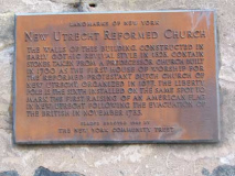
The heart of New Utrecht has always been the two sites of the New Utrecht Reformed Church. The first church in New Utrecht was formed in 1677 and its first church building was first built about 1699-1700, standing at what would become 16th Avenue at about 85th Street. This original church was razed long ago, but its ancient churchyard can still be found there.
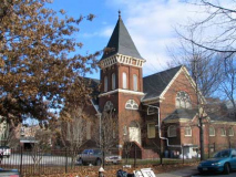
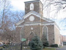
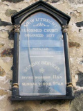
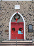
A “newer” church was built in 1828 at what would become 18th Avenue and 84th Street and contains some stones from its predecessor, along with Tiffany style stained glass. The bell of the two New Utrecht Reformed Churches has tolled to mark the death of every U.S. President…beginning with George Washington in 1799… and in the 1990s rung to mark the deaths of Joe DiMaggio and Frank Sinatra. The adjacent parish house, built in 1885, is no slouch architecturally in its Shingle Style finery.
The New Utrecht Reformed Church and its parsonage on 84th Street
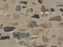
Some of the stones in this closeup of the ashlar exterior could be from the original church of the 1600s.
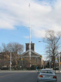
Liberty Pole
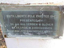
To harass the British, or to perhaps signal their defeat, Colonial patriots erected “liberty poles” on which the new American flag was raised. The first such pole in New Utrecht was raised in 1783 to celebrate American victory at the end of the Revolutionary War and the evacuation of the Britsh from New York, which happened at the Denyse Ferry in Bay Ridge in 1783. Six poles have been placed here subsequently; this latest pole was raised in 1946. The pole stands on what was Van Pelt Manor, which had been settled by the Van Pelt family in the 1670s and used as a military prison during the Revolutionary War. The manor was deeded to the city by the family in 1910, on the condition that the city preserve an ancient Dutch milestone that stood on the property.
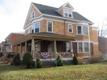
The New Utrecht Reformed Church’s parsonage is a Shingle Style house constructed in 1906 on 83rd Street just east of 18th Avenue.
Though several homes in the neighborhood were built in this style, the parsonage, built in 1906 as a pastoral residence, is the only one which remains relatively unchanged inside and out. The original parsonage on 18th Avenue near 79th Street was located on a small farm purchased by the church in 1808 from John Blake. Although the church sold the last of this farm land to a developer in 1881, it kept the parsonage for itself until it was sold in 1906. Historic New Utrecht
Compare the parsonage to some of the new objects that have been built across the street (or not; there’s no comparison).
Milestone Park
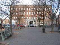
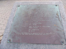
A concrete-paved park between 83rd and 82nd on 18th is rather undistinguished, except for a granite slab with a stamped metal sign relating what used to be here: the milestone the Van Brunts insisted be maintained by the city when they sold their property…
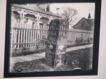
The milestone of Milestone Park, 18th Avenue and 82nd Street, is a remembrance of the oldest remaining milestone in New York City. The original, seen above right in a photo I obtained at an exhibition in a DUMBO art gallery, was moved to the Brooklyn Historical Society in the 1970s; a granite reproduction occupies the same spot where the original was placed on Kings Highway (now this section of 18th Avenue) in 1741. One side reads, “8-1/4 Miles to New York and 2-1/2 Miles to Denyse’s Ferry.” The other is inscribed, “10-1/2 Miles to New York Ferry, 15 Miles to Jamaica.” Though milestones were set up on many of NYC’s older roads in the 1700s and 1800s, only two, on Ocean Parkway, still stand in their original locations. The Friends of Historic New Utrecht, a neighborhood group, would like to see the original milestone put back.
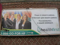
In another land? No, 78th Street. HealthFirst, an organization providing affordable health care.
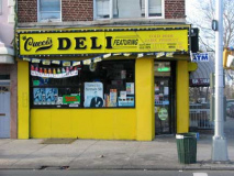
77th Street. My eye was caught by the striking yellow storefront and once again, Cooper Black typefont.
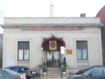
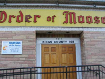
Between 77th and 78th Streets. I never attempted to join a fraternity in school. I was the last counterculturalist in the late Super Seventies and the idea of organizations with secret handshakes, fezzes or whatever was too conformist for your webmaster, the ultimate individualist. Sorry about all the Moose out there but even now I can’t fathom being in the Masons, the Elk, the Moose or whatever. That’s just me, though. I recognize that these clubs provide needed services in their neighborhoods around the country.
By the way, why do antlered animals like deer, elk and moose not pluralize using the letter “s”? And ox with an “en”?
(As an amateur etymologist, or rather someone with an interest in word histories, I’m aware that words with irregular plurals preserve dialectic plurals that were mostly replaced when the more widespread “s” plural flourished throughout England in the early Middle Ages.)
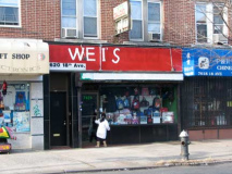
At 7620, here’s a real DIY sign. Or rather, a DI Wei sign.
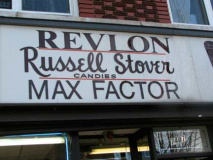
I like this sign, which has cut out letters and designs, possibly wood, mounted on a wood or vinyl base. The sign probably goes back to the 1960s.
Another pair of vintage signs, at Bay Ridge Parkway (75th Street, left) and just northeast.
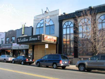
The now-closed Cotillion Terrace catering hall at 7311 was formerly the Senate Theatre, which opened in 1925 and closed, as a theater, in 1957, the year your webmaster opened.
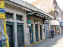
It was a fairly spacious house with three blocks of seats seperated by four aisles. The interior was done in light green and white and featured columns and decorative plasterwork throughout the interior. … There was a seperate entrance from the lobby to the orchestra, and the screen was large. The theater also had a domed ceiling…This theater was 10 blocks away from the more opulent Walker and 9 blocks away from the dumpy Colony. it was also close to the little but neat Hollywood and the majestic Oriental. This theater had air conditioning and a sign over the entrance said “cooled by refrigeration”. I remember going there with my father on a very hot and humid summer night, probably in 1956 to see 20,000 Leagues Under The Sea…the great movie based on the Jules Verne classic. We were totally blown away by it! It is still one of my favorites, but the small screen does not do it justice.That was the last time I went to the Senate. It became a catering hall called the Cotillion Terrace. Each time I went to an affair there, I always thought about the theater that once occupied that space. cinematreasures
Medium-Size Italy
You will find Bensonhurst’s heaviest Italian section between about 60th and 75th Streets along 18th and parallel avenues. Some urban experts argue that Manhattan’s Little Italy has for the most part been crowded out by the burgeoning Chinatown — and so, neighborhoods such as Bensonhurst or Morris Park and Belmont in the Bronx might begin to qualify as NYC’s true Little Italys, or, given their sizes, Medium Size Italys.
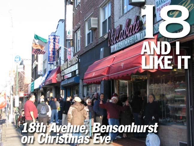
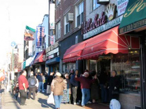
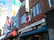
Social club (translation please ForgottenFans?) and record store. Everyone is lined up at the Villabate bakery to get cake and cookies for the next day’s visits on Christmas Eve.
LEFT: Children of Ragusa Society, Ragusa being a town in Sicily; RIGHT: Italian Rainbow. Thanks everyone…
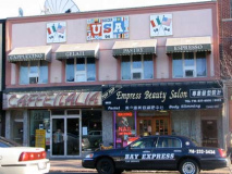
A second record store at 72nd Street. The USA 1994 signs above the cafe and salon refer to the soccer World Cup, which was held in the USA for the first time that year. Brazil defeated Italy in the finals after beating the USA in the round of 16.
At 67th Street we see one of the many defunct Childs restaurants in the metropolitan area, immediately recognizable by terra cotta sea life. Childs was obtained by the Riese Organization in 1960.
The Art Deco South Brooklyn Savings Bank, 65th Street and 18th Avenue. Chartered in 1850, the bank changed its name to Independence in 1975 and was acquired by The Long Island City Savings & Loan Association in 1992.
Like many metropolitan-area banks, the SBSB had the peculiar tradition of erecting its own light posts in front (especially if the bank was on a corner). Many of the posts still remain, like these, and some still illuminate.
The Mayor’s Theater
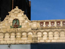
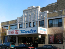
One of the rare NYC theatres named for a mayor (the only one perhaps), the Walker, at 6401, was named for Mayor Jimmy Walker, opening in 1927 with Walker appearing on opening night. The theater seated over 2200. It lasted surprisingly long as a performance venue: by 1980 it was still hosting acts like Helen “I Am Woman” Reddy, Kay “Rock & Roll Waltz” Starr and Rosemary Clooney, who as a 70s kid I knew only from her Coronet paper towel commercials. (“Extra value is what you get when you buy Coronet!”). Before the cable TV era, top prizefights like the 1975 Ali-Frazier Thrilla In Manila were beamed on closed-circuit feed here. It closed for good as a movie venue in 1988.
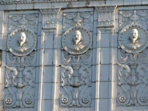
A close look at the exterior reveals a trio of William Shakespeares. To me, they look like they could be caricatures of “Gentleman Jimmy.” But maybe I am being imaginative.
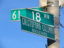
You might think the Department of Transportation would spell the name of the great exploi… ah, explorer correctly, wouldn’t you? But this is the NYC DOT we’re talking here.
The Sea Beach BMT N train’s 18th Ave. station has a rather nondescript entrance between 63rd and 64th Streets. The BRT turned the NY & Sea Beach Railroad into an open cut route in 1915.
The Baker
An interesting item has emerged just north of the 18th Avenue subway station…
From the ForgottenBook:
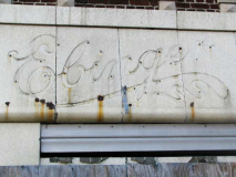
Arthur Ebinger’s Bakery is spoken of in hushed, reverential tones by Brooklynites of a certain age. I remember the company’s green boxes with diagonal black lines, its V-shaped counter on its 86th Street, Bay Ridge branch, and its small cakes coated on all sides by rich icing…as well as its butter cookies, drizzled with frosting that was every conceivable color in the rainbow. Ebinger’s bakery, an imposing brick building on Bedford Avenue and Albemarle Road in Flatbush with painted-over windows across from the Flatbush Town Hall featuring the words “Ebinger Baking Co.” emblazoned on the façade, is still there, though the cakes haven’t been sold for many years.
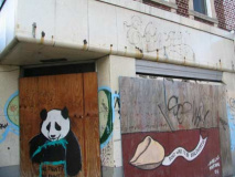
Here’s a second Ebinger relic, where remains of Ebinger’s script sign lettering are revealed after the sign covering it have been removed.
Street artist Marcus Motion has written something here.
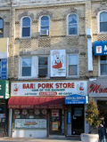
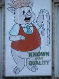
A source of endless fascination to me has been the depiction of animals wearing crowns, chef hats, or similar anthropomorphism. At 61st Street, the Bari pig, captioned “King of the Sausage” on other signs in Brooklyn, holds a string of encased relatives, wearing a slobbering, maniacal grin. Oh well, some animals are known to occasionally eat their young. (Flocke, a polar bear cub in Germany, was rescued from such a fate in early 2008). I’m trying to gather enough of these to do a full Animal Cannibal page.
I don’t know the exact literary term for it, but there are everyday depictions of grisliness that, out of context, sound awfully weird. As a kid we attended folk Masses at St. Anselm’s Church in Bay Ridge, and the lyrics of one of the songs (quite catchy actually) went, “eat His body, drink His blood, and we’ll sing a song of love.” This honored the process of transubstantiation in which Catholics, and other Christian sects, believe bread and wine is literally transformed, at the Eucharist, into Christ’s body and blood, as was done at the Last Supper.
In that light, I can say with a fair amount of certainty that the artists showing pigs carrying strings of sausage, wearing chef hats or carrying ginsu knives don’t think they’re showing cannibalism. I’ll bet it never entered their minds at all; just people who carry around a sharp sense of irony like your webmaster think about these things.
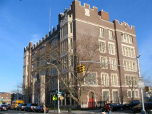
PS 48, the Mapleton School, between 60th and 61st, one of three large, fortress-like public schools we encounter on 18th Avenue. In front of it we see a double-headed Deskey lamppost, one of the few instances of this use outside of the ones we have seen on 5th Avenue in Manhattan. Mapleton, a small enclave in Bensonhurst on the edge of Borough Park (the borderline is at about 60th Street) runs from 60th-65th between 16th Avenue and Dahill Road. A public school, post office and library are named for Mapleton, though not many neighborhood regulars use the moniker.
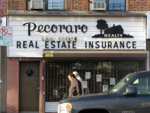
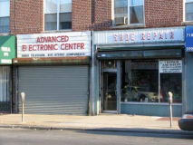
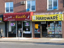
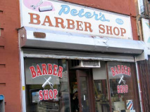
Another sampler of storefronts between 59th and 60th Streets.
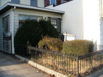
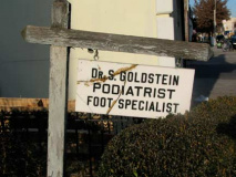
An abandoned podiatrist office at 57th Street.
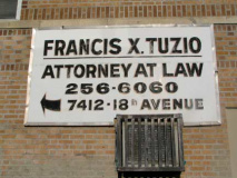
I intend to collect enough photos of enameled doctor office signs to do a whole page on them. A great deal of care went into these stamped black and white signs, which are pretty much disappearing as more modern (eg. Helvetica) fonts are used on these things.
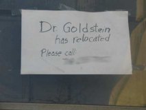
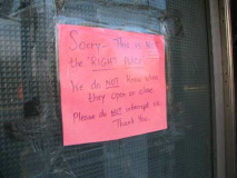
There’s a trend of taped up signs around here. What could be going on in there?
As we travel northeast on 18th Avenue and go from the 50s into the 40s, we enter Borough Park and the eastern edge of its sizable Hasidic Jewish neighborhood, and a number of old or colorful signs begin to appear.
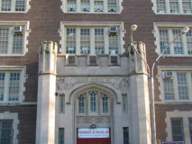
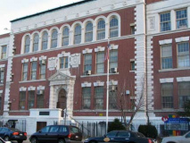
PS 192, between 47th and 48th Avenues, is the second of 18th Avenue’s public school trio. There are some terrific relief Gothic letters on the over-door entablature.
Parkville
After 18th Avenue’s brief trek through Borough Park it enters Parkville, a very old Kings County neighborhood laid out in 1851 by the United Freeman’s Association, which built what is now Foster, Parkville, Lawrence, Webster and 18th Avenues (which is the only one of Brooklyn’s numbered avenues to extend as far east as Coney Island Avenue). Originally known as Greenville, it was changed to Parkville in 1870. A small town further south, South Greenfield, retained its name somewhat longer.
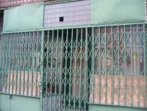
Gated, blinded storefront near 47th. The use of this kind of gate mark the place as pretty old; modern ones roll down from over the door. There are a couple of potted plants in the window, and old-school venetian blinds cover the door.
Here’s a pair of terrific painted signs on 18th just east of McDonald Avenue. Note that Cooper Black crops up again on the window signs at left.
PS 134, at about East 3rd. The address is 40-01…18th Avenue’s numbering begins at 3700 on Coney Island Avenue and runs east to west, meaning that its house numbering is based on “phantom” streets it never encounters. The first numbered street, other than East 2nd-East 9th, is actually 45th Street. Just another NYC anomaly I enjoy documenting here.
Now, that’s what I call a crap sandwich. A clown to the left, a joker to the right, and it’s stuck in the middle with a paved-over lawn. Just off East 7th.
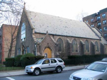
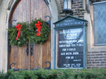
Completing our 18th Avenue romp at the Trinity Evangelical Lutheran Church of Flatbush, even though we’re still in Parkville. At Coney Island Avenue, 18th becomes Ditmas Avenue; mid-Brooklyn and Flatbush are a mish-mosh of lettered avenues and named roads, like Albemarle, Beverl(e)y, and Cortelyou, that stand in for them. But not always.
For sheer complexity and seeming nonsensicality in street layout, Brooklyn’s pretty bad, but check Philadelphia…you ain’t seen nothin’ yet.








1 comment
[…] how Forgotten NY‘s webmaster, who visited the theater as a child, remembered it: It was a fairly spacious […]
Comments are closed.