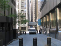
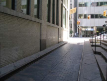
Your webmaster recently went prowling about lower Manhattan, re-shooting the little-known laneways and alleys of the island’s underbelly. It wasn’t so much an attempt to revisit old ground–though admittedly, the first time I photographed these alleys, back in 1999, I was more of a photography amateur than I am now, and the results were rather poor. (A link to the older FNY alley page, found at the bottom of this page, will allow you to judge for yourself.)
No, I was gathering research for an actual conference on alleys and laneways in which I was an invited panelist at the Calgary (Alberta, Canada) Beltline Initiative, a nonprofit institution concerned with issues related to the growth of the Beltline, a rapidly developing neighborhood south of the downtown area.
The topic at hand was Calgary’s alleys — called laneways up there — which are largely given over to garbage pickup and service vehicles. The CBI envisions Calgary’s laneways as venues for residential units, restaurants, and recreation. (I must admit I was taken by the existence of service lanes, in that NYC they are largely absent, meaning that garbage has to be left on the curb in full view here.) My one full day in Calgary was given over to a van and walking tour of the city’s laneways along with descriptions by CBI members, and an evening forum at which the speakers were several architects from Canadian cities, as well as a Britisher, Sebastian Deckker, the author of Mews Style: an examination of London’s handsome alleys, originally paths to stables called mews; the architecture critic of the Toronto Star, Christopher Hume; and your webmaster — who felt rather over his head in that illustrious company, to say the least! The meeting, attended by about 75 at the Beltline’s Victoria Hall, was moderated by the personable Natasha Rapchuk, news director of Calgary’s premier news radio station CHQR AM.
Returning to my hotel room at evening’s end, I switched on CTV and lo and behold, there, on the screen, was your webmaster; a camera crew and reporter were present. Thankfully for Canadians from St. John’s to Vancouver, I didn’t have a closeup, and Montreal architect Jocelyn Duff spoke on camera!
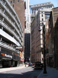
I’ll begin at tiny Moore Street, which used to be less tiny: presently running one block between Water and Pearl east of Whitehall, until the Swingin’ Sixties and the construction of the New York Plaza complex between Water and South, it traveled all of three blocks, including Front Street, which no longer gets this far south, and an el shrouding Front (the el diverged at Chatham Square in Chinatown and split into the 2nd and 3rd Avenue els). At the left side of the picture was once the US Army Building, where draftees from the NYC metro area were compelled to visit until the end of the Vietnam War era; the building, and its employees, was memorialized by Arlo Guthrie in “Alice’s Restaurant.”
Moore is not one of NYC’s oldest streets; it is absent from the Dutch street plans of the 1600s since this part of Manhattan was landfilled in in the 1700s. According to some accounts it was originally Moor Street, since it overlay an area where East River boats were moored. (Similarly many streets near the river are called “slips” since they were originally small inlets, or “slips” where boats docked. The land was filled in, streets overlaid them, but they kept the old names. Oddly, though, it has spawned a lengthier neighbor uptown in Tribeca, where you will find North Moore Street. It’s sometimes surmised that the “N. Moore Street” found on maps stands for Nathaniel Moore, Columbia College (later University) president from 1842-49. Actually N. Moore Street is named for Bishop Benjamin Moore, rector of Trinity Church from 1806-1816; many Tribeca street names are associated with the church. Nathaniel Moore, and “A Visit From St. Nicholas” author Clement Clark Moore, were nephews of Benjamin Moore.
As for Nathaniel, he’s still waiting in heaven for his street name, I think.
Today, Moore Street, 1/3 of its original length, is enveloped by huge office buildings, including the square mirror-paned Broad Financial Center, built in 1986, seen at the end of the street, which faces Pearl.
Throughout downtown, the Downtown Alliance, an organization dedicated to improving the quality of life in downtown Manhattan, has installed snazzy black and white street signs that cleverly include the house numbers you will find on the block they point to, and a photo of a local landmark. Since we’re near South Ferry, these signs have a photo of a NYC ferry boat. (They’ve also installed new streetlamps along Broadway and other places that I’m not nuts about, but that’s a rant for another page.) Mapping Moore
David Jeffreys writes:
We, the genealogists of the John Moore family, refute the claim that it was originally named Moor Street, and offer proof that it was named after John Moore. In fact, the City Grant Deeds , and surveys of the lots from the NYPL, as well as the “Iconography of Manhattan” all make it perfectly clear that Moore’s Wharf & Moore Street were named for John Moore.
We Have ’em Both
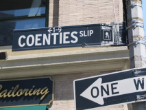
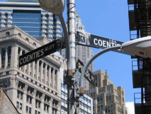
There probably isn’t another street in the USA named “Coenties” and in lower Manhattan, we have two. So there. Herman Melville mentions Coenties Slip in Moby-Dick, Chapter 1:
Circumambulate the city of a dreamy Sabbath afternoon. Go from Corlears Hook to Coenties Slip, and from thence, by Whitehall, northward. What do you see? Posted like silent sentinels all around the town, stand thousands upon thousands of mortal men fixed in ocean reveries.
We see from the 1834 Fireman’s Guide NYC map (click on map in the row), reproduced in Kenneth Dunshee’s As You Pass By, that Coenti(e)s Slip was one of the largest of lower Manhattan’s boat slips. Coenties Slip has pretty much kept its old slanted shape, too. Both Wall Street and Maiden Lane similarly bulge out when they near the East River since those streets were boat slips there before they became thoroughfares. The slip was filled in in 1835, a year after this map was produced. In the background looms 85 Broad Street, the present NYC home of Goldman Sachs, built in 1983. It demolished part of Stone Street, which prompted the NYC Landmarks Preservation Commission to protect the original Dutch street layout in lower Manhattan. 85 Broad stands where the seat of Dutch colonial government, the Stadt Huys, or State House, used to be. Archeological remnants of the neighboring Lovelace Tavern are still there.
The name “Coenties” is old Dutch as Dutch can be since it recalls an early landowner from New Netherlands era, Conraet Ten Eyck, a tanner and shoemaker. He was nicknamed Coentje, or “Coonchy” to the British, and over time settled into this spelling.
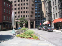
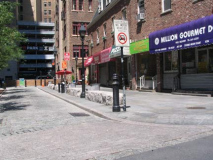
Like Moore Street, Coenties Slip’s eastern extremity has been removed; NYC’s Vietnam Veterans Memorial Plaza stands in its place. Coenties Slip was once important enough that the aforementioned el snaked on it on an S-curve while transitioning from Pearl to Front Streets on its way to Battery Park. Charting Coenties Slip
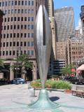
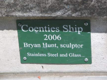
It resembles a lobster claw turned tuning fork, but Bryan Hunt’s “Coenties Ship” recalls the sailing vessels that once used this route. It’s one of the newst artworks to be placed downtown and was part of a near $1 million rehab of the triangle where it stands.
Coenties Alley
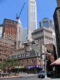
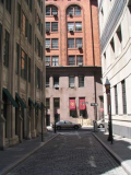
Coenties Alley, formerly Coenties Lane, is a short lane connecting Pearl Street with the rump section of Stone Street cut off by 85 Broad Street. here there’s a brief break from the towering skyscrapers, allowing a view of 54-story 20 Exchange Place, the Canadian Imperial Bank of Commerce Building (originally the City Bank Farmers Trust Building), completed in 1931, a feverish era for skyscraper building. Within 2 years, this building, 40 Wall (the Trump Building), the Chrysler Building, and the Empire State Building all rose.
Stone Street and Mill Lane
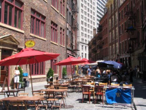
I photographed Stone Street (left) a few years ago while it was gussied up for a movie shoot. Back when I visited, it was still something of an urban backwater –which was a good thing, since several of its 1835-era buildings were decently preserved.
They’re still there but Stone Street, in the early 2000s, became lower Manhattan’s restaurant row, with a food court set up right on the street in warmer months. (With temperatures hovering around 80 most of October 2007 perhaps the season will be extended if that trend continues.)
Stone Street has been called Brouwers Straat (Brewer Street) in the Dutch era, probably for the title businesses, and later named for its possible history as Manhattan’s first stone-paved street. The stones in the pavement now were installed relatively recently.
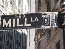
Mill Lane is a very narrow, short street running from Stone to South William, which was formerly called Mill Street. It faces Delmonico’s Restaurant. Mapping Stone and Mill
South William Street
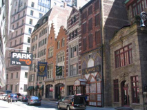
South William Street, running from Broad Street north to the confluence of Beaver Street, William Street, and Hanover Square, curves to echo the East River shoreline; it was indeed one of New Amsterdam’s original streets, well inland. On one side there’s an ugly parking garage (a redundancy, no?) but there’s a very interesting collection of buildings on the east side that harken back to the Flemish Gothic style of architecture that was popular in the days of New Amsterdam.
At numbers 13 and 15, the two neo-Flemish buildings demonstrate that even a century back Manhattan landlords altered their holdings to maximize rental income. Amos Eno, merchant, realtor, and major collector of views of early New York, was no exception. In 1903 he hired C.P.H. Gilbert to recast his two mid-19th century Greek Revival warehouses into a more fashionable, or at least different, guise.
At number 19 on the upper floor you can glimpse the “before” appearance of another face-lifted neighbor.
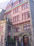
Finally, at number 21 is Block Hall (bottom left), a Tudor-like half-timbered conglomeration built as a private club house. Most recently it operated as the Italian Alps restaurant. It awaits a new calling. Explore NYC
Marketfield Street
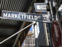
Marketfield Street — another NYC street name not repeated anywhere else — is probably the most nondescript of any of the alleys pictured on this page; it runs in an L-shape from Beaver Street at New south and then east to Broad — but the street, transliterated from New Amsterdam’s first produce market, ‘t Marktveldt, formerly ran all the way to the Hudson along Battery Place’s present alignment (Battery Place acquired its presnt name in 1830). In the past it has been named Exchange Street, Field Street, Fieldmarket Street and Oblique Road and most infamously, Petticoat Lane, possibly for the prostitutes that frequented it.
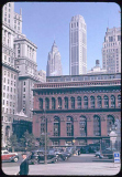
New Amsterdam’s first French Huguenot church was built on the narrow lane in 1688 between what is now Whitehall and Broadway. This part of Marketfield Street is no longer there; it was eliminated by the construction of the NYC Produce Exchange (foreground, left) between 1882 and 1884 by prolific NYC architect George Post. Photo: Charles Cushman; more here. We have a clear view of theAmerican International Buiilding at 70 Pine Street as well as the aforementioned Canadian Imperial Bank of Commerce Building in the background; in the Fab 50s, Downtown’s skyscrapers were more isolated.
Exchange Place
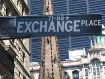
Exchange Place runs from Broadway east to Hanover Square a block south of Wall Street. It has been known as Tuyn Straat, then its English equivalent, Garden Street; it was renamed Exchange Place in 1827 after the old Merchants’ Exchange Building built that year on Wall Street, a block to the north. That building was burnt down in the Great Fire of 1835–which claimed most of Downtown’s older buildings from the New Amsterdam era:
By 12:30 A.M., the fire had progressed towards Wall Street and threatened the Merchant Exchange. The buildng, made of marble, was considered fire proof. Three stories high and spanning 115 feet, it was one of the largest buildings in the city and was located on the south side of Wall Street. Inside the main exchange room was a rotunda 75 feet long, 55 feet wide, and 45 feet high. The building had been completed and first occupied in July, 1827. As the fire progressed, merchants, not taking any chances, rushed down to retrieve their merchandise. The building, however, was not immune to the fire’s destruction. At 12:30 A.M., the building began to smolder; by 2:00 A.M., it was engulfed in flames. Having little chance to suppress the fire, Gulick ordered his firemen to help the merchants remove their goods from neighboring structures, though it was unclear where the fire would strike next. The financial and commercial district was compeltely overcome. Even ships along the piers took flame. Virtual NY, linked above
Above right, behind the sign, we see the Empire Building, now Empire Apartments (1898); the spire of Richard Upjohn’s Trinity Church (1846); and Francis Kimball’s Trinity Building, 111 Broadway (1907). Everything is backdropped by the monolithic, ponderous 1 Liberty Plaza (US Steel Building) (1974) which can barely be forgiven for replacing the Singer Tower.
Exchange Alley
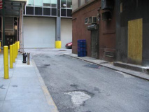
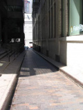
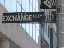
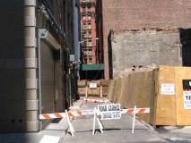
Exchange Alley, which is not quite a western extension of Exchange Place from Broadway to Trinity Place (it’s a bit south of Exchange Place) is probably the narrowest street in Manhattan open to auto traffic. In New Amsterdam it was Tuyn Straat’s western extension, called Tuyn Paat (Garden Alley). The British Anglicized this to Tin Pot Alley.
Ixtayul Martinez got better pictures. Nearly always in shadow, Exchange Alley is difficult to photograph.
Exchange Alley has also been called “Oyster Pasty Alley” for the nearby Oyster Pasty Battery (1695-1783) along the Hudson River. The name is perhaps reminiscent of British’ officers’ fondness for oyster pies.
In May, 1751, some workmen digging down the bank of the North river in the rear of Trinity Church discovered a stone wall four or five feet thick and nearly eight feet under ground. It was supposed at the time to be the breastwork of a battery, but the oldest person then living could give no account of it. We are more familiar with the city antiquities than the residents a century ago, and know from the records which have been published that this was at or near the locality of the fortification at the North river end of the city wall, called “Oyster Pasty Mount.” History Box
Mapping Exchange Place and Alley
Most of the above alleys can be seen on Columbia U’s page featuring a Bromley 1927 atlas of lower Manhattan.
Theatre Alley
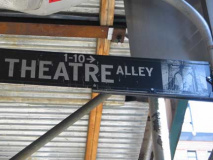
Theatre Alley, running from Ann to Beekman just east of Park Row, at one time was the back entrance to the old Park Theatre(originally the New Theatre), which fronted on Park Row. It stood from 1798 to 1820; after a fire the theatre was rebuilt the next year, and stood till 1848, when it once again burned down. At that time the Park Theatre was beginning to lose out to other theaters springing up along the Bowery uptown. The Astors, who owned it then, elected to not rebuild it.
John Howard Payne, composer of “Home, Sweet Home” was a frequent performer at the Park as a dramatic actor, as wasEdmund Kean and his son Charles Kean, Junius Brutus Booth (father of famed actor Edwin Booth and Lincoln’s assassin, John Wilkes Booth) and Tyrone Power (1795-1841), an antecedent of the famed screen actor of the 1930s and 1940s. Charles Dickens was feted at the Park on a visit to New York in 1842.
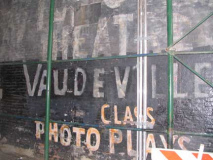
Today Theatre Alley is nondescript and usually covered by scaffolding; I happened by on a day when the usual scaffolds had been removed, looking north from Ann Street. For several years a curious stencil has appeared on a building wall near Beekman advertising the Victoria Theatre, with “vaudeville’ and “photoplays” added. It’s just an art project, originally done for a movie shoot, since there was never a Victoria Theatre here, and certainly never a movie theater. The stencil is reminiscent of the old marquee for Variety Photoplays on 3rd Avenue and East 13th, razed in 2005. Mapping Theatre Alley
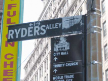
Ryders Alley
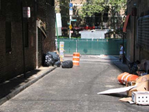
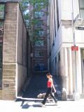
Another L-shaped lane, running between Fulton and Gold Street west of Cliff, Ryders Alley has also been known as rider Street, Rudder Street and Eden’s Alley (see below) before 1842 when it acquired its present name. No one knows precisely who “Ryder” was, though it shows up on maps beginning as far back as 1740. It’s a surprising survivor; most of the streets in the area north of Fulton between Gold and Pearl were razed to create Southbridge Towers, Beekman Downtown Hospital, and NYC Police Headquarters. We lost Ferry Street, Jacob Street, Vandewater Street, Hague Street, William Street north of Beekman, North William Street, and most of Rose Street.
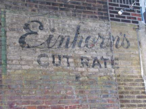
LEFT: decades-old painted ad, Ryders Alley and Fulton Street
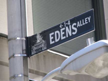
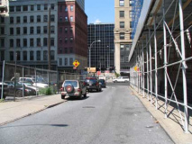
Edens Alley
Where Ryders Alley takes a 90-degree turn toward Gold Street, it changes its name to Edens Alley. This was once the name for the entire alley until it was renamed Ryders in 1842. Edens Alley was likely named for a wealthy resident, a farmer named Medcef Eden, a friend of Aaron Burr who owned an uptown tract. When Burr fell into disrepute after killing Alexander Hamilton in a duel in 1804, perhaps his friends were excised from the map. No NYC street or park are named for Burr. This small section had the old name restored in 2001.
Eden’s old farm? It’s now Times Square.
Robert Sullivan’s examination of NYC’s rats, named for the mammal in question, contains a chapter 4 named Edens Alley. The alley is one of NYC’s rat capitals, it seems. The chapter contains just about all of the lore ever associated with this narrow nondescript lane, and we have Rattus Norvegicus to thank. Sullivan goes on in Chapter 6 to describe his observations…
Once the rats were out in the alley, they moved quickly – sniffling, licking, nibbling, walking easily around empty, beat-up rat poison dispensers, then galloping off in impressive bursts along the cobblestones. I noticed early on that a rat would stick its head into a garbage bag for a number of seconds. I counted off seconds as a rat drank water from a thimble-sized puddle in the nooks of the cobblestones: six….
Elk Street
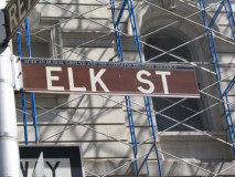
Speaking of mammals, here’s 2-block-long Elk Street, between Chambers and Duane east of Broadway. It is the last remnant of a longer street named Elm, which once ran as far north as Great Jones Street in Noho. In 1905 Lafayette Street was extended south to Foley Square and assumed the routes of most of Elm and another disappeared street, Marion. A small piece from Worth south to Chambers was left over; in 1939, it was renamed for the Benevolent and Protective Order of Elks, founded on Elm in 1867 by a group led by actor Charles Vivian. Finally, in the 70s, the northern 2 blocks were replaced by Federal Plaza, which presently is one of NYC’s most heavily-guarded complexes.
At the corner of Duane and Elk is NYC’s “newest” cemetery, the African Burial Ground. In 1991, construction workers discovered human remains while doing foundation work on a downtown federal building that turned out to be the Negro Burial Ground, cited on some period maps; approximately 20,000 people are interred there. A national monument was dedicated in the fall of 2007.
Vanished Republican
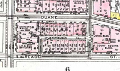
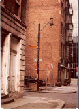
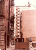
A pair of alleys, and some nondescript buildings,once stood where the African Burial Ground is today. Republican Alley, seen from Elk Street at left, extended west to meet another short lane, Manhattan Alley, which ran south to Reade Street.
The pair were demapped in 1990 when the new Federal Courthouse was to be built there; the discovery of the remains forced the plans to be changed. An outline of Republican Alley’s old route can be seen along the rear wall of the African Burial Ground. Both alleys first appeared about 1795. 1980 photos: Bob Mulero
Why weren’t the remains exhumed earlier, when these buildings went up?
Fletcher Street
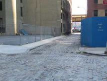
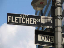
Belgian conference. Both Fletcher and Front Streets are beautifully Belgian blocked in this scene a couple blocks south of the Fulton Market-Pier 17 area. Fletcher Street first appears on maps around 1795 or so. This is a rare NYC street that commemorates a Britisher from the colonial era: Captain Benjamin Fletcher, a British colonial governor from 1689-1691. Fletcher awarded Trinity Church a patent that would permit the church to raise money from the sale of any whales that beached on shore; whales were used heavily in the cosmetics industry before many species became endangered.
If I’m not mistaken, during the 1980s Mets pitcher (and broadcaster in the mid-2000s) Ron Darling owned and operated a restaurant on Fletcher Street, which is rather narrower than its sister streets.
Gold Street
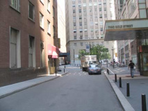
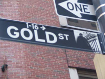
This section of Gold Street, at its beginning at Maiden Lane, isn’t really an alley but is narrow enough to be one. It turns up on maps as early as 1730 when it was called Rutgers Hill, for Tammany politician Henry Rutgers, who had holdings in the region. A further section to the north, from John to Fulton Street, was called Vandercliff Street, with the northern section called Gold Street from Fulton north to Frankfort. At length, by 1789, the entire length became Gold Street. The gentle curve that Rutgers Hill originally followed is still there, as you can see. The entire environs was once known as Golden Hill –the site of a 1770 Revolutionary War battle.
photographed August 2007; page completed October 21, 2007

