It’s fairly easy to walk Wyckoff Avenue in Brooklyn and Queens from one end to the other, and it can be done in about two hours, if, like your webmaster, you prefer to take your time. Speed walkers can do it in less than an hour. I was attracted to it, initially, by its collection of assorted lampposts (more on that below) as I was making my way around Ridgewood obe recent Saturday (the fruits of that labor being Stockhom Syndrome, Good Charlotte, and Great Scott).
Wyckoff, though, also makes a interesting Forgotten tableau: it is Brooklyn on the edge of Queens, Queens on the edge of Brooklyn, and Bushwick on the edge of Ridgewood. I think you’ll agree, though, that Brooklynishness seems to set the tone here, as I believe it mostly does in Ridgewood — though most Ridgewooders probably are proud Queensites…
Wyckoff Avenue is named for a Dutch family that first arrived in Brooklyn in the 1650s. In fact the house of the first Wyckoff in Brooklyn — Pieter Claesen Wyckoff, first built in 1652– still stands at Clarendon Road and Ralph Avenue in East Flatbush and has been preserved as a museum. In Dutch the name is derived from terms (wijk and hof) that mean “parish/small town” and “house/court”, thus Wyckoff can be translated as “parish house.” In the colonial era the Wyckoffs settled mainly in what became East Flatbush and East New York. The Wyckoff-Bennett House, at 1662 East 22nd Street and Avenue P, was built about 1766 and is presently a private residence.
Wyckoff Avenue runs from Flushing Avenue southeast to Cooper Avenue. on Bushwick’s eastern edge. It’s easily reachable by public transportation as the BMT Canarsie Line (L Train) runs under its entire length — one of the few streets in NYC that makes this claim. It’s not to be confused with the shorter Wyckoff Street, which in Boerum Hill runs from Court Street to 3rd Avenue and St. Mark’s Place.
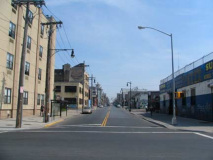
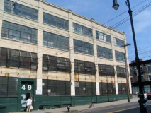
Wyckoff Avenue, as seen at its beginning at Flushing Avenue.
I suppose what made me walk down the avenue in the first place its its present variety of lampposts — whereas it was formerly lined as most NYC streets still are by regulation octagonal-shafted posts (seen on the right)…
… it has also been smattered with a number of retro-posts:
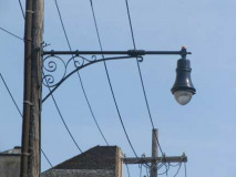
We have these Type G wall-bracket retros, that have been popping up gradually on NYC streets such as Eastchester Road in the Bronx and Sheepshead Bay Road and Wyckoff Avenue. They closely resemble, with different (simplified) scrollwork, masts that were placed on buildings when sidewalk space was at a premium. During NYC’s classic lamppost era, 1920-1960, there were never any telephone pole masts that looked like this.
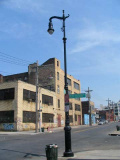
ABOVE RIGHT: Wyckoff Avenue is also dotted, here and there, with large Type F “Seventh Avenue” retros. These once lined the side strets of Manhattan by the thousands, albeit in a much thinner, shorter version. You could say these are Type Fs after a workout. Thus far, you can find tghem here and on West 8th Street in Greenwich Village. Note that the base is a version of the Type B Henry Bacon park post (for versions of these on steroids, see Eastern Parkway in Brooklyn).
The odd thing about Wyckoff Avenue is that these two posts, along with the octa-poles, have been placed here and there, and all the octas have not yet succumbed. It’s a strange palette of posts!
Note Wyckoff Avenue crosses Jefferson Street here; it later crosses, as we’ll see, Jefferson Avenue.
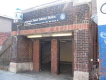
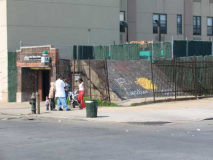
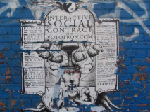
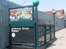
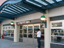
The Jefferson Street station on the BMT Canarsie L train, opened 12/14/1928, is a rare above-ground BMT station with a brick entrance reminiscent of a small stationhouse. (The entrance on Starr Street, below right, is a more typical entrance.) Below left, a poster for a website caled the Interactive Social Contract: see if you can make any sense out of this.
The L train was the final “pure” BMT line built: the Flushing Line was jointly operated by the IRT and BMT until 1949, when it reverted to the IRT. Like the Flushing line, no other lines use its tracks; for example, on Queens Boulevard, the E and F use the express tracks while the G, R and V share the local tracks. But the Flushing and Canarsie are one-line tracks. Therefore, the #7 is the only line with a purple bullet and the L is the only line with a gray one.
The only opportunity for the L to share tracks with another line is at the East New York complex, where a ramp allows trains from the Broadway el onto the Canarsie line. This is no longer used for passenger service, but it was used by an old line, the KK local (earlier the BMT 14) discontinued in 1967. The L also had a now-severed connection to the LIRR Bay Ridge Branch in Brownsville.
Though Wyckoff Avenue from Flushing to about Starr Streets is still largely industrial, its lofts are being increasingly occupied by the artists and musicians who lived in Williamsburg until a few years ago, when rezoning for luxury buildings began to price them out of there, and they have moved east and northeast to the Bushiwick-Ridgewood border. Can Maspeth and Glendale be next?
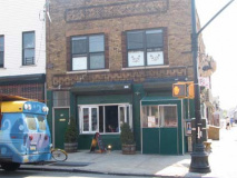
A new bistro called Northeast Kingdom has appeared at Wyckoff and Troutman Street:
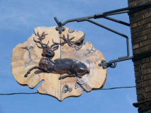
Bushwick is derived from the Dutch for “little town in the woods,” but a New England deer camp is the last thing you’d expect to find on its post-industrial streets. Nevertheless, husband and wife proprietors Paris Smeraldo and Meg Lipke have blithely imported touches of their native Vermont to the nether regions of the L train. Potted evergreens, seemingly the only vegetation for miles, mark the entrance, beneath a copper stag nailed to a slab of wood. Although a paint-by-numbers deer in a winter scene hangs over the bar, the interior avoids campiness; slate-gray planks in the ceiling impart a minimalist vibe. The food relies on fresh ingredients, with a menu that shifts accordingly. Gruyere cheese appears frequently, in a grilled mushroom sandwich, with cheddar in mac & cheese, and matched with coarse-cut country bacon in the N.K. version of a croque monsieur. Chicken pot pie is a signature dish, made with organic meat stewed with peas, carrots, and thyme, and crowned by a thick, flaky crust. An indie and glam-rock soundtrack sets a festive mood for the young crowd, reflective of a new Bushwick demographic attracted by cheap rents. And the discontinuity of northeast Vermont in northeast Brooklyn seems not to faze them. — Ethan Wolff, New York Magazine
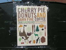
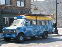
I liked the wood-carved deer at the front door, the modern-day equivalent of the tie-dye VW bus, and the Twin Peaks Tuesdays. I was a fan of the show way back in the early 1990s until the killer was revealed and the storyline went off in many confusing directions; the final show, like that of The Prisoner, was confusing and unsatisfying: I hope Lost’s producers have learned from those missteps.
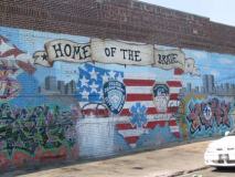
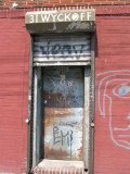
31 Wyckoff entrance and Troutman Street mural
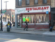
Nice hand-lettered sign at Starr Street for Palma’s Restaurant.
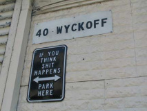
You heard him. (Shouldn’t it say “if you don’t think”…?)
Former candy factory converted to lofts at Willoughby Avenue.
Another interesting hand lettered sign at Suydam Street.
Light-brown brick residences, Wyckoff between Willoughby Avenue and Suydam Street. These may well be the yellow bricks produced by the Balthazar Kreischer kilns in 19th-Century Staten Island, which also turn up in Ridgewood and Long Island City.
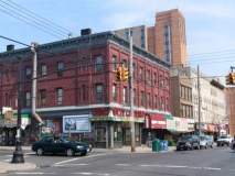
At DeKalb, a classic red brick building on the NE corner. However, on DeKalb just west of Wyckoff, WNBC-4’s Sue Simmons may have a question for the architect.
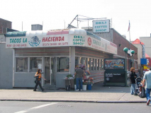
Tacos La Hacienda, SW corner DeKalb and Wyckoff, looks like one of those classic railroad-car diners under the awning. Anyone know which one?
I’m told it was the Bon-Ton.
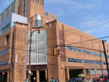
Some more classic Wyckoff bricks, backdropped by the beetling Wyckoff Heights Medical Center at Stockholm Street. I’m not sure there is a “Wyckoff Heights” — perhaps it’s a term made up by the hospital, since we’re between the two worlds of Bushwick and Ridgewood? The hospital was instituted by the Plattdeutsche Volkvest Verein, an organization of German immigrants, in 1889.
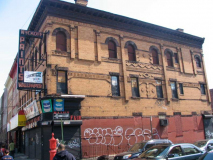
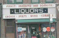
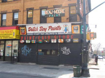
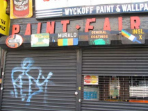
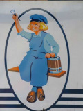
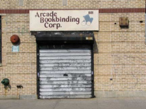
Check the amazing decorative brickwork on this building at Wyckoff and Himrod Street…and then check the signage on the front and sides…
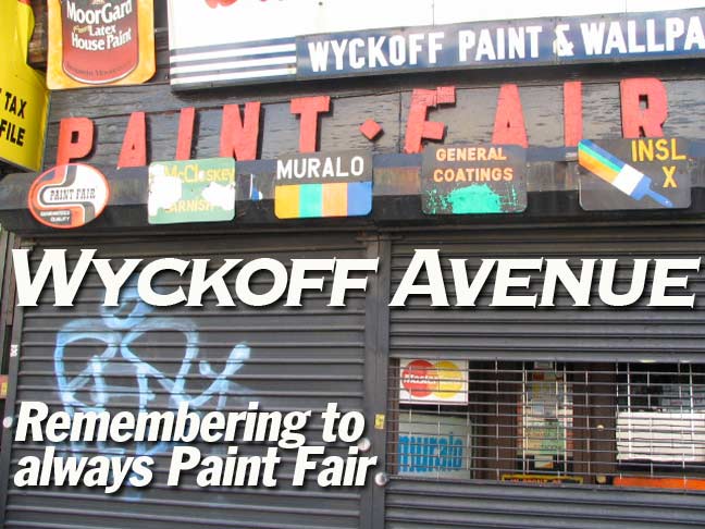
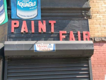
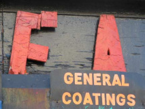
…including the terrific wood-cut lettered sign for Paint Fair Store.
There aren’t a lot of wood-cut signs like this remaining anymore (I found one earlier on 11th Avenue in Dyker Heights, Brooklyn (left).
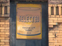
Is the Selected brand with Crysto-Lite enamel still around?
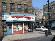
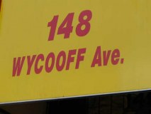
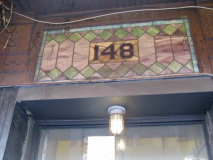
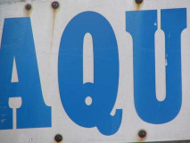
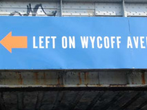
Next door to the paint store at 148 Wyckoff is evidence that many residents find spelling the name of the avenue difficult; we’ll see more of this later. If you look under the awning, you get an Easter egg: some stained glass with the house number.
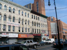
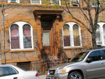
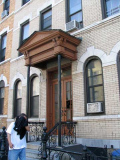
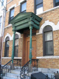
Some interesting building fronts in the Menahan Street area. Note the original wrought-iron railings. Menahan Street was renamed for an area corset manufacturer several decades ago; its original name was Ralph Street, and if you follow it southwest it ends at Bushwick Avenue; detour down the next street over, Grove, to Broadway, and then back up Broadway a block…you’ll find Ralph Avenue, which, along with Patchen Avenue, is named for clonial-era landowner Ralph Patchen. Ralph Avenue is one of Brooklyn’s longest streets, extending, in pieces, all the way from the Bedford-Stuyvesant-Bushwick border south to Avenue U in Mill Basin; I’ll have to walk that sometime. Was Ralph Street a northern extension? I’d have to think so.
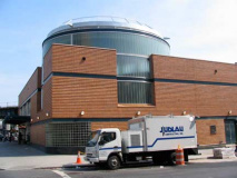
In the triangle formed by Wyckoff and Myrtle Avenues and Linden Street we find a new multimillion dollar interchange the MTA built, opening in 2007, that connects the BMT Canarsie Line and the BMT Jamaica Elevated (the J/M train). It’s unusual for the MTA to lavish such attention on a station so far away from Manhattan. Judlau Contracting built the new station.
To me it looks like the MTA’s tribute to Kronos, the Ravager of Planets (left).
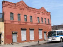
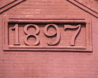
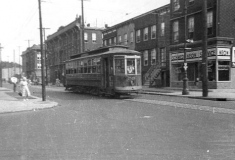
I had originally thought this 1897 building on Wyckoff just south of Myrtle was a trolley car barn, but my latest intelligence suggests it was a brewery. This, though, was the terminal for most of eastern and northeastern brooklyn and southwestern Queens’ trolley lines. The big facility (there’s a photo in Seyfried and Asadorian’s Old Queens in Early Photographs) was on the side of the street I was standing on, where there presently is a supermarket. Oddly Wyckoff never had a trolley line of its own after the W line was discontinued in 1920, though trolleys ran on a couple blocks of Wyckoff near the terminal (photo bottom right).
This, too, is the place where the Brooklyn-Queens county line arrives at Wyckoff Avenue (from Gates) and runs down the middle of the street southeast to George Street, where it zags SW again, leaving Wyckoff Avenue in Queens.
Wyckoff Avenue is one of 17 streets that border both Brooklyn and Queens. The others are Onderdonk Avenue, Flushing Avenue, Cypress Avenue, Menahan Street, St. Nicholas Avenue, Gates Avenue, Irving Avenue, Interborough Parkway, Robert Street, Eldert Lane, 95th Avenue, Drew Street, Liberty Avenue, 75th Street, Dumont Avenue and 78th Street.
The Brooklyn-Queens line in Bushwick-Ridgewood used to be a straight line running from Flushing and Onderdonk Avenues to Highland Boulevard in Highland Park (in the 1760s, a large stone known as Arbitration Rock was placed there to delineate Newtown, in Queens County, from Boswijck (Bushwick) in Kings County). In 1925, the lines were redrawn along streets, likely to avoid houses being in two boroughs and two post offices at once. (Oddly the ruler-straight Queens-Nassau border in Floral Park didn’t get that treatment).
I would’ve liked to walk the avenue in the 1960s and 70s…since the line was down the middle of the street, did the Brooklyn side have black and white Brooklyn street signs and the Queens side white and blue? Anyone remember?
801 Wyckoff. Somewhere between Putnam and Jefferson Avenues…I forget exactly where…Wyckoff Avenue trades in its Brooklyn house numbers, which had by that far SE attained the 300s, skipped a few hundred, and entered the 800s. This catcheds it up with its parallel Queens avenues, Cypress, Seneca, Onderdonk, etc. In Ridgewood east of Forest Avenue, house numbers take on a more Queensy cast, entering the 59-00 range.
Once Wyckoff is completely in Queens, it gains the Queens hyphen: 10-01, 10-05 etc.
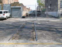
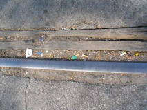
Above: LIRR Evergreen Branch tracks crossing Jefferson Avenue
When the BMT Canarsie Line subway was built in 1928 it closely paralleled the old LIRR Evergreen Branch, which ran just a few feet west of Wyckoff in a right-of-way.
This line was built by the Glendale and East River RR, opened in 1876 and eventually became known as the Greenpoint Division of the NY & Manhattan Beach Railway, which also included the Bay Ridge, Manhattan Beach and Kings County Central branches. Originally, It began at the East River in Greenpoint, with a depot at Oak and West Sts. From there it ran SE along N.15th St. to Richardson St. then turned E along Richardson to Vandervoort Ave. where it turned SE, crossed Metropolitan Ave., Grand St., a portion of Newtown Creek and the South Side RR’s Bushwick branch then proceeded E between Wyckoff and Irving Aves. and connected with the Bay Ridge branch at the Cemetery of the Evergreens.
This branch provided passenger service from northern Brooklyn to Manhattan Beach from its opening until 1885. At that time, the Bay Ridge Ridge Branch was connected to the LIRR’s LIC branch, and the passenger service switched to LIC, instead. Passenger service was also run on the portion east of the Bushwick branch out of Bushwick Terminal until 1894 (although Bushwick terminal was still used for passenger service until May, 1924 through Fresh Pond).
After 1885, the portion west of the South Side was abandoned. As far as I know, no trace at all exists. As mentioned above, passenger service continued on the Evergreen Branch until 1894, and freight service until the 1960’s, on the eastern portion. Bob Andersen, LIRR History
Art Hunecke has plenty of photos at Arrts Arrchives
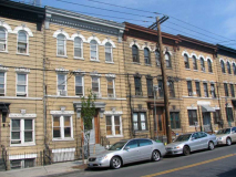
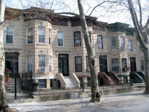
A look at some of the great row houses along Jefferson Avenue. You will find them along miles and miles of side streets in Bushwick, Ridgewood, Bedford-Stuyvesant and other Brooklyn neighborhoods. They first appeared between 1880 and 1910.
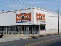
Wyckoff and Summerfield Street. I was initially perplexed about this sign: it looks like the Western Beef logo, but reading Junior’s. Had the downtown Brooklyn cheesecake-purveying diner entered into an association with Western Beef? Apparently not — Western Beef outlet stores bearing the Junior’s name appeared in 1998 –but I’m mystified about why the cheesecake place didn’t object.
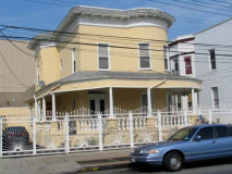
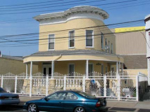
I liked this house between Decatur Street and Cody Avenue so much, I’m showing it from two angles. They’ve got to lose that gadawful fence though. I don’t think Wyckoff Avenue was once lined with porched houses like this, though in its southeastern stretch, which now has a lot of warehouses, it could have been.
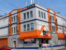
Self storage loft building, Wyckoff and Cody Avenues. I’ll admit, orange (along with green) is my favorite color, but even I will concede that on buildings, as well as sports team uniforms, orange is best used in a secondary role instead of the main item.
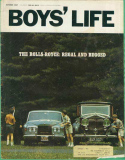
Egyptian Bold. One of my favorite fonts, and one that has sort of fallen out of favor of late; in the mid-60s and early 1970s you saw it everywhere especially for column headers and titles in such disparate magazines as New York Magazine as well as Boys’ Life, then as now the official publication of the Boy Scouts.
In the 60s Boys’ Life used an odd variant font on its title–it’s clearly Franklin Gothic, but that S isn’t classic Franklin. In the 2000s it’s fairly easy to alter a font to your liking with a computer (copyright issues aside) but not quite as simple in 1967; plenty of drawing pens and exacto knives were needed, if not a metalworker! I’m curious how the Boys’ Life “S” came about. It actually is closer to new versions of Franklin that appeared by the International Typeface Corporation (an outfit I worked for from 1982-1988).
That’s a weird cover, BTW — I don’t know why Rolls would be promoting cars to kids who wouldn’t be driving for 5 years at least, and unless they have a trust fund, wouldn’t be able to afford for several years.
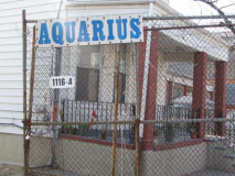
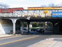
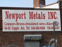
Wyckoff Avenue ends, somewhat abruptly, at Cooper Avenue, where it passes under the LIRR Bay Ridge Branch tracks. The tracks branch from the confluence of the Conrail (New York Connecting Railroad) tracks and LIRR Montauk Branch tracks in the Fresh Pond Yards and run southwest and west through Ridgewood, East New York, Canarsie, Flatbush, Midwood, Borough Park and Bay Ridge to the Brooklyn Army Terminal. It is presently used by the New York and Atlantic Railroad for freight service (the last remnants of passenger service ended in 1924), but at least one regional plan posits that the line could someday be used for crosstown mass transit use. (Since it doesn’t run into Manhattan, your webmaster dounts any such action will happen.) One more Wyckoff misspelling here, too.
Elvis Presley rode a train on these tracks in 1958 on his way to US Army deployment overseas.
A trip on the Bay Ridge-NYCR tracks in Tom Scannello’s oldnyc.com
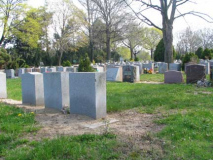
A look at Knollwood Park Cemetery, one of seventeen cemeteries in the Ridgewood-Cypress Hills Brookln-Queens Cemetery Belt, a vast area that runs, in general, between Bushwick Avenue, Cooper and Myrtle Avenues, the Jackie Robinson Parkway, Jamaica Avenue and Forest Park.
(I’d like to someday get into adjoining Trinity Cemetery since I hear most of its tombstones are metallic!)
I’m not sure if Cooper Avenue (Cooper Street in Brooklyn) is named for the great philanthropoist and industrialist Peter Cooper, who worked in Brooklyn extensively and is buried in Green-Wood cemetery; he worked in such varied enterprises as steam railroading and glue production. It wouldn’t be a surprise.
Newport Metals can’t spell his name…

