As most New Yorkers who have been here for the past 40 years or so know, most of our major projects that get proposed never see the light of day. The 2nd Avenue Subway is coming along very slowly, but has been planned for nearly 80 years. A perfectly manageable project to convert the James Farley Post Office at 8th Avenue and West 33rd Street to a new Penn Station became enveloped in hubris and collapsed of its own weight. The ill-conceived Atlantic Yards project, which would have brought an arena for the (New Jersey) Nets, office towers, and “affordable” housing to downtown Brooklyn, is stuck in development limbo. Ground Zero is a vast crater in downtown Manhattan eight years and counting after a terrorist attack leveled the World Trade Center.
One public project and one public project alone has managed to evade the overall malaise brought on by construction costs and public opposition, warranted or otherwise — a project that sailed through mostly unopposed, since it was destined to enhance neighborhood where market forces unleashed a major upgrade from light manufacturing as well as slaughtering and meatpacking, the far west side area west of 10th Avenue running from Chelsea south into the Village.
In the early 1930s twin iron trestles were bruited through the area, one carrying a railroad linking various businesses in the area, the West Side Freight Railroad, and the other, the Miller Highway, carrying auto traffic along the far west side of the island, seemingly freeing the north-south avenues from choking car traffic and exhaust. The plan worked well for nearly fifty years; but as manufacturers and meatpackers gradually began to leave the far west side, the freight railroad carried less and less customers until, finally, the railroad ended its run in 1980. The Miller Highway, called the West Side Highway by all its users, fell victim to neglect — it seemingly never was maintained or even had a paint job, until the road began to collapse in the early 1970s. It was finally razed in the 1980s, replaced by what is now called the Joe Di Maggio Parkway, a busy at-grade roadway (The massive, ambitious Westway project, proposed in the 1970s, would have placed the roadway underground and surfaced it with a park; it too fell victim to community opposition).
In 1999 a not-for-profit organization called Friends of the High Line formed with the mission of preserving the High Line and…converting it to recreational space. FOHL’s nuts and bolts community work, support of friends in high places, and diligent fundraising are too involved to enumerate here –_we’ll let them do it themselves on their website — but they are batting 1.000: unlike the city’s other grandiose projects, well or ill-considered, such as Moynihan Station, the Second Avenue Subway, the Olympic and Jets stadiums, which have either foundered or been delayed for years, reconstruction of the High Line has already begun and barring complete calamity, it will become NYC’s second rails-to-trails project (after the Bronx’ _Putnam Line in Van Cortlandt Park).
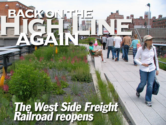
After the new public path on the High Line opened in June 2009, I went to see for myself what the high-end project, a New York City public park that is more lavish by far than any other save Central Park, would offer. Unlike many other chroniclers of the project, I distinctly wanted to capture it with a Forgotten NY sensibility. See if you think I succeeded…
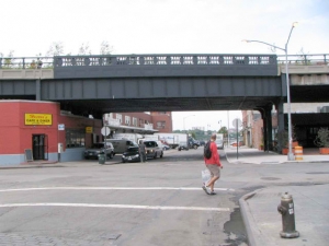
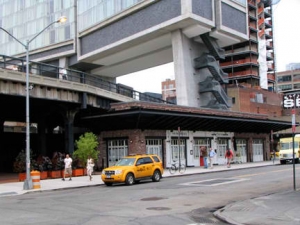
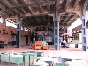
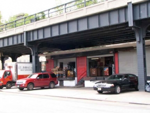
Before walking the High Line I ambled around under it for a while. Its southern end used to extend to what was known as the St. John’s Terminal (named for a former church) at West Houston Street, but the trestle was gradually removed over the years until its south end is now at Gansevoort and Washington Streets. This southern stretch has undergone a great deal of change as virtually all the meatpacking plants that bordered it ha ve moved out, to be replaced by chi-chi boutiques. Ambitious developers such as André Balazs began to build new residential buildings and hotels along the High Line route; Balazs’ Standard New York, which we’ll see more of when we get on the High Line, is shown above right, along with the Standard Grill, on Washington under the trestle. At left, the more downscale Hector’s Cafe is still hanging in there on Little West 12th.
There are a few meat wholesalers remaining on Washington Street, such as JT Jobbagy, above left.
In a telephone interview last week during one of his typically busy days, John Jobbagy, vice president of the Meat Co-op, said they are all just trying to keep on with their business amid the Market’s hubbub and transformation. The Co-op is fine with the Whitney Museum building a new facility on the Co-op block’s south side, he said, though it requires a zoning modification.
“It’s the city’s property and we support whatever their plan is for it, and it seems to be a very good plan,” he said… “The meat section is confined to Washington St.; itís a block or two. Fifteen years ago, it was five to six square blocks. The late ’90s, it changed a little bit. In the 2000s, it changed a lot. And in recent years, it’s really been changing.” The Villager
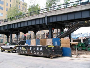
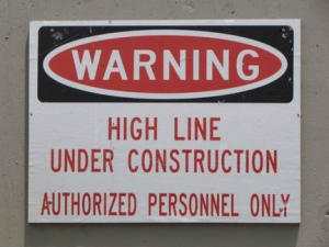
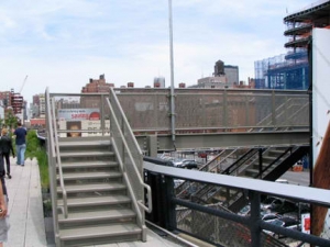
Even though High Line Park is now open, it very much remains under construction. The main staircase at Gansevoort was still being welded into place by workmen a few days after the official opening, and several buildings that will be straddling the park are still far from completed.
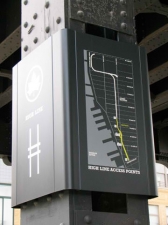
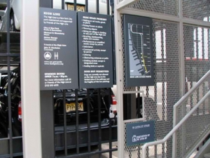
The map posted on one of the pillars shows the open section (in yellow) and a lengthy unopened section (in white).
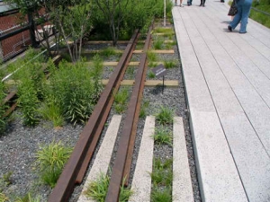
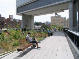
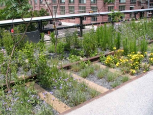
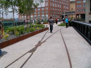
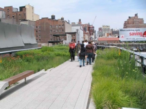
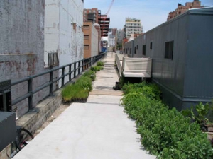
The south end of High Line Park, looking north. The developers wanted to reclamate a mix of the weeds and wildflowers that sprung up during the line’s 29 years of idleness, and so, there are plantings all along the park’s length with signs encouraging parkgoers to keep off. In addition, old railroad tracks that will never again see locomotives and boxcars have been restored on new ballast and concrete ties.
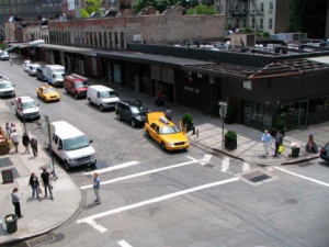
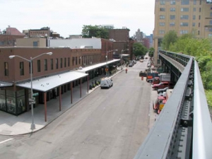
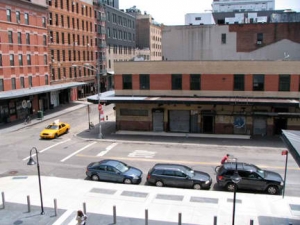
Views of Gansevoort (left) and Washington Streets, which haven’t been legally available for nearly 30 years by anyone except CSX (the railroad that formerly owned the High Line) personnel. We see the metal awnings that used to overhang sidewalks at meat wholesalers have been retained by boutique owners.
As we’ve seen earlier, the Standard New York was built to straddle High Line Park. Guests had better keep the curtains closed. Then again, since this is traditionally an edgy part of town, maybe they won’t.
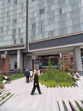
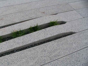
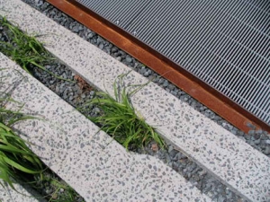
Note that slats have been built into the walkway to encourage plants to grow “into” the sidewalk.
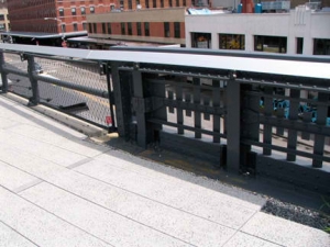
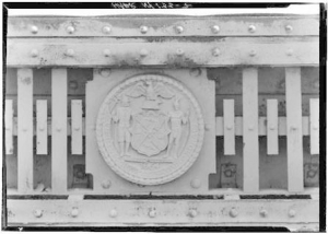
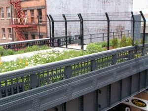
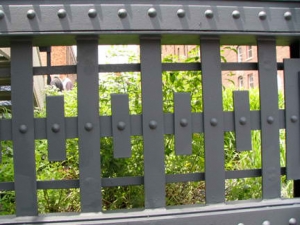
LEFT: sections of retained fencing at High Line Park; right: guardrail on the Miller (West Side) Highway. They are quite similar and they should be, since each was built at the same time and the two roads were meant to complement each other. The seal is that of the City of New York. Highway photo courtesy Jonathan Bornstein
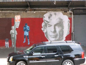
Views of Washington (left) and West 13th. Mr. Spock, what have they done to you!
FAR RIGHT: A close look at the “slats” built into the sidewalks to allow plant infiltration. Esthetically, it’s a pleasing idea, but note that the slats are slightly elevated. Parkgoers have to practice extreme caution — trippings and turned ankles will result if you’re too busy watching the scenery instead of where you’re going, as I nearly found out a few times.
A look at some of the former meat wholesalers on Washington and 13th, left, and the west end of 14th Street, with the Liberty Inn, the rotting remains of a Hudson River pier, and a pleasure craft in the river (it wasn’t the Circle Line).
The Liberty Inn, designed by Richard R. Davis, was built in 1908 for poultry dealers, the Conron Brothers. Originally known as the Strand Hotel, it accommodated sailors from the nearby piers. When the Titanic survivors were brought to these piers, the New York Times used the hotel as a headquarters. Other uses have included a boarding house, speakeasy, night club, and restaurant. Its many alterations reflect the changes in the Gansevoort area from shipbuilding to meatpacking to night-life hot spot, and it stands out within the area as one of the few buildings still retaining its original use, that of a hotel. Historic Preservation Studio
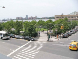
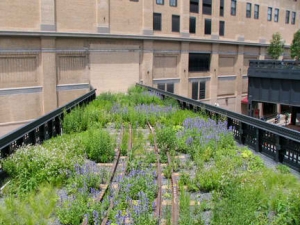
A look at the triangle formed by 10th and 11th Avenues and West 15th Street. Though the entire stretch of waterfront from Battery Park City north to West 59th Street is officially known as Hudson River Park, this attracive though hard-to-get-to triangle is also signed Hudson River Park. Not sure how long it has been curated, though I remember it from at least ten years ago, if not before that. RIGHT: a look at the plantings and flowers along the restored tracks.
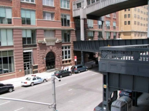
The High Line cut through several buildings along its route — loading docks were built to abut the tracks within the buildings. At West 15th, the line burrows through the National Biscuit Company — the first NBC (later known as Nabisco) complex, with one trestle leading off to the baker’s office building on the west side of 10th Avenue. A 22-building complex, combining new, renovated and older buildings including Nabisco, has been combined to form the Chelsea Market retail and broadcasting complex. I’d imagine that the High Line will eventually provide direct access to the market; there is already an exit staircase and elevator on West 16th Street.
To present a varying look, old tracks at West 14th Street have been filled in with concrete instead of given new ties and placed amid foliage, as they are elsewhere.
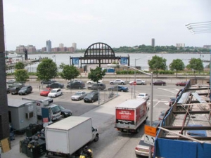
FAR RIGHT: the gate at Pier 54 has been allowed to stand. This was formerly a berth for the White Star/Cunard steamship lines, and HMS Titanic was scheduled to dock at an adjoining pier in early April 1912. Pier 54 has evolved into a seasonal concert venue.
Tracks leading into the old Nabisco offices seem to go nowhere, since the entrance was blocked long ago. Nevertheless, the High Line planners have landscaped it. RIGHT: to prevent baby carriages from entering the green areas (bikes have been proscribed on the High Line) metal lips have been placed at the edges of the park paths, to divide them from the plantings. Unfortunately, I nearly lost my footing a couple of times on these.
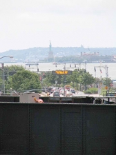
ABOVE: There’s a new vantage point to see Miss Liberty: the curve in the tracks as they cross over 10th Avenue at West 16th. The extra space provided by the curve gave planners some room to play with, and they fashioned an outlook point north on 10th Avenue. This has also been planned as a mini-theatre and performances may be presented here. Unfortunately it was still under construction the day I passed by.
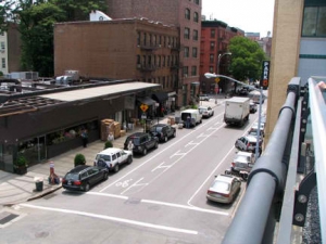
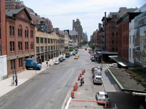
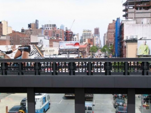
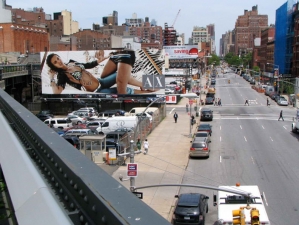
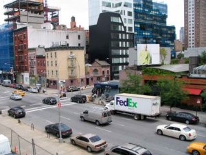
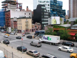
Two views looking north on 10th Avenue from the bend in High Line Park at about West 16th, including a large billboard erected to take advantage of the new foot traffic. She’s so nice, I shot her twice.
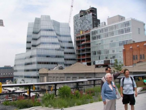
As New York Magazine described the week of June 15-22, avant-garde architectural designs, mostly for hotels and condominiums but also office buildings, have begun or have already completed construction along the High Line Park length from Chelsea south to the Village. At left on West 18th Street, we seethe new black & white and blue-glassed Chelsea Modern at 459, designed by Della Valle Bernheimer LLP. At right is Frank Gehry‘s only completed major NYC project to date (he is also constructing the Beekman Tower downtown), the IAC (InterActive Corp) Building. IAC Chairman and CEO Barry Diller and wife, fashion designer Diane von Furstenberg, contributed thousands to assist High Line Park.
Walking north, High Line Park’s home stretch begins at West 17th, where a new staircase replaces an older one that was formerly one of the only ways to attain the High Line easily. (Another was via a parking lot on West 34th that leads to a still-undeveloped section.
OOBject describes 9 reasons they don’t like the High Line. Reason 1 is a major point in the High Line’s favor: no bicycles allowed. Can you imagine the havoc up here if bike racers took over?
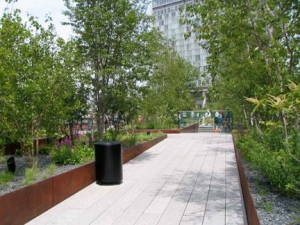
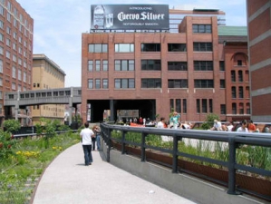
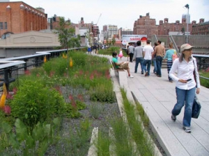
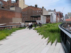
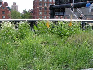
This rather quiet section at about West 19th gives you a good idea of the mix between park path and plantings that were meant to echo the weeds and wildflowers that once reigned atop the trestle. Note the lack of lampposts: the park is closed at 10PM, and most of the lighting is located at ground level. Additional security has been provided, but residents who patronize other parks around town have complained that this comes at the expense of parks in other boroughs.
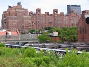
High Line Park provides unique looks at well-established landmarks such as London Terrace Gardens, West 23rd east of 10th Avenue, a 1930 apartment complex designed by Farrar and Watmaugh. When it opened it boasted a central garden, swimming pool, solarium, gym and doormen dressed as London bobbies. Its Marine Roof was designed to look like the deck of a transatlantic liner. Some of the apartments are now co-ops. At right we see the Episcopalian General Theological Seminary, which occupies almost the entire block between West 20th and West 21st Streets and 9th and 10th Avenues. The complex contains buildings constructed between 1836 and 1900, and boasts a Harvard or (closer to home) Brooklyn College-like quadrangle. Famed author Clement Clarke Moore (1779-1863) donated the land on which it stands.
A woman on West 20th favors leopard prints. Here, and possibly north of here, High Line Park abuts residential apartments and some interesting views are possible — we’ll see!
Wishfully thinking, High Line Park between West 20th and West 30th Streets is scheduled to open in 2010. There doesn’t seem to be much happening in June 2009, though, and knowing NYC deadlines for major projects, that opening date may have to be pushed back.
The end of the High Line, for now, is the staircase at West 20th and 10th Avenue. Much more, of course, is promised. (A section opened between 20th and 30th Streets in 2011)
The project the High Line is most closely compared to is the Promenade Plantée in Paris, a much-longer (3 miles) elevated trail running on top of a similarly disused railroad viaduct. Another successful rail-to-trail project was the Bronx Putnam Branch of the NY Central in Van Cortlandt Park. Chicago has the propsed Bloomingdale Trail, a project to be placed on an old el trestle; it hasn’t, ah, gotten off the ground yet.
Photographed June 17, 2009; page completed June 21, 2009

