Division Street is one of Manhattan’s most unremarked-on thoroughfares. It hasn’t gotten much respect over the centuries and decades, either — it’s been reduced to less than half of its original length, first by placing a public park smack in its path, and the rest was later taken out by a massive housing project.
In the grand scheme of the Manhattan street layout, though, Division Street played, and continues to play — a pivotal role. It also once hosted an elevated train line.
I recently slouched down Division Street on a light-bereft late fall afternoon to gather material for the last Forgotten NY feature page of 2009.
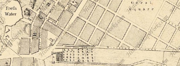
Division Street is so-called because it was the colonial-era line between the farms of James deLancey and Henry Rutgers, who between them owned most of the Lower East Side in the late 18th Century. The ‘no-man’s land’ was originally used as a ropewalk, ie. a lengthy space used to store rope and where hemp was manufactured into rope. By 1776, Division Street had already acquired its name. The “Fresh Water” on the left was Collect Pond, which was already so dirty that plans were being made to fill it in. It was drained into the Hudson River via a conduit that is now today’s Canal Street. The courthouses of Foley Square now occupy its old space.

By 1850 Division Street was a straight shot from the Bowery just north of Chatham Square to Grand and Pitt Streets. It was the running buddy of the wider and more trafficked East Broadway (originally Chatham Street) and separated the street grids of the “northern” and “southern” ends of the Lower East Side. It also allowed traffic (horses and wagons at the time) to proceed faster up East Broadway. Other examples of this sort of thing are Dahill Road in Brooklyn, which separates the street patterns of Bensonhurst and Flatbush, and Nashville Boulevard (St. Albans and Cambria Heights).
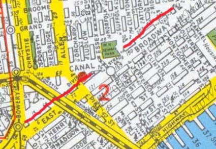
In 1899 the construction of Seward Park (the green square in the center of this 1949 Hagstrom) tore out a block of Division Street between Canal and Jefferson. The remainder of Division Street east of Jefferson Street would be de-mapped in 1957 when the Seward Park Houses were constructed. Check FNY’s Street Necrology for other streets eliminated by housing projects in the Lower East Side — there are quite a number.


Division Street begins at the Bowery just north of Chatham Square, formerly a great elevated train hub. Liu Shih’s sculpture of the great Chinese philosopher and nobleman (551-479 BC) was installed in 1976 along with the Confucius Plaza multi-family housing. Chinatown, now a fairly vast area running roughly between Broadway, Worth Street, Kenmare Street and the Bowery, also has a tentacle that runs northeast along Division Street and East Broadway that, if anything, may be more intensely “Asian” that its main cohort.
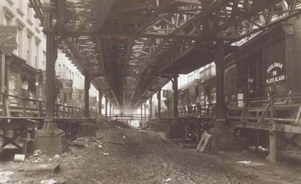
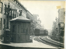
A rare photo of Division Street shrouded by an el. In its heyday (1880-1942) the Second Avenue El separated from the Third Avenue El at Chatham Square, ran up Division Street for about three blocks, then up Allen Street, 1st Avenue, East 23rd, and 2nd Avenue, rejoining the Third Avenue el for shared trackage over the Harlem River and then splitting apart again in the Bronx.
The 2nd Avenue El was built between 1879 and 1880, a 7.5 mile stretch, in 18 months. It will take the better part of the early 21st Century to complete its replacement line, the Second Avenue Subway, which will be complete approximately a century after the el was torn down, if the present rate of construction is not accelerated.
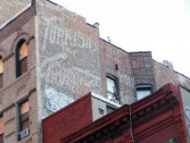
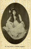
El riders likely got a good look at the painted Turkish Trophies cigarette ad on the right side of the street (everything on the left has now been torn down). The brand was introduced in 1892 and sold to the James Duke tobacco enterprise in 1900, which continued the brand till about 1930. The brand distributed card sets featuring smoking cuties, though most women didn’t smoke in public until the mid-1920s. This wall dog ad may well be a century old. Note the Manhattan Bridge up ahead…

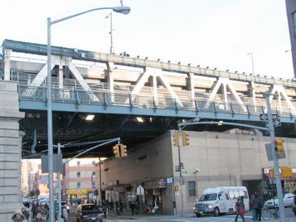
Castiron front buildings aren’t only in Soho — here is one at 41-43 Division. RIGHT: the Manhattan Bridge spans Division Street between Market and Forsyth Streets. The Bridge was finished in 1909 and the 2nd Avenue el in 1880 — yet that underpass seems sort of short to fit an elevated train beneath. Perhaps the el pillars were quite short in this location. Any engineers out there who know about this, let me know.

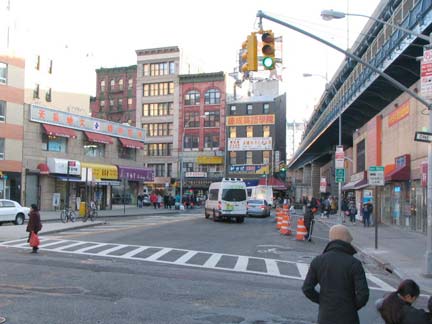
At Division and Forsyth Street we see two multifamily buildings of two different eras, the one on the left from the 1980s and one from 1900-1910 on the right. When I first began riding the Manhattan Bridge trains from Bay Ridge in the early 1960s, our Manhattan bound train from Bay Ridge ran on the north side of the bridge. So, I was able to see the huge painted ad for GGG Men’s clothes that was in this spot. Forsyth was extended south a block to East Broadway in 1909 along the new bridge approach.


Looking north up Eldridge, I saw the gleaming spire of the Chrysler Building up ahead. My first shot didn’t come out well, so I zoomed in and caught the slant-roofed Citigroup Tower with the second. Both are on Lexington Avenue but its slight northwest angle athwart Eldridge allows both buildings to be in the same picture.
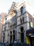
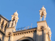
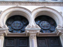
The most beautiful building on Eldridge is a few feet away from Division — the Museum at Eldridge Street, originally the Eldridge Street Synagogue — services are still given there. The grand structure was built by the Herter Brothers in 1887 but by the early 1980s was in danger of collapsing. A 2-decade long restoration followed.

In this circa 1915 map, note that our synagogue is in place; Allen and Pike are separated — more on that below — and also note “Elevated RR Power House” on the corner of Allen and the two lines, representing tracks, curving off Division onto Allen. This, of course, was the 2nd Avenue El — which is now gone. But this remains….
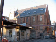
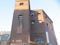
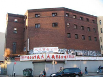
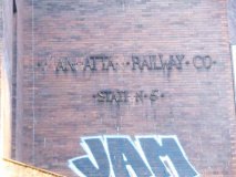
Manhattan Railway Co. Station No. 5 powerhouse, serving the 2nd Avenue el was never razed. The slant on the corner allowed the el to curve onto Allen Street.
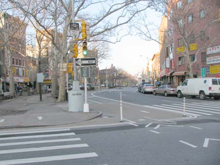
Allen Street was, like Division Street under the el, crowded, close and noisy — it was the home of metal shops and a red light district that long preceded Times Square’s. Before the el was built, Henry McCarty, Billy the Kid, was thought to have been born on 70 Allen near Broome in 1859. He was famed in his career as an outlaw gunfighter in the Southwest of the 1880s only after his killer, Sheriff Pat Garrett, wrote his biography, The Authentic Life of Billy, the Kid.
Allen Street was widened in 1932 by razing the buildings on the east side of the street. The el was razed 10 years later.
Allen Street for years after its widening was home to pedal to the metal traffic leading to or from 1st Avenue. The traffic has been tamed, at least the motor traffic, in recent years by the conversion of the two lanes closest to the center malls to bicycle lanes.
On older maps, and even some present ones, Allen Street ends at Division Street a good half block from where Pike begins, but at present, Allen Street curves so its traffic flows right onto Pike. I’m not sure when this alteration was made. Any takers?
The city also plans to reconstruct the pedestrian center mall.
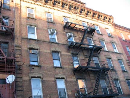

Corbels (the doodads holding up the roof brackets) are the rage on Division between Orchard and Ludlow. Would you take the corner apartment? I would — you’d have a sun drenched, 3-window room.Old-school storefront and doorway, Division facing Orchard. What does the lettering in Chinese say?


Forgotten Fan Cindy Ye: above fabrics store, “Chuen Lee, King of Clothing Material”; above doorway,
for a community group from someplace in rural China; blue lettering: “Haircut Beauty Center.”
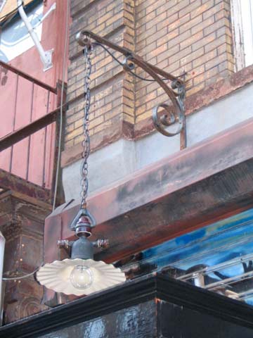
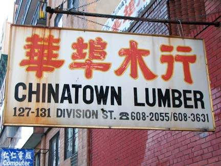
A new classic and an old one. Radial-wave diffuser on lamp above restaurant. Rads like these used to light NYC streets by the thousands, after the incandescent bulb first got popular (they will actually be outlawed by 2012). RIGHT: hand-lettered Chinatown Lumber store sign. In a few years will people recognize the dingbat by the number as a telephone?
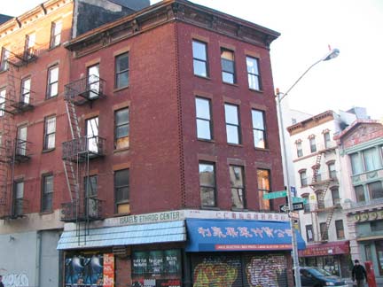
As we reach Ludlow, Canal Street is also in view. A very old “corbellated” building occupies a wedge formed by the two streets and Division. The etrog, rarely ethrog, is a citrus-family fruit used in the Jewish celebration of Sukkoth — this could well have been a distribution center for the fruits.
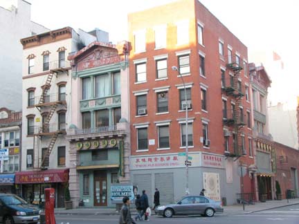
On Canal, the ornate front (#41) in the center was built in 1892 for a “brotherly aid association,” or landsmanschaften, for Jewish immigrants from Belarus. The building is L-shaped: note identical front on Ludlow. info: NYCSonglines
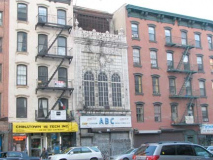
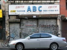
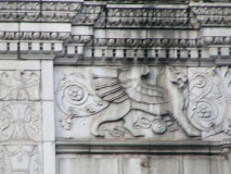
Just as Division Street ends its run at Canal — and just before Canal Street itself runs its traffic onto East Broadway, we see the elaborate facade of the Loew’s Canal Street Theatre, built by prolific theatre architect Thomas Lamb during the golden age of movie palace construction, 1927. It’s much larger than its narrow facade on Canal Street implies — its large auditorium is indicated by its wall facing Ludlow Street, where some fading murals from the 1970s or 1980s at the latest can still be seen. It has apparently not been a movie palace since the late 1950s; the upper floors are warehousing, and the Canal Street end fronts a TV repair shop — since I passed by on a Sunday, I’m not sure it it’s still open.
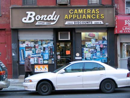
Another veteran sign is Bondy Export camera store at Canal and Ludlam.
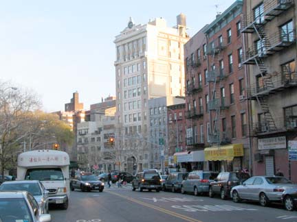
Looking at Canal toward East Broadway we see the impressive facade of the Forward Building, constructed in 1911. The Jewish Daily Forward, now in offices on West 33rd Street, publishes editions in English and Yiddish. I did not get close enough today to photograph them, but on the exterior you can see carven faces of Karl Marx and Friedrich Engels, the philosophers whose opinions led to the founding of Socialism. The Forward today is now a weekly. The Forward Building is now home to condominiums.

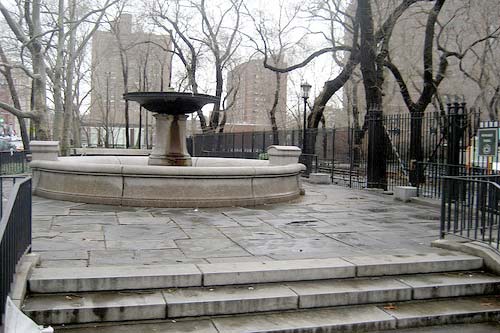
In 1899, as was mentioned, Division Street was interrupted for a block by the construction of Seward Park, named for William Henry Seward, Abraham Lincoln’s and Andrew Johnson’s Secretary of State. He is perhaps best known for his purchase, in behalf of the US Government, of Alaska from Russia for $7M in 1867. However he was also Governor of New York State (1838-1842) and a Senator representing NY (1848-1861). A statue of a pensive Seward can be found at the southwest end of Madison Square Park.
Seward Park featured what were among the first public playgrounds and baths in the USA. The Schiff Fountain was moved here from Rutgers Square in 1936. photos: NYC Songlines
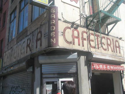
Lastly, the SE corner of East Broadway and Rutgers Street, across from the park, was once home to the Garden Cafeteria, whose classic 1930s or 1940s sign was exposed briefly while a new sign for a restaurant was being installled in 2005. The Garden was a favorite spot of the acclaimed author Isaac Bashevis Singer.
12/28/09


1 comment
[…] from a colonial border between two landowners, James deLancey and Henry Rutgers who, according to Forgotten NY, “between them owned most of the Lower East Side in the 18th Century.” The Second […]
Comments are closed.