Many years ago, when Queens was a collection of small towns divided by acres of farms and fields, every town and city had its own street naming and numbering system. This was a fine and dandy situation when Queens (then also comprising what is now Nassau County) was a separate and self-governing county. Once Queens consolidated with New York City and subsequently became slowly urbanized, this was a situation that could not be alloed to stand, however, as a plethora of Washington Streets, Main Streets, and 1st and 2nd Streets found themselves in the same street directory in the city ledgers.
And so, the Queens Topographical Bureau, under the guidance of C. U. Powell, was set the task of unifying Queens’ street system in the 1910s. To do this just about every street in Queens was assigned a number, except those in historic areas such as Flushing; some existing major roads kept their names, but were assigned the honorific Boulevard or Parkway to replace what was a mere Avenue or Road (the Jackson Avenue – Broadway combination was renamed Northern Boulevard, for example, while Little Neck Road became Little Nweck Parkway, and it’s hardly a parkway at all — it’s a major truck route. Numbered Avenues, Roads, Drives and Courts run east-west, while Streets, Places, Lanes and Terraces run north-south. Streets run from 1-271, and Avenues from 2-165: why Queens does not have a 1st Avenue is a mystery.
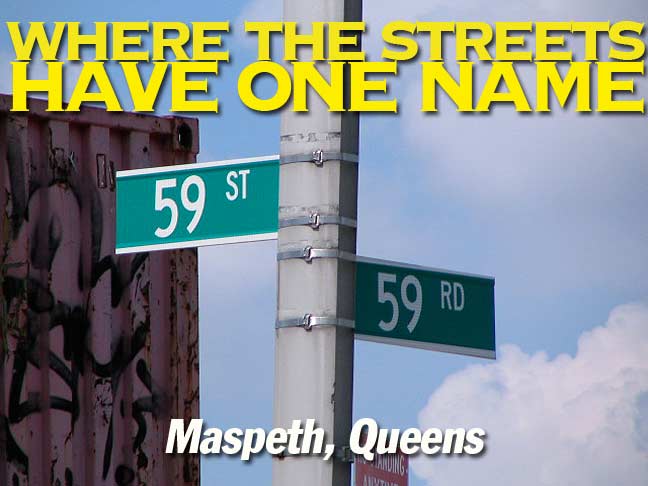
There’s one neighborhood in Queens where seeemingly, the numbers are all the same in the east-west and north-south system: Maspeth, Queens, where all the 59s and 60s meet…
The two street signs seen in the title card above, 59th Street/59th Road, are attached to a magnificent 1964-era double-masted Donald Deskey lamppost, of which Flushing Avenue boasts not a few.
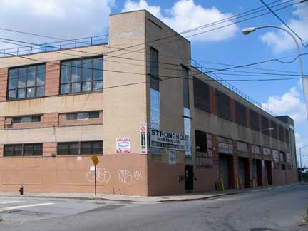
A block away, here’s 59th Street and 59th Drive. Western Maspeth, near Newtown Creek, was notable in the 1800s for featuring NYS Governor DeWitt Clinton’s mansion as well as Peter Cooper’s glue factory, where what became Jell-O® was first developed. Both are long gone and we are left with a mixed-use area of warehousing and aluminum-sided residences.
In western Maspeth, 56th Street meets 56th Drive, which also meets 56th Terrace; 57th Road meets 57th Place; 58th Street and 58th Place meet 58th Avenue and 58th Road; 59th Street meets 59th Road and 59th Drive; 59th Place meets 59th Drive; 60th Street meets 60th Avenue, 60th Road and 60th Drive; 60th Place meets 60th Avenue and 60th Court; and 60th Lane meets 60th Avenue, 60th Road and 60th Drive. And of course the 57s meet the 58s, the 58s meet the 59s, the 59s meet the 60s … and on and on…
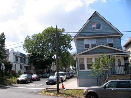
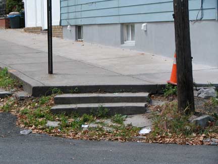
Here at 59th Drive and 59th Place, the sidewalks are about a foot higher than the roadbed. To compensate there are steps leading from the sidewalk to the roadway. This is a relatively rare situation that also pops up in places like Richmond Hill, Queens, Crown Heights, Brooklyn and Stapleton, Staten Island.
Photographed July 11, 2010; page completed July 13.


