I hope you’re not getting tired of Brooklyn and Queens, as this turned out into an epic walk between Queens and Brooklyn — I shot over 250 photos and may have to go to Part 4! I did an even longer, 13-mile walk a few weeks later, on which I got about 400 pictures, and that too will be a multi-part epic.
At the end of Part 2 I had reached the borderline of Brooklyn and Queens at Cypress Avenue and Bleecker Street. (It’s a testimony to the strength of our democracy that the Brooklyn-Queens border is unguarded, and there are no machine guns, checkpoint charlies, or bomb-sniffing dogs at the border. You may enter and exit as you please, and you don’t even need to show your NYC ID card.
By crossing into Brooklyn I am also crossing from Ridgewood into Bushwick, where mansions, churches and workplaces built by beer barons of over a century ago are still in place. After the riots and looting during the Blackout of 1977 large parts of Bushwick became an urban wasteland but the district has begun a slow climb back, and there are plenty of old-time architectural treasures to recommend it.
Read about Bushwick’s decline and revival in this paper by John A. Dereszewski.
GOOGLE MAP: Woodside to Bedford-Stuyvesant
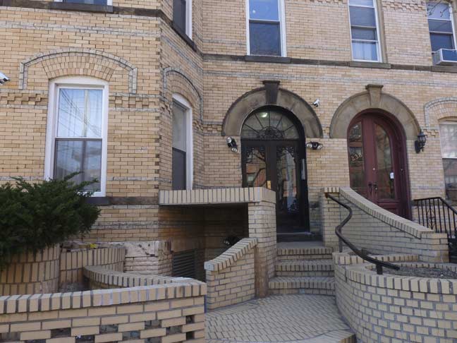
At Bleecker Street and St. Nicholas Avenue, this is one of many multifamily buildings in the area built with light-colored bricks, but this has unusual, undulating front stoop treatments, all made with the same color bricks.
Many streets in Ridgewood-Bushwick celebrate NYC’s Dutch heritage, with Onderdonk, Knickerbocker, Wyckoff and St. Nicholas Avenues. Wilson Avenue was re-named for President Woodrow Wilson after World War I; its old name, Hamburg Avenue, reflected Bushwick’s German-American longtime influence that became unpopular during the war.
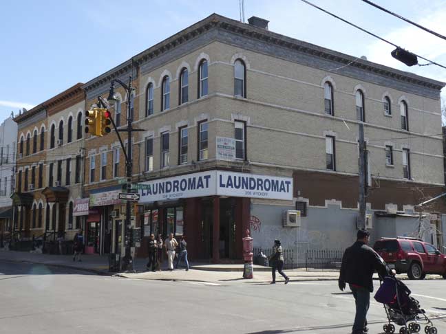
Bleecker at Wyckoff Avenue. I walked the length of this avenue, which spends about equal time in Ridgewood, Bushwick, and on the Brooklyn-Queens border, a few years ago. The BMT L train was opened under it in 1928; the B13 bus line runs on the avenue. There’s a Wyckoff Avenue here, a Wyckoff Street in Cobble Hill, and a former Wyckoff Avenue in East New York.
Wyckoff Avenue was given a set of retro Type F lampposts in the 2000s, as well as new Type G masts on telephone poles.
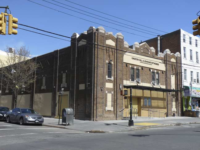
On the southwest corner, this Jehovah’s Witnesses Kingdom Hall appears to be a 1930s Art Moderne building with intricate brickwork. (But it’s not!)
From Comments:
JW Kingdom Hall is the original Wyckoff Theatre:
http://cinematreasures.org/theaters/7934
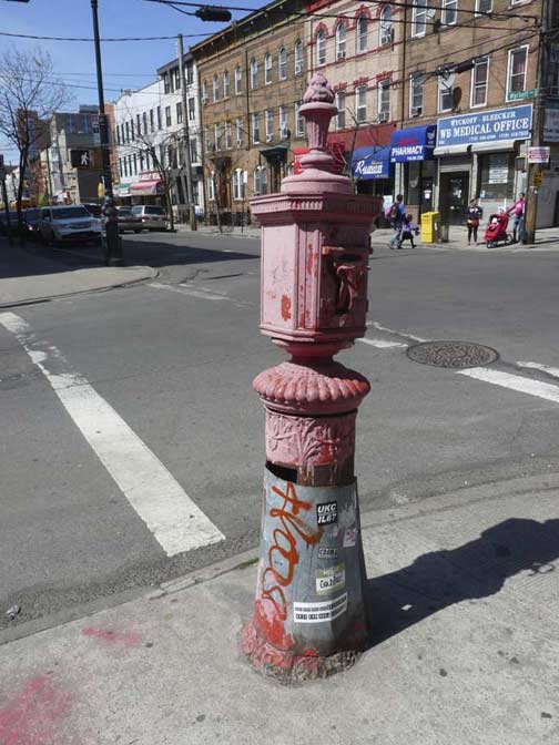
This FDNY fire alarm is battered and the worse for wear but still carrying on in front of the laundromat.
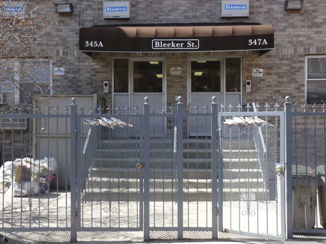
I think I mentioned in Part 2 that “Bleecker” is the most misspelled street name in NYC. Here’s proof. I think the DOT should just give in — if the people want it spelled Bleeker, then let it be Bleeker! A fairly new Fedders Special development, complete with iron gates, garbage in the front and concrete lawns.
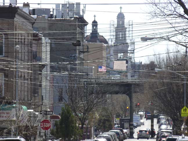
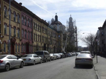
A very tall building has appeared on the horizon — I zoomed in to capture it. I passed it after a few more avenues — unfortunately it’s being renovated and is under some scaffolding [as of May 2015]. Till I get there, I’ll let you guess what building it is.
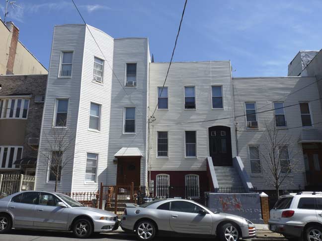
No doubt, this group of houses were once distinctive, especially the one on the left, but for a few decades they have been mummified by aluminum siding. However, all three still have what appear to be their original doors.
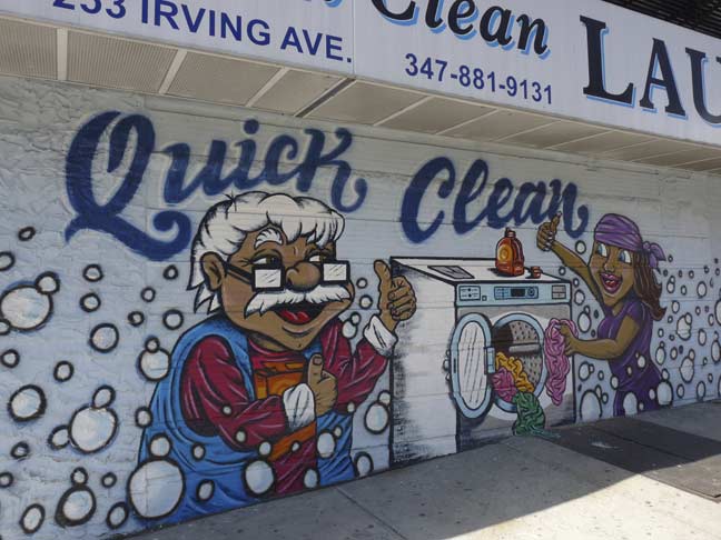
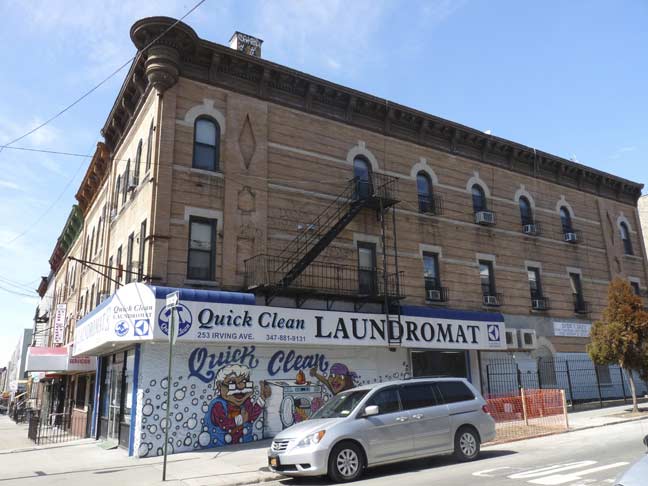
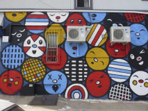
Quick Clean Laundromat, Bleecker and Irving Avenue, has some new artwork on its sidewall.
At the Boobie Trap bar on the opposite corner, the waitresses are quite thin.
Boobie Trap is a small, kitschy dive bar in an otherwise lonely part of Bushwick. Amusing décor – especially a fan of the neon FUCK YOU sign behind the bar, the creepy chandelier made of dolls in the restroom, among all the other fun stuff on the walls. I recommend their Warhead cocktail and any of the beer+shot combos! And who needs business cards when you have jars of free lighters at the bar with your logo on them? —yelp
A pair of classic storefronts on Irving Avenue between Bleecker and Greene. Irving Avenue is named for author Washington Irving (“Legend of Sleepy Hollow,””Rip Van Winkle”). One of his light history novels is the 1809 Story of New York, whose narrator, Dietrich Knickerbocker, is name checked one avenue to the west.
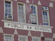
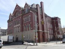
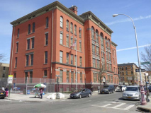
One of Bushwick’s two classic school edifices is Public School 86 at Irving Avenue and Harman Street. It is a Romanesque Revival building designed by architect James W. Naughton and completed in 1893. Naughton served as Superintendent of Buildings in the City of Brooklyn from 1874-1876, and became Superintendent of Buildings of Brooklyn’s Board of Education from 1879 until his death in 1898. He also designed Brooklyn’s Boys High School and Girls’ High School. All school buildings constructed in Brooklyn during that period were designed by Naughton.
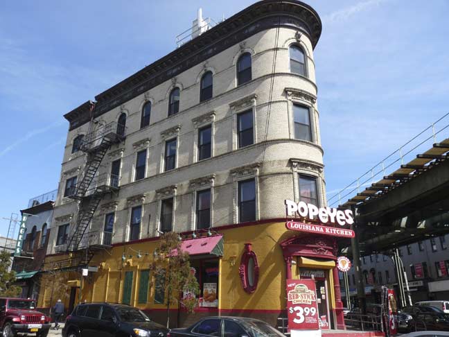
There are a trio of fascinating items at Bleecker Street and Myrtle Avenue, which cuts across the overall Bushwick street grid at an angle. Myrtle Avenue was laid out as a tolled plank road between downtown Brooklyn and Queens’ Richmond Hill in 1853, and various street grids sprang up around it in the different neighborhoods it runs through.
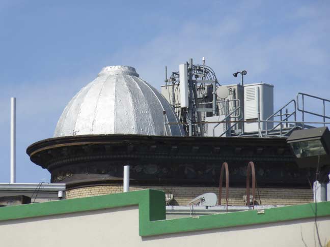
The dome-shaped ornament at the wedge reminds me of Greenpoint’s Digester Eggs.
In 2010 I walked Myrtle Avenue’s full length.
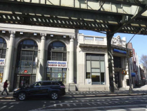
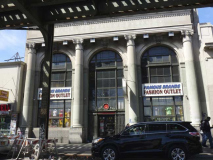
This Beaux Arts classic was built in a triangle shape to fit the wedge-shaped plot.
The former Hamburg Savings Bank at Bleecker Street and Myrtle Avenue survived under that name till an acquisition by College Point Savings Bank in 1983, later Federal Home Savings Bank. The building is now occupied by Citibank and by Famous Brands Fashion Outlet.
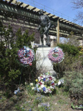
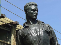
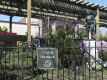
Heisser Triangle is named for a World War I sergeant in the Headquarters Company, 106th Infantry, who perished in France during WWI. Sgt. Heisser lived on nearby Grove Street. The memorial is by sculptor Pietro Montana, who has a second WWI memorial at Freedom Triangle at Myrtle, Willoughby and Bushwick Avenues.
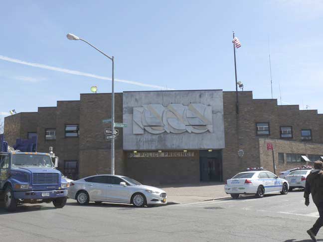
A walk in Bushwick is a walk through decades of building design. Here’s the Modernist (some may say Brutalist) 83rd NYPD precinct at Knickerbocker Avenue and Bleecker. This “new”83rd Precinct was constructed after the 1977 blackout and fire that gutted much of the surrounding area. The “old” 83rd, a landmarked building, still stands at Wilson and DeKalb Avenues.
PS 116, in flaming red brick, is Bushwick’s other truly great public school building, on Knickerbocker Avenue between Menahan and Grove Streets. It is a brick and terra cotta Romanesque Revival building designed once again by James W. Naughton and opened in 1899, a year after his death. In 2002 it was named an official NYC Landmark.
[Read the NYC Landmarks Preservation Commission’s Report for PS 116]
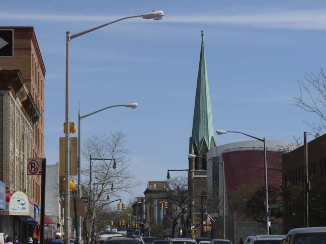
The tall spire of St. Paul’s Lutheran Church can be seen further south on Knickerbocker Avenue at Palmetto Street.

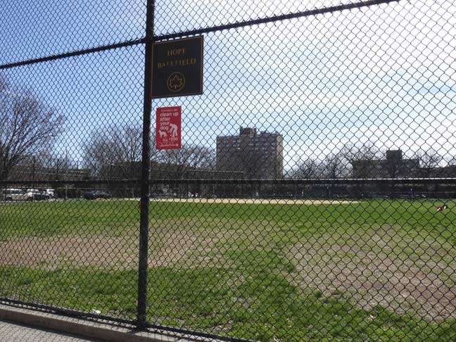
Hope Gardens and the Hope Ballfield fill two square blocks between Menahan and Linden Streets and Knickerbocker and Wilson Avenues. The houses were constructed in 1981 after a number of former tenement buildings had to be razed after the looting and fires during and after the 1977 blackout.
Though the neighborhood still has its share of woe, “hope” is the watchword. It’s difficult to imagine the scenes of destruction in Bushwick in the late 1970s and 1980s, with burnt-out and abandoned buildings littering the landscape. Much of this has now been alleviated, though drug dealing and crime may never completely go away.
Bushwick’s Hope Is a Public Project [NY Times, 1993]
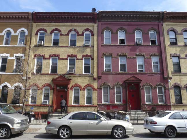
Some multicolored attached brick residences on Bleecker between Wilson and Central Avenues from when craftsmanship and attractiveness were yet virtues.
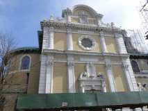
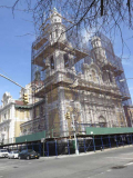
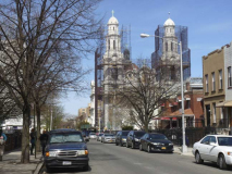
This is the building I was alluding to earlier, at Bleeecker Street and Central Avenue, St. Barbara’s Roman Catholic Church. It’s likely the largest church in NYC after St. Patrick’s Cathedral and the Cathedral of St. John the Divine in Morningside Heights (there are other candidates like St. Agnes in the Gowanus area in Brooklyn, but fill me in if there are other contenders).
It is a gleaming white and cream twin-towered Spanish Baroque Catholic parish. It was constructed in 1910 by prolific architects Helmle and Huberty with a sizable donation by brewer Leonard Eppig — the church was named for his daughter Barbara. The parish has served a German, then Italian and now a Hispanic congregation.
The construction should be finished in a few months church was still scaffolded in 2018, so a visit to this epic edifice is warranted for both the exterior and interior whenever it can be seen again.
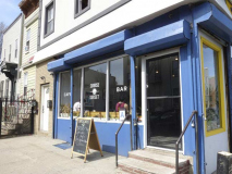
The Sunrise Sunset Cafe, on Evergreen Avenue and Bleecker Street, is fairly new [May 2015] as it isn’t on Google Street View in September 2014. It is more of a wine bar than restaurant, but there are brunch options. I was attracted by its newly painted, colorful wall art.
If you look at a map of Bushwick, you will notice that Evergreen Avenue doesn’t quite parallel other avenues like Bushwick, Central, Wilson, etc, and takes a noticeable jog between Menahan Street and Putnam Avenue. The reason for this is simple. That section of Evergreen Avenue was originally part of a much older road, the Old Bushwick Road*, a path from the Dutch colonial days documented as early as 1640, and it may be descended from a Native American trail. As the street grid of Bushwick was established the older road was closed by the mid to late 1860s, with the exception of the section that was incorporated into Evergreen Avenue.
The avenue itself was named for the vast Evergreen Cemetery or Cemetery of the Evergreens on the Brooklyn-Queens border.
*information from the very helpful “Colonial Highways of Greater New York” by NYC Comptroller Herman Metz, 1908
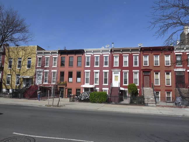
Bleecker Street ends (or begins) at Bushwick Avenue, a main route between Williamsburg and East New York. This section of Bushwick Avenue has its share of brewers’ mansions, but it’s also home to modest rowhouses like this. NYC mayor John Hylan, who was in City Hall between 1918 and 1925, lived in one of the houses along this stretch.
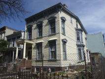
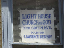
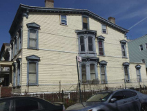
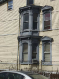
One of the more distinctive houses in Bushwick, if only because it hasn’t been shrouded in aluminum siding, is the Italianate #1090 Greene Avenue at Godwin Place, “a busy Tuscan columned-entrance building with window lunettes ( a half-moon shaped carving)and muticolored trim.” According to the AIA Guide to New York City (which insists on calling it #1080), the house may have at one time been owned by Henry C. Bohack, the founder of the once-giant Bohack’s supermarket chain. The house is now the Lighthouse Church of God.
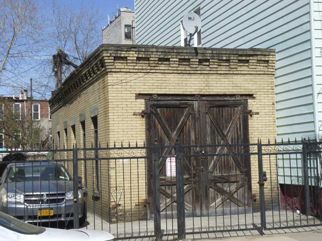
There’s a small brick garage in the back, accessible from Goodwin Place. It has its original door and could have been a stable at one time.
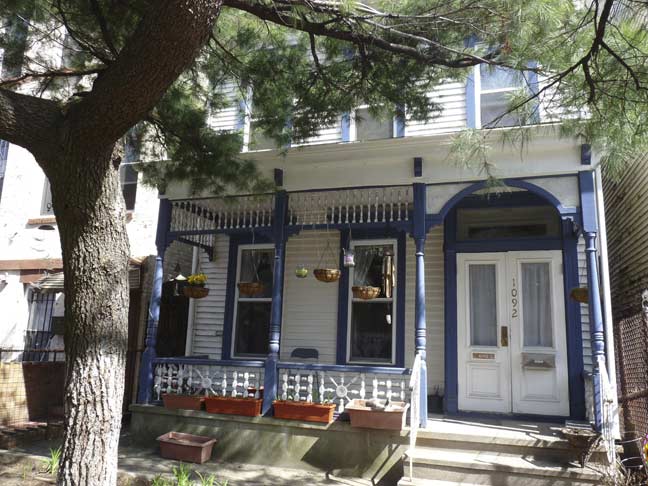
The building next door, #1092 Greene Avenue is a Victorian-era “stick style” house so called from the thinness of the timbers and porch pillars. It’s rather more maintained than #1090.
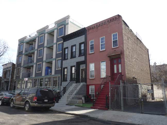
Meanwhile, on Goodwin Place, here’s three stages of Brooklyn gentrification: a new building, an old building with “improvements,” and an intact old building.

The new building has bike parking on a porch-like platform, while because NYC was laid out with no service alleys, the garbage bags go out front.
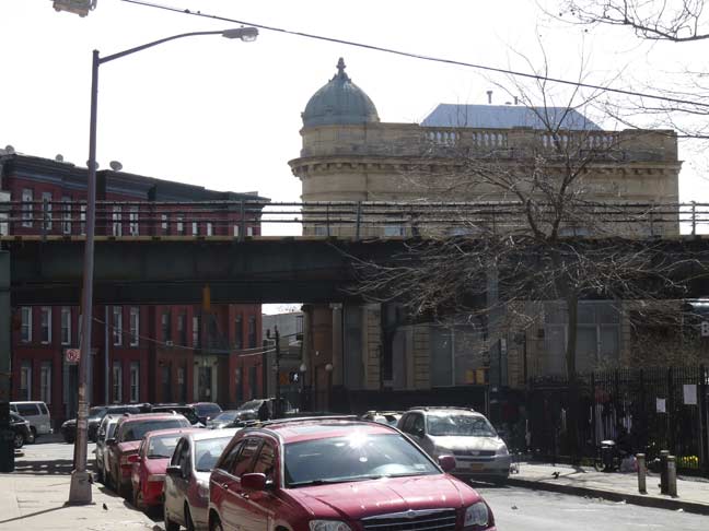
The el coming into view serves the J train, in rush hours the skip-stop Z line and further north, past Myrtle Avenue, the M. It’s one of the oldest els in the system, today connecting the Williamsburg Bridge with Jamaica, Queens. Most of it opened in July 1888, though the bridge connection was done in 1913, the section between East New York and 121st Street in 1893, while the final section in a tunnel to Parsons Blvd and Archer Avenue was finished in 1988. Parts of the line incorporate the now-demolished (Brooklyn) Lexington Avenue built in 1885.
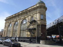
Broadway runs at the edge of two colliding street grid patterns: east-west (Bedford-Stuyvesant) and northeast-southwest (Bushwick). This creates some more odd-angled plots were unusually shaped buildings were constructed.
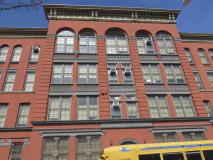
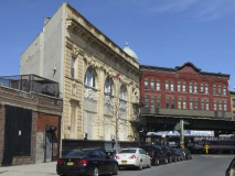
I would like to have more to tell you about 1240 Broadway at Greene, where there’s a gorgeous building with arched windows on the 2nd floor, terra cotta ornamentation on both sides, and a small dome at the point of the triangle. I’d have to guess it was a bank at one time, but no lettering or ghosts of lettering can be found. At one time it had dentist offices and was home to a neighborhood church, but it seems to be purely residential these days. It’s on the border of two neighborhoods and seems to have slipped through the cracks, with none of my guidebooks mentioning it. Any ideas?
I haven’t walked the full length of Brooklyn’s Broadway since June 1, 1999 on the first ForgottenTour! Will have to do it before I need a walker…
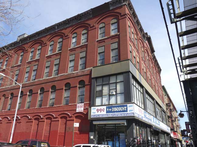
The building on the southeast corner of Broadway and Greene is red brick pile of considerable age, but the current owners keep it up well with the exception of a noncontextual building front facing Broadway. The owners would tell you it’s practical and suits their needs.
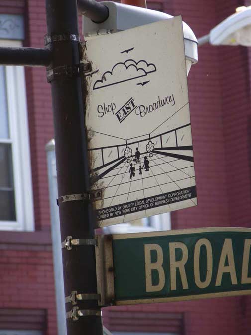
One of these days I’ll have enough of these small signs installed by local business organizations to promote commerce to do an entire FNY page on them. They often appear beneath els. Some are very colorful and well-done, while this one could have used a larger type point size.
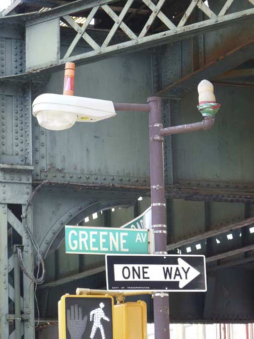
Short lamps painted choloclate brown like these were installed under elevated trains in the 1980s. The luminaire, here a new GE M400 but originally a globular, gumball-shaped lamp, were actually installed over the sidewalks, but there was sufficient light to light up the streets as well. This one has a fire alarm indicator.
These type of under-the el lamps are starting to be phased out in 2015 by short davit-style lights featuring LED lights, which shine an intense white but don’t have the coverage of the yellow sodium lights.
I will have to go to a Part Four next week in… Bedford-Stuyvesant
6/21/15


3 comments
JW Kingdom Hall is the original Wyckoff Theatre:
http://cinematreasures.org/theaters/7934
As to the largest church – OLPH in Sunset Park has got to be up there – just a guess.
1240 Broadway was designed by J.J. Glover and H.C. Carrell in 1898. It was called the People’s Bank. You can find prints of its design on ebay every now and then.