
These handsome red, white and blue signs, designed by artist Richard Deon, working with the cooperation of NYC’s Public Art Fund, first appeared in Astoria / Long Island City and Sunnyside in the early 1990s along a seven-mile route. the signs are approximately two er, feet in diameter and are accompanied by smaller signs pointing to local highlights. The route runs along Vernon Boulevard (a sign at 9th Street is shown here), 44th Drive/Thomson Avenue, 43rd Street, 35th Avenue, 36th Street, Broadway, Crescent Street and 31st Avenue.
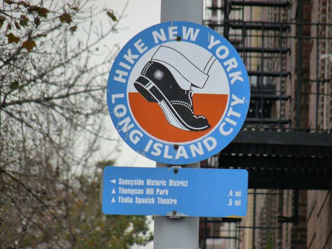
Interestingly since the signs were installed in the 1990s they’re just a little outdated. The 44th Drive Public Pier is now occupied by a caterer called Water’s Edge. The Institute for Contemporary Art is now the Queens branch of the Museum of Modern Art, MoMA PS1. The Thomas P. Noonan Playground, Greenpoint and 47th Aves and 43rd Street in Sunnyside was once known as Thomson Hill Park, as Sunnyside was once Thomson Hill. It never had the “p” as in the sign; the signs also misspell Rainey Park, named for a local physician who was an early champion of the Queensboro Bridge.
kevinjudewalsh@gmail.com
8/11/16