


MANY of the world’s great cities mark their borders with walls and gates, but New York knocked down Wall Street’s ramparts by 1699 and expanded its territory north until reaching the eventual border where Bronx meets Westchester. On the Bronx River Parkway, the county line is approximated by a dramatic arch and signs underneath reminding drivers not to exceed 25 miles per hour on streets, not to turn on a red light, and the presence of red light cameras. Welcome to New York City!
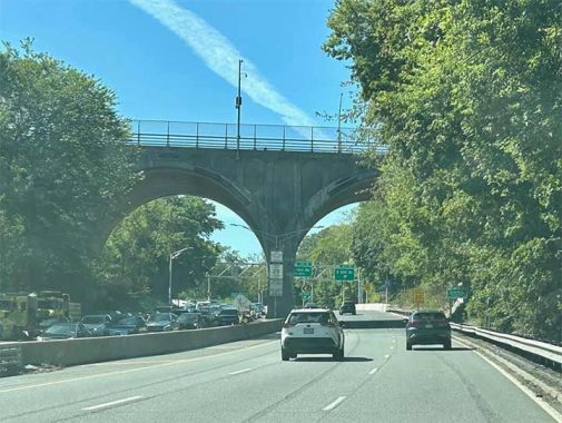
The arch carries Nereid Avenue across a valley formed by the Bronx River. Its design was meant to match the “beauty of the parkway” when it was proposed in 1918. It opened in 1931 in a ribbon-cutting ceremony attended by officials from the city, Corbetta Concrete Corporation, and the New York, New Haven & Hartford Railroad, which financed the project. The dedication plaque calls it East 238th Street Bridge, as it was assumed that Nereid Avenue would be assigned a number conforming to the Manhattan-Bronx grid.
On the west side of the river, Nereid Avenue serves as the city line for one block, with its north side designated as McLean Avenue of Yonkers and its south side as East 240th Street of the Bronx.
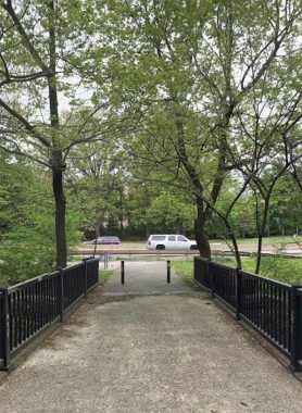
To see this bridge from beneath, one would start on a hiking path at the Woodlawn Metro-North station, and proceed north. A monument at the start of this path describes the course of the Bronx River, from its source at Kensico Reservoir, to its mouth at Soundview Park.
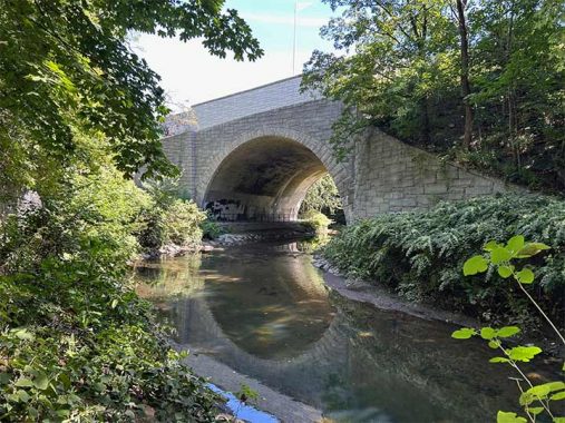
Within the Bronx, the borough’s eponymous river makes a couple of turns while the parkway sharing its name runs straight across these meanders. Pedestrians can walk underneath these turns with stone arches carrying the Bronx River Parkway across the stream. A similar arch above the bikeway and river is at Gun Hill Road.
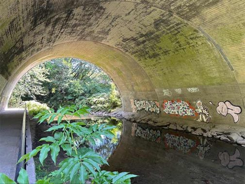
Graffiti slabs are reflected on the water, offering a double take on an art form made famous by this city. Historically, graffiti writers preferred tagging moving objects such as subways, boxcars, and trucks with their splashes of color. Perhaps a body of water also satisfies their artistic vision.
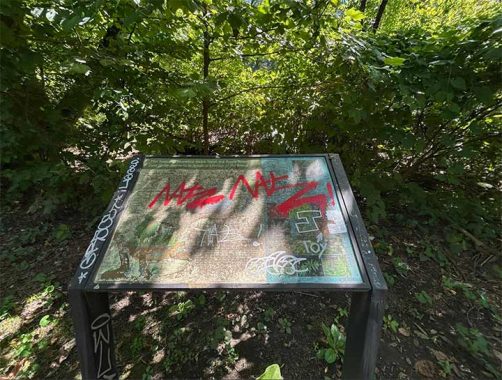
The section of the Bronx River at the East 238th Street Bridge is designated as Muskrat Cove, named for a resident animal and park signs installed here speak of the river’s restoration from an open air sewer to a naturalistic waterway that can host wildlife again. At the same time, the informational sign for Muskrat Cove deteriorated beyond legibility. One can learn about parks online, but physical signs make the jog or bike ride more meaningful.
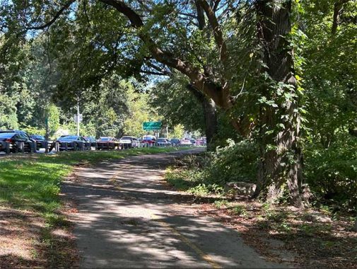
Looking north, Westchester County is marked on the roadside. The Bronx River here marks the border between the cities of Yonkers and Mount Vernon. In 1894, they both held referendums on whether to join New York City. Up here, the voters resisted and the two cities retained their municipal independence. In 1934, Manhattan alderman Elias Jacobs again proposed annexing Yonkers, and this city’s council firmly rejected it. NYC Mayor Fiorello LaGuardia then replied, “I have enough headaches for the next three years without another borough.”
The trail bends away from the highway a few yards into Westchester County, while the highway follows the river for another 24 miles to its northern end at Kensico Dam. The trail then crosses a bridge across the stream and dead-ends in a forest sandwiched between the river and railroad tracks. Maps of the Bronx River Pathway in Westchester County have bikers using nearly four miles of streets paralleling the stream between East 233rd Street and Bronxville.

Although the East 238th Street Bridge marks the city line on the Bronx River Parkway, there is one more bridge going upstream that is entirely within New York City. Because the city line was mapped in 1898 before the course of the Bronx River was straightened, it meanders in a way that places the entirety of the East 241st Street Bridge within New York City. Architecturally, it is not as impressive as Nereid Avenue’s arches above Muskrat Cove.
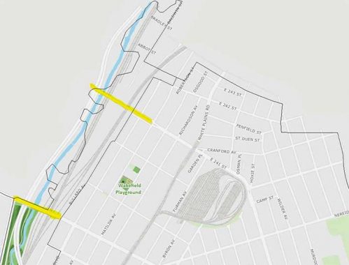
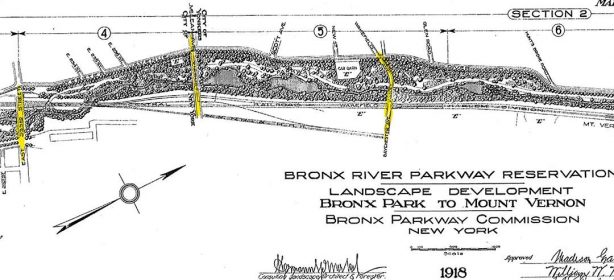
An older planning map from 1918 by architect Charles W. Stroughton shows the bridges at 233rd, 238th, and 241st streets. The last one appears here as Baychester Avenue, which was later assigned a number in the Wakefield neighborhood.
Sergey Kadinsky is the author of Hidden Waters of New York City: A History and Guide to 101 Forgotten Lakes, Ponds, Creeks, and Streams in the Five Boroughs (2016, Countryman Press), adjunct history professor at Touro University and the webmaster of Hidden Waters Blog.
Check out the ForgottenBook, take a look at the gift shop. As always, “comment…as you see fit.” I earn a small payment when you click on any ad on the site.
9/25/25
5 comments
I’m not certain, but I think the Bronx River Parkway may be the only major Parkway or Highway in New York City that was not proposed, or built, by Robert Moses.
Kenneth: Regardless of what Robert Moses’ role was or wasn’t, the route of the Bronx River Parkway is one magnificent road. It features waterfalls, wooden foot bridges that connect the riverbanks, willow trees, ducks & some great residential archetecture. I spent many pleasasant hours, hiking, biking & driving thhrough the area. So many pleasnt memories, so little time. If current life in the Bronx & NYC in general causes you despair, raise your spirits wth a Bronx River excursion through Westchester County.
Indeed, the Bronx River Parkway stands “Head-and-Shoulders” above any other parkway in New York City, Long Island, or the Hudson Valley. The later roadways (at least in the suburbs) were nicely landscaped, but the BRP was intended to be scenic from the start.
The Bronx River actually begins north of Kensico Reservoir and flows in the Towns of New Castle, North Castle and Mount Pleasant before flowing into Kensico Reservoir and then continuing south to the city.
Here is a link to a YouTube video exploring 8 miles on the Bronx River by kayak.
https://www.youtube.com/watch?v=SKNLdwT3SnY