
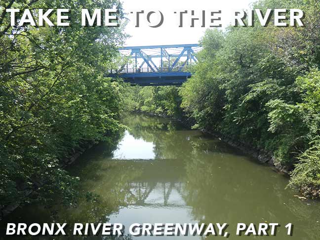

REALIZING that it had been awhile since I had been in the Bronx (a shamefully deficient aspect of Forgotten NY I am always meaning to correct) I decided to explore a relatively new section of public parkland alongside the Bronx River encompassing parts of Starlight and Concrete Plant parks. Though most people visit for the greenery and tranquility, there’s also plenty here for the infrastructure buff including some brand new bridges as well as some very aged ones. This section of the Greenway was opened to the public in 2023, joining previously opened sections. I was there on City of Water Day in late July in the dead dog heat, but nevertheless had a very manageable and enjoyable trip of about three miles total. With about 140 photos, I’ll do a two-parter.
GOOGLE MAP: BRONX RIVER GREENWAY — STARLIGHT — CONCRETE PLANT PARK


During the last few Forgotten NY Walks I have begun recording the subway stations I arrived at and left from. Today it’s the elevated West Farms-177th Street station on the #2 White Plains Road line, which also leaves you at East Tremont Avenue. West Farms took its name from farms west of the Bronx River, which served as the Bronx’ main geographical dividing line from the colonial era up to the later 1800s. The Bronx became a part of New York City in sections between the years 1874 and 1898: all of the Bronx west of the Bronx River was annexed to the City of New York in 1874, while everything east of the river became part of the City in 1895. Soon after, in 1898, New York City consolidated with the city of Brooklyn and the boroughs of Queens and Staten Island. Though it was already a borough, the Bronx was a part of New York County until 1914 when it became a county in its own right. Today, New York County is coterminous with Manhattan.
The artwork at the station is “Animal Tracks”, appropriate for its location near the Bronx Zoo, by Naomi Campbell (the artist, not the supermodel) and was installed in 2005.
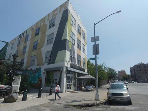
At East Tremont Avenue and the dead end Bronx Street is the Bronx River Art Center, founded in 1987 to bring arts programming and environmental experiences to the West Farms neighborhood, which historically has been culturally underserved. The building has received a new painted design, with its BRAC initials wrapping around the side, so amusingly, it looks like the “BRA” Building when you approach it east from Boston Rd.


For decades Bronx Street was a rubble-strewn dead end (see it in that condition in the Tremont Avenue page) that was eventually fenced off. I was happy to see that it has been repurposed as a public pathway through West Farms Rapids Park and extends north to East 180th Street. My compass was pointing south today, but I have resolved to visit the new pathway soon.
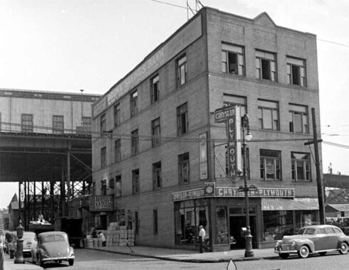
Here’s Bronx Street and the Bronx Art Center in 1940: it was a car dealership when this area was more heavily commercialized.
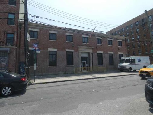
At Wyatt Street and Devoe Avenue is a handsome, pitch-roofed, Ionic-columned post office built in 1935, likely under the auspices of the Works Progress Administration.
A look at the cornerstone reveals that Mott Haven’s distinctive post office was built in 1935 when Henry Morgenthau was Secretary of the Treasury and James Farley was Postmaster General.
After 1937, while still in charge of the Treasury, he played the central role in financing US participation in World War II. He also played an increasingly major role in shaping foreign policy, especially with respect to Morgenthau Plan) preventing Germany from ever again being a military threat. His son Robert Morgenthau was the longtime District Attorney for Manhattan from 1975-2009.
James Aloysius Farley was one of the first Irish Catholic politicians in American history to achieve success on a national level, serving as Chairman of the New York State Democratic Committee, Chairman of the Democratic National Committee and as Postmaster General simultaneously under the first two administrations of President Franklin D. Roosevelt. He was one of the first Roman Catholics to achieve national success; Al Smith had run unsuccessfully for President in 1928. He was a champion of civil rights in the 1920s, as Chairman of the New York State Athletic Commission, he unsuccessfully tried to integrate boxing, as after Jack Johnson’s success, promoters colluded to keep African-Americans from challenging for titles. Later, he was CEO of Coca-Cola and helped spread the brand worldwide. –adapted from wikipedia
The main branch of the post office in Manhattan at 8th Avenue and 33rd Street was named for him. It was adapted as an eastern extension of Penn Station and named the Daniel P. Moynihan Train Hall, for the long-serving NY State Senator, in 2020.


The north entrance to the Bronx Park Greenway is rather obscure, and a bit treacherous for both walker and bicyclist. Here, East 177th Street, Wyatt Avenue and the entrance to State Route 895 (Sheridan Boulevard, formerly Expressway) all come together. I’m surprised that the Department of Transportation, which has preferred walking/bicycling solutions over car/truck traffic of late, hasn’t done any traffic engineering to make this safer, but they haven’t. The site also borders on the busy West Farms MTA bus depot. A careful look also reveals the presence of an iron pole that formerly carried trolley wire.
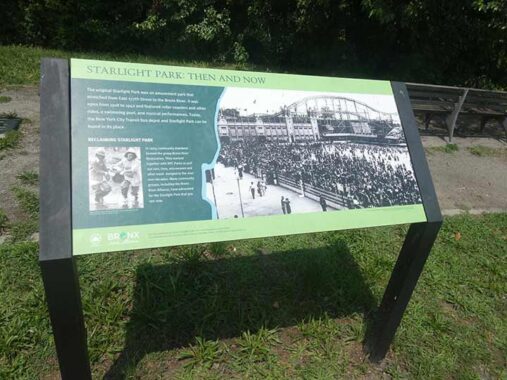
Starlight Park isn’t named because the stars aren’t more easily seen in it; NYC’s light pollution is as bad here as anywhere else in town. Instead, it was the site of a popular amusement park by the Bronx River that operated from 1919 to 1942, as the helpful plaque by the northern entrance to the greenway explains. The year before, 1918, this was the site of the Bronx International Exposition of Science, Arts, and Industries.
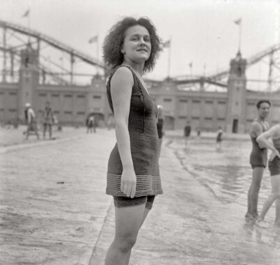
Starlight Amusement Park, which no one talks about today, rivaled Coney Island as it featured a public pool, roller coasters and other rides, and games.
Fun and Death in a Lost Bronx Park [Bowery Boys]
Over the decades, community groups such as the Bronx River Alliance have tirelessly worked (and I mean that literally, they got rid of old tires in the river) to clean up the waterway, restore wildlife and flora on both sides. When the Sheridan Expressway (since turned into a surface Boulevard) in 1958, its border was developed into a public park that opened in 1963. Sheridan Fields was renamed Starlight Park in 1998, in homage to the old amusement park. Two sides of Starlight Park were linked across the Bronx River by new pedestrian arch bridges in 2023.


These newest arch bridges crossing the Bronx River were built in 2023 during Starlight Park’s last renovation. Like many of NYC bridges the past ew decades, it’s painted robin’s egg blue.
It must be mentioned that the Bronx River is the only “true” river located entirely within New York City. NYC shares Hudson River with New Jersey, and the East River is a strait connecting Upper New York Bay and Long Island Sound. There are substantial riverlike waterways like Newtown and Coney Island Creeks, and rivulets and trickles like Lemon Creek and Palmer’s Run in Staten Island, but they’re not true rivers. The Bronx River is about 24 miles long and rose from a confluence of creeks near Kensico, but today arises at Kensico Dam. It drains into the East River at Hunt’s Point.


The Greenway is well-delineated and marked. Its sanserif font on park signage appears to be in the Clearview font family, formerly used on NYC street signage.


The Greenway path passes beneath the 174th Street Bridge, painted blue of course. The handsome truss bridge crosses the Bronx River, connecting East 174th Street with Crotona Park East and Soundview. A look at the plaque on the west riverside –which motorists can’t safely do — reveals it was constructed in 1928 during the Jimmy Walker mayoral administration.
Bridges NYC has a good history of the span:
The East 174th Street Bridge carries four lanes of vehicular traffic and two pedestrian sidewalks across the Bronx River and the railroad tracks of Amtrak and CSX in the West Farms section of the Bronx. It has a total length of 589 feet, with a main through truss span of 190 feet, and has a vertical clearance of 30.5 feet.
A bridge across the Bronx River at East 174th Street was in demand for years before it was built. In 1910, six tracks ran just east of the river, operated by the New York, New Haven and Hartford Railroad. That year, the railroad agreed to build bridges over all street crossings. A span was erected at East 174th Street, but only over the tracks. In subsequent years the New York, Westchester and Boston Railway also began using the tracks. Disputes between the railroads and the city over who should pay for the rest of the bridge ensued, and no river crossing or approaches to it were built. By 1918, the finishing of the bridge was considered long overdue, and Bronx property owners requested that the Public Service Commission build the bridge.
By 1925, due to efforts by the Bronx Board of Trade, a proposal for the bridge had been accepted, and plots of land around it started to be bought up. In January 1927, the Board of Estimate finally appropriated $340,000 for the construction of the bridge.
It had been since 2013 since I’d been in this part of the Bronx. On that occasion, I crossed on the 174th Street Bridge.


Here, the Greenway path runs past, and occasionally crosses, the accompanying Amtrak Northeast Corridor tracks, once home (as we’ll see) to the old local New York, New Haven and Hartford line. In this case, though, one of the signal stanchions cuts into the park, which indicates to me that at one time, a track ran through here. The contrast of glorious rust and full greenery at the height of summer is fascinating.


Another of the Greenway’s new arch bridges crossing the mighty Bronx River, and I was close to a City of Water Day event. This bridge brings parkgoers to Starlight Park’s Bronx River House:
“River House is a cutting-edge environmental learning laboratory and operations home for the Bronx River Alliance.In addition to storing kayaks and canoes for community use, the River House shares offices, classrooms, and meeting space with the people who live, work, and play in the Bronx. This model of sustainability and resiliency is located between the Bronx Botanical Gardens and the Bronx Zoo in beautiful Starlight Park.”
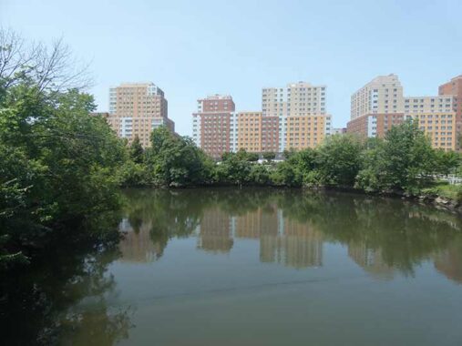
Seen across the Bronx River is Starlight Park in the foreground and a relatively new batch of high rise apartments arrayed along West Farms Road between Boston Road and East 174th Street.


After passing the pedestrian bridge, the Greenway path ascends a hill that also features a landscaped stairway. This provides a vista that overlooks the Bronx River and a look at its western side. The Bronx River House can be glimpsed through the foliage. This is a very handsome design, and I hope the city budget can maintain it in this condition. Without constant care and vigilance, vandals will embark on their grim task.


I have to mention the Greenway path lamps. This is a relatively new genre used alongside or in place of the more traditional Type B park lamp. According to the Department of Transportation it’s called the Flushing Meadows lamp…in spite of its first use in Canarsie Park, Brooklyn in 2004.


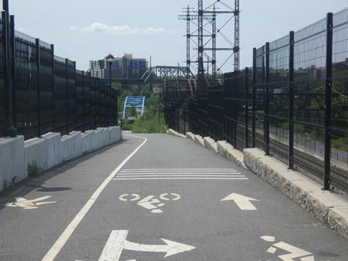
A truss bridge, painted blue of course, spans the busy railway tracks and moves the park path to their east side. It also allows entrance and egress to a stub of East 172nd Street near Bronx River Avenue in the western section of the Soundview neighborhood.
I am unsure if this bridge was built new in 2023 for the Greenway renovations, or if it was rehabilitated. Area residents, help me out in Comments.
I’ll wrap it up in Part Two with a couple of defunct rail stations that may actually be funct before too long.
Check out the ForgottenBook (HarperCollins, 2006), as well as Forgotten Queens (Arcadia, 2013). I also have a chapter in the anthology “New York Calling: From Blackout to Bloomberg” (Reaktion, 2007). As always, “comment…as you see fit.” I earn a small payment when you click on any ad on the site.
10/18/26