In early April 2012 I walked the route of the New York, Westchester and Boston Railway, or the closest possible approximation along the tracks, from the Bronx Park East station all the way northeast to Dyre Avenue. It gave me a chance to traverse the Pelham Gardens and Eastchester sections of the Bronx, which I’m in just a few times per year, and to approach both the subway route and the neighborhoods it travels through with a fresh perspective.
For an explanation of what the NYW&B was, and remains today, check the link to Part 1 at the top of the page.
TOUR ROUTE
Gun Hill Road
One of the Bronx’ more colorfully-named routes, Gun Hill Road, seen here at Wilson Avenue, begins at Mosholu Parkway at Van Cortlandt Park and runs generally east to the confluence of the Hutchinson River Parkway, New England Thruway and Bruckner Expressway. Most of it is actually “East” Gun Hill Road, with a short “West” Gun Hill Road between Mosholu and Jerome Avenue, the divider between East and West Bronx streets. As is the case with Throg(g)s Neck, there’s a dispute whether the proper spelling is Gun Hill or one word, Gunhill.
The western section of the road near Van Cortlandt Park is the oldest part, with the eastern section gradually built out in the early 20th Century. The actual Gun Hill, from which a group of Americans fired on British troops on January 25, 1777, is located within Woodlawn Cemetery.
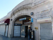
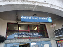
The Gun Hill road station is located on the south side of the road between Seymour and Fenton Avenues. The NYW&B is in an open cut at this point. It’s rather difficult to get good photos of NY&B stations because they tend to face north and the sun is shining directly over them at midday. Nevertheless I got a representative sample.
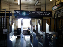
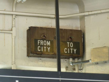
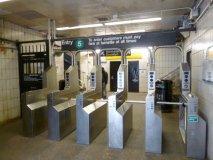
The exterior resembles Pelham Parkway (see Part 1) with a concrete exterior with an arch over the entrance. There’s a bench just past the entrance turnstile, and an indicator notifying patrons when a Manhattan or Dyre Avenue train is inbound (“From City” or “To City.”) Since this station now has the timers that show how long the wait is till the next train (most IRT stations had them by 2012) I’m not sure if the old indicator is working at all.
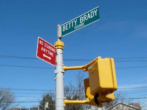
A street sign or two indicate Betty Brady Square, at East Gun Hill Road, Fenton Avenue, Knapp Street, DeWitt Place and Morgan Avenue. (The NYW&B, its attendant streets that run alongside and the overlying street grid make this a complicated intersection.) Betty Brady was a community volunteer and organizer associated with Holy Rosary Church. As it happens, the paperwork associated with the naming of the square in 1991 is all online. Everything was still done with typewriters then.
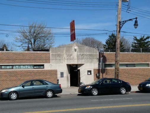
The Eastchester branch of the New York Public Library, which adjoins the railroad, arrived in 1985 — the building looks rather older than that, as it resembles the no-nonsense structures built by Works Progress Administration during the Depression.
Click on the photo for a bigger view. A Bromley atlas plate shows Ward 24, or Eastchester, in northeast Bronx. In 1906 this was still mainly farmland, with the just-formed NYW&B Railway plotted out in a straight line running SW to NE — I highlighted it in red. The waterway in the center of the map is Stony Brook, a tributary of Westchester Creek now buried in the sewer system. Though today’s street grid is mapped it would still be several years before any of the streets were actually built.
Only three roads were actually open, shown in pink: Boston (Post) Road on the left, Eastchester Road on the right, and the vanished Saw Mill Lane at the bottom.
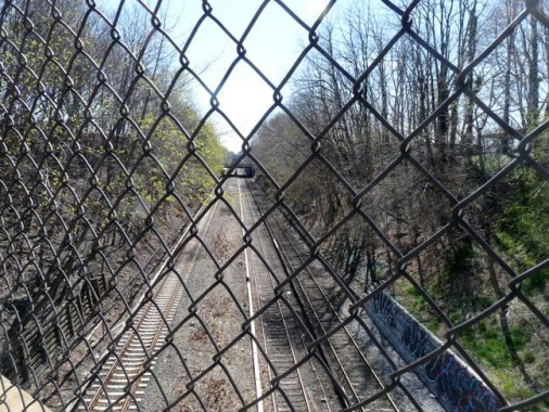
A curve at Fenton and Hammersley Avenues reveals the New York, Westchester & Boston in an open cut. Topography and street levels change quickly in the northeast Bronx and the NYW&B finds itself in tunnels, open cuts, embankments and elevated structures. A fellow named J. Hooker Hammersley owned a lot of Bronx acreage in the 1860s.
This large house at the corner of Hammersley and Eastchester Road boasts a huge lawn abutting the railroad. Now used as day care and a nursery school, it may have been a farmhouse at one time.
Eastchester Road, which connects Westchester Square with the NE Bronx Eastchester neighborhood, predates European settlement as it was once a trail used by the Siwanoy Indians.
Eastchester Road is bridged over the NYW&B tracks. The railroad used to have 4 tracks, but when the City purchased it and converted it to subway use, the inner two were removed in most stretches.
A look northeast on Hammersley Avenue toward Co-Op City, built in 1968 on land formerly used as a historical amusement park, Freedomland (1960-1964), which in turn was formerly swampland. In the early 1900s, roads were plotted to run through there, but were never built, but that is why the Bronx has Hunter, Boller, Palmer and DeReimer Avenues that have 50-block gaps between one piece of them, and another.
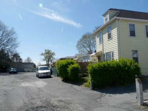
I’m attracted to alleys and dead-ends, the obscurer the better, and just north of the NYW&B bridge, there’s one called Fox Terrace, lined with one-family houses, trailing west on Eastchester Road. It’s 200 feet long and there are 13 houses facing it.
As I mentioned in Part One, the builders of the NYW&B were generous about planning for traffic below Pelham Parkway, with a minimum of interruptions — the railroad was elevated above the cross streets. When the NYW&B was being plotted out, the land was occupied by farms and the Morris Park Race Course south of Pelham Parkway (as you can see on this 1906 atlas plate — zoom in for a clearer view). North of Pelham Parkway, though, the railroad runs in an open cut below grade and when streets were built, they tended to be routed around it.
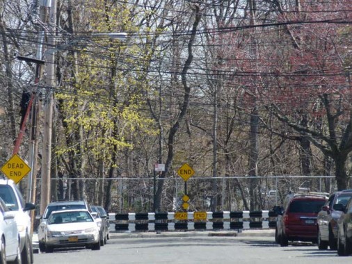
Here, I’m walking against auto traffic as Burke Avenue curves into Mickle Avenue. The ROW is guarded by a yellow concrete barrier with directional arrows. In this part of town, north-south streets are named for 19th Century mayors; Mayor Andrew Mickle served from 1846-1847. Other area avenues honor NYS Governors.
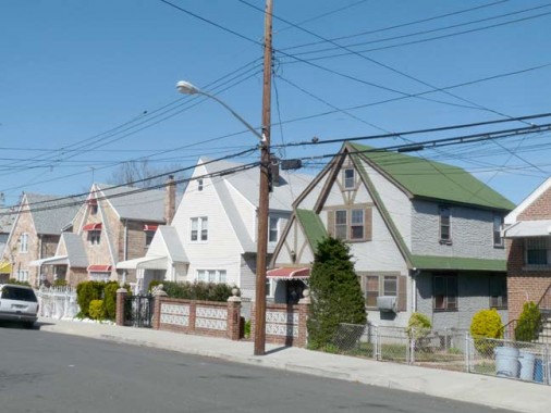
A look at Kingsland Avenue from both sides of Givan Avenue. There are some handsome peaked frame buildings — likely once part of a real estate development. The NYW&B ends Kingsland’s run here temporarily.
A couple of northern Brooklyn avenues and northern Bronx avenues share names. Both Greenpoint’s and Eastchester’s Kingsland Avenues are named for Ambrose Cornelius Kingsland (1804-1878) NYC Mayor from 1851-1853. The sperm whale oil merchant resided in Greenpoint, where he had a lot of acreage, and there is a short Newtown Creek inlet called Whale Creek Canal. Kingsland appropriated funds for the creation of Central Park.
Throop Avenue, in Pelham Gardens, and Throop Avenue, in Bedford-Stuyvesant, Brooklyn, are also named for the same person, Enos Throop (pronounced ‘Troop’), NYS Governor from 1829-1833.
Robert Givan
Scotsman Robert Givan arrived in the USA in 1795, establishing a mill in Westchester County; he and his family established a large estate north of what is now Pelham Parkway and east of Eastchester Road through which most of the neighborhood of Eastchester was established in the early 20th Century.
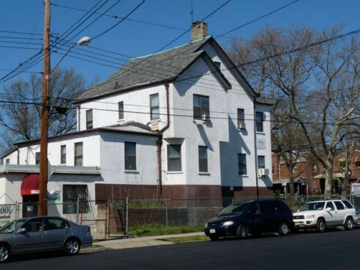
One of the former Givan mansions, hidden behind modern siding, can still be found at 2910 Mickle Avenue near Givan Square, at Gun Hill and Eastchester Roads. When you see a house facing athwart the street on which it is standing it’s a good bet that the house predated the street grid.
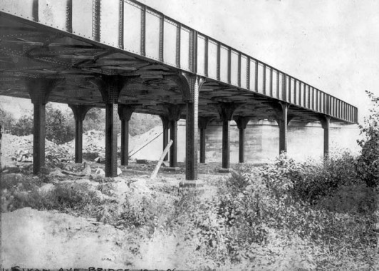
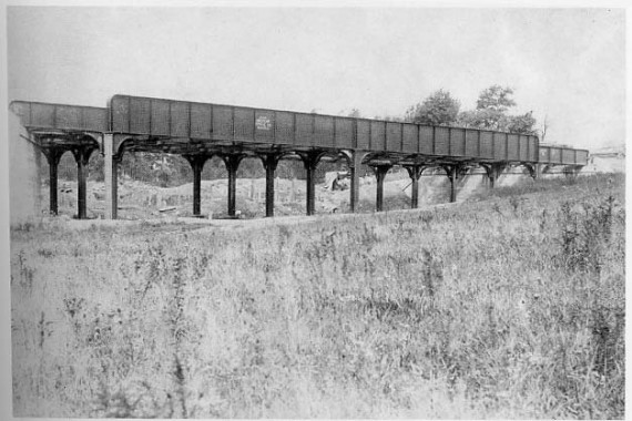
In 1906 the NYW&B railway builders anticipated the construction of Givan Avenue that would run through here, and constructed an overpass at what would be Wickham Avenue. At the time, though, the overpass stood in pretty much open country. Courtesy Robert A. Bang Collection, John Tolley Archive.
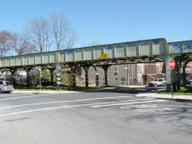
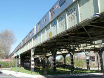
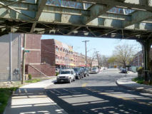
Today the rail bridge is exactly the same, while the modern #5 train uses the overpass. The road has been newly constructed under the railroad.
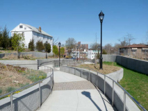
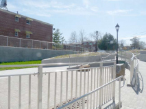
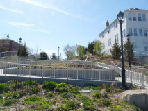
Turning north on Wickham, the next avenue encountered is Tillotson. I was surprised to find a brand new shiny park has been built on what was the former roadway between Wickham and East 222nd Street. It’s so new, signs haven’t yet been posted that identify it.
Both of these photos show the NYW&B railroad bridge crossing East 222nd Street, east of Ely Avenue. In 1906 when the RR was ran through, East 222nd was a dirt road. Courtesy Robert A. Bang Collection, John Tolley Archive.
This far north in the Bronx, especially in Eastchester in the shadow of Co-Op City, there are still a few reminders of a rural or suburban past. For one block between Ely and Grace, Tillotson Avenue has no sidewalks.
There is some older housing stock in northern Bronx. I think the small porch on the second floor of this Grace Avenue house is a newer addition; the concrete lawn and brick fence certainly is.
PS 169 (Baychester Academy) at Boston Road and Edson (not Edison) Avenue is actually brand-new, having opened in 2009. It was named the Willie Ella Paschal Bowman Campus after a local community activist and buinesswoman. The school replaced what had been the Baychester Diner.
The Baychester Avenue station, east of Boston Road, is directly under the RR overpass and architecturally, isn’t much to write home to Mother about. It’s the penultimate station on the Dyre Avenue line, which is uncharacteristic for what is nominally an IRT line with lengthy distances between stations, a sign of the line’s railroad pedigree.
I encountered Tillotson again and turned north on Boller Avenue, where there are a couple of interesting structures.
You could probably shave your beard with the peaks on this stucco-exterior house on Boller between Tillotson and Boston Road.
I’d like to know the story behind this group of stone buildings at 3434, identified as Belvidere XLIV (44) which has been divided into apartments.
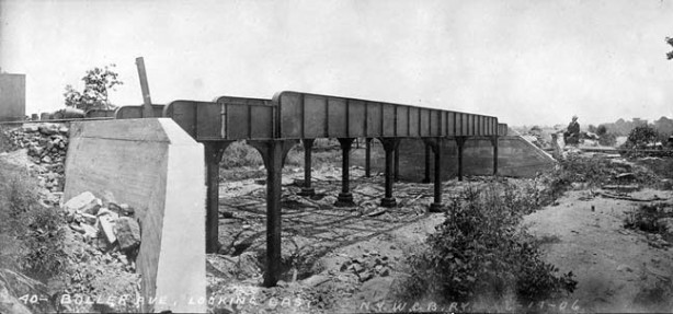
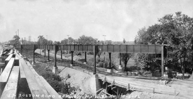
1906 view of the railroad bridge carrying the NYW&B over Boller Avenue. It looks as if the builders anticipated a wider road would be built through, but Boller is one lane only. Courtesy Robert A. Bang Collection, John Tolley Archive.
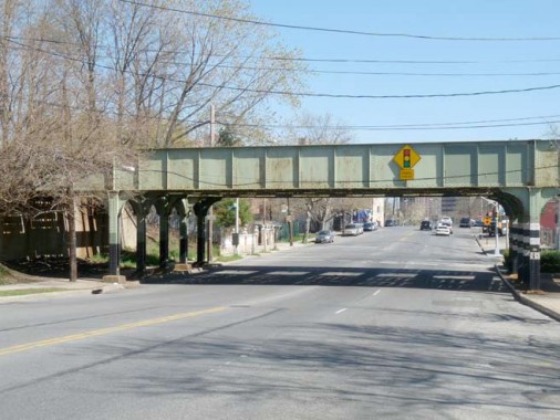
A couple of 2012 views of the Boller Avenue railroad bridge. Strictly speaking it’s a pair of railroad brudges connected by lengthwise girders.
Exposed rock outcroppings, the product of a glacier’s passage at the end of the Ice Age, are a frequent sight in northern Manhattan and much of the Bronx.
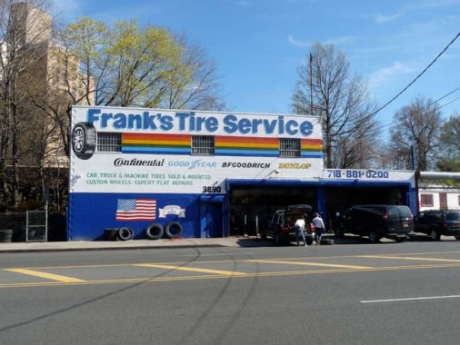
Till it roars past the city line and into Westchester County, Boston Road is pretty much lined with gas stations, auto repair palaces and tire replacement shops. But this one has a nifty painted sign.
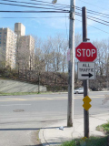
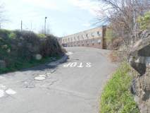
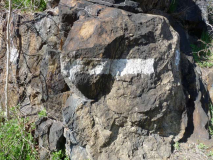
Though no street signs identify it this is actually the intersection of Boston Road and Needham Avenue, a directional arrow is painted on one of the rock croppings and traffic signs are mounted on what could be an old trolley pole.
When NYW&B builders ran through the railroad on a straight line in 1906, it had to cross Boston Road at an angle as it curves a bit to the northeast here. The road was just two lanes at the time, but later in the 20th Century two more lanes were added. The road is part of US 1 at this point. Courtesy Robert A. Bang Collection, John Tolley Archive.
2012. The city has added Twin versions of Corvington posts to illuminate the busy roadway here. I’m skeptical about this esthetically, since Corvs were never twinned during their first great run between 1900 and 1950. When Boston Road was widened, anew bridge replaced the older one.
Turning north on Harper Avenue, where you can occasionally see a train running in your backyard.
At Light Street and Harper Avenue we are almost in Mount Vernon and it’s getting to look fairly suburban. There are three streets in the neighborhood called Light, Dark and Lustre; Dark Street was named first, for a Charles Darke who owned the property through which the street was laid out. The other two were named whimsically in imitation.
Dyre Avenue
Dyre Avenue is a main traffic and shopping drag from Boston Road north into Mount Vernon, and the NYW&B built a station here that has become the end of the line for the IRT when it took over in 1940. It ia named for William Dyre, an early NYC mayor from 1680-1681. It was still a dirt road in 1906 when the railroad arrived. Note the gas lamp: though electric lamps were beginning to take over in 1906 there were still quite a few gaslights, and there would be until the 1920s. Courtesy Robert A. Bang Collection, John Tolley Archive.
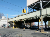
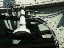
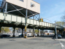
The Dyre Avenue trestle is today much the same except for the superstructure with station offices, added sometime during the 20th Century. One of the interesting aspects of the railroad bridge for me is a pair of nonfunctioning “crescent moon lamps” that illuminated the road underneath the bridge. These were installed about 1940 and might have worked into the 1980s or 1990s.
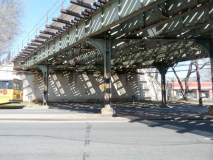
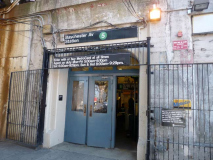
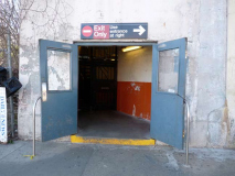
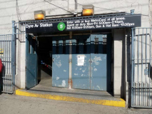
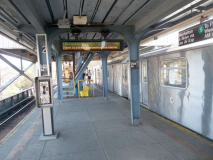
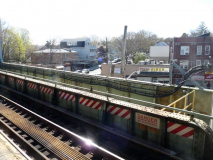
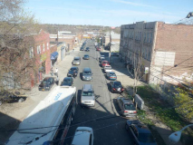
Some views from the station exterior, just inside the station, on the platform, and from the window of an idling #5 train. It appears that in the 1960s the station got the same species bricked tiles that IRT station extensions were getting then.
As I’ve said, the old NYW&B extended well into Westchester County (plans called for an extension into Connecticut but the road went bankrupt before that happened). There are indeed several station traces in Westchester, but I’ll let the NYW&B website handle those.
Are there other NYC subways that descend from railroads? At least 4 in southern Brooklyn do: the D train (West End steam railroad); B/Q (Brooklyn, Flatbush and Coney Island); F (Culver) and N (Sea Beach).
However, the NYW&B differs from them all because it is of more recent vintage and never used steam engines. It was designed to take electric power from overhead wires from the start. When the city bought it, it installed a third rail on the surface.
Sources:
History in Asphalt, John McNamara. Where it all begins.
The New York, Westchester & Boston Railway Company, Robert A. Bang. The NYW&B is surprisingly well-documented in print.
4/22/12


















55 comments
“When the city bouht it, it isntalled a third rail on the surface.” 2 typos.
‘bought’
‘installed’
Fixed. Thanks. But to be honest, some people seem more interested in spotting typos than with the content of the articles.
Yeah, the Internet tends to breed some crotchety types who love to complain about other people’s mistakes, while they themselves haven’t produced anything. Nice work Kevin, as always.
“…love to complain about other people’s mistakes, while they themselves haven’t produced anything”
Non-sequitur.
Complaining about something does not require producing anything.
There’s some really cool parts of this railroad you still haven’t covered!
North of Dyre Ave station there were actually two original stations, and more original embankment for a couple blocks. At E Kingsbridge Rd is a strange old bricked up structure, a station house for Kingsbridge Road Station, and traces of the concrete walls that hold up the trestle and so ballast doesn’t spill onto the street.
East of the NYW&B 180th Street Station the ROW can easily be seen. There are remnants of the ramp in between 178th and Wyatt Streets that would connected have connected it with the bend in the Amtrak line slightly south of it.
That To City/ From City sign at the Gun Hill Rd Station work until 8 months ago.
The sign shown in the article must be a different one, because this view from 2015 had the “To City” on the left and “From City” on the right.
https://commons.wikimedia.org/wiki/File:Pelham_Pkwy;_NYW%26B_To-From_City_Lighted_Sign.jpg
It’d be disappointing if none of them are working. Those are some seriously impressive artifacts.
Ironic about the typos comments, because I thought I caught one as well, but instead learned a new word!
a·thwart (-thwôrt)
adv.
1. From side to side; crosswise or transversely.
2. So as to thwart, obstruct, or oppose; perversely.
prep.
1. From one side to the other of; across: “the Stars that shoot athwart the Night” (Alexander Pope).
2. Contrary to; against.
3. Nautical Across the course, line, or length of.
And no, I’m more interested in the content 🙂
The Bowery Boys did a piece and podcast on Freedomland. I remember doing there.
http://theboweryboys.blogspot.com/2009/02/podcast-freedomland-usa.html
The Bowery Boys did a piece and podcast on Freedomland. I remember doing there.
Typo: is it ‘doing’ or ‘going’?
***Just playing around and having some fun! Great site Kevin!!
we used to swim in the creek before they built Freedomland. a great place with class AAA entertainers every week. if you didn’t mind getting your clothes wet you could enter in Little Old New York after a short wade in the narrow creek. it was a great idea but it was in the wrong part of the country it only opened half the year. when they built Co-Op city the pumped sand from orchard beach for a couple of years to fill in the water, and pile drived steel halfway to china and it still started sinking about 4 years after it was completed. and the baychester diner was good but the wayfarer on baychester and strang was better
You got that right,,, the Wayfair Special after a night of drinking was the best! and way before that.. how about taking the sled down Adee ave all the way to Bruner !
I remember going there as well. The link provided didnt’ work for me, but I found it eventually here: https://omny.fm/shows/the-bowery-boys-new-york-city-history/77-freedomland-u-s-a-new-yorks-weirdest-theme-park
Whats a “historical amusement park”?
One where all the rides are themed from events from american history?
Historically-themed.
I LOVE the content!! Please keep doing this, I love everything about this site (typos and all) and I’m not even from New York!
Most of the people reading this site are from New York, such as I. And, great job on the website and the walks, Kevin.
Also, I care more about the content than the typos on the site, like That Guy mentioned above.
“Are there other NYC subways that descend from railroads? At least 4 in southern Brooklyn do: the D train (West End steam railroad); B/Q (Brooklyn, Flatbush and Coney Island); F (Culver) and N (Sea Beach).”
…and of course the “A” Rockaway branches, descended from former LIRR steam (and later electric) lines.
Great pages as always!
Great walk! It’s a shame Westchester County didn’t keep more of the NYW&B (or the Put) as a mass transit entity of sorts. Especially for the city next door Mt. Vernon which lost 5 train stations once it closed.
I read Harwood’s book on the NYW&B. The line never had enough ridership to be profitable. Built like a rock, beautiful stations and electric trains, but couldn’t compete with the existing lines and burgeoning roads. Why would Westchester Co. have kept the line running?
Nobody even knows why Morgan built the line – he surely knew it would have to split traffic with the Harlem Line.
As for lines that used to be railroads, wasn’t part of the Steinway line originally a trolley tunnel under the river?
Oh, and thank you, Kevin. Having read the book, it’s good to see what is left today.
Yes, it was built in the 1890s as a trolley tunnel, but was never used as such. It opened in 1915-1917 as the Manhattan-Corona line, later Flushing Line. What a golden age for transit building 1885-1935 was.
re “This far north in the Bronx, especially in Eastchester in the shadow of Co-Op City, there are still a few reminders of a rural or suburban past. For one block between Ely and Grace, Tillotson Avenue has no sidewalks.”
I vaguely recall in one of Chester Himes’s Coffin Ed/Digger Jones Harlem detective novels that they had to see someone in that area and described it as populated by Italian farmers and goatherds, with very few houses. And that was some time in the mid-20th cent. In that same novel they referred to someone at the passenger docks in Hells Kitchen as a “Hoboken drunk,” as if that was a generic term of abuse, or even an accepted descriptor. Things have really changed.
Great series. The outer end of the Canarsie line was also a steam railroad – the Canarsie and Rockaway Beach.
Re the “Hoboken drunks”–they still exist. Now they are rowdy yuppies from bars….( google recent news about drunkeness in Hoboken)
Back in HS, I used to have a great time digging in one of the NYWB midden piles alongside the ROW in New Rochelle near the Quaker Ridge house/station. Still have some of the intact patent medicine and beverage bottles. We brought our Pocket Rockets along to finish off the incompletely broken ones.
Re: “For one block between Ely and Grace, Tillotson Avenue has no sidewalks”
Correction: Tillotson Avenue does not have sidewalks only on the half-block closer to Ely Avenue; the Grace Avenue side of the block does have sidewalks, but they dead-end in the middle of the block.
“Turning north on Harper Avenue, where you can occasionally see a train running in your backyard.”
Yeah, like any homeowner would enjoy all that NOISE every day and night, 24/7. The trains make so much noise, I’m guessing they can’t even sleep because every 20 minutes a train comes speeding by with their loud wheels and braking sounds!
“It appears that in the 1960s the station got the same species bricked tiles that IRT station extensions were getting then.”
And later, the BMT.
Other that that, great job on the website and the tours, as always.
i lived on Amundson Ave. off of 233rd st. i could here the dyre ave. train and the White Plains Rd, train, not to mention the accelerating buses. had no problem sleeping unless it was really hot. after moving to Ct. my wife and i had trouble sleeping because it was so damn quiet outside
Also, the NYW&B ROW continues until the Bronx county border after the Dyre Avenue station.
One can see an archived 1961 B&W advertising film for the “Freedomland” amusement park at:
http://archive.org/details/TravelTimeFreedomland
One can see an archived 1963 B&W advertising film for the “Freedomland” amusement park at:
http://archive.org/details/TravelTimeFreedomland
For those who are inclined to travel up the NH ROW toward Stamford, notice that just north of New Rochelle (a.k.a.: Nurshell) there seems to be space enough for two more tracks. That space is, in fact, more “Westchester” ROW that ends at Pot Chestah Station. Just north of New Rochelle it scoots west across I-95 just before the station. The exit ramp from southbound I-95 (the one with the small stone block bldg) is a remaining part of the ROW. From there it loops around, joins the part that went as far as downtown White Plains and finds its way to Dyre Ave.
Just north of Larchmont, between I95 and the NH ROW exists a small red brick building which was a station for the B+W and converted years later into the local Girl Scouts building. I recall being in the building and seeing the covered-over tunnel portal which led underneath the tracks to the Northbound side.
Never understood the drive for parallel service with NH – looking at all the numbers and the characters involved, maybe much of it was real-estate profit driven.
The new crew room at Dyre Avenue was built in time for the spring pick in 1985. We even moved the checkerboard up from East 180th Street crew room to make it “official!” (A crew room in the subway was Not Real, at least when I worked there, unless it had a checkerboard, no matter how fancy or shabby, or if there are even checker pieces — Flatbush Avenue crew room in the ’70s and ’80s had a pathetic little checkerboard painted on the old wooden table.)
I can date the opening of the new Dyre crew room because I was working there in June 1985 when I went to sign in one Saturday morning and there was a note “See Dispatcher” (*never* a good omen). My mom had died suddenly in Albany Medical Center late Friday night, and my aunt had called the Dyre Avenue Train Dispatcher to have them tell me because she figured out (rightly) that I’d freak out if she’d called me when I was at home by myself. She called the Dispatcher, he got someone to cover my job, and the Dispatcher and my Conductor (along with a couple of the other guys) helped me get my head back on straight enough to be able to go home and do what I had to do and head upstate.
what a sad but nice story, i have many fond memories of Dyre Ave. in the late 50 and most of the 60s.
love that sign on Boston Rd. anyone remember the original Wedge Inn on bosto rd. when it had the draw bridge? or Tucci’s, Hickey’s or the Lodge on Dyre Ave. How about the Horseshoe Bar where Praise cleaners now stands or used to? Dark St. is one short street it is also wher P.S. 15 stands , now a historical site on Dyre Ave. it looked ancient over 50 years ago.
Coming into this site a little late, but you brought back memories for me. I saw that you lived on Amundson, we lived on Secor.
of course the Wedge Inn, and Hickey’s (best hamburgers, on toasted bread), and Tucci’s- great. My mom had gone to PS 15.
Thanks for the reminders.
What exactly was the part that was torn down in 2003 used before it finally met its demise?
The section of the NYW&B ROW south of the 180th St station was demolished in order to expand NYCT’s Coliseum bus depot. That structure wasn’t being used and hasn’t been used in many years.
I grew up in the Dyre Avenue neighborhood and can identify the group of stone houses at 3434 Boller Avenue (“I’d like to know the story behind this group of stone buildings at 3434, identified as Belvidere XLIV (44) which has been divided into apartments”) as part of a motel-type business for lodging that included wood frame cabins as well as the stone structures that remain. Through the mid-1960s a billboard that read “Cabins” pointed in from Boston Road where the rock outcropping still flanks both sides of Boller Avenue.
The painted arrow on the rock outcropping across Boston Road at Needham Avenue indicated the driveway for the Eden Motel which is the low-rise building viewed on the slope in the background. It was one of several motels built around 1960 which presumably accommodated travelers to Freedomland– before they became dens of ill repute or housed welfare recipients.
My mother was born in the Givan Mansion home on Mickle Avenue. My grandfather had the farm there up until the early 40s. Then the family moved to Throgs Neck. When we were kids we lived at 2932 Mickle, and the Givan mansion still had chickens running around, that was in the early 60s. BAck in the 30s they were doing repair work on the grand staircase and found a box with gold coins in it fron the 1800s, not sure how much, but it prompted my grandfather’s brother to dig up half of the basement, in this house, and his sister’s home around the corner on Kingsland Avenue.
As always, very nice work. I enjoy all of these postings.
Happy Holidays
I recall the day that I stepped off the #2 train at Dyre Ave. (this was the first line to run to Dyre Ave, then in 1965 NYC Transit swapped lines with the #5) and the whole top and side of the Dyre Ave. train station had blown away down into an adjacent valley. Being only 10 years old at the time I thought that a tornado had hit he area when we were let off the train on to the platform. I was in the the 5th grade at the time and the calendar year was the beginning of 1959. I was returning to our new home in the vicinity of Dyre Ave. from my school in my old neighborhood in the mid Bronx.
Until about 1963 the #2 train, which had 9 car consists at the time, was stopping at the 5 NYWB stations, but did not open any of the trailing 4 cars since the platforms only covered the length of 5 cars.
“As you can see, when Boston Road was widened, reinforcing concrete pillars were added to support the RR trestle.” The entire bridge was replaced, not just the pillars and it was done after the railroad had stopped operating but before it became part of the NYC Subway system.
Thank you — fixed.
I have a rare book called “Westchester’s Forgotten Railway” by the late Roger Arcara. It was originally published in 1961, and there is a 1972 add-on within the same book. Roger Arcara’s NYC’s electric rapid transit, trolley & urban/intraurban bus DVD’s can be purchased here : http://backinthebronx.com/trolleys.php?prod=portable001 .(many Dyre Avenue Route scenes !).
Hi..3434 were cabins long ago…I walked passed it twice a day from Dyre ave to Baychester for school..The sign was large and was still there until at least 1976..maybe later…One could rent a cabin for the day…Cheers, Rick D.
[…] Bronx Tracks: A meticulous truly adventurous walk along the old New York, Westchester and Boston Railway in the Bronx, with sights along Gun Hill Road, Dyre Avenue and stops near the old Freedomland amusement park. [Forgotten New York] […]
[…] Also just above Pelhamway Parkway in 1895, a map shows the world “Connersville” named after a small community of homes in the area, with one landowner being the Conners family I believe? (Pg. 342) The huge Givan estate was located off of Eastchester Road in the vicinity of the 10469 Post Office (a Givan home “pre street grid” can be seen behind it today, pictured at left, down the street form the Holy Rosary Parking lot.) Photo via Forgotten NY (check out their cool article on the area here.) […]
[…] Bronx Tracks: A meticulous truly adventurous walk along the old New York, Westchester and Boston Railway in the Bronx, with sights along Gun Hill Road, Dyre Avenue and stops near the old Freedomland amusement park. [Forgotten New York] […]
Great site! Does anyone know of a similar website on the route as it continued into Westchester? I just found out about this railroad today after I saw the White Plains Greenway in Google Maps and looked it up. Never knew that so many odd-looking sites in Mount Vernon, Scarsdale, and elsewhere in Westchester were actually the remains of a railroad!
I was recommended this blog by way of my cousin. I am no
longer certain whether or not this submit is written by means of him as nobody else realize such targeted approximately my problem.
You’re wonderful! Thanks!
I’m fascinated by the history of this railroad, and it’s remaining traces. I live in Mount Vernon, and had always wondered about the high concrete embankments near the city line (both sides of East Kingsbridge Road and the west side of South Third Avenue), among lots of other little oddities. The one day I saw White Plains Greenway in Google Maps, which I’d never heard of. Looked it up and learned about the railroad. ☺️
Re: Freedomland, there were some paved and signed streets there prior to the park being built, but I don’t know if they ever had houses on them. When I was a kid living in New Rochelle, I used to ride my bike down and poke around there in what was pretty much swampland with a semi-paved grid. One tale, told second-hand, was that there were some homes there but they were washed away in the great hurricane of 1938. It makes
sense, but I can’t guarantee the veracity.
The last piece of track north of the Dyre Avenue station was still in place to the Westchester County line last time I checked the area, perhaps a dozen years ago, used for train storage. I was on a New York Transit
Museum excursion that travelled on it up to about 100 feet shy of the railhead, and I was lucky enough to have captured a spot at the front window. It’s as close as I’ll ever come to riding on The Westchester, as it was
known colloquially. At the time of my travel, the rails petered out into some woods, but there is now industrial development there according to Google satellite view. Another interesting fact is that the distance between
the Dyre Avenue and Kingsbridge Road stations was the shortest between any two stations on the line, about 1/3 mile. Googlemaps still marks the “NYW&B Kingsbridge Road Station” despite the fact that it is a ruin that last saw action when the wrecking trains came through in 1942.
One last note: the thought behind the NYW&B paralleling the New Haven east of New Rochelle was to reduce overcrowding on the New Haven. Westchester trains generally departed 10 minutes before New Haven
trains, and of course both lines had common ownership, at least at first. When built, the track east of North Avenue station switched into the New Haven at a point near or within the Cedar Street Interchange of I-95, but
that connection was never used in revenue service. There was also a never-used switch tower built at that junction, according to research I’ve read. The junction was removed when the NYW&B was extended, and I have seen one photo of it.
Thanks for keeping the memory of this wonderful failed experiment alive. Forgotten-ny.com is wonderful!
Gun Hill Road and Throggs Neck are two words each, not run together like that. First I’ve heard of that nonsense!
Speaking of Throgs Neck, I was astounded to heard the Ft. Schuyler was gone. I spent some time there as a kid, since my father was into Navy stuff…
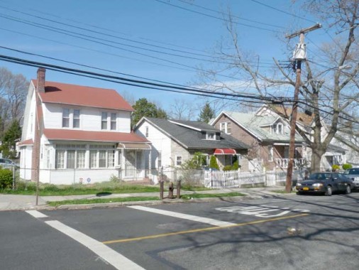
I remember doing a service call somewhere in that eastern section of The Bronx, and what struck me at the time was how *small* the house was. Set among a
whole community of these really tiny houses. The word “bungalow” comes to mind. I was of the impression then that these were not made to live in all year round,
but were there for people to come and stay in during the summer time, what with the proximity of Pelham Bay Park and Orchard Beach. Any ideas about this
place?