It was the first really hot day in May (2017), and I went forth to DUMBO on a mission. As it turns out I had to abort the mission, as you will see later, but I did get a good walk in and had plenty of photo opportunities. I usually find myself in DUMBO in the cold months, when shadows are long and good photo ops are few. I actually was there every day in early 2015 as I had a temp job with the educational publisher, Amplify, which was located on Washington and Water Streets. In contrast with recent winters, 2015’s was stone cold and there were few chances for me to get about and take photos; I just got lunch and came back and ate it at my desk (no cubicles, which are being phased out in workplaces). Thus, I relished a chance to get some DUMBO shots in full sun. I also learned that the mustard they use on sandwiches at La Bagel Delight, Front and Adams, is incredibly pungent and will clean out your sinuses in short order.
Today I did something a bit different from my earlier DUMBO explorations. I frequently go east into Vinegar Hill (which I explored in detail on this FNY page) but also walked along Navy Street past the Navy Yard and into Fort Greene, as I wanted to check the progress of something. What was I checking? You will find out below.
My route: GOOGLE MAPS: DUMBO and FORT GREENE

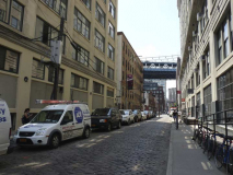
John Street looking east from Pearl Street in front of the new glass-walled condominium, #1 John Street, which features 42 apartments that are between 2500 and 3000 square feet each.

Jay Street Connecting Railroad tracks set amidst Belgian blocks at John and Pearl Streets.
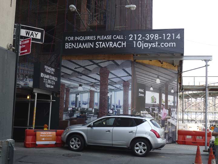
A warehouse building at John and Jay, #10 Jay, is being reconfigured as offices. The building was constructed in 1897 by the Arbuckle Brothers, previously mentioned in Part 1, as a sugar refinery, part of their coffee importing business (sugar was used as part of the preservation process). 10 Jay was the first structure in the area with brick curtain walls hung on a steel frame. The building housed machines used to fill, weigh and seal bags of coffee until it was shut down in 1945. Various tenants employed the structure for the next few decades until its current conversion.
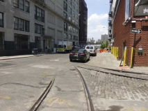
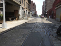
Plymouth Street is my favorite street in DUMBO, as it still has its naked Belgian blocks and track switches for the JSCR are quite visible. As stated in Part One, the city is taking a look at these unevenly paved roadways. Bicyclists are now a favored group in NYC, and City Hall has heard complaints of bicyclists new to the area getting their spokes rattled, and it’s likely that these bumpy bricked roads will be evened out somehow, losing some of their character.
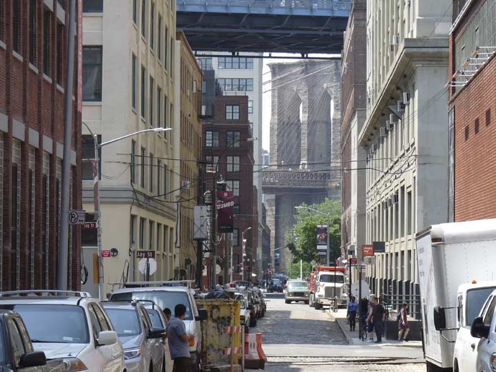
I used my zoom feature to get this shot of the looming Brooklyn Bridge beneath the Manhattan Bridge from Plymouth just east of Jay.
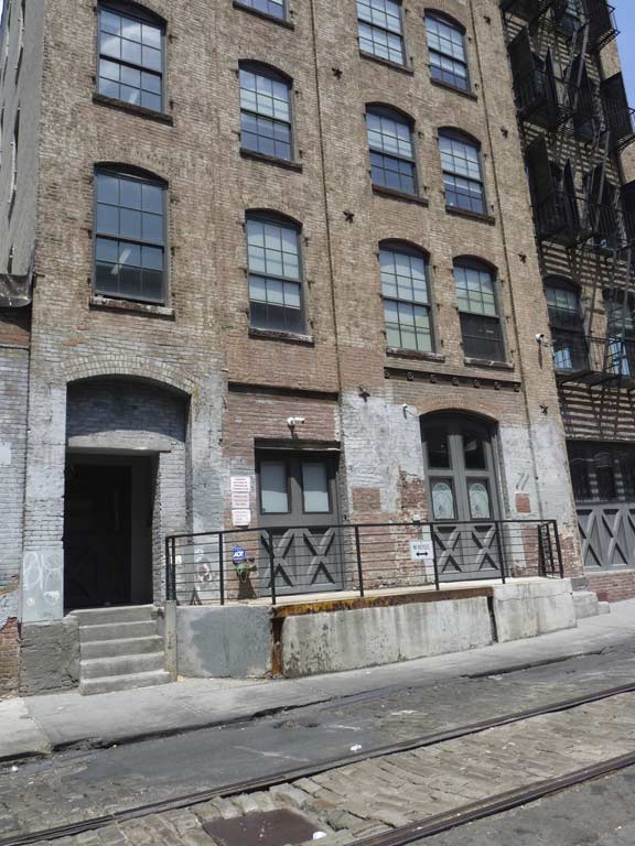
In some spots, Plymouth Street is sidewalk-free. 195 Plymouth, a very old building (1892) evidenced by the visible iron tie rods used to hold up the walls, still has its loading dock. The building is now used for temporary offices; this site has some interior views.
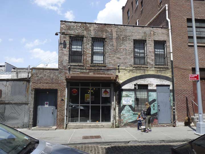
Chabad of DUMBO (DUMBO Gan), #205 Plymouth. Founded in 1775 by Rabbi Schneur Zalman of Liadi, the name “Chabad” (חב״ד) is a Hebrew acronym for Chochmah, Binah, Da’at (חכמה, בינה, דעת): “Wisdom, Understanding, and Knowledge”. It is a school of philosophy in the Jewish religion, mainly with Orthodox and Hasidic Jews. “Gan” is “garden” in Hebrew and in this case indicates a day care center.
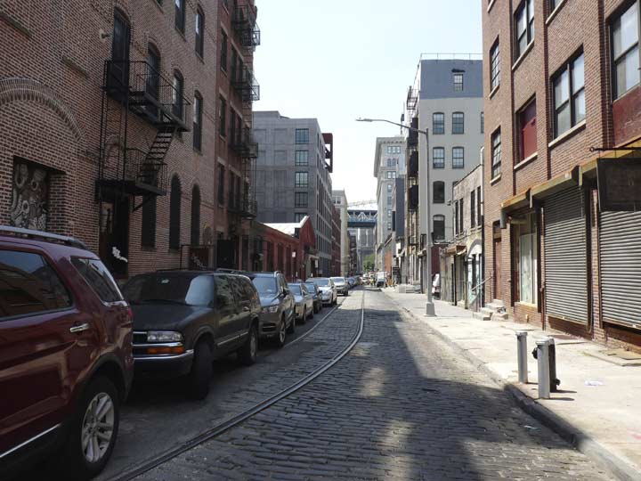
Another look west on Plymouth between Jay and Bridge Streets.

Split Level art gallery, 213 Plymouth Street, actually part of the brick factory facing 32-34 Bridge Street, constructed in the 1890s for the Howard & Fuller Ale Brewing Company and later owned by spring manufacturer Miller & Van Winkle Company. Thus the building has been home to companies that brewed beer and during World War I, manufactured five million springs for gas mask canisters, three million for Browning machine guns, and ten million miscellaneous springs according to the NYC Landmarks Preservation Commission DUMBO Report, page 29. (Just about every building in DUMBO is described therein.)

37 Bridge Street, at the corner of Plymouth, was built in 1915 as the last of the Kirkman and Son soap empire buildings. The British manufacturers John and Alexander Kirkman moved to Brooklyn in 1880 after some decades in Manhattan and produced borax soap, octagon soap (soap shaped like an octagon so that it could easily be held), soap powder, softener, floating soap, and cleanser. Kirkman owned several buildings in this neck of DUMBO from the late 19th into the 20th Century, and on a jaunt to DUMBO in 1998-99 or so, I photographed the painted name “Kirkman” on Bridge Street, but it has since been painted over. In 1930, the company was sold to Colgate-Palmolive, which maintained it as a factory until the 1940s. In recent years, the building has become luxury condos, but the conversion did preserve its original brickfaced factory appearance.
Bridge Street, which predates both the Brooklyn and Manhattan Bridges on Brooklyn maps by over a century, is named for a bridge that was proposed, but never built, from its East River landing to Manhattan.

I don’t know how I missed it but on the corner of 28 Bridge at Plymouth, but there’s a painted ad on the Plymouth Street side, a vertical ad saying PEERLESS PAINT and in smaller letters, AND VARNISH CORP, and an OFFICE sign with a human hand pointing to a door. This was another building in the Miller & Van Winkle spring empire, constructed in 1912. It was leased to Peerless in 1944, meaning those signs can be no older than that date.
East of Bridge Street, the huge brick factory buildings cease, and we enter an area of empty lots, interspersed with brick dwellings that begin to be more frequent as you walk east. This is Vinegar Hill, much different in character both from DUMBO and from Brooklyn Heights.
John Jackson purchased its land from the Sands brothers (for whom Sands Street is named) around 1800. Jackson actually hoped to attract Irish immigrants in an era when Irish were otherwise unwelcome. He named his tract Vinegar Hill after the site of a fierce battle in the unsuccessful Irish rebellion of 1798. In Ireland, the name “Vinegar Hill” was an English transliteration of an Irish Gaelic term meaning “hill of the wood of the berries.”
Vinegar Hill has three areas under protection from the Landmarks Preservation Commission: dwellings along Front between Bridge and Gold, the corner of Gold and Water, and along Hudson Avenue between Bridge and Front.
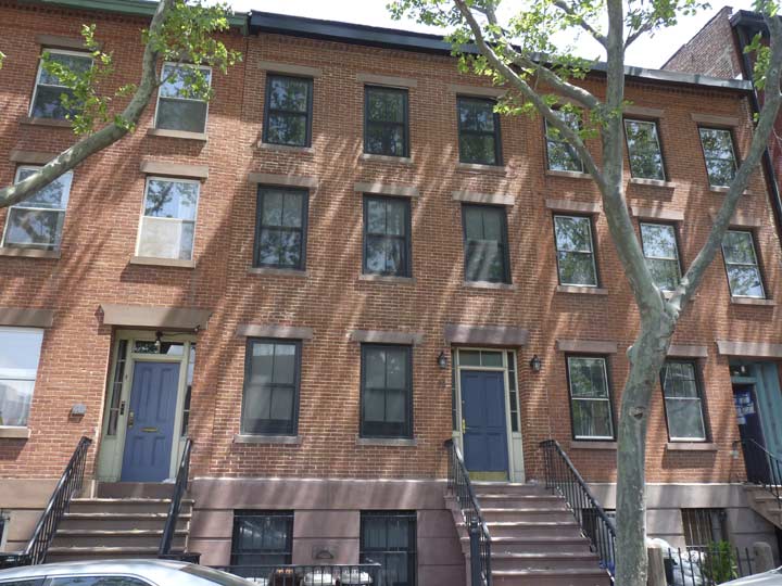
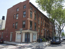
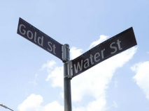
Gold and Water Streets were laid out to intersect long before there was a senator from Arizona named Barry Goldwater who ran for President in 1964. 69 Gold, on the corner of Plymouth, and the trio of townhouses, 71 to 75 Gold, had all been built by 1850 and all are in excellent condition today.

Looking north on Gold Street toward Manhattan and the King of All Buildings past the massive Con Edison generating plant, spread along the East River from Jay Street to the Navy Yard Basin, an inlet of the East River. Electricity has been generated here since the 1920s; before that, there was a huge plant manufacturing white lead, a compound used to make lead-based paint. Its use has been discontinued because it tended to cause lead poisoning.
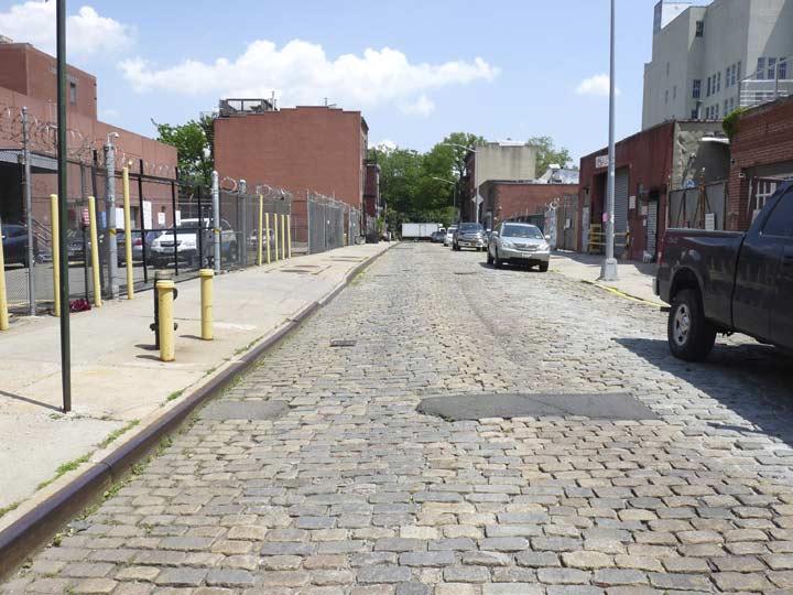
Water Street between Gold and Hudson Avenue. Can its uneven Belgian blocks survive city scrutiny? This stretch of Water Street faces parking lots and storage building entrances, but there are a couple of notable exceptions toward the east end of the block…and that’s where there’s a small piece of Landmarked territory.
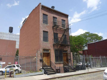
For some reason 310 and 311 Water Street are NOT included in the Vinegar Hill Landmarks designation Report, but I think they should have deserved protection for surviving this long. Both are 3-story brick residences surrounded by parking lots, likely constructed in the same era the landmarked buildings across the street were, in the post-Civil War era, 1865-1875.

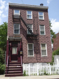
312 Water Street, south side near Hudson Avenue, is an Italianate multi-family buildings constructed by grocer John Shutte, who also built several buildings around the corner on Hudson Avenue, about 1870. The small bathroom windows were added by the Italian company that owned the building by 1916.
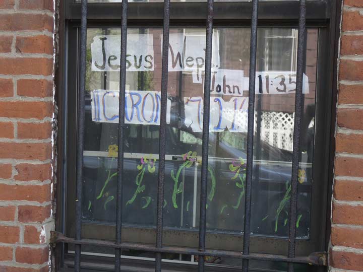
John 11:35: Jesus wept. (the shortest sentence in the New Testament)
II Chronicles 7:21: This temple will become a heap of rubble. All who pass by will be appalled and say, ‘Why has the LORD done such a thing to this land and to this temple?’
As Google Street View indicates the Bible verses in the window at 312 Water Street change from time to time.
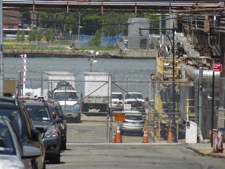
ForgottenFans know I’m always seeking out ancient lampposts and uncovering traces of them all the time. There’s one post that will forever remain the Holy Grail because it’s on the corner of Hudson Avenue and Marshall Street…completely within Con Ed plant territory. No cajoling the man at the gate would allow entrance….I’ve tried. As Yogi might have said, there’s more than one way to kill a dead cat, and thankfully, with my 18-inch zoom lens, I’m able to stand at Hudson and Water and get as good a shot as I think any non-Con Ed employee can get of this ancient Corvington.

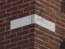
Evocative view of Hudson Avenue looking north toward the huge Con Ed plant smokestack. The building on the corner of Hudson and Evans Street was built around 1850. Two small signs on the corner above the second floor window indicate this used to be the corner of Jackson (Hudson) and Water (Evans). Jackson was named for Vinegar Hill’s original developer John Jackson, while Evans used to be an eastern extension of Water. Samuel Evans was a Commandant at the Navy Yard and ran one of the East River ferries.
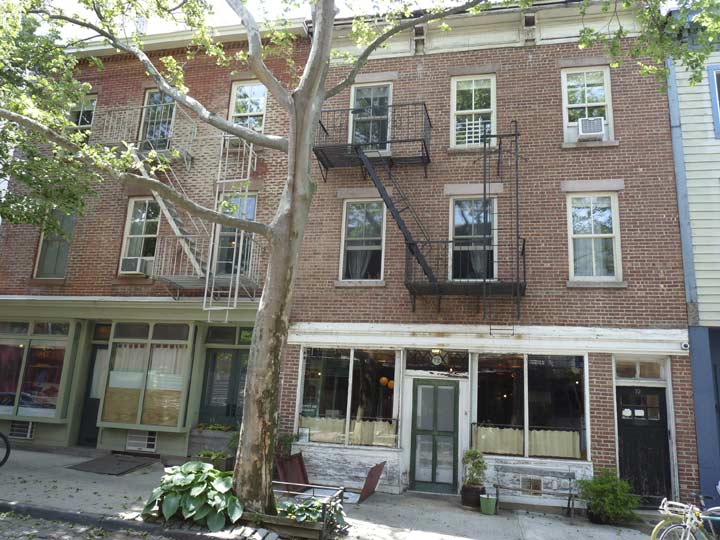
72 Hudson Avenue, built around 1870 by grocer John Shutte, houses the first restaurant (or retail business of any kind) to open in the neighborhood in decades, the Vinegar Hill House, opened by a couple who met working in Freeman’s (on Freeman’s Alley in Manhattan).
I won’t cover Hudson Avenue’s buildings in detail here, since I’ve done it previously on this FNY page, but I’ll repeat a bit from that page here. In any case, if you can get over to Vinegar Hill, prepare yourself for a Brigadoonish Brooklyn that has not changed in decades.
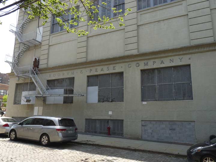
Boorum and Pease was one of the major businesses that called Vinegar Hill home. The company manufactured and marketed office supplies, record-keeping supplies, and information storage and retrieval products, and was a leading manufacturer of blank books and loose-leaf binders. The company had an office and factory for many years in Vinegar Hill here at Hudson Avenue and Front Street, and many Vinegar Hillers found employment here over the years. B&P, which had moved to Elizabeth, NJ, was acquired by Esselte Pendaflex in 1985.

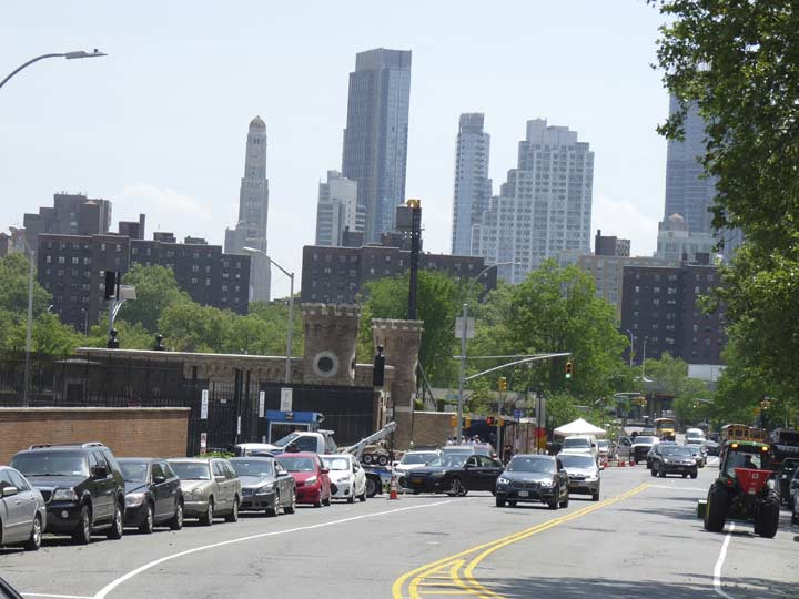
At Front Street, Hudson Avenue jogs southeast, becoming Navy Street and running along the west side of the Brooklyn Navy Yard. Until the 1940s Hudson Avenue had run continuously south to Fulton Street, but the construction of the Farragut Houses and the Brooklyn-Queens Expressway took out most of that stretch; one short block between DeKalb Avenue and Fulton Street remains in downtown Brooklyn.
As Navy street makes the curve, the Revolutionary War Martyrs’ Monument in Fort Greene Park becomes visible, along with the new towers of downtown Brooklyn joining the 1929 Williamsburg Bank Tower, now #1 Hanson Place.
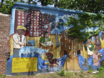
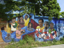
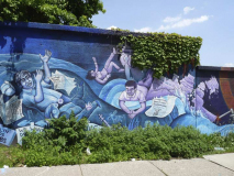
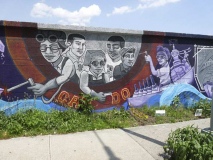
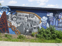
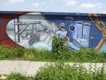
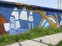
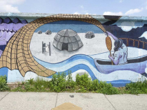
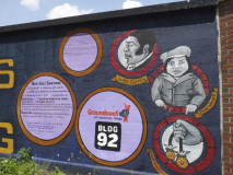
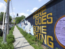
Painted on the Navy Yard brick wall is an engaging mural conceived by Tanya Lynn Albrigtsen-Frable and painted by her with the assistance of young artists and volunteers. Depicted is the history of the Navy Yard from its 19th-century beginnings to the small business and design hotbed it is today.
“Here Goes Something” celebrates the rich and vibrant history of the Brooklyn Navy Yard. The mural was created by 19 fourth and fifth grade students from PS 307. At the start of the mural design process, the group received a tour of the Navy Yard from its education staff and participated in in-depth discussions about its history. The mural tells the story of the Navy Yard from right to left. It begins with the indigenous Lenape people who inhabited the land before the Yard existed; it then travels through the industrial revolution and ends with a broadcast tower. Interspersed throughout the mural are hints to the different types of ships that have docked there over the years. Many of the youth live across the street from the Navy Yard but had never been inside this modern industrial park, and they were excited to paint a wall that they and their community would see everyday. [groundswell.org]
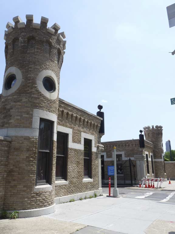
The entrance to the Brooklyn Navy Yard, at Navy and Sands Streets.
The New York Naval Shipyard, known popularly as the Brooklyn Navy Yard, was established by the federal government in 1801. Robert Fulton’s steamship Clermont was built here and launched in 1815; the battleship Maine in 1890, as well as the first angled-deck aircraft carrier, the Antietam, were also built at the Navy Yard.
The Navy Yard at its peak just previous to World War II employed 10,000 workers. It has 5 miles of paved streets; 4 dry docks (including the nation’s oldest, which began construction in 1840) ranging in length from 326 to 700 feet; two steel shipways; and six pontoons for salvage work. The Navy Yard was decommissioned in 1966 and is now a center for private manufacturing and industrial parks (including a branch of Steiner Movie Studios), and is still, unfortunately, closed to the public except for the occasional tour and those who have passes to get in.
As it happens Navy and Sands was one of the childhood homes of one Al Capone.
When little Al came along, the Capones lived at 95 Navy Street … bordering the New York Naval Shipyard — better known as the Brooklyn Navy Yard. Predictably, the neighborhood was rough, Sands Street especially. Conveniently dead-ending on Navy street at the Navy Yard gate, Sands offered all the diversions suggested by the phrase “drunken sailors.” …Sailors could swagger into the salons that lined sands, then stagger out to the attendant pickup dance halls, brothels, hot-bed rooming houses, pawn shops and tattoo parlors. Sands was a street, as one of its historians put it, “of cheap liquor and even cheaper women.” —Mr. Capone, Robert J. Schoenberg
Sands Street is still rough — it’s now the main east-west bisecter of the Farragut Houses.
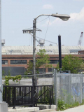
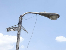
Although a stroll around the Navy Yard is still verboten for riffraff like me, I was able to snap a curiosity just outside the front gate: one of the Navy Yard’s older streetlamps, complete with a “new-look” Westinghouse OV-25 Silverliner from the late 1960s, complete with a vinyl street sign.
Silverliners are now rare in the five boroughs, but between 1960 and 1972 they duked it out for supremacy on NYC streets with the General Electric M-400. The species is still rather common outside NYC, but the elimination process by Light Emitting Diode lamps is slow and inevitable.

Meanwhile, the Navy Yard has installed a new series of what appear to be solar powered streetlamps. I know little about these, though, so if anyone does, fill me in.

The Kings County Distillery has leased part of the Navy Yard gatehouse. This is the retail branch of the actual distillery, which is located in the Paymaster Building within the yard itself. The distillery was founded in 2010 and makes whiskey-based drinks such as moonshine and bourbon.
Check out the ForgottenBook, take a look at the gift shop, and as always, “comment…as you see fit.”
9/10/17


11 comments
I still don’t find it worth it just to change or remove the Belgian blocks just for a group that will hardly use it anyway. They should just ride more slowly or just not at all there. Unfortunately, the bike zealots believe that they should be allowed to ride everywhere and demand redesigned streets rather than just riding responsibly, because they tend to have that claim that the rules don’t apply to them.
Why is it that transplants have this obsessive need for instructions to be painted on the ground in order to do the same? Lack of common sense, street smarts and no survival instincts come to mind. I, and other native New Yorkers, have ridden bikes on the streets of Brooklyn since I was mere pup of seven. Even then, I knew that I needed to respect the fact that in a bike vs. car confrontation, bike draws the short straw every time.
The first to complain about rules not being followed are the geniuses who get were too preoccupied with peripheral nonsense to pay attention to their surroundings. They were texting/talking on their i-Crap toys or had their riding tunes cranked up to maximum volume and couldn’t hear the horn of the vehicle that plowed into them because they obliviously swerved into traffic. Ghost bike memorials come in handy for spare parts in a pinch.
About that Westinghouse OV-25 streetlight, is it on private or city property ?
Navy Yard property, just inside the Navy St gate
As a kid in the 1960’s Avenue B in Manhattan was all Belgian blocks from 14th street down as far as I could see.
Cobble stones are sold in the ‘burbs for landscaping by masons. The old streets are $$$ for the City and the large suburban houses and thus torn up. Driveway curbs, retaining walls etc.
Roads altered in landmark areas must be returned to their original states. That means Belgian block paved streets stay paved with Belgian blocks, regardless of the noise made by bike lane activists.
I went exploring that gatehouse when it was trashed and abandoned in the early 70s.
In fact I was in the Navy at the time.
In an upper room some reservist or short-timer had scrawled on a blackboard”Out the gate in ’68”
An obviously jubilant reference on getting out of the Navy in 1968.
Very ignorant to say that cyclists are a favored group in this city. Ignorant and codgerly.
I’ve worn the “codger” label proudly since age 12.
I walked about the Navy yard while working as a rigger for Seatrain Shipbuilding in 73 & 74. Great place to work, in retrospect.