After spending my first 35 years in Bay Ridge, Brooklyn, I moved to Queens in 1993, in that gray area on the borders of Flushing, Auburndale and Fresh Meadows. My home park, Kissena, was a couple blocks away. In those days I rode a bicycle much more than I do now (I really should get back to it — between 1993 and 2007 I lived in a 4th floor apartment and you can work off the pounds by carrying a bike up and down 4 flights repeatedly) and I was in awe of how wide open everything was. Bay Ridge was crowded and congested in comparison to eastern Queens, with its wide roads and surfeit of stoplights. It was a relevation for a bicyclist, especially when I discovered the extant section of the Long Island Motor Parkway, one of the first express auto routes built by William Kissam Vanderbilt in the early 20th Century.
I returned to Kissena Corridor Park in the summer of 2012, an unusually shaped park that cuts as a diagonal athwart the Fresh Meadows street grid. (I know why it does that, but I’ll mention that later.)
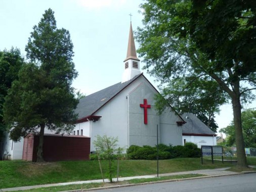
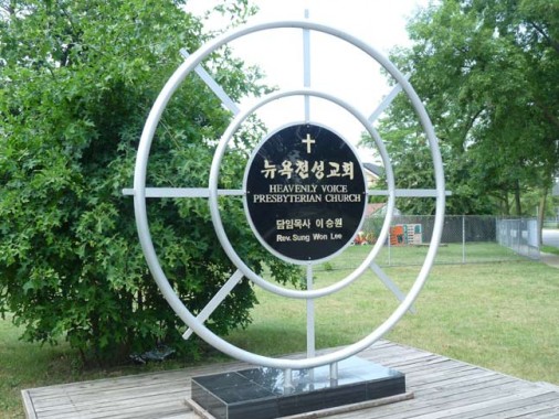
Beginning my walk at Peck Avenue and 191st Street, I spotted the Kwang Ya/Heavenly Voice Presbyterian Church, which looks like one of those suburban churches you find in New England after crossing a covered wooden bridge or two. No real information online about it, but it probably has a history that predates the Korean congregation.
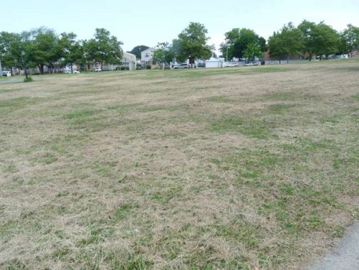
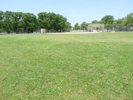
Though this was a Friday, I was rather surprised to find that the ballfields completely empty. I suppose they are busier on weekends, since I have cycled past the Corridor Park when the fields were filled with ballplayers.
Yet how much of this is due to kids staying inside playing with IPads and video games?
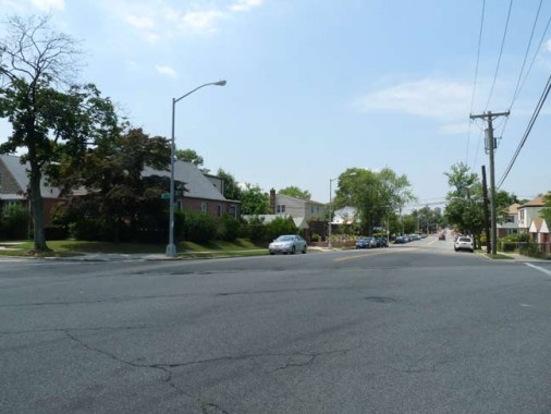
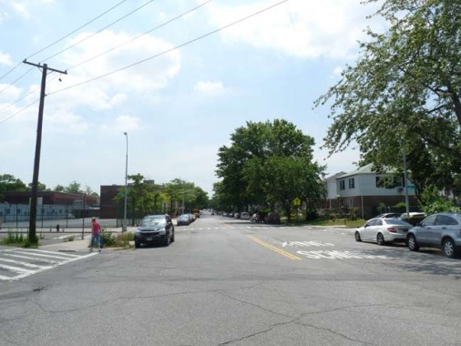
Not many streets go through Corridor Park, but both 58th Avenue (top) and 188th, or Saul Weprin Street, both do. Yet, their intersections with Peck Avenue, which forms the southern boundary of the park, are unguarded by stoplights, and stop signs suffice.
Peck Avenue runs along the south end of the Queens Botanical Garden for a couple of blocks. It’s one of the more unusual avenues in eastern Queens, as it runs through Flushing, Fresh Meadows, and Hollis Hills in five different sections; in its longest section, it runs south of Corridor Park, while Underhill Avenue runs along the north. At one time, Peck and Underhill were mapped out to the Nassau County line along the route of the Motor Parkway, but were never built that far.
Peck Avenue is named in honor of longtime Flushing resident and property owner Isaac Peck (1824-1894). He owned a department store in College Point for many years. Members of the Peck family are buried in St. George Churchyard on Main Street in downtown Flushing.
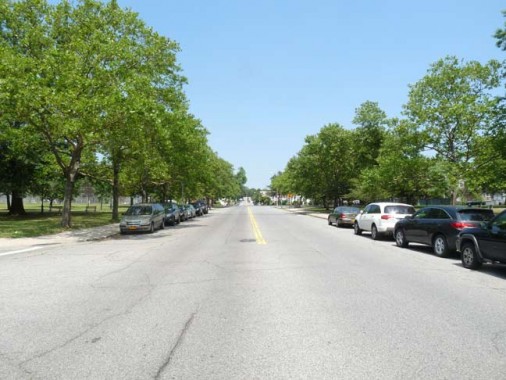
Peck Avenue looking east from 188th Street
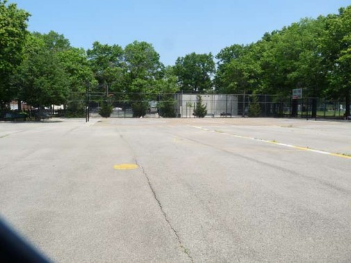
The b-ball court was bereft of basketball players. The adjoining kiddie playground had a number of kids and moms in it, though I never photograph kids to avoid misunderstandings.
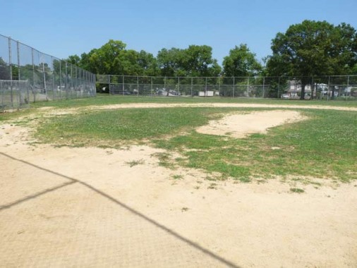
All quiet on the baseball pitch.
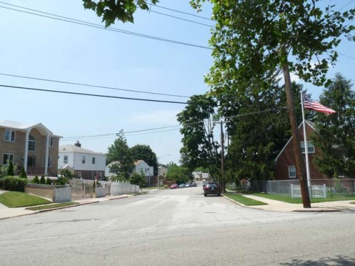
I shot a photo of 50th Avenue where it meets Peck Avenue. There’s nothing to make 50th Avenue stand out these days, but prior to the era in which Fresh Meadows was suburbanized, it was one of the first roads through the area. In the early 20th Century it was called Lawrence Road, likely after the wealthy Queens family that produced mayors and military men. There are two extant cemeteries that belonged to the Lawrence family in Queens, one in Bayside, the other in northern Astoria.
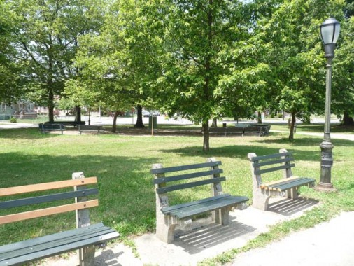
The Corridor is not exactly neglected, but its paths contain some aged infrastructure. The park benches probably go back to the 1960s — of late the City has replaced some of the wooden slats. The Type B park posts are aged as well — and seem to be inneed of a paint job. The luminaires are of a type widely used in the 1970s.

Utopia Parkway is a major north-south Queens route, running from the East River in Whitestone south to Grand Central Parkway in Jamaica Estates, where it becomes Homelawn Street. It’s named for a real estate development that never panned out.
The Utopia Land Company planned to construct an expansive cooperative community for Jewish residents of the Lower East Side on fifty acres of land east of 164th Street between the communities of Jamaica and Flushing. The land was obtained for development in 1905, at which time the company acquired a $9,000 mortgage to grade streets and divide the land into lots.
When the Utopia Land Company found itself unable to secure additional funding, the project was swiftly abandoned. While the dream of the development faded, the project’s name was remembered, providing a name for Utopia Parkway… NYC Parks
The community, in turn, took its name from an ideal island in a 1516 fictional work by Sir Thomas More.
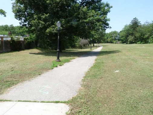
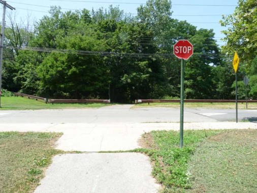
Between Utopia Parkway and Fresh Meadow Lane, Kissena Corridor Park continues as a grassy bike lane. The city actually installed a small STOP sign meant for bicyclists before they attempt to cross Fresh Meadow Lane that so far has resisted the efforts of local youth to pry it off.
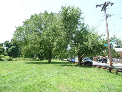
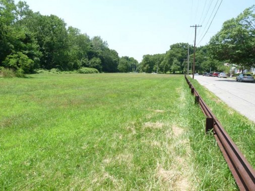
The Corridor continues just south of Underhill Avenue between 170th and 164th Streets as a wide grassy area. The western end of the lawn is used by riders from the Western Riding Club…
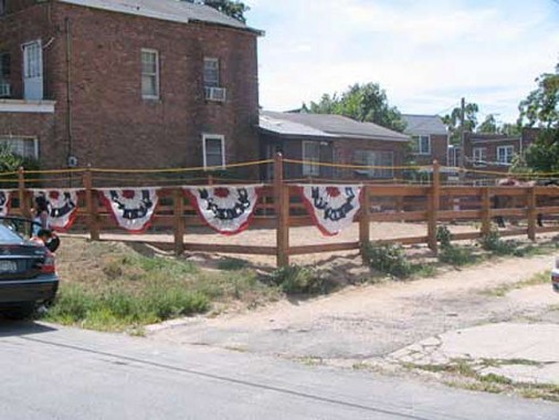
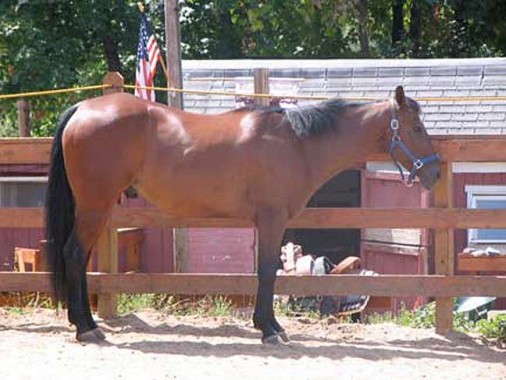
…located a couple of blocks away at Pidgeon Meadow Road and Auburndale Lane. Stop by and say hello to Buddy the horse.
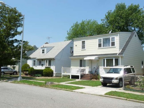
Facing the lawn on Underhill Avenue are several pleasant-looking cottage-style houses…
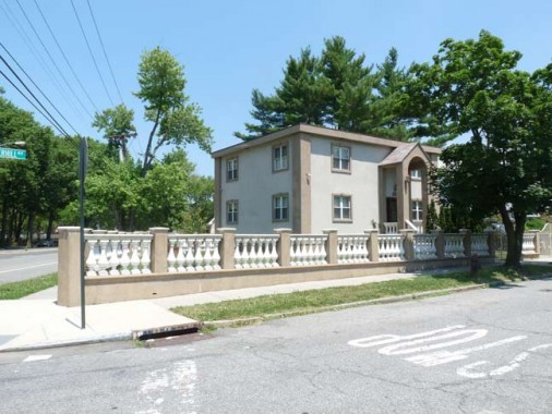
…as well as this object at Underhill Avenue and 164th, which has been renovated in Late Period Ugly.
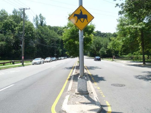
164th Street is now a 4-lane throughway divided by a median. It has always been rather wide, though, because until 1937 it was the right of way for a trolley line running from Flushing to Jamaica. The Q65 bus replicates the line nearly exactly.
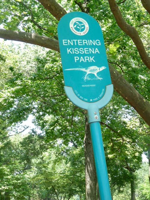
The are actually ring tailed pheasants in Kissena Park, though they tend to stay in the brush surrounding the bridle paths. I’ve already dome a comprehensive Kissena Park page (2007) but it seems there are a couple of things I’d missed.
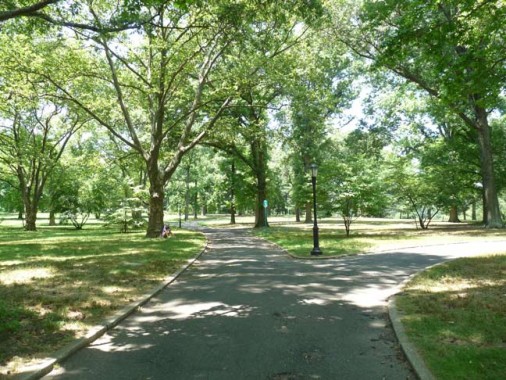
The maze of park paths, if you take the right one, leads to an overlook…
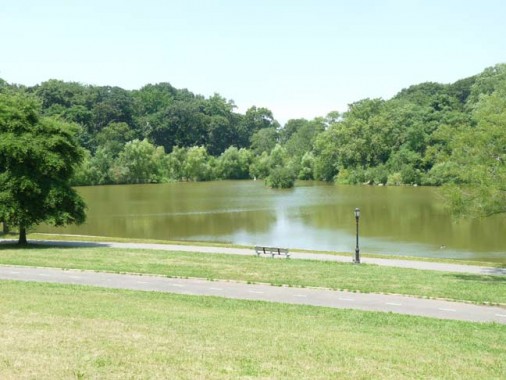
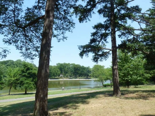
…of Kissena Lake. From the above-linked Kissena Park FNY page:
A natural body of water fed by springs connecting to the Flushing River was named Kissena by Parsons, and is likely the only Chippewa (a Michigan tribe) place name in New York State. Parsons, a native American enthusiast, used the Chippewa term for “cool water” or simply “it is cold.” After Samuel Parsons died in 1906 the family sold the part of the plant nursery to NYC, which then developed Kissena Park, and the other part to developers Paris-MacDougal, which set about developing the area north of the park. Kissena Park attained its present size in 1927. Much of its southern end remains wilderness, with bridle paths running through it….
… In 1942, the streams were filled in and Kissena Lake was bordered with concrete.
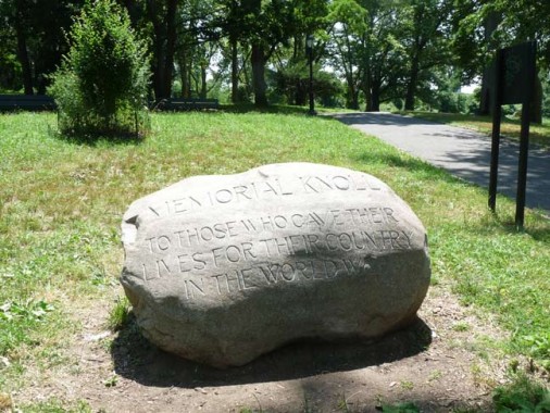
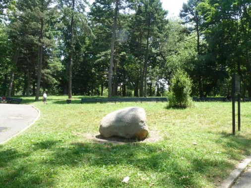
Though I had lived a few blocks away for 14 years and visted Kissena Park frequently I had never before noticed this World War I tribute called Memorial Knoll, a boulder inscribed with the words “to those who gave their lives for their country in the world war.”
The six-ton granite boulder, Flushing’s first memorial to what was then known as the Great War, was dedicated June 5, 1921, and unveiled by Boy Scouts in front of a crowd estimated at several hundred and a delegation that included a band from Fort Totten and representatives from American Legion posts and religious organizations. The boulder itself was unearthed during the construction of the golf house at the Flushing Country Club on Jamaica Avenue and its inscription was carved by local stoneworkers Prowse & Sugden. Most of the $275 cost of the memorial by the Flushing United Association was spent on simply moving the boulder. NYC Parks
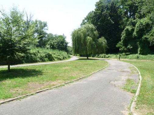
I left the bike path at this point, which extends west to Kissena Boulevard and hen into Flushing Meadows-Corona Park. Instead I ascended a staircase which connects with …
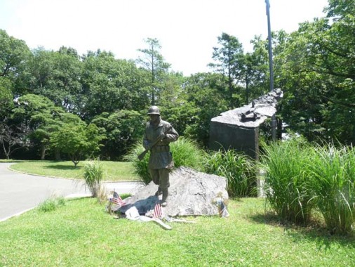
…Kissena Park’s Korean War Memorial, installed in 2007.
On the rear of the pedestal are inscribed the names of all 172 Queens soldiers who died during the conflict, and the names of persons and groups supporting the project. The Korean War Veterans Memorial Association and (then) City Councilman John Liu (in 2012 NYC Comptroller) assisted in assembling the funds necesary for the plaza, while the South Korean government, New York State and private donations raised funds for the sculpture in 2007.
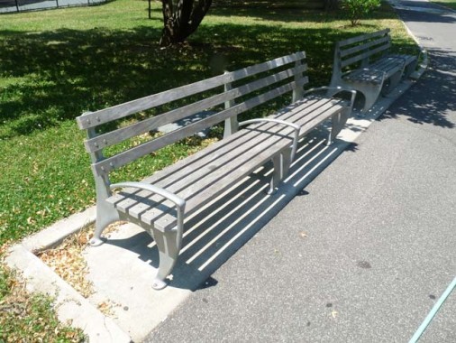
Remember the older benches shown above? These, found near the Korean War Memorial, are some of the newer models. Handrests in the center discourage loitering.
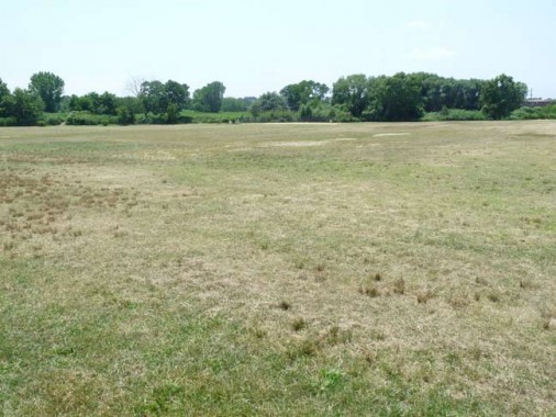
At its western end, Kissena Park opens up into ballfields, just about empty during the week, but local leagues fill them on weekends. Queens College looms in the background.
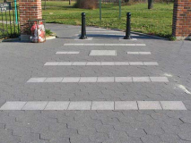
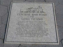
I mentioned earlier that Kissena Park Corridor clashes diagonally through the street grid. The reason for that is the corridor actually runs on the right-of-way of a long-abandoned railroad, the Central Railroad of Long Island, built by Scottish immigrant and department store magnate Alexander T. Stewart in 1872 as a means to connect western Queens with a new development of his, Garden City.
The railroad was a financial failure and survived for just a few years, yet the railroad, built 140 years ago in 2012, still survives…after a fashion… as a park, which matches its fate with that of the High Line on the west side of Manhattan.
Central Railroad of Long Island [Art Huneke]
7/8/12

22 comments
One thing I find fascinating is that we are still running buses on trolley routes, when the trolley has benn gone for almost 2x as long as it existed. The “trolley era” in general started in the 1890s, and in the case of the College Point line of the NY&Q been gone since 1938. Historically, the trolleys were fadeing before GM destroyed them. Lines were being abandoned by the late 30s, the war slowed things down (also kept a lot of railroads afloat) , then with the drop in traffic post war came a lot of abandonments. Trolleys and trolley car companies were the .com bubble of their era, with many founded where not a yard of track was ever built. Remember, I like trains and trolleys, but when you realistically look at it, it is an interesting historical curiosity
I first explored Kissena Park in 1972. There was a boat house that offered rowboat rentals. On the north side of the park on 164 St. there was a pony ride concession. By 1980 both the boats & the ponies were history. In the ’80’s the Urban Park Rangers were offereing tours. My daughter was fascinated by the tale of the snapping turtle who ruled the lake at the expense of the water fowl. I loved the photo of the stable. Queen Creek, AZ has many equestrian properties & horses are a common sight. You urban cowboys in Flushing should pay us a visit; your horses would love our wide open spaces.
Nice to see there is still a stable in the area. Back in the 60’s it was called Chicks. I grew on 158 between 45th and 46th. Left the city in 1971. There was also a place at the corner of 164th and Oak Av called the Pony Carrol. Had ponies for the kids ride and had a little bar for the adults. Spent a lot time in Kissena.
For whatever reason, I was just thinking of this place my parents took me in Flushing in the late 1970s where you could ride a pony. I remember it was somewhere near a cemetery and Kissena Park. I guess it must have been the Pony Carrol.
Glad to see that barn (formerly known as Chicks) is still there! Is it the only one left in that area?
you’ve just described my running route of the last 12 years (though I start/end just west of Main Street0
“A cooperative community for Jewish residents of the Lower East Side?” Just TRY using language like that today in any publicity materials! The neighborhoods on either side Utopia Parkway between Underhill Avenue and Union Turnpike, which is mostly single-family and row houses- with a small garden development around 56th Avenue- built after WWII, has historically been largely Jewish. But tha twould be through natural postwar migration from the tenements of the Bronx, Brooklyn, and indeed the Lower East Side..
The Kissena Corridor, which ties into the old Motor Parkway ROW, provides some wonderfully suburban neighborhoods along their length. There are long intersection-less stretches of 164th Street, Booth Memorial Avenue, Francis Lewis Boulevard, Hollis Hills Terrace and other arteries in the area that are unfortunately irresistable to drag racers. But it’s also possible to see raccoons, possum and pheasants while driving or biking along them (some alive, some- well, you know).
Always love your Flushing posts, as I was born (1954) and raised near Kissena Park, at 153rd Street and 58th Ave. PS 163, ho! Played a lot of golf at Kissena Golf Course growing up. “Walked the pipe” in Kissena Park many times. Played many Little League games there, QBH ho!
Yes. Walking the pipe over the stream.
Great memories!
Peck and Underhill did not run alongside the Motor Parkway, but ran on both sides of the Central Railroad of Long Island right-of-way, with Underhill (Underhill was a Director on the railroad) on the north and Peck on the south. A small, disjointed piece of Peck remains west of Kissena Boulevard, and a disjointed piece of Inderhill can be found east of 164th Street. They run in parallel from Fresh Meadow Lane and are interrupted by the LIE and Cunningham Park. They restart immediately south of the Motor Parkway right-of-way at Kingsbury Avenue, but Underhill has changed to Stewart (yes, that Stewart, who built the Central Railroad to his Garden City). They only run a few blocks, and are stopped by the Grand Central Parkway. If you follow the old Central’s path, you can recover it again running alongside the LIRR through Floral Park and into Garden City. The Motor Parkway ran more northerly through Glen Oaks and into North Hills.
Yeah, I think I’m wrong — Elkmont and Shiloh were supposed to run along the LIMP
I don’t think that they weren’t interested in being outside, it was probably because of the weather for the reason why the playground shots look so empty.
I grew up on 196th St and 56 Ave. We moved there in 1948 when I was 2. As soon as I was old enough the “park” was the place to go for adventure. At that time the local kids all called the area “the lots” as in vacant lot. My parents always told us that the corredor would be a great park. Unfortunately by the time it was finished I was too old to be interested in it. The first part of the park in our area was the playground at 188th St which was just accross the street from PS 177, the school I went to. I think that park was opened in about 1953. Prior to that time that area was quite swampy. A point I can atest to as I feel through the ice on the way to school. Mom had to come with dry clothes. The reason the land was never developed is that a major sewer line runs under it. This sewer drains all the street water for block around the corredor into the Flushing River. There’s a picture in the NY Times in either the late 30’s or early 40’s of Robert Moses driving a jeep in the sewer. I think there weren’t any kids in the park because there aren’t many children living in the area. My mother still lives on 196 St and there are very few kids living there, particularly compared with all the baby boomer who were there in the ’50s. It seemed every family had at least three children and one with nine. There were always enough kids to play stick ball.
I noticed along the greenway, near the ballfields and west of the stairs up to the Korean War Memorial area, if you step off the path into the grassy/woodchip area, a concrete block. Wondering if it was part of the railroad or what. It’s only a couple feet long/wide and in plain sight.
Just a note on the modest WWI Memorial and the living tree memorial set behind it, in Kissena Park is the only memorial to WWI in Queens. It is to the credit of the Kissena Park Civic Association and its active park advocates that moved NYC Parks Maintenance & Operations to keep it a memorial rather than just a bolder in a grassy meadow. The Great War and those that served and sacrificed their lives is not forgotten.
Born and raised at Peck Ave and Utopia Pkwy, 1962-1985. Your reference to Peck Avenue at 191st is incorrect. 191st Street was “skipped” in this part of Fresh Meadows…The current church pictured at Peck Ave and 193 St was formerly “St Margaret of Scotland Episcopal Church” and probably changed hands with the shift in demographics for this area.
Thank you Kevin for confirming what I felt as a little kid of 4 – that Kissena Lake was not man-made as my mother told me. I vividly remember rowboating out there with my dad. Back then I rode one of those ponies at the corral, feeling more like it rode me! My mom, a fine equestrian, watched bemused and embarrassed as her daughter, who so loved horses, was scared shitless on a miniature version. (My next attempt on a bigger model proved my last, but I held on.) Fondest memory was of a white duck who followed me by the lake until dusk, eating bits of salmon sandwiches from my hand. ( Fishing with a long thin branch and piece of string didn’t lure his lunch.) I cried bitterly having to leave my newfound friend; my mom so wished she could’ve brought the big guy home for me. Kissena Park will always remain a jewel among Queens memories from the 32 years I lived close by.
Lived on Station Rd between 195th St and Francis Lewis Blvd from 1955-62 when we moved to central New York State. The neighborhood looks the same except for looking much smaller now than it did when I was a toddler. Biggest memory is that an Aisian-looking guy named “Herb” taught me how to actually ride a two-wheel bike on the sidewalk of Station Rd. And the L.I. railroad ran along our backyard.
Does anyone recall the bicycle store located on 162nd street and the LIE service road ( Horace Harding Exp) ? The corner location is now owned by an accounting firm.
Or where i can find information on 162-19 ?
I just scanned in old slides from my (late) parents collection. I found slides from June 1975 of me on the pony rides. (This would have been the month prior to be turning 6 years old). I remember my parents taking me there frequently when I was a kid probably up until that time.
I looked up the corner on mapquest. I’m pretty sure it was across Oak Avenue from the northeast corner of Kissena Park, at the corner of Oak and 164 Street.
Great memories! Cheers!
-Richard E. Vehlow
grew up in Bayside (Oakland Gardens), Queens, NY (1969-93)
now of Latham, NY
I grew up in Flushing, Parsons Blvd. And Negundo Ave..Kissena park was our bike riding trail. What a Beautiful way to remember my childhood…We used to Sled down the Golf Course Hill in the winter . The hot dog Shack with the Pony rides in the summer and Hot Chocolate in the winter. Caught my first fish in Kissena Park Lake.. Took our Wedding pictures in the Park. Now living in the country upstate near Kingston. I’m 68 now , so that tells you how long ago it was.. Enjoy it all and pass it down to new Generations..
There is another memorial to World War I in Queens: in Astoria Park along the East River, between the pool and the River on Shore Blvd. It has an inscription that reads, “ GREATER LOVE HATH NO MAN THAN THIS THAT A MAN LAY DOWN HIS LIFE FOR HIS FRIENDS”.