Astoria…Ditmars Boulevard…the subway roll signs on the R train advertised these outlandish, far-off locales when I boarded it in Bay Ridge when I lived there for the better part of three decades, but I never really thought to trouble this northwest section of Queens, except for the occasional bicycle ride through, until I actually moved to Queens in 1993. Newcomers will find it extraordinarily hospitable, with Astoria Park, and its Olympic-size pool, facing Hell Gate and the landfilled island once known as Wards and Randalls Islands; a bustling Greek neighborhood (but now increasingly upscale) centered along the main shopping drags, 30th Avenue and Broadway; spectacular views of midtown Manhattan and the Triborough and Hell Gate Bridges. In recent years, Astoria and its neighbor, Long Island City, have become increasingly welcoming to major museums such as the Museum of the Moving Image, as well; even the Museum of Modern Art set up shop in nearby Sunnyside from 2002 to 2004.
I’m in Astoria quite a bit. For the last 3 years (since 2011) I have been reduced to occasional freelance work as a 40-hours a week job with benefits is increasingly becoming a dream, and I have been volunteering at the Greater Astoria Historical Society, which partners with this website. In May 2014 I plumbed several Astoria depths I hadn’t before, including, amazingly, Astoria Park.
When I left off I had arrived at St. John’s Prep at Ctescent Street and 21st Avenue. It was at this time I relaized I had never been in the northern section of Astoria Park, which overlooks the Hell Gate, where the East River is divided in two by Randalls Island, which actually used to be Wards and Randalls Island, Randalls the northerly of the two. During construction of the Triborough Bridge in the 1930s, NYC traffic czar Robert Moses connected the two islands with landfill. Like Roosevelt Island, Wards Island had become home to institutions and psychiatric centers over the years, and Randalls Island for many years has held concerts and sporting events at Downing Stadium and later, Icahn Stadium. Randalls Island is separated from the Bronx by the narrow Bronx Kill.
The connection of Wards and Randalls Island wasn’t the first civil engineering job nearby Astoria Park, however. For centuries Hell Gate had been a bane to commercial shipping because of its shifting currents and a rocky shoal nearby Mill Island, just south of Wards Island. In 1885, the United States Army Corps of Engineers detonated 300,000 lbs. of explosives to break up the shoal, erasing the worst impediment. It was one of the largest explosive detonations until the atomic bomb drops on Hiroshima and Nagasaki, Japan, in August 1945.
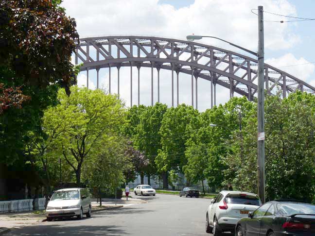
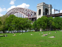
The Hell Gate Bridge looms over Shore Boulevard at 21st Avenue. Here. the boulevard, which runs between Astoria Park South and 20th Avenue, takes a bend to match the shoreline of the East River.
Astoria Park is relatively new, as it was established in 1913. That year the City acquired about 56 previously privately-held acres along the river. Before that, prominent families in Astoria and Ravenswood such as the Barclays, Potters, Woolseys, and Hoyts (formerly, streets were named for them) built mansions on the hillier ground looking down on the river. The park the city created was at first called William J. Gaynor Park, after the mayor of New York City from 1910-1913, but finally settled for Astoria Park. Stephen Halsey, who founded Astoria in 1839, named it for his friend, fur merchant John Jacob Astor, who actually never set foot in the then-small town (nor was Astor ever in Astoria, Oregon, also founded on the fur trade).
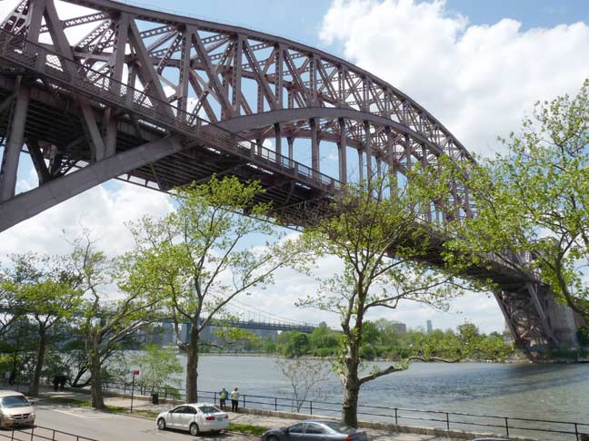
The Hell Gate Bridge was the final piece in the puzzle of running railroad trains into Midtown Manhattan. The tubes connecting Long Island with Penn Station opened in 1910, and Hell Gate Bridge, connecting Long Island with the mainland, opened in 1917 as the lengthiest steel arch bridge in the world until surpassed by the Bayonne Bridge in 1931. “Hellgat” means ‘beautiful strait” in Dutch, but lived up to its English transliteration as an extraordinarily dangerous stretch of water due to conflicting currents of the East River and Long Island Sound, as well as a great deal of rocks that made it treacherous for shipping until the rocks were dynamited into rubble in the late 19th Century (see above). The construction was overseen by Gustav Lindenthal, who worked on the Williamsburg and Queensboro bridges as well. In the mid-1990s it was painted a deep maroon, which the sun has faded to light magenta.
Sharon Reier in The Bridges of New York: The 1,017-foot long arch, of course, is only the keystone is a system of water and land crossings that in itself was the largest of its type in the world. The whole length of the structure, including the arch and approaches from the abutment on Long Island to the abutment in the Bronx is 17,000 feet, or considerably more than three miles…
….few people, even passing as close to it as the Triborough Bridge, realize the colossal size of the various parts. No existing large span bridge had ever been designed with such huge parts. Some of the steel members were more than twice as heavy and bulky as any parts ever hoisted in previous bridge construction… The heaviest bottom chord section weighed 185 tons. They were made of a recently developed material — carbon steel — which gave greater strength for its weight. The bridge, it was said, used more steel than the Manhattan and Queensboro Bridges combined.

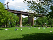
I have always admired the step and repeat nature of the concrete arches that take the steel structure to and from the arch, located in Astoria and Ward’s Island, and also a feature of the Hell Gate that has always been little remarked upon: the massive arches that take the railroad over 29th, 31st, 33rd, 36th, 37th and 38th Streets. The railroad tracks are built on a massive, concrete-supported embankment in much of its route in Astoria, and a combination of iron trestles and concrete arches span the streets beneath.

![]() Steve Anderson’s Hell Gate Bridge page in NYCRoads.com
Steve Anderson’s Hell Gate Bridge page in NYCRoads.com
![]() Dave Frieder’s Hell Gate Bridge photos
Dave Frieder’s Hell Gate Bridge photos
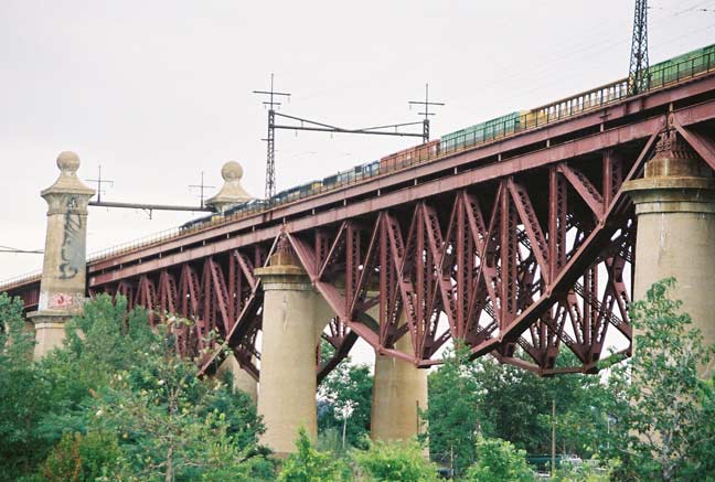
The Hell Gate section over the East River is the most photographed, but its other sections on Randalls Island are, in my view, equally spectacular. Here, there’s an inverted truss and massive concrete pylons holding up the trackway.

This section of the Hell Gate Bridge spans the Bronx Kill between Randalls Island and the Bronx.
The above two photos come from ForgottenTour #48, in September 2011, when we walked the Triboro Bridge on its 75th anniversary. Here’s a complete set of photos on Flickr.
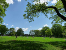
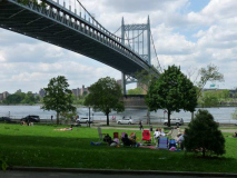
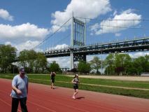
The Hell Gate Bridge affords a breathtaking backdrop to the carefully manicured lawns of Astoria Park, which is cared for by the NYC Parks Department and the Astoria Park Alliance volunteer group. The park no doubt is a prime place for wedding photos and picnics. Today a preacher was holding forth in front of a rapt audience. It was warm enough for sun tanning on a May afternoon.
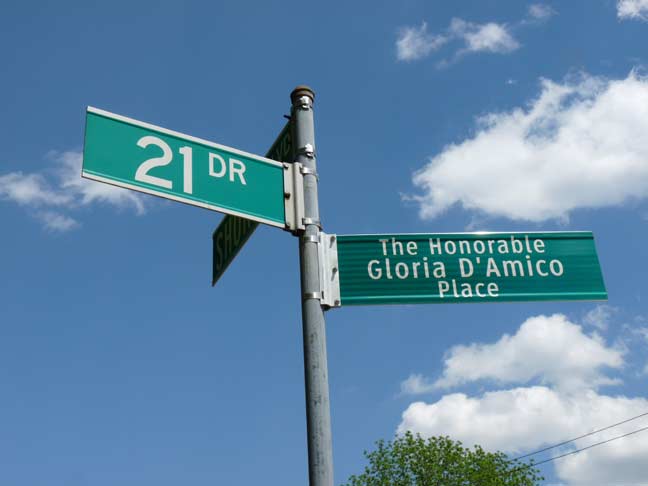
Gloria D’Amico is honored at Shore Boulevard and 21st Drive. The Astorian (1927-2010) served as Queens County Clerk for 19 years and was a leader in local Democratic Party affairs. She teamed with Ralph DeMarco (1908-1977), who has a northern strip of Astoria Park between the Hell Gate Bridge and 20th Avenue along Shore Boulevard named for him.
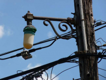
Also found here at Shore Boulevard and 21st Drive is a short masted version of the old-style mastarm used to hold fire alarm indicator lamps. By 2014 this lamp was no longer being serviced, as the small “top hat” on top of the main luminaire, installed several years ago, now functions as the indicator. The city hasn’t removed the old lamps, but no longer services them or replaces the bulbs.
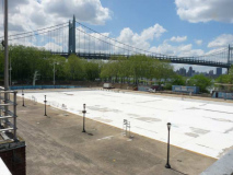
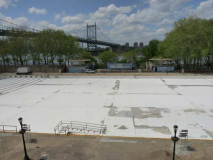
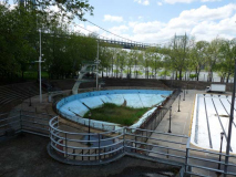
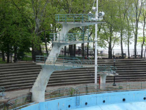
The Astoria Park Pool was constructed as one of eleven large pools scattered throughout the five boroughs by the Works Progress Administration, which was set up by the US Government during the Great Depression. The pool opened July 4th, 1936 and was host to Olympic swimming and diving trial competitions that year and again in 1964. In fact, the final trials were held on opening day.
Astoria Pool has always been a favorite in the neighborhood, inviting community involvement in creating pool events. In the early 1940s, a group of boys in the neighborhood who were devoted swimmers got together to perform on Wednesday nights at Astoria Pool. The Aquazanies wore costumes and treated audiences to choreographed swimming acts with music, backdrops, props, and on occasion, even dogs. Their routines were always inventive and never failed to showcase their unique talent as swimmers and divers. One of the participants was Whitney Hart, who became a professional diver and was eventually inducted into the Swimming Hall of Fame.
The exemplary design of the pool complex remains largely unchanged. The main pool was planned to hold 3000 people; underwater lighting, considered a “revolutionary development in recreation,” encouraged night swimming. Flanking the pool, bleachers stand atop both the Art Deco bathing pavilion (with facilities for 6200 swimmers) and the water filtration house. The 1997 restoration of the pool effected mild aesthetic changes such as new cement, lights, pumps, pipes, electric lines, filters, showers, and improved chlorination and security systems. NYC Parks
Astoria Park Pool is not the only locale in Queens in which Olympic trials were held. In 1964, hopefuls for the USA bicycling team competed at the Kissena Park Velodrome.
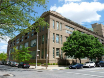
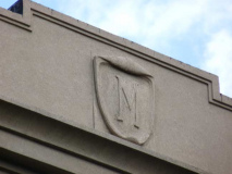
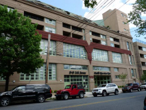
Most of the former Eagle Electric factory and office buildings are located in Queens Plaza and Hunters Point, but there was also an Eagle Electric building here in north Astoria at 19th Street and 24th Avenue opposite Astoria Park. About a decade ago it became the residential complex Pistilli Riverview East. In its early days, the building was plagued by leaks and other construction problems.
Elsewhere in Astoria is Pistilli Grand Manor, Ditmars Boulevard between 45-46th Streets. It was built by Henry Steinway in 1902 as a piano factory that predated Steinway & Sons’ larger factory now at Steinway Place and 19th Avenue. The forbidding-looking brick factory lay empty for 20 years until developer Joseph Pistilli remade it as upscale housing beginning in 2003.
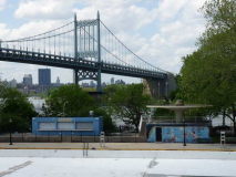
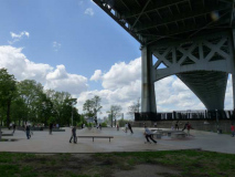
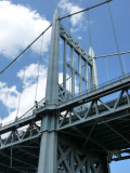
In NYC at least, only the East River Park in Brooklyn’s DUMBO can boast scenes of two world-class bridges (Brooklyn and Manhattan). Astoria Park lies beneath the Hell Gate and Triboro Bridges, both of which have three separate sections as they cross Wards and Randalls Island. The Triboro is made up of three separate bridges, but the most monumental of which is the main span, seen here between Randalls Island and Astoria.
The main span is 1380 feet (421m); it is the longest of the Triborough’s three spans, and the total length including approaches is 2780 feet (847m). It contains just one narrow sidewalk, on the north side, which is still more walkways than Robert Moses vouchsafed on later major bridges. The towers are 315 feet (96m) in height. The architect, Othmar Ammann of Switzerland, built most of the City’s great bridges of the 20th Century: The George Washington; Triborough; Bronx-Whitestone; Throgs Neck; and Verrazano-Narrows.
According to legend, a sign on the bridge once read, “In event of attack, drive off bridge.” Since the bridge roadway is the equivalent of 15 stories from the river, that advice would have meant certain death.
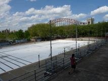
Astoria Park’s skateboard park and oval running track are adjacent to the Triboro.
ForgottenTour #48 in September 2011 walked the bridge’s two major spans.
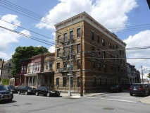
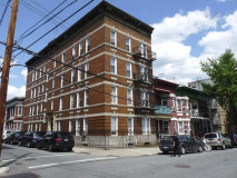
Directly south of Astoria Park is the oldest part of Astoria, founded by Stephen Halsey in 1839. None of surviving buildings are quite that old, but there are some postbellum houses and mansions from the late 1800s still around. More seem to vanish every year because the small area has never been recognized by the Landmarks Preservation Commission and one or two, it seems, vanish each year to be replaced by boring, prosaic multifamily buildings.
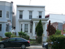
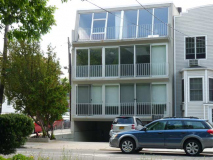
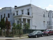
On Astoria Park South on either side of 14th Place are two variations on the theme of a small one-or two- family building facing the park. One has kept its old Ionic-columned entrance.
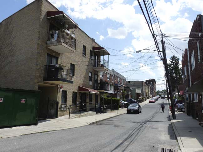
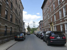
I took special interest in 14th Place, which runs between Astoria Park South and 26th Avenue. It was probably once a carriage lane bearing stable entrances for the wider streets on either side of it. As is, it’s one of Queens’ narrower streets and has a slight curve downhill.
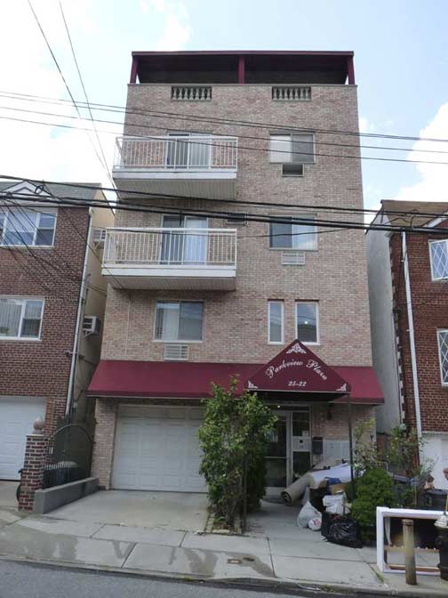
There’s a mix of ugly buildings from after 1980,which likely replaced some of the handsomer ones further south on the block.
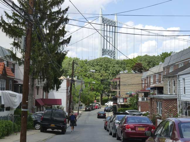
Looking north about midblock on 14th Place toward the Triboro.
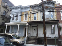
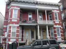
I have always been fascinated with this quartet of attached houses that virtually face each other across 14th Place. The east side pair have second-story porches and are the better maintained.
The builders couldn’t have known that when these two houses were constructed, a glance up the street would provide a great view of the towering bridge.
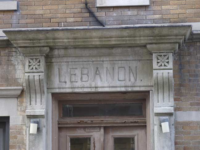
14th Place was known as Lebanon Terrace decades ago; this is reflected in the name of the apartment building on its west side. When you walk over to the dead end stub of 14th Place south of 26th Avenue, you see that it is one of a matched pair that, again fortuitously, frames the Triboro Bridge effectively. The buildings are not quite twins, as a close look will show.
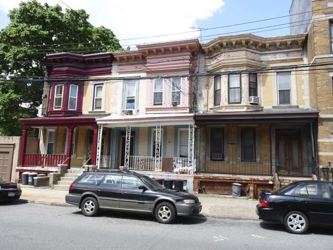
A walk around the corner on 26th Avenue will reveal a skein of porched houses that are probably of the same vintage as the ones on 14th Place, and possibly the same architect was involved.
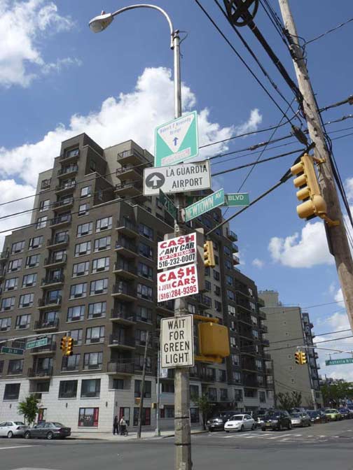
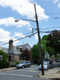
There’s a relatively new residential monstrosity at the NW corner of 21st Street and Astoria Boulevard at Astoria Square, where those two streets as well as 27th Avenue and Newtown Avenue come together, but I’ve always enjoyed seeing this lamppost, because it’s the most heavily “signed” one in Queens.
Between traffic signs and signals, street signs and a couple of used car ads, there are no less than ten signs on the pole, and I challenge anyone to send me a photo of a utility pole with more.

Like a number of streets and roads in NYC, Newtown Road and Newtown Avenue aren’t named for the neighborhoods where they are, but for the neighborhood they go to. And, like a number of NYC streets that run aslant the overall grid, they’re one of the older roads in the area. Both Netwown Avenue and Roads comprise an Indian trail that became the main road to early Astoria settler William Hallett’s farm in the mid-17th Century, and to the treacherous Hell Gate, the East River crossing to Manhattan. Its eastern stretch that ended in the heart of Newtown, now Elmhurst, was called Hurlgate, or Hellgate, Ferry Road; later named for the town through which it passed, becoming Woodside Avenue.
Newtown Avenue and Road were once one road, but today Newtown Avenue runs from Astoria Square to 30th Avenue and 33rd Street, while Newtown Road picks up at 30th Avenue east of Steinway Street and then runs to the confluence of Northern Boulevard and Woodside Avenue.

Newtown Avenue can boast some distinctive buildings such as this castellated apartment building at 23rd Street.
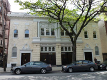
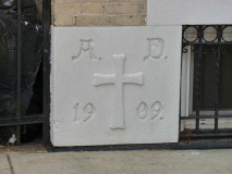
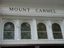
Mount Carmel Institute on Newtown Avenue between Crescent street and 23rd, was built in 1909 [Francis J. Berlenbach, arch.] It was once the parish hall of Our Lady of Mount Carmel Church (see below) but today it functions as a concert venue.
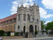
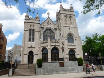
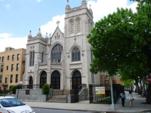
Our Lady of Mount Carmel Church, which calls itself the “Mother Church of Queens County” is one of the borough’s oldest Catholic parishes, having been instituted in 1840. The present white limestone structure dates to 1873 with a 1916 enlargement. Other handsome buildings in the Mt. Carmel complex include the parish rectory and the Young Women’s Leadership School of Astoria.
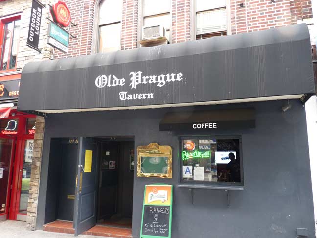
Time to kick it in the head for another Astoria walk but before getting on the el at 30th Avenue, I should note that the Bohemian beer garden isn’t the only Eastern European drinking establishment around here.
12/6/14

7 comments
Is that graffiti on the side of that bridge in photo #5?
If it is they must have used a team of mountain climbers and scaffolds to paint it there
Thanks for an enjoyable tour of the town I was born in (Mt.Sinai-Queens nee Astoria General).
Seeing your pics of the Triboro Bridge reminds me of the penchant for streets and bridges in NYC to bear two (or more) names.
I don’t think anyone will ever think of Sixth Avenue as “The Avenue of the Americas”. I’d be interested to know if anyone thinks “Edward Koch Bridge” or “Robert F. Kennedy Bridge” might catch on.
You’re absolutely right, Andy- it’ll always be The Interboro Parkway to me….NOT the Jackie Robinson Pkwy!
A slight correction concerning the former Eagle electric. The company was still operating as late as the early Ninetees. I live around the corner and every morning going to work i used to say hello to a friend who worked there out on a cigartte break. I know that by the mid ninetees it was closed and eventually was remodeled as Pistilli River East in the beginning of the twenty first century. Something that might be of interest noting the M on the top of the former eagle electric building. This led me to think that there might have been something else there before eagle electric was. I did some research and found that on an old 1919 Belcher Hyde map this was listed as a silk factory.
Fane
Greater Astoria Historical Society
yes it was a silk weaving factory , my dad worked there for many years , it HAFFNER * RYDELL , DO NOT REMEMBER THE SPELLING BUT THAT WAS THE COMPANY, WHEN EAGLE ELECTRIC BOUGHT IT MY DAD STAYED WITH THEM , HE WAS THE MAN THAT KEPT THE FACTORY WARM IN THE WINTER AND COOL IN THE SUMMER , AND THEN THEY SENT HIM DOWN TO THE LONG ISLAND CITY FACTORY , AND HE WORKED THERE TILL HI PASSED AWAY IN 1959 , THE SILK FACTORY WAS THERE MUCH LONGER THEN EAGLE ELECTRIC WAS !!
anyone rember iron track oval (baseball park) it became a shopping center in the 70`s or have any photos in astoria
Any info on the Iron Track Oval??? Was it on Vernon Ave?