Other than the BMT 4th Avenue Broadway Line (N, R, Q and now W trains) perhaps the majority of my subway rides for six decades have been on the Flushing Line, the #7 train, one of the few subways’ general east-west routes. I rode 4th Ave/Broadway when living in Bay Ridge (1957-1993) and the 7 when living in Flushing and then Little Neck since. Most of the 7 train (stops between Queensboro Plaza and 103rd/Corona Plaza) celebrates its centennial on Friday, April 21st, 2017, weeks after the Hell Gate Bridge, which transports freights, Amtrak and Metro-North trains between Queens, Manhattan and the Bronx, celebrated its first 100 years.
From its beginnings in June 1915 running one stop from Grand Central to Vernon/Jackson what has become known since then as the Flushing Line has been extended eight times: east to Hunters Point Avenue and Court Square (11/5/1916); Queensboro Plaza to 103rd Street (4/21/1917); 111th Street (10/13/1925); Willets Point Boulevard (5/7/1927); Main Street (1/2/1928) and west to 5th Avenue (3/22/1926); Times Square (3/14/1927) and Hudson Yards (9/13/2015). (A tiled sign at the Hunters Point Avenue station says the line goes “to Astoria and Corona,” referring to the split at Queensboro Plaza that sends the BMT to Ditmars and the IRT to 103rd/Corona Plaza.)
The Flushing Line was long-delayed when it opened. In the late 1880s it was going to be the first iteration of East Side Access, sending Long Island Rail Road trains to Grand Central Terminal to meet the New York Central. This plan was caught up in red tape and high cost estimates. Piano magnate William Steinway began work on the tunnels as an extension of his network of Queens surface lines to Manhattan but ran up against community opposition in Queens as well as underground springs. Steinway passed away in 1896 and IRT king August Belmont was next in line to try and get the line started, completing a tunnel to be used by trolleys in 1907. But Belmont got tied up in red tape again and the tunnels were idle until 1915 when they were purchased by the city as part of the Dual Contracts expansion, modified to accept IRT cars and finally placed into service along two stations.
The Flushing Line has had its quirks over the years. The line accepts 11-car trainsets instead of the usual 10, because when it purchased R-33 cars, they came individually instead of in pairs, thus an extra car could be placed onto each trainset. Between 1923 and 1949, The Astoria and Corona lines used BMT and IND cars, but the divorce was made final in the latter year, with the BMT going to Astoria and IRT going to Flushing.
In November 2016, I walked the full length of Roosevelt Avenue under the Flushing Line to Main Street. I’ve also amassed several photos of the stations along Queens Boulevard over the years, and thus I can create a multipart FNY series on the #7 train, and what’s under it.
Queensboro Plaza
The Queensboro Plaza complex, which serves both BMT and IRT divisions with a cross-platform transfer (unique in the NYC subway system) was opened on April 21, 1917. Before going further, a little clarification is necessary between “Queensboro Plaza” and “Queens Plaza.” Queens Plaza North and South are the two roads north and south of the elevated complex between 21st Street and Jackson Avenue. The plaza was created in 1909 when the Queensboro Bridge to Manhattan was opened, and the Queens Plaza IND subway station serving E, M and R trains (as of 2017), opened in the 1930s, is named for Queens Plaza North and South, the roadways under which it was located.
Queensboro Plaza, meanwhile, is named for the bridge. Until the 1980s, I enjoyed seeing its blue enamel signs with white lettering in serifed capitals that said “QVEENSBORO PLAZA” with the V of Importance. The plaza looks much different than it did just ten years ago; older buildings lining the north side, including the Brewster Building which was a factory turning out auto and airplane bodies were rundown and decrepit, and a line of strip joints, restaurants and a particularly ugly parking lot building on the south side.
Today the Brewster and other buildings on the north side have been refurbished and repurposed and the parking lot and strip joints have, in the main, been replaced by glass towers containing city residences and pricey apartments; dozens have been built, with more to come.
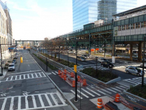
Queens Plaza North has been remade as a streamlined route with plantings and bike lanes leading to the Queensboro Bridge. However, QPN used to be completely shrouded by an elevated train: the Second Avenue El had a spur extending over the bridge to Queensboro Plaza until 1942. In the 1950s the elevated section formerly serving the 2AL was razed, throwing Queens Plaza North open to light. Queensboro Plaza also served a network of trolley lines that crossed the bridge.
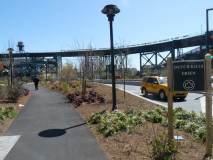
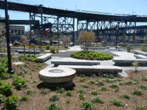
Beginning in 2011 the eastern end of Queens Plaza North, where it meets Northern Boulevard, was converted to a park named Dutch Kills Green, replacing a large parking lot called the John F. Kennedy Commuter Plaza.
Queens Plaza, a maze of traffic and elevated trains located at the foot of the Queensboro Bridge, has recently undergone a $45 million makeover. Its traffic patterns have been rerouted, a bike path has been added, and its landscape has been redesigned. The largest new addition to the plaza is a park named Dutch Kills Green, which is located atop [the former JFK Commuter Plaza] on the plaza’s eastern end. This 1.5-acre park is an island surrounded by elevated subway trains and a nonstop flow of cars, buses and trucks. It borders several abandoned and empty buildings. The park houses a native-plant wetlands, a collection of artist-created benches, a small amphitheater, and two Dutch millstones from the 1600s. — curbed.com
As part of its makeover, Queens Plaza traffic patterns were rearranged and its traffic medians decorated with broken stones. Pedestrian footpaths lead through jagged rocks between multiple lanes of traffic. After complains from locals, most of the ugly rocks have been removed. Two historic millstones, reportedly first employed in a grist mill in 1650 by Dutch immigrant Burger Jorissen, were formerly on a curbside traffic plaza but have been placed within the new Dutch Kills Green, where they’re open to the elements and subject to weathering and vandalism. More on Dutch Kills Plaza in FNY’s 31st Street walk page. The Bank of Manhattan Building, once Queens’ tallest tower, overlooks Dutch Kills Green.

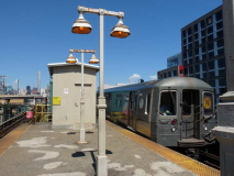
On a recent visit to the Queensboro Plaza upper (Queens-bound) platform I saw a new work train loco, the MP8AC-3 (the MTA classes it as R156).
Subway riders are quite familiar with MTA New York City Transit’s fleet of 6,300 stainless steel subway cars, but what they may not realize is that we also have an impressive roster of specially-designed diesel-electric locomotives ready, willing and able to haul work trains to the farthest segments of the subway system.
NYC Transit maintains a fleet of 62 diesel-electric locomotives that haul work trains and pumping equipment into sections of track where power to the third rail has been turned off to facilitate capital construction, maintenance work or repair damage. On May 1st, the first of 28 new locomotives was delivered to NYCT’s facilities. MTA

It wasn’t too long before a #7 Flushing Line train arrived. I noticed it was one of the now-vanishing breed of R-62A cars employed on the line; these are being rapidly phased out and replaced by R-188 cars, many of which still have a “new car smell.” The R-62As and their brothers, the R-62 cars, first saw NYC subway tracks in 1983. The R-188s were introduced in 2012.
The R-62As on the Flushing Line were first introduced in 2003 and rapidly took over for R-33 and R-36 cars, introduced on the line in 1964, taking passengers to the 1964-1965 World’s Fair; they were painted in light blue and white in those days, and some carried the names of sponsoring states. After several years spent being covered in graffiti, a dark red — maroon color was settled on and the cars became known as “redbirds.” A few Redbird cars can still be seen in the Corona Yards near Citifield.
I was traveling to the Astoria Broadway station and waited a few more minutes for the N. I was indeed fortunate to see a set of R-68 cars pull in; the N usually employs newer R-143 cars, but for the summer, some trainsets were being used on different lines.
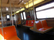
The R-68s, introduced in 1986, featured the same color scheme and seating layout as the older R-46 cars first introduced in the mid-70s. The chief difference (for me at least) is that while the R-46 has light brown/buff walls with faint alternating seals of NYC and NY State on it, while the R-68s have shiny silver walls with vertical striping.
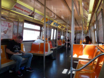
I mourn the eventual phaseouts of the R-46 and R-68/68A cars, since the seating scheme allows you to sit, turn your head and watch the borough go by, at least on the elevated lines, and closely observe the stations in the underground lines. I also prefer the roll signs in front of the trains that display the line colors.
I do not know why the MTA has used the bench system for the new R-143 and R-188 cars, which gives you a great view of the guy clipping his nails or eating takeout chicken opposite you. But I’m just a crank.
Queensboro Plaza uses reproductions of classic lampposts used on many IRT and BMT lines when the stations were first constructed in the 1910s and 1920s (yes they are rusting already). As seen here they are not the originals.
Until 1987, R trains from Bay Ridge ran through Queensboro Plaza en route to Astoria, and N trains ran via tunnel to Continental Avenue in Forest Hills. The two routes switched terminals that year.
33rd Street (Rawson Street)
Some people new to the NYC subways are under the impression that this station is at the corner of 33rd and Rawson Streets. In actuality, the station still uses the former name of 33rd Street before an overall numbering system in Queens was instituted by its Topographic Bureau in 1915; it took 10-15 years before all the new numberings were completed, and some subway lines thought it best to retain older names for the oldtimers in the neighborhood who were used to them. Back in 2011, FNY chronicled these remaining ghost street names that exist only in the subway. There are used now only for tradition’s sake.
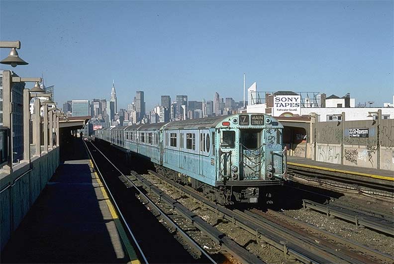
In 1981 an eastbound R-33 on the center express track makes its way past 33rd-Rawson. The train still has its light blue and white 1964 World’s Fair paint job that is somewhat obscured by graffiti. In the 1980s, the graffiti scourge was at its height until the MTA got a handle on the situation; the cleanup began under MTA chief David Gunn, who implemented several changes such as daily cleanings. Also, beginning in the late 1980s, the IRT fleet was painted mostly maroon red (with some green) after a short-lived experimentation with whitewashing them. The maroon red cars eventually became known as “redbirds” and survived on the Flushing Line until 2003.
Note the still-functioning incandescent lighting. High intensity sodium lights were installed later in the 1980s. Also note the corrugated windscreens. Though the stations above Queens Boulevard received extensive renovation in the 1990s, these windscreens are still in place in some stations above Roosevelt Avenue. photo: nycsubway.org
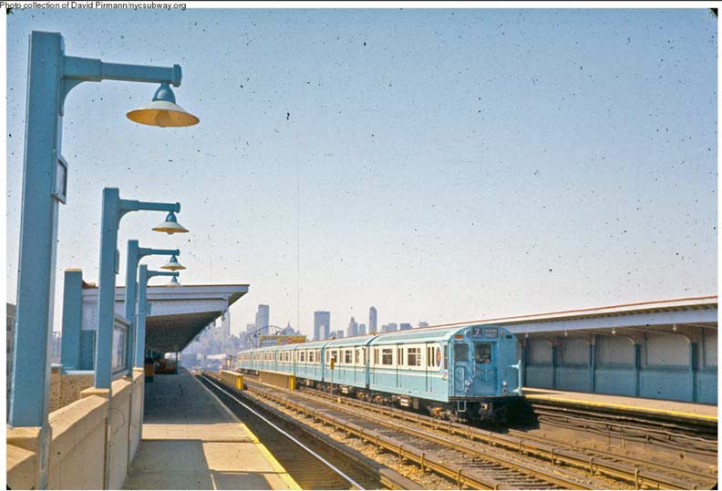
Some years earlier, the station had just received a paint job and the cars were pristine. photo: nycsubway.org
I walked Roosevelt Avenue for this project, but not under the elevated concrete viaduct along Queens Boulevard — the most extravagant such viaduct in the city. I did do so, however, in 2009.
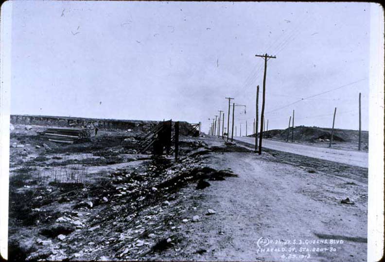
Here’s a look at what Queens Boulevard looked like at the “intersection” of Harold Avenue (39th Street) in 1913. At the time the Dual Contracts purchase had gone through and the boulevard, formerly Thomson Avenue but renamed when it was connected to the Queensboro Bridge via Queens Plaza, was being prepared for the massive concrete el that would begin rising the following year and be open for business on 4/21/17. At first the massive viaduct ran through empty fields with some farms sprinkled in, but apartments and businesses soon began to cluster along its length.

Approximately the same spot but on the south side of Queens Boulevard about 60 years later. The R-33 World’s Fair specials were still running then but as you can see, the concrete viaduct had seriously deteriorated by then. In the 1990s it was resurfaced with new terra cotta work.

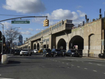
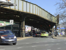
That’s more like it… a view east from beneath the 33rd/Rawson station. On a Sunday afternoon there’s relatively little traffic. It’s largely forgotten about now but the Queens Boulevard trolley lines used to run beneath the viaduct; these have been replaced by the M32 bus (which comes over the bridge from Manhattan) and the Q60.
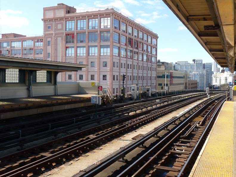
Looking west from the 33rd/Rawson platform. The tracks are about to make the curve to cross the Sunnyside Yards over a combined viaduct holding both the roadway and tracks.
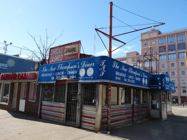
The New Thompson’s Diner at 33rd and Queens Boulevard is a diner in the classic mold, a type disappering quickly in NYC. The diner was constructed in 1950 and was named for Queens Boulevard’s old name, Thomson Avenue without the “p”; a surviving section of Thomson runs past LGCC. The diner offers a mix of traditional diner fare with Latin dishes such as maduro (fried plantains), cabrito (goat) and arroz y habicheuelas (rice and beans).
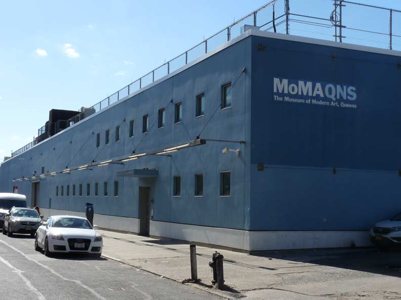
Museumgoers got their fix of Jack the Dripper, Picasso and other favorites here in Queens for a brief shining moment. In 2003-2004 the Museum of Modern Art decamped to a former staple factory on 33rd Street in Sunnyside while its 53rd Street headquarters underwent a stem-to-stern refurbishment. MoMA maintains a presence in Queens at the old PS 1 building on Jackson Avenue.
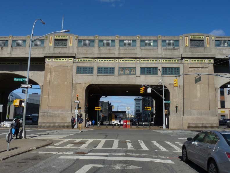
The Queens Boulevard elevated viaduct as seen from 33rd Street.
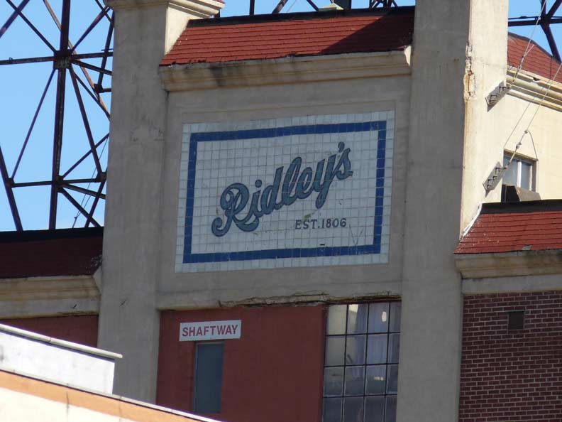
This sign for Ridley’s is invisible from the passing el because of the Rawson/33rd Street entrance. It’s a sign for the long-gone Ridley’s candy factory. According to a NY Times article the factory was built in 1923. Whatever happened to Ridley’s, I know not.
Ridley’s was a NYC department store in business between 1848 and 1901; the “est. 1806” mark here would seem to say that this sign is for a different Ridley’s. The department store building can still be found on the Lower East Side.
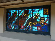
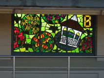
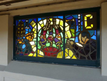
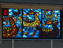
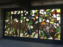
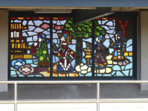
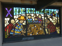
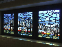
One of my favorite developments in the ongoing renovations in NYC subway stations is the stained glass artwork that has been installed on elevated station windscreens. My favorite by far in this series is artist Yumi Heo’s series “Q Is For Queens,” installed at the Flushing Line stations on Queens Boulevard, the 33rd, 40th and 46th Street stations in 1999, dividing 26 windows corresponding to the 26 Roman alphabet letters among the three stations, with a few more windows on station mezzanines added in.
I was sorry to read that Ms. Heo died after a battle with cancer in November 2016. She was primarily a children’s book illustrator. Her windows on the #7 line demonstrate a thorough knowledge of Queens lore and history — thorough enough that I can’t identify some of them, and I pride myself on my knowledge of stuff like this!
At the 33rd Street station, A stands for Aqueduct Raceway, B is the Queens Botanical Garden, C (I’m stumped; perhaps the Colombians living in Jackson Heights?) and D stands for the Hong Kong Dragon Boat Festival held in Flushing Meadows each August.
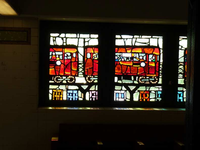
A look at the “redbird” R-33 and R-36 cars used on the Flushing Line up to 2003.

A look at storefronts along Queens Boulevard in stained glass.
40th Street/Lowery Street

In 1981 an 11-car set enters the 40th/Lowery Street station after a recent snowfall. Like the ermines whose coats turned white for disguise, the R-33 set has been painted snow white. This was a failed bid to curtail graffiti; instead, the white cars were canvases for the miscreants who soon set to work on them.
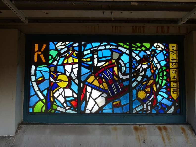
The K window at 40th Street stands for the Korean Festival held in October. Note the Korean lettering on the right (what does it say?)

The Onderdonk House on Flushing Avenue near the Brooklyn-Queens line is shown on the O panel.
46th Street/Bliss Street
The X and Y panels are stumpers for me, while the Z shows the Queens Zoo in Flushing Meadows. No problem recognizing the Queensboro Bridge, though.
Just east of the 46th Street station, The Flushing elevated turns east on Roosevelt Avenue. I’ll have more about it in Part 2. At the same time, the lengthy concrete-clad viaduct transforms to a more mundane iron trestle that runs east for over 75 blocks. I have said it’s the most magnificent concrete clad elevated viaduct in NYC, but it’s hardly the longest; the one supporting the A train on the Rockaway peninsula, engineered for the Long Island Rail Road in 1942, remains the lengthiest.
Individual stations have their ironwork clad in concrete and terra cotta at stations that were deemed especially important by the IRT and BMT in the subways’ early years. Ocean Parkway (B, Q), Mosholu Parkway (4), Bay Parkway (D) and Bronx Park (2, 5) come to mind.
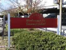
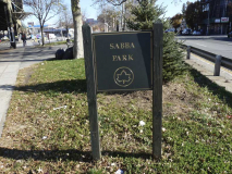
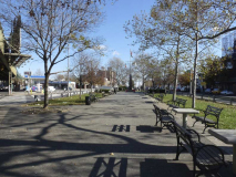
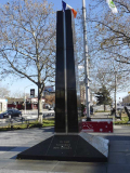
The Flushing Line’s turn onto Roosevelt Avenue throws Queens Boulevard into light for the first time since its westward end at Queens Plaza. The center median is marked by Joe Sabba Park, named for a local Sunnysider (1916-1999) who fought in World War II and edited the Sunnyside Herald newspaper for many years. The black Vermont granite war memorial by architect Dominick Segrete was erected in the Bicentennial year of 1976. After several years as Sunnyside Veterans Triangle, the space was named for Sabba in 2000.
Part 2: walking Roosevelt Avenue from 52nd to 69th Streets
“Comment…as you see fit.”
4/17/17


13 comments
The X mosaic may refer to the Chinese game of Xiangqi (Chinese chess):
https://en.m.wikipedia.org/wiki/Xiangqi
But the game depicted in the artwork itself reminds me more of Go: https://en.m.wikipedia.org/wiki/Go_(game)
very interesting
Kevin, great writeup. I too am very familiar with the #7 line. Been riding it on and off since about 1960. For a number of years in the 1970s I rode it every day to and from work, when I lived in Flushing and worked in one of the original World Trade towers.
You might want to make these additions:
1. “Between 1923 and 1949, the Astoria and Corona lines used BMT and IND IRT cars, but the divorce was made final in the latter year, with the BMT going to Astoria and IRT going to Flushing. Need to add that IRT and BMT cars were used because the Dual Contracts agreements gave both firms the right to serve the Corona and Astoria Lines. The BMT cars were older wooden elevated cars because they were built to the IRT’s narrower profile, unlike the BMT’s newer steel subway cars which could not continue east (operationally north) of Queensboro Plaza. The long-demolished north side of the station was for BMT trains, where customers transferred between steel BMT subway cars and wooden el cars to continue trips to Astoria or Corona.
The Second Avenue El used the south (current) side of QB Plaza, where IRT trains provided through service to/from Astoria and Corona, using the Steinway Tunnel and the Queensboro Bridge tracks that connected with the Second Avenue El. Even though the IRT and BMT subways unified with the IND in 1940, the split IRT/BMT operation continued until 1949. The Second Avenue El trains stopped running on the Queensboro Bridge in 1942. Its trains stopped at Queensboro Plaza where the N and W stop today.
2. The reason the R and the N switched north terminals in 1987 was because the old R route, between Bay Ridge and Astoria, had no layup or yard tracks at either end. Trains had to deadhead for overnight and weekend layups, in some cases as a far as Coney Island. The old N route, conversely had storage tracks at both ends (Coney Island and Jamaica). Under the post 1987 setup, most R trains are stored at Jamaica Yard, and N trains continue to use Coney Island. Also should that between 1949 and 1967, the BMT services to and from Astoria varied, with 4th Avenue (RR), West End (T), and Brighton (QB and QT) all taking turns over the years. In 1967, when BMT – IND became the B division when Chrystie Street connection opened, the RR was assigned 24/7 to Astoria, where it ran for the next 20 years.
Yes – however the (R) with Jamaica Yard became a very long, and UNRELIABLE line known as Rancid, Rarely or Rotten at best. When it ran to Astoria, it was much more
reliable, since it was only one hour and four minutes, verses the monstrous 1 hour, and thirty six minutes going to Forest Hill 71 Ave going completely local from Bay Ridge-95 Street in Brooklyn, which subjects this line to delays.
The Flushing line fleet beginning 1963 until retired consisted of 390 R36 WF and 40 R33 WF cars. The R33s came in two (2) versions: Mainline (small windows), Married Pair, 500 cars, #8806 – 9305, and Single Worlds Fair (picture windows), 40 cars, #9306 – 9345. The R36s also came in two (2) versions: Worlds Fair (picture window), Married Pair, 390 cars, #9346 – 9523 and 9558 – 9769, and Mainline (small windows), Married Pair, 34 cars, #9524 – 9557.
Some other concrete and terra cotta “important” or “pretty” stations are/were: Woodlawn (4), 161 St Yankee Stadium (4), Pelham Parkway (2, 5), Gun Hill Rd (2, 5), E 177 St – Parkchester (6), Westchester Square (6) and Pelham Bay Park (6).
The Polo Grounds Shuttle has a much less decorative concrete arch for a short stretch.
How many retired TRANSIT COPS can say they went to a ballgame in the Polo Grounds, Ebbets Field, 1st Yankee stadium,Shea stadium,Old and NEW MSG ? Just a nice thought. I am one of them. I bet there is less than ten. Retired 1984. There are 9 ways to reach 1st base in baseball. See if you can name them. It will take you a while. don’t get frustrated. it is fun.
Great post, and thank you for this site in general (I’ve been visiting for years). My first memory of Queensboro Plaza was when I was a child, back in the late 60’s. I moved away from NYC just before the turn of the millennium, and in my view, that part of Queens (or any part of Queens for that matter) had not changed much over the years. I drove through a few months ago on route to Long Island and boy has it changed in recent years. Manhattan has changed a lot over the years, but mostly the mix/ type of people. Despite the construction of new buildings here and there, it’s not all that different than it was when I was a child. Not so with this part of Queens, which has undergone a startling transformation.
One of the other posters commented:
“How many retired TRANSIT COPS can say they went to a ballgame in the Polo Grounds, Ebbets Field, 1st Yankee stadium,Shea stadium,Old and NEW MSG ?”
I was fortunate enough to have visited most, including the original Yankee and Shea stadiums as well as the old Madison Square Garden (for the circus, also gone now). I’m a regular at the current Dodger Stadium, but I’m thinking I’d of preferred Ebbets had I been there- too young for that one + the Polo Grounds. The Giants current home is rather nice, although Candlestick never was (too cold). Jackie Robinson and Willie Mays each have their statues prominently placed at their respective ballparks here in California, mostly for what they accomplished in New York. What an amazing era, and we’re not even talking about what the Yankees brought to it all.
If you lived in Queens in mid-1950’s how did you pick your team? All of the ballparks were within reach. I’m guessing it would have been tough and came down to an individual player. For me the choice was easy by the time I came of age, the Met’s had just won the series (I was 5) and I lived in Middle Village by then. The Dodgers and Giants were gone by then.
One last thing… I was playing Billy Joel’s live Shea Stadium concert album in the car a couple of weeks back. It was recorded just before the stadium was closed.Two things jumped out at me. First, Paul McCartney, a guest performer, said he was at Shea a long time ago, and he had a blast that night. Second, Billy Joel briefly went into a rendition of “Take Me Out to the Ballgame” and you can clearly hear the crowd erupting in the background. Highly recommended if you love ballpark history. In many ways, Shea, while newer, deserves its place ballpark history. Some truly magical things happened there.
The building that appears to be next to the subway platform does not in fact belong to LaGuardia community college. You would think so, because it really tricks you into believing it does but it’s actually home to other businesses. The building with the LaGuardia logo sticking out is the e building, and on the other side, attached, is the m building. Interestingly enough, further down Thomson u have the b and c buildings which comprise the rest of LaGuardias campus. I’m currently a film production student here and when I was going through the admissions process I mistook the building as belonging to LaGuardia at first too. I guess the red detailing on the page background is easily decieving.
Thanks — amended
Great to see and read about the NYC transit system. I lived in queens 1937 to 1959 on 39th place between 50th ave and Horace Harding Blvd (Now LIE) I walked to school 1st to 6th grade PS 76 at foot of Kosciusco Bridge (razed for LIE expansion) then JHS 125 47 ave and 46 st. Went to LIC high school in bridge Plaza and took the 7 train from Lowrey St to Bridge plaza. We recieved a train pass for FREE.I retired after 20 years from NYCTP in July 1986 and now enjoy the florida weather. I have a picture of the 7 line with just lots for blocks.
“Farming is earth’s foundation” – something like that in Korean.
This is such a good piece, but one error I noticed: the N uses R160s; only the J and L lines use R143s