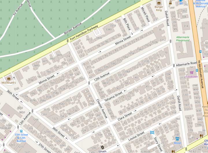
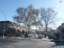
There is a small wedge of Brooklyn, between Church Avenue, 36th Street, Fort Hamilton Parkway and McDonald Avenue, that’s not quite Borough Park and not quite Kensington; I imagine both neighborhoods have claimed it over the years. There’s nothing unusual about its housing stock, mostly residential with a commercial strip along Church, and a mix of car repair joints and florists along Fort Hamilton Parkway, which borders Green-Wood Cemetery.
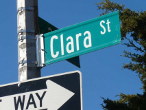
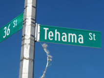
The area does have a set of streets that have nothing to do with the rest of Brooklyn’s map: Louisa, Clara, Tehama and Minna Streets. Perusing older maps, you see that 12th Avenue was extended east through the region to meet Dahill Road.
According to commenter Edward,
Minna, Tehama and Clara, along with Clementina Street (now 12th Ave.) originated on an 1868 map of the Martense Farm. The now-vanished Clementina Street survives in San Francisco, right near the others. Intersecting the “daughter” streets is Chester Avenue (possibly a son?), and Martense Lane (now 36th Street) was the farm’s southwestern boundary. Whether these were named for children of Mr. Martense or someone else, and what the San Francisco connection is and which came first, I know not. Two other streets, Park Street and Evergreen Place, are also mentioned, but I don’t know what they became.
The street grid here parallels those of Windsor Terrace and Parkville, and as in those preexisting communities was retained when the overall street grids were adopted by Kings County in 1874; it does make for a smooth transition between Borough Park and Kensington. It would appear that it was the 1874 plan that incorporated Clementina Street into 12th Ave, turned Martense Lane into 36th St., and added Louisa Street.
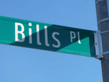
Though most of the development was constructed by the 1920s, a pair of streets between Minna and Fort Hamilton Parkway were added after World War II. These were simply named “Bill’s Place” and “Micieli Place”; Bills has lost the apostrophe over time. To this day, I’m unsure how Micieli is pronounced. Mitch-CHAY-lee is my guess, but set me straight in Comments.
Edward: The [Brooklyn] Eagle issue of June 18, 1942 (pg. 7, col. 4) reports: “One measure creates Bills Place in memory of Pvt. Matthew Bills, who lived at 921 New Utrecht Ave., and the other creates Micieli Place in memory of Second Lt. Frank J. Micieli, who resided at 70 Dahill Road.” The legislation naming the new streets was introduced by Councilman William McCarthy and signed by Mayor LaGuardia.
Please help contribute to a new Forgotten NY website
Check out the ForgottenBook, take a look at the gift shop, and as always, “comment…as you see fit.”
8/23/18; rev. 8/28/18

7 comments
Very, very interesting..Brooklyn is enormous……Thank you again.
“To this day, I’m unsure how Micieli is pronounced”.
I pronounce it mis-cel-lee.
Reading this reminded me that you featured the neighborhood in an article on Church Ave. in 2016. I commented at that time how I was introduced to the area as a newspaper boy for the World Telegram & Sun back in the early 60’s. Read the comment here: https://forgotten-ny.com/2016/01/church-avenue-flatbush-part-1/.
What did u use for that digital map? That’s some great detailing!
I searched The Brooklyn Daily Eagle for more information on developer William Micieli and found out that Judith Weiss should have researched a little deeper, as apparently William Micieli didn’t exist.
What I found out was even more interesting.
The two streets commemorate two soldiers from the neighborhood KIA during World War II.
The Eagle issue of June 18, 1942 (pg. 7, col. 4) reports: “One measure creates Bills Place in memory of Pvt. Matthew Bills, who lived at 921 New Utrecht Ave., and the other creates Micieli Place in memory of Second Lt. Frank J. Micieli, who resided at 70 Dahill Road.” The legislation naming the new streets was introduced by Councilman William McCarthy and signed by Mayor LaGuardia.
As to the “daughter” streets. Minna, Tehama and Clara, along with Clementina Street (now 12th Ave.) originated on an 1868 map of the Martense Farm. The now-vanished Clementina Street survives in San Francisco, right near the others. Intersecting the “daughter” streets is Chester Avenue (possibly a son?), and Martense Lane (now 36th Street) was the farm’s southwestern boundary. Whether these were named for children of Mr. Martense or someone else, and what the San Francisco connection is and which came first, I know not. Two other streets, Park Street and Evergreen Place, are also mentioned, but I don’t know what they became.
The street grid here parallels those of Windsor Terrace and Parkville, and as in those preexisting communities was retained when the overall street grids were adopted by Kings County in 1874; it does make for a smooth transition between Borough Park and Kensington. It would appear that it was the 1874 plan that incorporated Clementina Street into 12th Ave, turned Martense Lane into 36th St., and added Louisa Street.
Thanks. I have rewritten the page and included your comment.
Very interesting. I’ve found a map of San Francisco dated 1849. The “children’s streets” are on this map. Based on some additional research, I believe it likely that these street names were used in San Francisco before they were used in Brooklyn.
I also think it likely that some of the female names were in honor of favorite prostitutes who served the miners. An autobiographical fragment of Minna, that supports my theory, is on the internet.