
Staring out in New Dorp, I did a somewhat ambitious walk through northeast Staten Island, winding through Dongan Hills, Concord and Grasmere, winding up at the Staten Island Railway station at Bay street in Clifton. Naturally, I took the bus back to the ferry from there. The weather was crisp and clear, an anomaly in this so-far mild, foggy winter 2019-2020.
Dongan Hills is the neighborhood just north of Grant City. Irish Catholic Thomas Dongan (1634-1715) was appointed governor of New York by the Duke of York in 1682 and remained at that post until 1689. His tenure was marked by religious toleration, rare in that era; his family had to move to France when he was a boy when Oliver Cromwell’s forces overthrew and executed Charles I in 1649, and perhaps Dongan was sensitive to the persecution of faiths other than the Church of England. Dongan convened the first-ever representative assembly in New York history. He became 2nd Earl of Limerick in 1698. As part of his appointment he was granted 5100 acres in what is now Dongan Hills, which he later expanded to 25,000 acres. His legacy is remembered here, along with three streets on the island named for him.
GOOGLE MAP: NEW DORP TO CLIFTON


Located on Jefferson Street between Garretson and Cromwell, PS 11 is one of NYC’s classic public schools, many of which were designed by architect C.B.J. Snyder. The school serves students from K-5 and was constructed in 1918, celebrating its centennial in 2018. As is the case with many public schools and churches around town, online information about the history and architecture of the building is hard to come by.


The Roman Catholic parish of St. Ann was founded in 1914 and the present church building was dedicated in 1922 at Jefferson and Cronwell, with its newer school building across Jefferson Street. According to the church tradition, Ann was the mother of Mary and Christ’s maternal grandmother — though her name does not appear in any Gospel and has been only gleaned from apocrypha.
Dongan Hills’ Historic House
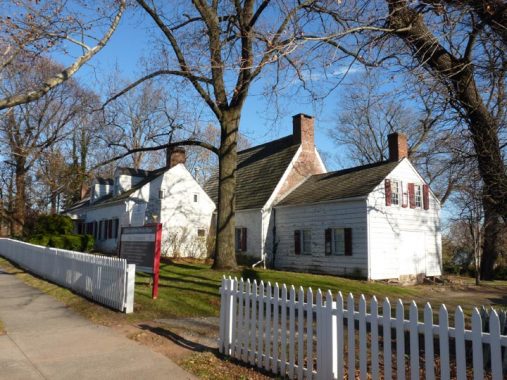


I made sure to visit the Billiou-Stillwell-Perine House, one of the oldest buildings in Staten Island and indeed one of the oldest in the city. This house on 1476 Richmond Road predates Thomas Dongan’s gubernatorial era. In a borough that preserves more 17th-Century dwellings than any other, this is its oldest: indeed it is the third oldest building in New York State. Like many colonial homes, it features a very small central section added to in subsequent years. Pierre Billiou (1625-1708), a French Huguenot judicial officer and delegate to the New York general assembly, built a simple stone structure here in 1662 when the region was known as Oude Dorp (“Old Town”). Billiou’s daughter married a Thomas Stillwell, and the Stillwells occupied the dwelling till 1764, gradually adding to the structure; members of the Perine family then lived here until 1919. It’s currently maintained by the Staten Island Historical Society. The oldest section of the building, the center fieldstone part, may be seen by strolling around to the back.
The Stillwell House was one surrounded by farmland that stretched all the way south to Raritan Bay. Though it is maintained by the Staten Island Historical Society headquartered in Richmondtown, it has not been transported to the Richmondtown Restoration as have so many other of Staten Island’s historic buildings.
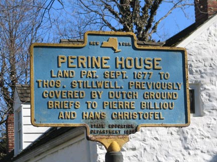
Unfortunately, the historic sign placed at the house in the 1930s by the NYS Education Department has been stolen or otherwise removed. I’m hoping that the SIHS could fund a replacement sign, as companied such as the Pomeroy Foundation do this sort of work. I snapped this photo of the sign on a previous swing by the house a few years ago.
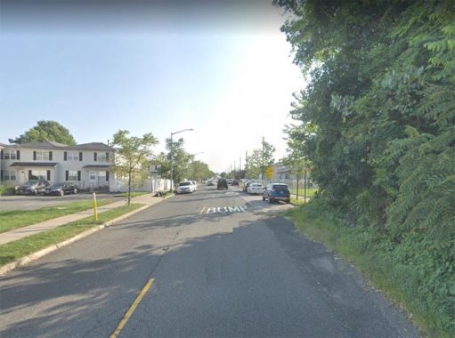
Richmond Road itself is a major route. It dates to the early 1700s in the colonial era, running from Clifton to Richmondtown, and may even have been part of a Native American trail in the precolonial era. It skirts the high hills of mid-Staten Island on their southern flank: Grymes, Emerson and Todt Hills. In New Dorp and Richmondtown, it gives rise to Amboy and Arthur Kill Roads, both of which run to Tottenville, and Richmond Hill Road, which climbs the hills of LaTourette Park on its way to New Springville.
Some of the buildings on the left side of the photo are actually on Overlook Avenue, on one of the foothills of the much higher Emerson Hill.


There aren’t a lot of pizzerias around town that resemble Dough By Licastri, at Richmond Road and Delaware Avenue. It’s what appears to be and likely once was a private home. I did not stop in and try anything, though it bills itself as the best pizza in Staten Island, a borough that can boast renowned pizzerias such as Denino’s in Port Richmond. Stephen Licastri passed away recently, in mid-2019.
A flower dealer operates out of the front of this gabled building with a corner tower at Richmond Road and Atlantic Avenue.
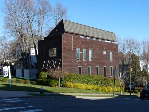
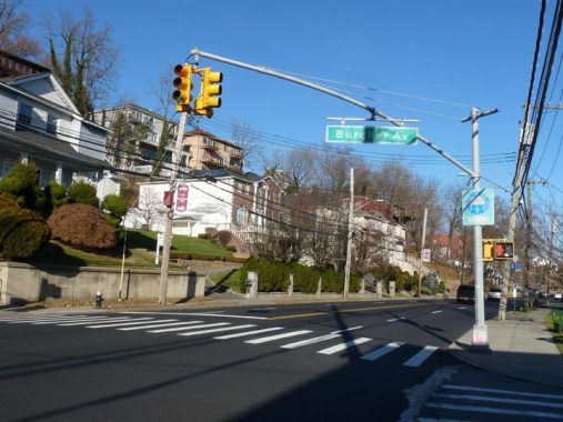
This is actually a newer building at Richmond Road and Burgher Avenue that has been given a rustic look by adding thin wood siding to the exterior.


Old Town Road runs east-west through the Staten Island neighborhood of the same name. It was originally, in Dutch, “oude dorp;” contrast to New Dorp a couple of miles to its south. In the 1660s it was settled as part of the first European formal living situation on Staten Island by Dutchmen and French Huguenots and Walloons that included Pierre Billiou, whose house still stands on Richmond Road (see above). To this day Staten Island street names have a Belgian and French flavor, such as Brabant Street (Mariners Harbor) and Huguenot Avenue (in Huguenot on the south shore). The Huguenots were French Protestants, Walloons Belgian Protestants; the two countries remain majority Roman Catholic.
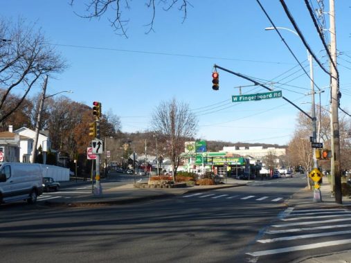
The west end of West Fingerboard Road meets Richmond Road at Targee Street. The name’s derivation isn’t totally clear, but rumor has it that in the early 1800s, a finger-shaped sign, mounted as part of a wooden board, pointed the way to the Richmond County courthouse, which was then located in Richmondtown in a building that still stands.
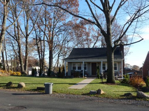
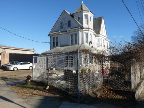
1010 West Fingerboard Road, at Stanwich Street, presents a suburban or even rural appearance on its sidewalk-free, isolated plot.


Stonegate is a large condominium complex, with mostly identical buildings, developed in the 1970s in Old Town and located between West Fingerboard Road, Stanwich Street and North Railroad Avenue. It’s a private development with its own lamppost and street sign designs, and also no trespassing signs, so I didn’t stick around. There’s more than one way to skin a cat, though, as this video shot by a drone overlooks the development.
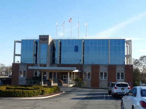
Only one NYC borough has its own borough-wide newspaper. The Staten Island Advance has published since 1886, before Staten Island was part of NYC, and competed with eight other dailies at the time. It was run by the Newhouse family for many decades. In 1960, it moved to its current headquarters on West Fingerboard Road, giving it access to the Staten Island Railway which aided in deliveries. The paper still has a track siding. The Advance runs the SiLive website.


Garretson Lane is a short road connecting North Railroad and Mosel Avenues on the east end of Stonegate. At first I thought these shacks may be very old dwellings, but they’re actually garages for houses on Grasmere Avenue, one block to the east.
This is the edge of the Grasmere neighborhood, which straddles the Staten Island Railway south of the Staten Island Expressway in an area with oddly-defined borders; I’ll just say it’s west of looping Hylan Boulevard. “Grasmere” means “grassy meadow” but the area is marked by its private ponds and lakes, many of which I visited on this walk through NE Staten Island in FNY in September 2013.
Mosel Avenue, seen here at the edge of Eibs Pond Park, is an express route from Grasmere to Park Hill, running from about Clove Road then under the Staten Island Expressway to Osgood Avenue. It skirts the east end of a neighborhood called Concord.
Glancing at the street signs in Concord will reveal the names of German rivers and other Germanic names: Steuben, Oder, Neckar, Rhine, Mosel, Elbe and more; Concord had a predominantly German population after its 19th-Century founding. Emerson Hill is nearby: Judge William Emerson, brother of Transcendentalist author and philosopher Ralph Waldo, lived on it, and R.W. and mutual friend Henry David Thoreau were frequenters of the region.
I was unable to enter Eibs Pond Park from here as there is no entrance on Mosel Avenue. However I was able to manage it on a previous visit to Park Hill. The pond and park were named for a German-American family who owned land in the area during the 1800s. They used the pond as a watering hole for their horses and dairy cows. Descendants of the Eibs family continued to live on this site until 1971.
Another entrance to a private development with a Checkpoint Charlie, Celebration at Rainbow Hill, this time on Osgood Avenue west of Mosel. The reason for a number of gated communities in the area maybe the nearby presence of the Park Hill Houses, a relatively tough part of town.
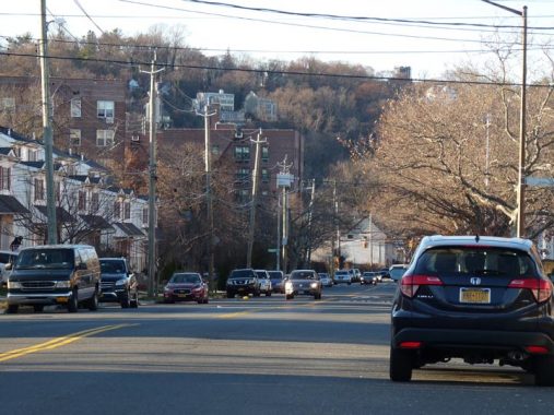
New York City is not known for being mountainous. However, some of the tallest hills in New York State are located on Staten Island. This is Osgood Avenue looking west toward Grymes Hill. Back in 2009, I climbed Grymes Hill and lived to tell about it.
Making my “final approach” to Clifton, I turned right on Greenfield Avenue. It had the benefit of going downhill.


Along Greenfield Avenue, as you will see, is a mix of the very old and the very new. Eastpointe at Bridgeview is literally in view of the Verrazzano-Narrows Bridge. It was constructed in the 1990s; I could have wandered in boldly, but I was losing the sun and decided against.
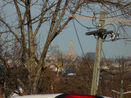
I used my 18x zoom to get this shot of One Hanson, or the Williamsburg Bank Tower at 4th Avenue and Hanson Place in downtown Brooklyn. For decades it was the undisputed king of Brooklyn skyscrapers, and still has the largest 4-faced clock tower in NYC. It has since been surpassed in height a number of times in Brooklyn, however. The tower is 10 or 12 miles away from Greenfield Avenue in Clifton. I also called it the House of Pain, since I had some oral surgeries done there.


At the bottom of the hill, Greenwood Avenue runs under the Tompkins Avenue overpass. Here, Tompkins Avenue is bridged over both Greenfield Avenue and the Staten Island Railway; the staircases still have their nearly century-old iron handholds and railings.
Tompkins Avenue relays traffic into the heart of Tompkinsville, originally a small town founded in the early 19th Century by James Madison’s vice president, Daniel Tompkins (1774-1825). Tompkins is buried in the St. Mark’s in the Bowery churchyard at 2nd Avenue and East 10th Street along with Pegleg Pete Stuyvesant, New Amsterdam’s Dutch colonial director general.


North of Tompkins Avenue, Greenfield is an utter mishmash of well kept dwellings from the late 19th and early 20th Centuries…


…as well as heavy industry, concrete plants, and building supplies outfits facing the Staten Island Railway side. Perhaps there had been layup tracks for these companies to transport supplies.


Most fascinating, however, is this abandoned pair of abandoned brick buildings on the railroad side. The larger one features some amazing Beaux Arts detail. The bars on the ground floor windows were likely added during the final days as an actual dwelling. I would like to know more about these buildings.


I was surprised to find that Staten Island has an Amazon Court, on Greenfield Avenue opposite the ancient brick houses. Of course it has nothing to do with the product delivery/entertainment behemoth, which has a sorting facility in Bloomfield on the other side of the island, but decided against bringing an office facility to Hunters Point, Queens.


With shadows lengthening it was time to wrap up this walk at Bay Street and Greenfield Avenue at the Clifton SIR station. Though most SIR stations were rebuilt in the 1980s, Clifton’s brick and concrete shelter was retained.
Check out the ForgottenBook, take a look at the gift shop, and as always, “comment…as you see fit.”
1/5/2020
5 comments
Interesting that you took the bus from a rail station. I ran the trip on Google Maps and it also put me on the S51 bus. Not sure why, since it carries a walk on both ends.
Followup: I see why the bus. During rush hour, the SIR runs zone trains. Trains from the southern part of the line skip the northern part (where you were) and go directly to the ferry terminal. and local trains end at Tompkinsville, not the ferry terminal, requiring a transfer or a walk.
I read the timetable incorrectly. Local trains DO go to St. George.
Interesting to see a Staten Island condominium named Stonegate. It must have been a trend setter: circa 2001 the Stonegate subdivision of Johnson Ranch, which is 50 miles east of Phoenix, AZ was built. It’s a gated community of single family homes that are adjacent to JR’s 18 hole golf course (click below):
https://www.neighborhoods.com/az/san-tan-valley
I wouldn’t say “Some of the tallest hills in New York State are located on Staten Island.” Rather “Some of the highest hills on the Eastern Seaboard are on Staten Island.”