

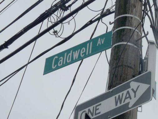
THERE’S something odd about Caldwell Avenue in Queens, which runs from 68th Street at Mount Olivet Cemetery east and southeast to Dry Harbor Road at about 84th Street, though it’s one way west between 68th and Eliot Avenue and one-way east from Eliot east to Dry Harbor Road. What’s odd is that it cuts across the street grid in the area and there’s something odd about the name, as it turns up elsewhere in the area…or used to. I’ll explain.
The avenue today is mostly residential, with one and two family homes dispersed along its length. except for the Caldwell Deli at 69-50 — where I occasionally made a pit stop when bicycling out to Maspeth from Bay Ridge back in the 1970s and 1980s.
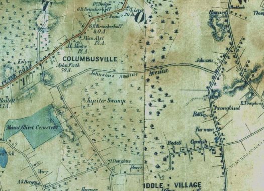
What we’re gonna do right here is go back…way back…back into time. Here’s an except from a Dripps map of Maspeth made in 1852. A street grid was not even considered at this point and as we’ll see, it really wouldn’t be plotted for several decades. The Plank Road at the top is now Grand Avenue, with Dry Harbor Road and Woodhaven Boulevard on the right.
But Caldwell Avenue is there too, running exactly where it runs today, but it was called Johnson Avenue. It abutted some property owned by a Johnson, hence most likely the name.
Moving ahead to 1909 we find little development at all along Johnson Avenue, with just a few houses (marked by yellow rectangles). Then as now, it ends at Dry Harbor Road.
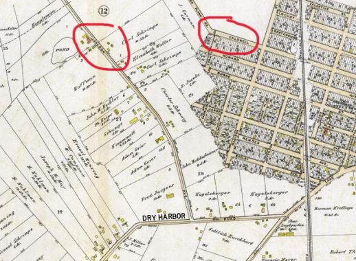
Look at the upper right corner of the map and you’ll see a Caldwell Avenue…but it’s tabbed here as part of what is now 57th Avenue, which was once a part of the North Hempstead Plank Road. The bend in the road shown here is still in place.
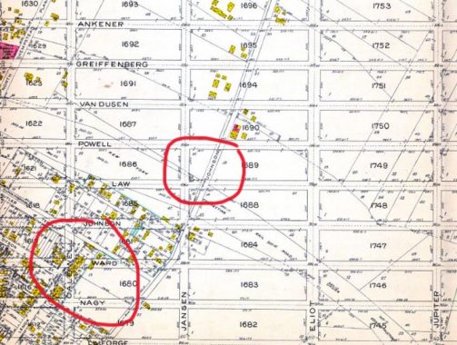
By 1915, developers are trying to impose a near-perfect street grid on the area, which had acquired the name “Nassau Heights.” As you can see, nothing had yet been built on any of the streets, one of which, if you look closely, is called Caldwell Avenue. Planners at one time wanted to redirect Johnson Avenue so it ran straight to the northeast. But that section of Caldwell Avenue was never built, as property owners in the small streets on the lower left end of the map refused to sell, and those little streets, now numbered, are still in place today as are some of the buildings.
Johnson Avenue, meanwhile, goes its merry way, floating off against the grid, and some of those yellow rectangles along its length are still there no doubt.
A couple of the names on this map survive on modern maps, such as Caldwell, Eliot and Ankener.
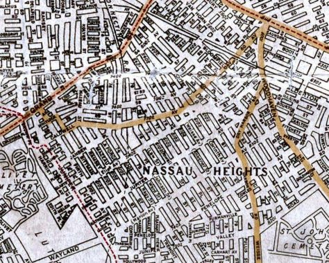
By 1922, south of Johnson Avenue, now called Caldwell, the grid was indeed built, but it was not heavily populated for years to come. The moniker Nassau Heights, as Columbusville before it, slipped into disfavor and residents say they’re in Maspeth or, toward the south, Middle Village, with Rego Park east of Woodhaven Boulevard.
If you pass Caldwell Avenue today, there are still traces of its past as a carriage road through farms… as it’s still sidewalk-free in some blocks, as seen in the title card.
But who was Caldwell?
In Comments, a pair of articles are linked that partially clear this up. Wallace, or W.E. Caldwell, is listed as a developer and a property owner. Johnson Avenue was likely renamed for him.
As always, “comment…as you see fit.” I earn a small payment when you click on any ad on the site.
6/30/21
1 comment
could be Wallace E. Caldwell. I located these 2 articles https://www.qchron.com/qboro/i_have_often_walked/not-the-city-s-street-to-pave/article_594869e7-5ae1-556d-90ab-63b04090cb09.html + https://junipercivic.com/juniper-berry/article/where-was-nassau-heights