

BY SERGEY KADINSKY
Forgotten NY correspondent
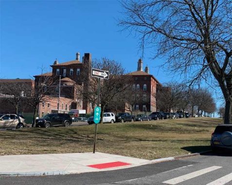
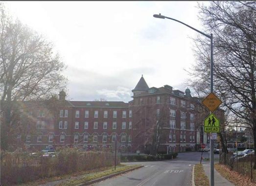
OVERSHADOWED by the tangle of ramps on the Bronx side of the Whitestone Bridge is a historic Catholic school bypassed by millions of drivers with little thought of its purpose and meaning. I’ve been puzzled by it for many years, an apparent chateau hemmed in between a sizable cemetery and the ramps that connect the Hutchinson River Parkway, and the Bruckner, Cross-Bronx, and Whitestone Expressways.
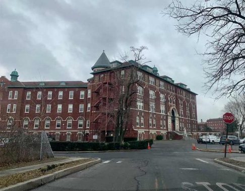
Having taken this highway on a couple of visits north to Quebec, St. Joseph’s School for the Deaf reminded me of Chateau Frontenac. But this isn’t a luxury hotel overlooking a walled Old City. It is a school built on the edge of the city befitting an asylum for the misunderstood members of society. At this school, the students have a sense of community nurtured by the church.
Driving closer to this Romanesque Revival structure that is St. Joseph’s School for the Deaf, I noticed that it has a fraternal twin on the other side of the Whitestone Expressway, Monsignor Scanlan High School. Indeed before this highway was completed with its namesake bridge, the two schools were on a single giant property lot. Before urbanization reached the eastern Bronx, the Roman Catholic Church had vast holdings in the borough, including an orphanage/reformatory on the site of Parkchester, and this Ferry Point property.
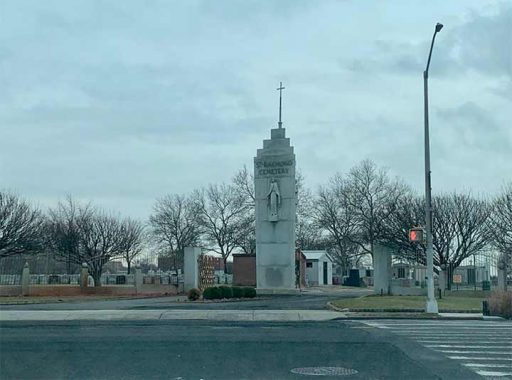
Across Lafayette Avenue, St. Raymond’s Cemetery welcomes an average of 2,500 departed individuals every year. Among the Catholics honored here are Latino entertainers Tito Rodriguez and La Lupe, jazz musicians Hilton Ruiz and Dave Valentin, Billie Holiday, Frankie Lymon, boxer Hector “Macho” Camacho, Typhoid Mary, and Father Duffy, among others. Numerous Irish, Italian, and Hispanic names appear on the headstones here. This is the city’s largest Roman Catholic cemetery, at 180 acres.
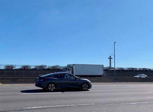
For drivers taking the Whitestone Bridge, the cemetery’s most visible monument is the massive crucifix facing the expressway. Giant crosses and Jesus monuments can be found in many places around the world, usually where Roman Catholics are the majority. But New York is not Rio de Janeiro or Montreal. Our government has always been secular, and that’s why our city’s biggest cross is on private land.
The older buildings of the church’s Ferry Point holdings are on the west side of the expressway, hosting Monsignor Scanlan High School. Looking east on Lafayette Avenue we see the school on a hilltop. It was originally part of the St. Joseph’s School, but as it became impractical to run one school separated by an expressway, it split off as St. Helena Commercial High School. In 1976 its boys and girls divisions merged as the co-ed Monsignor Scanlan High School. Its namesake is Arthur J. Scanlan (1881-1974), who served at St. Helena’s Parish that covers the eastern Bronx. This high school moved to the St. Joseph’s campus in 1949, having outgrown its original location near Parkchester.
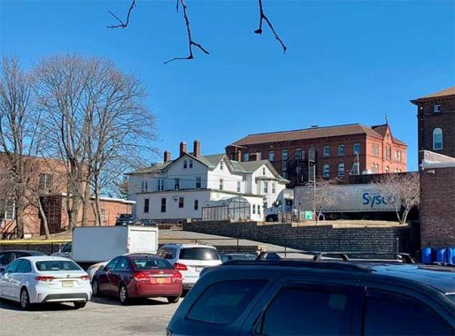
This old structure dates to 1897, designed by the firm Schickel & Ditmars, which worked on many Catholic structures throughout New York. This complex envelops a much older building, the alumni office, which previously served as the Sisters’ Convent. It was built in the 18th Century by the Ferris family, which owned land in Ferry Point and Unionport across Westchester Creek. They had a family cemetery that diminished in size as Unionport became more urban and industrial. Kevin took a tour of it in 2006. It seems to be an unintentional pun that the Ferris family had land on Ferry Point.
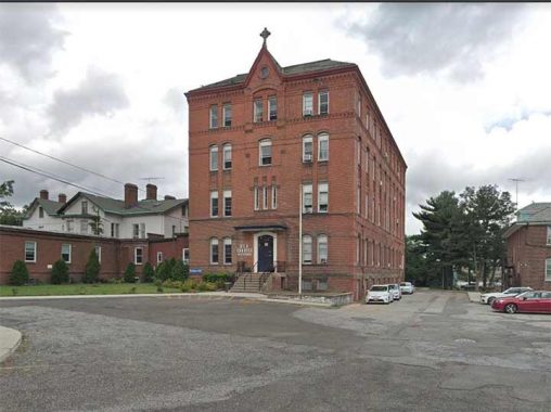
Catholic school enrollment in the city has been declining in recent years and some of the parochial buildings have been reassigned to non-Catholic schools. The Bronx Arts & Science Charter School now occupies the former boys school building. A Celtic cross atop the building testifies to its past. Last year I documented a similar Catholic-to-charter school conversion in Bed-Stuy.
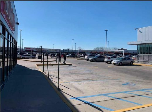
On the south side of Lafayette Avenue, across from the high school is Throggs Neck Shopping Center, with Target as its anchor tenant. It was completed in 2014, succeeding a warehouse that was built here in the 1960s. Further back in history, this is where English settler John Ferris built his first home in the Bronx in 1667, receiving a patent for this property from governor Richard Nicholls, the colony’s first English administrator. In 1934 the federal government conducted an architectural survey of the old house and took photos too, making it possible to have it rebuilt, or replicated in miniature.
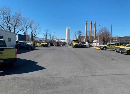
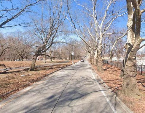
Lafayette Avenue is unusually wide for this part of the borough because it was intended to run uninterrupted from Hunts Point to Throgs Neck. Doing so would have involved building bridges across the Bronx River and Westchester Creek, but it never happened. The dead-end where Lafayette Avenue meets the creek is a DOT maintenance yard.
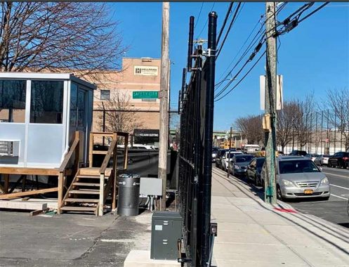
The curiosity here is the Safety City Boulevard sign. Prior to the Covid pandemic, this site hosted Safety City, a DOT educational facility where children are taught street safety on a miniature street layout. Having discussed the physical layout of St. Joseph’s and its environs, I examined its history on maps.
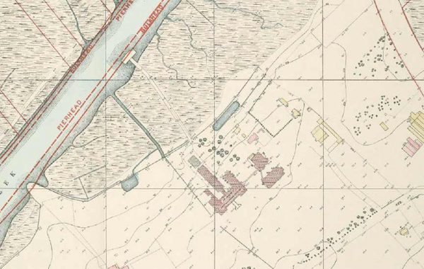
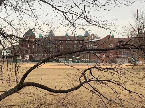
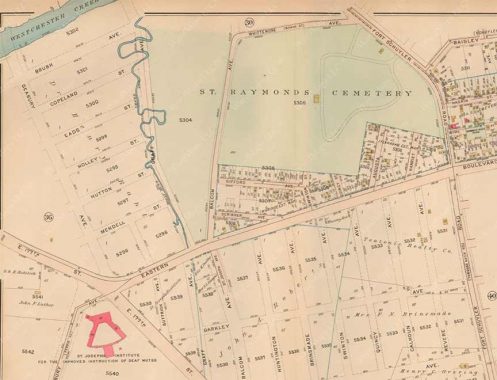
On this 1905 topographical survey, we see Monsignor Scanlan High School facing the creek, with a dock for boat access. The more scenic St. Joseph’s building would appear on maps in 1913. Its first campus was in Fordham, where the Society of the Daughters of the Heart of Mary opened the school in 1869. Growth in enrollment resulted in its relocation to Ferry Point.
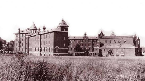
To my surprise, none of these historic buildings have been landmarked by the city. They are not in danger of demolition or abandonment, but one never knows. Across the city, decline in church attendance has resulted in their closing, with some of them razed in favor of housing. This photo from 1928 shows the school in an empty field. The cemetery had not yet expanded to surround the school. As a fan of comic books, the school’s appearance also evokes Prof. Charles Xavier’s School for Gifted Youngsters. But its location is further “uptown” in Westchester County.
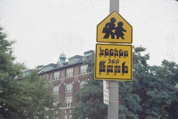
Those who cannot speak rely on sign language to communicate. In recognition of this, the city commissioned artist Martin Wong’s work Traffic Sign for the Hearing Impaired, which was installed in 1992 outside of the school. I don’t know when that sign was removed, but as the DOT occasionally approves of artistic street signage, I’d like to see it restored here. One of Wong’s sign language stop signs sold for $23,750 at an auction in 2019.
Westchester Creek has its own chapter in the book Hidden Waters of New York City, but until I researched St. Joseph’s School for the Deaf, I had no knowledge that it had an obscure tributary, Molly Hunt Creek.
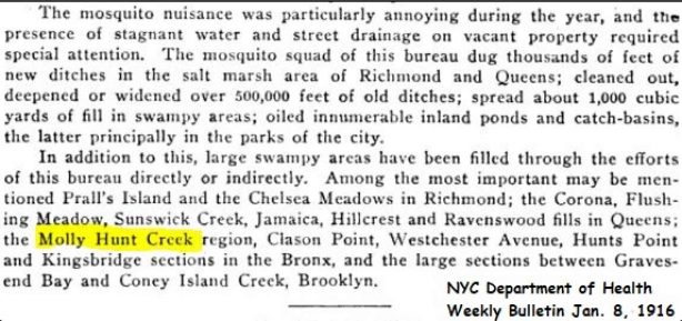
I could not find information online on its namesake, but the creek functioned as a border for Old St. Raymond’s Cemetery. It was filled by the city in 1916 in its campaign to eradicate the “mosquito nuisance.” With the construction of highways, the former course of the creek became the ramp connecting westbound Bruckner Boulevard with the northbound Hutchinson River Parkway, bordering on the cemetery.
The upgrade of Eastern Boulevard into Bruckner Boulevard and then Bruckner Expressway resulted in its widening and the erasure of the one-block Scribner Avenue and the isolation of Gifford Avenue, hemmed in by the cemetery and the highway.
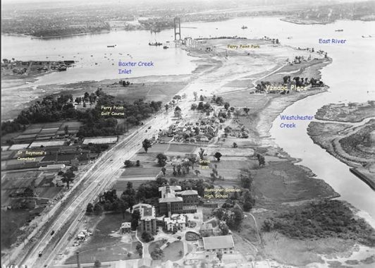
A 1938 aerial survey from the MTA archives shows Whitestone Expressway bisecting the church property. The labels indicate the Ferris family’s Grove Farm, Ferry Point Park, and Yznaga Place, which Kevin documented in 2001. The cove next to the bridge, Baxter Creek Inlet, would later be filled and became a Trump-operated golf course in 2015.
With so many changes to the landscape around it, the historic school for the deaf appears as it did when its doors opened more than a century ago.
Sergey Kadinsky is the author of Hidden Waters of New York City: A History and Guide to 101 Forgotten Lakes, Ponds, Creeks, and Streams in the Five Boroughs (2016, Countryman Press), adjunct history professor at Touro University and the webmaster of Hidden Waters Blog.
2/19/23
7 comments
Great posting, but may I suggest one correction. The roadway that begins immediately on the Bronx side of the Whitestone Bridge is the Hutchinson River Parkway. The Whitestone Expressway (Interstate Route 678) is the highway that connects the Queens side of the bridge and the Van Wyck Expressway just north and east of Citi Field. Believe me, I have driven on those routes enough times.
The road on the left side of St. Joseph’s is no longer there. The Hutchinson River Pkwy. is on the right side of St. Joseph’s.
An outstanding and extremely informative “slice”, Sergey.
Who knew that Billie Holiday was a Catholic
Thanks for sharing these historical, informative, landscape perspectives
I use to teach on the campus of Scanlan.
Eventually we moved to Soundview to a new building and a new charter took over.
Great memories.
Great article. I went to the Cardinal Hayes Annex in St Helena’s High School. It was one of those small white buildings. I also spent a lot of time swimming in Westchester Creek. I ascribe my excellent immune system to that.
I occasionally drive by St. Joseph’s, as it is a shortcut from the Bruckner Expressway to Randall Ave.