
GETTING tired of the One and Done series yet? I’m not, I’m having fun with it. My thinking is I’ll wrap up Manhattan, then wait a few weeks and tackle Brooklyn, then Bronx and Queens. Staten Island, that’s a bit different. The island is still being developed with new housing plots, with their own one-block streets, opening every year. Usually those streets take on generic, whitebread names or they are named for the sons or daughters of the developers. I will have to limit Staten Island coverage to longstanding streets that have been in place for decades.
A few weeks ago, it popped into my head that I haven’t listed every street in Manhattan that runs for one and only one block. My criteria for this project were simple. The one-block street should intersect only the two streets where it begins and ends (or one street, if it’s a crescent and begins and ends at the same street) and should not be a section of an interrupted numbered street. And, they cannot be honorific street names slapped onto already existing streets. If I listed those it would entail a separate website.
In Parts One and Two, I combed the island below 14th Street, so this week we’ll travel north again. Between 14th and about 125th, there’s little in the way of One and Done, but there are a couple squirreled away here and there.
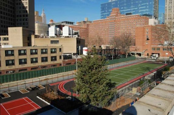
Asser Levy Place
A one-block stretch of Avenue A, between East 23rd and East 25th Street, was cut off from the rest when Stuyvesant Town and Cooper Village were constructed in 1947. It was renamed Asser Levy Place, for one of NYC’s first Jewish settlers. Governor Peter Stuyvesant tried to bar him from the city militia, but Dutch West India Company directors in Amsterdam upheld Levy. The city renamed Avenue A for him in 1954. Since then, the street has also been subnamed Jewish
Between about East 26th Street and East 53rd Street the Manhattan riverside bends inward and there is no room for Avenue A, but it once again appeared at East 53rd and runs north to another inward turn of the East River at East 92nd Street. It is known as Sutton Place, for dry goods merchant Effingham Sutton, north to East 59th Street.
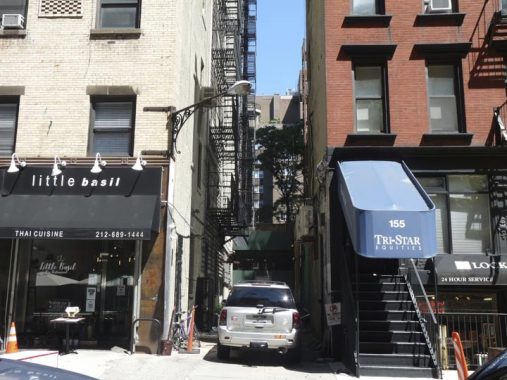
Broadway Alley
In older Northeast cities, or the oldest parts of those cities, the street system may follow a rough grid, but there are plenty of diagonals and meanderings. There is also a wealth of small alleys and dead-ends, used to enter the back doors of businesses, but also home to out-of-the-way dwellings. Unusually, NYC never developed very many of these alleys, especially in Manhattan.
There are exceptions such as Stuyvesant Street, between East 9th and 10th Streets and 2nd and 3rd Avenue, which used to be the driveway to the Stuyvesant family farmhouse when the area was completely rural, and Asser Levy Place on East 23rd Street — a cut-off former section of Avenue A. And then, there’s Broadway Alley, between East 26th and 27th Streets immediately west of 3rd Avenue. Broadway Alley, by some accounts, was laid out as early as the 1830s as a break between surrounding buildings.
By 1909, mapmakers began showing the name “Broadway Alley.” Note the individual dwellings shown on the east side of the alley. Today, just one remains.
Broadway Alley is approximately five blocks east of the actual Broadway, which is the longest street in Manhattan and the Bronx. There is speculation that along the way, it acquired the name because local property owners wanted to impart a gay, (in the ‘upbeat’ sense of the word) theatrical aura to the place. However, as you might expect, in its almost 2-century history, it has been home to prostitution and crime. It was once lined on its east side with stables and tenement houses. A story holds that the Barnum and Bailey Circus had kept their elephants in the alley at one time.
My chief attraction to Broadway alley is, of course, the antique Type G wall lamp on East 26th Street. On this FNY page, I take a deep dive into Broadway Alley and attempt to discover why it’s there.
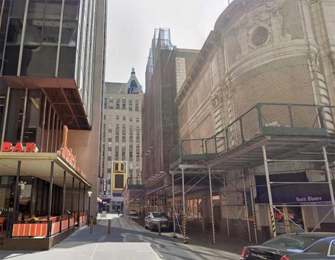
Shubert Alley
The Shubert Organization is one of the foremost “movers and shakers” on Broadway, constructing numerous theaters and producing dozens of plays. It was founded by three brothers, one of whom, Sam Shubert, lent his name to this Venetian Renaissance theater in 1913, on the right in this view from West 45th. Pal Joey, Kiss Me Kate and Chicago have all played here but in recent memory, the theater is most famous for A Chorus Line, which set a record for continuous performances here. A public alley adjoining the theater was where actors looking for calls used to meet. It’s also notable for its corner neon sign on West 44th. So far, the NYC Department of Transportation hasn’t marked it with street signs.
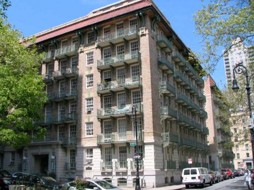
Cherokee Place
I had always been under the impression that Cherokee Place, between East 77th and 78th Streets near the FDR Drive, was cut through when the Drive was constructed here in the early 1940s, but the short alley has actually been here since 1912. It was named for the Cherokee Club, an East 79th Street headquarters of the powerful Democratic Party organization, Tammany Hall. As it happens, the Cherokee Club is still there, now as an apartment building.
But, what truly dominates Cherokee Place, and has since 1912, is the former Shively Sanitary Tenements (now Cherokee Apartments) with its distinctive balconies facing the river. Before today’s tuberculosis treatments, it was thought that the best way to treat ‘consumption’ was with plenty of light and air. The Shively Tenements were conceived with that thought in mind by Dr. Henry Shively, a leading physician in the treatment of tuberculosis at Presbyterian Hospital. Mrs. William K. Vanderbilt sponsored the project, which was built by architect Henry Atterbury Smith from 1909 to 1912. Every apartment in the building had a balcony, accessed by floor-to-ceiling windows, and each apartment could also be accessed from staircases, built with seats so those afflicted with TB could rest on their way up, in the inner courtyard. The apartments were miraculously filled with fresh air and sunlight in an era when most housing featured shadowy, dark rooms. The Shively Tenements were 6 stories high, making the top floors a rather uncomfortable climb for anyone of a certain age, let alone TB patients!
Cherokee Place wasn’t always “one and done.” Formerly two blocks, the southernmost block, between East 76th and 77th, became a public walkway adjacent to John Jay Park.
Pomander Walk
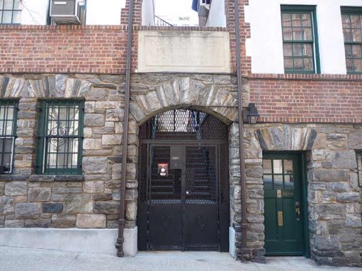
This is one of the “One nd Dones” I’ne never actually been in, as this public walk between West 94th and 95th Streets west of Broadway is accessible only to residents with keys, much like Gramercy Park most of the time.
Pomander Walk is the only Manhattan thoroughfare named for a stage play. The play – itself named for a London alley – ran briefly in 1910 and starred one Dorothy Parker. This Parker was not the later doyenne of the Algonquin Round Table, though the actress and the writer were contemporaries.
The alley and its row of twenty-seven small town houses were constructed in 1922 and have pretty much stayed unchanged since then. In 1920, nightclub proprietor Thomas Healy acquired the property and built 27 Tudor-style buildings on each side. Healy must have been a fan of the play. He meant to tear down the buildings after a few years and construct a hotel, but this reminder of an earlier age has survived various challenges over the years. Humphrey Bogart and Lillian Gish were once residents. You can see the inside of the walk from various sources...particularly Scouting NY.
This is one of those exclusive NYC enclaves I haven’t been able to crack. Years ago, I was able to get into Grove Court in Greenwich Village because I happened to be there (on a blind date, no less) when a resident arrived purely by chance with a key to the gate. That didn’t happen today at Pomander Walk.
Paladino Avenue
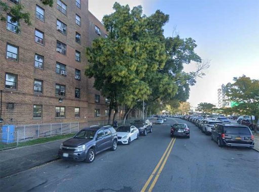
Paladino Avenue is a semicircular roadway connecting 1st avenue and East 120th Street, built around the Sen. Robert F. Wagner Senior Houses along the FDR Drive in East Harlem. It intersects only those two streets, so it counts as One and Done. When built in the 1940s it was a northern section of Pleasant Avenue, itself a renamed bit of Avenue A. The avenue was renamed for construction company owner Anthony C. Paladino (1881-1944), a civic leader in East Harlem.
Lenox Terrace Place
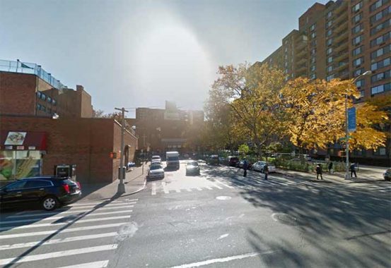
I debated including Lenox Terrace Place since it can be classified as a dead end, not a One and Done, since it connects West 135th between 5th Avenue and Malcolm X Boulevard with a stub of West 134th that is also a dead end, making it a T-shaped enclave. As Sergey Kadinsky explains, there’s a number of interesting things hidden here, so I decided to keep it in.
Chisum Place
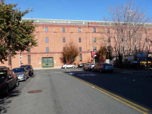
Chisum Place is a one-block street running between West 141st and West 142nd streets just west of 5th Avenue in Harlem. It was constructed in the late 1950s between the two streets when the Delano Village housing project was built; all three streets are two-way, and in Chisum Place’s case it’s unusual for a one-block street to be two-way.
Chisum Place was named in 1961, according to Sanna Feirstein’s Naming New York, for Colonel W. Woodruff Chisum (the name is likely a variant spelling of Chisholm) a commander of the adjacent 369th Infantry Regiment (15th Regiment) during World War II. Given that the 15th Regiment was composed of African-Americans, it’s quite possible that Chisum Place was the first street in Manhattan named for an African-American: Adam Clayton Powell Boulevard, Frederick Douglass Boulevard, and Malcolm X Boulevard (Lenox Avenue) and other streets subnamed for Dr. Martin Luther King, Jr. and Duke Ellington received their names between 1974 and 1987.
An article about a New Year’s Day reception given by Colonel Chisum can be found on this page of The New York Age, January 6, 1945.
Hamilton Place
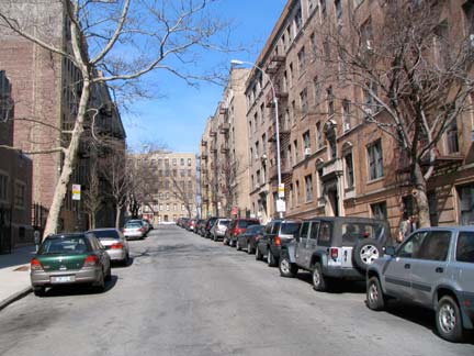
Hamilton Terrace is an out-of-the way enclave, running one block between West 141st and West 144th (there are no intermediate streets) east of Convent Avenue. It was mostly developed between 1895-1900, but it also boasts the 1951 Ivey Delph Apartments, developed by Vertner Tandy, the first African-American architect registered in New York State.
What makes this little street so desirable? Like Strivers Row and Convent Avenue, it has single-family rowhouses in excellent condition. But unlike those areas, it’s on an oddly placed street with little traffic, giving it “a certain sense of exclusivity,” says Lisa Silversmith, who owns properties on both Convent Avenue and Hamilton Terrace. It’s a peaceful enclave where residents know each other, a sort of urban Mayberry. NY Magazine
Hamilton Terrace is found near Hamilton Grange, the Manhattan home of Secretary Treasurer Alexander Hamilton, which was moved to Morningside Park.
Colonel Robert F. Magaw Place
Revolutionary War hero Colonel Robert F. Magaw claims a one-block street from West 181st-183rd Street (182nd is skipped) west of Bennett Avenue, and a very old plaque on the corner of West 181st commemorates the Philadelphia lawyer who commanded Fort Washington during a British attack on northern Manhattan in 1776 but was forced to surrender. The British occupied the island until the war ended in 1783. When the street was mapped in the 1910s and laid out in the 1930s it was apparently briefly called Fort Washington Place and occupies the old position of the driveway to the estate of newspaper publisher J.G. Bennett.
Chittenden Avenue
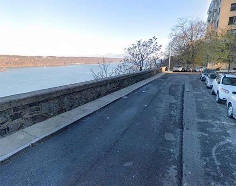
The shortest north-south “Avenue” in Manhattan runs for one short block between West 186th and 187th Streets one block west of Cabrini Boulevard. It could better be classified as a “Place” but it’s been an Avenue for several decades now, and there’s no reason to change now. It’s Chittenden Avenue and I’m surprised I haven’t spent more time there because the views are, as they say, jaw-dropping.
There is, to me, a bit of mystery about this street but not regarding its name. The avenue is built atop a high cliff overlooking the Hudson River and the New Jersey Palisades beyond. In the colonial era, Manhattan was settled from south to north and upper Manhattan remained relatively rural until almost the 20th Century. What is now Washington Heights was parceled into several large estates, one of which was owned by an individual named Lucius Chittenden, whose 130 acres ran from Kingsbridge Road (today’s Broadway) to the river and from where West 185th to Dyckman Streets would be now. By the early 1900s, these estates had been sold off and streets were being cut through to as strict a grid as was possible given the hilly terrain.
There’s much to investigate on this One and Done, not least the grand river view. See this FNY page for much more.
Broadway Terrace
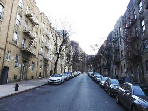
Unlike Broadway Alley, Broadway Terrace is just a block away from its namesake. A block east of Broadway itself between West 193rd Street and Fairview Avenue where Washington Heights meets Inwood runs a one block street, lined with apartment buildings, called Broadway Terrace. Both Broadway Terrace and Fairview Avenue traverse steep hills and bordering apartment buildings, fronting on nearby Wadsworth Terrace, depend on massive superstructures.
Bogardus Place
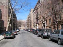
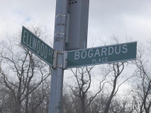
Bogardus Place runs one block from Ellwood to curving Hillside Avenue. It’s somewhat run of the mill and lined with apartment buildings, but it’s named unusually. The name “Bogardus” is known in NYC lore for archiect/designer James Bogardus, who designed the first cast-iron front buildings in Manhattan in the 1840s. But they were in the Financial District, Tribeca and SoHo, not this far north. The answer lies in the Bogardus family holdings in the Fort Tryon area when streets were laid out.
Dongan Place
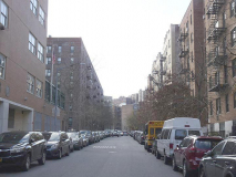
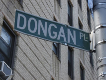
Dongan Place, one block between Arden Street and Broadway, has a bend in it much like East 196th Street. Irish Catholic Thomas Dongan (1634-1715) was appointed governor of New York by the Duke of York in 1682 and remained at that post until 1689. His tenure was marked by religious toleration, rare in that era; his family had to move to France when he was a boy when Oliver Cromwell’s forces overthrew and executed Charles I in 1649, and perhaps Dongan was sensitive to the persecution of faiths other than the Church of England. He became 2nd Earl of Limerick in 1698. As part of his appointment he was granted 5100 acres in what is now Dongan Hills, Staten Island, which he later expanded to 25,000 acres.
Dongan’s place in NYC history was solidified when he gave the nascent New York it’s first charter, divided the city into wards and founded the Common Council, the first-ever representative assembly in New York history, whose descendant is the current City Council.
Henshaw Street
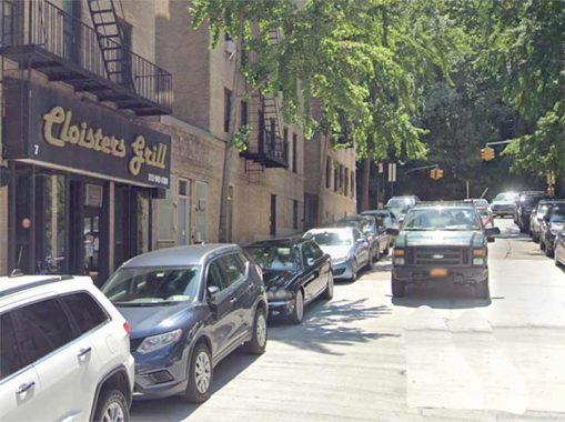
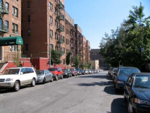
This is one of a pair of One and Dones that connect Riverside Drive and Dyckman Street near Inwood Hill Park. Of the two, Henshaw is the busier, with a few residential addresses as well as a barbershop and Cloisters Grill, named for the medieval exhibit in Fort Tryon Park. It was named for a local resident who perished during World War I.
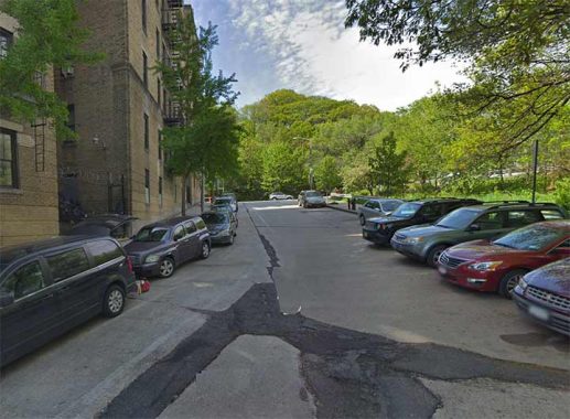
Staff Street
Staff Street is Henshaw’s running buddy a block away. One difference is that no properties face on the street and Inwood Hill Park faces the other sides. Interestingly, both Henshaw and Staff are paved with concrete blocks, instead of the usual black macadam. Sgt. Harry Staff was killed in action during the so called Great War. Both streets were opened in the year immediately following the war.
Beak Street
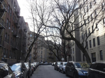
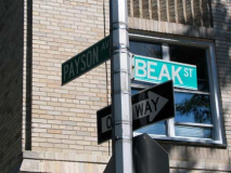
Beak Street runs between Payson and Seaman Avenues for one block north of Dyckman. None of my sources can account for the origin of the name, but one guess is perhaps London’s Beak Street in Soho — perhaps a Londoner developed the area.
Update: According to My Inwood, the street is named for an umbrella salesman named Albert Beak.
I gather from a 1985 NY Times article that Beak Street and Payson Avenue used to be Belgian-blocked, but the city removed them and repaved the streets that year — the City was more expedient about such things then — the stones might well have been preserved in 2010.
Cumming Street
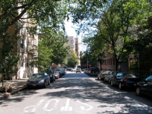
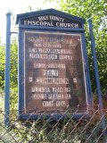
Cumming Street is yet another one block street, running between Seaman Avenue and Broadway. As with Beak Street, it was named in 1925, but the Board of Aldermen (the precursor to the City Council) did not give an attribution, according to Sanna Feirstein in Naming New York. I was attracted to the Holy Trinity Episcopal Church signboard.
I could mention strange NYC intersections like Gold and Water, Crystal and Waters, Randolph and Scott, President and Clinton, Bush and Clinton, and Miles and Davis, but I refuse comment on Seaman and Cumming.
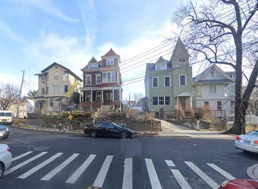
Jacobus Place, Van Corlear Place, Fort Charles Place
By the late 19th Century, when the difficult conditions of the Hell Gate (where the Harlem and East Rivers meet) had been alleviated, and there was a need for ship traffic to be able to easily enter the Hudson, and thence the Erie Canal, Great Lakes and western United States. Therefore, Spuyten Duyvil Creek was straightened and dredged deeper to allow larger ships to use it. After the newly christened Harlem River Ship Canal was completed, an island was left over between the canal and the remaining section of Spuyten Duyvil Creek. The section remained an island from 1895 to 1914, after which the old creek was landfilled, joining what was once the northern end of Manhattan to the mainland. However, this small bit, now called Marble Hill, retained its political identity as Manhattan even though it was now on the mainland.
The name of Marble Hill was conceived by [real estate broker and community leader] Darius C. Crosby in 1891 from the local deposits of dolomite marble, which is a relatively soft rock that overlay the Inwood and Marble Hill communities. The marble was quarried for the Federal buildings in lower Manhattan when New York was the Capital of the United States in the 1780s. Washington Heights and Inwood Online
Marble Hill is a true enclave because it can be accessed by vehicle only by West 225th and 228th Streets on Broadway and via Marble Hill Avenue on the north. It boasts a trio of One and Dones, Jacobus Place, Van Corlear Place, Fort Charles Place, which form a tuning fork-shaped street layout between West 225th Street and West 227th/Marble Hill Avenue. The above photo shows Jacobus in the foreground, Van Corlear on the left and Fort Charles on the right.
That’s it for Manhattan. I plan on resuming the One and Done series in a few weeks in Brooklyn.
As always, “comment…as you see fit.” I earn a small payment when you click on any ad on the site. Take a look at the new JOBS link in the red toolbar at the top of the page on the desktop version, as I also get a small payment when you view a job via that link.
2/25/24-3/2/24

14 comments
You are correct in that Staten Island has tons of newer one-block streets named for developers’ family members and such. There are a fair amount of older lanes on the North Shore that likely meet your criteria (they’ve been around a long time; are shortened versions of older streets that have been cut down for whatever reason; streets that were mapped to be longer but never quite got there, etc). I can send you a list of what I consider “one and done” Staten Island streets under separate cover if you’d like to narrow the list down.
def–go for it, I won’t get to SI till later in the year…
What about Gracie Terrace and Gracie Square? This pair of eastward one block dead end streets extend from East 82nd and 84th Streets, respectively, between East End Ave. and the FDR Drive. Do they qualify?
Finally, West 134th Street, at its extreme west end, is a block long east of the Riverside Drive viaduct, ending in a dead end. I realize that the same number street resumes east of Broadway, but the two parts do not connect.
Not doing dead ends–one block, intersecting two and only two streets. I may revisit dead end alleys as I haven’t featured them in 25 years.
I wonder why NY doesnt call its neighborhoods “wards” anymore like they still do in Chicago
or New Orleans.
Maybe because of the association of that word with the word ” Tammany?”
some utility maps in Queens still refer to Wards, five of them in Queens
Because NYC is now one giant (mental) ward……
Thank you Kevin for this series. Old school Forgotten vibes.
Here is a website re: Beak Street. https://myinwood.net/beak-street-the-umbrella-merchant-behind-manhattans-shortest-street/#:~:text=Beak%20Street%20was%20named%20by%20the%20Board%20of,the%20itty-bitty%20street%20that%20now%20bears%20their%20name.
The marble used to build Federal Hall was quarried from the Inwood Marble formation. However, it was not quarried in Inwood or in Marble Hill. It was quarried in Tuckahoe, NY. Check Tuckahoe Marble in Wikipedia.
Even though Marble Hill remaines a Manhattan neighborhood, they didn’t get to keep the 212 area code after the 718 area code was given to the rest of the boroughs.
The crack down the middle of Chittenden Avenue! Well, ya take yer chances, right?
In an old book that I cannot possibly find now, someone around 1890 or so criticized the canal at Marble Hill, saying the Harlem River was not navigable by large ships since the dawn of time! Anyway the Columbia rowing team like it.
I don’t know how I managed to not see this installment when it posted. I have been eagerly awaiting the segment that included my long time stomping grounds, Inwood. My apartment faces out onto Payson Avenue, whose Belgian paving blocks get a mention above. I remember well the summer that they dug them all out and all the day-long jackhammering that it involved. I wish they had left them in place. Now, it is a speedway for Jerseyites, who exit the Deegan at 230th St. come across the Broadway Bridge at 225th and then down 218th and Seaman Ave, wanting to get home without paying the Henry Hudson Bridge toll and skipping a couple of traffic lights along the way. Miserable for a couple of hours in the late afternoon. Though it is not a one block long street because of it intersecting with Beak, it is probably one of the longer two block streets, at least in this neighborhood.
Lovely Hamilton Terrace (not Hamilton Place — different street, I believe) is also notable as the location of the house from The Royal Tenenbaums