
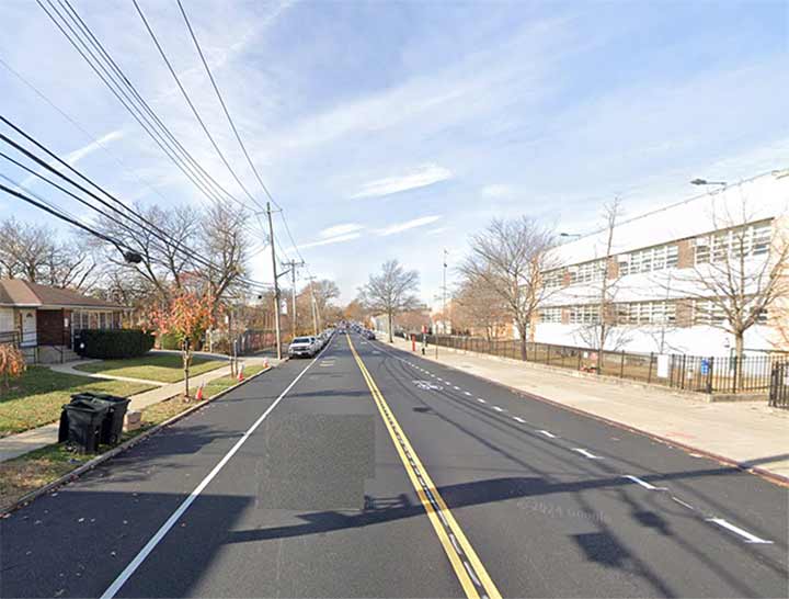

OLD Staten Island place names are fascinating. By 2026, most of the old place names have been expunged or renamed, with a few exceptions like Fingerboard Road, named for a finger-shaped billboard sign pointing the traveler toward the Richmond County Courthouse, located in a building that still stands in Historic Richmondtown. I was recently perusing a very old map from 1896 by Staten Island historians and chroniclers William T. Davis and Charles Leng entitled “Map of Staten Island (Motanucke, Monocknong, Aquehonga, Eghqueous, Staten Eylant)” by Charles W. Leng, with ye olde names & nicknames by William T. Davis”, available in a negative print via the New York Public Library. Some of the old names have to be seen to be believed.
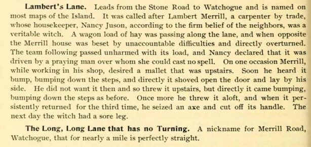
The map has a companion volume by Davis and Leng, “Staten Island Names: Ye Olde Names and Nicknames,” available via archive.org.
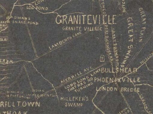
Let’s look at an excerpt from the 1896 map. Today the general area is part of Bull’s Head, taking its name from a long-lost tavern. In 1896, you had your pick of names as it was also called Graniteville (for local granite quarries) and Phoenixville (perhaps local businesses failed and rose again). There are two straight east-west roads still in existence today, Lamberts Lane and Merrill Avenue. As we can see from the book excerpt, the two roads are named for one person, carpenter Lambert Merrill, whose colorful story is included in the scanned entry.

In the book excerpt, Merrill Avenue, or Merrill Road, had a nickname: The Long, Long Lane That Has No Turning. I tried to envision what it would look like if the Department of Transportation had to make up a green and white street sign with that name on it…
|
|
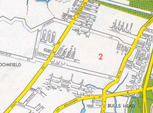
This 1949 Hagstrom shows both roads running through vacant territory, with surface streams. All of this has been fully built out though it took until about 1980 for that to happen; most of the waterways were moved underground.


Note the tombstone-shaped symbol with the cross through it on the 1896 map. It marks Merrell (sic) Cemetery (established 1784), Merrill Avenue west of Richmond Avenue, which is still there today, a remnant of an 18th century plantation founded by John Iyon Merrell. It’s been fenced off from vandals for a couple of decades now, but in 2000 I was able to stroll in, bold as brass, and photograph it. The local youth had been there before me and indulged in their grim work of knocking over the headstones.
Check out the ForgottenBook. As always, “comment…as you see fit.” I earn a small payment when you click on any ad on the site.
7/17/26
4 comments
An Irish proverb says, “It’s a long road that has no turning.”
That’s from an Irish Spring soap commercial
Though I attended junior high school nearby, I had never given Lamberts Lane or Merrill Ave much thought. I didn’t realize how far back their history goes. While Hagstrom Maps of Staten Island from the 1940s and ’50s were sometimes known to include streets that never existed, the current Google Maps aerial view appears to confirm that Lamberts Lane, Merrill Ave, and nearby Paulding Ave were at least graded, if never paved or developed. The remarkably straight tree lines within the wooded area of the Staten Island Industrial Park seem to trace the paths of these roads, extending at least as far as South Ave and the West Shore Expressway. Ghost roads from the past. Who doesn’t love those?
I should clarify that the portions of these three roads west of Graham Ave were not paved or developed. Obviously, the eastern portion of these streets are well developed with homes and other infrastructure.