

HUNTERS POINT, at the extreme west end of Queens abutting the East River north of Newtown Creek, has been visited often by the Forgotten NY camera. In the last 25 years it has undergone a complete transformation, from a mixed use industrial/residential region to a wealthy region dominated by high rises, especially along Center Boulevard (I do not know why this relatively new road was called “Center Boulevard”; logically it would be “West Boulevard.”) This transformation has added public amenities such as Gantry State Park and a new avant-garde library, which I will touch on. I last walked Hunters Point Avenue, the road connecting Hunters Point with Blissville, back in 2012. In June 2026, the light bulb in my head went off and I thought I would walk the road in its entirety, including its western end, 49th Avenue. The contrast in architecture and infrastructure is striking. I began at the Vernon-Jackson #7 station, headed west to Gantry, then east on 49th/Hunters Point Ave., and then Greenpoint Avenue back to the 46th Street station. The Hunters Point/49th Avenue photos alone total over 200, so I’ll be splitting things up: two pages for 49th/Hunters Point, and separate pages down the road for Hunters Point and Gantry state and for the Blissville/Sunnyside stretch of Greenpoint Avenue.
GOOGLE MAP: 49th/HUNTERS POINT AVENUES
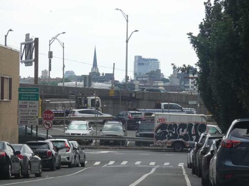
Once again, forgive the dullness of the photos in today’s entry, under leaden skies that magically cleared up later, as you’ll see. What can I say, the sun was shining when I packed the grip and left the house in Little Neck. 11th Place is a one-block street running between 49th and 50th Avenues east of the Pulaski Bridge, and looking south on it, I recognized the far-off steeple right away as St. Anthony of Padua on Manhattan Avenue in Greenpoint, by far the tallest structure in that neighborhood for many years, before the zoning was changed and presto, high rises sprouted along the East River. In the foreground are pedal to the metal (except during frequent traffic jams) ramps to the Queens Midtown Tunnel. As we’ll see, these ramps attain majestic heights further east.
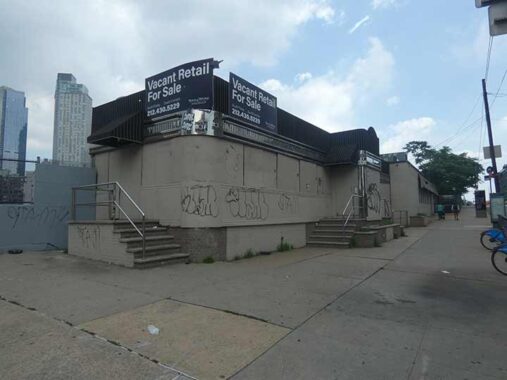
In my 30+ years experience in Queens, the Skyline Diner’s fortunes have declined, soared to heights unexperienced by most chrome diners, and then fallen again to abject ruin! Kind of like my story. Just kidding. When I encountered it in 2008 it was recently closed after having been known as the Blue Sky Diner. Handwritten signs were taped to the windows.
In 2010-2011, the Skyline enjoyed a brief period when it was the hottest “diner” in Queens, as the high-concept steakhouse M. Wells occupied the space, with fare such as bone marrow stuffed with escargot. Williamsburgers and Greenpointites flocked in, despite the prices. However, after a year the property owner raised the rent dramatically and Wells relocated to Crescent Street as well as another restaurant near PS 1. At last check. M. Wells is operating in a distillery in Bushwick.
Since then, the diner has stood unoccupied, as many owners will hold out however long it takes till they get the rent they want. On my last visit I could walk up to the window, bold as brass, and take. look inside, but this day those windows had been boarded up, and the property is for sale again.


If you check an aerial view, the Paragon (Oil) Building, a.k.a. the Queens Subway Building a,k.a. #2100 49th Avenue is a wedge-shaped triangle facing 49th Avenue, 21st Street and railroad tracks heading to the Long Island City yards. Paragon Oil was founded by brothers Henry, Irving, Robert, Benjamin, and Arnold Schwartz, born between 1896 and 1909 in Brooklyn, New York. The family designed and built the first oil heaters designed for residential buildings. Paragon Oil was the only oil company to supply Europe with fuel oil during the post-war reconstruction: this contract catapulted the company into national prominence. After WWII, Paragon supplied the U.S. Navy with oil for submarines. The company was sold to Texaco in the late 1950s.
The building itself was constructed by Paragon in 1916 and until the 1950s, housed the production, warehousing, and distribution of its petroleum-based products. Subsequently it gained employment as a warehouse and storage facility, and currently, is home to offices with a neat-o roof deck for employees to enjoy. Much more at the Newtown Pentacle.


To me, 49th Avenue and 21st Street seems to be an odd place to put a subway station, as it was in 1916 when the station opened. It appears to be the middle of nowhere (despite new residential housing popping up at the Pulaski Bridge landing a block away). But consider: the Paragon Oil office building was constructed in 1916 and it was known, at least informally, as the Queens Subway Building. It’s possible a greater office district was planned here, as the LIRR Hunters Point (see below) and LIC terminal were nearby. What was originally the Astoria and Corona Line opened at Grand Central, Manhattan in 1915, and gradually expanded east to the Hunters Point Avenue station (1916); Corona at 103rd Street (1917); 111th Street (1925); Willets Point Boulevard (1927); Main Street (1928) and westward to 5th Avenue (1926); Times Square (1927); and Hudson Yards (2015).
FNY took a look inside the station back in 2011.
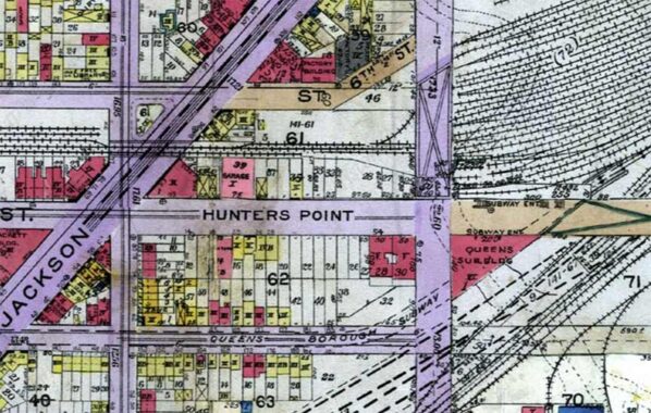
Hunters Point shouldn’t be confused with Hunts Point in the Bronx (and both locales have a subway station!). The subway is on 49th avenue, not Hunters Point and indeed, today, Hunters Point Avenue begins at the Dutch Kills waterway and so isn’t in Hunters Point at all. This 1918 map, though, shows the former arrangement that had Hunters Point Avenue beginning its eastward progress at Jackson Avenue. All the street names were changed to today’s Queens house and street numbering system about 1925. Note the “Queens Subway Building” at the location discussed above.
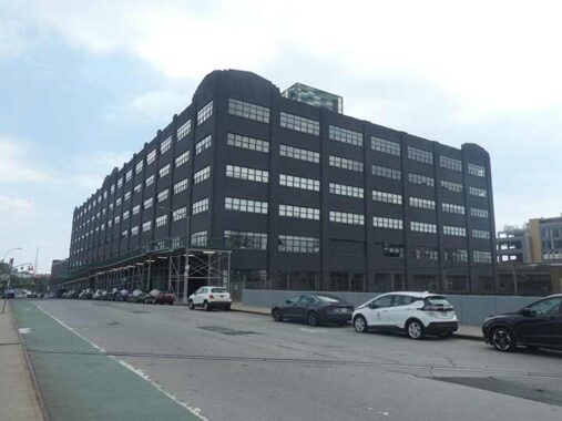
24-02 49th Avenue, east of the railroad bridge, is a vast former warehouse or factory now containing New York City Housing Authority (NYCHA) offices. It gives up its secrets on the internet reluctantly; if you know anything about its history, Comments are open. Far as I know it was not part of the Degnon Terminal area, which will be referenced presently.
Hunterspoint (sic) LIRR
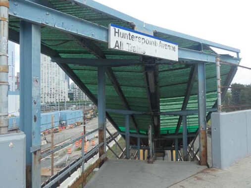
I’ve had opportunities, but haven’t photographed the Hunterspoint (sic) Avenue Long Island Rail Road (sic) station in depth before today. (Regarding the “sics,” they mean that’s how the MTA spells them, respectively; in one, it’s plain misspelling, and the other, it’s tradition.) I’ve descended to the platform before, but did not tarry; perhaps I expected Ernest Borgnine to show up and, mistaking me for a vagrant, try to kill me with a sledgehammer (many of you don’t know what I’m talking about; see “Emperor of the North” for that). This station looks much the same as it must have for fifty years and possibly before that; note the faded sign at the entrance staircase. The only recent change has been electronic arrival boards replacing the older printed ones. The station serves westbound Port Jefferson, Oyster Bay and Montauk trains in the AM rush hours, and eastbound trains during the PM rush. It’s not in use on weekends, yet, I was able to stroll down the stairs on a Sunday just the same.
The LIRR Hunters Point station serves commuters connecting to the #7 train during workweek rush hours and originally opened in August 1860. The original station was destroyed in a fire in December 1902 and permanently rebuilt, after two previous attempts, in 1914.


The platform at Hunters Point Avenue is unique among LIRR stations in NYC because there’s a concrete center extended by wood planks.


The station afford a look at the west end of the vast Sunnyside Yards, built in the first decade of the 20th Century as a layup yard for commuter trains toward and away from Pennsylvania Station in midtown. From the platform, you can also watch #7 Flushing Line trains ascend and descend from the Steinway Tunnel, originally built for streetcars and a decade later, modified for subway cars.
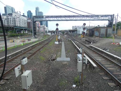
In this shot from the east end of the platform, tracks are en route to the main line coming from East River LIRR tunnels. The elevated trestle carrying the Flushing Line can be seen at left, with the elevated Montauk Cutoff spanning the tracks some distance ahead. The Sunnyside Yards are a treasure trove for photo transit fans.
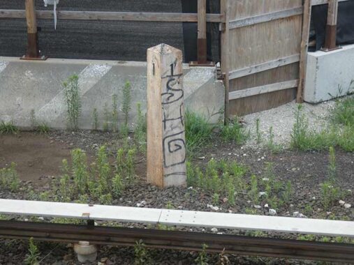
Here’s something I had been looking for for some time, the LIRR one-mile-marker. Here it no doubt measures the one mile distance from the end of the Long Island City terminal at 2nd Street in Hunters Point. My line, Port Washington, has its own set of mile markers after splitting from the main line east of Woodside, beginning with the 4-mile marker. I’ve located many of them but not all, including the 6 mile marker in Corona.
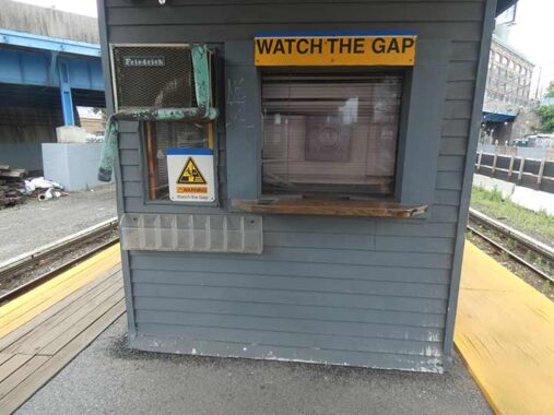
This was once the ticket seller window, before the advent of ticketing machines and now the transit app in which you can pay the fare direct from your bank account. The racks at left offered paper schedules, which were eliminated during the pandemic; you now use the TrainTime app on your phone for schedules, or the MTA website. I still have a couple of paper schedules in my collection. Some years ago I photographed the ticket window at Nostrand Avenue on the Brooklyn LIRR branch, which was eliminated in a station renovation.
I miss paper tickets, symbols of real “railroading.” They’re still offered, but their days are likely numbered. I’m still mystified why the LIRR eliminated 10-trip tickets. If you have a rationale for that, Comments are open.
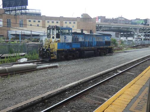
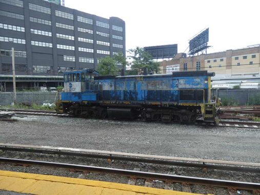
The sole indicator that anything at all was going on was the idling diesel Engine 164 on a layup beside the station. The smell of diesel fuel permeated the air, a renewed sign of traditional railroading.
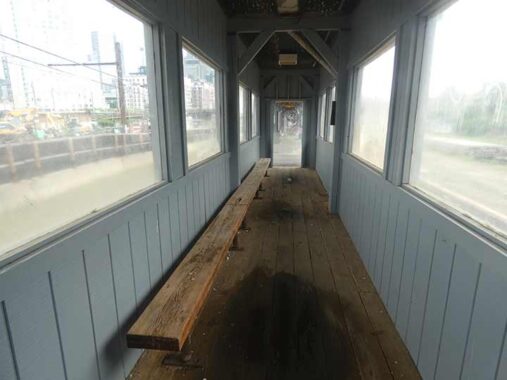
Speaking of smells, a peek inside the enclosed waiting room offered the smell of old wood. The rooms appear unchanged for decades. I paused for 5 minutes to ruminate on past sins.
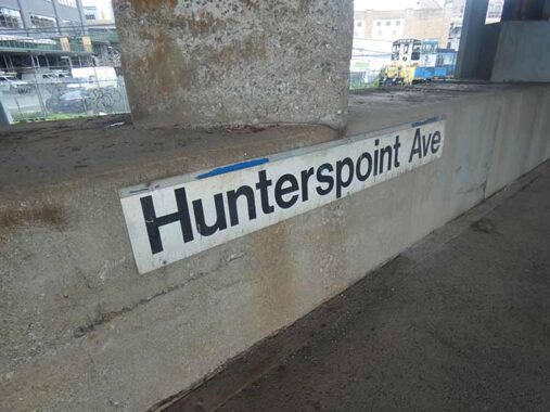
The MTA is consistent about its insistence that the spelling is “Hunterspoint.”
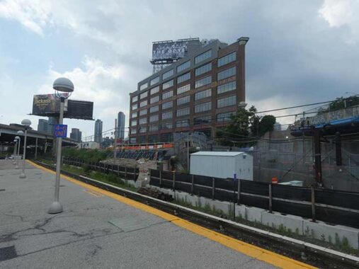
A look at the Paragon Building from the west end of the “Hunterspoint” Avenue platform.
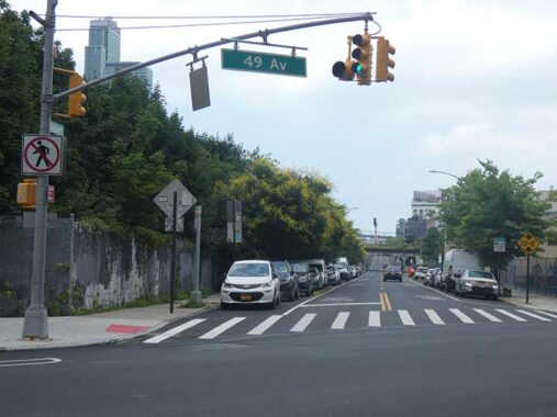
Skillman Avenue begins a lengthy run at 49th Avenue, forming the southern border of Sunnyside Yards for much of its run, ending at Roosevelt Avenue – beginning and ending with the IRT Flushing Line, from the Hunters Point Avenue station to a point just past the 52nd St/Lincoln Avenue station. The avenue’s length has varied over the years – it attained its present route in the late 1910s, when it was built out as far as Roosevelt, but the portion adjoining Sunnyside Yards (which opened in 1910) as far as Harold Avenue (39th Street) was known as Meadow Street until about 1920, when Meadow Street was changed to Skillman. Meanwhile, the portion of Roosevelt Avenue under the IRT el was called Skillman Avenue as far east as the intersection with Woodside and Betts Avenue (now 58th Street) until about the same time.
Skillman is an English name though its progenitors were Dutch. There were Skillmans in England as early as the 13th Century; the name derives, like Truman, from the term “believable” or “trustworthy” individual. The first Skillman in America was Thomas Skillman, a soldier/musician under Colonel Nichols in the Duke of York’s expedition to seize New Amsterdam from the Dutch in 1664. After the Brits took over, Skillman settled in Newtown, married Sarah Pettit in 1669 and raised a family of seven sons and four daughters. All the Skillmans in North America today are believed to be descended from Thomas Skillman.
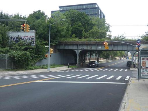
Continuing to traipse east on 49th Avenue, the elevated trestle of what is called the Montauk Cutoff comes into view at 25th Street. This is a railroad bridge that enabled freights to more easily get from Sunnyside Yards to the relatively isolated Lower Montauk LIRR branch, which in this part of Queens runs south of Borden Avenue. It opened in 1910, same year the Yards were, and saw decreasing use by the 1990s, when it was decommissioned. It has since become overgrown with weeds. Back in 2019, FNY’s Sergey Kadinsky touted its possible use as an elevated park a la Manhattan’s High Line; but to date, no work has been done toward that end. On his post, you’ll find multiple links exploring its old right of way.
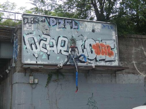
At a former billboard on 25th Street at the Cutoff, a Thing has apparently wandered onto it, where it met its demise. In the dead of night, and even in the dead of day, creatures abound hereabouts.


This sequence of photos (I have no control over how Imagely sorts photos in Galleries) show the Queens Midtown Expressway gradually “gaining altitude” as it crosses 25th and 27th Streets and Dutch Kills. It was built in the 1950s to do so, as commercial shipping was more frequent in the waterway. The expressway later sinks to grade level and then an open cut east of the Kills.


I thought this building, #25-11 49th just east of the Cutoff, looked different from when I encountered it last, and I was correct. In 2020 it was remodeled, with an addition featuring several extra stories, by the Studios architectural firm, which kept the brick exterior but added hundreds of not-quite-square windows. The building, now containing office spaces, is now called Gantry Point, more than a mile from the waterside gantries. Interior renderings can be seen at the link.


Speaking of overhauls and remakes, I was always fascinated with this formerly beautiful masonry building at 27th Street and Pearson Place, seen here from 49th Avenue, because of the ugly gun metal gray makeover it was given a decade ago. It was constructed back in 1917 for the Marcus Ward Company:
This stationery manufacturer and printing company was established in 1848 in Belfast, Ireland. Originally known as John Ward & Sons in the first half of the 19th Century, the company grew from a small paper mill into a successful color lithographer, specializing in Victorian-styled calendars and greeting cards towards the end of the 19th century that garnered international reputation, moving to London by the end of the 1800s. At the turn of the 20th century, as satellite branch was established just outside of Bush Terminal on 29th St. in Brooklyn, where Ward remained until completion of this site and the beginning of 1917. This site, housing the company’s main manufacturing plant and company headquarters, employed between 150 and 200 people in the first decades of early 20th century, while maintaining permanent salesrooms at 200 5th Ave in Manhattan, as well as sites in Chicago, Philadelphia, and San Francisco.
|
Several of Ward’s brands during the early 20th century were marketed towards the higher classes, with brand names such as “Gentlemen’s Writing Paper” and “Gentlemen’s Stationery,” white paper made from both parchment and bond paper, as well as Irish linen and Irish poplin. Other brands included the “”Papeterie des Tuilieres,” rose, blue, and pink envelopes embossed with a gold-colored four-leaf clover. By the early 1940s, however, the nearby Henry Waldes Company, also known as the Waldes Koh-I-Noor Company and initially established on 27th St and Austell Pl, purchased the facility, as well as several other factories in the immediate area, owning this building until at least the late 1970s.
|
During this time period, the building also housed Kelvinator Corporation, a national home appliance manufacturer specializing in refrigerators. Founded in Detroit in 1914 by engineer Nathaniel Wales, the company took its name from Lord Kelvin, the founder of the mathematical concept of absolute zero. Wales introduced the world’s first refrigerator with automatic controls in 1918, and within five years, his company controlled 80% of the home refrigeration market. In the mid-1930s, the company unveiled its Kelvin Home design, one of the earliest attempts at mass-produced residential air conditioning and heating. During World War II, the entirety of the company’s operations were converted to military production. After a series of corporate acquisitions in the latter half of the 20th century, the Kelvinator name continues to grace products across the globe. Currently, a film archival company known as Paramount Antiques leases space inside the factory. — FNY Commenter, Joshua W
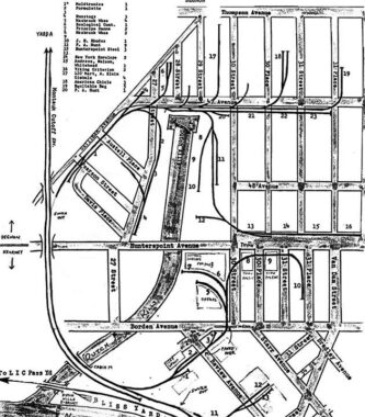
Note the bumper block on the bottom right. Railroad tracks once ran along the side of the street, formerly called Degnon Terminal.
We are passing a remnant of an extensive railroad network through this industrial area. Trains would connect from these tracks via a routing from the Sunnyside Yard over the Montauk Cutoff overpass over Skillman Avenue just north of 49th Avenue, and would run on a trunk line along Skillman and 47th Avenues with spurs along many of the side streets. A small freight line served warehouses of NYC’s great department stores such as Gimbels, Kleins, and Macy’s; some of their names can still be seen on buildings. Sunshine Bakeries, American Chicle gum and Swingline, with its famous neon sign were here as well. Swingline decamped to Mexico in the mid 1990s.
This was originally a private railroad known as the Degnon, after its originator, Michael J. Degnon. The LIRR absorbed it in 1928, and all official rail activities ceased here in 1985.
Degnon also filled the valley marshes between Corona and Flushing, giving rise to F. Scott Fitzgerald’s “valley of ashes” in The Great Gatsby. In 1912, his company also excavated the tunnel that was home to the Alfred Ely Beach pneumatic subway from about 40 years previous. The Degnon company laid out and graded the streets in the area surrounding the factories and warehouses served by its railroad. Michael Degnon is interred in nearby Calvary Cemetery.
Degnon trackage ran alongside the headwaters of the Dutch Kills waterway to allow shipping to unload goods.
|
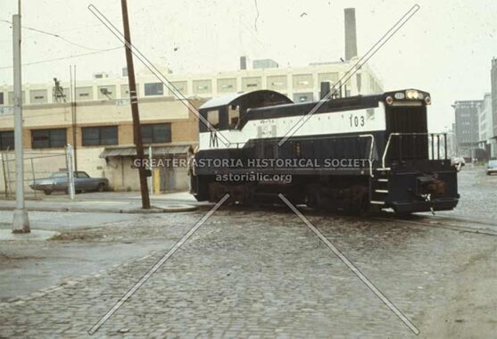
A Degnon locomotive is shown in this photo from the early 1980s [Greater Astoria Historical Society]


Continuing on, you encounter the monolithic #27-11 49th Avenue.which appears to be as monstrous as George Orwell’s Ministry of Love. Actually it was built in 1965 and currently is home to MANA, a fragrance manufacturer.
Sitting on approximately 2.5 acres of land, the property was constructed in 1965 and consists of load-bearing, reinforced brick masonry walls with steel columns. The Property features 20’ clear heights, 4 loading positions, 2 state-of-the-art freight elevators, as well as executive suits and sales offices.
|
The three-story manufacturing, warehousing and distribution facility is 100% leased to MANA Products, Inc. a major developer and manufacturer of beauty and skin care products for established brands within the cosmetics industry. The building boosts large floorplates for MANA’s manufacturing floors to operate with efficiency at full capacity, while providing ample space for warehousing and storage of raw materials and finish product. [Metropolitan Realty Associates]


A look at Dutch Kills, which 49th Avenue is bridged over. In the precolonial and immediate postcolonial era, Newtown Creek was an inlet of the East River extending east and southeast into western Long Island, and had multiple branches and rivulets that spread out through marshy territory for perhaps a few miles surrounding the bulk of the creek itself. After the Industrial Revolution those rivulets and watery capillaries were tamed and placed underground into sewers. A number of them, like Newtown Creek itself, were tamed into canals by surrounding them with reinforced bulkheads. Perhaps the most prominent of these are English Kills and Dutch Kills; according to legend, Dutch Kills extended north into what is now Astoria, mainly held by the Dutch in the 1600s, while English Kills headed west into what became East Williamsburg, dominated by the British, though elements of both groups occupied land north and south of the Creek.
The first settlement in western Queens, in 1642, may have been Richard Bruntall who owned 100 acres on the east side of Dutch Kills at its intersection with Newtown Creek. The farm included all of Blissville one half of Old Calvary Cemetery. Ten years later he sold the western end to the Debevoise family whose homes remained on Van Dam Street in 1900. The eastern end of the farm was sold to William Herrick of Flushing who died a few years later.His widow married Thomas Wandell. He died in 1691 after expanding the farm to include all of Cavalry Cemetery and Laurel Hill. His nephew, Richard Alsop inherited the farm. The colonial Alsop family burial ground can still be seen among Cavalry’s modern graves. The Alsop Farm, which grew tobacco, was on the richest land in Newtown Township. With the intrusion of industry in the 1840s on Newtown Creek, it was sold forming the nucleus for Cavalry Cemetery. Greater Astoria Historical Society
With the passage of time, some names have been replaced. The present Dutch Kills neighborhood is north of the Sunnyside RR yards, and doesn’t border on the namesake creek at all.


The Hunters Point Avenue Bridge, which crosses Dutch Kills, opened in 1910, is a vehicular bascule bridge that replaced two earlier bridges, made of wood and then iron. It is two years younger than the neighboring Borden Avenue Bridge, which is one of four retractile bridges remaining in the USA. It celebrated its centennial in 2010, though it had been largely renovated in the 1980s.
Seldom commented on, the Hunters Point Avenue Bridge segments Dutch Kills neatly, and has done so for [over] a century now. The marshes and streams which once typified the area before the advance of railroad and vast agglutination of industrial installation are long gone, relegated to subterranean sewers and masonry clad spillways, but a century ago the Hunters Point Avenue Bridge (and its predecessors) allowed egress between the terrestrial isolation of the Long Island City center and the rest of western Queens. Newtown Pentacle
Whenever I see a “Draw Bridge” sign, two words, I half expect to see a group of people in artists’ smocks furiously scribbling away on blank white paper. The control house is interesting to me, as the words “Hunters Point Avenue Page” is spelled out in chiseled Garamond, with an upside-down “S” in “Hunters.”

Midway across the Kills, 49th Avenue becomes Hunters Point Avenue. Thus, Hunters Point Avenue is in the southern reaches of Sunnyside, not Hunters Point; while the Hunters Point Avenue subway stop is actually on 49th Avenue. (That’s because everything east of Jackson Avenue, as we’ve seen, used to be called Hunters Point Avenue.)


Scattered throughout NYC, and no doubt many industrial towns, are giant neon signs bearing the names of now-extinct businesses. Urban explorers can seek out and research these signs in a similar manner to biologists looking for dinosaur bones or anthropologists seeking the remains of Piltdown Man. Thypin Steel, 30-30 Hunters Point Avenue, installed one such sign.
The Thypin Steel Company was founded in 1910 and became one of the largest steel companies in the Northeast, with an annual revenue of $335 million. It was sold to Ryerson Tull, a Chicago steel company, in 1997. Its name lives on in the Thypin Oltchick Institute for Women’s Entrepreneurship. Gertrude Thypin Oltchick (1916-2012), the daughter of the founder, ran the company for many years. Thypin’s Building of Many Windows dates to 1948. Oddly its neon billboard can only be seen at some distance to the west, as it is set way back on its building and so is invisible from 30th Street.
O Brother, Where “R” Thou? Other Neon Billboards


The Epicure railcar diner stood alone on this site, 30th Place and Hunters Point Avenue, in the 1940 tax photo, and I was surprised that it still shows up on the 1980 photo, as a carveout in the Thypin building! Indeed its footprint survived until 2012 as a combination comic book and Spanish food store. The present cinderblock building home to the Griddle food shop and deli, serving workers in this industrial region, went up in 2014.
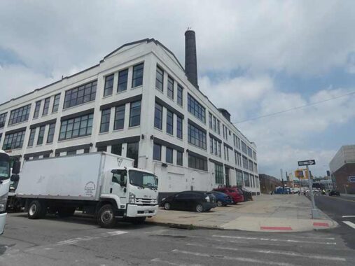
This is the back end of #30-02 48th Avenue, a former book bindery. The parking space on the right formerly supported Degnon railroad tracks, which ran along the north side of Hunters Point Avenue. The former right of way is visible on HPA for several blocks to the east.
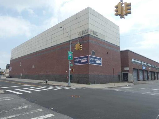
Sometimes, the purpose of buildings in industrial areas is hard to discern. This near-windowless monolith appears at Hunters Point Avenue and 31st Street, but two helpful signs identify it as HQs for Empire Movers and Elite Anywhere, “white glove deliveries.”


I’m an infrastructure enthusiast, but these objects are popping up as standalone shafts or plopped on top of lampposts, and they’re just too big. If tech firms can make small drives that can hold 32T of data (they do) they can reduce the sizes of these things.


Though it’s separated from it by the Queens Midtown Expressway, Hunters Point Avenue may considered to be a main road leading to Blissville.
Blissville is the small wedge of Queens positioned between Newtown Creek, Calvary Cemetery and the Queens-Midtown Expressway; it takes its name from Neziah Bliss, inventor, shipbuilder and industrialist, who owned most of the land here in the 1830s and 1840s. Bliss, a protégé of Robert Fulton, was an early steamboat pioneer and owned companies in Philadelphia and Cincinnati. Settling in Manhattan in 1827, his Novelty Iron Works supplied steamboat engines for area vessels. By 1832 he had acquired acreage on both sides of Newtown Creek, in Greenpoint and what would become the southern edge of Long Island City. Bliss laid out streets in Greenpoint to facilitate his riverside shipbuilding concern and built a turnpike connecting it with Astoria (now Franklin Street in Greenpoint, Vernon Blvd. in Queens); he also instituted ferry service with Manhattan. Though most of Bliss’ activities were in Greenpoint, he is remembered chiefly by Blissville in Queens and by a stop on the Flushing Line subway (#7) that bears his family name: 46th Street was originally known as Bliss Street. [FNY, Blissville and Laurel Hill]
Another Bliss, Eliphalet, was a big name in Bay Ridge:
[Owls Head] Park was created from the estate of Eliphalet Bliss (1836-1903). In 1867 he founded the machine shops that became the E. W. Bliss Company and the United States Projectile Company. His estate, Owls Head, featured an observatory known as the Bayard Tower. He willed the estate to New York City, provided it be used for parkland. The park, still known by old-timers as Bliss Park, has been in use by local residents since the 1920s; Robert Moses redesigned it in the 1930s. The mansion and tower were razed in 1940. [FNY Places Matter: Bay Ridge]
Hunters Point Avenue bends southeast at 31st Street and the FDNY “repeater” tower, one of the tallest structures in southern Sunnyside, comes into view. The antenna repeats voice traffic so there are no gaps in communications. The building at Hunters Point Avenue and 34th-35th Street is home to the FDNY’s Buildings Unit, their EMS medical supply depot, and more importantly, their fleet maintenance complex. Reportedly, every fire truck in the city goes there to be fixed.
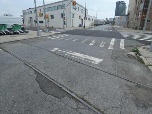
Crossing 31st Place is a tangible remnant of the Degnon railroad tracks.
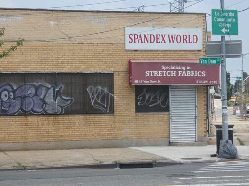
I thought Spandex went out with 1980s exercise videos, but it’s still widely used and Spandex World at Hunters Point Avenue and Van Dam Street is where you (or at least wholesalers) obtain it. Contrary to rumor, Freddie Mercury did not obtain his stagewear here.
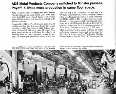


At Hunters Point Avenue and 32nd Place you can see a plaque marking the low-rise brick building as the HQ of ADS Metal Products, founded by Fred Schwartz on 1942. I have excerpted some of its 1970s ad brochure.
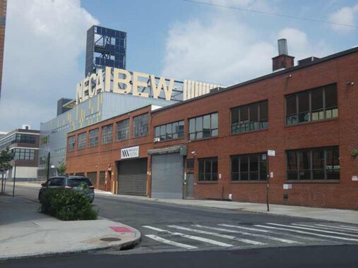
48-39 33rd Street off Hunters Point Avenue was remodeled in 2015 as the local headquarters of the NECA-IBEW Benefits Administration Association. The prominent letters stand for the National Electrical Contractors Association and the International Brotherhood of Electrical Workers.
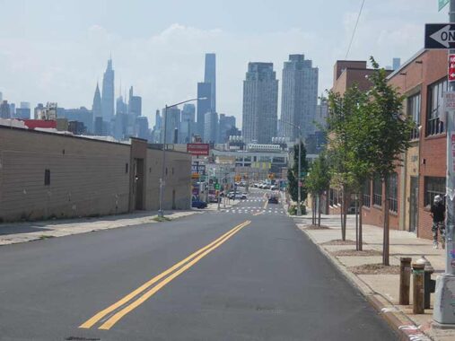
At 35th Street looking west, Hunters Point Avenue is on a slight elevation and the view of midtown Manhattan is outstanding. However, increasingly, it’s a view of Long Island City as towers in western Queens blot the view of Manhattan. Recent “supertall” apartment tower construction along 57th Street had dwarfed the Chrysler Building in the view. As little as forty years ago, the Chrysler, and the Empire State, would have easily been the tallest buildings in the picture. The tall black rectangle is the Trump International, once the tallest residential building in the world. At left, beside the Chrysler, is One Vanderbilt, which, at 1,401 feet, is the 4th tallest building (2026) in Manhattan’s ever changing scene.


The doyenne of south Sunnyside is St. Raphael’s Church, named for an archangel, dominates views from Hunters Point, Blissville, Calvary Cemetery, and Sunnyside. It was built from 1881-1885 here at Greenpoint and Hunters Point Avenues and replaced an earlier structure; the parish dates to 1865. The reputed architect is Patrick Keely, the famed architect of mostly Catholic churches in the 19th century.
As always, the most comprehensive history of this church, as well as others, is found on the American Guild of Organists’ NYC pages.
The parish of St. Raphael was established in 1865, and the first Mass was said in November 1868 by Rev. Theodore Goetz, who attended the parish from Winfield. At the time, the area was known as Blissville, named for Neziah Bliss, inventor, shipbuilder and industrialist, who owned most of the land in the 1830s and 1840s. Blissville was bordered by Calvary Cemetery to the east, Newtown Creek to the south, Dutch Kills (a tributary of Newtown Creek) to the west, and the Queens-Midtown Expressway to the north. Blissville existed as a small village until 1870 when it was incorporated with the villages of Astoria, Ravenswood, Hunters Point, Dutch Kills, Middletown, Sunnyside and Bowery Bay into Long Island City.
Located on Greenpoint Avenue at Borden Avenue, the first church was a wooden frame building that would serve as the mortuary chapel for Calvary Cemetery. The second pastor, Rev. N. J. Farrelly, who succeeded Father Goetz after his sudden death in 1879, was determined to build a new and larger church. In 1881, the old church was demolished to make room for the new, and Bishop Loughlin laid the cornerstone for the present church on June 18th that same year. However, due to a lack of funds only the stone basement was completed by Christmas. Over the next four years, sufficient funds were raised and the completed church was dedicated by Bishop Loughlin on June 7, 1885. Built of brick and sandstone, the church is 149 feet long, 69 feet wide, and the height of the steeple is 150 feet. It is believed that the Gothic-style church was designed by Patrick Keely.
On a sad note, St. Raphael’s elementary school was forced to close in June 2012 because of declining enrollment and rising costs. Outside the church is a monument to Saint Andrew Kim Taegon (1821-1846) the first ordained Catholic priest in Korea, the patron saint of Catholic clergy there.
The first native Korean priest, Andrew Kim Taegon was the son of Christian converts. Following his baptism at the age of 15, Andrew traveled 1,300 miles to the seminary in Macao, China. After six years, he managed to return to his country through Manchuria. That same year he crossed the Yellow Sea to Shanghai and was ordained a priest. Back home again, he was assigned to arrange for more missionaries to enter by a water route that would elude the border patrol. He was arrested, tortured, and finally beheaded at the Han River near Seoul, the capital.
Andrew Kim Taegon’s father Ignatius Kim, was martyred during the persecution of 1839, and was beatified in 1925. Paul Chong Hasang, a lay apostle and married man, also died in 1839 at age 45. [Franciscan Media]
Saint Andrew Kim was canonized by Pope John Paul II in 1984.
Check out the ForgottenBook. As always, “comment…as you see fit.” I earn a small payment when you click on any ad on the site.
7/18/26
6 comments
Until January 2023 the LIRR service to and from Hunterspoint Avenue station carried a few thousand regular riders who worked in the East Midtown area and used the #7 train to cross the East River. A smaller number, probably in the hundreds, work in the area don’t need the subway (some get picked up by shuttle vehicles).
In January 2023 LIRR began its long-awaited Grand Central train service, eliminating the need for riders to transfer at Hunterspoint or backtrack on subways to/from Penn Station. The station and trackage remain for riders whose destinations are in the immediate area, and because LIRR diesel trains still must travel to Long Island City for midday storage anyway.
Prior to 1994, the B61 would turn right off the Pulaski Bridge onto 11th Place, go under the bridge on 49th Ave. and turn onto Jackson Ave. terminating in front of Brothers Three Bar & Grill, which was located at 10-74 Jackson Ave.
Another excellent entry of great interest. Crikey, that clip from Emperor of the North was a tad gruesome, though. I only looked because Ernest Borgnine was a fave actor.
The building at 24-02 49th Ave, now a NYCHA building at one time was a Blooingdales warehouse.
And the FDNY maintenance building back in the 80’s was so backed up with servicing the vehicles they were also parked on the sidewalks and street surrounding the building, giving it the nickname of “Red Square” (as in Russia).
24-02 49th Avenue was utilized by Macy’s as a warehouse. A friend of mine worked for them as a carpenter.at this site in the 1970’s.
As soon as I saw the mention of “Ernie” Borgnine I just *knew* it had to be “Emperor of the North”! Was somehow allowed to watch that movie when it came out, despite being all of eight years old. (Disclaimer/”Spoiler Alert”: I was rooting for Borgnine, not Lee Marvin…)