

By DAVID MELTZER
Forgotten NY contributor
SEPARATING the working class neighborhood of College Point, and the mansion studded neighborhood of Malba, there is Powell’s Cove. Before the earliest settlers came, this was Matinecoc land and was called Tues Neck. The earliest record of the area shows that it was in the possession of David Roe, who came from England in the 1640’s. He lived in a log hut and traded with the Indians. Roe increased his holdings in the area, and became wealthy. In 1683 he was taxed on owning 35 acres, livestock, carpenters tools, and two slaves. David Roe died in 1707, and was buried on the farm in one of the large fields.
The property passed to David’s son, Nathaniel, who had five son’s of his own. In 1758, Nathaniels oldest son, another David, willed “the dwelling place where I now live” to his son, yet another David. This next David willed to his son Lawrence “all the dwelling house wherein I now live, Barn and all other out Houses and all the land thereunto adjoining.” Lawrence Roe was the person who sold it to John Powell.
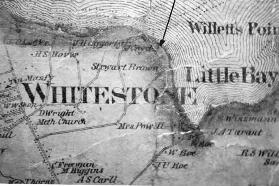
In 1786, John Powell purchased Roe’s 87-acre parcel for 1,685 pounds, 6 shillings, and 8 pence. Roe lost his lands betting on the wrong side during the American Revolution. Powell thereafter built a home and the cove was renamed “Powell’s Cove,” the name it bears today. Powell’s house was destroyed by fire in the 1890s. During the second half of the 19th century, the Roe/Powell land passed to a succession of owners. A map dating from 1873 lists the Smiths, Biningers and Nostrands as landowners in the area. The Nostrand and Smith farms represented a large portion of what is Malba today. But, the Roe’s and the Powell’s did not disappear from the area. There is a map from 1859 showing that a Mrs. Powell still owned a tract of land in the area. Her name can be found right under the word “WHITESTONE.” Beneath the property owned by Mrs. Powell, is property that was owned by R. Roe, W. Roe, and JU Roe. A direct line from over 200 years before.
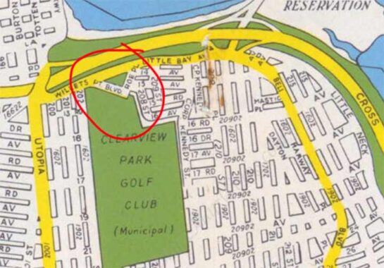
For several decades a short street called Roe Place was mapped in what later became the Bay Terrace and Baybridge areas near Fort Totten. All the streets shown there on this 1949 map were the dreams of developers and the area never evolved in that vision.
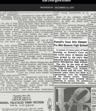
Throughout the 20th century, the city attempted ambitious development projects for the area. In 1970, the site was controversially selected for a new Mid-Queens High School, which was never built. Here is an article in the NY Times from 1970 about that.
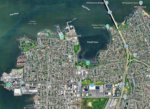
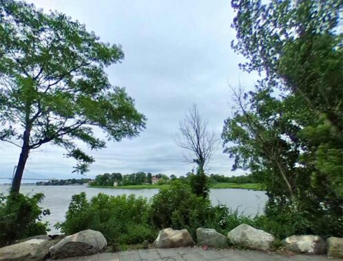
Today, the area along the shore once owned by the Roes and the Powells is lovely.
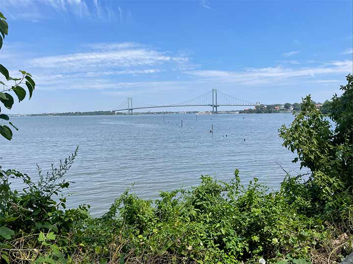
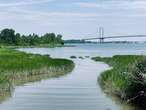
Powell’s Cove Park, located between 9th Avenue, 130th Street, 11th Avenue and 131st street, was acquired in two main parcels, in 1993 and 1995 respectively. The park is divided into two parts above land, as only 7 acres of the park are above ground, while 17 acres are submerged marshlands. The park is a haven for snowy egrets and cormorants. Not to mention hiker’s walking along the shore. The park also has amazing views of the Whitestone Bridge.
Check out the ForgottenBook. As always, “comment…as you see fit.” I earn a small payment when you click on any ad on the site.
7/20/26
16 comments
There was a member of the Culper Spy Ring. named Austin Roe
He lived in Setauket, Long Island and carried secret messages to Manhattan
I wonder if he was relayed to the Roe family mentioned in this article
Growing up in Whitestone, Malba was a frequent destination as I loved to look at the homes there, and see the cove from “The Boulevard” and the waterfront at the end of Malba Drive. It’s sad to see the “McMansios” where they’ve replaced the original substantial homes of Malba, as rarely do any of the new homes have an architectural charm, and it would be a pity to see this lovely area lose its special charm.
Thanks for this! As I would pore over my Hagstrom map book back in the ’70s, I was always fascinated by all of the “underwater” streets shown within the Cove. (I lived nearby in Whitestone). I didn’t really know about “paper streets” back then, so had no idea what was going on…..
Great piece, thanks!
Lived in the “Point” in the early ‘70’s. Used to be a heavily German neighborhood with a small town feel. Seems everybody knew everybody else. Every year the VFW would pick up my mother in-law since she was a Gold Star mom, and take her to the Memorial Day parade and luncheon. Spent many a day at what locals called Chisolm’s Park, now know as McNeil Park. Summer time BBQ’s drowned out by noise from the aircraft from LaGuardia. The prominent jet was the 727, which was known as the Whisper Jet. Actually made the Guinness Book of World Records for the most bars per square mile. Some great memories.
Found the attached article about ship building in this area
https://shipbuildinghistory.njscuba.net/us-emer-small/collegepoint/
Growing up in Whitestone in the 50’s and onwards, this area was always one of the many bicycle trips that ranged from College Point to Bayside. Indeed, College Point had many watering holes, the truly most missed was Flessel’s, which had been around for something like 125 years when it closed in the late 1990’s. You could follow the old LIRR right-of-way from Northern Boulevard (Bridge Street) through College Point, through Malba, and all the way to Whitestone Landing. With a careful eye and the help of an old map, it can still be done today.
Always in mind was wondering what Francis Lewis’s home looked like and where it actually stood. It is reported to have been at what is currently 2nd Avenue and 147th Street, but I have never seen verifiable proof of that. A signer of the Declaration of Independence, Francis Lewis paid a high price for it. The British burned down his house and took his wife prisoner. She died shortly thereafter from what is said was intential mistreatment by the British. Roe, a Loyalist, was a neighbor of Lewis and had to be unhappy with his Revolutionary Patriot neighbor. One has to wonder if Roe pointed out Lewis’s home to the British.
I grew up in Whitestone and delivered the LI Star-Journal in Malba in 1962.Mostly a long both sides of 14th. ave near the parkway. I could do 48 papers in 15 minutes. I took a lot of shortcuts.
For more details on the history of Powells Cove and its unbuilt streets, see my 2009 essay.
Mention of the Culper Ring jogged a memory. On 5th as it bends towards Chisholm Park there was an old Victorian house. Old timers said it had a tunnel that ran down to waters edge and had been part of the Underground Railroad. Had also been used by bootleggers during Prohibition. No idea if this is factual.
Tropicana Orange juice used to transport juice from Florida by ship, the facility for processing it was in Powell’s Cove. I remember seeing it as a youngster. The ship was the SS Tropicana and was painted white. https://www.freightwaves.com/news/freightwaves-flashback-1961-orange-juice-cold-chain-flows-from-port-canaveral-to-ny
The dock was at the foot of 154 st in Beechhurst when i lived on 10 th ave
There were two judges named Roe in Queens in the mid twentieth century, both named James Roe – father and son.
Great place to grow up. Unfortunately, for many it was a dumping ground for household materials and cars. We would fabricate rafts, Huck Finn style from materials found and float around the cove aimlessly, swimming and fishing. Very often we got lucky and find a dumped car still working and practice our driving skills navigating the garbage strewn trails around the lot. Like many lots that were dumping grounds, Giuliani came in and cleaned everything up. In no time the dump was transformed into a beautiful little park. It is enjoyed by many.
I grew up on 138th Street which in the 1950’s and early 1960’s was a dead end street which led down the hill to Powell’s Cove. I remember riding my bike along dirt roads in the area which still had some old railroad ties left over from the old LIRR branch which ran along what is now 11th Avenue. I recall the area had lots of wildlife including horseshoe crabs; pheasants; owls; snapping turtles; and frogs. The marsh area had very tall grass which typically dried out by July resulting in brush fires often caused by Fourth of July fireworks. We had a neighbor across the street who legend has it was involved in the bootlegging trade as he would row a boat out in the cove to ferry illegal liquor back onshore during the Prohibition era. My grandmother was employed in the post WWI era as the housekeeper for a wealthy industrialist who had a large waterfront estate on Crescent Drive which is situated at the eastern end of Powells Cove.
David Roe, pioneer in Whitestone Malba and Austin Roe ( Culper spy ) are related. I communicated with an Austin Roe descendant today who filled in many long lost historical gaps re: Flushing and Setauket connections. His stories are fascinating. In Austin roe’s story are the incredible families of John Underhill in Setauket and Flushing. Closer research will show the Roe family ties to the Jackson, Jones,Seaman,Fowler , and Bloodgood families. Incredible history here stretching from New amsterdam to birth of our country.