
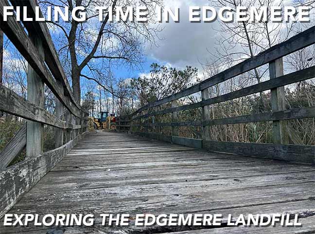


THE highest point on the surface of the Rockaway peninsula is a decommissioned landfill mound that is 70 feet at its summit on a knob of land pointing north into Jamaica Bay. Opened in 1938, the Edgemere Landfill collected the city’s trash until 1991, when complaints from nearby JFK Airport and the discovery of hazardous waste forced its closure. Since then, nature has been reclaiming the so-called Mount Edgemere as other landfills have been redeveloped into parks.
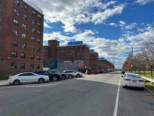
On the map, the landfill is within Rockaway Community Park, built across the street from Ocean Bay Apartments. This complex of 24 buildings was built in 1960 as NYCHA Edgemere Houses. Designed in the most visually boring style, they deteriorated over time representing the city’s neglect of the peninsula. In 2002 the apartments were renamed following a reconstruction project.
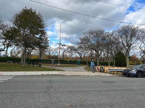
The park, however, did not receive much of an update. Its handball and basketball courts had cracks in the pavement and the baseball fields were overgrown with grass. The flagpole had no flags in contrast to a typical city park. This is not to say that the park is entirely forgotten, as it was undergoing a capital project during my visit.
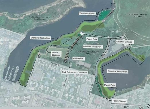
In early 2026, the city began fortifying the shoreline with more sand and made plans to build a boardwalk path through the forested area behind the basketball courts, while leaving the summit of the landfill closed to the public. It can take decades for a decommissioned landfill to be safe for public access, after the remediation, capping and covering the cap with soil and vegetation. Examples of landfills turned into parks include Flushing Meadows, Shirley Chisholm State Park, and Fresh Kills Park.
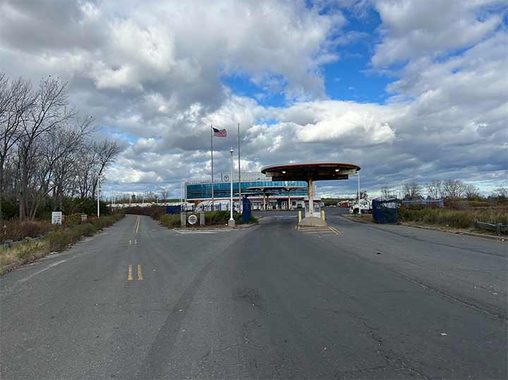
The entrance to Edgemere Landfill is an extension of Beach 51st Street that appears on maps as Conch Place. It leads to the Queens District 14 sanitation garage. Completed in 2010, it is dedicated in memory of local DSNY worker Stephen Dixon. On my visit, I did not see any public signage bearing his name, but there is a plaque in the lobby. Conch Place splits here with the road on the left leading further into the wilderness.
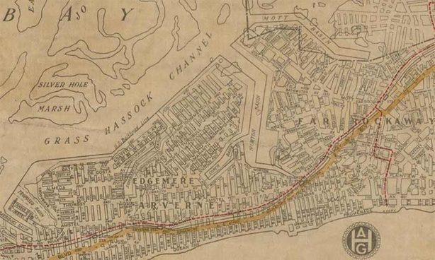
There are no addresses on Conch Place and this road used to be longer, following the shoreline of Conch Basin to Beach 49th Street at Conch Playground. The road is part of an unrealized plan to develop the entire peninsula into a street grid as seen on this 1922 Hagstrom map.
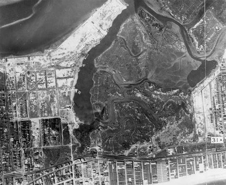
In reality, this knob of land wouldn’t be filled until the 1950s. As seen in this 1924 aerial survey commissioned by the city, Edgemere was then a maze of inlets amid salt marshes. The shoreline at Dubos Point was bulkheaded for a Jamaica Bay seaport plan that was also never realized. Closer to the oceanfront, bungalow colonies proliferated with the Rockaway railroad line connecting them to the city. A map from 1912 names two of these uninhabited marshy islands: Charmattoir and McCafferty, likely for the owners who claimed them. For more examples of forgotten islands on the bay side of the Rockaways, see the essay on Barbadoes Basin.
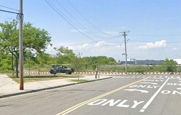
Looking north from Beach 49th Street at Conch Playground, the diagonal path in this park marks the portion of Conch Place demapped in 2014. Pronounced konk, it is a species of sea snail common in the warmer waters of Florida and the Caribbean. To see more streets with nautical names, visit Arverne-by-the-Sea, where the developer added dozens of streets such as Spinnaker Drive, Aquatic Drive, Beach Breeze Place, and Sandy Dune Way.
“Conch” is pronounced differently depending on where you are. In America it’s “konk” but in the UK, it’s a soft ch, as in “church.” –Ed.
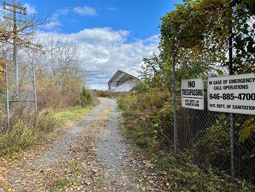
After splitting at the sanitation garage, the road then splits again with one branch turning past a salt shed and then rising to the summit. “No trespassing” signs discouraged me from ascending to the top as this barren hilltop is visible from the sanitation garage’s parking lot.
Spot the spelling error in the signs –Ed.
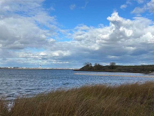
Looking north from the landfill is JFK Airport and for airborne travelers this hill is easy to see when landing and taking off. There was talk in 2009 of building a 158-acre solar panel farm here but it never went beyond discussion. I could imagine land art in the style of Robert Smithson, Maya Lin or Andy Goldsworthy greeting travelers as the city’s biggest artwork. A good example of this in Queens is Nobuho Nagasawa’s installation at Hunters Point South. In 2014, artist Agnes Denes proposed an art installation at Edgemere titled A Forest for New York, sponsored by the Rockaway Waterfront Alliance.
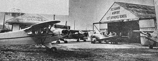
Prior to its use as a landfill, this site had perhaps the city’s shortest-lived airport. Operated by Harry Gordon, he sued the city to begin operations. So it did on Dec. 26, 1939, closing merely 15 months later for failing to meet the city’s requirements for airports. During World War II, it was used by the military and then for delivering air mail.
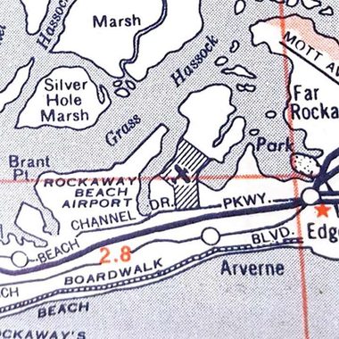
Besides its short runways, Rockaway Airport was too close to Idlewild, which would expand over the decades as JFK International Airport. Its fate resembled that of Flushing Airport in relation to LaGuardia Airport. It resumed civilian use in the late 1940s, holding on for another decade as a flight school. The airport site was then split between NYCHA, Parks, and the Sanitation Department. The peninsula had an earlier airport on the site of Riis Park, Rockaway Naval Air Station that operated from 1917 to 1930.
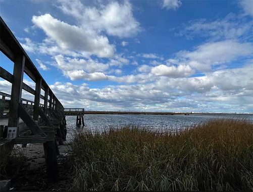
Two piers on the western side of the landfill were built in 1995 to barge in 700,000 cubic yards of topsoil to cap the landfill. It was assumed that the piers would then be open to the public for fishing but on my visit, they were deep inside the fenced-off park. The inlet here is Thursby Basin with Dubos Point Wildlife Sanctuary on the opposite side. The namesake was Rene and Jean Dubos, the biologist and environmentalist couple that advocated for the creation of this park.
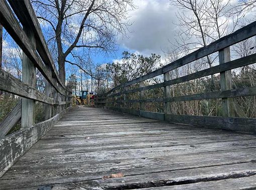
Seeing their condition, these piers would need to be reconstructed before fishing or boat launching takes place here. The bay side of the Rockaway peninsula has long been forgotten by the city but in recent years, new parks and local nonprofits have given more attention to it. Perhaps the day will come when the public can access the piers, roads, and summit of the former Edgemere Landfill.
Sergey Kadinsky is the author of Hidden Waters of New York City: A History and Guide to 101 Forgotten Lakes, Ponds, Creeks, and Streams in the Five Boroughs (2016, Countryman Press), adjunct history professor at Touro University and the webmaster of Hidden Waters Blog.
Check out the ForgottenBook (HarperCollins, 2006), as well as Forgotten Queens (Arcadia, 2013). I also have a chapter in the anthology “New York Calling: From Blackout to Bloomberg” (Reaktion, 2007). As always, “comment…as you see fit.” I earn a small payment when you click on any ad on the site, which helps in site upkeep and also aids Greater Astoria Historical Society.
11/15/26