
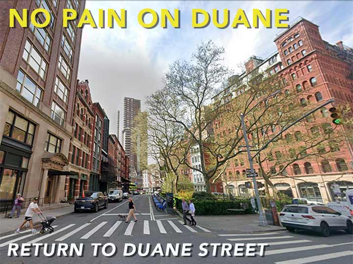

ONCE again, I miscalculated. At the beginning of summer in mid-June the sun is highest and I thought I’d get a different variety of shading in my photography by starting my walk around 9 AM. As it turns out, this was at least 2 or 3 hours too early for optimum lighting and sun glare compromised a number of shots. (Professional photographers use sun shading umbrellas to combat this.) I know better next time, live and learn. Today the camera demanded a journey west to east on Duane Street, which is unusual in a number of ways. As we’ll see, it actually bends southeast at its end, and there are a couple of distinctive items I have probably mentioned on other FNY pages, but I’ll collate here. This trip actually took me across the Brooklyn Bridge and I wound up at the Jay St/MetroTech station, but I’ll save that leg of the walk for another page.
Duane Street was named and laid out in the post-Revolutionary War era (1794) and was named for Mayor James Duane (1733-1797), a New York delegate to the Continental Congress, a leading lawyer in Revolution-era NYC, and NYC’s first mayor after the British forces’ evacuation in 1783. Its westernmost two blocks were eliminated in the 1970s to make way for the Independence Plaza housing project and the then-new Washington Market Park. Like its parallel streets in lower Manhattan, its house numbering runs from east to west; its easternmost blocks were also closed to traffic when several federal and civic center buildings, including Police Plaza, were constructed in the 1960s and 1970s.
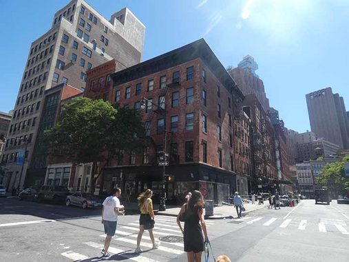
That sun glare issue is immediately apparent here at the west end of Duane, #325 Greenwich Street, a building constructed in 1857 for physician Robert Buchan.
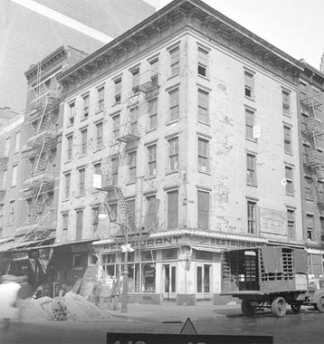
I won’t do a “before and after” for all the buildings on Duane; but here is #325 Greenwich back in 1940 when a restaurant was on the ground floor. A different restaurant, Cafe Clementine, is there now. Note the Dwarf lamppost on the corner with an odd bend in the mast. It’s left over from the 9th Avenue El, which had been torn down just recently in 1940. The bend got the mast around one of the el girders. How I wish someone had preserved a few of these; but the preservation movement didn’t gain much momentum till the original Penn Station was torn down.
I have worked all over the city. In 1992 I worked for a couple of months in a type shop on Greenwich and King streets (in a building now torn down) and I’d wander down to Greenwich in Tribeca for lunch. There was a taco joint at Greenwich and Warren I’d frequent; Lizard’s, I think it was called. Ancient history in mists of time!
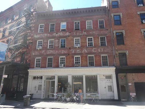
I like a building with ancient writing on it. #188-190 Duane Street by World War II contained the shipping offices of Lappin Tea. Around this time, Lappin sued a rival company for advertising their tea as Irish in origin, using symbolism such as harps, shamrocks, and the phrase “Erin Go Bragh” on their boxes. The court found in favor of Lappin and enjoined the rivals from referring to Ireland in their ads. The company’s painted ads can still be seen here. I have much more on this FNY page. The building was designed by architect Theodore A. Tribit in 1876.
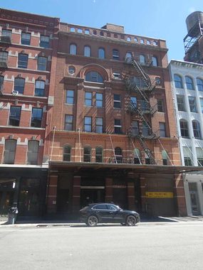
#173 Duane Street, a handsome Romanesque Revival building. From the Landmarks Preservation Commission report:
“This six-story… store and loft building, located near the Staple Street end of the block, extends fifty-one feet along Duane Street. This structure was built as two buildings in 1879-80 for owner Catherine Cook, mother of architect Walter Cook whose firm, Babb & Cook, was responsible for the design. The firm of Babb & Cook was noted for its distinguished commercial and institutional buildings. This building is an important early example in the district of the use of arcading as a design scheme.”
Duane Park


Duane Street splits in two in Tribeca, with one half ending at Hudson Street and the other half continuing east into the Foley Square area. Between the two halves, you’ll find Duane Park, a spot that has been green since the very beginnings of New York City. It was originally part of a Dutch farm dating to the mid-1600s that later was owned by the Duke of York of England, who gave it to Trinity Church, which owned vast amounts of property in lower Manhattan. The church sold it to New York City for the grand total of five dollars in 1797. Since the park predates lower Manhattan’s street grid, Duane Street was purposely divided to get around it when it was cut through in the early 1800s.
For such a tiny park—it’s only .115 acre in size—Duane Park has had several redesigns over the years. In 1870 it was given trees, a lawn, shrubs, bluestone curbs, and a new iron fence. In 1887, Parks Commissioner Samuel Parsons Jr. and Calvert Vaux, who had co-designed the much vaster Prospect and Central Parks with Frederick Olmsted, designed a new plan featuring pedestrian paths. In 1940 there was yet another plan, featuring more concrete, fewer trees and a new flagpole, and finally, in 1999, Duane Park reversed course, adding more plants and returning to Parsons’ and Vaux’s plan, while keeping the flagpole.
In fact Duane Park may have been responsible for lower Manhattan’s street layout at least in part. When Duane Street forks, it changes direction from roughly northeast to east, as do all the streets on the Lower West Side north of it. Then, they turn east at a certain point. Today, 6th Avenue is where the bend happens, but in 1922, it wasn’t yet extended south to Church and Franklin Streets. So, streets like Varick, MacDougal, Sullivan and West Broadway formed that dividing line.
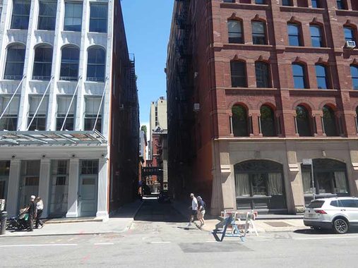
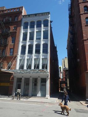
The Italianate #171 Duane Street was built as early as 1803 as a two-and-one-half story Federal-era structure built for schoolmaster Henry Verveelen, and then filled out to five floors by 1831. It was then given its cast iron facade, now a brilliant white, in 1859 when the cast-iron exterior trend was ramping up. By the early 20th century, like many of its fellow buildings on the west end of Duane Street, it was home to a butter and egg wholesaler. I’ll discuss the brick building on the right a bit later.
The space between the buildings is Staple Street, which runs for two blocks from Duane north to Harrison Street west of Hudson. It’s most famed for its pedestrian bridge that formerly connected downtown branches of New York Hospital. Staple street and its bridge are discussed in detail in the Forgotten NY book and on this webpage.
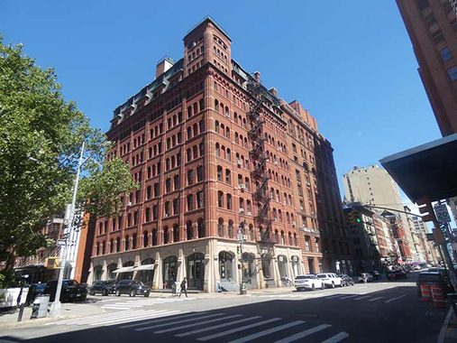
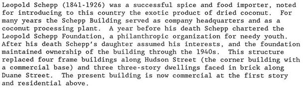
The magnificent 10-story brick Schepp Building, #51 Hudson Street, corner of Duane and designed by Stephen Decatur Hatch in 1880 as a factory, warehouse, and office building, was named for importer Leopold Schepp, whose most notable product was dried coconut. Landmarks:
I’d be remiss if I didn’t mention that 30 years ago, when Forgotten NY was just in its initial photography stage, there was a very unusual Bishop Crook lamp on this corner. It had apparently had an accident (truck collision?) and its “crook” was severely compromised. A Holophane “bucket lamp” was attached to its apex on a simple J-bracket. It was subsequently replaced by a new retro-Crook.
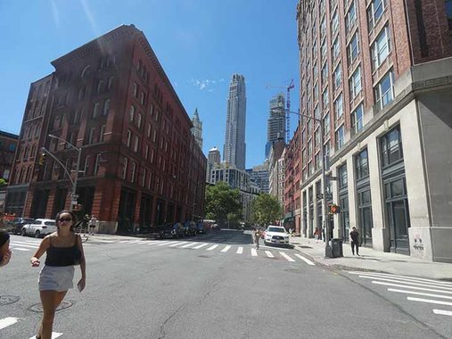
A look south on Hudson Street from Duane. At left is the Romanesque #24-28 Hudson, built in 1890 and designed by architect Samuel A. Warner for Margaret Wallace. (You can see what I mean by sun angle.) While the Woolworth Building peeks above it, in the center is the immense 30 Park Place, an 82-story limestone skyscraper designed by architect Robert A.M. Stern.


Before continuing east on Duane, there’s an interesting item a block north at Hudson and Thomas. For many years the 3-story brick # 46-50 Hudson Street, completed in 1925, served as a paper factory for John F. Sarle Co. Despite its being in a Landmarked district, developers have somehow been able to add two stories to it. My interest lies in the sidewalk outside the building: despite a sidewalk repaving in recent years, the compass showing north has been fortunately left alone.


I couldn’t resist getting a shot of #166 Duane Street, a.k.a. #25 Hudson Street, without the looming One World Trade Center as the backdrop. It was built for the prolific Central Building Improvement and Investment Co. (a noted real estate development firm in the early to mid-20th century) by Rouse & Goldstone in 1910.


You never know what you’ll see if you keep looking down. On the southeast corner at #24 Hudson, originally a Renaissance Revival warehouse dating to 1891, I found a set of surviving skylights that let light into basements prior to the inventions of Thomas Edison. Intense sun will sometimes make the glass in these old skylights turn purple or opaque, as with a few of the glass circles here.
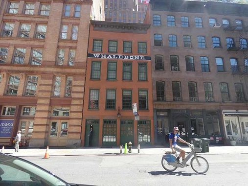
A black and white painted sign, “Whalebone,” has been located above the 3rd floor at #161 Duane Street since at least 2012 (as far back as Google Street View shows) but in the 1920 a “whalebone” sign was prominent as well, as George Messman, the last whalebone cutter in the U.S.A. retired that year after working there worked there for 56 years, with two predecessors (A.J. Vetter and, before him, William Forster). More on this in Tribeca Citizen, and here’s the 1920 NY Times ad it links to. Developer Joseph Pell Lombardi restored the sign when he obtained the building in 2007, according to the Citizen.


A pair of buildings at Duane and West Broadway sit in a “no-man’s land” between two Landmarked historic districts. The reason they aren’t included is probably that, for the NW corner building at least, the top three floors were lopped off since 1940, leaving just the bottom two, which look nothing like they did 86 years ago.
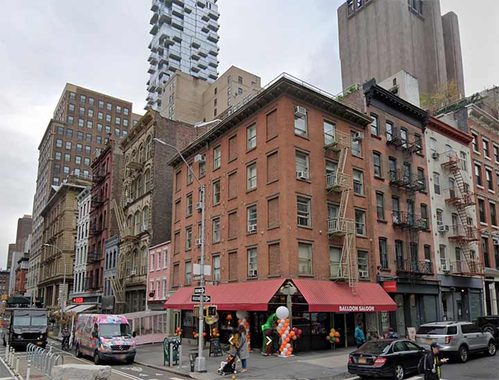
I turned to a 2022 Street View for this building at the NE corner Duane and West Broadway, which was hidden under restorartion/construction netting in 2026. Historian Hoyt Schermerhorn in 1940s.nyc: ‘At the time of the photo, ‘[This building had been] a distributor of children’s shoes for the Madison Shoe Company. In the 1980s, after sitting vacant for some time, it became the Balloon Saloon that launched the business of delivering balloon bouquets as gifts and greetings in the NYC area. As of 2026, the Balloon Saloon is still in business and celebrating 45 years in the balloon business.”
One block of Duane Street between West Broadway and Church Street sits in the Tribeca South Historic District, including this building. The building itself, now backdropped by the Jenga Tower (#56 Leonard Street) was constructed between1855-58 for Ralph C. Van Houten.


At #146 Duane is one of NYC’s most notable building clocks — look at the intricate metalwork on the bracket. It is a remnant of wholesale shoe company Nathaniel Fisher & Co. When a fire struck the headquarters in 1895, the NY Times reported that it had already been in business for 50 years. The Italianate building with cast-iron elements was constructed in 1859-60 for James Benkard and Benjamin Hutton, partners in the dry goods firm of Benkard & Hutton. The Landmarks Preservation Commission report says the clock was installed in 1940, though it looks a lot older than that. A close look at both clock faces shows that the one facing east is newer than the west-facing clockface, with numerals in the Clarendon font and two inscriptions: “U.S. Observatory” and “Tribeca Medical.” The U.S. Naval Observatory in Washington, DC maintains the Master Clock, the last word in official timekeeping in the USA.
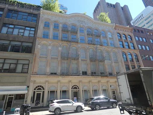
#131-135 Duane is the beautiful Hope Building, named for president of the dry goods wholesaling firm of Thomas Hope & Co. Constructed in 1862, it replaced the earlier P.S. 10. According to the LPC, “The present building was initially leased to two leading dry goods firms, Bauendahl & Co., wool importers, and Henry W.T. Mali & Co. Tenants of the present building have included wholesale shoe merchants such as Dryzer & Rosenberg Inc., the W.D. Hannah Shoe Co., the Lion Shoe Corp., and the Pincus Lester Shoe Corp. ; businesses associated with the printing industry such as the Stow-Whittaker Co. Inc., typographers; the Jewelry & Novelty Engine Tuning Co.; and the Apartment House Directory Service.”
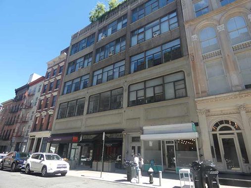
Next door, #137-141 Duane is actually the rear side of #62-66 Thomas (seen here). Hope is right next to Diamond, as there is a “Diamond Building” inscription above the door. It was constructed for rubber goods merchant Horace H. Day in 1864; but the inscription can be no earlier than 1929, when the building was acquired by Diamond Shoe Corp. (at one time, Duane Street must have boasted a number of shoes wholesalers). The building has been extensively remodeled on the Duane Street side since 1864, including the addition of a 5th floor.
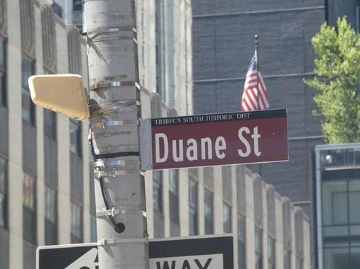
I’d like to know what this orange wedge-shaped item is at one of NYC’s remaining Donald Deskey lamps, introduced in 1958, on the SW corner of Duane and Church Streets. I thought it was an original Deskey fire alarm indicator lamp, but they were boxier than this. Same color, though. It’s been on the lamp since at least 2012.


Aachh, the blasted sun glare was so bad here, I was forced to use Google Street View to capture the New York State Insurance Fund Building, #199 Church and Duane, completed in 1955, with white brick facing and a bas relief to break things up a bit on Duane, “Unity of the Family” by Oronzio Maldarelli. New York State Insurance Fund is a non-profit, public insurance carrier and state agency providing workers’ compensation, disability benefits, and paid family leave insurance to New York employers.


Trimble Place, between Duane and Thomas Streets east of Church, doesn’t even get a lamppost of its very own. I haven’t been around here at night, but there may be lights on its adjoining buildings. FNY did a deep dive on this unknown lane on this page.


The Beaux Arts Engine 7, Hook and Ladder 1 was designed by architects Trowbridge & Livingston ands opened in 1907. From the Landmarks Preservation Commission report:
“The architects created a facade remarkable for its symmetry and emphatic horizontality. It is visually unified by superimposed architectural elements drawn from early seventeenth-century French civic architecture: the boldly rusticated Indiana limestone ground story, the brick and raised limestone bands of the upper stories, the entablature and parapet. The seventeenth-century French architects adapted these elements from the urban palace facades of the Italian Renaissance. In the often heroic execution of their mandated responsibilities, Engine Company No. 7 and Hook & Ladder Company No. 1, two of the city’s oldest fire companies, share an honored place in the city’s history. The companies, housed together since 1851, were sited in the northeast comer of City Hall Park. The new Duane Street location was chosen both for its proximity to the center of municipal government and to assure protection for the new skyscrapers going up adjacent to the park. This dynamic firehouse facade projects the strength and solidity associated with an arm of municipal government and is appropriate to the home of those dedicated to protecting the lives and property of the citizens of New York.”
The LPC Report describes the firehouse and the surrounding neighborhood in its customary thoroughness and detail. They don’t subscribe to “TLDR.” If you’re reading the whole thing, make a cup of coffee and a sandwich.
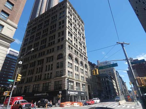
The Richardsonian Romanesque Revival Mutual Reserve Building, #305 Broadway, NW corner of Duane, was designed by William H. Hume and opened in 1894, one of a number of 19th and early 20th century insurance firm buildings along this stretch of Broadway.
Hey, that’s the original Duane Reade location…on Broadway between Duane and Reade, which opened in 1960, founded by Abraham, Eli and Jack Cohen. Duane Reade is now owned and operated by Walgreens.
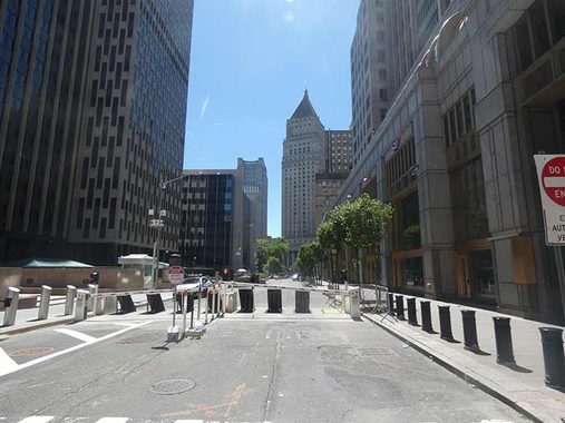
East of Broadway, Duane Street is closed to all but official traffic, as it passes the Jacob Javits Federal Building. Here are located NYC headquarters of the Department of Homeland Security, the Department of Health and Human Services, the Social Security Administration, the Department of Housing and Urban Development, the Federal Executive Board and Federal Bureau of Investigation.
Here, Duane also enters another Landmarked district, the African Burial Ground and Commons Historic District.
African Burial Ground


Workmen excavating a construction site on Duane Street east of Broadway in the fall of 1991 stumbled upon human remains interred in wooden boxes about 25 feet below street level. A search through property maps revealed that this area was a former burial ground for enslaved African Americans in the early 1700s.
The burial ground, when it originated, was just south of a body of water known as Little Collect Pond, a marshy area south of the much larger Collect Pond (a freshwater pond later made brackish by local industry; it was drained after 1816 by a canal that is now located in a sewer beneath Canal Street). A succession of dwellings and businesses rose on the site, and over time it was completely forgotten that it had ever been a cemetery.
When the interred remains were originally discovered, the federal government was building what was going to be the US General Services Commission Building, and had every intention to go ahead with its construction. After public pressure led by then- Mayor David Dinkins was brought to bear, however, the Feds reversed course and, in 1993, declared a small patch of land at the corner of Elk and Duane Streets a National Historic Landmark. The office building was modified to avoid the ground where the remains were discovered. More than 400 individual human remains were disinterred, along with artifacts also found there such as ceramics, animal bones and shells, and sent to Howard University in Washington, DC, for study. In October 2003, the remains were reinterred in the burial ground during a Rite of Ancestral Return ceremony. The site is now The African Burial Ground National Monument.
It’s not the only lost burial ground around town; more are discovered all the time including the Bunn Family Cemetery in Flushing, which spent decades as the Martin’s Field Playground before it was “rediscovered” and remodeled as a cemetery (seen on this FNY page). My friend, filmmaker Heather Quinlan is working on a film, “American Graveyard,” about a lost African Methodist cemetery in Port Richmond, Staten Island.
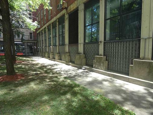
The rear end of the African Burial Ground also preserves a lost Manhattan alley, Republican Alley, now a public walkway. More on this on FNY’s Elk Street page.


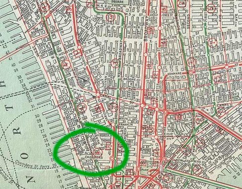
I am standing on Duane Street just west of Foley Square looking at the pyramid-domed US Courthouse. In the 1867 Dripps atlas excerpt, I’m approximately where it’s circled. Just about everything on the street layout has changed. It would yet be a few decades before Lafayette Street would be extended south and just about every street save Pearl on the right side of the map would be eliminated. See Manhattan Place? It survived as a trash-strewn alley till the 1970s. On the extreme left, New York Hospital, shown in green, once occupied a superblock bounded by Duane, Church, Worth, and Broadway. A small piece of Park Street survives as Mosco Street. That ever so slight bend in Duane Street where circled (by me) is still there.
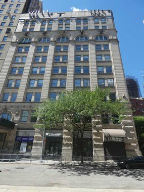
#52-58 Duane Street, corner of Elk, is a 10-story commercial office building built in 1935 (though its sort-of Beaux Arts design makes it look older). It hosts the New York City Law Department and various private legal firms, and often turns up on cop and legal TV drams such as “Law and Order” and “Blue Bloods.” I found an archaic Federal Express logo beneath an awning, and wrote about it on this FNY page.


On the NW corner of Duane Street and Foley Square is the glassy James L. Watson United States Court of International Trade. Here are adjudicated civil actions arising out of United States customs and international trade laws. The Court itself was established in 1890, and the current courthouse opened in 1968. In the plaza outside the front entrance is a second African burial ground memorial, located on the sidewalk, that preceded the larger memorial a block away.
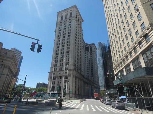
Seen from Duane and Centre Streets at Foley Square is the New York City Municipal Building, which houses most of NYC’s municipal agencies (including City Comptroller, Public Advocate, and Manhattan Borough President) employing over 2000 people. It was constructed from 1909-1914, designed by William M. Kendall, an architect in the offices of McKim, Mead and White. Topping the building is Adolph Weinman‘s gilded 20-foot-tall “Civic Fame” for which he used his usual model, Audrey Munson. In 2015, Mayor Bill DeBlasio named it for his predecessor two mayors before him, David N. Dinkins.
I have only been in the building twice: on 10/23/06, when I was in the WNYC studio to discuss the then-new Forgotten NY the Book on the Brian Lehrer Show. The book was offered as a gift with a certain dollar pledge to fund the station, but nonetheless, the book got its highest Amazon rating that day, approaching the top 500 (sort of like making the Billboard Hot 100 or even Top 40). The book is still in print and still selling a couple of dozen copies every month! The WNYC studio has since moved west, to Hudson Square. In 2025, I gave a lunchtime Forgotten NY presentation to employees in then Comptroller, now Congressman, Brad Lander’s office. I briefly chatted with Lander: he asked about the whereabouts of the old Kentile Floors sign in Gowanus, and I told him, the last I heard, there were plans to set it up below the IND elevated in the area, which I thought was a bad idea.


I never hope to enter any one of the courthouse buildings surrounding Foley Square, since mainly defendants, lawyers, and jurists enter them, and I’ve only been one of the latter. Foley Square was named for “Big Tom” Foley, saloon owner and Tammany Hall capo, in 1925, and encompasses the area where Centre and Lafayette Streets form a V, or a triangle with Worth Street. It sits on the site once occupied by the freshwater Collect Pond, used as a dump so long by colonists that it became fetid and was drained into the Hudson by the canal that Canal Street now sits atop.
In 1849, cast-iron building pioneer James Bogardus built the nation’s first all-iron building at the NE corner of Duane and Centre.
Foley Square stands atop the former infamous Five Points district and is where Lafayette Street breaks away from Centre and continues north to Cooper Square. Foley Square is marked by the Thurgood Marshall United States Courthouse and the octagonal US State Supreme Court, known to TV and movie enthusiasts for exterior shots of “12 Angry Men” and “Law & Order.”
The Duane Curve
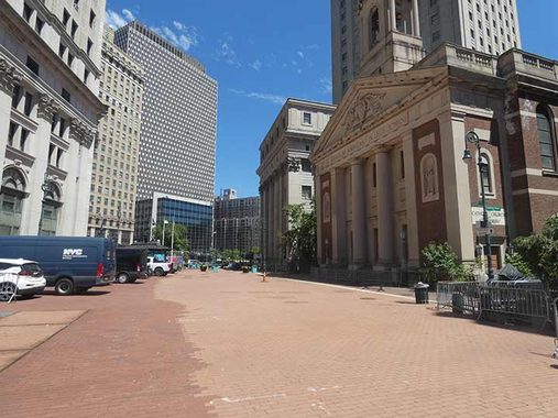


Remember that slight curve in Duane Street I mentioned? Today, Duane Street ends (rather, begins, as its house numbering runs east to west) at Foley Square. That wasn’t always the case, as the street once took a much sharper turn southeast through what is now Police Plaza, all the way to a section of Rose Street that no longer exists just north of the Brooklyn Bridge. However, its old route up to Cardinal Hayes Place at St. Andrews Church remains as a pedestrian plaza. It’s paved with red brick, which I believe is a latterday development.
Why did Duane Street take this curve? it followed a stream that issued from Collect Pond; both were drained dry 150 years ago.
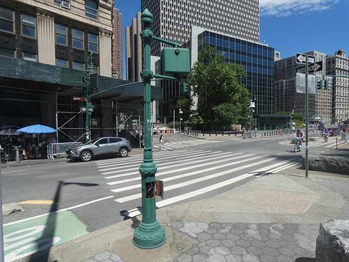
Here in Foley Square, stoplight and pedestrian control standards are Type B park poles with a finial at the apex.
St. Andrew’s
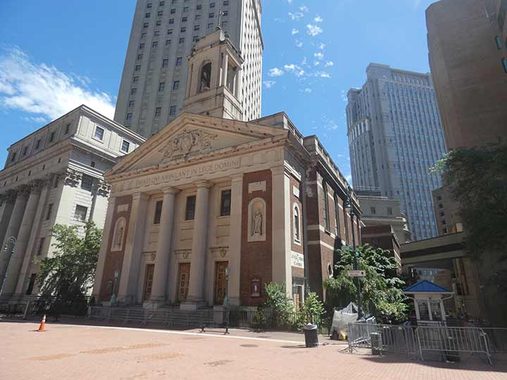


“St. Andrew’s Church was consecrated here in 1939, replacing an earlier church named Carroll Hall built in 1842. Just before the Civil War when the City Hall area became the center of the printing and newspaper business, the church received special dispensation to say a “printer’s Mass” at 2:30AM for the night shift of newspapermen and printers. It later became the first parish church to offer a noon mass for the growing number of businessmen in the area. The Latin phrase on the frieze, Beati qui ambulant in lege domini, means ‘Blessed are those who walk in the law of the Lord.’” —Gerard Wolfe
I know about the printing industry: I worked night shifts as a proofreader, typesetter and other duties in the 1980s and 1990s and in fact, for a couple of months as late as 2018.
Among the exterior church statuary is the saint, the brother of St. Peter, holding an X-shaped cross; upon his martyrdom in what is now Greece, he deemed himself unworthy to be crucified on the same type of cross as Jesus had been, and requested a cross that did not match Jesus.’ The X-shaped cross iconography, though, did not occur until the Middle Ages.
The Latin phrase on the pediment is from Psalms 119 and means: “”Blessed are those whose ways are blameless, who walk in the law of the Lord.”


A pair of skybridges spans Cardinal (Patrick Joseph) Hayes Place, one of the old warren of streets now replaced by Police Plaza that was surprisingly preserved from the old days, connecting the NYPD HQ with the Marshall Courthouse. The short lane, which dead-ends at St. Andrews Plaza (Duane Street), was once called City Hall Place and was was renamed for the prelate, a parishioner of St. Andrews and an area resident, in 1941.
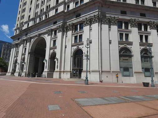
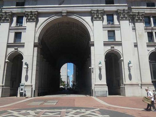
Since the 1960s, this has been the east end of Duane Street, the walkway facing Police Plaza at the rear of the Municipal Building (described above). The “Lyre” lamppost is imitative of a desk lamp. The design was used sparingly, but older photos show them occurring around the Municipal Building and in Times Square; these retro versions, installed 20 years ago (early 2000s), are almost note perfect copies.
Chambers Street once proceeded through the large arch, changing its name to New Chambers and proceeding through to Cherry and James Streets, where the Al Smith Houses have been for several decades now.
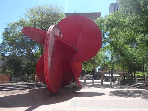
“5 in 1,” Tony Rosenthal’s steel sculpture, was the second of five public art sculptures, created by the artist now on permanent 24/7 display in New York City. Rosenthal’s revolving cube “Alamo,” 1967 (Cooper Square) was not only the first of his five New York City public art sculptures, but also has the well-known distinction of being the first post war contemporary sculpture purchased by The City of New York.
“5 in 1” consists of five interlocking discs which represent the interconnectedness of the City’s five boroughs, Bronx, Brooklyn, Manhattan, Queens and Staten Island. A lack of funds prevented the red coat of paint specified by Mr. Rosenthal, and the sculpture was initially installed with the raw Cor-Ten Steel exposed. Because of the exorbitant cost of constantly removing graffiti, funds were raised to paint the 5 in 1 sculpture red, ultimately completing the One Police Plaza Commission with the artist’s original vision.
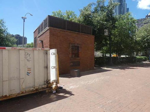
Sadly, the historic Rhinelander Sugar House window is stashed behind the Municipal Building, where it’s generally ignored, except for truck drivers who often place dumpsters in front of it.
“Preserved here is a window of the Rhinelander Sugar House, which commemorates the dismal Revolutionary war prison in which hundreds of American patriots died of starvation, neglect and disease. When the Sugar House was demolished in 1892, a window from the prison was preserved and built into the Rhinelander Building, which occupied the site until it too was demolished in 1968 to make way for the new Police Headquarters building. The window was rescued again and mounted here behind the Municipal Building.” –Gerald Wolfe
Another, better preserved Sugar House window can be found at the Van Cortlandt Mansion way uptown in the Bronx.
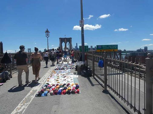
From here I made my way to Brooklyn across its titular Bridge. Pedestrians on the center boardwalk had a brief golden age a couple of years ago when bicycles were given their own traffic lane and moved off the boardwalk, but vendors have quickly filled in that lane, despite their illegal presence. The city turns a blind eye.
Check out the ForgottenBook (HarperCollins, 2006), as well as Forgotten Queens (Arcadia, 2013). I also have a chapter in the anthology “New York Calling: From Blackout to Bloomberg” (Reaktion, 2007). As always, “comment…as you see fit.” I earn a small payment when you click on any ad on the site, which helps in site upkeep and also aids Greater Astoria Historical Society.
11/8/26
1 comment
I saw some of Tony Rosenthal’s sculptures at the Chrysler Museum in Norfolk,Va.
They were pretty much ignored and obscured by foliage in a far corner of the museum grounds