

THERE are over a dozen streets in NYC named “Mill,” and I have always been interested in them because they point to waterside mills, most of which were torn down in the 1800s. In addition, most of these “mill” roads are aboriginal and date back before their neighborhoods’ various grids were constructed. I’ve covered a number of these before, and I will link to previous FNY pages that discuss them along with new photos and research. In addition to street names, two millstones, formerly a part of the Berger Jorissen Mill, are displayed in Dutch Kills Green in the heart of Queens Plaza. Other millstones can be found in front yards around town, likely rescued from mill sites.
Most of the mills remembered by street names were grist mills, which grind grain into flour or meal, historically powered by water wheels or steam, or tidal mills that use the rise and fall of ocean tides to grind grain or power machinery. NYC “mill” roads are invariably located near bodies of water.
Manhattan
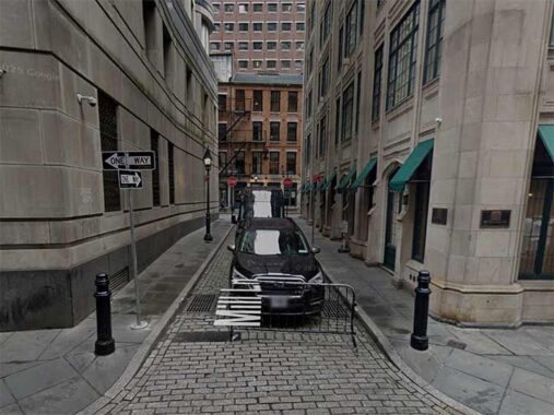
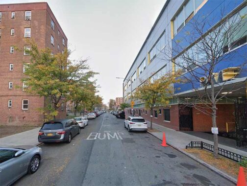
Mill Lane, a short path between Stone and South William in the Financial District, is one of the shortest streets in Manhattan (Edgar, between Trinity Place and Greenwich Street just north of the Brooklyn Battery Tunnel exit, takes the title according to the people who measure these things; see below). Mill Lane is much narrower and less trafficked than Edgar, though, and may well be the least-noticed of any street in Manhattan. In recent years it has been compeletely obscured by ubiquitous building scaffolding, which is mostly there to avoid lawsuits.
In 1628, a few years after New Amsterdam’s founding, a mill powered by circling horses was constructed in the area in which bark was ground up for tanning purposes. The city’s first religious services were led at the mill, and Peter Stuyvesant is said to have surrendered to the British there. A former name of South William Street was Mill Street. [info: “The Street Book,” Henry Moscow, Hagstrom 1978]
After several years under scaffolds, Mill Lane has again been revealed. The Belgian blocks are relatively new.
Bronx
Reed’s Mill Lane contains two sections: well-trafficked, wide portion between Tillotson and Steenwick Avenues north of the New England Thruway in Eastchester. This part of the road was expanded from a much narrower lane when the Boston-Secor Houses were built in 1969…
…and a shorter portion, not mapped by the city hence no identifying street signs, connecting Steenwick and Boston Road amid a clutch of flat fix and auto repair shops.
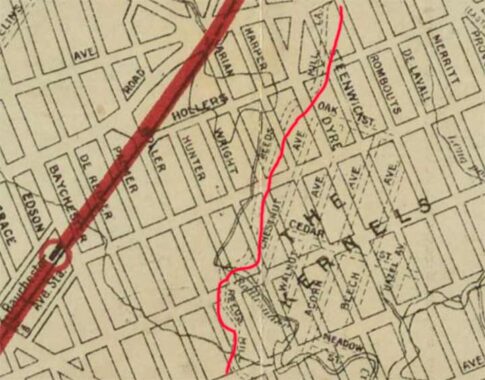
This early 20th century map shows an area in transition. Reeds Mill Lane is the only survivor of a Bronx settlement called The Kernels: in the colonial era, a Cornelius Jones, known as “The Colonel,” owned a tract on the west shore of the Hutchinson River. After a time his property was sold to developers, and a small grid of streets was laid out in the area by the Civil War area, the name corrupted to “The Kernels” in a swampy area frequented by rattlesnakes; Mill Creek, which issues from the Hutchinson River, later narrowed to a brook called Rattlesnake Creek. Most of both waterways are now in the sewer system, but some of Rattlesnake Brook surfaces in Seton Hall Park.
Reed’s Mill Lane remembers a tide mill on the Hutchinson River built in 1739 and in operation until the Civil War, with the mill standing till about 1900. One of its owners was John Reid.
Brooklyn
Brooklyn has more “Mill” streets than any other borough, with mills located on the Buttermilk Channel/Erie Basin waterfronts and along Jamaica and Gravesend Bays in the southern end of the borough.
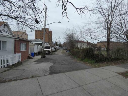
Mill Street in Red Hook is a very short route in Red Hook in two sections, one between Hicks and Henry Streets and another between Clinton and Court. It was formerly continuous, but the construction of the Red Hook Houses in the 1950s interrupted it. I can’t be sure, but there was likely a mill of some kind on nearby Gowanus Creek or Buttermilk Channel.


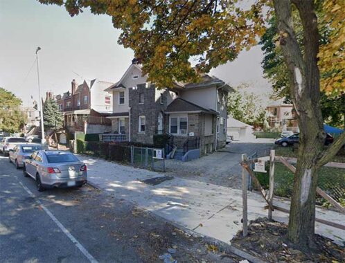
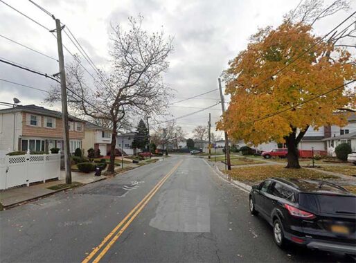
Encountering recently installed street signs along Mill Road in Bath Beach, a slight, unpaved road with houses built along it nonetheless (but also facing garbage-strewn empty lots) officially running for a block between Bay 44th Street and 27th Avenue near Cropsey, gave me the idea for this page. Perhaps NYC officially added it to its maps.
Mill Road formerly was the only road that led into a spit of a peninsula formed by Gravesend Bay and what was called Harway Basin. One would imagine that a mill was located on the peninsula, hence the name of the road. Walking Mill Road today, it’s hard to imagine that a waterway once licked its east side. This map also explains why Cropsey Avenue curves south to cross Coney Island Creek. I have the whole history on this FNY page.
There are two “Mill” routes in East Flatbush-Bergen Beach and Mill Basin, Mill avenue and Mill Lane.
Gerritsen Creek, and nearby Gerritsen Avenue, take their names from the Dutch Gerritsen family, who owned property where Marine Park is now as early as the mid-17th century. The family had a milling operation that ran continuously from two buildings in the Marine Park area until 1934, when the second of the two mill buildings burned down…perhaps by arson.
The mills had wooden machinery, leather beltings and large revolving millstones. It was on the edge of the basin into which poured the sea when the rising tide opened the flood gates of the dam that crossed the narrowest part of the creek (originally Storm Kill, later called Gerritsen’s Creek). When the water reached the top of the dam, the gates closed with a full pond behind them. A gate in the sluiceway in the back of the mill could be raised by hand by means of a ratchet wheel, and thus allow the water to flow over the mill wheel as needed.
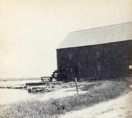
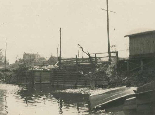
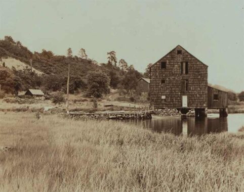
The second of the two mill buildings is shown here; it was most likely built around 1755. This mill was in continuous operation by the Gerritsens until the late 1890s; William S. Herriman, the last person to run the mill, sold the property in 1899 to the Whitney family, who used the acreage as a training area for his stable of race horses.
|
Mill Avenue is a main route in the residential neighborhood of Mill Basin, located south of Avenue U. Mill Basin and East Mill Basin are inlets of Jamaica Bay and are used mainly to berth pleasure boats owned by area residents. A new neighborhood was constructed south of Avenue U following World War II. It wasn’t built along a grid but in concentric circles, similar to an area in Rego Park, Queens. This is an expensive part of town and boasts a number of unusually-designed residences.
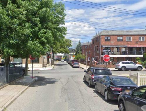
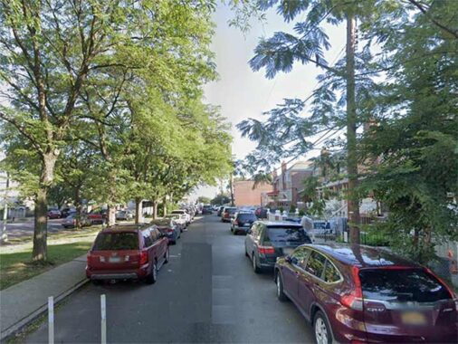
Meanwhile, two pieces of Mill Lane remain in the area. This is a Street View of the easternmost section that runs two blocks between Ralph Avenue and East 64th Street south of Avenue N.
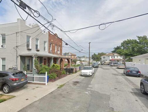
There is also a one-block slice of Mill Lane between East 55th and 56th Streets, again south of Avenue N.
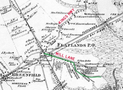
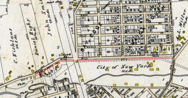
As you may have guessed, Mill Lane once ran continuously between Flatlands Neck Road, today’s Kings Highway, and the marshes near Jamaica Bay. Most of it was eliminated by the 1920s as a street grid was constructed and houses built along the new streets. The two remaining sections survived because homes had already been built on them (this is the reason many older roads, or pieces of them, are still there. The green line traces Mill Lane’s route.
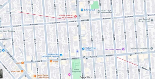
Even on today’s map, ghosts of Mill Lane can be found because there are still some empty yards or areas that remained undeveloped in spots. I’ve marked this Google Map excerpt with red lines where you can find them.
The junction where Mill Road separated from what is now Kings Highway can be seen in this slanted driveway at an older house, where Kings Highway bends just east of Flatbush Avenue, on the south side of the road.
Interestingly, Mill Lane was likely a Native American trail leading from a precolonial village to the water’s edge. A map drawn in 1946 shows these ancient trails.
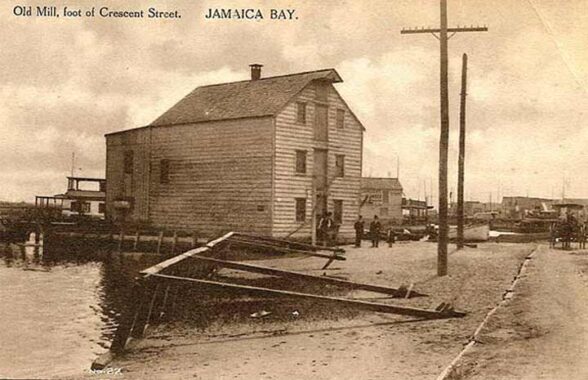
“Located at the foot of Crescent St. by Jamaica Bay, the Old Mill was not known to my generation. From Good Old East New York:”The Old Mill was established on the Bull Creek, about 1770 by one Van Brunt, at the same time as the Red Mill, just across the Flatlands town line, was built. Until 1810 the Bull Creek Mill stood at the second floodgate about a half mile south of the present site. In that year the mill was taken down and the present structure was built from the timbers of the original mill, at the foot of Crescent St. The mill was owned by L. Van Wicklen and known to many as Van Wicklen’s Mill.” The East New York Project
I first found Old Mill Road in the late 1970s, on one of my many bicycling trips from Bay Ridge way out east, to New Lots, Ozone Park or even further, depending on how much time was available. The longest round trip I ever made was Bay Ridge to Valley Stream and back. Modest by the standards of other bicyclists I have known, but I prided myself on making that round trip in five hours. This was when I was 18 to 23 years old, though.
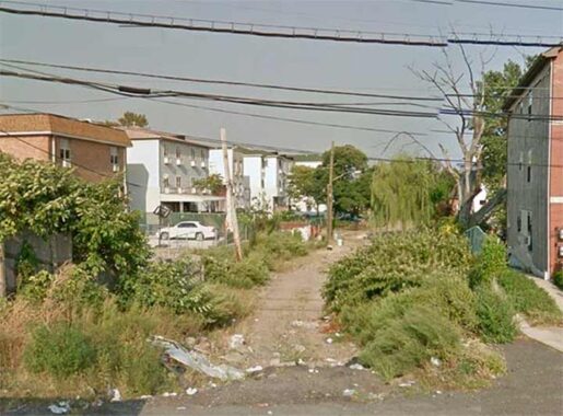
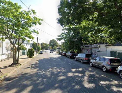
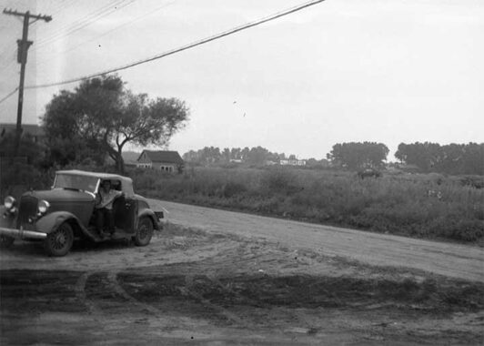
One of my favorite routes was down Cozine Avenue, to escape the mean streets of East New York further north; this was the blackout–Son of Sam era. Attaining Fountain Avenue, I noticed a dirt road just south of Cozine running east to Crescent Street. It was completely unpaved and there must have been a black and white street sign indicating “Old Mill Road” then. Recently the city installed some new green and whites, but it remains unpaved. There appear to be 2 or 3 ancient homes fronting the road, which explains its survival.
Sometimes, dirt roads unknown by most are the keys to the historic past.
Queens
There are no surviving roads simply called “Mill” remaining in Queens, but there is a surviving road named for its owner and another that has been renamed.
“Site of the old Jacksons Grist Mill (aka Jackson Tide Mill) on the east side of Bowery Bay Road (94th St.) at North Beach at the Bridge. The mill extended out into the water from the where the boats are to the right.
Cornelius Luyster laid the foundation for the Mill in 1668. It had a succession of owners and was called: Kip’s Mill, Fish’s Mill and Jackson Mill. The latter was in memory of its last owner, Samuel Jackson. The mill operated until 1870, and was still standing in 1881. The Abraham Rapelye (Rapalje) House is in the Distance on 94th St. on High Ground.”
The road that led to the mill, known as Jackson Mill Road for several decades, is well-chronicled in Forgotten NY; again, I found a piece of it while bicycling in the area in the 1990s. Today’s road exists in two pieces, one running northeast from 32nd Avenue at 93rd Street northeast to 97th…
|
|
|
|
…and another slanted piece, at 24th Avenue and 94th Street. In addition, another remaining piece can be seen connecting 24th Avenue and 95th Street, but that slice has been privatized (albeit without gates) and if you walk on it, you may be shooed out.
The entire road was once continuous, and served as the roadbed for a trolley line connecting Northern Boulevard with a bayside amusement park. By 1939 that area had been redeveloped as LaGuardia Airport. The trolley line survived into the 1940s; when it closed, some of it was replaced by the street grid leaving just two separate pieces.
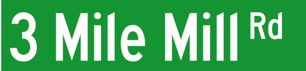
“If there’s a Three Mile Mill Road, it makes sense there is or was a Three Mile Mill. In 1938, there were some archaeological studies done at the site of Three Mile Mill.
The location given at 150th St & Goldfield St. Goldfield St no longer exists, but when it did exist, it intersected with 150th St in two different places: one close to the aqueduct and the other further south.”
|
|
|
|
|
1909 map excerpt showing 3 Mile Mill Road issuing south to Jamaica Bay (which is on the left) from the junction of today’s Rockaway and Sutphin Boulevards.
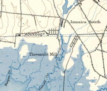
This USGS map produced about 1900 shows 3 Mile Mill Road running south to its mill on Cornell Creek, an inlet of Jamaica Bay. In the 1940s, Idlewild Airport (named for this southern area of Queens), now John F. Kennedy Airport, was built atop this area. What was the mill three miles away from? Who knows?
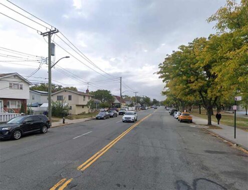
A portion of 3 Mile Mill Road remains as part of 150th Street between Rockaway Boulevard and Shore Parkway.

For a few decades, the section of Booth Memorial Avenue between Strong’s Causeway and Kissena Boulevard (on this 1908 map called Jamaica Road) was called Ireland Mill Road, as it paralleled an estuary of the Flushing River called Ireland Mill Creek. Today, the creek is mostly in the NYC sewer system beneath Kissena Corridor Park. The section of Ireland Mill Road just east of the causeway was originally renamed Rodman Street and in 1969, became the south end of College Point Boulevard.
Booth Memorial Avenue has been in place through Fresh Meadows since the colonial era. When Ireland Mill Road was extended east of Fresh Meadow Road, apparent plans called for it to run as far as Jericho Turnpike/Jamaica Avenue, which indeed went as far east as the town of North Hempstead. However, North Hempstead Turnpike, at its furthest extent east, got as far as Hollis Court Boulevard, amid woods that eventually became Cunningham Park. Thus it was a misnomer from the start.
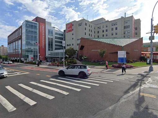
The reason Booth Memorial Avenue has its present name is the present New York-Presbyterian Queens on Main Street. This branch was actually founded in Manhattan by the Salvation Army, as Rescue Home for Women on East 123rd Street. When it expanded its operations to care for injured military personnel and their families, it became Booth Memorial Hospital and moved to 316 East 15th Street in 1919. William Booth (1829–1912), was an English-born, impressively-bearded Methodist preacher who, with his wife Catherine, co-founded the Salvation Army in 1865. In 1964, the city decided to honor the work of Booth Memorial Hospital by renaming the entire length of North Hempstead Turnpike to Booth Memorial Avenue. With the construction of Cunningham Park, Fresh Meadows Houses, and the Clearview Expressway, there was no chance the “turnpike” (I’m unsure if it was ever actually tolled) would ever be extended to Jamaica Avenue to fulfill its “mission” as a connecting route between Flushing and North Hempstead (and by then, the Long Island Expressway was filling that role as best it could, as “the world’s longest parking lot.”)
Booth Memorial Hospital became New York Hospital in 1993, so it’s a misnomer once again!
Staten Island
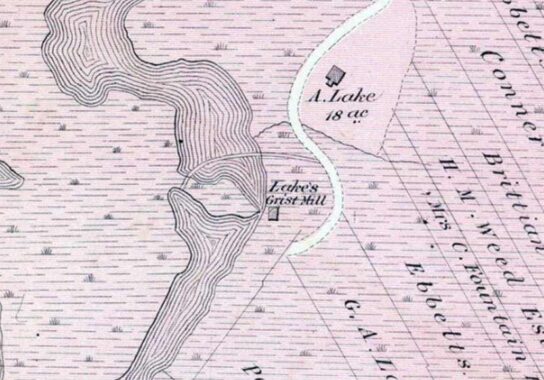
Mill Road is a major north-south route in New Dorp and Oakwood beaches, running from New Dorp Lane at Miller Field south of Hylan Boulevard southwest to a rather ignominious end at the Oakwood Beach Wastewater Treatment Park. However, it’s one of the first roads built through this marshy area, as shown on this 1873 atlas excerpt.
Also from that atlas you can see the road led to a grist mill operated by the Lake family. All this is just north of Great Kills Park, though you have to backtrack to Hylan Boulevard to gain access by auto; a park path also issues from Grayson Street.
|
|
|
|
|
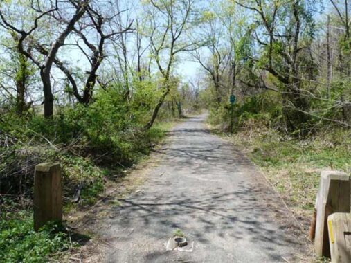
Old Mill Road in Richmondtown, Staten Island originates of Richmond Hill Road’s S-shaped “Snake Hill” curve — it mainly leads to the church caretaker’s building. However, it is actually a very old road that may go all the way back to the colonial era. There were once dwellings scattered here and there along its route, including a former British fort from the Revolutionary days, and a tidal grist mill from which Old Mill Road gets its name, in operation from 1790-1927. There was amother freshwater grist mill in the fregion in the 1800s, as well. Before Latourette Park, through which the road now runs, was created, this land was in the possession of several landholders including the Green family.
In 2013, I was able to walk Old Mill Road’s full length through the park as far as Forest Hill Road. When I first saw it in 1999 it was completely covered in weeds and thorns, making it an uncomfortable stretch.
|
|
|
|
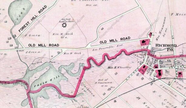
This 1874 atlas also excerpted above shows Old Mill Road’s run through what became Latourette Park, as well as both mills.
Check out the ForgottenBook, take a look at the gift shop. As always, “comment…as you see fit.” I earn a small payment when you click on any ad on the site.
4/8/26