It was a gorgeous day when I did a reconnaissance walk for a since-completed Forgotten NY tour of Uptown Trinity Cemetery. So much so that when I was finished, I kept right on going and crossed over into the Bronx, where I walked past the New Yankee Stadium (where I still have not seen a game, though I did tour it on a n off-day when it first opened) and on to the Grand Concourse, where I got a D train back to Manhattan.
As it turns out, the day of the tour was overcast with drizzle and light rain, so the cemetery looked a lot better the day of my scouting mission than it looked the day of the tour, and thus, I’ll show a bit of that today as well as some of my other discoveries…
GOOGLE MAP: UPTOWN TRINITY CEMETERY TO YANKEE STADIUM
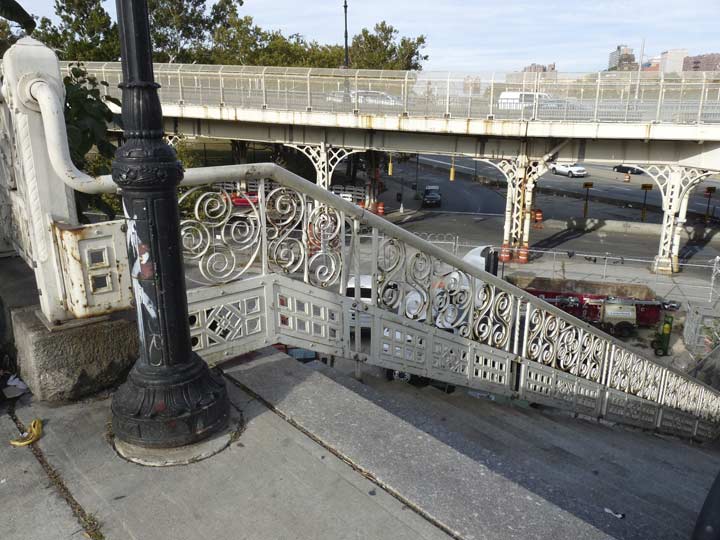
As I said in Part 1, West 155th Street is actually carried on two bridges: one, a viaduct that takes traffic on an even grade over a very high escarpment located between Edgecombe Avenue (appropriately the name means “edge-hill”) and 7th Avenue (Adam Clayton Powell Boulevard) where there are a variety of ramps that connect to the East River Drive and the Macombs Dam Bridge. The viaduct was completed in 1895, the same year as Macombs Dam Bridge; engineer Alfred P. Boller handled both projects. The staircase and sidewalk railings were originally designed by Hecla Iron Works, which would also design the exit and entrance kiosks for the IRT Subway in 1904.
Though the original railings on the viaduct have been largely replaced, you can still see them not only on the Macombs Dam bridge, but here on the very steep staircase that takes foot traffic from the viaduct down to local streets. You can see the viaduct itself in the background. Since the early 2000s both the bridge and viaduct have been painted very light yellow or beige.
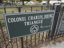
Speaking of foot traffic the Department of Transportation does not make it easy to walk from the viaduct continuously onto the Macombs Dam bridge itself because on busy turning traffic. You have to proceed south to Macombs Place and West 154the and try your luck there, as there are no stoplights. You will then find yourself in Colonel Charles Young Triangle, wedged between Macombs Place, the pedestrian West 153rd and Powell Boulevard.
The triangle’s namesake, Col. Young (1864-1922) had a colorful military career that is Hollywood-worthy. He was just the 9th African American graduate of West Point in 1884 and commanded the 9th Ohio Volunteer Infantry on the home front during the Spanish-American War in 1898, and later served during a Philippine insurrection between 1901 and 1903. Trained as a cartographer, Col. Young made military maps and in 1912 published a book, Military Morale of Nations and Races.
He was later feted by the NAACP for his contributions in organizing Liberia’s National Military Constabulary from 1912 to 1915. The next year he led the 10th Cavalry Regiment against incursions in the American southwest by Mexico’s Pancho Villa and established a school for African-American soldiers at Fort Huachuca, Arizona. He was pronounced physically unfit for service in World War I, but was promoted to full Colonel at the war’s outset. He passed in Lagos, Nigeria in 1922 and was laid to rest in Arlington National Cemetery. This park was named for him in 1937.
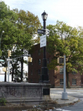
Before the 1990s, this park featured a flock of now-rare Type F lampposts, but they were torn down when the park ws renovated in 1997.
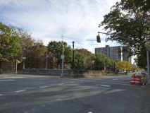
Powell Boulevard (7th Avenue) is shunted to the Harlem River Driveway via a ramp under West 153rd Street. For decades the ramp, on which traffic was light, was illuminated by a set of ancient, rusted iron posts with a unique design, employing Westinghouse “cuplights.” In the early 2000s the posts were granted a paint job (especially rusty ones were removed) and the cuplights were replaced with post-tops.

There’s a brotherhood of bridges spanning the Harlem between Manhattan and the Bronx. The 3rd Avenue, Madison Avenue, East 145th, Macombs Dam, and University Heights (originally Broadway) Bridge were all designed by Alfred Pancoast Boller and all share a certain thematic style, with spidery ironwork and stone gatehouses on each end. All opened between 1895 and 1910. The 3rd Avenue (and Willis Avenue) Bridge were replaced in the early 2000s, and the City Island Bridge, using a Boller design when it opened in 1901, was replaced by a new bridge in 2017.
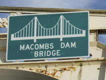
Farmer Robert Macomb opened the first dam and bridge on this site in 1814, but annoyed neighbors by damming the Harlem River in the East 160s, and collecting tolls. On more than one occasion gangs breached thee dam to allows ships to pass. After some years the city tore down Macomb’s bridge and replaced it with a wooden swing span, and built another wood and iron drawbridge in 1861. Tolls were eliminated in 1858.
However, the second bridge also proved unsafe and difficult to maintain, and finally, the City commissioned Boller to build this iron swing bridge, originally known as the Central Bridge, assembled between 1892 and 1984.
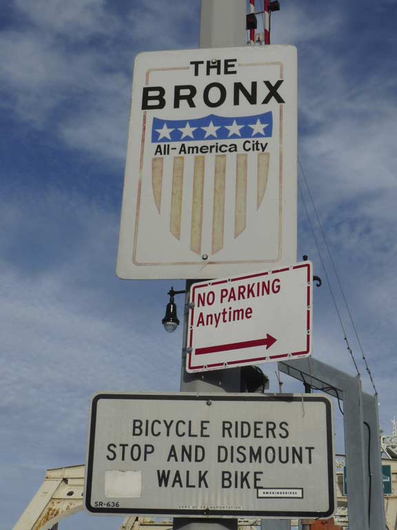
These “All-America City” signs, with the US flag shield, have been seen all over the borough since 1997, when the Bronx was granted the National Civic League ”All-America City” award.
The ”All-America City” award is based on a community’s application and presentation, which includes questions relating to community challenges and concerns and citizen participation. Applicants were also responsible for corroborating the degree of success in realizing community goals, by describing in detail three recent community-driven projects that made a difference in the last three years. [NY Times]
Projects that prompted the National Civic League to designate the Bronx were the Mid-Bronx Senior Citizen Council, dedicated to rebuilding housing stock; the Undercliff/Sedgwick Neighborhood Safety Service Council, that attempted to alleviate blight and crime; and the Women’s Housing and Economic Development Corporation, an organization that acquired $23 million in state, Federal and private funds to create Urban Horizons, an effort to provide affordable housing, child care and economic development.
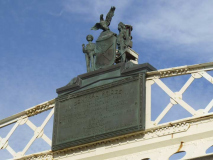
The original dedication plaque with the NYC shield featuring a Dutchman, Native American and eagle, remains in place, with Boller’s name, various city commissioners, and NYC mayors in 1892 and 1894, Thomas F. Gilroy and Hugh J. Grant. When he took office, Grant was the youngest NYC mayor to date. A more streamlined recent sign appears beside it.
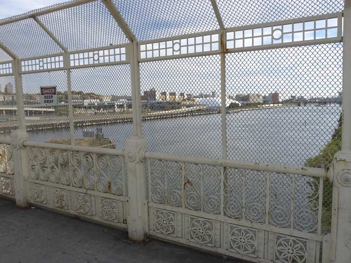
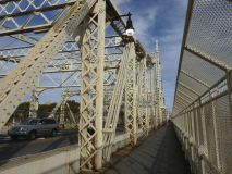
Though I am a big fan of High Bridge, which reopened in 2015 after a 55 year closure, I probably enjoy walking the Macombs Dam Bridge more than any of the others, at least between Manhattan and the Bronx, despite the narrow pedestrian path that has to be shared by both walkers and speeding bikes. Unlike the viaduct, its original railings have been preserved in glory. Look at the gorgeous ornamentation.
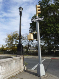
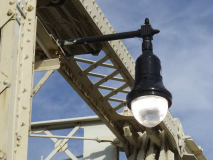
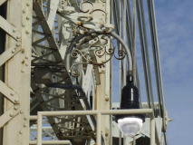
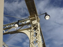
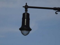
Macomb’s Dam Bridge is illuminated by Bell fixtures using brackets and supports found nowhere else in NYC. The ornately scrolled “crook” lamp has supported a number of lamps over the years. Recently, new Bells using Light Emitting Diode (LED) lights were installed. Instead of black, I would have painted them the same light yellow or beige of the bridge.

This fixture has held a sign with a similar warning probably since the bridge opened. This sign is fairly recent, but uses the same 1890s-era usage of “draw” for “drawbridge.”

What attracts me to the Macombs Dam is the spindly, Erector Set like combination of metal supports and struts.

The bridge’s long-unmanned gatehouses remain in place.

The protective upper section of the railings was likely added after the bridge opened in 1894, but it too has some interesting metal scrollwork, especially where it is angled.

The Macombs Dam Bridge actually has two trestles divided by the movable center. The westernmost is more angled, while the eastern, shown here, has arched tops.

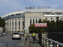
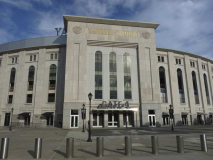
Once entering the Bronx, the Macomb’s Dam Bridge roadway becomes Jerome Avenue and runs past Heritage Park, the location of the old Yankee Stadium, and the New Yankee Stadium. Both stadia were inaugurated with World Championships in 1923 and in 2009, respectively.
The old Stadium was renovated between 1974 and 1975, forcing the Yankees temporarily into Queens to play at Shea Stadium. In the 1990s, owner George Steinbrenner, citing supposed inadequacies, began to rattle his saber about moving the Yankees to a new facility in the New Jersey Meadowlands, joining the football Giants and Jets. Toward the end of his term in 2001, Mayor Rudolph Giuliani allocated funds for new stadia for the Mets and Yankees, but Michael Bloomberg tabled them upon assuming office, saying there were more pressing financial concerns. However, work began on both new parks in 2007, and both opened in 2009; the Jets and Giants also opened the New Meadowlands, later Met Life Stadium, in 2010.
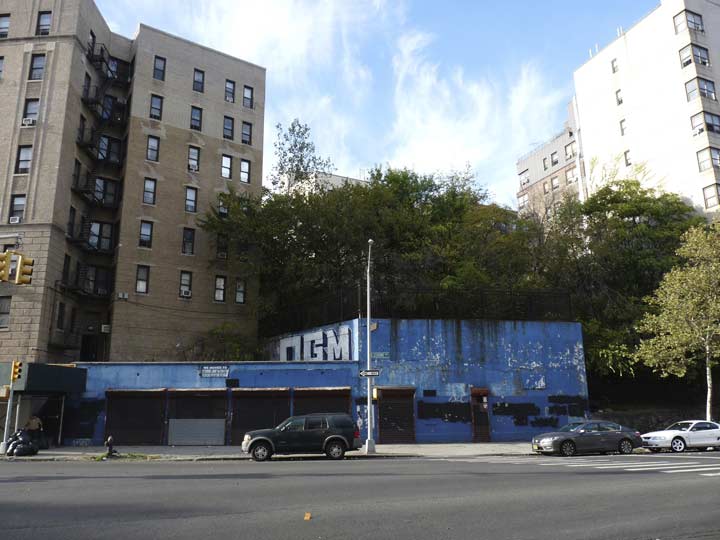
If you were to climb up to the top of this brick wall painted blue on the west side of Jerome Avenue at the former intersection of West 163rd Street (the sign is still there) you would find an abandoned elevated subway platform. Decades ago this was the Anderson-Jerome station of the 9th Avenue El. The El was bridged over the Harlem River and because of the western Bronx’s hilly topography, through a tunnel between Sedgwick and Jerome Avenues, and then an elevated structure again, meeting the Woodlawn and Manhattan-bound elevated at River Avenue. The line operated as a shuttle train between the Polo Grounds and Yankee Stadium until after the 1957 season when the Giants moved to San Francisco.
FNY correspondent Sergey Kadinsky has more.
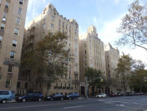
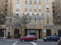
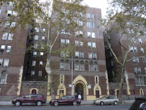
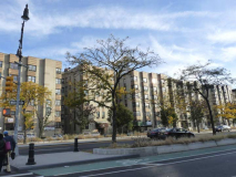
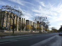
Though the Grand Concourse is rightly acclaimed for its many Art Deco and Moderne apartment buildings, The section of Jerome Avenue between the Major Deegan Expressway and River Avenue unfettered by an el is no slouch in that department, with a variety of buildings overlooking John Mullaly Park. First and foremost is the Park Plaza Building at 1005 Jerome.
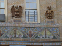
It may be the Bronx’ most famed apartment complex not located on the Grand Concourse. The massive Art Deco building was designed by architects Horace “Harry” Ginsbern (interiors) and Marvin Fine (exteriors) and constructed between 1929-1931, at about the apotheosis of Deco-ism, at least in the States. In the early 1930s, polychrome terra cotta was in vogue, and Park Plaza does it better than just about anywhere else. Ginsbern was known as “the genius of the Bronx” as he designed no less than 137 apartment buildings in the borough. Designer Fine’s taste in gargoyling was eclectic — besides the standard-issue pondering long-eared beast, of the type seen on Notre Dame in Paris, there are also frogs and squirrels.
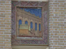
I used to think that one of the terra cotta friezes was a stylized version of High Bridge, but Constance Rosenblum explains in Boulevard of Dreams that it actually depicts an architect presenting a model of his new building to the Parthenon for approval. I’d have to think that High Bridge was not far from Marvin Fine’s consciousness when dreaming this up, though.
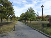
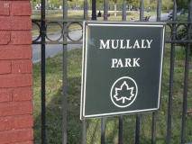
John Mullaly Park was shrunk somewhat by the construction of the New Yankee Stadium on some of its acreage. This park honors John Mullaly (1835-1911), a newspaperman and civic official who was a tireless proponent of green space and the father of the Bronx parks system. Born in Belfast, Ireland, Mullaly came to the United States as a young man and soon became a special correspondent for the New York Herald. He reported on the laying of the first Transatlantic Cable (1857-58), and served as secretary to the inventor Samuel F. B. Morse. As editor of the Metropolitan Record, then the official publication of the Roman Catholic Church in New York City, Mullaly developed a printing technique known as aluminography. He also worked at the New York Tribune and the New York Evening Post. Later he served as New York Commissioner of Health and as a two-term member of the board of tax assessors. NYC Parks
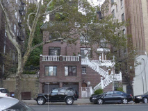
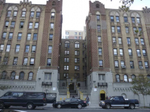
1055 and 1065 Jerome Avenue, across Jerome Avenue from Mullaly Park, and large apartment complexes, separated in the middle by the smaller 1061, which requires a helter skelter staircase as it is built on a hill.

The grade was too steep for West 166th Street to be extended to Jerome Avenue, so here it is a pedestrian-only step street.
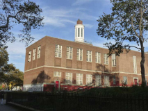
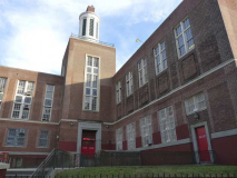
PS 114, the Luis Lorens School, is another massive edifice, occupying the wedge of territory between Jerome and Cromwell Avenues north of Mullaly Park and McClellan Street. It has a distinctive center tower.
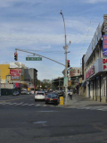
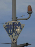
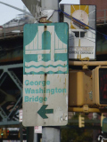
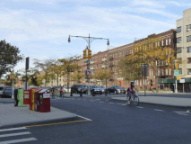
This combination stoplight/streetlamp on Jerome and East 167th is chockablock full of former and current signage. There’s the “arrowhead” sign pointing to the Bronx-Whitestone Bridge (to get from here to the bridge, you would take Jerome to the Cross-Bronx Expressway, then the Hutchinson River Parkway to the Whitestone); a more modern sign pointing to the George Washington Bridge (you would also use the Cross-Bronx, but go west); a defunct fire-alarm indicator lamp; and a 167th Street Shopping District sign. There’s also a shaft-mounted stoplight and pedestrian control signs.
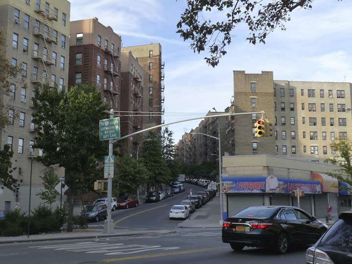
At left, Shakespeare Avenue climbs the hill west of Jerome Avenue. The Highbridge neighborhood was in large part once the Marcher estate. The lord and lady of the property maintained a formal garden dedicated to the works of William Shakespeare and displayed busts of the Bard himself and some of his best-known characters. The heavy hand of modernity eventually encroached, and the property was sold off. Only Shakespeare Avenue is a current reminder of the Marcher estate and its garden.

There’s a 167th Street stop serving the #4 train at River Avenue, but the #4 doesn’t go where I need to be at this time, so I’m pressing on. The territory was never leveled off in this part of the Bronx, and this is a challenging uphill in a borough that has quite a few.
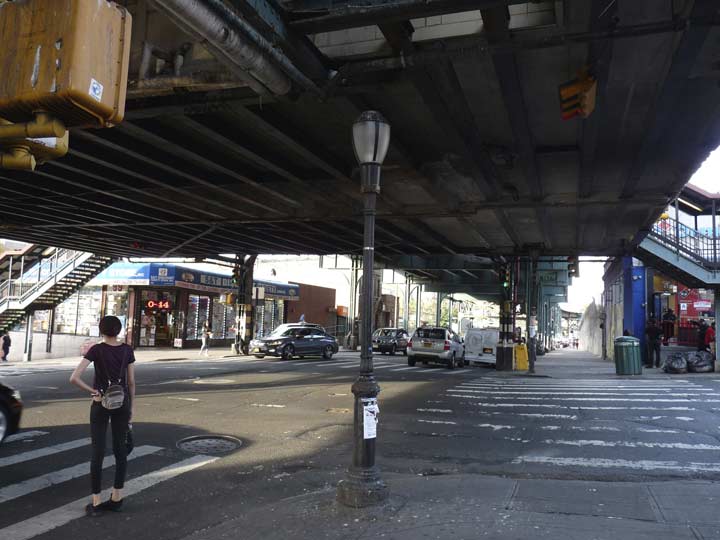
A Type B park lamp is short enough to fit under the pedestrian concourse of the 167th Street station at River Avenue, so it’s pressed into service here, far from the green territory where these posts are usually encountered.

Crosstown traffic is able to avoid the Grand Concourse traffic and stoplights at intervals by using several tunnels that were originally built under the Concourse (which is located on yet another ridge) for trolley lines to use.
The Grand Concourse roars through the heart of Morrisania, Mount Eden, Tremont, Fordham and many other Bronx neighborhoods from East 138th Street to Mosholu Parkway. It was built in 1909 and in its early years, acquired some of the Bronx’s finest residential architecture. Recently, it attained a set of Twin Corvington lamps, outfitted with some special Bell lights that resemble the stovepipe hats favored by a certain president. I’ll call these the Abe Lincolns.

One of the new fancy Dan neighborhood maps the city has been installing around the busier neighborhoods.
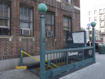
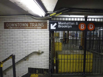
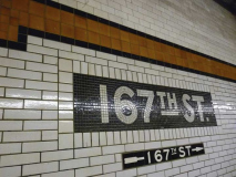
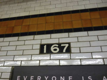
Home again, home again, this time from the IND 167th Street Concourse station, opened on July 1, 1933. The station is tiled in black and burnt orange.
Check out the ForgottenBook, take a look at the gift shop, and as always, “comment…as you see fit.”
11/26/17

7 comments
167th Street and the Grand Concourse, and the next uptown station at 170th Street, are different from every other IND station because the name tablets on the walls do not have color tile borders around the tablets. Both are a plain black tablet with the station name in white tile. Don’t know why this design was used.
I always figured it was because those two stations, along with 155th Street (which does have color borders), use what I’m guessing are glazed bricks instead of tile. Maybe I’m wrong and they are just brick-shaped tile, but when I was a frequent Concourse Line rider in the early aughts I liked that 167th and 170th did not have any missing tiles or obvious patch jobs, which led me to believe they were brick.
Still doesn’t account for the lack of color borders, of course.
One correction, you stated that Colonel Charles Young was the ninth graduate of the United States Military Academy, he was the ninth to attend West Point and the third to graduate.
Henry O. Flipper (1877)
John Alexander (1897)
Alexander and Colonel Young were classmates.
Sorry, Alexander graduated in 1894.
Sorry, one more correction it was 1887.
Cooper Archeon has been taken over the Bronx this year replacing the 100 and 150 watt streetlights.
There’s a lot more information on John Mullaly, including details of his work to create parks in the Bronx, on my Atlantic Cable history website:
http://atlantic-cable.com/CablePioneers/Mullaly/index.htm