
Before I was so rudely interrupted I was working on this page last weekend, and had it about 80% complete. I hadn’t realized, though, that my WordPress autosave wasn’t activated. Now, when you leave a WordPress page open for a few hours, say overnight, you have to refresh the page before WP allows you to keep working on it. Without autosave, WordPress wiped the page, which also wiped out every word I had written. So I’ll just begin again this week…
GOOGLE MAP: HIGHLAND PARK and RIDGEWOOD RESERVOIR


According to TV legend, Chauncey was the street where the volatile bus driver Ralph Kramden, his upstairs neighbor, sewer worker Ed Norton, and their spouses Alice and Trixie resided, even though they apparently lived in Bensonhurst. In reality Chauncey Street is located in Ocean Hill and Bushwick and is named for Isaac Chauncey (1772-1840) a longtime director of the Brooklyn Navy Yard.
To access Highland Park, I de-trained at the Chauncey Street station, whose stained glass platform windows by Maria Domingues, “El-View,” depict neighborhood scenes.

Looking northwest from the platform, the King of All Buildings as well as the needlenose towers of 57th Street are in view.
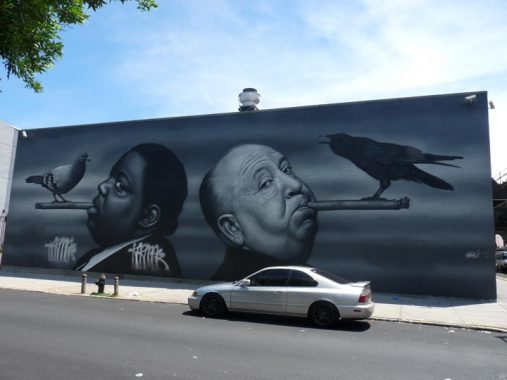
Owen Dippie is a New Zealander “street artist” renowned for his playful photorealistic portraits. His playful depictions of rapper Biggie Smalls (1972-1997) and British mystery film director Alfred Hitchcock (1899-1980) was painted on the Decatur Street and Broadway wall in mid-2018.
This isn’t the only large wall depiction of Notorious B.I.G. in Brooklyn. He also appears at Fulton Street and North Portland Avenue in Fort Greene; he was from nearby Clinton Hill.

We’re not quite done with Dippie. His portrait of artist Jean-Michel Basquiat (1960-1988) appears on Cooper Street and Broadway. Dippie collaborated with artist Al Diaz on the piece; Diaz and Basquiat collaborated on pieces under the name SAMO.
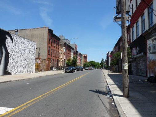
Cooper Street, seen here from Broadway, is fairly sleepy two-lane street until it crosses into Queens at Wyckoff Avenue. Once in that borough, it gains lanes and roars all the way to Woodhaven Boulevard in Forest Hills, skirting the edge of the Cemetery Belt in Glendale. The route is likely named for Peter Cooper, the industrialist/inventor/philanthropist who founded Cooper Union. Closer nearby, he owned a glue factory near the noisome and noxious Newtown Creek, and a by-product of the bones of Dobbins was gelatin. You could say that Peter Cooper was the Father of Jell-O®.

Here’s a lightpost at Broadway and Decatur. It has the thick shaft of a guy-wired stoplight, but it must have been transported from elsewhere, as the Broadway el is not high enough to allow such stoplights beneath it; instead, traffic is controlled by stoplights strung along a wire under the el or hanging from the structure pendant-style. The pole still has a control box which likely controls those stoplights.
Decatur is one of those streets whose pronunciation stumped me as a kid, like Cortelyou or Joralemon. When I saw it on maps, I assumed it was DECK-a-toor, until I heard other people pronouncing it Da-KAY-ter.


Dancing with cardinals: This mural at a day care center at Broadway and Moffat Street is by street artist ZIMERNYC.
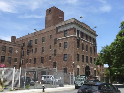


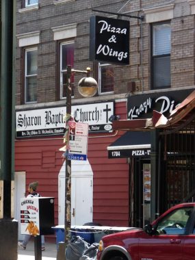
Evangelical Deaconess Hospital, #629 Chauncey Street off Broadway, is now the Eddie Harris Residential Facility, a homeless shelter. The hospital was built in 1931 and was converted to a “temporary re location facility” in 1971. There are a number of “Evangelical Deaconess” hospitals around the country; they were established by the Evangelical Deaconess Society as a training institution for deaconesses (religious sisters) who provided nursing and administrative services for hospitals affiliated with the Evangelical Church (now the United Church of Christ).
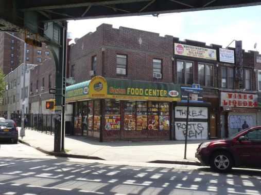
The Gaston Food Center is aptly named because this is the northern end of Mother Gaston Boulevard. In 1981 Stone Avenue, named for a signer of the Declaration of Independence from Maryland, Thomas Stone, was renamed for the founder of Brownsville’s Heritage House, Rosetta “Mother” Gaston, and thereby a bit of Brooklyn’s connection to Maryland was hidden in favor of a new designee.
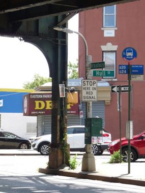
The corner of Stone Avenue and Hull Street in Bed-Stuy is the only remaining corner with signs featuring the old street name. I imagine I’m dooming it to extinction by featuring it here, but Brooklyn street signs are slowly being replaced by new upper-lowercase signs in the Clearview font, so its days may be numbered, anyway.


Strangely, Thomas S. Boyland Playground, along Broadway between Granite and Aberdeen Streets, is two avenues away from Thomas S, Boyland Street.
Though there are still a few Hopkinson Avenue signs here and there, for the most part this two-lane north-south route mostly bears Thomas Boyland street signs. Leonard Benardo and Jennifer Weiss, authors of Brooklyn By Name, report that Boyland was a two-time State Assemblyman representing the district before his death at age 39.
Thomas Boyland (1942-1982), [was] a charismatic and fiercely independent State Assemblyman from Brownsville who dedicated his life to public service. Boyland was born in Memphis, Tennessee, one of thirteen children. He graduated from Philander Smith College in Little Rock, Arkansas, and studied in graduate programs at Hunter College and Syracuse University before receiving a master’s degree in education from New York University. During the 1960s, Boyland spent nearly five years in East Africa working as a volunteer with the Peace Corps. NYC Parks
The Kennedys of Brownsville [NY Times]
The new name displaced that of Francis Hopkinson (1737-1791), a signer of the Declaration of Independence from New Jersey. Scholars say he played a substantial role designing the American flag.

A pair of street vents on Granite Street and Broadway have the thick bases of the Percheron variety, but the tops are different. [See FNY’s street vets page]

The beautiful parish school for Our Lady of Lourdes Roman Catholic Church can still be found on De Sales Place near Broadway. The original church used to be a block away, but fate intervened.
It’s now one of the more obscurer Roman Catholic churches you’ll ever see, Our Lady of Lourdes, a simple brick building at the dead end of Furman Avenue off Bushwick Avenue, marked by a simple cross, church bell, and an image of Jesus’ mother, the Virgin Mary. The original church was much more massive and prominent, but it was arsonized in 1976. The original parish school building survives a block away on Broadway, but its grotto was demolished in 2015; the school had closed in 2004. The parish convent is being converted to residential.
Now is the time on Forgotten NY when we talk about lampposts. This variety, on short poles painted brown and featuring luminaires I call the “new Gumballs” because their spheroid shape reminds me of the older Gumball fixtures from the 1940s. (They’re really Holophane bucket lights with a spheroid covering). Of late the Department of Transportation has been replacing the Gumballs with the newer LED fixtures, or replacing the Brownies completely with dwarf davit posts.
Side-slotted Donald Deskey-designed lamps, which broke the octagonal shaft tradition, were introduced in 1958 and started getting wide use in the early 1960s; for a time they dominated expressways and parkways. Dwarf versions were designed for use under elevated trains; most have disappeared, but here’s one at Broadway and Hull Street.


I doubt they still work but several Westinghouse AK-10 “cuplights” can still be found under the Broadway el at Eastern Parkway. They were probably decommissioned decades ago, but the DOT hasn’t gotten around to removing them.
Eastern Parkway was constructed between 1870 and 1874 between Grand Army Plaza and Ralph Avenue as a true parkway, with greenways on both its “service roads.” This was still the horse and buggy era and Dobbins were the swiftest method of transportation.
The original design called for a 55-foot wide carriage drive centered between two pedestrian malls with four rows of trees extending 2.2 miles. There were also side roads for delivery wagons. Adorned almost exclusively with American Elms, this landscape of over 1100 trees is now mixed with twenty-four other species. Varieties of maple, linden, oak, and ash trees were introduced to discourage the spread of infestations such as Dutch Elm Disease. Eastern Parkway Extension, which proceeds northeast to Bushwick Avenue, continues the landscape for another two miles. [NYC Parks]
Information on what’s officially called the Eastern Parkway Extension, from Ralph Avenue northeast to Bushwick, is more sketchy. It still has some parkway elements, but not as much as the original section. Old maps show it as a proposed road in 1896 and in place by 1900, but I am unsure about when exactly it was constructed without a lot more research. The DOT now makes no difference between the Parkway and Parkway Extension, marking the entire road as Eastern Parkway.


Tombstone, or monument, dealers can be found at the edges of most NYC cemeteries, and nearby Evergreens (see below) is no exception. Carbone Memorials, Broadway and Conway Street, celebrated its centennial in 2016 and is one of the oldest remaining dealers in the city. In 2013, prices for a typical memorial headstone ranged from $900 to $2800.
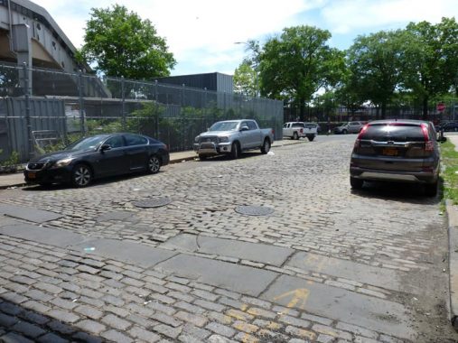
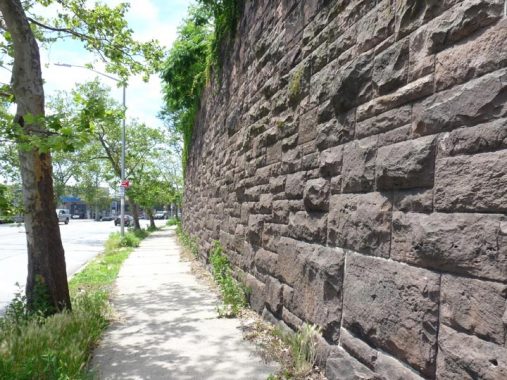
Conway Street between Broadway and Truxton preserves some of its original Belgian block pavement. And, there’s even some of the bluestone pedestrian crossing still there.


Two elevated trackways cross paths over Conway Street: the BMT elevated Canarsie Line {L), and a spur connecting the elevated Broadway Brooklyn line (J) to the East New York subway yard, which services the L and J lines. In addition, the Long Island Rail Road freight branch connecting the Fresh Pond Yards with the Bay Ridge waterfront runs in a tunnel under the street about a half block west, emerging just south of Atlantic Avenue.
The main entrance of Evergreens Cemetery, Brooklyn’s second largest cemetery after Green-Wood, is at Bushwick Avenue and Conway Street. The cemetery was founded in 1849 as The Cemetery of the Evergreens. Cemetery “biographer” John Rousmaniere points out that “Evergreen” was symbolic; pine cones and evergreens symbolize rebirth and immortality. Evergreens were later brought to the cemetery from the Catskill Mountains by Rev. John D. Wells and A. P. Cummings. The land was purchased from a number of the local farming families, including the Howards. Alexander Jackson Davis and Andrew Jackson Downing, the most noted architect and landscape architect of the time, teamed up for the initial design.
“Permanent residents” include Broadway impresario Tony Pastor, dancer Bill “Bojangles” Robinson, jazzman Lester Young, founder of the Society for the Suppression of Vice Anthony Comstock, and etiquette expert Amy Vanderbilt who showed America “how to keep the lid on,” an ability sadly being lost in the present age.


The entrance to, and the communications tower, of East New York Yards can be seen from Bushwick Avenue, but the public is rarely vouchsafed a view inside except from the windows of passing L or J trains. Fortunately there’s Dave Pirmann’s New York City Subway for that kind of thing.
Highland Boulevard (though Queens and Staten Island have the lion’s share of “boulevards,” Brooklyn has some, too) issues east from Bushwick Avenue at the train yards, heading east and south to Jamaica Avenue, skirting Highland Park and part of the cemetery belt before looping to an end at Jamaica Avenue. It sits at the top of one of Brooklyn’s highest slopes, hence its name.


Though they don’t usually work, you see a number of pushbuttons on utility poles around town that indicate that you can get the traffic light to change to green by pushing the button. If they ever worked, they don’t anymore. What’s unusual about this one is that it’s mounted between Bushwick Avenue and Fanchon Place, far from any crosswalk, and even has a “Department of Traffic” emblem; the agency was changed to Department of Transportation in 1971. This is another case of the DOT using whatever could be found in the yard when it came to replacing a lamppost.

This handsome brick staircase allows pedestrian access to two parts of Highland Boulevard: the section bridged over the Jackie Robinson Parkway, and the section with home built on it that intersects the JRP’s service road.
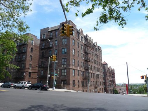
This handsome brick apartment building sits at the SE corner of Highland Boulevard and Miller Avenue at the apex of one of Brooklyn’s steepest hills. So steep, in fact, that east of here, there are no streets permitting vehicular traffic between Jamaica Avenue and Highland Boulevard that actually tackle the hill.
A look at the Miller Avenue hill can be found in FNY’s definitive page on Highland Park written in 2008 by guest columnist Brian Berger, who edited the compilation book New York Calling to which I contributed.
Also: do not miss the Highland Park section of the East New York Project for early views of the region.


A playground in Highland Park and the boulevard itself are subnamed for a famed former resident, Vito Battista (1909-1990) a colorful Italian immigrant, architect by trade, multi-term Assemblyman as both a Democrat and Republican, and perennial mayoral candidate.
He viewed himself as a spokesman for ”the little people” and ”the oppressed taxpayer.” A blunt tough-talking campaigner, Mr. Battista often resorted to gimmicks to garner attention. He appeared in a wooden barrel at the Federal Hall National Memorial to denounce high taxes. He arrived at City Hall with a pair of monkeys labeled ”Rocky” and ”Lindsay” and on another occasion set up a guillotine to emphasize the effect of government on taxpayers…
Parading a camel through lower Manhattan, Mr. Battista warned that if politicians adopted another tax measure its back would break. He railed against welfare, low-income housing, raises for officials and rent controls. He created the United Taxpayers Party to champion the cause of the small landlord and once inspired a group of landlords to storm City Hall to protest continued controls on apartment rents. [NY Times]


Part of the playground is illuminated by an antiquated pair of mercury lamps. At night they come on with a buzz and shine a greenish hue before “warming up” to a green-tinged white.


In the shadow of the elevated transit complex at Broadway Junction can be found a clutch of impressive mansions that look down from the crest glacier-deposited high hill that looks down on East New York and on clear days all the way to Jamaica Bay. A walk along Highland Boulevard running from Bushwick Avenue east to Jamaica Avenue near National Cemetery, Sunnyside Avenue, a block south, and some streets at the bottom of the hill such as Arlington Avenue and Ashford Street will reveal surprising remnants of when he area was thought of as a suburban retreat, including a Carmelite mission.

Oddly, Highland Park contains a number of streets that exist only on paper or as dirt traces between buildings. One is Barberry Court, a dead end issuing north on Highland Boulevard between Hendrix and Barbey Streets. I had noticed that its name and Barbey Street’s are similar, which is purported to be no coincidence:
From a comment on the linked Barbey Street page:
The 1909 Bromley Atlas of Queens shows it as a part of Barbey Street, extending from Highland Boulevard to Crosby Avenue. (Highland Boulevard was the borough line at the time) By 1937 the border was relocated and the street was in Brooklyn and known as Barbey Place. A Brooklyn Eagle article from April 30, 1937 reported that Mayor LaGuardia signed resolutions changing the names of eleven Brooklyn streets, and Barbey Place became Barberry Court.


Heath Place, meanwhile, is a pedestrian park path running into Highland Park on its east end. Formerly, on paper at least, it led to Robert Street, which ran from there east to about Barberry Court, but the route has disappeared from modern maps.


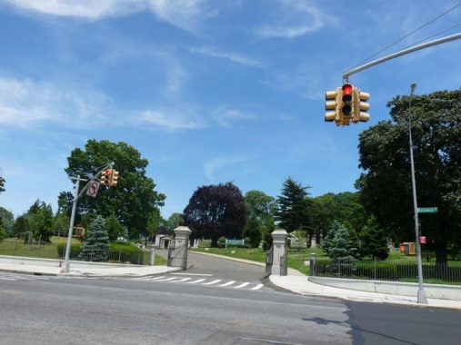
Entrance to the Ridgewood reservoir pedestrian path at Highland Boulevard and Vermont Place. If you look at an online map carefully — Google Maps does not deign to include country boundaries, but Open Street Map does — you see that here, Highland Boulevard enters Queens — but just barely as the county line runs just south of the boulevard. Just east of Vermont Place, Highland Boulevard re-enters Brooklyn. It’s just a quirk of geography and there are no affected addresses. I’d like to know more about how the Kings-Queens line was drawn; it’s changed over they years, especially in Ridgewood, and that weird neighborhood south of Linden Boulevard called City Line (Brooklyn was once its own city). I’ll have to research a lot more about this.
Above, I’ve shown the pair of white and blue signs (Queens colors) that used to be on the corner of Highland and Vermont. Before the 1980s, different styles of street signs, or at least different colors, were used to delineate boroughs, and I’d say that the decision to scrap that arrangement was a boneheaded one.


Ridgewood Reservoir, along Vermont Place north of Highland Boulevard, straddles the border of Brooklyn and Queens just south of the Jackie Robinson Parkway. The reservoir was built in 1856 and used in Brooklyn and Queens’ water supply for over 100 years; it was decommissioned in 1959 but was used as a backup sporadically for the next 30 years, finally ceasing all operations in 1990. At its peak it held over 154 million gallons of water. Its 50 acres were added to NYC’s 28, 800 acres of parkland in 2004.
Surprisingly, the reservoir’s legacy survives in several local names: Force Tube Avenue, running perpendicularly from Jamaica Avenue to just beyond Fulton Street, is named for high-pressure water mains that once ran under it, and Conduit Boulevard in Brooklyn, North and South Conduit Avenues in Queens and Aqueduct Raceway were all named with the reservoir’s proximity a factor.

The Reservoir received Protected Wetlands status under the Freshwater Wetlands Act in early 2019 after many years of wrangling. Prior to that, the pedestrian path surrrounding the reservoir had already been improved, with new park lamps, etc. after many years of deterioration.
The Newtown Historical Society, on whose board I am a trustee, has also been instrumental in the activism to obtain such protections for the Reservoir, and had this plaque placed at the reservoir path entrance on Highland Boulevard in early 2019.
For a comprehensive look at Ridgewood Reservoir, look mo further than my colleague Sergey Kadinsky’s Hidden Waters Blog.
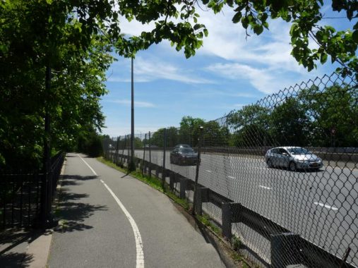
The Highland Park Greenway skirts the reservoir. To return to the street grid, you go down a staircase which gets you to a path along Vermont Place, crossing under the Jackie Robinson Parkway.
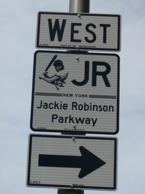
I really like the new DOT signs denoting the many parkways around town. Each has a symbolic picture representing whatever parkway, and you may expect the one for the JRP is a photo of Jackie at bat.
The Jackie Robinson Parkway along with the Grand Central were the first of NYC’s “parkways” providing express (more or less) auto through-routing built within New York City, and was built from 1932-1934.The “Jackie” unusually begins at the confluence of Jamaica and Pennsylvania Avenues, two local streets, in East New York, twisting through a convoluted route through the “cemetery belt” and Forest Park at the Brooklyn-Queens border, meeting the Grand Central at Flushing Meadows. It was known by the prosaic “Interborough Parkway” until 1997, the 50th anniversary of Robinson joining the Dodgers.


Vermont Place ends at Cypress Avenue, smack in the middle of the Brooklyn-Queens Cemetery Belt. Mount Judah Cemetery, established in 1912, is one of 17 cemeteries contained in the belt. Unlike some of the other cemeteries in the belt (most along Jamaica Avenue or Cypress Hills Street) Mount Judah is meticulously maintained and cared for.

Cypress Avenue is a very old road indeed. It ran from the Bushwick and Newtown Turnpike, the precedent of today’s Flushing Avenue, southeast and east across the marshes and glacial moraine along which the cemeteries would later be built to meet Fresh Pond Road, today’s Cypress Hills Street. It was a plank road and consisted of actual wood planks. That pavement style did not hold up well and gave way to later innovations such as macadam and asphalt.
On the map, the Kings-Queens line is marked in red. The street grid, and private dwellings, came along later. The line cut through individual houses, confusing post offices, until the line was redrawn along streets in 1925.
Traveling northwest on Cypress Avenue puts you in a direct line with the King of All Buildings. My walk wasn’t done — I continued into Ridgewood. Images from that leg of my walk will make their way into later FNY pages.
Check out the ForgottenBook, take a look at the gift shop, and as always, “comment…as you see fit.”
7/22/19
5 comments
“Though they don’t usually work, you see a number of pushbuttons on utility poles around town that indicate that you can get the traffic light to change to green by pushing the button. If they ever worked, they don’t anymore. ” There is such a pushbutton that does in fact work, on Flatbush Avenue just south of the Belt Parkway. i’s mostly used by bicyclists using the bike paths along the Belt or hipsters on their way to the beach. DOT has had to modify it a bit since it was allowing bicyclists to take priority, often backing up beachgoer auto traffic on Flatbush Avenue in the AM southbound and northbound later on summer days.
Decatur never stumped me, but boy did some others, like Pythagorean, which I said in class as Pie-the-GORE-ee-an. My dad told me that when he was in middle school he was excited to recite a book report before his teacher and schoolmates on Poe’s Cask of Amontillado (pronounced a-mon-TILL-a-do; what do those Spaniards know, anyway?).
Joe Harris Residential Facility-make that Eddie?
A fascinating article was written by Joseph Heathcott in 2015 about the mysterious borderline between Brooklyn and Queens. I found it at https://urbanomnibus.net/2015/01/borderlands-traveling-the-brooklyn-queens-divide/.
Thank you sooooooo much for your research and pictures! I am working with a child and I want to teach her how to start reading maps. As a first try, we used Apple Maps on my phone and tried to walk from her home to the Reservoir. I couldn’t find a pedestrian entrance ♀️ …but there is some construction going on over there at this moment. Your article, pictures, content and resources are super helpful. Thank you for taking this work seriously and for all the different/varied ways you’ve documented this neighborhood. Your work is valued and appreciated.