
After 4 out of 5 weekends when I handed the reins over to Sergey Kadinsky, I’m returning to weekend longform this week and I have a large backlog to get into. Since today’s jaunt netted me over 120 photos, I may have to go Parts 1 and 2, but we’ll see. I’ll dedicate this weekend’s page to the late FNY correspondent Gary Fonville, who passed away in October 2024 at age 72.
THOUGH back in 2011, I walked Crescent Street from about Broadway south to Long Island City and snapped a few images on the way, I thought this would be a good time to revisit one of Long Island City’s most interesting north-south routes, at least architecturally. There are now vast worlds spanning the route from Hunters Point all the way northeast to Ditmars.
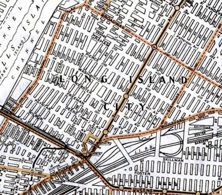
As this screenshot from a 1922 Hagstrom map indicates, Crescent Street is the only “survivor” from western LIC’s north-south named streets that include Ely Avenue (still the name of a Queens Blvd. Line IND station) and Van Alst Avenue (still attached to the G train 21st Street station; when the BMT and IND were built, old names were often kept for the benefit of area old timers; now, they’re kept for tradition’s sake. Some of these street names are preserved in apartment building names.
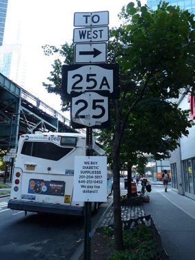
To arrive at Crescent Street’s southern end, I began at the Queensboro Plaza station. This was just before its new elevator opened, and it’s three staircases to the street. Fortunately I was descending. I traveled along 28th and Hunter Streets to arrive at Crescent Street’s source.
NYS Route 25 begins at 2nd Avenue and the Queensboro Bridge in Manhattan and after crossing the bridge, uses a number of routes including Queens Boulevard, Hillside Avenue, Jericho Turnpike, and several roads in Suffolk County east of that, arriving at Orient Point at the end of the north fork of Long Island 100 miles to the east. Route 25A takes a path north of that along Northern Boulevard.

28th Street and 42nd Road. Today, southern LIC where it meets Hunters Point has an overall bluish tint, as that’s the color of most of its new residential high rise buildings. Hunters Point, along with its partner across Newtown Creek, Greenpoint, was formerly a mixed industrial/residential area, with small brick and frame buildings where the families associated with riverside and creekside manufacturing and shipping lived. Today, it’s a new world indeed as both neighborhoods’ developers adhere to the credo: “the higher the better.” any sustained sunshine must be had along the riverside parks.
I have been chronicling this section since 2009. This FNY page will give you a good look what the area used to look like. And in 2007, here’s a look at the ugliest building ever constructed, in Queens Plaza. The Long Island Star building, housing the offices and press of the longtime newspaper The Long Island City Daily Star (founded 1867), stood at 28th Street and 42nd Road for decades until its demolition in 2008, on the right in this photo. A verdigrised plaque of its founder, Thomas Todd, could be seen at the corner.
Truthfully, I like a building with corner windows as it allows views from two directions.
South of 42nd Road 28th Street is a study in contrasts: a few surviving brick walkups, hidden behind some surviving street trees, and the brave new high rise world beyond.
Few neighborhoods in NYC have been changing as quickly as the Hunters Point and Dutch Kills neighborhoods near Queensboro Plaza in LIC, where a Glass House Gang of supertall residential and office buildings have been sprouting like weeds after a rainy spring. One of the survivors is Roman Bronze Works at 25-20 43rd Avenue at Hunter Street. Bronze is a metal alloy consisting of copper and another metal, usually tin. It has been produced for thousands of years.
The company has a lengthy pedigree: it was established in 1897 by Riccardo Bertelli, and was a subcontractor to Louis Comfort Tiffany’s glassworks studios, which operated from a brick building on 43rd Avenue in Corona for much of the 20th Century. In NYC, the studio’s most famous works are Prometheus and Atlas, both in Rockefeller Center.
The foundry’s mold makers, casters, chasers and finishers, and patinaters cast sculptures from plaster and terra cotta models provided by sculptors. They also scaled down monumental and other finished works for editions of collectors’ bronzes, allowing works by Daniel Chester French, Henry Augustus Lukeman and Augustus Saint-Gaudens to ornament a private library or drawing room.
From 1898, Frederic Remington worked exclusively with Roman Bronze Works, as did Charles M. Russell. Remington bronzes were being cast by Roman Bronze Works as late as the 1980s. wikipedia
A Century of American Sculpture: The Roman Bronze Works Factory [amazon]
Today, the Roman Bronze Works building is home to a popular Asian “noodle bar,” Soothr, set to open in the spring of 2025.
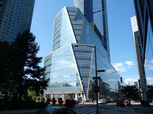
The angled rear end of Two Court Square at Crescent and Hunter Streets, completed in 2007 and designed by Kohn Pedersen Fox Associates; the front curves along the intersection of Hunter Street and 44th Drive. Both Two Court and its “big brother” One Court originally held Citibank offices but are now home to other companies; Two Court is home to the City University School of Law.
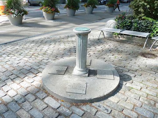

Crescent Street “begins” at a small triangle park where you will find a small sundial that no longer works, as its gnomon (the part that casts the shadow) is missing. Four names are inscribed under it and I only know two; if you know the other two, Comments are open. Brian Watkins, from Provo, Utah, was visiting NYC with his parents in September 1990 to take in the U.S. Open when he was killed while fighting off robbers in a subway station. Maria Hernandez was a community organizer in Bushwick, opposing drug dealing; she was assassinated in 1989 and park in Bushwick was renamed in her honor.
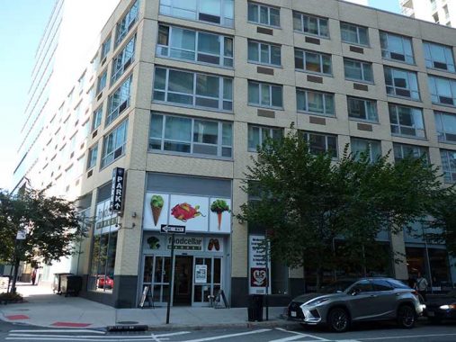
This modest 5-story residential at Crescent and 44th Road, with a Food Cellar supermarket on the ground floor, is a relief from the unrelenting blue glass surrounding it.
A bit further north near 43rd Avenue, this former one-story brick auto collision repair shop (with some of its exterior painted signage still readable) is the most recent stop of the high-concept steakhouse M. Wells, featuring fare such as bone marrow stuffed with escargot. Williamsburgers and Greenpointites flocked in, despite the prices, ai its original location at the former Skyline Diner at 49th Avenue and 21st Street. The property owner raised the rent dramatically and Wells relocated to 43-15 Crescent Street where it is open on a limited basis from Wednesdays through Saturdays.
The Skyline, meanwhile, has stood empty for years, awaiting another revival.
More from Crescent Street and 43rd Avenue
I may have to amend my crack about blue glass, as Crescent Street seems dominated by beige and brown in its new high-rise overlords. 42-60 Crescent, corner of 43rd, seems to have had its corner built with cinderblocks; it’s called The Factory, probably because of that feature.
42-40 Crescent is the lone survivor of a group of low-rises. See the 2013 version of this Street View.

42-17 Crescent Street at 42nd Road, called the Crescent Club, has a striking design with a corner glassy triangle below rectangular picture windows. The design makes me think of what would happen if a high rise was built atop the Jamaica Savings Bank (now a Bank of America branch) on Queens Boulevard in Elmhurst.
If you’re wondering, Crescent Street runs in place of 25th Street from LIC to Ditmars; a short 3 block section of 25th can be found between Borden and 49th Avenues.

A look west from 42nd Road and Crescent; another high rise will be going up in the lot, making this view unavailable sooner or later.
A legacy of Hunters Point/LIC’s recent industrial past is the presence of exterior power and electric wires carried on poles. I wonder if these will be relocated underground when the area is finally built out.

Uneven window treatments, both in size and spacing, is another high rise residential design trend. It’s seen here at Link, a 26-story complex at 25-01 Queens Plaza North that will open in 2026. In front, of course, is the IRT/BMT two-level Queensboro Plaza station, which opened in April 1917 along with each station on the Flushing Line to its east as far as 103rd Street. It’s the only station with cross-platform transfers between the BMT Divison (N, W) and IRT (7).
The Queensboro Plaza station used to be even larger: the entire north side of the station was removed after the connection to Queensboro Bridge service of the Second Avenue El was ended in 1942.
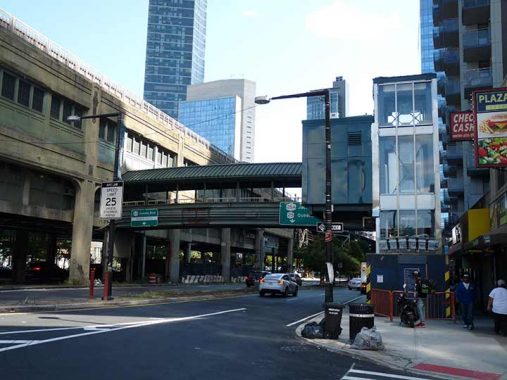
A look east along Queens Plaza South from Crescent Street. The new elevator, not yet in service, is on the right, with the pedestrian overpass used to access the station spanning the road.
For me, a holy grail of transit would be a free transfer from the Queensboro Plaza station to the nearby IND Queens Plaza station; though a free transfer from the 7 to the E, M and G lines can be had at Court Square. It involves some walking, as the subways’ only “people mover” or flat escalator, was removed several years ago.

There is no pedestrian crossing across Queens Plaza at Crescent Street, so I went a block over, to 27th. Returning to Crescent, I got this shot of another new tower, 42-02 Crescent (on the left), a.k.a. Hero LIC. It was built atop an already existing bank building. On the right is 1 QPS (Queens Plaza South) at 42-20 24th Street.
North of 41st Avenue, Crescent Street leaves the high rise district and changes character completely. Emblematic of this is this tiny parking lot and billboard on the corner, and adjacent used car (mostly cabs) repair shop with a terrific yellow painted sign. Forgive me — I used to know what this font was called when I worked with it at Photo Lettering, but its name escapes me after almost 40 years. Comments are open.
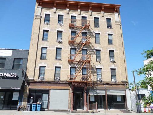
A stalwart 5-story walkup, 40-16 Crescent. Oddly the storefronts are labeled “Stores C & D” and “Stores A & B.”
I noticed that the street lighting and stoplights at some of the Crescent Street intersections have been newly configured. This type of cylindrical post for stoplights is relatively rare. There are shiny new octagonal lamps there as well.Note how the mast is mounted a bit lower on the apex than usual; a provision has been left for a perpendicular shaft. The bike lanes are also unusual in spots; I’ll explain further down.

The Evangel Christian School is a handsome brick building at #39-21 Crescent Street. It turns up on maps as early as 1918 as Public School 4.
Dutch Kills is north of the most expensive batch of luxury residences south of Queens plaza, but there are a few here as well including The Lanes at 37-10 Crescent.

On its website, Hephaistos Building Supplies Inc. at. Crescent Street and 37th Avenue describes itself as “a leading distributor of building materials, power tools, and construction hardware in the New York construction industry. Established in 1994, Hephaistos Building Supplies Inc. has gained a strong reputation for providing quality products and services to its customers.”
I don’t mind the building; I’ve seen worse, and at first glance to me it resembled a school building. However, local architecture site Astoria Ugly (burying the lede) described it thusly:
I am so glad Neo-Hellenic architecture is not dead in Astoria. With all the recent green-glass condos, I was afraid this art form, which promotes the glory of ancient Greece, was being lost. (The last new example I have is from 2011.)
But here we have the reborn Hephaistos Building Supplies, bedecked in Greek letters and, even better, gold Greek letters. (Handily, H works in both alphabets.)
The ancient Greeks had a blacksmith god, Hephaistos, who had a thing for Aphrodite, as did most of the gods. His Roman cognate was Vulcan.
Crescent Street widens a bit as it goes north. Under pressure from advocacy groups such as Transportation Alternatives more and more street space has been turned over to painted bicycle lanes, which are protected by concrete “Jersey barriers” and in this case, raised mid-street concrete islands; much $$$ has been spent by the Department of Transportation on. non-automobile traffic, which the DOT and TA wishes to devote more expense on. (I rode a bicycle in NYC streets in all five boroughs for 40 years and followed signals and traffic lights, deferring to pedestrians and motorists and didn’t give it a thought; however the threat of climate change has given activists more influence and power, and a new breed of bicyclists has arisen, many of whom believe in flouting traffic regulations.) In addition, delivery workers on ebikes ignore traffic regulations as a matter of course.
I was never a fan of outdoor dining areas, but in the dark days of 2020-2021 when dining outdoors in all weather was considered the only option, I imagine they were unavoidable. In situations like this, though, things bordered on the ridiculous since the outdoor dining shed was built outside the bicycle lane, making waiters and diners sheepishly look both ways when entering and exiting to avoid bicycles and scooters. In 2024, the city is forcing restaurateurs to dismantle them; however when warm weather returns, I’d allow some restoration on a case by case basis. Not in this configuration, though.
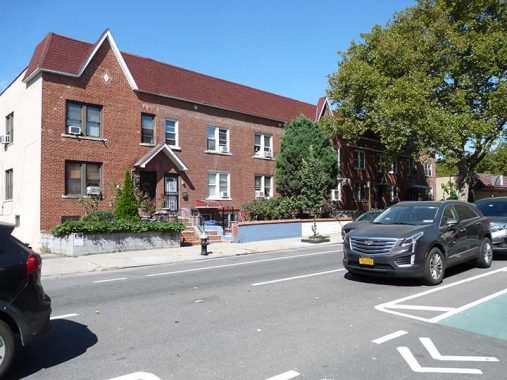
I was attracted to these attached brick residences with peaked pediments on Crescent north of 36th Avenue. As you can see the relatively wide Crescent Street now has one southbound motor traffic lane; parking on both sides (climate activists despise parking, calling it “subsidized vehicle storage”) and a two-way bike lane.

This pair of attached brick homes on Crescent north of 35th Avenue features a stoneworked entrance that may have been added years after original construction.
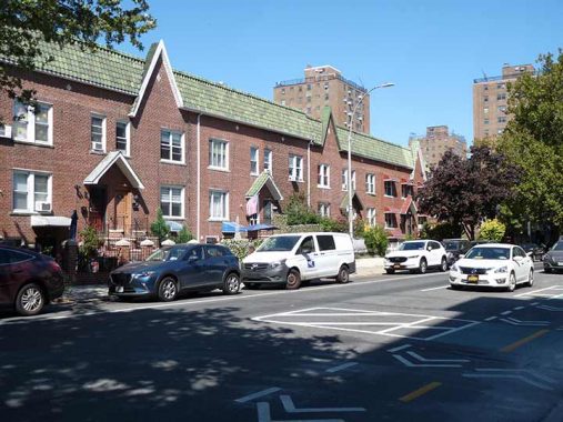
This grouping may have had the same developer as the batch of homes a block south, as the design is a close match.

North of 35th Avenue we enter a region of large apartment buildings built from about 1915 through 1950. This is the east end of the large Queensview Apartments complex. From its website:
Queensview, Inc., founded in 1950, is a residential cooperative housing complex with 14 buildings and 726 co-op apartments located in the thriving neighborhood of Astoria/Long Island City, Queens.
With over 10 acres of park land, mature trees and walking paths, Queensview is often described as, “living inside an oasis.”
Did I say large apartment buildings? Here’s some magnificent specimens at 33rd Road and 33rd Avenue. Compare the soulless glass boxes we saw earlier.
I’ll admit something here. Well, not so much an admittance, but a disclosure. Though I grew up with it all around, I have never smoked marijuana for the same reason I disdain hard liquor: I don’t like the taste and in weed’s case, don’t like the smell. I also don’t like mind-altering substances of any type and the most I’ll go in that direction is 5-Hour Energy or oxycodone, both of which provide a slight buzz. I like beer on a hot day but never drink alone. I also fear addiction, and stay away from bakeries lest I begin swallowing too many carb and sugar laden treats.
That said, I liked the yellow Highsenberg signage at Crescent Street and Broadway. Cannabis is legal in NYS in most cases, and this seems to be a weed supermarket of sorts; take a look at the wide range of products at its website, which seems to exhibit a spelling inconsistency as on the website it’s spelled “Heisenberg,” matching the spelling of the Third Reich-era German physicist who first conceived of quantum mechanics. If anyone can clear up the spelling discrepancy, Comments are open.
{See Comments for another interpretation]

These handsome red, white and blue signs, designed by artist Richard Deon, working with the cooperation of NYC’s Public Art Fund, first appeared in Astoria / Long Island City and Sunnyside in the early 1990s along a seven-mile route. The signs are approximately two er, feet in diameter and are accompanied by smaller signs pointing to local highlights. The route runs along Vernon Boulevard, 44th Drive/Thomson Avenue, 43rd Street, 35th Avenue, 36th Street, Broadway, Crescent Street and 31st Avenue.
I call this style “Brooklyn Bays” as this style of residential housing is frequently found in central and south Brooklyn, two story brick and stone buildings with projecting angular or round bays.
The Story of Crescent Street
How did Crescent Street get its name? As you can see here, Crescent Street makes a slight bend south of 31st Avenue which is also reflected in the angular construction of this pair of apartment buildings. And if you look at a modern map, you’ll see that Crescent Street runs at not quite a parallel to its brother LIC north-south streets.

This Dripps map excerpt of Queens in 1852 shows the nascent Long Island City street plan. Astoria’s pedigree dates to the mid-1600s, when William Hallett received a grant for the area surrounding what is now Hallett’s Cove by Peter Stuyvesant. However, the oldest structures in the region date to the mid-1800s, after fur merchant Stephen Ailing Halsey had incorporated the village in 1839.
Much of the structure and street plan of Halsey’s village can be seen on the 1852 map and that original plan, still in existence, has radiated south and east. Newtown Avenue and Newtown Road were once a continuous road, with the center section lengthened west and east to become Grand Avenue, eventually 30th Avenue. “The Crescent,” — its bend likely got around a hill — is still called Crescent Street and was never given a number…even after most Queens streets were numbered beginning in the Roaring Twenties.
I like the design on the Kelly’s Bar building, 31st Avenue and Crescent Street, so much I shot it from two angles.
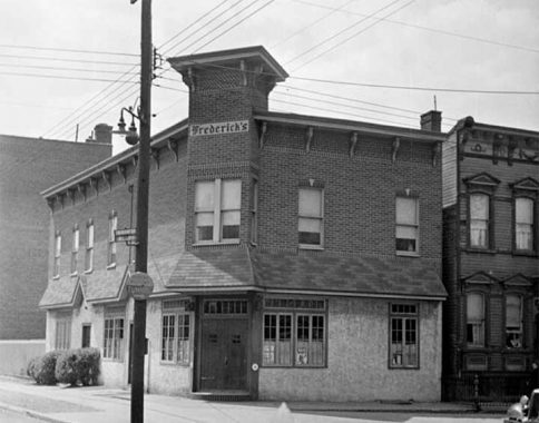
I consulted 1940s NYC to see if it could shed any light on the purpose of that corner tower; but it revealed not much, except that it looks much as it did then, when it was called Frederich’s.
I did see some interesting things going on though. The circular yellow and black or white and black signs directing traffic to tunnels were already in use by 1940. In much of Queens, the perpendicularly placed street signs also showed its former name before it was changed to a number. Also, the scrolled mast containing the radial wave lamp with a simple incandescent bulb were a staple on NYC side streets into the 1950s. The large globe was orange plastic and diffused a second incandescent bulb inside; they indicated the nearby presence of fire alarms.

The Department of Transportation did something creative with the green bicycle lane markings at 31st Avenue, painting in a series of green parallel lines similar to the white ones (right) used in pedestrian crosswalks. In September 2024 these were brand new as they don’t show up in the August 2024 Street View.
It’s a frame building sandwich on Crescent Street, as a trio of surviving frame houses sit between a pair of terraced apartment buildings. A similar scenario can be seen at 30th Drive.
Churches Face Off
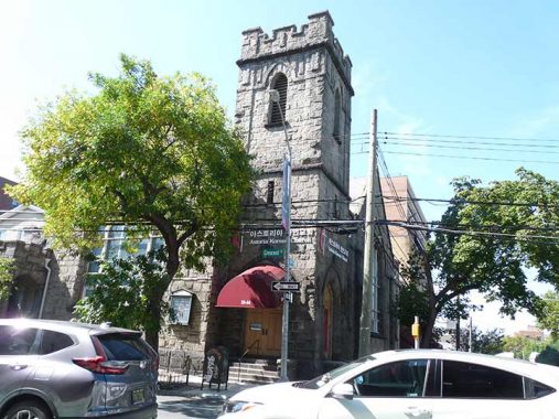
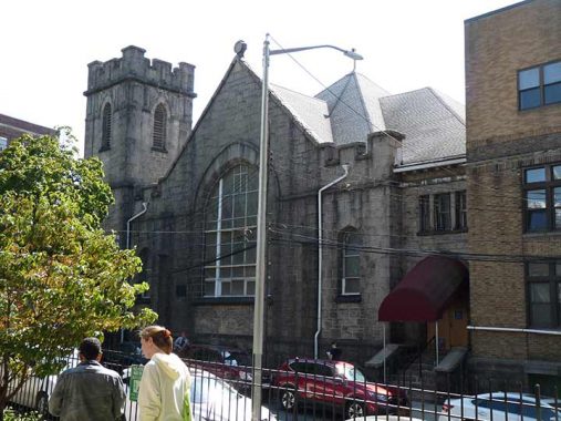
A pair of classic brick and stone churches face off across 30th Road and Crescent Street. The first is Good Shepherd United Methodist Church although I can’t find that name anywhere on the church because the signboard needs some repair and letter are missing. An inscription elsewhere calls it First Methodist Episcopal Church; and a third sign on the corner has “Korean Astoria Church.”
As usual, NYC American Guild of Organists fills in some blanks…
The congregation known today as Good Shepherd United Methodist Church can trace its root back to 1836 when a small group of Methodists in the part of Queens now known as Astoria formed classes and held meetings in members’ homes. In 1841, the group was chartered as the First Methodist Episcopal Church. During the next year the cornerstone was laid for the first church building that was erected on a site near the junction of Main Avenue and Astoria Boulevard. This building was completed three years later and exists today as apartments and commercial space…
[I cannot identify any building at that location as a church]
The cornerstone of the present stone building was laid in 1908, but it would not be completed until 1911, due to various delays with contractors. In the interim, the congregation met temporarily in the original building of what is known today as Mount Sinai Hospital and in the Episcopal Church of the Redeemer. Finally, on October 30, 1911, the new building was dedicated by a grateful congregation. The cornerstone of the adjoining Community House was laid in 1931 and the building was completed a few years later.
In 1970, the congregation began to share its facilities with the Korean United Methodist Church of Astoria, and in 1982, the congregation of St. Paul’s United Methodist Church – who had worshipped in First Church’s second building – merged into First Church. It was at this time that the combined congregation was renamed for the Good Shepherd, as seen in the north-facing stained glass window in the sanctuary. The building is also used as a rehearsal and performance space by the Astoria Performing Arts Center.

Across 30th Road is the Episcopalian (Anglican) Church of the Redeemer, a much older church consecrated in 1867:
For the first eighteen months, the society held services in a store on Main Street, with Holy Communion being administered for the first time on September 2nd, celebrated by the Rev. William D. Walker, who would later become Bishop of North Dakota. In December 1866, the Rev. Edmund D. Cooper, D.D., became the first rector. Plans for a permanent church were drawn up, and the cornerstone was laid on June 27, 1867. Designed in a plain Gothic style, the structure is constructed of ashlar granite. The first service in the completed church took place on Sexagesima Sunday, February 9, 1868, with the sermon preached by Rev. Dr. Haight of Trinity Church, New York. [Church of the Redeemer]
It was a Sunday, the gates were open, and thankfully no congregants were alarmed by the presence of a shabby figure skulking about with a camera to obtain photos of the beautiful ashlar-stone church.
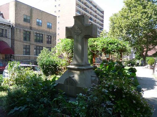
What appears to be a grave marker is in the churchyard near the entrance, but apparently, it isn’t:
… [A] retired merchant named Cornelius Rapelye Trafford donated some money to the parish, a much-appreciated bequest since the church had money problems. According to a February 19, 1899, article in the Brooklyn Daily Eagle: “Through the death of Cornelius Rapelye Trafford, a wealthy Astorian, the church was left $10,000 for a set of chimes. The bells were purchased and placed in the church tower built for that purpose.”
[Trafford] was born in 1809 and died in 1872. His father was one of the earliest colonizers to live at Halletts Cove, and the family lived at a beautiful mansion that even back then was 100 years old. Here’s a bit more about what the book has to say about him.
- “Mr. Trafford was a man of large means, which he expended liberally in the building of very many of the most attractive dwellings in different parts of Astoria and particularly on the ” Hill ” — always the aristocratic section. He was largely interested in the Astoria ferry, and aided materially in the first introduction of street cars, in fact, was to the time of his decease one of the most important factors in the community. He was noted for his geniality, and many remember with pleasure and gratitude his acts of unostentatious charity
- “Mr. Trafford was never married, and therefore leaves no direct descendants to perpetuate the name. The beautiful chimes in the tower of the Episcopal Church of the Redeemer, on the Crescent, were given in his will by Mr. Trafford, and annually on the recurrence of his birthday, ring out sweet melodies. A massive granite cross is a striking feature on the beautiful lawn in front of the church and marks the last resting place of Mr. Trafford.”
…[M]y guess had been that it was put up as a sign of appreciation to honor the gift that Trafford made the church. I’m not totally sure which is true, though, because according to findagrave.com Trafford seems to be buried in Green-wood Cemetery in Brooklyn, a popular burial place for the wealthiest 19th century New Yorkers, alongside George R. Rapelye and his wife, Jane Maria Suydam. [Buried Secrets]
One more church, this time Roman Catholic: At Crescent Street and Newtown Avenue, filling the block north to Astoria Boulevard., is Our Lady of Mount Carmel Church, which calls itself the “Mother Church of Queens County.” It’s one of the borough’s oldest Catholic parishes, instituted in 1840. The present white limestone structure dates to 1873 with a 1916 enlargement. Other handsome buildings in the Mt. Carmel complex include the parish rectory and the Young Women’s Leadership School of Astoria. The parish was founded further west in Astoria Village, and the parish churchyard can still be found at 21st Street and 26th Road; the grounds are known as the “Irish Famine Cemetery” since so many Irish immigrants fleeing the 1840s potato famine now rest there. I don’t know the significance of the year 1966 on the cornerstone; perhaps it was rededicated that year.
On the south side of Newtown Avenue is one of the most perfect buildings in Queens, Mount Carmel Institute on Newtown Avenue between Crescent Street and 23rd Street was built in 1909 [Francis J. Berlenbach, arch.] It was once the parish hall of Our Lady of Mount Carmel Church but today it functions as a concert venue.

Disappointingly, many Catholic parishes have not had the financial footing to keep their schools open. When I was a kid, this wasn’t the case since in the Boomer years, classes were overflowing with as many as 50-60 children per class. This was no problem for the nuns, who augmented the discipline youths received at home. We were well behaved, and learned the material.
Mt. Carmel’s school is now The Young Women’s Leadership School of Astoria.
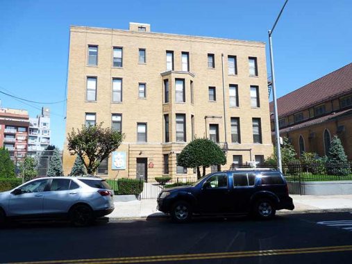
Carmel’s rectory, or priests’ residence, still fulfills its original purpose.
Newtown Avenue is one of Queens’ oldest routes. Together with part of 30th Avenue, Newtown Road and Woodside Avenue, it comprised a colonial route, Hellgate Ferry Road, which connected the town of Newtown, now Elmhurst, to a ferry at Hell Gate on the East River.

Some urban residential construction I like, since I enjoy the white color, balconies and large picture windows. Note the AS (for Astoria) telephone exchange on the adjacent shuttered real estate office.
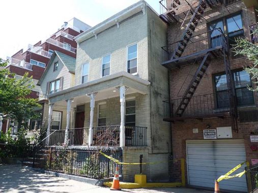
There aren’t many freestanding porched houses remaining on Crescent Street. Here’s one between Astoria Boulevard and Hoyt Avenue South.

Hoyt Avenue is one of the named streets in Astoria that was allowed to retain its old name; but divided into North and South, it’s on either side of the Triborough Bridge approach. I do not drive, but have walked the Triboro’s pedestrian path on the north side a number of times. Its low railing in spots is somewhat unnerving to me.
In September 2011 to mark the bridge’s 75th Anniversary I and Greater Astoria Historical’s Rich Melnick led a group of 45 over the Triboro from 125th Street in Manhattan, into Randall’s Island, and then into Queens. This was when I was composing detailed pages describing tours.

These handsome paired brick homes can be found on Crescent Street between Hoyt Avenue North and 24th Avenue.
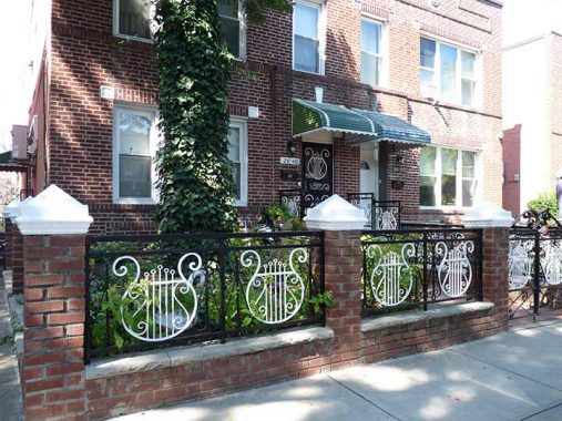
Perhaps a musician resides here, since the fence ironwork is lyre-shaped.

North of 23rd Avenue Crescent Street passes beneath the mighty concrete arches carrying railroad tracks across the Hell Gate Bridge, completed in 1917.

St. John’s Prep is a Catholic high school located on Crescent Street between Ditmars Boulevard and 21st Avenue. It was named for St. John the Baptist, a central figure in the Gospels, a preacher who foretold of the coming of Christ and in the Gospel of St. Mark was beheaded at the behest of Salome (rendered in the gospel as Herodias), a daughter of King Herod.
The school had its origins in 1870 as a prep school for St. John’s University, but today there is only a marginal affiliation between the two schools. Located in Bedford-Stuyvesant, Brooklyn, the original prep school was all-boys and closed in 1972. However, later on in the 1970s Mater Christi High School (constructed on Crescent Street in 1961) merged its boys’ and girls’ divisions and took over the name St. John’s Prep in 1981.
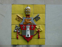
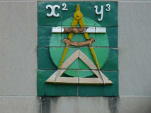
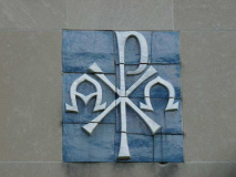
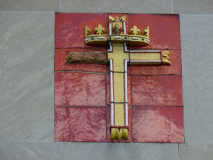
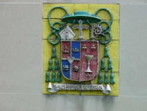
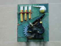
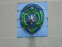
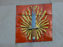
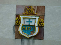
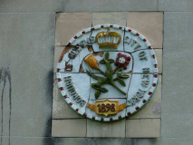
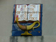
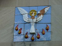
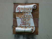
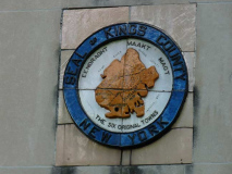
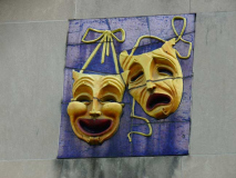
I almost never make a Gallery this large, but I was entranced by the colorful plaques mounted on the side of one of the school buildings. I had to shoot through the chain link fence on Crescent Street to get them. There are the usual ecclesiastic symbols, including a crowned cross, the chi-rho (which is taken from the first two letters of “Christ” in classical Greek) with alpha and omega (Christ referred to himself as the Alpha and Omega, the first and last letters of the Greek alphabet in Revelations, known to Catholics as The Apocalypse). There are symbols of the arts, math and science departments, the boroughs of Brooklyn and Queens, the dove representing the Holy Ghost and tongues of flame symbolizing Pentecost, and much more. The plaques were likely produced by St. John’s Prep students.
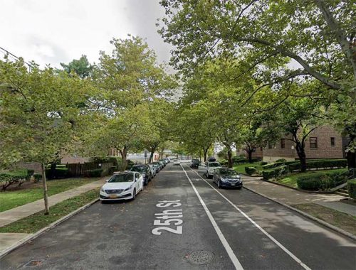
Crescent Street ends, or begins (its house numbering begins) amid a pleasant, if samey-looking, garden apartment complex. Note that Google Street View, in a rare error, calls it “25th Street”. The north end, at 20th Avenue, borders a massive Con Edison plant.
As always, “comment…as you see fit.” I earn a small payment when you click on any ad on the site. Take a look at the new JOBS link in the red toolbar at the top of the page on the desktop version, as I also get a small payment when you view a job via that link.
12/22/24


7 comments
Looking at the now-Chicago-loop-esque Queens Plaza/Court Square western Queens “downtown,” combined with the Hunter’s Point residential high rises, you wonder what Battle Ax Gleason would say if he were around to see the Long Island City of today. …
I am most intrigued by the ad in the very first photo. Why in the world would anyone sell their diabetic supplies? You would have them only if you needed them. Very odd.
“a spelling inconsistency as on the website it’s spelled “Heisenberg,” In this case, it has nothing to do with the Third Reich. The proper spelling on the website and particularly the headshot image on the sign are references to “Heisenberg,” the alias used by drug designer Walter White (played by Bryan Cranston) on the TV series Breaking Bad. The glasses, goatee, and porkpie hat that he wore became iconic symbols of the series.
Never watched it
Werner Karl Heisenberg (https://en.wikipedia.org/wiki/Werner_Heisenberg), German physicist and winner of the 1932 Nobel Prize in physics, was most likely the source of Walter White’s character, though I am not familiar enough with “Breaking Bad” to cite any proof of this. He was, indeed, the main scientist involved in the Nazi’s atomic bomb project and I would think that the creators of the show considered him a scientist who used his knowledge and skills in a less than ethical/moral fashion.
Actually, ‘Crescent Street’ may be a the result of a fight between Flushing and Astoria which the latter lost big time.
There was a lot of nasty backbiting in this area. For example, when Grant Thorburn moved his nursery to Astoria, just across the Ferry from NYC, he advertised that he was closer than Flushing and the nurseries out there.
What did Flushing’s Prince who owned nurseries there do? Well he brought four farms next to Thorburn – with access to Sunswick Creek, and promptly subdivided the area into large plots with a gentle curve ending at Broadway – at first glance it looked similiar to the ‘Crescent’ streets in London with their elegant mansions.
However, he also devided the rest of the property into tiny plots, just perfect for the new Irish immigrants working on the waterfront and the local carpet factory. He also sold lots to noxious industry as fat rendering, tanneries, all sorts of nasty things.
The 1852 Quillch map, which first advertises Crescent Street, seems to be the ‘official’ map in records but it is very difficult to find and is normally in a terrible condition (likely all are copies of a sad original).
There were a lot of things that killed Ravenwswood and what could have been a beautiful asset, Sunswick Creek, became the likely culprit that killed Ravenwood with malarial disease and pollution.
Long story short, ‘Crescent Street’ was never inteneded to be a real London Crescent, but the successful product of a forgotten quarrel between Astoria and Flushing which Astoria lost.
Is that why there never seems to be pictures of what was in the area of the Ravenswood projects because of the polluted creek, except for the DS garage?