

GOOGLE MAP: WALKING TOTTENVILLE 2025
It had been since 2017 since I walked extensively around Tottenville, the southernmost point in New York State (it would be the southernmost town in NYS, were it not a part of Greater New York). The older you get, the faster time flies! Perhaps I go into the following spiel every time I discuss Tottenville, but I visited it very early on, maybe age 6, when my parents were visiting someone there. We did not have a car, so what I think happened was we boarded the ferry at the 69th Street pier in Bay Ridge and traveled to St. George (the ferry was discontinued when the Verrazzano Bridge opened, but revived by NYC Ferry in a limited fashion in 2026) and then took a bus that went all the way south to Tottenville. I noticed the rutted Arthur Kill Road and its incandescent lights even at age 6. That’s really all I recall at this remove. This latest visit was in early October 2025. It was warm for the calendar at 85 degrees…


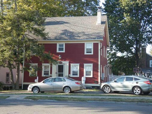
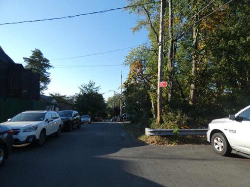
Here we are at the far west end of Hylan Boulevard at Satterlee, where traffic is controlled by a flashing yellow Cyclops traffic signal; some of these flash yellow, others red.
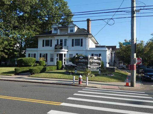
Hylan Boulevard is the newest of Staten Island’s lengthy auto routes. It was constructed in pieces in the 1920s between Rosebank and Tottenville. In Rosebank, it took over the route of Pennsylvania Avenue, while along Staten Island’s south shore, it originally had the name Southside Boulevard until it was renamed to honor NYC Mayor John Hylan, who occupied the office from 1918-1925. Amazingly, Hylan begins and ends with 17th Century houses: Clear Comfort, which for many years was home to Alice Austen, features an original section dating to as far back as 1691, while the Conference, or Billopp, House in Tottenville at the other end of Hylan, was built in 1680.
More NYC beginnings and endings
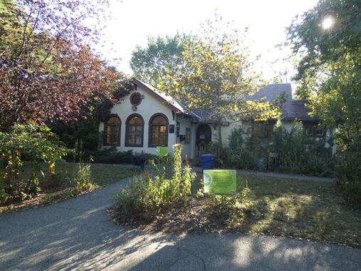


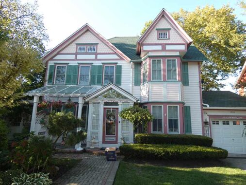
I encountered a mild surprise on Satterlee Street just south of Hylan when I encountered what looked like a Spanish Colonial residence—which is what it had been before it became the Conference House Visitors Center. Recall that, in Part 1, I mentioned that I found the streets south of Amboy Road mostly unfinished in 1972 and indeed, this building, constructed in the 1930s, was one of the few buildings that attained completion by the Harmon National Real Estate Corp. beginning in the 1920s, which mapped streets and planned homes that wouldn’t be built for another 40+ years. The Visitors Center was established in the building in 2005.
To get to Amboy Road, I staggered north on Aspinwall Street, where, in early October, the trees (same species, likely planted at the same time by the same developer) were beginning to change color. I wonder if Aspinwall Street is pronounced the way Beatles associate Neil Aspinwall pronounced his name, as if the “w” wasn’t there. If you know, Comments are open.


Perhaps I didn’t grasp it at the time but the unusual concrete pillared building and the pitched-roofed building at #73 Aspinwall, but a Street View from the winter months makes it clear. In 2021, it was selling for $2.5M.
I’ll once again mention that most of the streets south of Amboy Road weren’t built out or developed till the 1970s, and traces of this can still be seen on Aspinwall. Many streets in NYC’s outer reaches that were developed at different times have varying widths. Here, Aspinwall narrows and loses its sidewalk for a few paces.
I mentioned cobblestones in Part 1, and here’s #1 Aspinwall just south of Amboy, which has plenty of cobblestone trim on the first floor as well as numerous cobblestoned fenceposts.
Amboy Road is one of Tottenville’s oldest routes and features several classic homes almost two centuries old. I covered many of these during my 2017 visit, but I checked on a few again in this non-landmarked area. At 7631 Amboy Road at Aspinwall Street, a plaque on the lower right of the building gives the construction date as 1810, but it’s not quite that old. It was constructed by carpenter Melanchton Rutin in 1850; the Rutan family constructed many buildings in western Tottenville during the 1850-1860 period.
Next door is multiple-gabled #7635 Amboy, which also dates to 1850 and was built for boatsmith Lot Reckhow.
The compact #7639 Amboy Road was built in 1850 for ship joiner Abraham Romaine. Joiners are “specialized, skilled tradespersons who construct, install, and repairs interior woodwork, furniture, and fittings on ships and boats. They work with various materials—wood, metal, and fiberglass—to build cabin interiors, cabinets, doors, and decks, often in tight spaces.” The building is bigger than it looks: its additions were made in its rear.
While Tottenville unfortunately has no landmarked districts, some individual dwellings have gotten designation such as this cottage at #7647, the Rutan-Journeay House, one of the oldest privately-owned buildings in Tottenville, constructed in 1848:
The Rutan-Journeay House is one of the earliest documented houses of newly created Tottenville, and the first on Amboy Road. Through its first two owners the house has close ties to the shipbuilding industry, which flourished in Tottenville from its beginnings in the 1840s through the early 20th century. Shipbuilding and ship repair were important partners of the oyster industry that created the town. NYC.gov
The New Chabad Jewish Center, #7630 Amoy Road at Aspinwall. A small plaque with a Star of David out of the picture on the lower left side proves it has been a temple for many years.


Even on my first bus ride as a teenager to Tottenville in 1972 I noticed Carteret Street had this curious dog leg at Amboy Road, even back then as Carteret trailed off to a dead end that has since been built out. I think it was just pavement back then, but a green traffic island has been added since. While Perth Amboy is across the Kill Van Kull and was once accessible by ferry and now by the Outerbridge Crossing from Tottenville, Carteret is a few miles to the north and sits across the KVK from Fresh Kills Park. The NJ borough was named after Sir George Carteret, one of the first proprietors of the province of New Jersey, and his son Philip Carteret, the first royal governor of New Jersey.


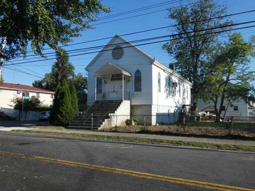
St. Paul’s Methodist Episcopal Church, at Amboy Road and Swinnerton Street, built in 1861 in Romanesque Revival from a design by architect T. Kilpatrick, gained, or regained a bell tower in 2000. When I visited Tottenville as a teenager in the early 1970s, there was not much but woods south of the church. The congregation was established in 1856 by Bethel Methodist Episcopal Church (Amboy Road and Bethel Avenue, seen on this FNY page) members who desired a shorter trip from their homes in the heart of Tottenville.
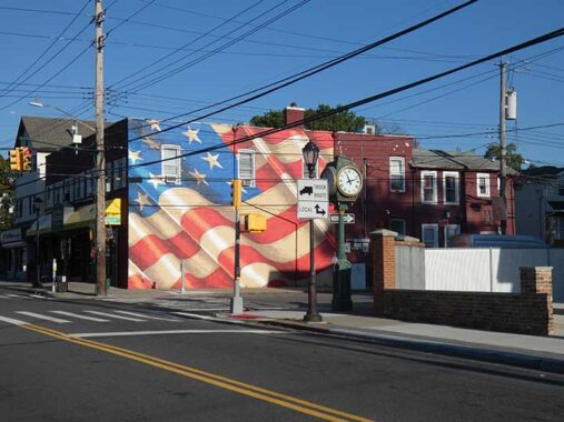
On this visit I did not walk on Tottenville’s north-south axis, Main Street, as I had on previous trips. I did discover that this striking American flag mural on the corner of Main and Amboy was rendered in 2017 by conservative artist Scott LoBaido.


The Copts are an ancient Egyptian Christian sect. The Coptic Church predated the arrival of Islam in Egypt by several centuries; presently, there are 9 million Copts in Egypt in a population of nearly 60 million. On FNY’s tour of Tottenville in 2015 we were lucky to get in the interior of a Coptic church in a former bank building at main and Craig Avenue. Joe DeMarco got some interior photos.
Above is the second of the two Coptic Orthodox churches in Tottenville, at Amboy Road and Chelsea Street, sharing space with St. Stephen’s Episcopal Church. Other Staten Island Coptic congregations can be found in Great Kills and Todt Hill.
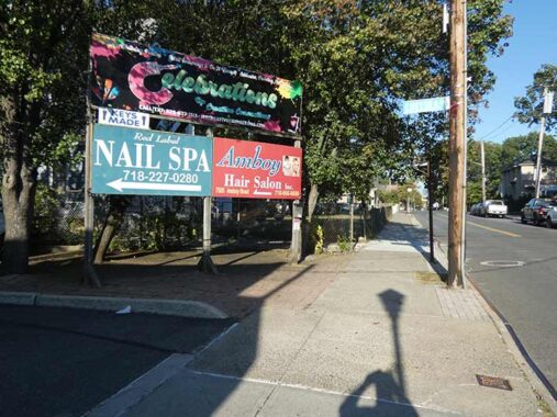
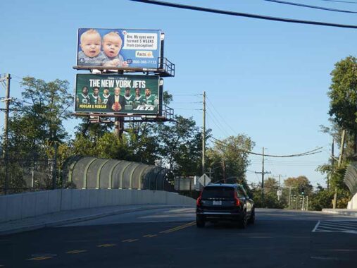
Tottenville has gotten somewhat more urbanized the past couple of decades but there’s still the touch of “Toonerville” about it, like this billboard at Amboy and Chelsea, heading east. Lengthier October shadows put my shadow in the photo.
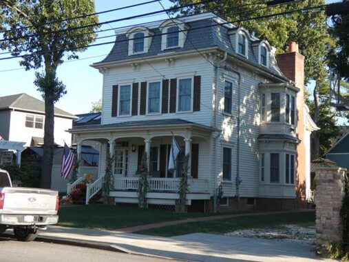
You can still find some classic architecture on Amboy east of Main, such as #7484, a bit west of Johnson Avenue. It was buildit in 1869 for carpenter and undertaker James Bedell and looks largely the way it must have then. This house was designated a NYC landmark in 2005.
…until it was altered in March 2005, this was the best preserved house in the style on Staten Island’s South Shore. Second Empire houses once proliferated on the South Shore, where the popularity of the style coincided with a period of growth tied to the opening of the Staten Island Railroad, but they are now becoming increasingly rare.
|
Designed in what was at the time a very up-to-date version of the style, the Bedell House was handsomely proportioned and carefully detailed. It is the only architecturally distinguished Second Empire frame house in Tottenville that retains its historic form and clapboard siding. The house features such historic details as molded window surrounds, cornices, scrolled rackets, and a two-story polygonal bay enriched by recessed panels and molded cornices.
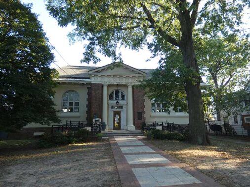
Speaking of landmarks, here’s another one a few doors down at #7430 Amboy. When Tottenville was still a small oyster fishing village in 1904, it got its very own world-class Classical Revival library building thanks to millionaire philanthropist Andrew Carnegie, whose donations were the springboard that helped the New York Public Library expand to its present 85 branches. The Tottenville Library was designed by the prolific firm of John Carrere and Thomas Hastings, who also masterminded the great main branch at 5th Avenue and West 42nd Street and the Staten Island Borough Hall. Tottenville was the home of Staten Island’s first public library in 1899, a rented house on Johnson Avenue holding 230 volumes.
I got the photo on a Sunday, when the library was closed, but they were accommodating interior photos on my previous visits, whcih I can’t say for other libraries or post offices around town.
#7448 Amboy, corner of Brighton, was built in 1905 for Charles Thrall, architect and foreman at the Atlantic Terra-Cotta Works, one of Tottenville’s most prominent businesses. Thrall co-designed Tottenville’s Masonic Hall on Main Street. Such was the importance of Atlantic Terra Cotta to Tottenville’s economy that a small railroad station on what was then called Staten Island Rapid Transit was built near the plant in the 19th Century (see below).


With trees still fully leaved in early October it was difficult to get a photo of Our Lady Help of Christians Roman Catholic Church at Amboy Rd. and Yetman Avenue, so I turned to Street View for a better look. The parish was founded in 1890, the first Roman Catholic parish in Tottenville, and the original church building was dedicated in 1898. Among the parishioners was activist and journalist Dorothy Day, a southern Staten Island resident, who was baptized in the church in 1927. The original church was replaced by this building in 1956, and was later rebuilt in 1990 after a fire.
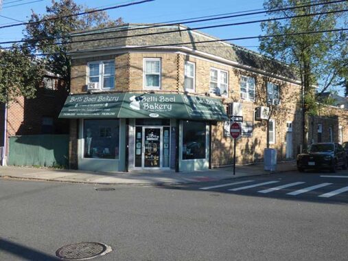
“Belli baci” in Italian means “lovely kisses.” The bakery, at #7358 Amboy at Sleight Avenue, was founded in 2011 by Ernie Guzzo. The 1940 tax photo reveals that it was also a bakery that year as well.
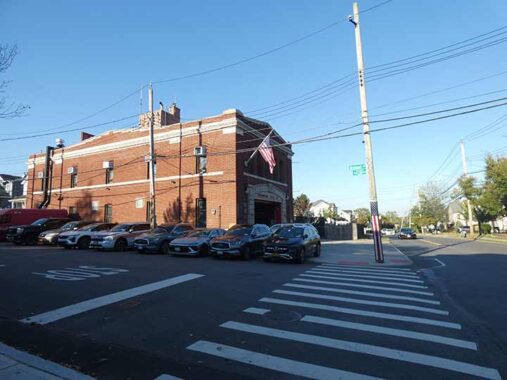
At Amboy Road and Brehaut Avenue (another NYC name I am stumped about how to pronounce, is it BREE-hawt or Bree-HO?) is FDNY Engine 151 Hook and Ladder 76, built during the Jimmy Walker mayoral administration; most firehouses built in the 1925-1932 period look similar to each other.

7379 Amboy Road at Lee Avenue, formerly belonging to Dr. Henry Litvak, was built in 1895 and, of course, once resembled the houses near it on Lee Avenue. But in 1941 designer Eugene Megnin got hold of it, and took things to another level by adding an Art Moderne front. The striking exterior uses 394 glass blocks in the bay entrance.
I decided to head for the train at this point and walked north on Brehaut, since I had never previously walked the street. Recently, I returned to Amboy Road and walked a couple of miles from Pleasant Plains to Huguenot Avenue, but that’ll be another page. Like some other Tottenville streets, Brehaut Avenue was developed unevenly, and so its widths vary and at times, sidewalks are missing.


Arthur Kill Road is bridged over the Staten Island Railway at Lion Street, and a short distance away is the fairly new Arthur Kill station, opened in 2017, which replaced the Nassau and Atlantic Streets, named for two defunct businesses. The MTA provided only perfunctory maintenance for their last couple of decades, and then tore them down and built the new station, which FNY covered shortly after its opening.
To my horror, on weekends the SIR has been operating on 45 minute headways on weekends due to trackwork, which was true in October 2025 and still going during my latest visit in May 2026. Worse, in what I call “MTA logic” the train leaves just before the boat arrives at St. George, and arrives in St. George just after the boat leaves.


When I did get on the ferry and looked out the window, Upper New York Bay offered a sailing vessel, a working tug and a rising near-full moon.
Don’t miss Sergey Kadinsky on Tottenville
Check out the ForgottenBook, take a look at the gift shop. As always, “comment…as you see fit.” I earn a small payment when you click on any ad on the site.
5/21/26