
I write this the day I turn 63. I feel terrific! Except some mornings, when my back is sore and only walking around will ease it. An affliction tailor-made for me, since I like nothing more than to grab the camera and go out “parading” like Ringo in A Hard Day’s Night. Unlike Mr. Starkey, though, I go out seeking notable infrastructure or other interesting sights on the streets. I have written, photographed and managed Forgotten New York since 1998, and if I had gotten tired of it by now, I would have, so everyone is stuck with it perhaps for as long as I am alive.
I have been thinking about beginnings and endings of late; not my own, but beginnings and endings of lengthy streets around town, especially when one end looks nothing like the other, or when there are interesting sights on both ends. Since I have no time to actually travel to both ends of lengthy streets as a rule, I depended on Google Street View or my own archives for the images I’ll use here. Since I think all the tags and doodads Google likes to add to Street View images to be intrusive (it’s their version of watermarking) I edited them out using Photoshop; crudely, in some cases, so forgive any ugly bits — their images, not mine.
Before anyone says I forgot a street, or several, I’ll just say I’m thinking of this as an ongoing series that I’ll return to from time to time, so if a street you like isn’t here, it may be there the next time I do one of these.
STATEN ISLAND
Since Staten Island gets short shrift in any book or article that gets around to including all 5 boroughs (even in Forgotten New York The Book, in which I arranged the boroughs alphabetically; it still was discussed last) I’ll discuss it first here, and the first street I’ll get to has the most interesting beginning and end in perhaps all five boroughs.
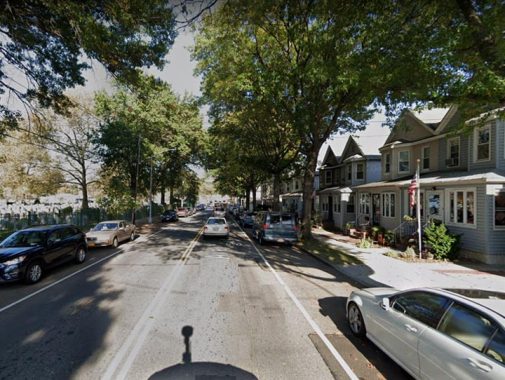
Hylan Boulevard
Hylan Boulevard is the newest of Staten Island’s lengthy auto routes. It was constructed in pieces in the 1920s between Rosebank and Tottenville. In Rosebank, it took over the route of Pennsylvania Avenue, while along Staten Island’s south shore, it originally had the name Southside Boulevard until it was renamed to honor NYC Mayor John Hylan, who occupied the office from 1918-1925.
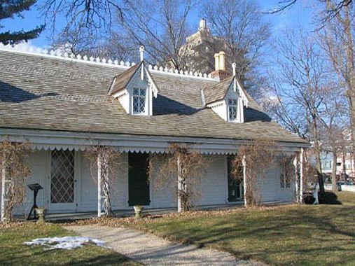
Staten Island’s longest street, Hylan Boulevard, amazingly begins and ends with 17th Century houses: Clear Comfort, which for many years was home to Alice Austen, features an original section dating to as far back as 1691, while the Conference, or Billopp, House in Tottenville at the other end of Hylan, was built in 1680.
Alice Austen (1866-1952) was born to a prosperous family in what was then a part of Clifton and is now Rosebank. Her father, Edward Munn, disappeared before her birth; her mother, Alice Cornell Austen, moved with her daughter to her parents’ house, Clear Comfort, shortly after that. The house, at 2 Hylan Blvd. (then 2 Pennsylvania Avenue) had been purchased and later completely renovated from a simple farmhouse to a Victorian cottage by John Haggerty Austen, Miss Austen’s grandfather, in 1844.
Miss Austen was introduced to photography by her uncle, Oswald Müller, in 1876, when she was ten. Aside from Müller’s original demonstrations, her photographic skills and techniques were entirely self-taught. In the latter years of the 19th Century, photography was a burdensome business; cameras were large and bulky, made of mahogany or cheaper wood with a leather cover. Negatives were produced on large glass plates covered with chemical emulsion and a number of these had to be carried, along with a selection of lenses, cartridges of magnesium powder, cables allowing the photographer to insert herself in her own photographs, and tripods. More than one camera had to be taken, since in that era, larger cameras took larger prints; cameras could only take one proportion. As much as fifty pounds of equipment accompanied Miss Austen on her journeys. She maintained her own darkroom, spending many hours indoors processing her photographs.
I have more on Alice Austen’s story on this FNY page.
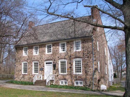


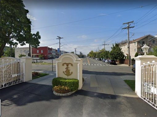
Hylan Boulevard ends at Conference House Park at Satterlee Street, which is named for this building…
A brick mansion built by British Royal Navy Captain Christopher Billopp at about 1680 (the date changes depending on the source) at the end of what would be Hylan Boulevard was almost a century old on September 11, 1776 when Benjamin Franklin, John Adams, and Edward Rutledge met here with Admiral Lord Richard Howe, representing King George III, in an attempt to stave off any future hostilities. While Howe proffered an offer from George III to grant the patriots more rights than other British colonies enjoyed if they ended their fight for liberty, Franklin and the others stood firm and insisted upon American independence. Fighting continued and NYC remained occupied by the British for the next seven years.
What became known as the Conference House passed through many successive owners after the loyalist Billopps were forced to vacate after the Revolution. The building was purchased by Samuel Ward for his son Caleb Ward Senior, who divided the property into smaller parcels for his five children and his many grandchildren. A family scion, Caleb T. Ward, developed Stapleton; his mansion still stands on Ward Hill near the St. George Ferry in New Brighton.
After the Ward era the Conference House passed through several owners and underwent deterioration. The Conference House Association was established in 1927 to preserve the house, and it was restored to its Revolution-era appearance and opened as a museum. It remains the oldest stone manor on the island. The Conference House welcomes visitors: call (718) 984-6046 or go to www.conferencehouse.org.
Richmond Avenue
The longest road that runs north-south through Staten Island, Richmond Avenue first appears on maps under that name in 1912, but it’s really an amalgamation of several connected roads (as is the case with many other lengthy roads around town). When the Staten Island Mall was built in the 1970s, Richmond Avenue gained several lanes as a feeder road to the Korean War Veterans Parkway and Outerbridge Crossing. The avenue runs from Port Richmond on the north to about Raritan Bay in Eltingville on the south.
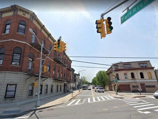
In the 1970s, the section of Richmond that runs through Port Richmond was renamed “Port Richmond Avenue” north of Forest Avenue. However, for my purposes it’s still the north end of Richmond Avenue.
I have visited Port Richmond repeatedly since it’s something of a ghost town, complete with an abandoned rail station. Here’s the most complete version of my Port Richmond ramblings.
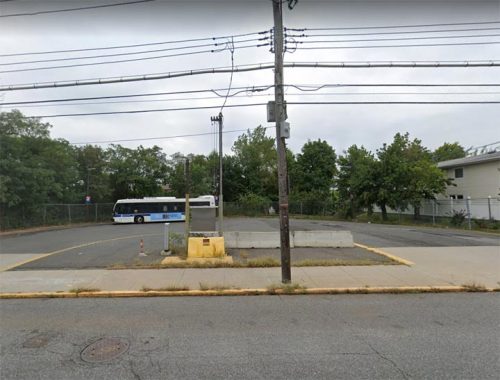
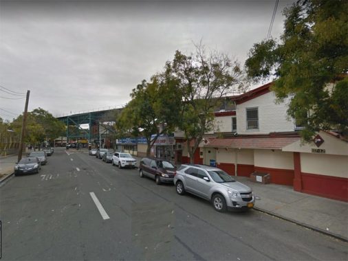
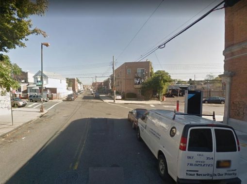
Richmond Avenue ends at Tennyson Drive in Eltingville, a bit south of Hylan Boulevard, but that intersection looks a bit boring—I thought I’d show this bus turnaround on Hylan off Richmond. Why this? Well, it bears the earmarks of a former trolley turnaround, with trolley poles converted to carry electric wire.
Staten Island had plenty of trolley routes, like the other boroughs, and while I have relatively sketchy info about those trolley routes I only have a map of Brooklyn’s, as well as Stan Fischler’s book Confessions of a Trolley Dodger from Brooklyn, Staten Island’s routes are a complete blank to me, though this proves Richmond Avenue had a line.
Richmond Terrace
Richmond Terrace is the longest street named “Terrace” in New York City, and for all I know, anywhere. In New York City, streets named “Terrace” are usually a block long, or even dead ends. Staten island, though, has two lengthy Terraces…this one, and Ocean Terrace in Todt Hill, which runs from the Staten Island Expressway to Manor Road.
Richmond Terrace begins at Staten Island’s Borough Hall across from the ferry landing, and runs along Staten Island’s northern shore…dead-ending at the Arthur Kill. In Staten Island, some of its main streets, such as Victory Boulevard, Richmond Terrace and Arthur Kill Road all dead end at the water’s edge. All three of these roads led to long-defunct ferries to the mainland, and were main coach routes to Trenton, Philadelphia, and other locales along the east coast.
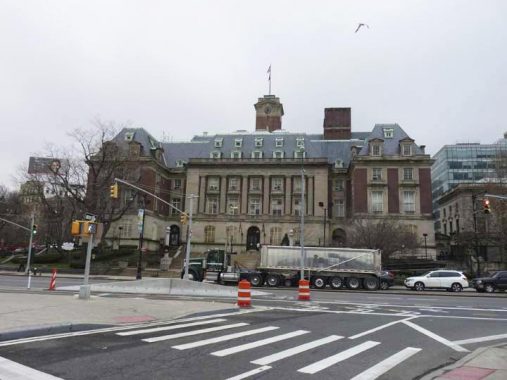
It’s quite possible that Staten Island has the most distinctive borough hall between Brooklyn’s, Bronx’s, and Queens’. The magnificent John Carrere and Thomas Hastings edifice was completed in 1906. It doesn’t look much different today. It houses the Borough President’s Office, offices of the Department of Buildings and other civic offices. On the inside, the grand marble lobby contains a series of significant WPA reliefs and murals painted in 1940 by Frederick Charles Stahr, illustrating events in Staten Island history (your webmaster has never seen these, and wouldn’t mind getting a look at them someday).
SI Borough Hall sits where Richmond Terrace meets Bay Street and Borough Place. The county courthouse, completed by Carrere and Hastings 13 years after Borough Hall opened, is now on the right of this picture.
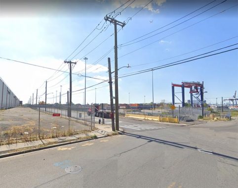
At the other end of Staten Island’s North Shore, Richmond Terrace peters out just west of the now-shuttered Mariners’ Marsh Park at Western Avenue, at what was once called Port Ivory, home to a large Proctor and Gamble factory. Beginning in 1907 and continuing for 8 decades, P&G’s products included soap, Crisco, Duncan Hines cake mix, detergents, Pringles “potato chips”, Citrus Hill orange juice, and dozens of other products, employing thousands over the years; Howland Hook, at the end of Richmond Terrace, became so identified with the factory that it became known as “Port Ivory.” At its height in the 1920s the site employed 1500. Port Ivory closed down in 1991, while its old buildings remained intact until about 2000.
Victory Boulevard
Future Vice President Daniel Tompkins founded Staten Island’s town of Tompkinsville in 1815, and extended a turnpike west from the street named for his daughter Arietta in 1818 and for a century it was called simply Richmond Turnpike. After the USA’s successful WWI campaign, the turnpike was renamed Victory Boulevard in 1918.
This is the original stretch of what had been Arietta Street, now the western end of Victory Boulevard just past Bay Street.
As above, I’m not showing the very end of Victory Boulevard, which dead ends about a half mile west of the West Shore Expressway; instead, I’m showing the last major neighborhood it runs through, Travis; the church is St. Anthony of Padua.
Just as Proctor and Gamble made Mariners Harbor a company town for many years, so did the American Linoleum Company in Travis between 1873 and 1931; the industry became so identified with the region that the town became known as Linoleumville during that time. After the company moved to Philadelphia, residents voted to rename the town for early settler Captain Jacob Travis. From Time Magazine, December 8, 1930.
QUEENS
Rockaway Boulevard
Rockaway Boulevard and Rockaway Turnpike were formerly known as Rockaway Road (or Rockaway Plank Road) and the Jamaica and Rockaway Turnpike. You can see its route on this Dripps atlas; zoom in on southern Queens. The atlas goes back to 1852, shortly after the turnpike was constructed as a toll road with pikes, or logs, that were “turned” after the fare was paid. The toll was removed when Queens joined Greater New York in 1898. Rockaway Boulevard follows the same route today, from Woodhaven southeast to Lawrence in the Five Towns of Nassau County (which was part of Queens until 1898).
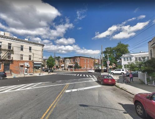
This is the west end of Rockaway Boulevard as it meets Eldert Lane at Ridgewood Avenue. It ends at the Brooklyn-Queens border. Two lanes at this point, it expands to four at Atlantic Avenue.

Rockaway Boulevard is pictured here at the Queens-Nassau Line, in a remote neighborhood known as Meadowmere (some called it Warnerville), located at a twisting canal at the east end of a Jamaica Bay inlet called Head of Bay. South of here, Rockaway Boulevard is bridged into Nassau County, where it’s known as Rockaway Turnpike, ending at Broadway in the town of Lawrence.
Queens Boulevard
Queens Boulevard is Queens’ widest, though not longest, road. Its widest section from Greenpoint to Hillside Avenues is 200 feet, and it has 12 lanes of traffic (16 for a section at Yellowstone Boulevard). It’s also a relatively new route, built atop older roads such as Thomson Avenue and Hoffman Boulevard (renamed from Jamaica Road for John Hoffman, mayor of NYC and governor of NYS from 1866-1873; sections of Thomson Avenue and Hoffman Drive are still on the map.
At first Queens Boulevard featured a normal width and was a relatively sleepy route, but the construction of the Queensboro Bridge spurred a growth spurt. First a trolley line was built in 1915 (it lasted until 1937) and then the IND Subway arrived, all of which added lanes for auto traffic. Before traffic calming measures were enacted around 2000, Queens Boulevard was called the “Boulevard of Death” for its frequent pedestrian fatalities.
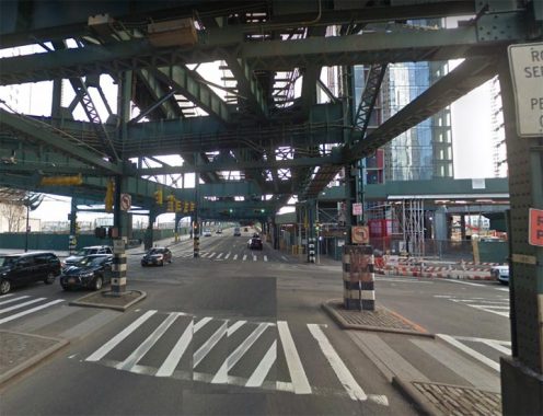
If a street is long enough (outside Staten Island) a lot of them have elevated trains; at Queens Boulevard’s beginning, where Queens Plaza meets Jackson Avenue, the el shrouds it on its bridge across Sunnyside Yards. East of there the el is on a concrete trestle with east and westbound Queens Boulevard flanking it. Queens Boulevard’s trolley formerly tan under the concrete viaduct, but after 1937 it was replaced by parking.
The multi-lane version of Queens Boulevard ends at Hillside Avenue but it soldiers on as a two-lane road one block further, reaching Jamaica Avenue at an apartment building (left) called, coincidentally enough, “Queen’s House.”
Cooper Street/Cooper Avenue
Beginning as a modest two-lane road at Broadway in Bushwick, Cooper Street, unlike its parallel streets, just keeps going…and going…and going…changing to Cooper Avenue at the Queens line, gaining lanes at Central Avenue and 73rd Place, roaring past the Shops at Atlas Park and St. John’s Cemetery.
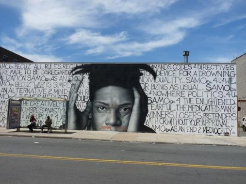
Owen Dippie is a New Zealander “street artist” renowned for his playful photorealistic portraits. His portrait of artist Jean-Michel Basquiat (1960-1988) appears on Cooper Street and Broadway. Dippie collaborated with artist Al Diaz on the piece; Diaz and Basquiat collaborated on pieces under the name SAMO.
Before ending at Woodhaven Boulevard, Cooper Avenue runs past St. John’s Cemetery (left) and Archie Bunker’s house (right).
Main Street
Though there’s a Main Street in every borough (even Manhattan has one, on Roosevelt Island) Queens’ Main Street is by far the lengthiest, running from Northern Boulevard south to the complicated interchange of Queens Boulevard and the Van Wyck Expressway. However, until about 1940 Main Street wasn’t nearly as long; it was in downtown Flushing, all right, but only between Northern Boulevard (which east of the Flushing River was Broadway until about 1920) and where the Flushing Library at Kissena Boulevatrd is today. South of that, a short route of Jaggar Street ran for a few blocks. South of that there was undeveloped farmland for miles, and Main Street wasn’t mapped out and built south into Briarwood until well into the 20th Century. I’m fascinated with Main Street and walked its full length in 2010.
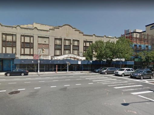
In 1928 the grand RKO Keith’s Theatre was constructed at the T-shaped crossbar where Main meets Northern Boulevard, and until its shuttering in 1985 it was the doyenne of Main Street, visible in most photographs and renderings looking north on Main Street during its six decades of showbiz dominance. First run movies premiered here, and live action comedy and song from big names like Hope and Crosby was presented as well.
Since its shuttering, it has changed hands from owner to owner, and has not fared well under any of them. Its future is, as it has been since 1985, up in the air.
I wrote the above words in 2010, and not much has changed now that it’s 2020. You hear of various redevelopment plans for the theater, but thus far, the ruin continues to defy the decades.
At the south end of Main Street, a ramp serves Van Wyck Expressway traffic, while Main Street also continues as a service road on either side. The street ends officially at Queens Boulevard at the Van Wyck-Briarwood E train station.
Utopia Parkway
Utopia Parkway is a major north-south Queens route, running from Little Neck Bay in Beechhurst south to Grand Central Parkway in Jamaica Estates, where it becomes Homelawn Street. It’s named for a real estate development that never panned out, and overlays part of an older route, Fresh Meadow Lane.
In the early 20th Century the Utopia Land Company, named for the term for a perfect or eminently desirable place coined by author/scholar Thomas More in 1516, planned to build a community of co-operative apartments for Jewish residents of the Lower East Side. The company spent $9,000 to build and grade streets and divide area lots. However, it was unable to acquire further funding and the plan was abandoned, with the newly built Utopia Parkway its only legacy.
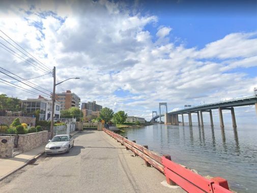
At its north end, Utopia Parkway trickles to an end as a one-lane road just north of 12th Road in Beechhurst, bordering Little Neck Bay in view of the Throg(g)s Neck Bridge.
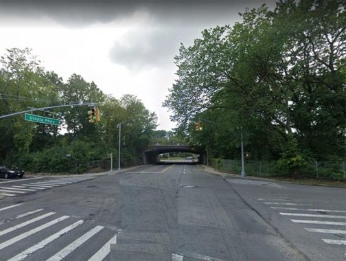
At its south end, Utopia Parkway passes under the Grand Central Parkway and emerges with a different name: Homelawn Street, which runs through ritzy Jamaica Hills. But where, exactly, does the changeover take place: at the north or south service road…or at the midpoint of the GCP? It’s an imponderable and unanswerable question. East of here, Bell Boulevard similarly transforms into Spencer Avenue.
BRONX
Gun Hill Road
Gun Hill Road rumbles west to east across mid-Bronx from Norwood to Pelham Gardens. It runs along a Native American trail and even by 1900 went from Mosholu Parkway east only as far as White Plains Road.
The road figured prominently in the Revolutionary War. Gun Hill Road was a major east-west artery by the late 1700s, and control over it was contested feverishly. In January 1777, skirmishes occurred at Fort Washington, located then where Giles Place and Sedgwick Avenue would be, and then at John Williams’ bridge at Gun Hill Road and the Bronx River. The patriots took refuge at a redoubt (a small temporary fort made of earthworks, stone or brick) on January 25th, 1777, that was located just north of East 211th Street and west of Webster Avenue in what is now Woodlawn Cemetery.
A monument to this redoubt can be seen inside the southern Woodlawn Cemetery fence north of the intersection of East 211th and Decatur Avenue. The patriots, commanded by Major General William Heath, fired cannon at the British here, which sent the King’s forces retreating. The spot became known as “the gun hill.”
By 1875, Gun Hill Road had received its name west of White Plains Road, but the Bronx east of that was mostly farmland and meadows at the time. As the Bronx became built out and newly populated, a grid system of streets was laid out and Gun Hill Road was extended east, arriving at its present length in 1938.
Let me digress a bit, as I’m wont to do on occasion.
There’s no “Gun Hill Road,” of course; there’s an East Gun Hill Road and a West Gun Hill Road, with the divider Jerome Avenue, which serves as the demarcator of East and West numbered and named streets in the Bronx. In Manhattan, Broadway does the trick, with 5th Avenue serving the role north of Washington Square. House numbers begin at 1 on either side of these avenues. Other municipalities across the region, and across the country, divide streets into East, West, North and South sections in similar fashion (though Brooklyn does it much differently, with its “East” and West” streets running north-south on either side of a Y-axis street: McDonald Avenue for the most part).
My question is: why? When John Randel laid out Manhattan’s grid system, why not just begin the house numbering at the Hudson, and finish it at the East River, with the Bronx simply continuing the numbering across the Harlem River?
That would lead to more problems, apparently. Across the Harlem River, Bronx’s and Manhattan’s numbered streets don’t line up on the same longitude. Also, you’d have the more prominent addresses in Midtown with high numbers in the hundreds, instead of the “20” and “40” you find on either side of 5th Avenue, though that doesn’t seem to be a concern with the lengthy north-south avenues.
Anyway, I often make a mistake writing “West” when I should write “East” and mid-19th Century cartographers should have had that in mind when naming their streets!
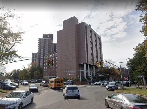
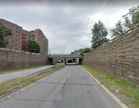
Looking west at West Gun Hill Road’s beginning at the St. Patrick’s Rehabilitation Center on Moshulu Parkway and Dickinson Avenue. South of here, the Mosholu Parkway service roads are called West Mosholu Parkway North, West Mosholu Parkway South, East Mosholu Parkway North, and East Mosholu Parkway South. It gets kind of silly…
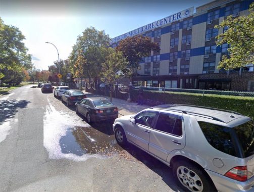
East Gun Hill Road ends as a service road at the spaghetti interchange of the New England Thruway and Hutchinson River Parkway at another health center, Kings Harbor Multicare Center. The Bronx is home to many hospitals, nay of them affiliated with Montefiore. My father passed his final days at Calvary Hospital in Eastchester; he rarely journeyed to the Bronx for any other purpose!
Tremont Avenue
Another of the many “East-West” roads around town. The genesis of Tremont’s name is similar to that of Boston’s Tremont Street: while that city’s Tremont was named for three hills on the originally narrow peninsula where Boston grew and prospered, so the Bronx’ Tremont was named by its first postmaster for three hills in mid-Bronx: Mount Eden, Mount Hope and Fairmount. The main difference is that Bostonians pronounce it TREM-mont, while Bronxites say TREE-mont.
Like most of New York City’s lengthy routes, Tremont Avenue wasn’t called Tremont Avenue for its entire length in its early years. The late Bronx historian John McNamara, in his indispensible History in Asphalt, says that east of about Third Avenue, the road was known by many names along different sections of its length, including Morris Street, Walker Avenue, Fort Schuyler Road and Throggs Neck Road. Some of it was briefly part of East 177th Street! By 1900 or so, the part east of Boston Road was a northeastern extension of West Farms Road east to Westechester Square at Westchester Creek. However, by 1920, the full length road was Tremont Avenue, divided into East and West sections by Jerome Avenue. I’m unsure of the reason why East Tremont name took the place of the other sections, but it did leave the East Tremont section about 8 miles long, with the West Tremont side about one!
The west end of West Tremont Avenue is at Roberto Clemente State Park in Morris Heights, close to the Harlem River. Just past the Major Deegan Expressway it’s a red brick lane trickling to a step street section. Gaining two lanes at Sedgwick Avenue, it has to twist and turn around the very hilly neighborhood: at one point it goes northbound!
Only the East River can stop East Tremont Avenue’s southeast progress, at it ends at Schurz Avenue and the exclusive Marine del Rey compound in Throg(g)s Neck.
MANHATTAN
2nd Avenue
Manhattan’s numbered avenues are quite lengthy — or would be, if city planners hadn’t intervened in the years after John Randel surveyed the island from 1805-1810 and the grid plan was adopted in 1811. For example, 10th Avenue would be the city’s longest numbered avenue, running from the East River in Chelsea all the way to the Harlem River in Washington Heights had the city not renamed the section north of West 59th for the largest city in Holland, Amsterdam, in 1890; 8th, 9th and 11th Avenues are also renamed north of 59th.
5th Avenue would be even longer than it is if it wasn’t mapped to run through a high outcropping called Mount Morris; instead, it’s interrupted and Marcus Garvey Park takes its place. Central Park, not on the Randel survey in the early 1800s, interrupts 6th and 7th Avenues, which were renamed above the park in any case. 4th Avenue became Park, in a bit of counter-naming strategy as the yards for steam engines arriving at Grand Central Terminal were located there above 42nd Street.
Only 1st, 2nd and 3rd Avenues run continuously. Of these three, 2nd Avenue is the longest, edging out 1st Avenue by two blocks as both run from Houston Street north to a bend in the Harlem River. 3rd Avenue isn’t in the running, as it emerges from the Bowery at Cooper Square, several blocks north of Houston (and it isn’t continuous with Third Avenue in the Bronx).
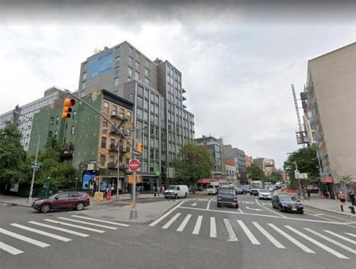
2nd Avenue begins at East Houston at Chrystie Street. While Chrystie is two-way, its northbound traffic can’t use 2nd Avenue, as it’s one way southbound. In this photo, the glass tower in the center replaced a building whose ground floor was home to the late lamented Mars dive bar.
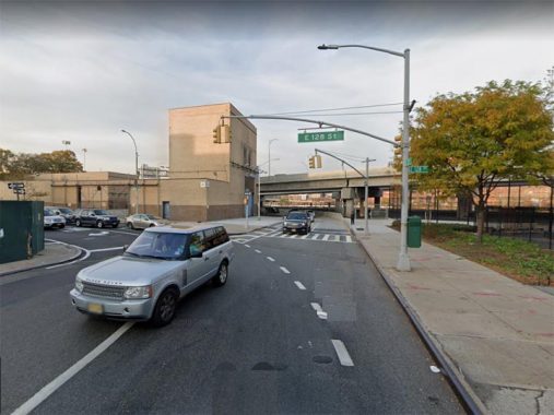
Not sure if anyone except bus drivers have traversed 2nd Avenue all the way from East 128th to Houston; here at East 128th, there’s an exit ramp from the Harlem river Drive, which is the Franklin Delano Roosevelt Drive’s name north of the Triboro Bridge.
BROOKLYN
Myrtle Avenue
Myrtle Avenue was first laid out in 1835 from Fulton Street in downtown Brooklyn as far as Cripplebush Road, an ancient Kings County track now largely replaced by Bedford Avenue. It was extended in 1839 to Brooklyn’s Broadway, and again in 1854 as the tolled Jamaica Plank Road out to Jamaica. (Most of NYC’s toll roads of this type were made “free” around 1890-1900.) Horsecars appeared on Myrtle in 1854, which later became trolleys taking electric power from overhead wires. The infamous El shrouded Myrtle from 1888 to 1969 — at first as far as Grand Avenue, to Brooklyn’s Broadway early in 1889, and to Wyckoff Avenue later the same year. The structure reached its current terminal, Metropolitan Avenue, as a surface line and it was “ellified” in the 1910s.
The western end of Myrtle Avenue between Fulton and Jay was eliminated for courthouse construction and Cadman Plaza in the 1950s, while the stretch between Jay and Flatbush Avenue Extension became part of MetroTech Center beginning in 1989.
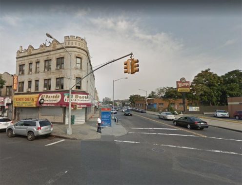
Here’s the home stretch of Myrtle Avenue as it approaches Jamaica Avenue. The last stop on Myrtle Avenue is the old Triangle Hotel (seen at right), named for the corner formed by the two major routes. Almost as long as there’s been a Richmond Hill, the Triangle Hotel building has marked the triangle where Myrtle Avenue meets Jamaica Avenue. It was built by Charles Paulson in 1868 and was originally rented out as a grocery and post office. By 1893 the building, now owned by John Kerz and operating as a hotel, included an eatery named the Wheelman’s Restaurant in honor of the new bicycling craze.
According to the Richmond Hill Historical Society, Babe Ruth (who was a golf enthusiast in nearby St. Albans) and Mae West were patrons of the Triangle Hofbrau in the 1920s. Vaudeville-era pianist/composer Ernest Ball (1878-1927) wrote the music for the now-standard “When Irish Eyes Are Smiling” in one of the hotel’s guest rooms in 1912.
Kings Highway
I call Kings Highway “Brooklyn’s mother road” as it cuts a well-traveled swath from Bensonhurst to Bronsville. What we call Kings Highway these days isn’t its original route, though; in the early 1700s, this colonial-era road went from where the Fulton Ferry landing is today in Brooklyn Heights southeast, approximating today’s Flatbush Avenue, as far as Flatlands, where it turned west and southwest; that stretch of Kings Highway is the road we know today. It’s one of the few routes in NYC that directly references a colonial past (though the boroughs of Kings and Queens also do it).
The west end of Kings Highway, where it proceeds northeast from Bay Parkway and 78th Street. However: a century ago the road went further west, meandering through Bensonhurst and Dyler Heights to what is the current intersection of 86th Street and Fort Hamilton Parkway. Only a wider stretch of 84th Street between 16th and 18th Avenues remains as a surviving section.
In the 1920s, Kings Highway was rebuilt as a multilane speedway, taking over the old route of Flatlands Neck Road northeast of Flatbush Avenue (a second “neck” road, Gravesend Neck Road, is surviving). Kings Highway ends at the #3 train el at East 98th Street, with its traffic transferred onto Tapscott Street and Howard Avenue.
Bedford Avenue
Beginning in Greenpoint, except for a bend following the East River in Williamsburg, Bedford Avenue heads south in a relatively straight line through Bedford-Stuyvesant, Crown Heights, Prospect-Lefferts Gardens, Flatbush, Midwood, and Sheepshead Bay. The oldest section of Bedford Avenue runs between about Flushing Avenue on the north and Fulton Street south; it is the straightened section of an aboriginal Brooklyn road, Cripplebush Road.
The name Bedford’s origins are in Brooklyn’s dim past; it could have been named for Britain’s Bedfordshire, or the village of Bedford (as Bedford Park in The Bronx was) or it may be an English version of the Dutch Bestevaar, “place where old men meet.” Bedford Avenue was called 4th Street in Williamsburg and Perry Avenue south of Fulton Street until the mid to late 1800s, but by the 1890s its full length had been established.
This is the south end of Bedford Avenue at Emmons Avenue in Sheepshead Bay. In southern Brooklyn, Bedford Avenue sits in the place of East 25th Street (Ocean Avenue stands in for East 20th; while Ocean Avenue continues for a couple of blocks south of the bay, Bedford ends here.
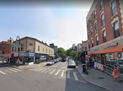
Bedford Avenue begins here at Manhattan Avenue in Greenpoint. The building on the left, with Frankel’s Appetizing on the ground floor, is #1 Bedford.
Flatbush Avenue
While Hylan Boulevard begins and ends at two separate 17th Century houses, Flatbush Avenue (which is barely edged out by Bedford Avenue for the title of Brooklyn’s longest) begins and ends at two separate bridges. At the north end Downtown is the Manhattan Bridge, completed in 1909. Flatbush Avenue is much longer than that, originating from a Dutch-era colonial road that has been straightened for the most part (a detached part of the older road is Amersfort Place in the Brooklyn College area). The north end of Flatbush avenue was originally Fulton Street (see below) but it was extended north as — naturally — Flatbush Avenue Extension when the bridge opened.
The twin statues Miss Brooklyn and Miss Manhattan graced the entrance ramp of the Manhattan Bridge from 1909-1959 when they were unceremoniously removed by killjoy Robert Moses. They bore a historic pedigree since they were sculpted by Daniel Chester French of Lincoln Memorial fame. While the originals can be found at the Brooklyn Museum, replacement versions by sculptor Brian Tolle that rotate in place were installed in December 2016.
At its southern end, Flatbush Avenue roars past Floyd Bennett Field and runs into the tolled Marine Parkway Bridge (a.k.a. Gil Hodges Bridge) which deposits traffic in the Fort Tilden area and vast Riis Park beaches on the Rockaway Peninsula.
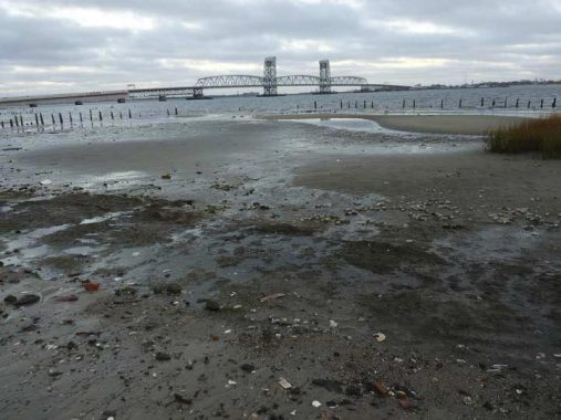
I took this photo at Dead Horse Bay, where ancient glassware, effluvia and horse bones from a ruptured landfill can be found.
Fulton Street
Brooklyn starts with Fulton Street, and almost ends with it, as well. Brooklyn began as a small Dutch settlement along the East River, with easy passage to Manhattan by ferry. In the early 1700s, an Indian trail was officially named Kings Highway and extended south and east. At one time, every vehicle and conveyance traveling to or from Manhattan to Brooklyn, or vice versa, and destined for any place on the island had to come to this point or else start off here.
What we know as Fulton Street east of Flatbush Avenue was once the Brooklyn and Jamaica Turnpike, and it can be argued that Jamaica Avenue/Jericho Turnpike/Route 25, which leads to Orient Point, the easternmost point of Long Island, was once considered Fulton Street’s extension; Jamaica Avenue was once known as Fulton Street in eastern Queens. Officially, Fulton now ends at Eldert Lane and 91st Avenue at the Brooklyn-Queens border. (Jamaica Avenue received its name in 1920).
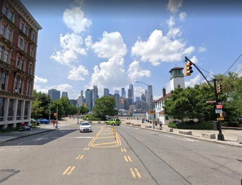
This is the original north end of Fulton Street in Brooklyn Heights. The city couldn’t help but tinker with the name, though, so for many years it was called Cadman Plaza west in this stretch, though Cadman Plaza proper begins south of the Brooklyn Bridge; and original stretch of Fulton Street from the bridge south to Adams Street is still called the ungainly CPW. Since the 1980s the northernmost stretch has been known as Old Fulton street, which is better; but why not rename the whole thing Fulton, as it was originally? From the 1880s to about 1941 this was completely shrouded by an elevated train, as was most of Fulton Street. Today, only the Jamaica Avenue-Crescent Street stretch is.
Fulton Street ends its miles-long run in the Cypress Hills-City Line area at Eldert Lane; east of here, the road continues as the more pedestrian-sounding 91st Avenue. When I was a kid and rode past on a bicycle, I noticed this intersection had the only Queens blue on white Fulton Street sign. Which was an error, as it never enters Queens.
Check out the ForgottenBook, take a look at the gift shop, and as always, “comment…as you see fit.”
8/23/20
21 comments
Happy Birthday, and thanks for continuing to share stories of New York! They’re always a highlight of my day, and I look forward to reading about your latest discoveries.
How come you didn’t include Broadway in Manhattan and The Bronx, the longrst street in the city which begins at Bowling Green by Battery Park and ends around Tarrytown with the city end being at the northern end of Van Cortlandt Park, also why didn’t you include Atlantic Ave in Brooklyn and Queens which begins at Brooklyn Bridge Park and runs to the Van Wyck Expressway where thr Air Train tracks curve on it’s way to Jamaica Station
As it says in the article, this list wasn’t meant to be comprehensive, and I’ll be returning to this subject later.
My favorite “Main Street” is the one in Newark’s Ironbound/Down Neck section. It’s not Main at all, as in being the central business/government street. Someone told me it was named after the German river, and had nothing to do with the English word Main or the American meaning of a principal street.
Main Street Station on the #7 subway line is the busiest individual subway station in NYC outside of Manhattan, in terms of daily fares collected (at least until March 2020 when all hell broke loose). That’s because of the large number of bus routes that feed the station from points further east in Queens and Nassau. Years ago I commuted daily to and from Main Street on the #7, as I lived nearby on Union Street. In the morning, if you wanted a seat on the #7 express, you had to board the train immediately after it arrived, or else standing room only.
Great post Kevin
Happy birthday and many , many more
Regarding Utopia Parkway, I lived in the Gross-Morton (“fire and police”) houses on the north aide of Union Turnpike and understood that development was originally called “Utopia Estates.” Also, there is still a Fresh Meadow Lane, abutting and ending at Utopia Parkway, from the LIE to 69th Ave.
Thanks, Comrade Mayor:
https://nypost.com/2020/08/23/dozens-protest-trouble-magnet-queens-hotel-near-borough-hall/
Think you meant North/Hudson River as the southern terminus of 10th Avenue in Manhattan.
You mentioned recently that the Atlantic Beach Bridge once had a toll for bicycles and pedestrians. I believe the Marine Parkway Bridge had a bicycle toll. I remember crossing it in the late 60s and paying a toll.
Not in my recollection as I began cycling it in 1975, but maybe before that.
I always thought that avenues that ended with South or Extension weren’t really part of those streets as they were made after the original failure to renumber the streets when extending past where they originally began.
You could say Fulton Street doesn’t really end at Cypress Hills/City Line. Early maps suggest it sort of continues as Fulton Street well in through Jamaica Queens.
Jamaica Avenue was formerly called Fulton Street but I think it wasn’t a continuation.
They found Radioactive stuff un dead horse bay
Happy birthday Kevin! Thank u for bringing us two decades of amazing content. It’s thanks greatly in part to u that I’ve learned to enjoy getting around nyc (even when I get lost!)
Staten Island did have a streetcar system but they were mostly eliminated by about 1933-34. There was a streetcar route along Richmond Avenue but it only ran between Richmond Terrace and Victory Blvd (now part of the S59 route). I think the bus turn-around at Hylan Blvd dates back to the 1950s. The recycled streetcar poles probably were imported from Brooklyn since the BofT/TA was in the midst of a 5-10 year effort to junk the trolley system. The same type of treatment was also used for the lighting set-up at the Mackenzie Street bus loop in Manhattan Beach. (As an aside, the MTA still continues what appears to be a longstanding tradition of running alternate trips on the S78 route between the Ferry Terminal and Hylan & Richmond during the daytime hours.)
Why does the Marine Parkway Bridge have that name? here is a Marine Parkway in Brooklyn, but it ends far from the bridge.
Also, Broadway qua Rt 9 ends up near the Canadian border. I’m not sure if it technically connects to US 9 in NJ.
BTW, you mentioned some streets that are or aren’t the longest in their boroughs. I wondered why you didn’t mention that Bedford Ave is the longest street in Brooklyn, unless you want to count Linden Blvd – Rt 27, which goes all the way from the Prospect Expressway to Montauk Point.
Whenever you have a follow-up, don’t forget Francis Lewis Boulevard which traverses the north-south depth of Queens. While most of it is divided, the southern couple of miles through Laurelton and Rosedale includes two 90-degree turns and it ends up at the city line narrow and undivided with one lane in each direction.
Cooper Avenue really continues as Yellowstone Boulevard in Queens, and really starts as Rockaway Avenue (and before that, Rockaway Parkway) in Brooklyn. If one were to connect all the roads, I would imagine it would be the longest road combined in Brooklyn and Queens, starting at Canarsie Pier and ending at the LIE in Northern Queens.