
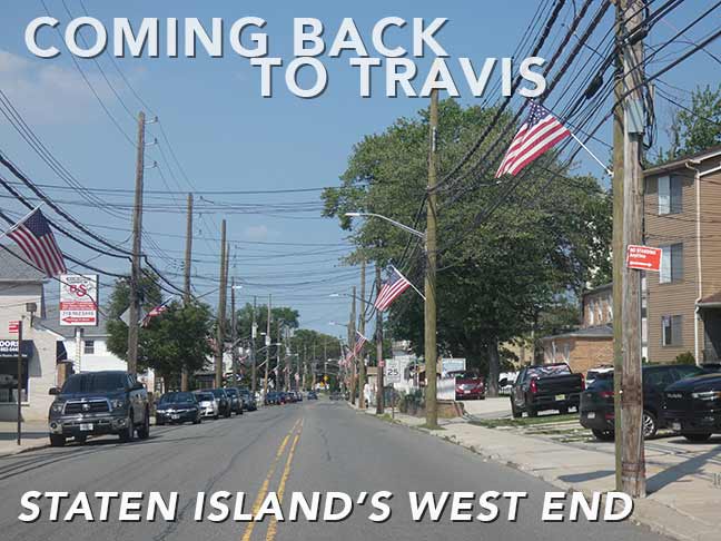

DURING the Forgotten New York era, I’ve only discussed Travis, Staten Island, in depth twice, in 2006 and 2015. Thus, I decided a repeat visit was more than warranted in July 2026, and I hope to touch on a couple of developments there since those earlier occasions. I’m sure I visited Travis earlier than 2006, because beginning in the 1970s I took bus rides all over Staten Island and Travis must have been the destination one one or two occasions. This time, I walked Victory Boulevard with a couple of detours.
Travis is about as far west as you can get in Staten Island, at the west end of Victory Boulevard. Just as Proctor and Gamble made Mariners Harbor a company town for many years, so did the American Linoleum Company in Travis between 1873 and 1931; the industry became so identified with the region that the town became known as Linoleumville during that time. After the company moved to Philadelphia, residents voted to rename the town for early settler Captain Jacob Travis.
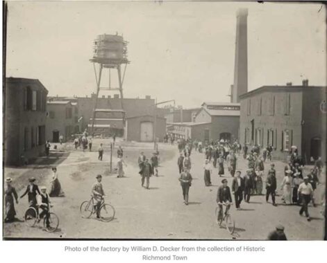
Linoleumville was originally called Long Neck, but after Joseph Wild, the founder of the American Linoleum Manufacturing Company, acquired a 300-acre tract and constructed a large factory, docking facilities and a workers’ village, it became Linoleumville. Linoleum is a floor covering produced mainly with pulverized or ground cork and oxidized linseed oil (and thus is eco-friendly and biodegradable). The process was perfected by Englishman Philip Walton, who supervised Staten Island’s Linoleumville along with Wild in the early days. Walton was succeeded by David Melvin, a Scottish-born inventor and engineer who developed several new varieties of linoleum products including colored linoleum and “battleship” linoleum, originally used by the US Navy but later installed in office buildings and department stores.


I took the S62 bus from the St. George Ferry down Victory Blvd. to just past the West Shore Expressway, where there were a pair of dead ends I wanted to inspect. The first of these was Feldmeyer’s Lane. On a lawn there is an old sign for Vincent Automotive, which is apparently still in business as it has been since 1916, though I found little evidence of it; it was a Sunday, so no one was around to accost me for snooping around. Street View indicates the repair business is located in the garage.


The lane has survived, no doubt, because of Vincent’s and three private residences as well as a condo maintenance business on the corner. I also inspected a second alley, Crabbs Lane, on an earlier FNY post (to which I have nothing to add).
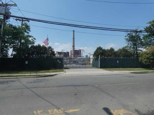
American Linoleum moved out decades ago, but industry still thrives in Travis. Con Edison operates the Fresh Kills Substation north of Victory Boulevard, situated near the Arthur Kill power infrastructure. It serves as a key node in the local power grid and has been targeted for regional energy storage and modernization initiatives. Next door is Pratt Industries, opened in 1997, a paper manufacturer that consumes about 1,200 tons of waste paper daily to produce over 1,000 tons of 100% recycled paper.
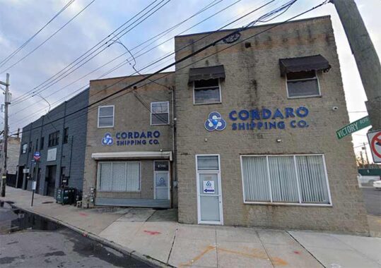
The last private business on Victory Blvd. and Wild Avenue is Cordaro Shipping, founded in 1996, a licensed U.S. customs broker and international freight forwarder offering ocean, air, and door-to-door logistics. It has other locations inlcuidng Rockville Centre in Nassau County.
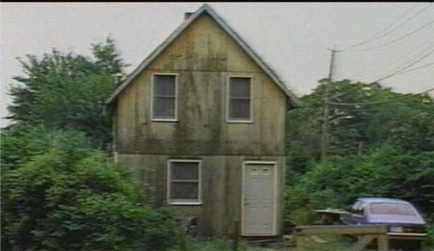
As late as 1980, this corner at Victory Blvd. and Wild Avenue looked like this.
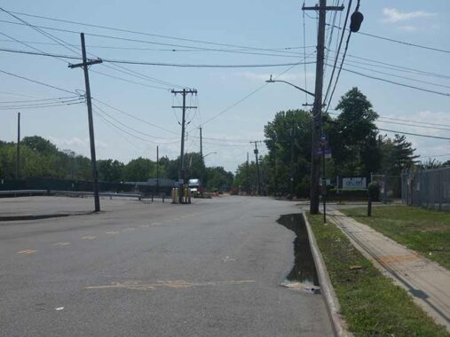
West of Wild Avenue, Victory Boulevard peters to an end, intersecting a freight railroad in a fenced-off section. The road was commissioned as Richmond Turnpike in 1818 by Staten Island resident Daniel Tompkins (1774-1825), governor of New York from 1807-1817 and US vice president from 1817-1825. In its early days it was a conduit for wagon travel to Philadelphia, as the New Blazing Star Ferry ran to Carteret, New Jersey where the road met the Arthur Kill waterway. In 1918, the year of its centennial, the road was renamed Victory Boulevard after Allied victory in World War I.
On August 22, 1777, a major skirmish on Staten Island between General George Washington’s Patriots and General William Howe’s Loyalists was fought in New Blazing Star, one of the many names Travis had adopted in the colonial and postcolonial times. Since 1911, Travis boasts one of the nation’s most popular Fourth of July parades.


Wild Avenue, named for the founder of the American Linoleum Manufacturing Company, takes a “wild” route in which it encounters Victory Boulevard twice. Beginning at Glen Street north of Melvin Avenue, it runs SE past Victory, turns southwest, is divided by the West Shore Expressway, then turns NW again to end at Cordaro Shipping.
These scenes can be found along the “cutoff” section of Wild Avenue west of the West shore Expressway. Surprisingly there’s a mix of dance studios, facility rentals, car repair and some new housing as well as decrepit and abandoned housing. A cellphone relay tower surveys tha area like a Martian “fighting machine” straight out of H.G. Wells’ “War of the Worlds.”
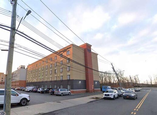
On a recent visit to Travis, urban explorer Rob Stephenson ran into the National Guard on the stretch of Wild Avenue on the east side of the expressway, as the local Fairfield Inn, one of three lodges on this stretch of Wild Avenue (likely built to serve travelers along the West Shore), was housing recent migrants from the southern border. His take on Travis, which mentions escaped private zoo animals, is a worthy read.


An unusual lamppost (for NYC streets) was installed at Wild Avenue and West Service Road (named entirely for its function, as the West Shore Expressway wasn’t built along a previously existing road; for example, Korean War Veterans Parkway (formerly Richmond Parkway) was built along the path of Drumgoole Boulevard (named for Father John C. Drumgoole) and its service roads are called Drumgoole Roads North and South.
The lamp, a species used on the West Shore Expressway, is manufactured by Flagpoles.


“Have you heard about the hot rod race where the Fords and Lincolns were setting the pace?” Along West Service Road I found some absolutely huge Ford and Lincoln illuminated signs. Ford Motors was founded, as you know, by Henry Ford in Dearborn, MI in 1903 and much of American automotive industry was located in the Detroit area for decades. The logo has changed over the years; in 1909, the automaker adopted Ford’s personal signature as its logo and it has remained such since, with some tweaks and slight stylistic changes.
Lincoln was founded by Henry Leland in 1917 and was acquired by Ford in 1922. Since 1940, it has been Ford’s imprint for luxury vehicles. Its 4-pointed star logo was designed by Robert Thomas and first used on the 1956 Continental Mark II.
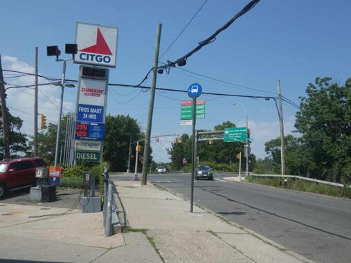
I don’t see a lot of Citgo (Cities Service Co.) signs around town, or maybe I’m not looking too hard, but apparently in this part of town, “go big or go home.” The biggest sign, to my knowledge, remains in Boston’s Kenmore Square, visible from Fenway Park.
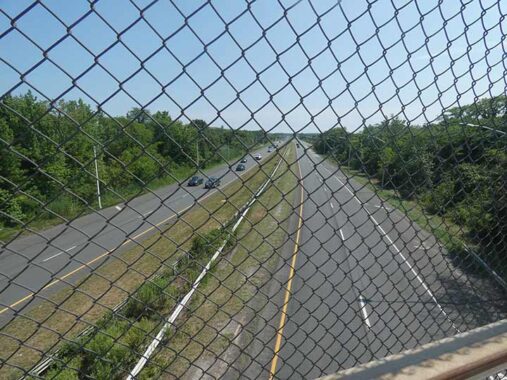
The West Shore Expressway, seen here from its Victory Boulevard overpass, is NYC’s newest expressway of major length and was constructed over nearly two decades from 1959-1976. It connects the Staten Island Expressway in Bulls Head with the Korean War Veterans Parkway and the Outerbridge Crossing in Pleasant Plains. What’s interesting to me is that it runs through sections like Fresh Kills Park (formerly landfill; more about FKP later) where no previous roads existed. Its completion to more rapid development of Staten Island’s west and south shores.
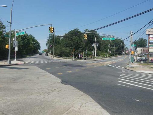
East of the traffic bridge, there’s a fork in the road where Glen Street, formerly Burying Hill Road due to its position along Sylvan Cemetery, splits from Victory Boulevard. The expressway’s construction eliminated a small grid with private residences between Glen Street and freight railroad tracks. A newer extension of Glen Street was built as a West Shore Expressway service road further north.


Independence Park, at the apex of Glen Street and Victory Boulevard, is a relatively new addition (opened in 2011) and sits on what was previously Sylvan Cemetery. NYC Parks in 2010:
Independence Park will share ground with historic Sylvan Grove Cemetery, which has been restored and maintained by the Friends of Abandoned Cemeteries. Parks will consult with an archaeologist and work with Friends of Abandoned Cemeteries throughout the construction process to consider the cemetery’s specific needs and to ensure that the centuries-old site is undisturbed.
|
Independence Park was once a stronghold for British soldiers in a loyalist Staten Island neighborhood, and it is also the final stop for Travis’ long-running, vibrant Fourth of July Parade, which will celebrate its 101st anniversary on July 4, 2011.
|
Parks will clear invasive plants at the site and build a timber barrier rail around the perimeter with stone piers at the entrances. In addition to the installation of new paths, pavements, and plantings, Parks will install benches and a flag pole at a central gathering place, which will accommodate the crowds generated by the annual parade. The park was designed by Parks Landscape Architect Tara Valenta and will be built by Ravine Construction, Inc.
Sylvan (Grove) Cemetery
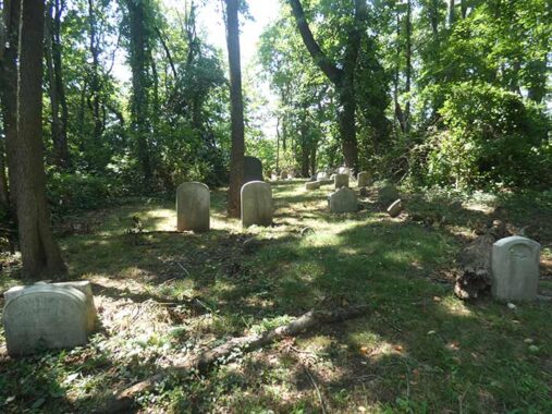


This is a cemetery of many names, but I call it simply Sylvan Cemetery, on a wedge of territory between Victory Boulevard and Glen Street; it’s also been called Sylvan Grove Cemetery and Travis Cemetery, and Open Street Map has Patterson Cemetery. I am seeing differnt scholarship on its founding since I was here in 2015, so I’ll paraphrase from the Historic Districts Council entry. ..
The cemetery was established by the Cannon family as a family burial plot in the late 17th century and became a nondenominational burial ground in 1781. As this area was a site for a Revolutionary War battle it’s possible that British and Hessian casualties are interred here. It was already in decline in the 1880s and completely abandoned by the 1930s. It has been periodically cleaned up at intervals since.
The cemetery had been in poor condition for decades. As early as the 1920s, Staten Island naturalist and historian William T. Davis was decrying its decrepitude, noting broken headstones, weeds and vandalism. However, the Friends of Abandoned Cemeteries has really done a terrific job in recent years making the plot look more respectable, much like what has been done in Jamaica’s Prospect Cemetery in recent years. Members of the prominent Staten Island family the Deckers (the name doesn’t look Dutch, but progenitor Johannses De Decker (perhaps Dekker) arrived from Holland in 1655 during the first great period of Dutch immigration to the New World, establishing a 120-acre farm) and Ridgeways (including a World War II general) are within. However, the inevitable and grim work done by local vandals, destroying and defacing tombstones, can still be seen. Remains of the Ridg(e)way family were exhumed and reinterred in Sylvan Grove when the Ridgway family cemetery was developed in 1989. There is also a Ridgeway Avenue further up Victory Boulevard.
In 2010 an archeological dig was, er, ah, undertaken in Sylvan Grove. Its findings, as well as an incredibly detailed history of the Travis region, can be found here.
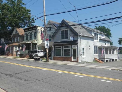
Much of western Victory Boulevard across from the cemetery features homes older than a century, though many have been lost over the years…
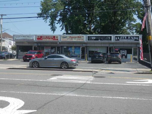
… making way for strips of businesses like this one.
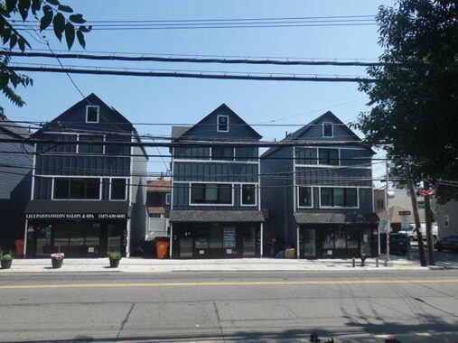


Formerly an empty lot, the corner of Victory Blvd. and Roswell Avenue now hosts a trio of peak-roofed homes that strive to match existing housing stock along this stretch. It marks the former location of the Blanchard residence in Splendor in the Grass, the 1961 drama directed by Elia Kazan with Warren Beatty and Natalie Wood. Many other incidental scenes in the movie were filmed in Travis, which stood in for 1928 Kansas in the film, including houses that are still standing on Victory Boulevard south of Roswell. The film’s title is taken from a line of William Wordsworth’s poem “Ode: Intimations of Immortality from Recollections of Early Childhood”:
What though the radiance which was once so bright
Be now for ever taken from my sight,
Though nothing can bring back the hour
Of splendour in the grass, of glory in the flower;
We will grieve not, rather find
Strength in what remains behind


On the corner of Victory Blvd. and Melvin Avenue is Arberia, which vends Albanian food. I haven’t found a similar establishment in NYC though I suspect there are more in the Bronx Pelham Parkway area, which has been an Albania stronghold. On the Melvin Avenue side is an American flag mural (possibly a Scott LoBaido) and a tribute to Rozafa, an Albanian folk tale about a woman walled up in a castle. AI robot:
The Vow: The brothers swore an oath to keep the secret and let fate decide, but the two older brothers broke their promise and warned their wives.
The Chosen Wife: Only the youngest, honest brother stayed silent, meaning his devoted wife, Rozafa, brought the midday meal the next day.
The Final Request: Accepting her fate for the good of the fortress, Rozafa asked that parts of her right side be left exposed so she could still care for her baby son.


PS 26, at Victory Boulevard and Melvin Avenue, also called the Carteret School, has no less than three facilities in Travis. It was founded in 1880 as District School No. 3, on Victory between Wild and Melvin Avenues, when the area was called Long Neck, and this “new” school was finished in 1896. I call it “new” because the previous school building is intact, directly behind it.
And now there’s a third building. While PS 26 serves Pre-K to 5th-grade students, a new facility at 4074 Victory Blvd., opened in fall 2025, as IS 26 serving middle school students.
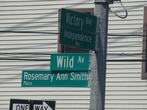
I’ve begun to pay more attention to honorific signs that are increasingly seen around town. Wild Avenue of course, is named for Joseph Wild, founder of American Linoleum, while Rosemary Ann Smith was an area resident killed in the 9/11/01 terrorist attack at the World trade Center.
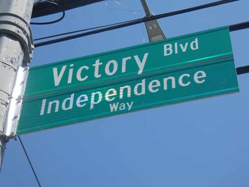
Additionally, Victory Blvd. is subnamed Independence Avenue for NYC’s largest 4th of July parade held in Travis.
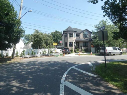
I turned east on Wild Avenue which, as mentioned earlier, curves to the south east of Victory Boulevard.
Fresh Kills Park
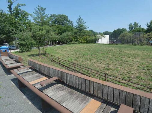


I wanted to check out Schmul Park, named for the 19th century landowner on which the park sits, entered on Wild Avenue between Pearson Street and Melvin Avenue. The park has been remade in recent years (actually 2012, but I did not pass it on my 2015 visit), and now features a brand new restroom facility and kiddie park (I holster the camera when children are about). The farming Schmul family donated the land to Parks in 1936.
I was surprised to see, though, that the Schmul name no longer appears on park signage that I couldee. That’s because it’s now the northwest arm of the vast 2200-acre Fresh Kills Park project, built on former landfill. I did not have the time to fully inspect that connection to FKP, as it’s something of a hike to get to the park section that’s open to the public, North Park Phase 1. I will likely return sooner than a decade hence to inspect that section. At 69, time is beginning to be my enemy!


On Melvin Avenue I spotted this many-gabled house, and possibly Travis’ only standalone octagonal lamppost.
I returned to Victory Boulevard, where Part 2 will begin soon.
Related: Down on the Farm in Travis
Check out the ForgottenBook. As always, “comment…as you see fit.” I earn a small payment when you click on any ad on the site.
8/7/26
4 comments
There are many relatively undeveloped areas around the South and West Shores which seem to be Staten Island’s answer to Tobacco Road. There re more than a few which appear to be trapped in 1966.
Thanks, Kevin, for documenting our Staten Island history!
I used to frequently deliver mail there during the 80’s on the 9 route out of GPO. It started at the WWI memorial and went to the very end of Victory Boulevard. That cemetery was there all that time without being commented on.
Travis used to be called “Liinoleumville” do to the factory there.