

By PATRICK O’CONNOR
Forgotten NY Contributor
I found myself in a quandary as to what to do with myself, with several hours to burn, launching off from Bushwick at 8:00 AM on a Friday. I was figuring on a long walk but couldn’t decide which direction. Ultimately, I decided to walk to Greenpoint via Morgan Avenue. My first “up close and personal” encounter with Morgan Avenue was on a bike ride from Manhattan to Montauk in 2013 in which the route took riders on Morgan Avenue from Metropolitan Avenue to Knickerbocker Avenue before turning up into Ridgewood. This part of the ride was done before sunrise, so I had absolutely no feel for what was around.
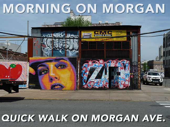
Title card image: Morgan Avenue at Thames Street
Morgan Avenue runs about a mile and three quarters, northward from its beginning at Flushing Avenue, in Bushwick, passing through East Williamsburg and ending past the BQE at Norman Avenue in Greenpoint. Morgan Avenue is named after the Morgan Brothers surveyors who were responsible for mapping and laying out streets in East Williamsburg during the 19th century.
Boar’s Head Sandwich


The block bounded by Flushing and Morgan Avenues and Bogart and Rock Streets is a large facility without clear marking of ownership or purpose. Property records indicate the address is 24 Rock Street. Original construction dates to 1920 and belonged to Boar’s Head Provision Company. Recent transaction records indicate the property was sold to Con Edison in 2013, although trucking operations continue and there is no apparent usage by Con Ed.
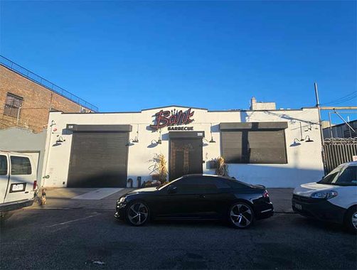
A few eateries caught my attention. Bark Barbecue is on Thames Street, just west of Morgan. “Bark” refers to refers to the crusty layer that develops on meat when slow cooked or smoked.
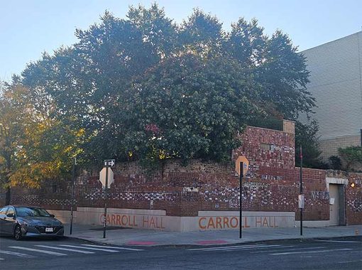
Across Morgan Avenue is an event space named Carroll Hall with a beer garden type setting and also an inside venue.
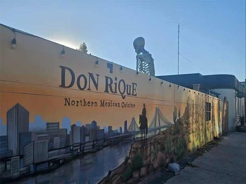
At the triangle intersection of Morgan, Knickerbocker and Johnson Avenues is a fine-looking mural advertising Don Rique’s Mexican Restaurant. A little too early to participate but will keep these places in mind.


There is certainly no shortage of concrete producers in East Williamsburg with three of them fronting Morgan Avenue. Concrete is comprised of Portland Cement, sand and gravel, with additives for specialized applications. The towers store dry materials that are mixed to client specifications. Water is usually added in the truck, which is then called a “transit mix”. Trucks have only 90 minutes to arrive at the pour site to ensure the proper consistency. If not, the truck should be rejected.
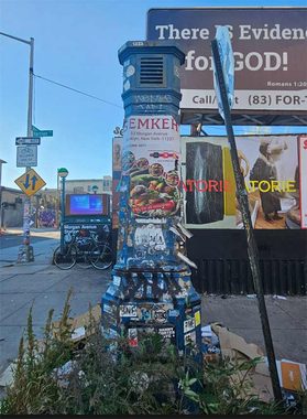
This classic subway vent pole (classified as a Badger I8VV-254a in a long-ago parodic FNY post) has seen better days. Noting that stickers have become a common method of tagging in the 2020s.
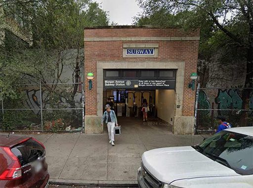
A look westward on Harrison Place shows the building entrance to Morgan Avenue Station on the Canarsie Line.
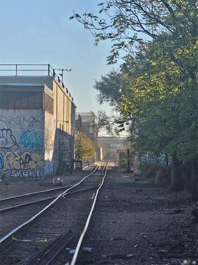
Between Johnson and Meserole Streets (not to be confused with Meserole Avenue in Greenpoint) is the Bushwick Branch, that shoots off from the Lower Montauk Branch at Andrews Avenue in Maspeth. This line forf the last century has been used solely for freight, including being used to deliver subway cars for the Canarsie Line. I was hoping to catch a peek at the Scott Avenue pedestrian bridge, but it was too far away. The property didn’t appear inviting, so I passed by without traipsing through.
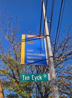
I always thought “industrial park” was a contradiction in terms but with the conversion from manufacturing to artsy and event spaces, it’s becoming more fitting.
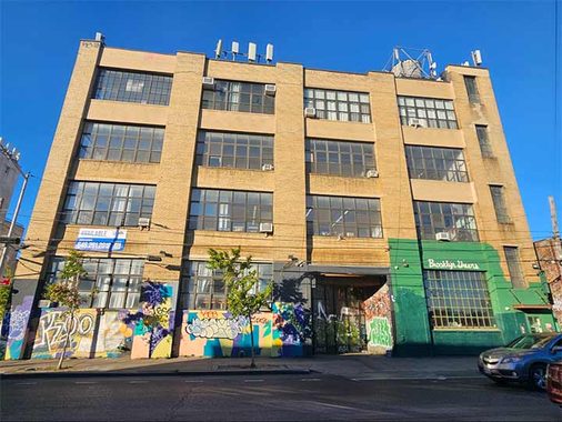
Brooklyn Greens, at 195 Morgan Avenue, serves as a virtual golf attraction but appears to be temporarily closed. The factory building dates to 1930.

This mural near Maujer Street caught my eye as the best on Morgan. About a decade ago, one of my younger co-workers got one past me by mentioning something on Maujer Street, he pronounced it “mow (rhymes with now) jer”. Kevin comes to the rescue identifying the namesake as 19th century attorney Daniel Maujer (pronounced Moy-er).
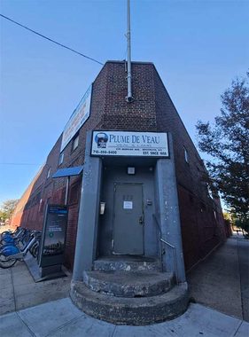
Crossing Grand Street provides a break in the heavy traffic activity. Google identifies this business at Devoe Street as Atlantic Veal and Lamb, and the door sign says “Plume De Veau. Could this be word play on the street name? De Veau on Devoe? Plume De Veau is French for feathered (or thinly sliced) veal. The street is named for a French Huguenot family who owned large plots of farmland in the area. Fredrick W. Devoe founded the Devoe and Raynolds Paint Company in the 19th century.


A brief respite from industry is provided by Cooper Park, on the west side of Morgan, north of Metropolitan Avenue. The park and the adjacent Cooper Houses are named after Peter Cooper, the industrialist who owned and operated a glue factory at the site. He was also founder of Cooper Union, the private college in Manhattan. Cooper constructed housing for his employees at the glue factory.
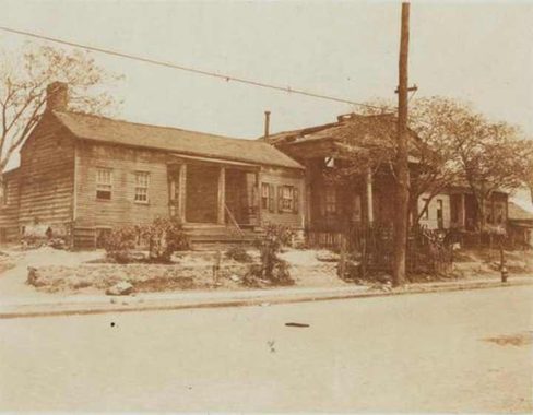
This 1922 photo from NYPL, Eugene L. Armbruster Collection shows one of the employee houses and the caption reads that the factory was located just behind the house.

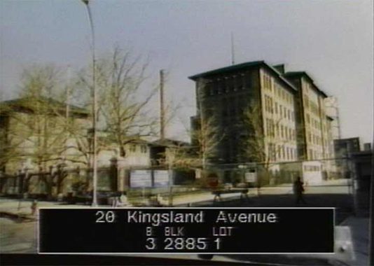
Brooklyn’s Skillman Avenue runs briefly between Vandervoort and Morgan Avenues, ends at The Cooper Houses, then picks up again at Debevoise Avenue. The Barbara Kleiman homeless shelter is located at 300 Skillman Avenue, between Debevoise and Kingsland Avenues. This building dates to 1914 and was originally Greenpoint Hospital that closed in 1982. I worked at Greenpoint Hospital briefly in the summer of 1981, boxing up materials to be moved to Wyckoff Heights Medical Center.
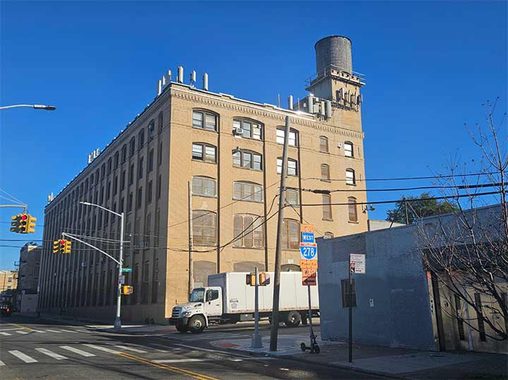
This warehouse building at 470 Morgan Avenue, at Richardson Street, previously described here, dates to 1918 and has been partially repurposed over the years to be artist studios.
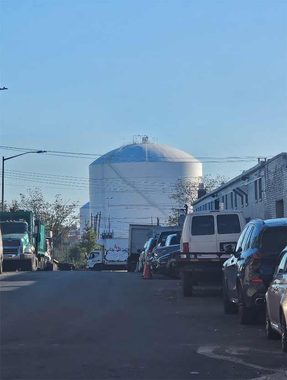
A peek down Richardson Street allows for a nice view of the new Greenpoint Liquid Natural Gas Tanks. They’re much smaller than the previous storage tanks but hold more gas due to the much higher storage pressure.
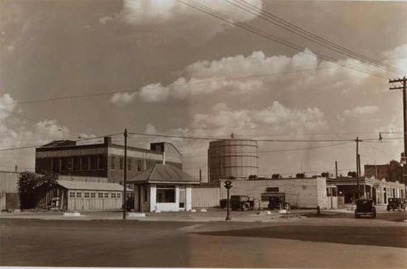
Meeker and Morgan Avenues intersect at the BQE near the foot of the Kosciuszko Bridge. This 1938 NYPL photo from that location shows one of the old Greenpoint Gas Tanks and the Brooklyn Union Gas Company. This was a year prior to construction of the original Kosciuszko Bridge. At the time, there was only one gas tank, constructed in 1927 with the second constructed in 1948.
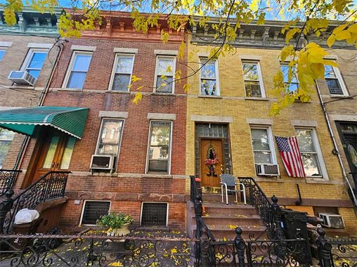
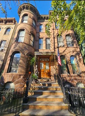
Morgan Avenue, between Driggs and Nassau Avenues, is a nice-looking residential block with varying brick colorations. Houses on Morgan Avenue were constructed in 1901 as three family row houses. A couple of houses have bay windows rather than flat fronts making for standouts in mid-block.
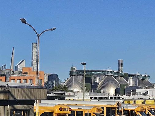
Morgan Avenue ends with a tee intersection at Norman Avenue. It isn’t as nice as reaching Shangri-La, but today’s exploration ended with a unique view of the Newtown Creek Sludge Digesters. We know what you call them…
I had originally planned to walk to Queens from there but unfortunately, I began to feel under the weather. So, I made a beeline for the G-line at Manhattan Avenue and went home to rest!
Patrick O’Connor is a lifelong resident of Queens, retired with 40 years of service for City of New York Department of Environmental Protection and is a licensed sightseeing guide in New York City.
Check out the ForgottenBook (HarperCollins, 2006), as well as Forgotten Queens (Arcadia, 2013). I also have a chapter in the anthology “New York Calling: From Blackout to Bloomberg” (Reaktion, 2007). As always, “comment…as you see fit.” I earn a small payment when you click on any ad on the site, which helps in site upkeep and also aids Greater Astoria Historical Society.
11/1/26
3 comments
This always irks me. “East Williamsburg” is a bogus, contrived neighborhood created by real estate brokers in order to maximize rentals in the area. This is actually Bushwick. The historical East Williamsburgh, with an “h”, was an area located primarily on the Queens side of the border, bleeding right into the industrial and agricultural zones of Maspeth, Middle Village, and Glendale. As a matter of fact, the Morgan Ave.–Jefferson St. L train station is historically and culturally Bushwick, even if Google Maps and brokers label it “East Williamsburg”. Ask any lifelong local and ignore what interloping, parentally subsidized flyover state playcationers say or think since they know absolutely nothing about the historical background of the neighborhoods they infest. Go check NYC Fire Insurance, Topographic and Property Maps a thttps://www.nypl.org/collections/nypl-recommendations/guides/fire-topo-property-maps to corroborate what I’ve posted. The name changing tactic is similar to what they did when real estate interests and gentrifiers created Carroll Gardens in the 1960s because they didn’t want to be associated with Red Hook/South Brooklyn and its then-bad reputation as a crime-ridden area..
Hagstrom had it when they still used their hand drawn map. Good enough for me.
Prior to the invention of ready-mix trucks around 1920 concrete was practical only for larger construction projects such as schools and office buildings because it was necessary to build production facilities right at the job sites. It was almost never used for residences, which is why if you see an older house with a concrete foundation it was built after about 1920.