There’s a New England undercurrent running through the Bronx. The New York Yankees’ rivalry with the Boston Red Sox began when the Sox’ owner Harry Frazee sold his pitching and slugging star, Babe Ruth, to the Yankees before the 1920 season, and the subsequent championship tally, 27 to 2 in favor of the Yanks, has ratcheted the antagonism toward insanity at times, especially when both teams contend, as has been the case, as of 2012, for over a decade.
But there are other places and landmarks in the Bronx that point toward New England, such as the New England Thruway, the name that Interstate 95 takes between the confluence of the Bruckner Expressway and Hutchinson River Parkway and the Connecticut state line (as named, the New England Thruway actually never touches a New England state; as a New York Jets fan, why does there have to be a road in New York City called “New England”?).
One of the Bronx’ longest roads is Boston Road, which arises at Third Avenue in Morrisania and roars northeast to the city line in Eastchester, with a break for the Bronx Zoo. In northeast Bronx it assumes the mantle of United States Route 1, which runs from Key West, Florida to northern Maine, and if you follow US 1, which is called the Boston Post Road for part of its route, you will indeed catch sight of the Prudential Center and The Hancock Tower after several hours’ driving, though I-95 is much faster.
[see Eric Jaffe’s excellent The King’s Best Highway for the complete Boston Post Road story.]
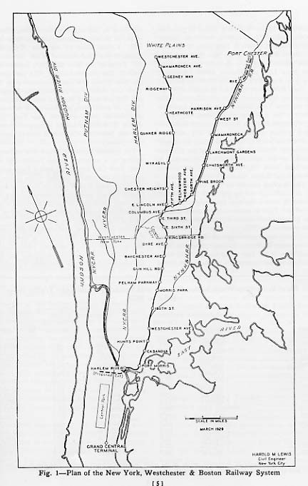
That brings us to the former New York, Westchester & Boston Railway, which is celebrating its centennial in 2012. When conceived, it was assumed that it would eventually reach Boston, but instead at its lengthiest, it ran from southern Mott Haven in the Bronx to two terminals in Westchester County, at White Plains and at Port Chester. Originally conceived in 1872, it was delayed for a few decades by the Panic of 1873, essentially a depression. Once emerging from receivership in the early 1900s, the railroad began construction in 1906 and built north, with the northernmost stations at Rye and Port Chester opening in 1928 and 1929. When most stations opened in 1912, the NYW&B was considered state of the art for its time, taking power from overhead lines, no grade crossings, high platforms to enable comfortable boarding, and spacious, architecturally attractive ticket offices/station houses.
Despite its advantages, the NYW&B was not a success. When it opened, the automobile industry was beginning to take off — by the 1920s, scenic parkways had appeared to handle intracity auto traffic, and the NYW&B could not reallly compete as a commuter railroad because it ended its run in Mott Haven and riders had to detrain and switch to the Third Avenue El to get to Manhattan. It soldiered on for a decade, but finally declared bankruptcy in 1937, ending service.
But all was not lost. The City of New York saw a golden opportunity to expand service into Pelham Gardens and Eastchester, and purchased the NYW&B right of way, stations, and tracks. After making modifications like adding a third rail, the NYW&B became the Dyre Avenue Shuttle in 1940, and after new tracks were installed to connect it with the White Plains Road el in the 1950s, the full-fledged Dyre Avenue Line, today the home of the #5 train.
In early April 2012 I walked the route, or the closest possible approximation along the tracks, from the Bronx Park East station all the way northeast to Dyre Avenue. It gave me a chance to traverse the Pelham Gardens and Eastchester sections of the Bronx, which I’m in just a few times per year, and to approach both the subway route and the neighborhoods it travels through with a fresh perspective.
TOUR ROUTE
East 180th Street
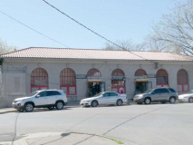
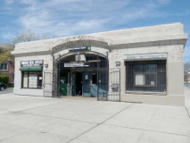
I didn’t start at the East 180th Street station at Morris Park Avenue, but I can’t help but cite the station house, which is the largest in the New York City subway system. It was recently renovated and painted, and houses the station entrance turnstiles as well as some offices. It was formerly a police precinct house.
The elevated platforms of the old NYW&B are still standing here. Until a track connection was made in the 1950s, a paper transfer was used to cross from the White Plains Line to these tracks.
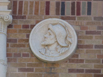
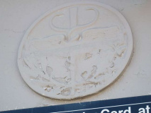
The station house bears the image of the NYW&B’s standard-bearer, the Roman messenger god Mercury, with his winged cap and symbol of a staff entwined with two snakes (for more of these examples, see below).
The New York, Westchester & Boston at its furthest extent in the 1930s, from Mott Haven in the south Bronx to mid-Westchester County with branches to White Plains and Port Chester. South of the 180th Street station, the NYW&B shared track with the old New York, New Haven and Hartford Railroad, of which there are still several stations surviving, in incredibly deteriorated states.
By 1940, all that remained of active service on the NYW&B was the shuttle line that ran from 180th Street to Dyre Avenue. I set out to walk this branch in April 2012.
Bronx Park East
As you might expect Bronx Park East is the road bordering the east side of Bronx Park, but it has some quirks that make it interesting. For example, for one block between Birchall Avenue and Unionport Road it does not border Bronx Park at all. It also has something of a personality problem, because just south of Pelham Parkway it becomes Boston Road, only to resume its identity north of the Parkway. Whereupon it loses it again at Burke Avenue, where it become Bronx Boulevard.
I got off the #2 train at Bronx Park East to embark on my NYW&B adventure.
In this view from the platform, the elevated NYW&B curves off to the northeast.
The Bronx Park East station, on the White Plains el, currently hosts the #2 train, which also runs through Crotona Park, Longwood, East Harlem, the Upper West Side, and runs all the way south to “The Junction” at Flatbush and Nostrand. So, it can be said it runs to both The Hub and The Junction.
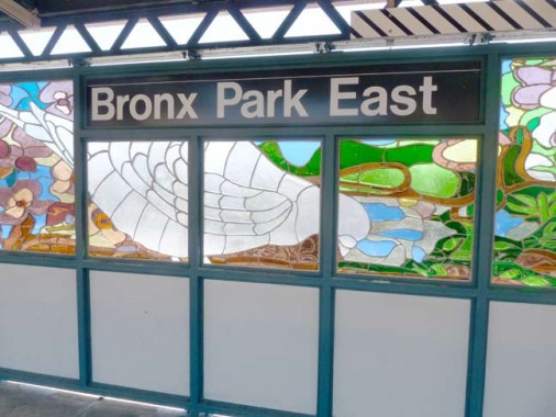
Bronx Park East opened in 1917 and received an overhaul in 2006, when colored glass artwork, Candida Alvarez’ “B is For Birds in the Bronx” was installed along with new windscreens.
Every time I’m on a FNY mission, I learn something new. Having never gotten off at Bronx Park East before, I was unaware that the el runs over Birchall Avenue (for about 3 blocks). I thought I knew all the streets in NYC that were shadowed by els. I was also unaware that Bronx Park East got the full concrete cladding with terra cotta accents that the els seems to reserve for the more important stations.
I was also pleased to see a pair of now-rare Dwarf double-mast light poles guarding the corners.
I doubt all but the most seasoned Boogiedown Bronxites could tell you where the corner of Birchall and Sagamore is.
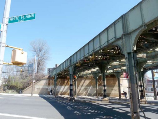
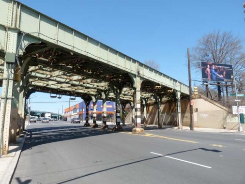
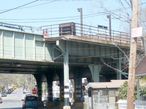
White Plains Road spends half its length underneath an el, as it assumes the #2 train from Birchall Avenue just north of Bronx Park East. You can see it in the distance in the second photo. Before its shadowing, White Plains Road gets a foretaste of life in the shadows as the NYW&B tracks are bridged over it at Sagamore Street.
White Plains Road was laid out in 1863. While the name of the road ends at the Bronx-Mount Vernon line, it leads to a route that will get you to the northern Westchester County city of about 56,000.
On July 9, 1776, a copy of the Declaration of Independence was delivered to the New York Provincial Congress, which was meeting in the county courthouse. The delegates quickly adopted a resolution approving the Declaration, thus declaring both the colony’s independence and the formation of the State of New York. The Declaration itself was first publicly read from the steps of the courthouse on July 11. wikipedia
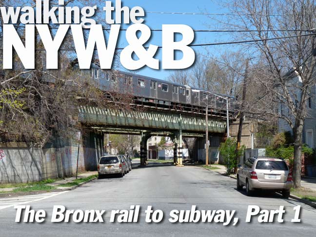
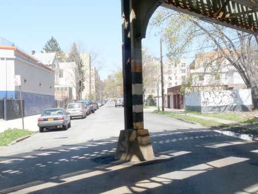
A #5 train runs the Dyre Avenue Line, the successor of the NYW&B, as it is bridged over Cruger Avenue. However, there is something interesting about this particular railroad bridge.
Like the eastern end of the M train, the Brooklyn Broadway-Myrtle Avenue line, the Dyre Avenue Line has its own right-of-way that did not run over a particular street or avenue, although, as we’ll see, parallel avenues and streets were later constructed along its length.
I am still a little remiss about when the northern Bronx street layout was conceived or built. In some cases such as the 1811 Commissioners’ Plan for Manhattan Island, the grid is fairly well-documented, but in other parts of town, not so much. You’re left to wonder if, between 1906 and 1912, when the NYW&B was constructed, did Cruger Avenue exist then, and if so, why place pillars in the center of the street? Unsuspecting neighborhood visitors have probably had a crackup or two on these things.
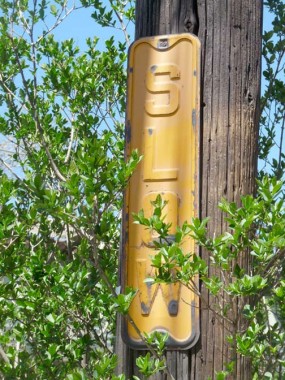
A number of old relics can be spotted on Cruger between Sagamore Street and Bronxdale Avenue, including this metal “SLOW” sign.
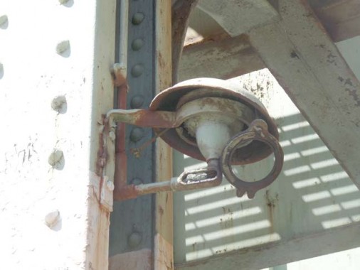
The pillars on the NYW&B don’t have the typical flashing warning lights that el pillars usually have in heavily trafficked areas. These structures I found on the pillar may have once been warning lamps, but they haven’t worked in years.
Cruger Avenue between Sagamore Street and Bronxdale Avenue is also known as Regis Philbin Avenue after the TV personality (1931- ) who was born at 1990 Cruger. When I did a page about the avenue in 2000, there were a couple of blue and white “Regis Philbin Avenue” signs on the poles, but these seem to be desired by memento seeks and are no longer there. A newer sign hangs at Cruger and Bronxdale, rather high on the post (above photo).
Though 1990 Cruger was razed in 2010, an adjoining house pretty much resembles it (below).
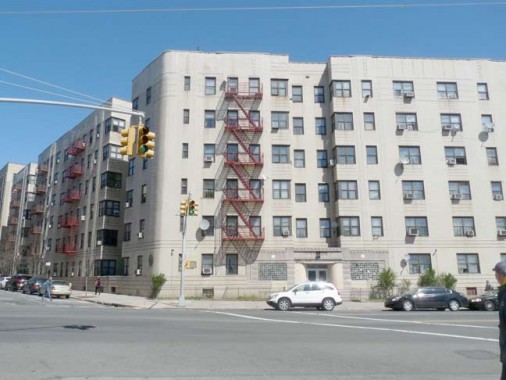
 The Bronx is the Borough of Apartment Buildings, and the neighborhood of Bronxdale near the NYW&B route boasts several great examples such as this one at the corner of Cruger and Bronxdale.
In the colonial era, Bear Swamp was situated between what is now Wallace, Fowler, Bronxdale and Lydig Avenues; Bronxdale Avenue carried the name Bear Swamp Road until the early 1900s. I wish the more colorful name had been kept around, so I made a faux blue and white Bronx street sign with it.
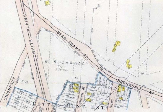
1905 Bromley map showing Bear Swamp Road (Bronxdale Avenue) near White Plains Road. The pair of dotted lines on the right mark the proposed route of the New York, Westchester and Boston RR, today’s Dyre Avenue Line.
The full map, which is fascinating, showing the wide open spaces in the northern Bronx of a century ago.
One of the Bronx River’s vanished freshwater wetlands was the Bear Swamp. Draining into the Bronx River about where the Bronx Zoo’s Boston Road entrance is today, it covered over 180 acres east of White Plains Road in the present-day Bronxdale and Van Nest neighborhoods. Bronxdale Avenue follows the line of the old Bear Swamp Road that ran through this marshy area. There may have been a Native American settlement there at one time: in the early 1800s a basin for grinding corn was found cut into a rock outcrop…The original Siwanoy name for the place appears to have been forgotten, but the early colonists called it “Bear Swamp” for good reason. The swamp was a productive hunting ground, and among the animals hunted there were Black Bears, whom the Siwanoy trapped by driving them between converging wooden palisades. Bronx River Alliance
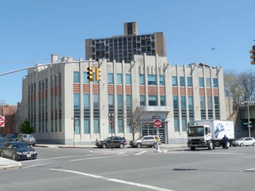
2016 Bronxdale Avenue at Antin Place is a 1928 building from the height of Deco, now home to the Bronx Park Medical Pavilion, but the former home of the Bronxdale Swimming Pool. It’s also the approximate geographical centerpoint of The Bronx.
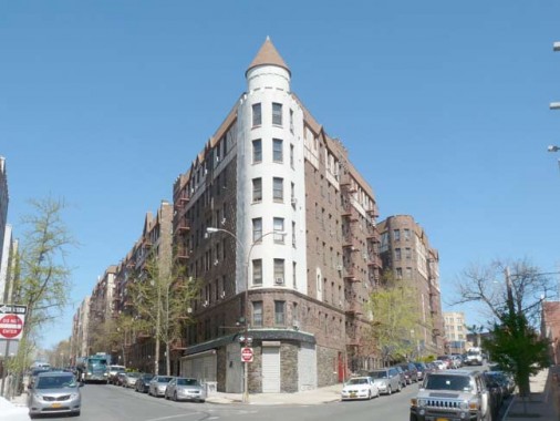
Whenever I’m in the area I can’t help shooting this impressive turreted apartment building on a triangle-shaped plot at Antin Place and Holland Avenue.
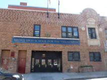
The Bronx High School of Visual Arts is located in a former campus building of Mercy College, which is located in Dobbs Ferry but has campuses in The Bronx (now in Morris Park), Manhattan, White Plains and Yorktown.
Founded in 2002, the Bronx High School for Visual Arts offers a rich arts curriculum. Some students have internships at organizations such the Bronx Museum and the Whitney Museum of American Art. The school, which shares a building with a District 75 school for severely disabled students, has a new library and a new computer lab. Inside Schools
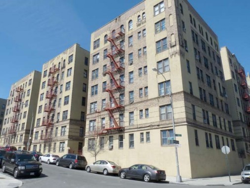
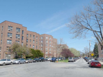
Another massive apartment block, this one at Brady and Barnes Avenues.
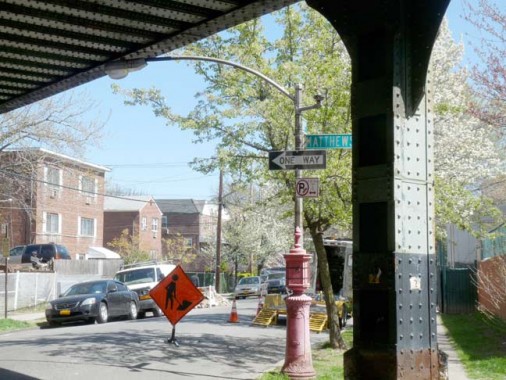
The NYW&B is bridged over the intersection of Brady and Matthews Avenues. The SE corner boasts an early 1950s-vintage Curved Mast lamp, which were phased out when the cobra necks started appearing about 1960s, though there are several around town. A shorter pole and a curved mast enable these lamps to light areas that more conventional masts can’t.
Mercury and the Caduceus
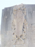
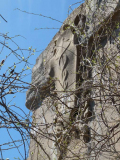
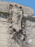
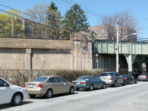
As stated before, the emblem of the New York, Westchester and Boston RR was the Roman god Mercury and his caduceus, or rod with two entwined snakes. North of 180th Street and south of Pelham Parkway, the NYW&B is generous in allowing traffic to pass, located on a concrete embankment with iron bridges over the cross streets. At most of these intersections you can find 4 caducei in concrete. North of Esplanade, though (see below) the NYW&B travels in an open cut, forcing a number of detours.
NYW&B concrete embankment, Brady and Matthews Avenues
NYW&B railroad bridge over Muliner Avenue. The caduceus is on the embankment on the left.
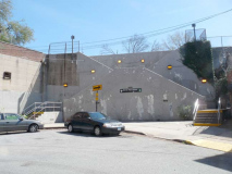
The back end of the Morris Park station can be seen at Bogart and Colden Avenues. Tantalizingly, the station cannot be accessed from here: there is a very high hill and the station is actually on two levels, the end of an elevated section and the start of a tunnel.
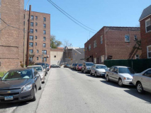
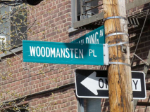
Access to the Morris Park station from the south is via a short road called Woodmansten Place and a walk up a staircase at Paulding Avenue to Esplanade, where Paulding Avenue resumes at the top of the stairs at the station.
“Woodmansten Place” is almost as long as the very short street, which is named for a colonial-era estate owned by Denton Piersall, who also has a neighborhood avenue named for him.
Morris Park
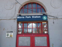
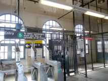
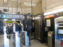
The Morris Park station, at which the Dyre Avenue Line/NYW&B enters a tunnel that runs for about 10 blocks, is the lone remaining Spanish Mission style station that’s still open; other stations to the south in the style at Westchester Avenue and Hunts Point are in ruins. Though NYW&B stations have been described as spacious, the addition of the high turnstiles has made them a bit more cozy or cramped. In the Bronx, Morris Park is the northernmost station still bearing traces of the old caduceus symbol.
Before the Metrocard, fare collection on the Dyre Avenue line was unusual after working hours. At night, clerks working at the booths (who’d now start closing them) would use an allen wrench to close the tops of the turnstiles and tie the slam gates open. Customers who’d come into the station would be directed to enter through the slam gate, walk up to the platform and pay on the train. When the East 180th Street-bound shuttle train would arrive at the station, only one door on the train would open up. The customer entering the train would drop their exact fare into a Johnson Fare Box (the kind used on buses).
Esplanade
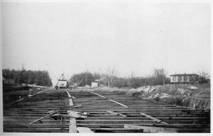
Because of a change in grade, the NYW&B was constructed in a tunnel beneath Paulding and Mace Avenues, which also meant the railroad didn’t interfere with Bronx and Pelham Parkway traffic. A new roadway called the Westchester Esplanade was laid out to cover the paved-over tunnel. That was a mouthful, so it was relatively quickly changed to simply Esplanade.
These two photos, from Robert A. Bang’s The New York, Westchester and Boston Railway Companybook, show the construction of the tunnel now covered by Esplanade in the first decade of the 20th Century. Courtesy Robert A. Bang Collection, John Tolley Archive
Esplanade is now a pleasant neighborhood avenue with an attractive center median. Since there are no sidewalk vents there is no hint at all that a subway is running underneath.
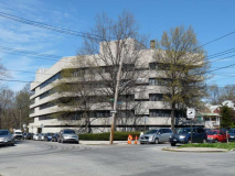
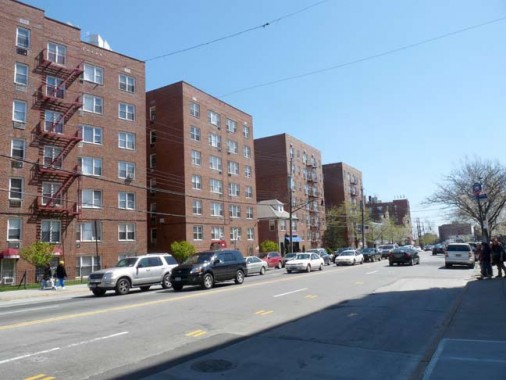
There is a modern building at Lurting Avenue that looks as if it’s filled with offices, but it’s actually the Morningside House nursing home.
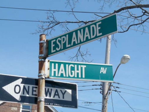
For some, the name “Haight” brings to mind the Haight-Ashbury neighborhood in San Francisco, the supposed epicenter of the counterculture in 1967. There are actually two streets in NYC called Haight, one in western Flushing and this one, named for 19th Century landowner Stephen Haight.
One of the Bronx’ busiest intersections is where the Bronx and Pelham Parkway and Williamsbridge Road come together. The NYW&B runs in a tunnel underneath this intersection.
I think it’s a mistake, but the Department of Transportation actually stumbled into the original correct spelling of “Williams Bridge” road here. The road begins as a trickle at Cruger and Adee Avenues in Bronxdale but then picks up steam at Boston Road and roars southeast to Tremont Avenue at Westchester Square. It is named for John Williams’ colonial-era bridge over the Bronx river at Gun Hill Road.
The section of Williamsbridge Road at Pelham Parkway was subnamed for Judge Benjamin F. Nolan in 1996:
Benjamin Francis Nolan (1917-1996) was born in Manhattan on June 22, 1917, the son of Irish immigrants. Raised in Yorkville and a graduate of Regis High School, Judge Nolan attended law school at night and was awarded the Law Review Gold Key in 1950 by St. John’s Law School.
He served with honor during World War II, and was awarded the Army Commendation Medal. After the war Judge Nolan served as commander of the Van Nest Post of the American Legion. He was also founder and president of the Van Nest Little League and president of the Van Nest Civic Association.
Judge Nolan was appointed to the Civil Court by Mayor John Lindsay in December, 1971 and was elected to a full 10-year term in 1972. He was re-elected in 1982, but due to an age restriction was forced to retire in December 1987 at the age of 70. Judge Nolan continued in public service after being appointed a member of the City Council Redistricting Commission. He later served as a Judicial Hearing Officer until his death on April 18, 1996, at the age of 78. NYC.gov
Along Williamsbridge Road and Morris Park Avenue the Department of Transportation has fashioned unusual telephone pole lamps, featuring double masted, bracketed poles with Mission Bell luminaires.
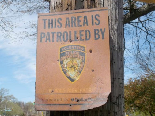
There are a number of ancient yet surviving signs at this intersection, like this neighborhood patrol reminder. I wonder if there is still a Morris Park Patrol.
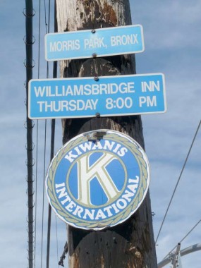
Kiwanis Club signs (not installed by the DOT) appear with some frequency around town. Kiwanis is a volunteer service club established in 1915 and headquartered in Indianapolis, IN. Its name is derived from an Otchipew Indian expression roughly meaning “we share our talents” or “we build.”
I’m not sure the Williamsbridge Inn is still around.
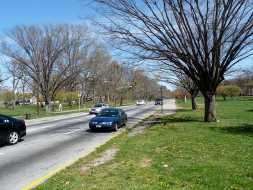
The Bronx and Pelham Parkway runs from Bronx Park, where it becomes East Fordham Road, to the Bruckner Expressway, where it becomes Shore Road in Pelham Bay Park and connects to the Hutchinson River Parkway.
The Bronx and Pelham Parkway (its official name) was constructed in the early 20th Century in the tradition of “garden trafficways” like Ocean Parkway and Eastern Parkway in Brooklyn, between Bronx and Pelham Bay Parks and bears close resemblance to Mosholu Parkway, i.e. a four-lane main road with access roadways flanking it. Unlike Mosholu, though, Pelham Parkway originally ran through open country; parcels for it were obtained from local landowners.
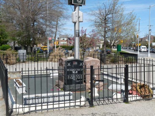
Rudy Macina Peace Memorial Plaza
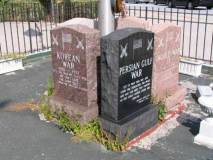
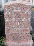
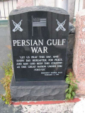
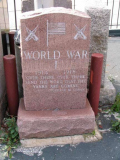
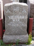
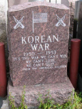
The unusual Peace Memorial Plaza/Rudy Macina Square gathers 5 memorials resembling tombstones, memorializing war dead in the Gulf War, Vietnam War, Korean War and World Wars I and II.
A Bronx native from Morris Park, [Rudy] Macina earned the Distinguished Flying Cross and the Air Medal during [World War II]. He returned to Morris Park and gave the neighborhood an aura of espirit de corps.
“I was a sergeant on [Inspector-Instructor] duty in 1976,” said [Morris Park Columbus Day Parade Executive Director Dexter Hendon], who served in the Corps for eight years. “Rudy got a retired Colonel to come in and paint a mural on the side of his building.” Hendon said Macina paid for the painting with his own money. “He just loved the Marine Corps that much.”
The mural that the colonel painted almost 30 years ago depicted the raising of the American flag on Mt. Suribachi, Iwo Jima in 1945. The building and the painting are both still intact on Williamsbridge Road, across the street from the parade’s reviewing stand.
Macina died at the age of 70 in 1993. The intersection of Williamsburg Road and Esplanade, which is a couple blocks down the same road as Macina’s decorated building, was renamed “Rudy Macina Peace Memorial Plaza” in 1999. Today, fellow former Marine Hendon continues to run the Columbus Day parade with similar Marine Corps motivation. Hendon’s sons have also continued the Marine Corps tradition as well. His son Joseph served four years, and his younger son Andrew is scheduled to graduate from recruit training at Marine Corps Recruit Depot Parris Island, S.C., in December. US Marine Corps Reserve
Pelham Parkway Station
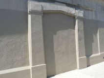
Beginning with the Pelham Parkway station at Alfred E. Santangelo Plaza, former NYW&B stations are more low-key and no-frills, with simple concrete buildings. There’s evidence of a former side entrance here, long since paved over. Santangelo was a U.S. Representative in Congress from 1957-1963.
Esplanade holds on to its center mall at the subway stop, but at Astor Avenue, it becomes just another avenue for two blocks. William Astor, a distant relative of fur magnate John Jacob, owned property before the city acquired it and laid out streets.
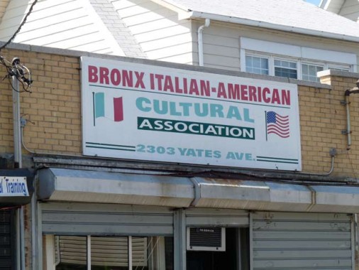
Morris Park, like the Arthur Avenue section of Norwood to the west, has long been an Italian-American Bronx stronghold. Officially, here we’re in Pelham Gardens, but close enough.
“Another Little Italy, With Scant Parking to Match” [NY Times]
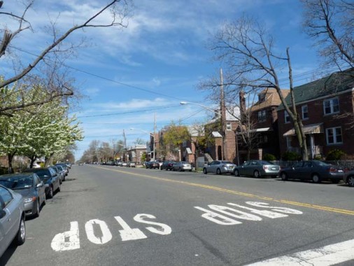
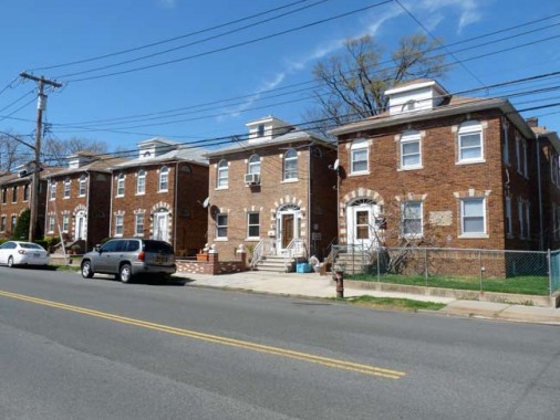
When you see near-identical houses close together like this, they were usually part of a long-ago real estate development, private more often than not. Today anyone can buy one.
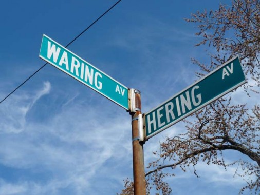
I had previously completely overlooked the rhyming corner of Waring and Hering. The latter is named for an early landowner with a notable name: Hercules Hering.
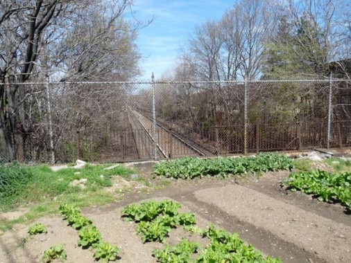
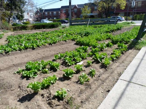
The NYW&B tunnel ends at Mace Avenue, and so does Esplanade. I had hoped to get a closer photo of the open cut the line emerges into, but I didn’t want to damage the lettuce, or whatever crop is growing here.
At Allerton Avenue, one of the major east-west streets in Pelham Gardens along with Gun Hill Road, the NYW&B enters a valley again and is bridged over. Although everything else has changed these railroad bridges look nearly exactly the same as they did in 1906, when they were built.
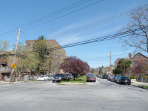
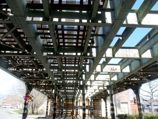
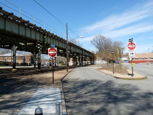
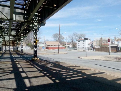
North of Allerton, Stedman and DeWitt Places parallel the NYW&B against the street grid. DeWitt Place, shown here, has to dodge around the el pillars in order to intersect with Wilson Avenue.
Part 2: the NYW&B from Gun Hill Road to Dyre Avenue
4/17/12


















48 comments
Hello there, I live near this subway line and I have a suggestion. Inside Pelham Parkway station on the Esplanade, if you walk into the entrance and look up, you will see 2 light bulbs that still work (to an extent). These light bulbs indicate approaching trains, they’re on a black box near the ceiling. One side says “To City” and another side says “From City”. I believe you should check it out, I can’t tell if the lights are stuck on, or if they indicate an approaching train on either side. I should take a look as well. This is an ideal addition for this page (you can actually see it from one of your photos of that very station)!
Me and my girlfriend are huge supporters of this site, keep up the good work!
I will be mentioning them in Part 2….
I took a picture of that a few years ago. Look under SUBWAYS & TRAINS and look for GETTING IN AND ON. It was posted in 2009.
Very nice. it was a shame when they demo’d the structure from 180th St south to the Amtrak, Freight lines. The old signal houses at Westchester Ave and down below 149th are still there.
Are you going to venture into Westchester? There is alot still sitting in the weeds, including the Station in Scarsdale that is a private house. I have been in it, very cool.
Thanks for your story
Bryan
Thanks for a very illuminating feature. I was a Bronx resident from my birth in 1949 until my marriage in 1972. Despite this I’m unfamiliar with most of the territory you covered. This is because my family lived in Parkchester, which was such a self contained community that there was little incentive to explore the surrounding neighborhoods, which it seems are quite interesting & desirable. I now live 2500 miles disatant in the graet state of Arizona, so if it weren’t for FNY I’d remain forever ignorant of my birthplace. Go Yankees!
Is them bullet holes in that yellow”This area patrolled by….” sign,or are
you just glad to see me?
Volunteer NYPD officers still patrol that area, they were reorganized as the NYPD Auxiliary Police and still active patrolling neighborhoods to this day
And….
Do you think this city has enough names for just one street?
Its getting ridiculous.
Theres actually an on-ramp to the brooklyn bridge named after someone.What an honor.
Pretty soon theyre going to start naming sidewalks,fire hydrants,restrooms,parking spaces….
I still live in Morris Park and I just wanted to answer both of the quetions you had in the article:
1. Yes, there is a Morris Park Patrol team and you can actually see them driving around the neighborhood in a Morris Park Patrol car. I couldn’t tell you exactly what their responsibilities are however.
2. The Williamsbridge Inn has been closed for about 20 years and from what I’ve heard used to serve a great burger.
from their website:
Auxiliary Police provide extra “eyes and ears” for the Police Department by performing uniformed foot, vehicle and bicycle patrols. They are trained to observe and report conditions requiring the services of the regular police. Whenever possible, they assist in non-enforcement and non-hazardous duties. The following are some areas in which the Auxiliary Police assist the Police Department:
Residential and commercial areas
Community festivals, parades, concerts, street fairs, park patrols
Subway entrances and token booth areas
Perimeter of Houses of Worship
Crime prevention activities
Traffic control
The Williamsbridge Inn was at the NW corner of Williamsbridge Road and Poplar Street.
I think it was a restaurant called King Cole when I was a kid in the ’70’s.
I had my wedding reception there in 1970
Hooray! FNY has proven this ancient geezer’s contention that the Third Avenue El once traveled north of Gun Hill Road — and that one can still ride some of the beloved El’s tracks! Check out the second (1940) map at the top of this page. The El joined the White Plains Road IRT line at Gun Hill, and continued north to East 241st Street in those days — at least until 1948 or a little later, when Gun Hill Road became its Bronx terminus. So, take a ride on the # 2, and pretend the El still lives!
The Third Avenue El came to a dead end at Gun Hill Road. That was its terminal at a level below the White Plains subway line. Passengers had to exit and transfer to the completely right of way for trains going to 241st street.
Check the official 1948 [Subway] System Map at: http://www.nycsubway.org/wiki/Historical_Maps
I used to ride the El from 241st Street to Fordham Road until my Junior Year in High Scchool, when its service was cut back to Gun Hill Road. Thereafter, in 1949 or 1950, one had to change from the # 2 Line to the El at Gun Hill.
Too bad they had to demolish the childhood home of Regis Philbin. I am surprised that it wasn’t land marked. I guess him living there wasn’t enough to save it. Now, it seems wrong to name it after him after him after it being gone.
Way cool Kevin. When I come back to the city I stay with a friend off Gun Hill. Can’t wait to see what gems you find in part two. Depending on when I lived in the city I was a 7 train kind of guy or an A train guy or currently a Dyre Ave. (5 train) guy.
That was one of those subway lines I only took twice, so I didn’t get to see all those neat carvings. It’s really a shame that the rest of it is in ruins (I had heard of its history).
And htat was a Led Zep cut I’d never heard!
excellent
I do remember seeing over on nycsubway.org photos of the former rail line that were being taken down over between 177th and 180th Streets in 2003, though I am guessing that the viaduct is long gone by now especially seeing how long ago that was taken.
http://world.nycsubway.org/us/nywb/remains-e180.html
Nice. By the way, is Regis Philbin Avenue a real avenue name?
The addresses are on Cruger Avenue …
In 1872 it was reasonable to think that terminating a Boston-to-New York railroad line in Mott Haven made sense. The frontier of New York City had relentlessly moved north since the early days of the Dutch settlers, and the investors in the NYW&B expected that the southern Bronx would eventually be the new “midtown”. One of the things they never anticipated was the creation of zoning, which would alter what had an been an unfettered march uptown for real estate developers and builders. While the Bronx did not remain farmland it also never attained the lofty goals those investors needed to make the NYW&B a success.
the train that ran from Dyre Ave to 180th St. was for many years called the dinky. it had only 2 cars if you travel north on Dyre ave. you will very shortly wind up in Mt. Vernon at the traffic light on the border make a right and 1/2 way down the hill you will see a cemented over station entrance that when it was operational would take you to Boston. the station at Dyre Ave had a luncheonette called Artie and Joe’s where many a coffee and roll were bought for the trip to Manhattan. The station at Baychester Ave, had a candy store on the 1st floor. Pelham Parkway was a station sitting surrounded by nothing but a beautiful lawn. Gunhill and Morris Park had their stores right next to the stations entrances. a bit of trivia: in A Bronx Tale the place where the neighborhoods changed was the !80th St. Station. the movie though shot in Queens was about Morris Park Ave. they even had the #12 bus which would take you from Pelham/Split Rock public golf course and Orchard Beach to Fordham Rd and the Concourse. we used to caddy early in the morning $6 for a double bag +tip or no tip. get off at Pelham Parkway, take the train to 149th St. and then take the Jerome Ave train to Yankee Stadium. we’d sit in the bleachers for .50cents , a quarter on Tuesday and see the Greatest Yankee’s teams from the late 50s to early 60s. with the flag pole and monuments just in front of the warning track in dead centerfield. if a ball got behind the monuments it was an inside the perk homer for sure as the ball would bounce around like a pin ball. a little towards left center the sign read 465″ and i saw “moose” skowron hit not one but 2 homers over that sign. boy, those were the days when the Bronx was the best place in the world to grow up. there were more vacant lots than there were houses back then near Seton Ave.& 233rd St. i’ve lived in Connecticut for 40 years and still say TWO DIRTY DIRD STREET
Re: “We used to caddy early in the morning $6 for a double bag +tip or no tip…”
Did you get to choose?
When I used to caddy (not there), and had no idea what I was doing, I used to get stuck with the duffers and I’d be out for twice as long as the caddies with the faster (better) players. Usually my tips were smaller, as well, so the net effect was the tip hardly mattered.
sometimes we declined a foursome because we had a few steadys. one group of 4 barbers would take us every Monday tip great, buy anything you wanted at the snack bar in the middle of nowhere. good guys they bet on every hole. then we had a older husband and wife that booked us every Saturday they were terrible golfers sometimes not only missing the ball but hitting it onthe backswing and knocking it backwards 20 yards or so. it was a 1 round day with them but lokking back they were a nice old couple
Nice story Mike. Those Yankee teams are the ones I grew up with. My accent primarily went west but it doesn’t take long for it to come back.
Hi Mike, I lived on Secor Ave—–one block up Dyer—and I went to P.S 68 from 1946 to 1954 and spent lots of time at Artie’s and Joe’s and walked the tracks from Dyer to 180th Street many a summer night.
Nice, that’s my neighborhood. I live in the building you captioned as “Another massive apartment block, this one at Brady and Barnes Avenues”, although the address is actually on Wallace Ave. (one block west of Barnes). The “modern building at Lurting Avenue” you show is actually not “an unusual apartment house” but rather a nursing home, known as Morningside House.
Are you sure that paper transfers were involved when the Dyre Ave. shuttle ran at the old NYW&B platforms? I would have assumed that the turnstiles were simply a bit closer to the building entrance at Morris Park Ave., so that the stairs to the old platforms were within fare control. But I guess I don’t really know for sure.
Speaking of stations and stuff of the NYW&B south of 180th Street that are in a deteriorated state, there is a rusty, deteriorated elevated structure south of that station. The right of way still continues to south of 177th Street, but the structure itself ends at Lebanon Place. The grassy ROW continues south of there, going between rows of houses built in the 1910s or 1920s, but there are no tracks.
I noticed that under the Kiwanis Club sign, there is a date and time. Why is that? I wonder, is it supposed to be every Thursday at Williamsbridge Inn at 8 PM? Or is it just a temporary sign that someone forgot to take down?
By the way, this is a good site, Kevin. I’ve been reading this site and your writings since I was able to.
Speaking of the New England current running through. I recently read that Westchester (of which the Bronx was a part) was named because it was the western most British acquisition for their New England and Suffolk County as the southern most.
>The NYW&B is bridged over the intersection of Brady and Matthews Avenues
Was that area built up during the Civil War? Are there period photographs of the area?
(yuk, yuk)
Was browsing through the internet to see if there were any updated articles regarding my father, Rudy Macina. I really liked your piece on Dad and the Peace Memorial that was dedicated to his name. He certainly was a character and has been dearly missed. I live in Honolulu and both he and my Mom who passed on in December of 2006′ are interned at Punchbowl National Cemetary of the Pacific. I will be bringing orchids to put in the vase at their gravesite this Memorial Day. Mahalo & Aloha, Carolyn A. Macina
a masterpiece; , I could not do better; regards; Nicholas Di Brino; Author;historian: The History of the Morris Park Racecourse, and the Morris Family ;NOTE; A few errors, but this will always occure;, no matter who may be the author, creator of any such works;But I must add: a work of art and a great tour , if you will: Thank you sir: July 5 2012 – Nick a earley resident of morris park starting from the year of 1944.
The reason why the Bronx Park East station got the grand architectural treatment (and why the two-block Sagamore Avenue beneath it is so wide) is that at the time of construction in 1916 there was planned to be a major entrance to Bronx Park at the end of Sagamore. This never came about, and the extension of the Bronx River Parkway through the park in 1952 killed off the idea for good. The Bronx River Alliance’s monthly Bronx River Rambles occasionally does a walking tour of the area; check out http://www.bronxriver.org for details.
I am going to add your site on our link page… I have pictures and more pictures
Just stumbled upon this site, and these pictures. I grew up in that neighborhood but have not been back in years.
Sorry, got cut off a second there.
I love it !!
Whoa! Tremendously fascinating post. I am just saving the website currently. Thanks a bunch!
Thanks for the tour.
I lived on “Bear Swamp Rd.” (1868 Bronxdale) in Morris Park 1965-1979,
before that on Rhinelander Ave., so I’m familiar with all the territory you covered.
Yes, I also knew that BxPkE was at Birchall Ave. & Sagamore St. since I
walked to it every day to get to the subway to high school in Manhattan
(also went to Regis). Or I would walk to the Morris Park station.
Woodmansten Place is completely changed. It was only partly paved
back in the 60’s and the upper park was a rough hill with rock outcropping
one could only scale on a dirt footpath. It was a great hill for sledding
down in the winter snow.
As someone else mentioned the Morris Park station also has two lights
(or did) which would light up “To City” or “From City” a few minutes
before the train arrived. If I recall there was also a pot bellied stove
where you could keep warm in winter and go to the platform only
after the light came on.
As kids we used to play touch football on the grounds
of the old Bronx pool you mention with the art deco facade newly restored
(it looks like). We thought it was adventurous to climb some of the facades
you mention to watch the subway cars roar by at eye level 3 feet away.
I see that the 180th St. bldg. has also been restored. Very nice.
The city did some good maintenance for a change. This is a fine
bldg. worth preserving. I noticed the Mercury and Cadeucus on top
when I was 7 or 8 and always liked that station. I remember
asking my dad what NYW&B stood for.
Having travelled far afield from my roots and particularly in Europe
one thing that strikes you is how the Europeans preserve their
architectual heritage and how we in the US generally neglect ours.
Glad to see the 180th St. station restored & preserved.
With google street view I recently tried to trace the NYW&B
trestles back to their merging with the NYNH&H (now Amtrak)
tracks near Starlight Park, 172St. I see that they have been torn
down south of Lebanon St.–a block from 180th. Like the
destruction of the els this was also a silly mistake. An express
service could have been reinstituted on those tracks to Penn
Station, which would make much more sense that the
proliferation of diesel bus fume spewing express routes.
I also see that the 2nd Ave. subway is being built at tremendous
expense replacing the el torn down in 1940. As long as I
remember this was supposed to happen, and it’s delayed
75 years. Even now a two-track local service ending at 125St
with spread out stations and no service to the Bronx is less
than the 2nd and 3rd Ave. els provided. So this is not just
about preserving architectual heritage, but actual useful
urban transportation systems that with a little refurbishing
and care were perfectly functional and efficient–destroyed
without replacement for misguided reasons. But this
is another story.
Thanks again for the pictures reminding me of very familiar
haunts.
–Emil Mottola
Thanks for finally talking about > NEW YORK,
WESTCHESTER & BOSTON RAILROAD Part 1 | | Forgotten New YorkForgotten New
York < Loved it!
This is the right blog for anyone who really wants to
find out about this topic. You understand a
whole lot its almost tough to argue with you (not
that I personally would want to…HaHa). You certainly put a fresh spin on a subject that has been discussed for many years.
Excellent stuff, just wonderful!
I was wondering, if we every meet, at a meeting or a walking tour. Fomer trustee.12 terms , or 12 years bronx county historical society.Your last name rings a bell; regards nicholas di brino
This was an very interesting blog to me. My mother, aunts and maternal grandparents and great grandparents lived in the Morris Park area. In the 1930s, before the New York, Boston and Westchester Railroad shut down in the midst of the depression, she would walk to the 180th St station from Kinsella Stree and ride the train up to the Ridgeway Station in White Plains which was within a short walk of my mother’s maternal grandmother. Some of the concrete structural remnants are still visible in the woods close to the bottom of the hill on Ridgeway. The irony for me is that my parents bought a house built in 1946 which was on the land and right of way along Weaver Street in New Rochelle. All of the houses along our street had garages in the back the access to which was facilitated by a single lane common driveway which had previously been the train line through that area for the NY, W & B. I remember as kids there were still railroad ties partially buried in the ground along side there and occassionally we would find a rail spike from the tracks and railroad ties which had been there. About a 1/4 mile to the east there was a station along the route at the intersection of Pinebrook and Stratton Road which had been converted into a private home. Also up at 5 corners intersection in Scarsdale there was a small rail station(with all of the NY,W,&B architectural accoutrements) which was used for many years as the working station for the Scarsdale Volunteer Ambulance corps. I know that the line ran along what became Pinebrook Blvd and there were at least a few other stations between my area and the Bronx including one in the area of the Wykagyl shopping center in New Rochelle and at least one in Mt. Vernon. There was also one or two stations upline, north of the one at Ridgeway in White Plains.
Very enjoyable recap of the NYW&B. Until I was 5 I lived two blocks from the hollowed-out concrete fortress-like remnants of the North Avenue Station in New Rochelle, a photo of which exists on line. It, like the Fifth Avenue/Pelham station, was massive!
A clarification: the Bronx Park East station is on the White Plains Road elevated subway line (#2 train), not the NYW&B (#5), which had no stop there. The large subway yard north of 180th Street station was the main NYW&B yard. 180th Street was the railroad’s headquarters. The stylish but not historically-accurate rehab has sealed off the entries to the staircases up to the old NYW&B platforms, now hidden behind locked doors.The platforms are still there – no more tracks, though. Also, as of a few years ago, the entire viaduct south of the station has been demolished – a waste of a resource that at one point was projected to carry the northern extension of the Second Avenue Subway along the NYW&B’s right of way beside the Hell Gate line, over that now-gone viaduct and to a connection with the Dyre Avenue section..
The Heathcote station was actually an express stop; behind it was a large walkway with stairways down to two island platforms between the four tracks. Of note was a rare freight spur to the north of the station leading to a lumber yard. For three decades or so after the line was abandoned, the catenary for that spur was still in place. It’s gone now, of course.
In New Rochelle, the Quaker Ridge Station has been a private home held by the same family since 1947. It was uniquely designed as a mini-Penn Station (NYC). The large paved plaza on its west side was originally designed to be a business area of small shops to serve the expected housing development spurred by the railroad. That station is also the only two-track center-island station on the White Plains line. .
Also, until perhaps a dozen years ago or so, the terminal building for the railroad still stood at the foot of the Bronx; coming off the Willis Avenue bridge heading east, the fading pained sign for the NYW&B RR could still be seen.
I have spent many wonderful hours lost in forgotten-ny.com – there went another! Thank you for all the effort you put into it!
I traveled to the Morris Park neighborhood yesterday 1/23/22 and walked underneath the #5 trestle at Bronxdale Avenue. I noticed a platform at track level and a stairway leading to it. The stairway is entirely enclosed and blocked from access. I would think there was once a station on the NYW&B at Bronxdale Avenue but I find nothing to verify this. Do you have any idea about that?
Fare boxes at Morris Park Station were more than likely late 1960’s-style KEENE K25 series.
[…] to the East 180th Street subway station, which used to be a train terminal for the now-defunct New York, Boston and Westchester Railroad. Both the 2 and 5 trains stop here and the 5 continues on along the old NY,B &W route to Dyre […]